


LandQuest® Realty Corporation is a Canadian-owned real estate company specializing in marketing ranches, farms, oceanfront, private islands, marinas, lodges, resorts, lakefront, riverfront, recreational, development, investment, unique, trophy, timbered, fishing and hunting properties throughout Western Canada. With expertise in both auction-style sales and traditional real estate brokerage services, LandQuest® offers a customized sales approach tailored to meet the unique needs of each landowner.

Discover the perfect blend of coastal living and investment potential at Alder Bay RV Park & Marina, ideally located between Telegraph Cove & Port McNeill. 1- or 2-bedroom manufactured homes on leasehold pads, with oceanfront views & access to resort amenities.

Piers Island south facing 3-bedroom waterfront residence with licensed private dock. Spectacular ocean and Gulf Island views! An Idyllic year-round retreat, easy access,5-minute boat commute to Dolphin Dock at Swartz Bay or Canoe Cove Marina.

This 7-acre property perched along the St. Mary River features flat, buildable land in a stunning location. Zoned for multi-family, although also well suited for single-family use.
Foreign Buyer Ban does not apply to this property

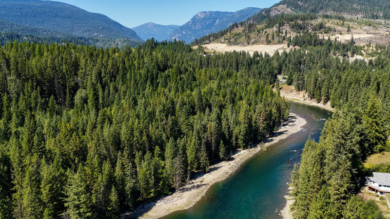
A huge 360° view from this 18+ acre property bordering Crown land along Small River. There is a further 850 ft of great riverfront at your doorstep.
Foreign Buyer Ban does not apply to this property
128 acres on riverfront. Primary home 2,840 sq. ft., secondary home 1,104 sq. ft. Split zoning; 42 acres with no zoning, 86 acres under review from open space to rural residential. Plenty of potential for RV resort/campground, eco-village, and more!
Foreign Buyer Ban does not apply to this property
Personal Real Estate Corporation
john@landquest.com 250-307-2100
Remote 79-acre off-grid oasis with its own airstrip, lakes & multiple furnished homes in the picturesque Nemaiah Valley. Ideal for multi-family living. Historic lodge, log homes, multiple cabins, a large shop with apartment, all surrounded by pristine lakes and breathtaking views.
Foreign Buyer Ban does not apply to this property

250-acre ranch with 1.9 km of Kettle River frontage. Climate to produce almost any crop. Multiple farm outbuildings. Fenced and cross-fenced paddocks. Modest 2,495 ft2 home. Sandy beaches with swimming holes and fire pits. Camping area on the river for RVs. Backs onto Crown land.

Life at its finest! 2 homes, large workshop/bay, multiple outbuildings, and over 1 mile of Kettle River frontage. Fenced and cross-fenced, with multiple hay fields. Above-ground pool, hot tub, and extensive decks/patios. Fish and hunt from home! No zoning (In ALR).

This 1.18-acre lakefront parcel on Marshall Lake, north of Lillooet, BC, offers 141 ft of water frontage & a roughed-in access road off the adjacent parcel, with the option to add a private driveway. A prime opportunity for building a cabin or investing in a sought-after location.
Personal Real Estate Corporation
cole@landquest.com 604-360-0793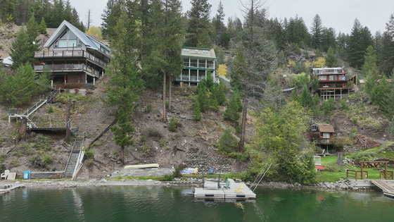
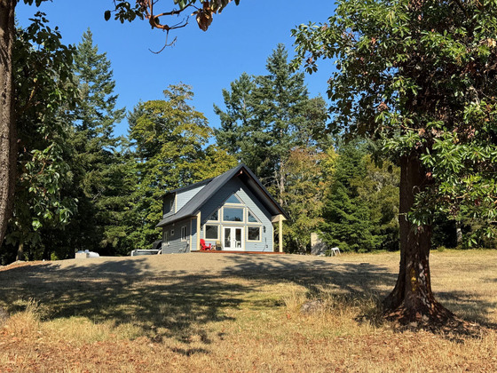
Escape to this rare 1,260 sq. ft. lakefront cabin on sought-after Missezula Lake, just an hour from Princeton. With panoramic views, private dock, and year-round recreation, this 3-level retreat offers the perfect blend of comfort, charm, and adventure.
Personal Real Estate Corporation
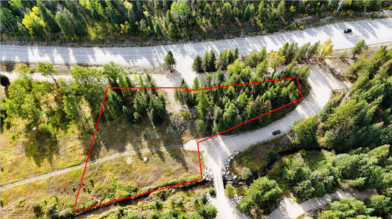
Located less than 30 mins to Kelowna, this off-grid acreage (1.39 acres) is a great buy with 225 ft of frontage on Clark Creek, a beautiful sunny meadow, forest buffer, drilled well & approved for septic. Land is unzoned allowing for a variety of uses.
German-inspired custom log home with addition, set on 136 acres with nearly 3,000 feet of Kootenay River frontage, alongside a tidy guest cabin and supporting outbuildings. An East Kootenay legacy property with privacy, scenery, and timeless craftsmanship.
Foreign Buyer Ban does not apply to this property
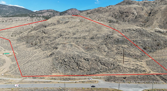
66 acres of arid land half-way between Kamloops & Cache Creek. The seller has identified 2 building options (1) a lower option with easy access to the highway and SW exposure; & (2) an elevated site with stunning views up and down the valley. Drilled a well. Seller financing available.
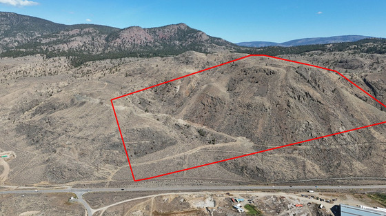
Affordable 81 acres 25 mins to Kamloops with gorgeous views. Land is arid & covered in grass & sage brush. 2 great building options, one with easy access & SW exposure & a 2nd elevated site offering amazing views & privacy. Ideal climate & exposure for solar power. Drilled well.
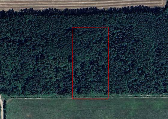
Just 15 minutes north of Fort Fraser, this undeveloped lot offers residential, agricultural, and recreational potential. Surrounded by lakes, forests, and outdoor adventure, it’s an ideal base for a homestead or recreational retreat.
Personal Real Estate Corporation
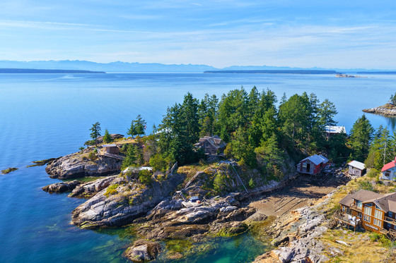
A unique island property with full services rarely found on boat-access islands, including water, sewer, and hydro. Just minutes by boat to Lund, Savary Island, and Desolation Sound, it is surrounded by world-class boating, fishing and coastal adventure.
Foreign Buyer Ban does not apply to this property
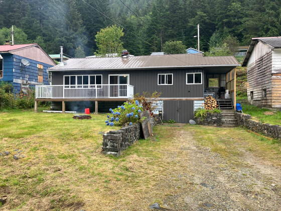
Imagine spending summers enjoying ocean views, world class fishing, clean air and fresh water in quaint coastal home. This very affordable, 3-bedroom home in Martin Valley/Ocean Falls is well maintained, furnished, newly renovated and move-in ready.
Foreign Buyer Ban does not apply to this property
Personal Real Estate Corporation
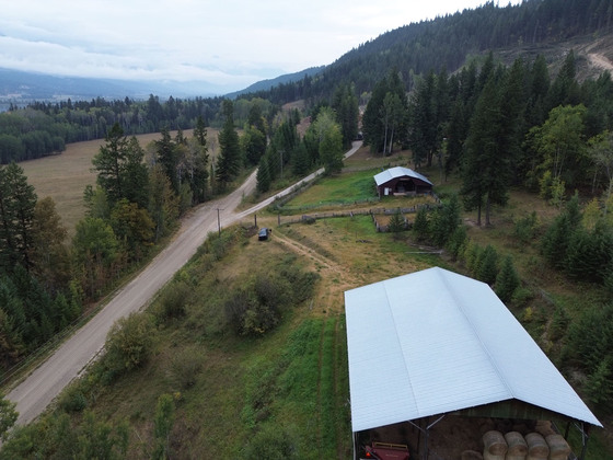
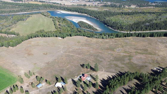
Stunning acreage on Columbia River with panoramic Rocky Mountain views. 30 mins to Golden & 45 mins to Radium. 35-acre hay field. Recent logging, Abundant wildlife. 2,000+ sq. ft. 5-bed, 2.5-bath rancher. Outbuildings include a 60' x 80' hay shed and 40' x 60' barn with corrals.
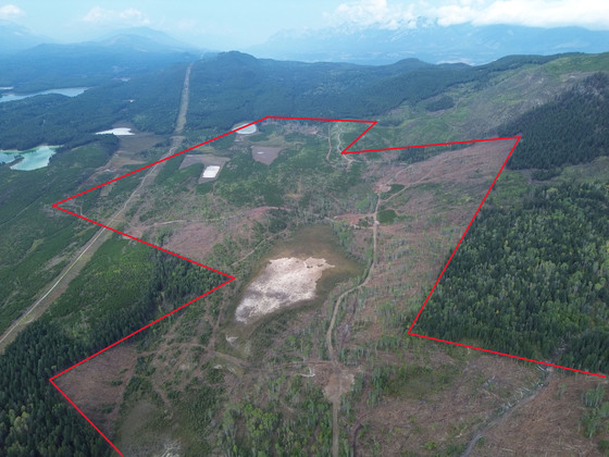
Private acreage surrounded by Crown land. Rare commercial water bottling licence for 100,000 gallons per day. A great investment in one of BC’s most valuable natural resources. No zoning, allows unlimited potential uses. Ideal hunting, grazing, or off-grid development. Recently logged.
Personal Real Estate Corporation
2.59 acres, 231 ft oceanfront open, warm and sunny, with lawn sloping gently westerly through arbutus to amazing sunsets across Sidney Channel. The 1,162 sq. ft. 3-bedroom, 2-bath full basement home, completed in 2024 with top end power and water systems.
Personal Real Estate Corporation
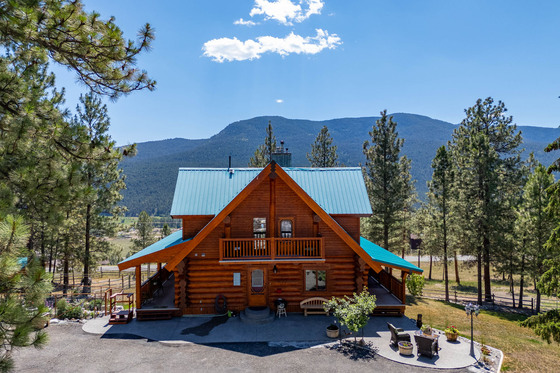
Stunning custom log home in Miller’s Sunshine Valley Estates, just 15 mins from Merritt. Rustic charm, modern comforts & breathtaking valley views. Featuring Acacia hardwood floors, a spa-like primary suite, heating systems, sauna & a wraparound deck. Heated shop, horse facilities.
Personal Real Estate Corporation