


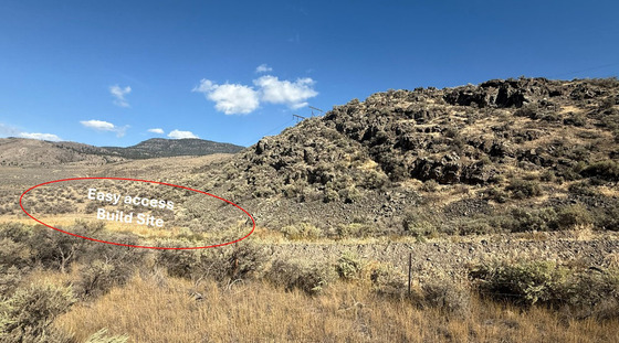
66 acres of arid land half-way between Kamloops & Cache Creek. The seller has identified 2 building options (1) a lower option with easy access to the highway and SW exposure; & (2) an elevated site with stunning views up and down the valley. Drilled a well. Seller financing available.


 +9 photos
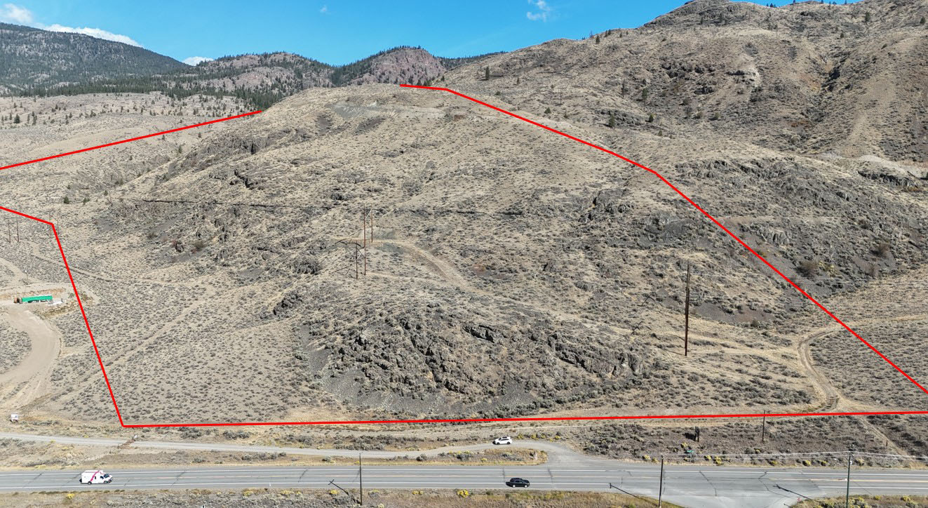
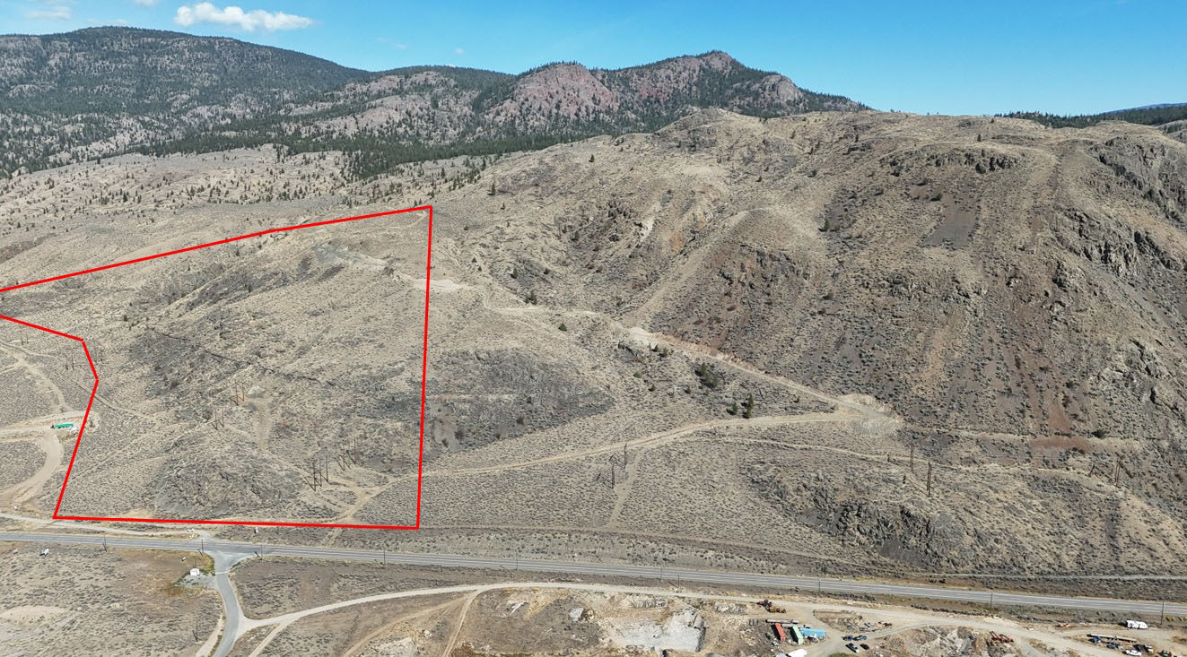


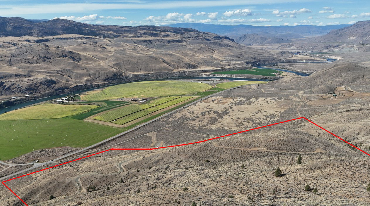
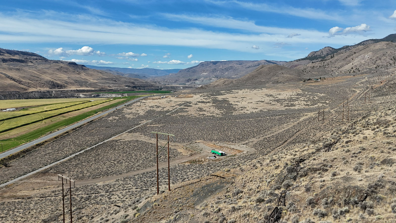
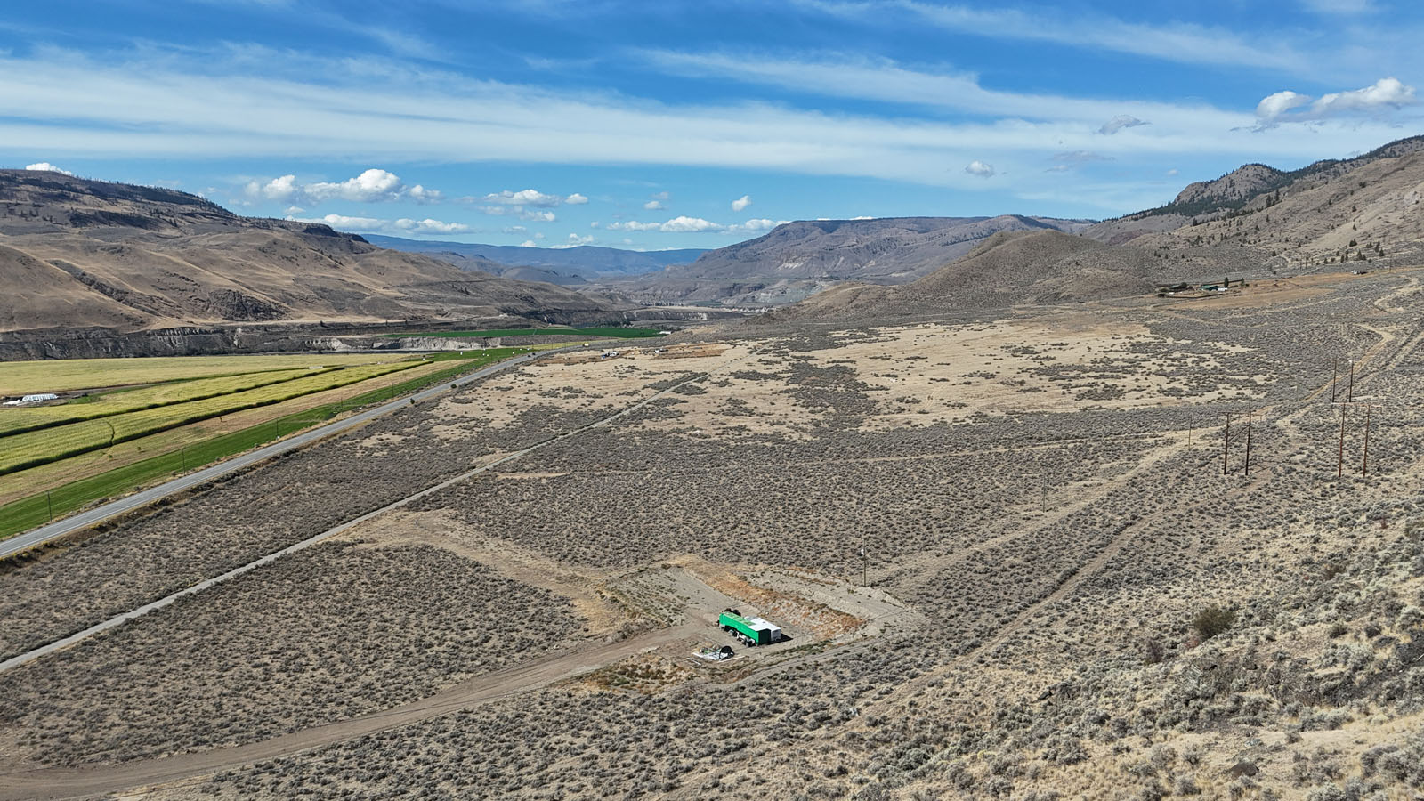
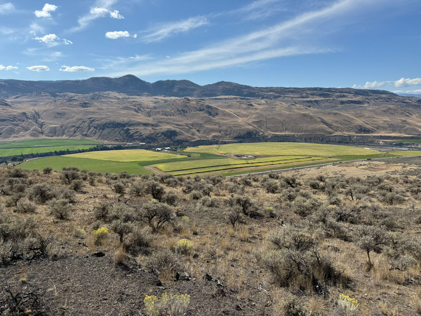
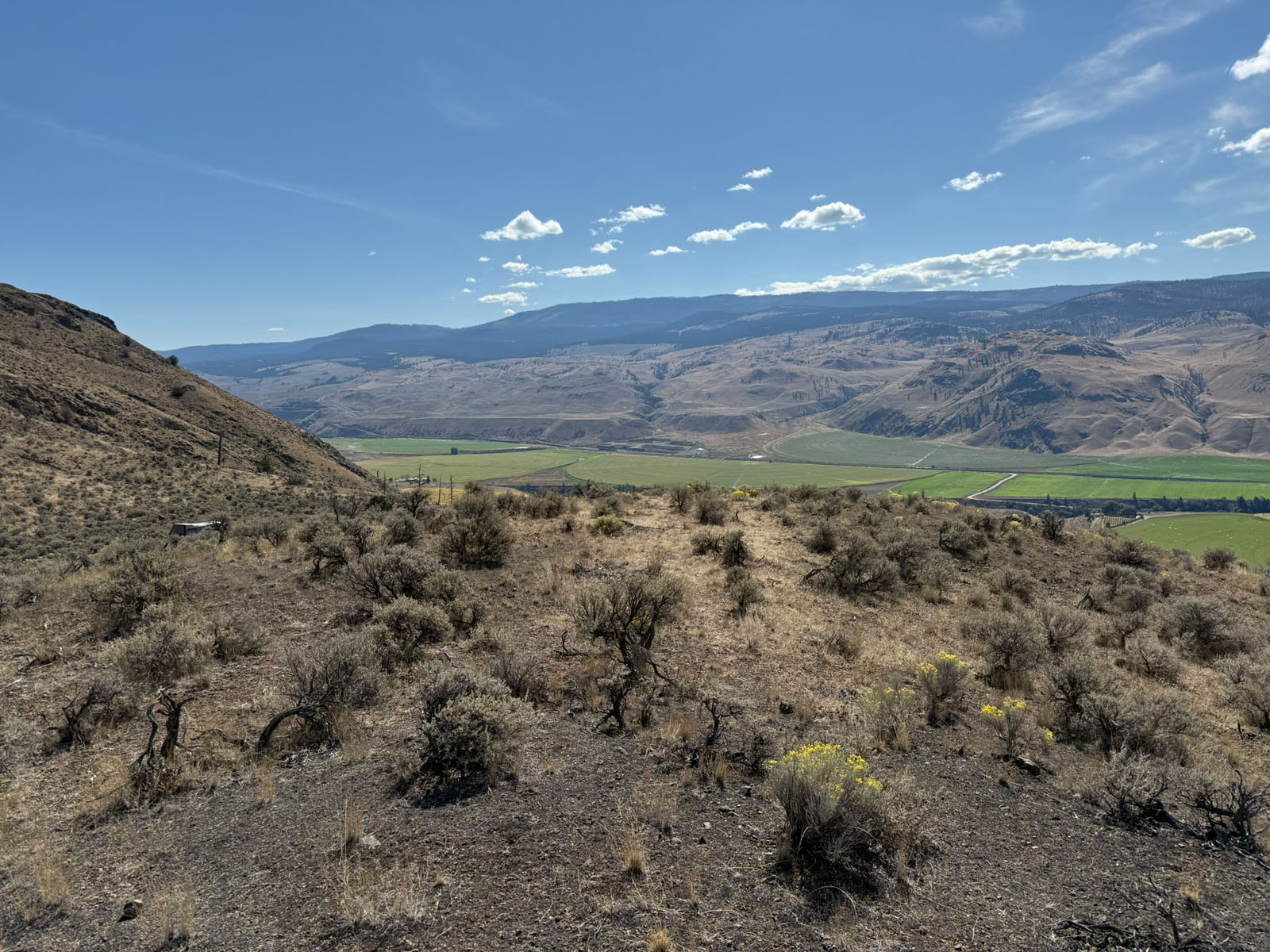
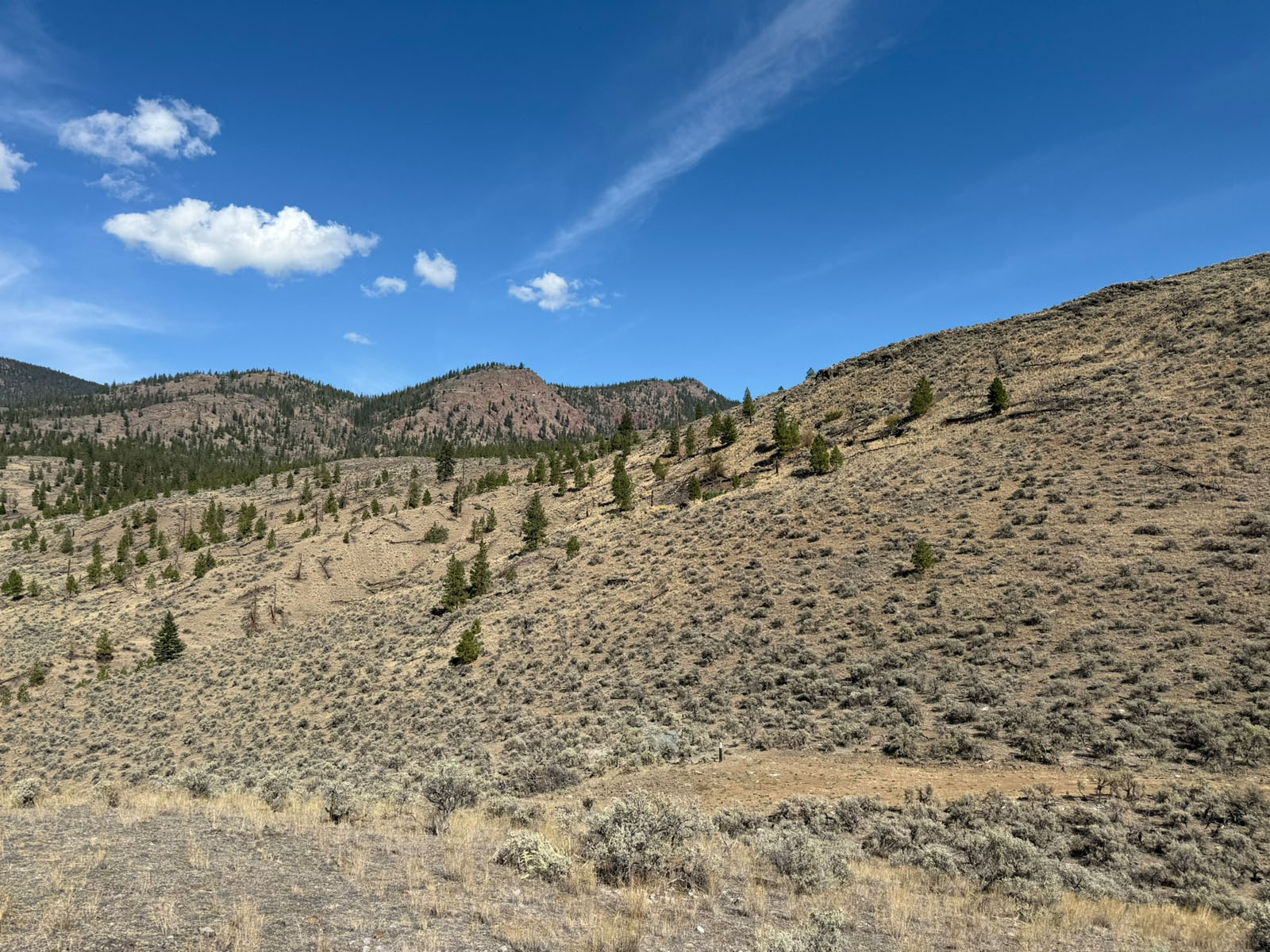
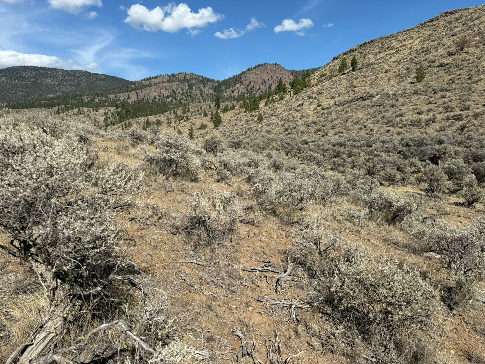
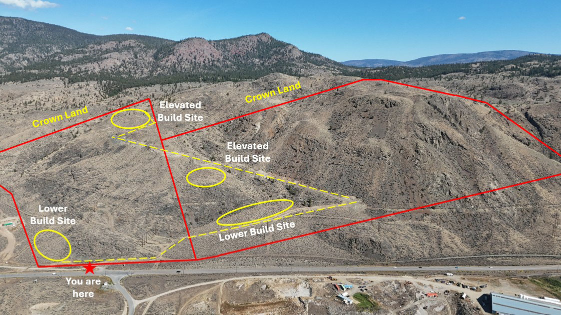
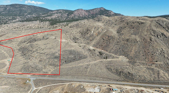
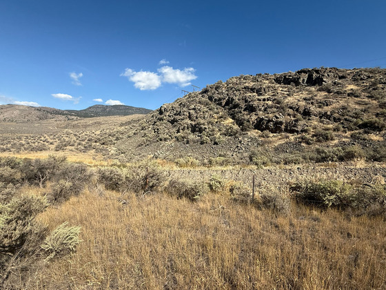
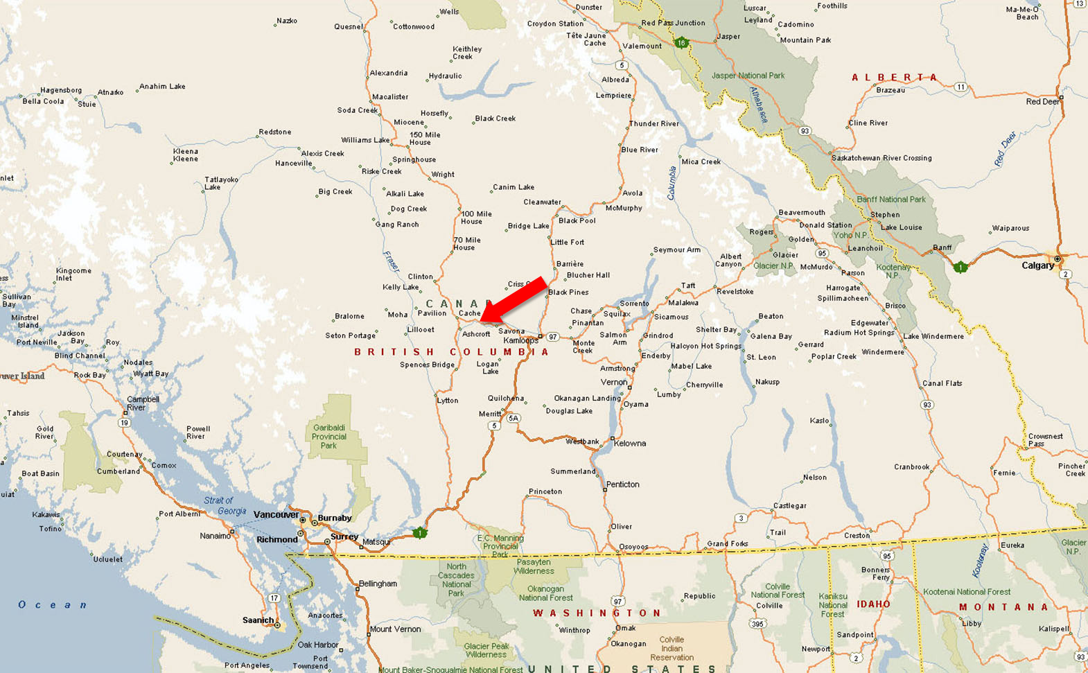
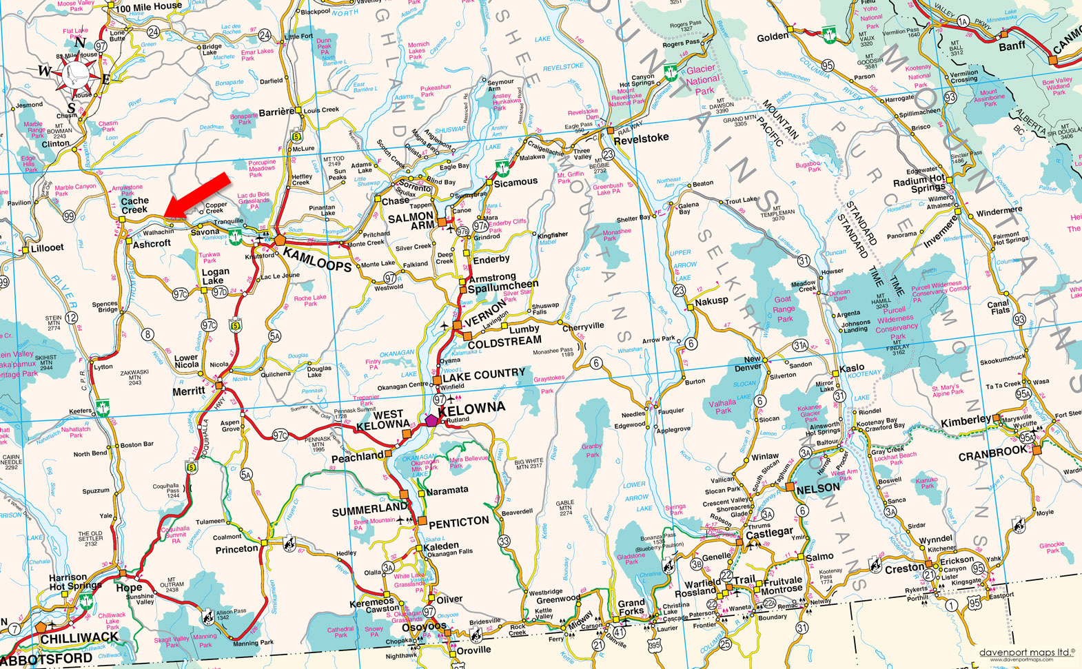
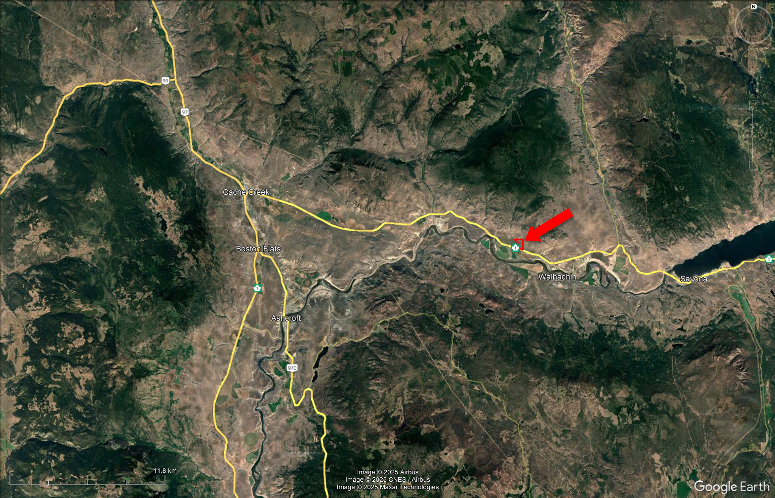
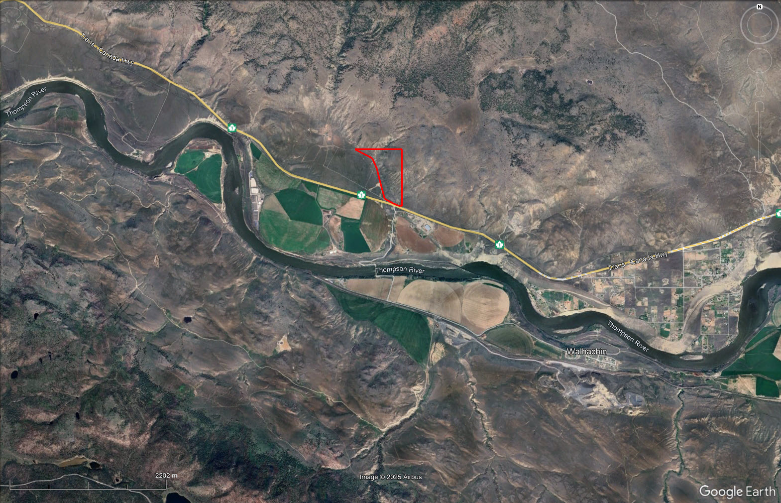
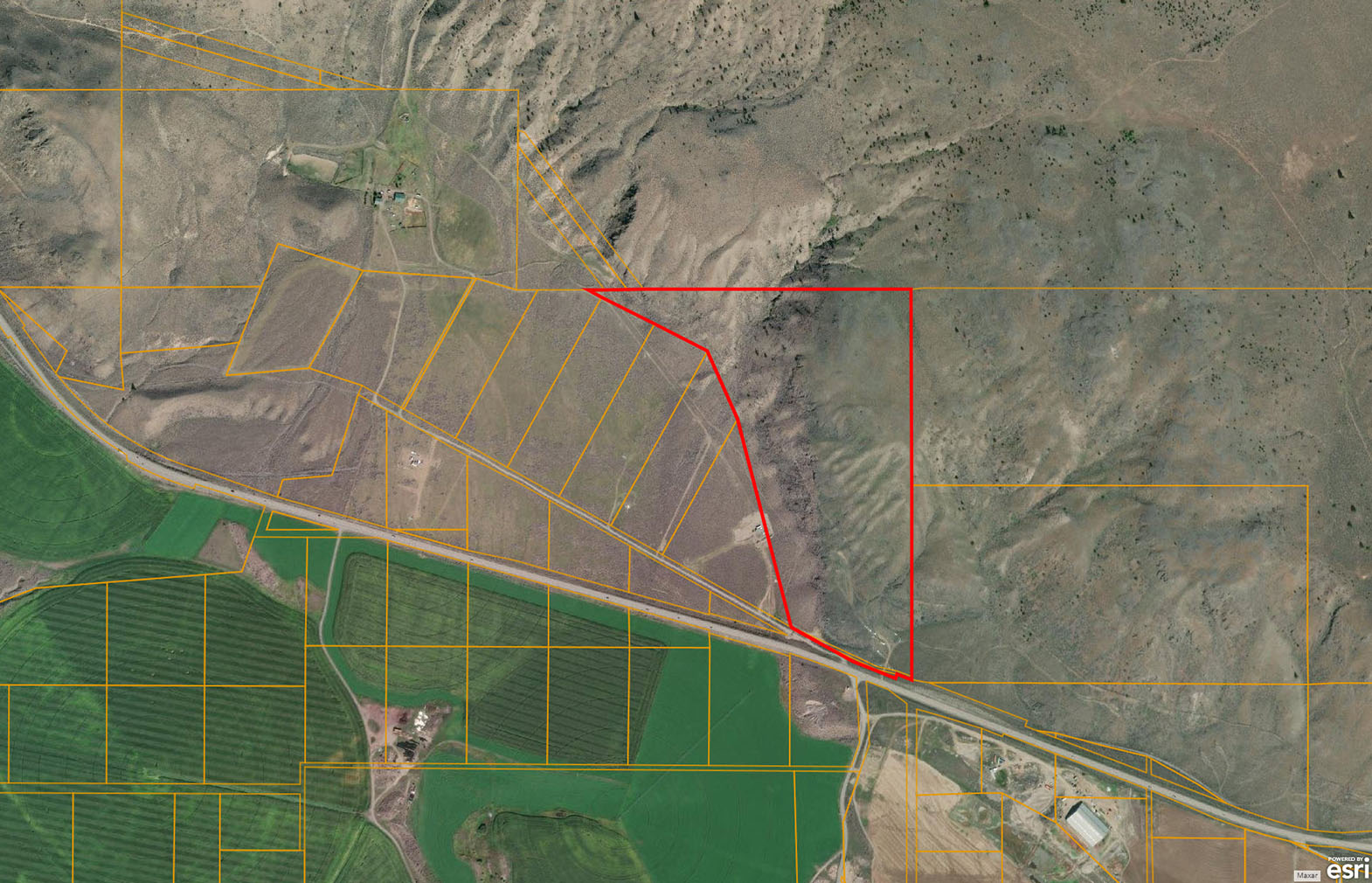
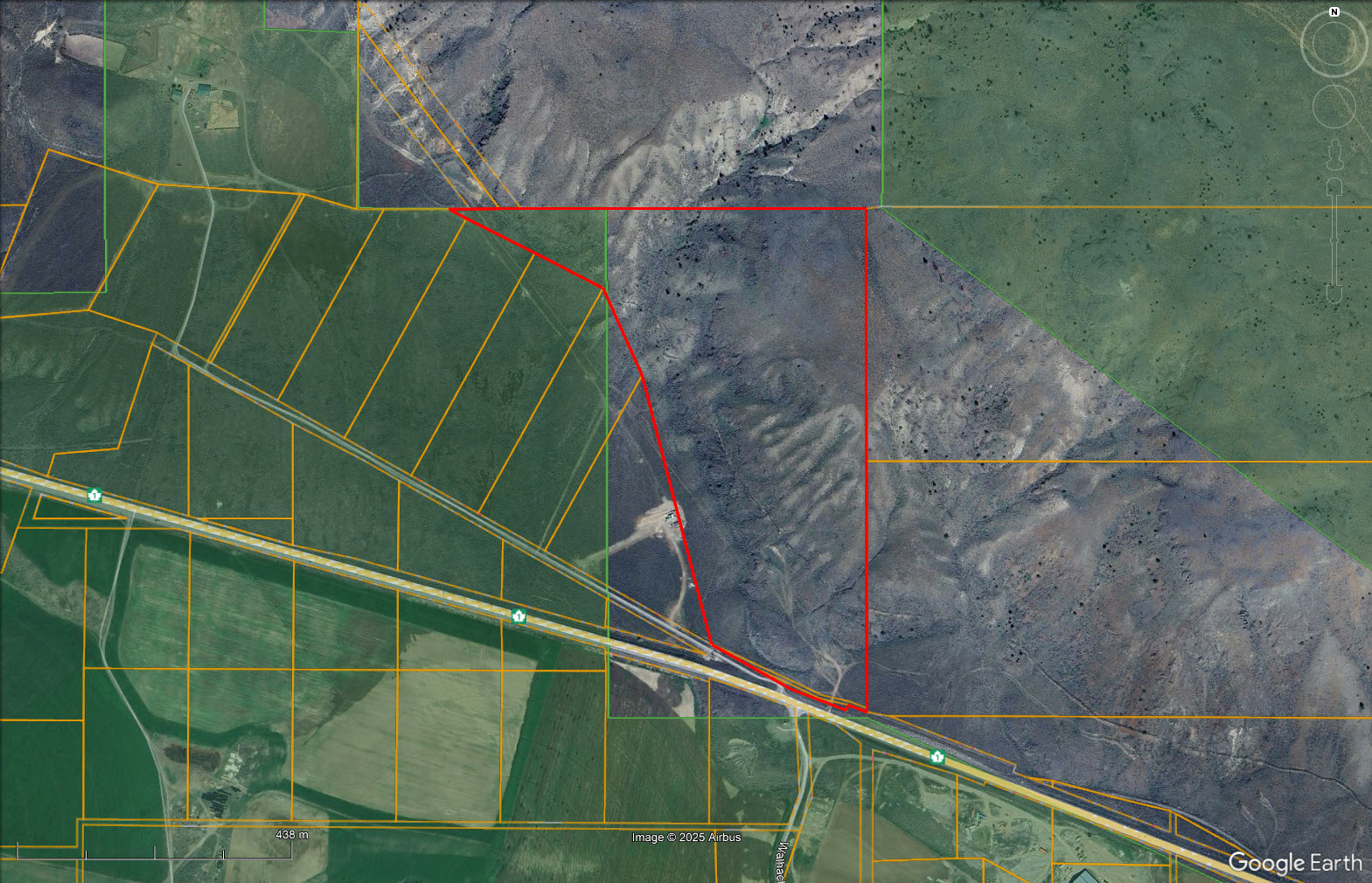
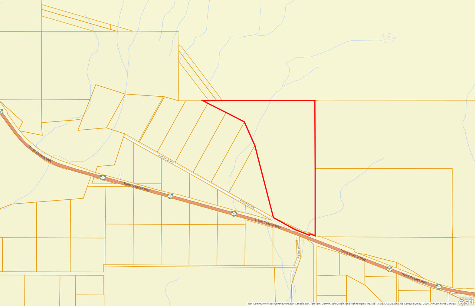
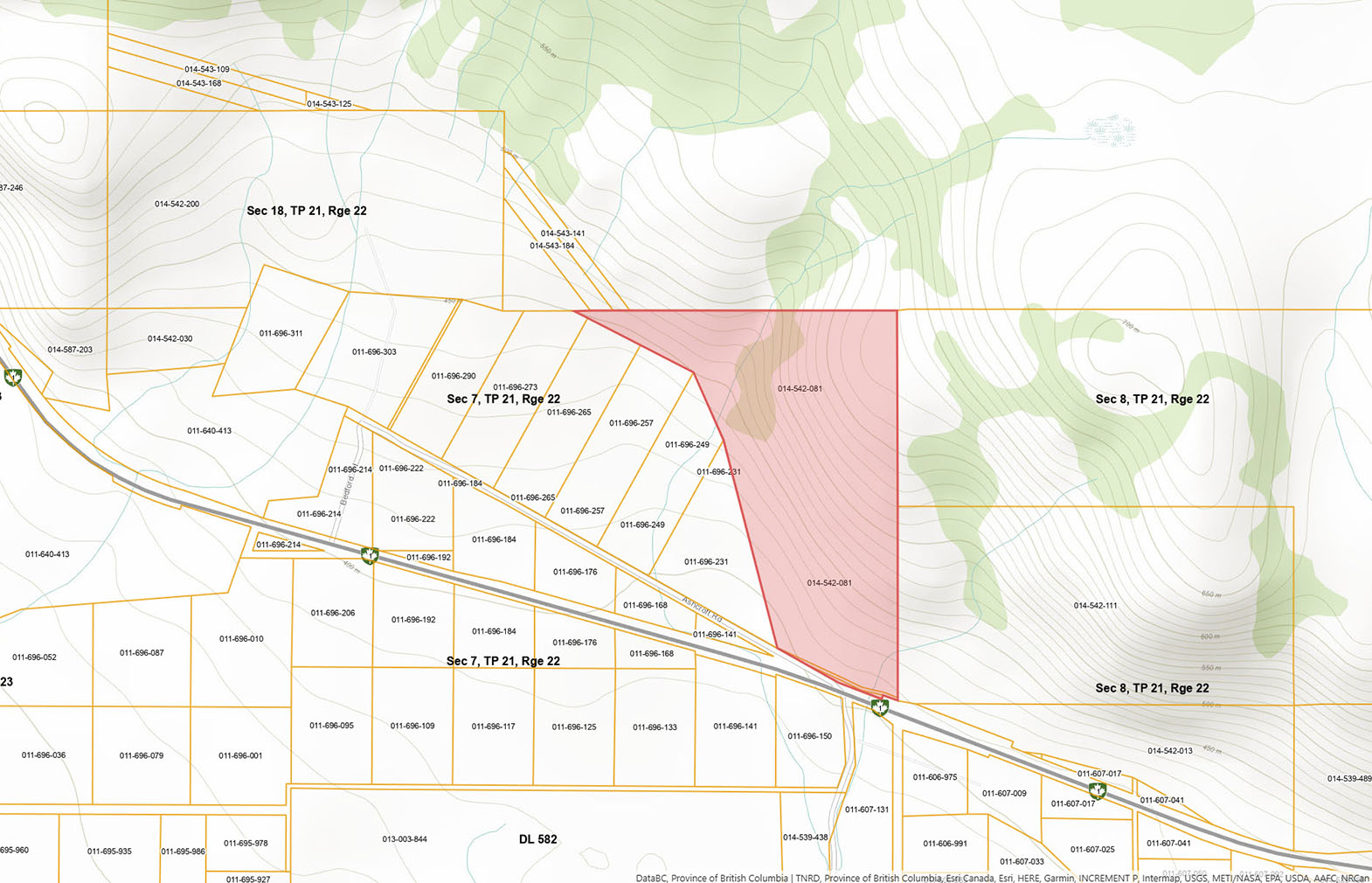
66 acres in the rural community of Walhachin, approximately half-way between Cache Creek and Kamloops. The land is irregularly shaped and covered in arid grass land and sage brush. The majority of the land is sloping with a few gently sloping areas and an elevated flat plateau.
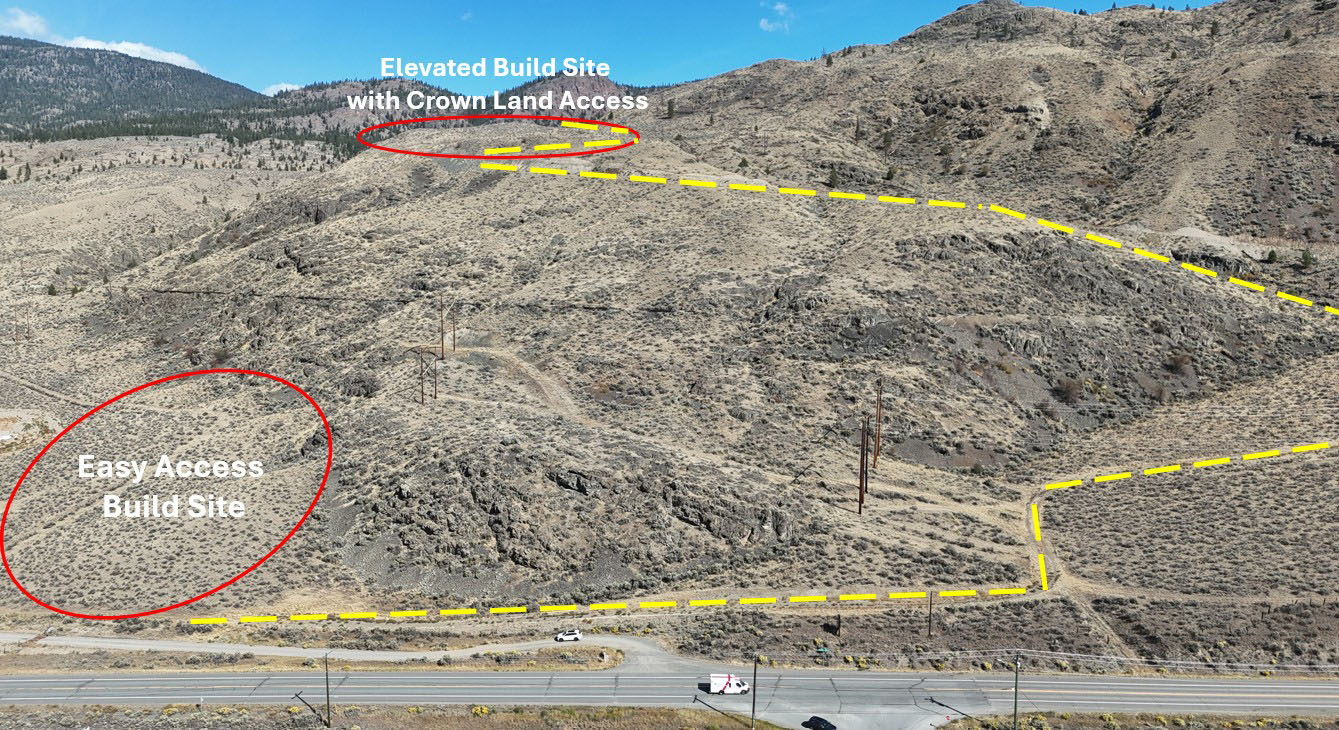
The lower portion of the land has good and easy access off the highway and connecting to a frontage road—Ashcroft Road. Here you will find a great building site with southwest exposure and nice pocket of soil up against the hillside.
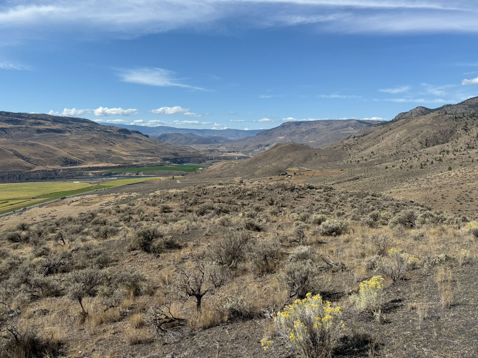
The adjacent 81 acres is also for sale (same seller—package pricing available). If one wanted an elevated building site, there is a well-established internal road that cuts into the 80 acres and switches back and up to an amazing high elevation build site on a flat plateau with excellent Crown land access and the utmost in privacy. The views from up here at absolutely stunning—see pictures. A well is drilled near this site and partially cased; the seller is planning to complete the well casing for the sale.
As stated, the land backs onto Crown land where one can find endless recreation with established trails and roadways suitable for motorized or non motorized recreation.
Although power runs along the hwy and the adjacent property to the west it may be more economically feasible to set up a solar power system to be more self sufficient.
Seller is open to financing at an attractive rate of 3% for up to 2 years allowing one to build a cabin/home and later refinance much more easily once the cabin/house were built.
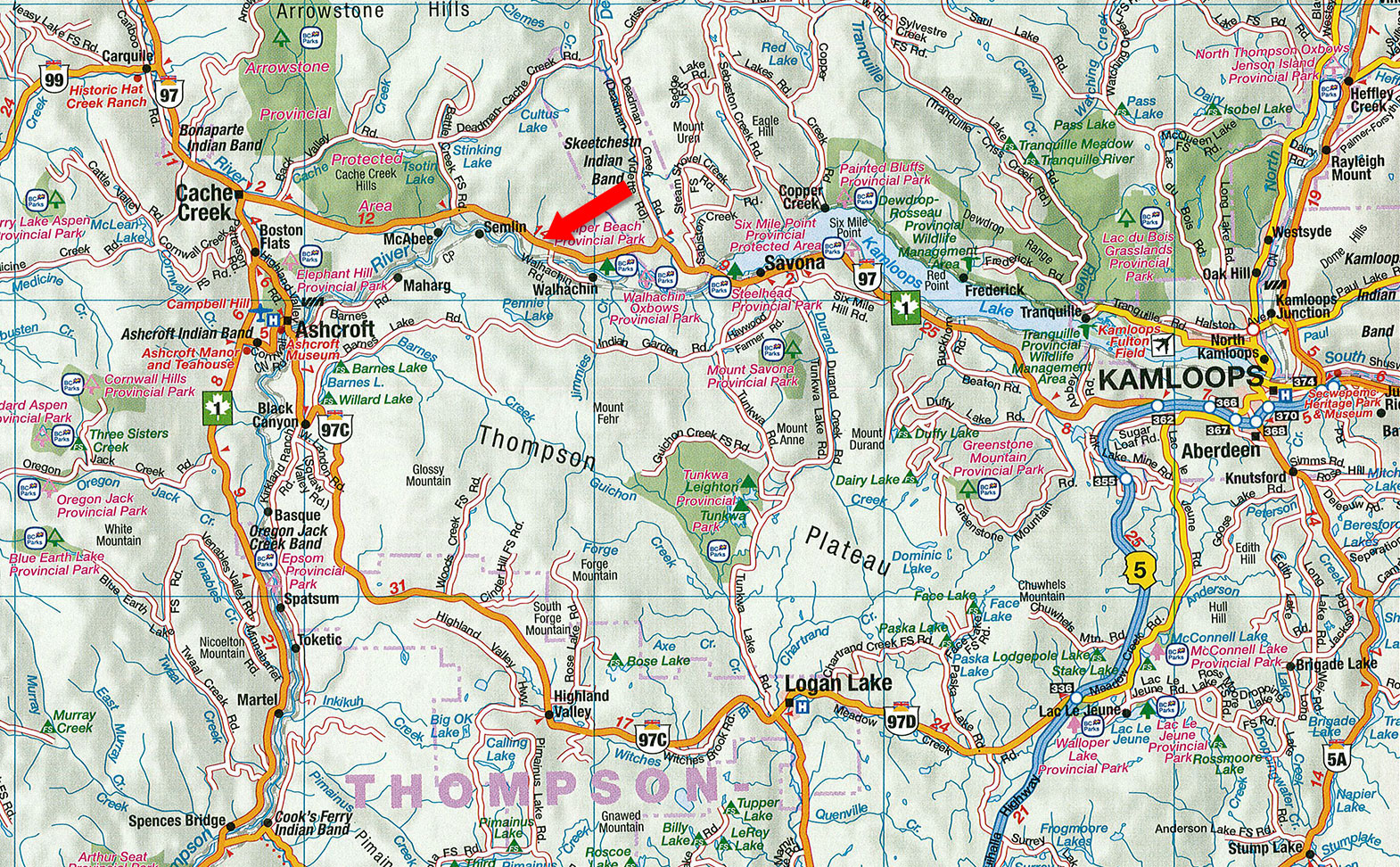
Ashcroft Road - Walhachin, BC
This acreage is accessible off of Ashcroft Road, a frontage road along the highway. Ashcroft Road is directly across from Walhachin Road and just west of the Walhachin/Museum sign.
At the turn of the century, British Columbia experienced economic prosperity, attracting upper-class Englishmen to settle in Walhachin. In 1908, the British Columbia Development Association Ltd. purchased approx. 3,500 acres of benchland properties, west of Kamloops along the South Thompson River. The intention was to create a community surrounded by orchards. During the World War I, Walhachin had the highest enlistment rate per capita of any Canadian community with 97 of the 107 able bodied men signing up during the war. Many settlers and their families returned to their aristocratic roots and fought for the “mother country.” After the war, only a few settlers returned, leading to the decline of Walhachin. Today, only remnants of the irrigation flumes, relic homes, and fruit trees remain. The flumes run through this acreage.
This property is well located to take advantage of some amazing recreational opportunities.
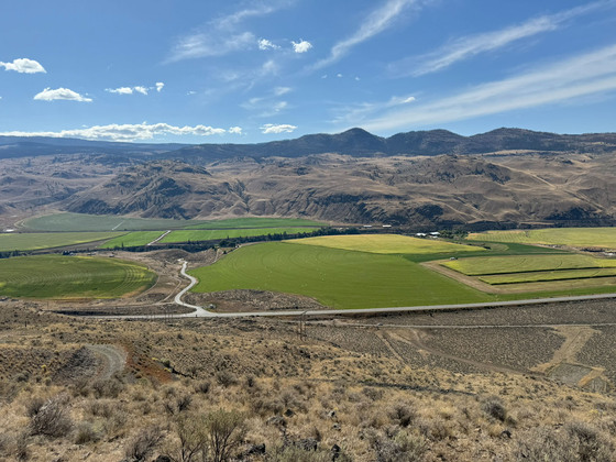
Less than a 20-minute drive to the east is Tobiano Golf Club, one of Canada’s top rated public courses and top 100 in the world. At Tobiano you will also find Bruker Marina where there are seasonal slips available and a gateway to Kamloops Lake. There is also a public boat launch on Kamloops Lake just 10 minutes away in Savona. Kamloops Lake has great boating and fishing.
On the west side of the land and just a 5-minute drive west is Juniper Beach Provincial Park with access/a boat launch to the Thompson River, where one could boat up into Kamloops Lake.
With access across the adjacent 80 acres and over a well constructed internal road one has good access to the upper plateau of the land and then directly back onto the vast tract of Crown land in behind the land. There are some nice little lakes and lots of forest cover and wildlife for hunting and motorized recreation.
Please see maps and aerial photos, all boundary lines on maps and aerial photos are approximate sketches.
50°46'36.94"N and 121° 1'46.18"W
Drilled well—approximately 3 litres a minute. The well is deep and has a large capacity/reservoir to get through high use periods, but adding a cistern would add more water flexibility.
How much water does an average single family home use a day . . . the water consumption for a single-family home with three bedrooms can vary significantly based on household habits and the efficiency of appliances. However, a rough estimate for a typical household is around 375 to 450 litres per day.
Cell reception.
Although power runs along the highway and connects to the neighboring property, it may be more economically feasible for solar power.
Bare land
$1,000
RL-1 (TNRD)
Permitted Uses
One single family dwelling with or without a secondary suite, or one duplex, agriculture, winery, cidery, micro brewery, etc.
Accessory Uses
Home based work, Bed and Breakfast, Kennel, riding stable, Outbuildings, etc.
Building Scheme
No single-wide mobile homes.
Only a small section of the property is in the Agricultural Land Reserve—approximately a few acres in the northwest corner.
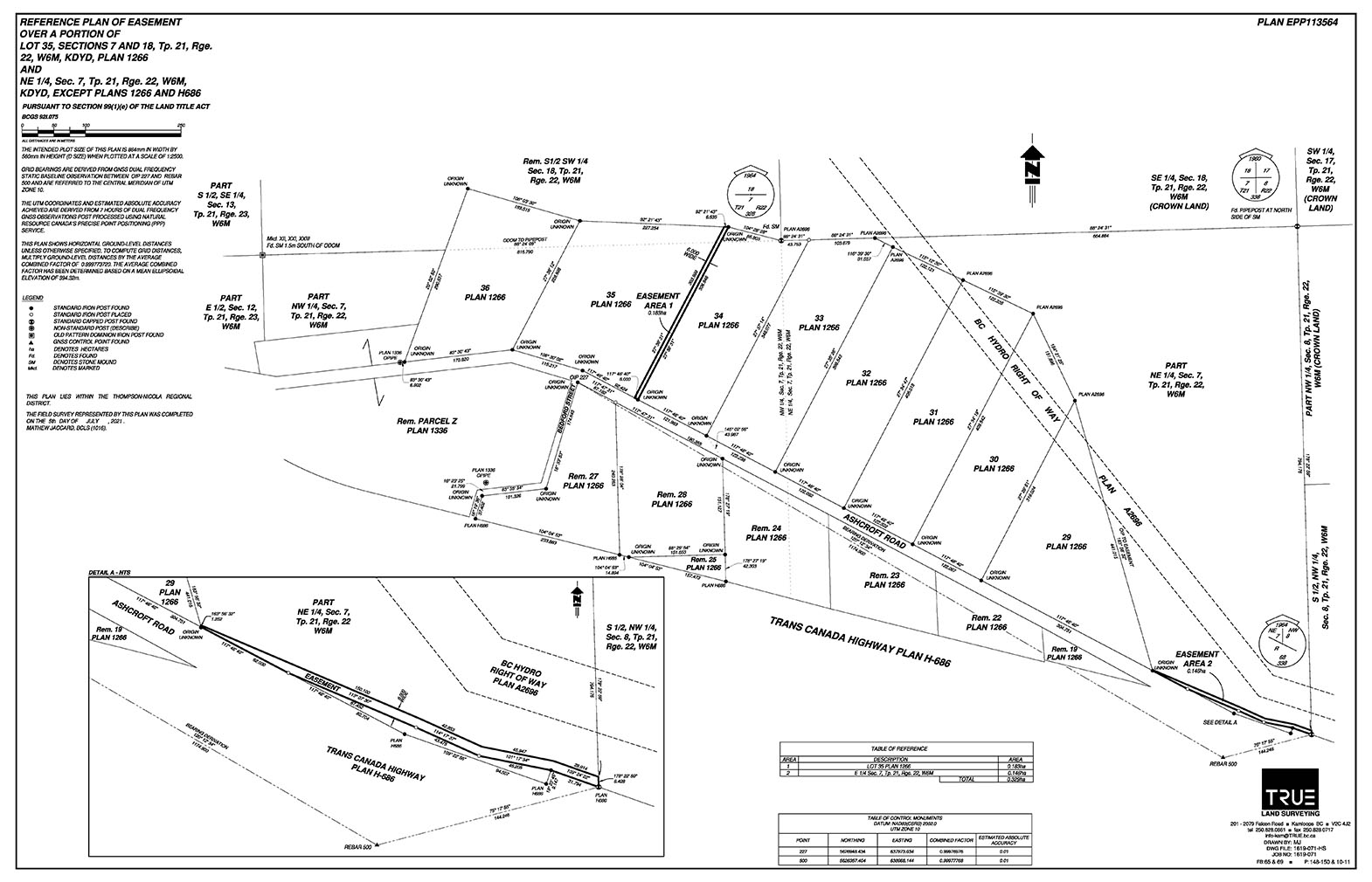
PART NE 1/4, SECTION 7, TOWNSHIP 21, RANGE 22, MERIDIAN W6, KAMLOOPS DIV OF YALE LAND DISTRICT, EXCEPT PLAN 1266
PID 014-542-081
 +10 maps
Our property descriptions and geographical information are taken from the BC Assessment Authority, Land Titles Office, government maps and other sources. While LandQuest® does not guarantee the information, we believe it to be accurate, but should not be relied upon without verification. This communication is not intended to cause or induce breach of an existing agency agreement.
Savona
 19℃
23℃
19℃
23℃