


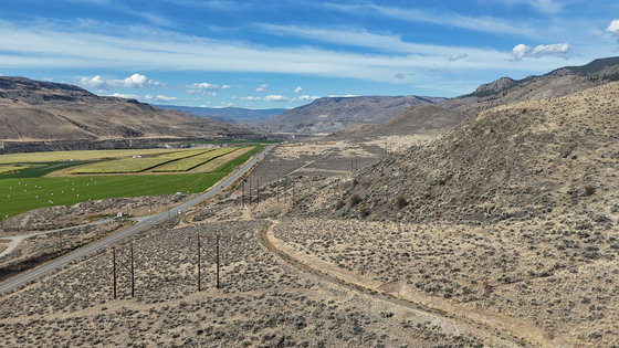
Affordable 81 acres 25 mins to Kamloops with gorgeous views. Land is arid & covered in grass & sage brush. 2 great building options, one with easy access & SW exposure & a 2nd elevated site offering amazing views & privacy. Ideal climate & exposure for solar power. Drilled well.


 +17 photos

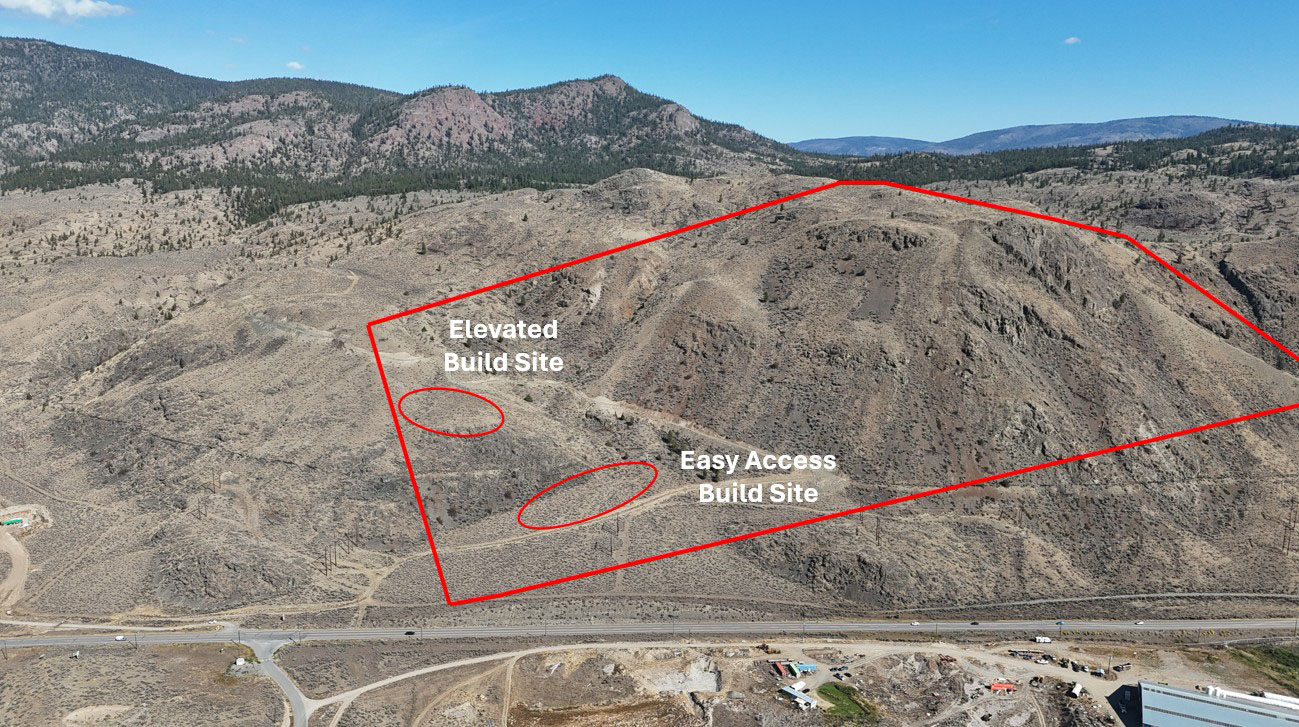
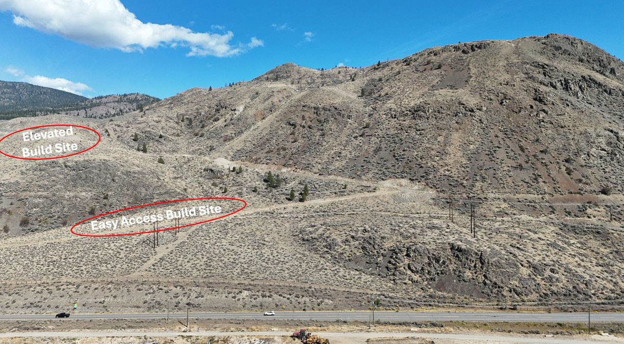
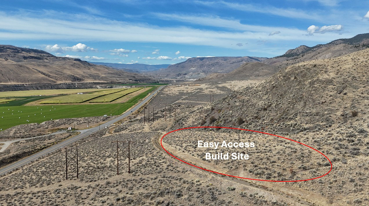


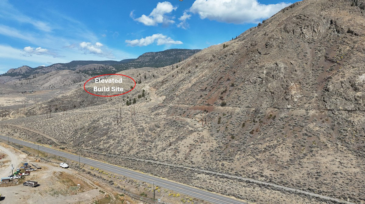
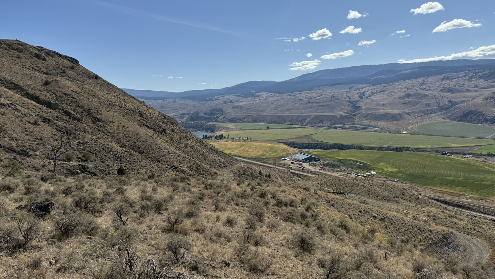
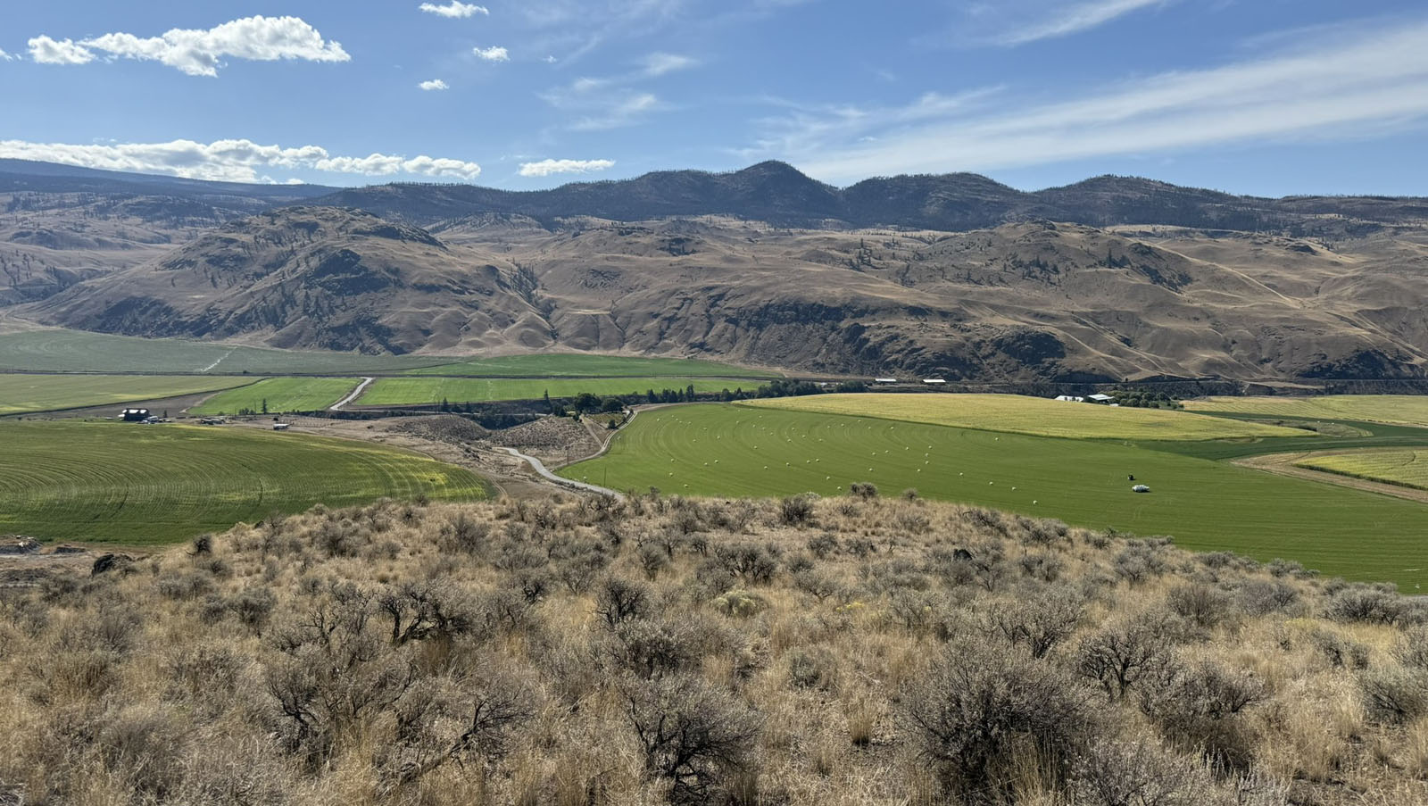
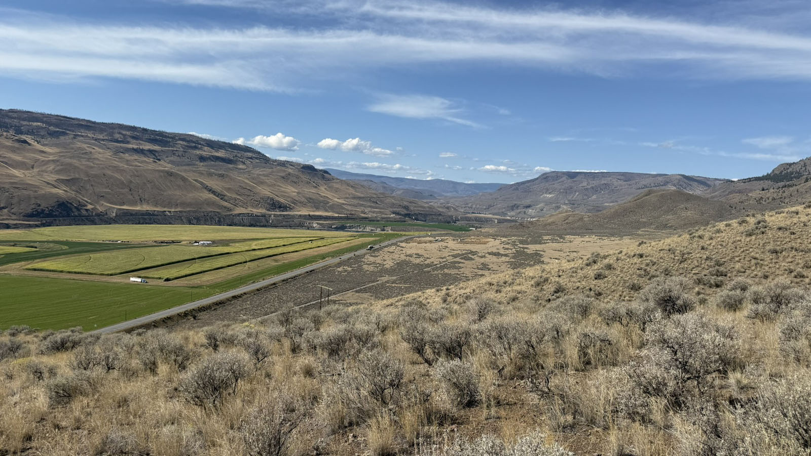
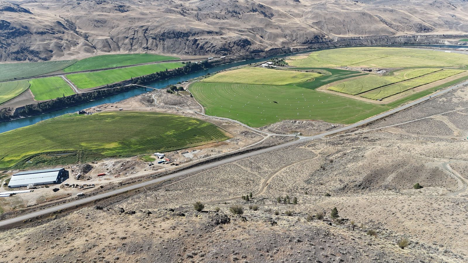
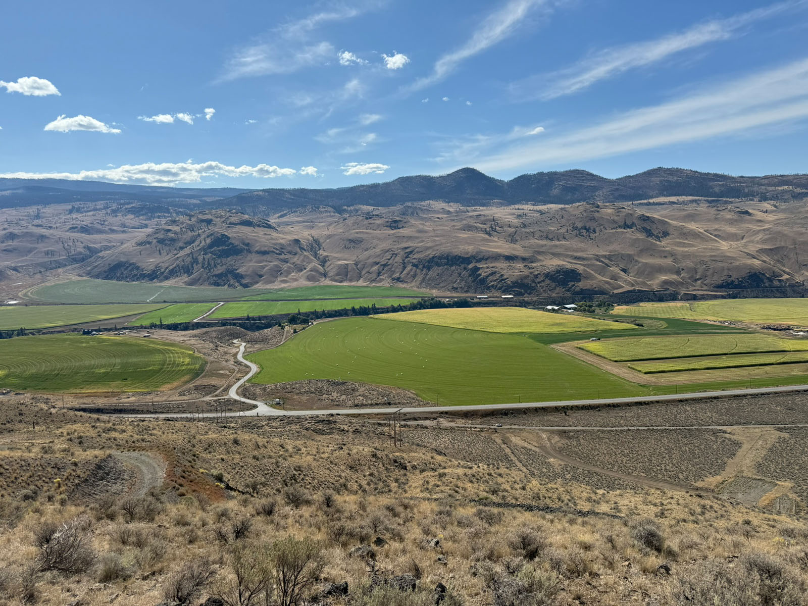
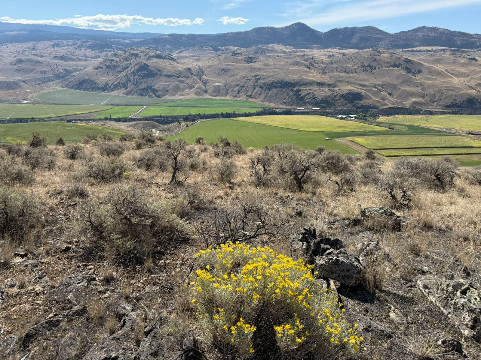
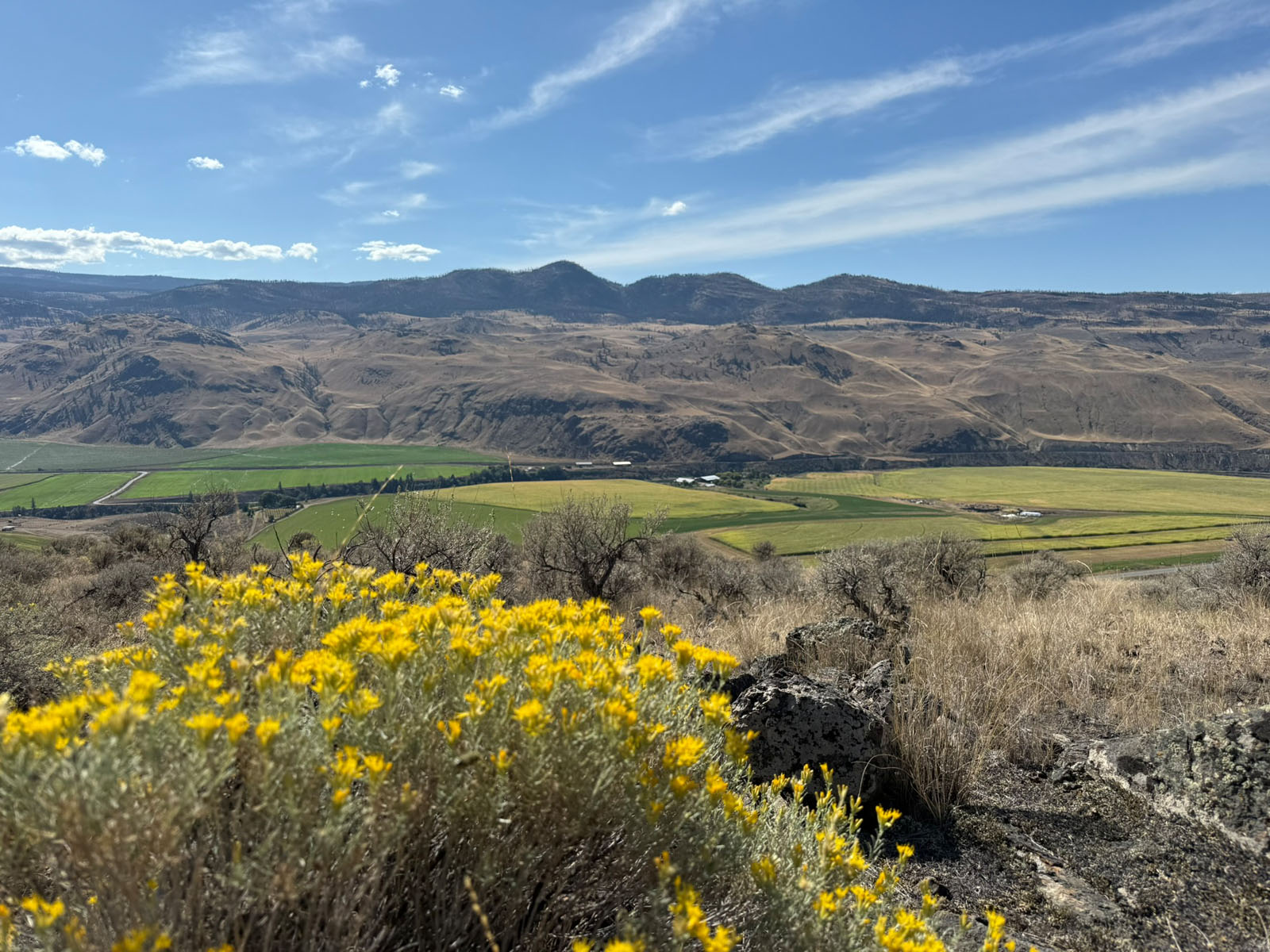
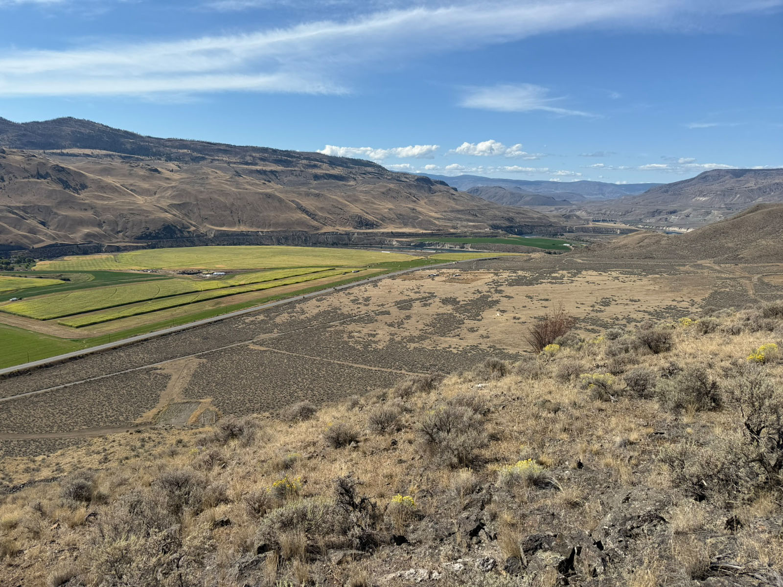
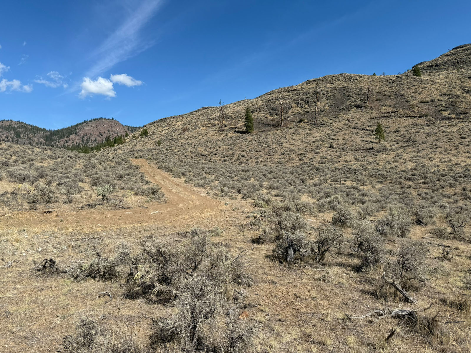
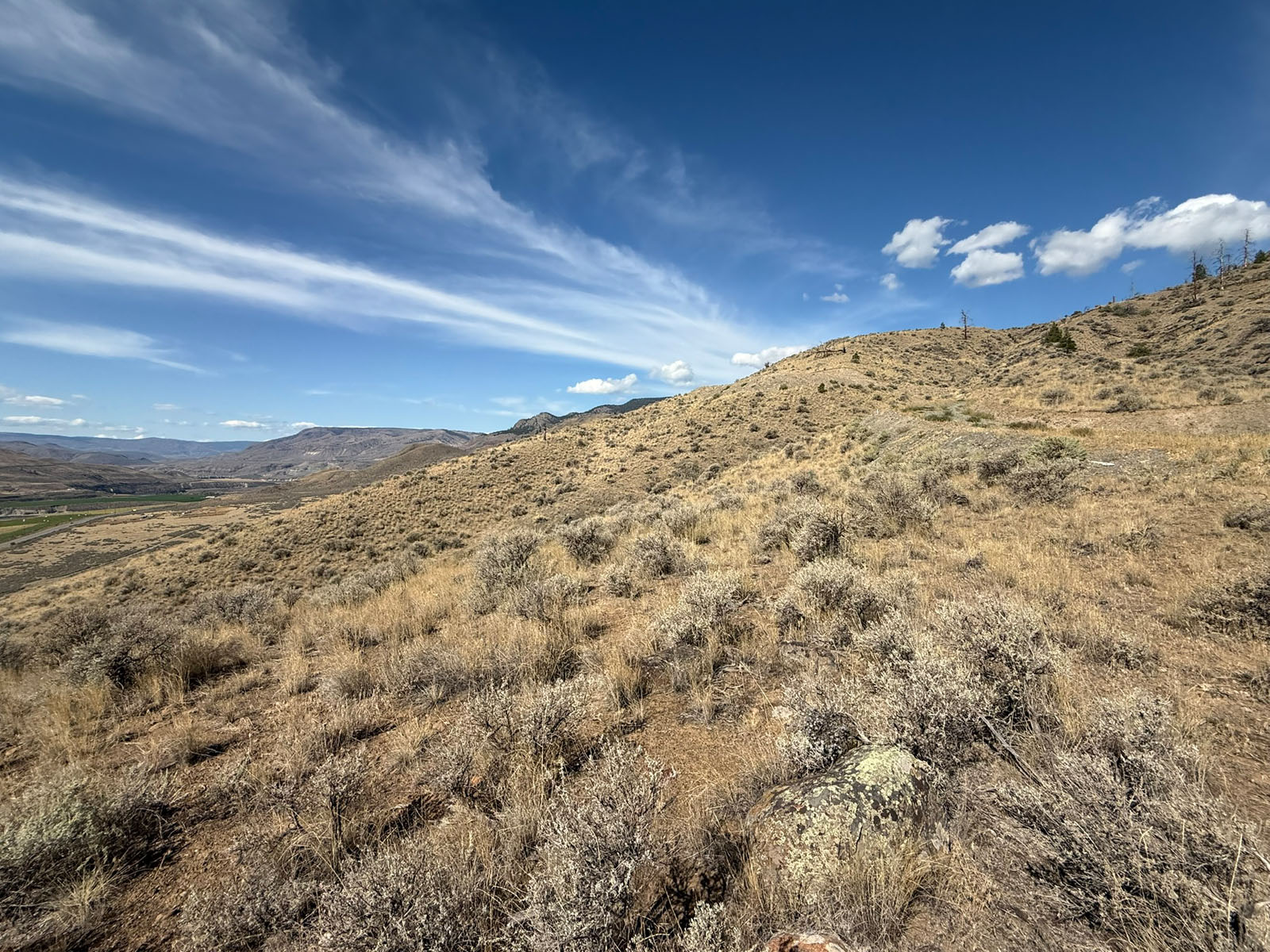
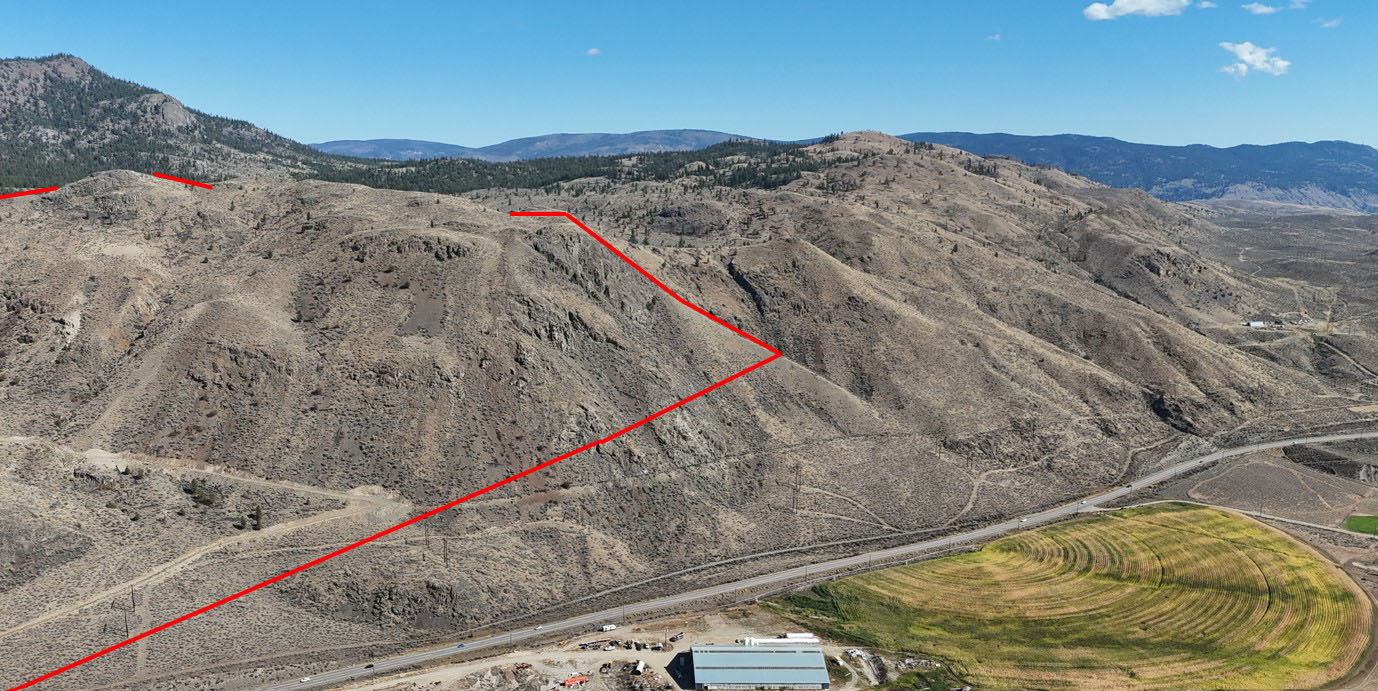
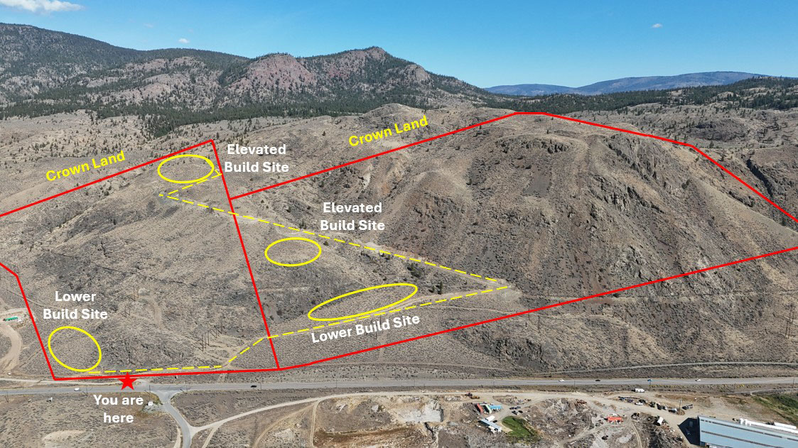
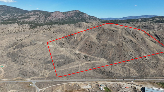
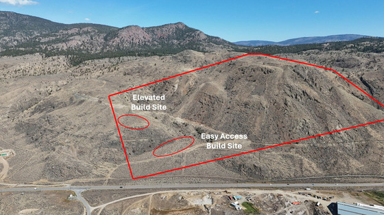
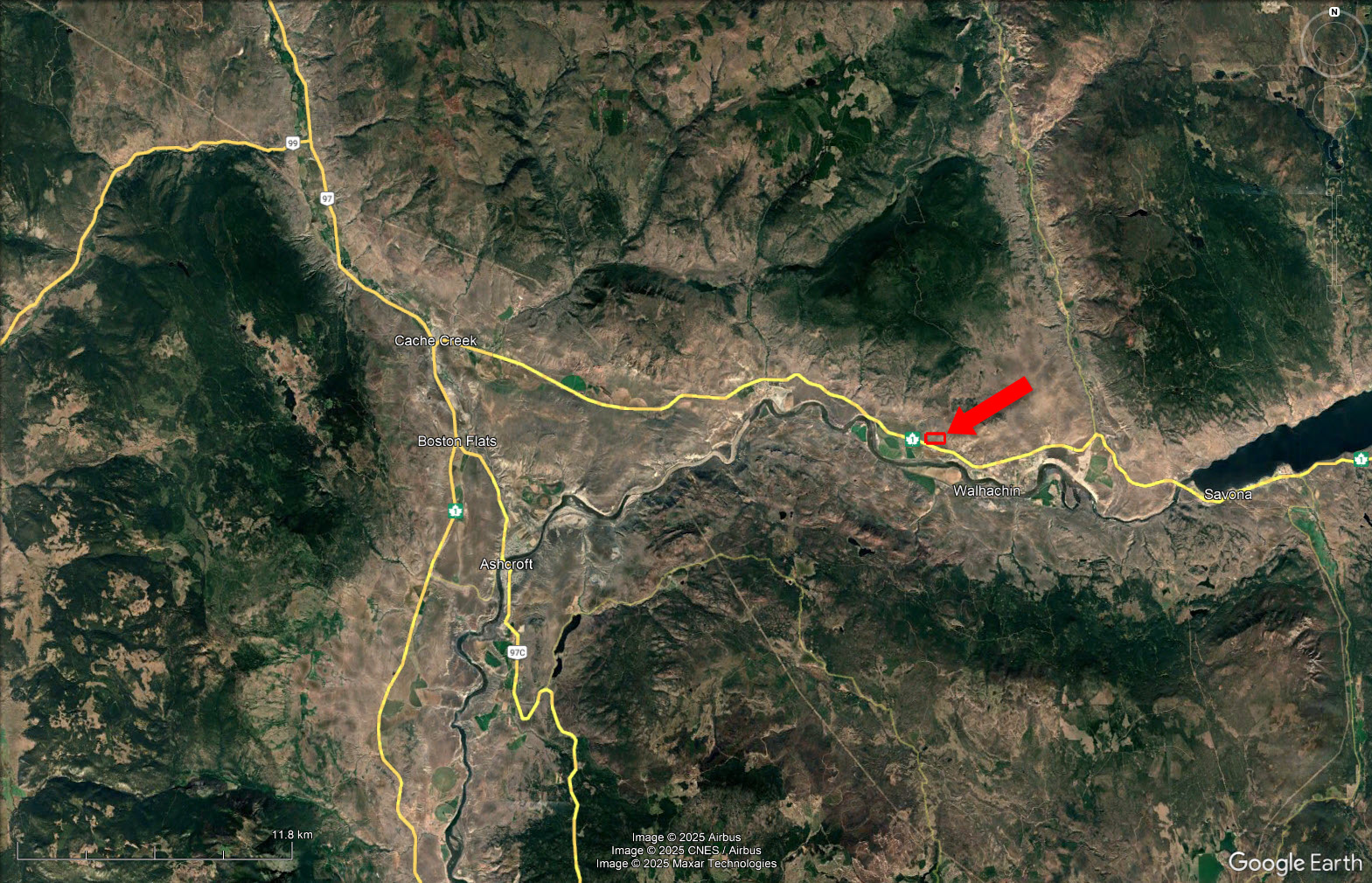
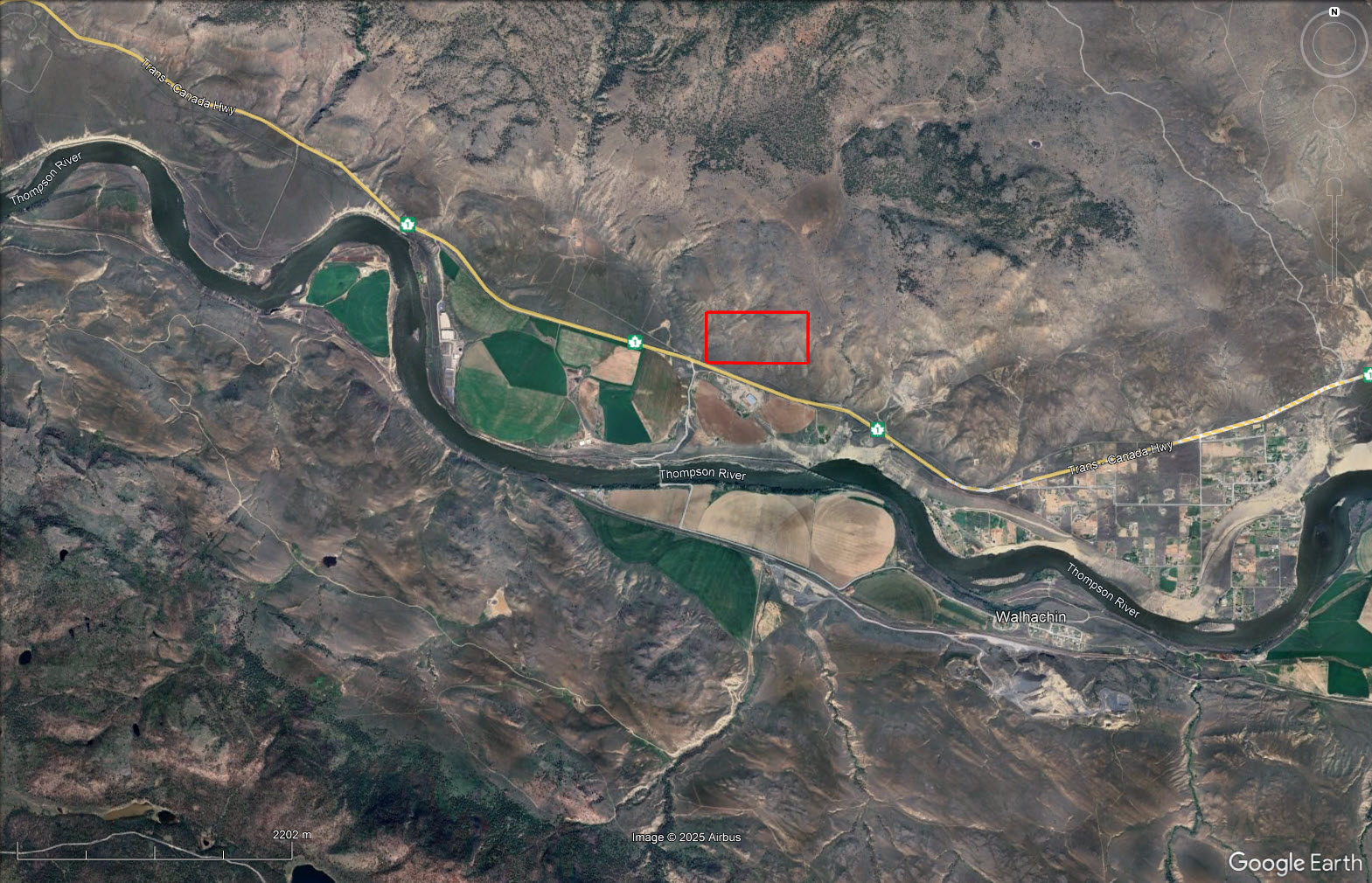
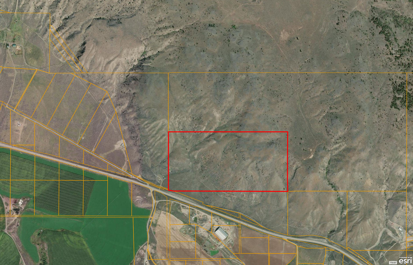
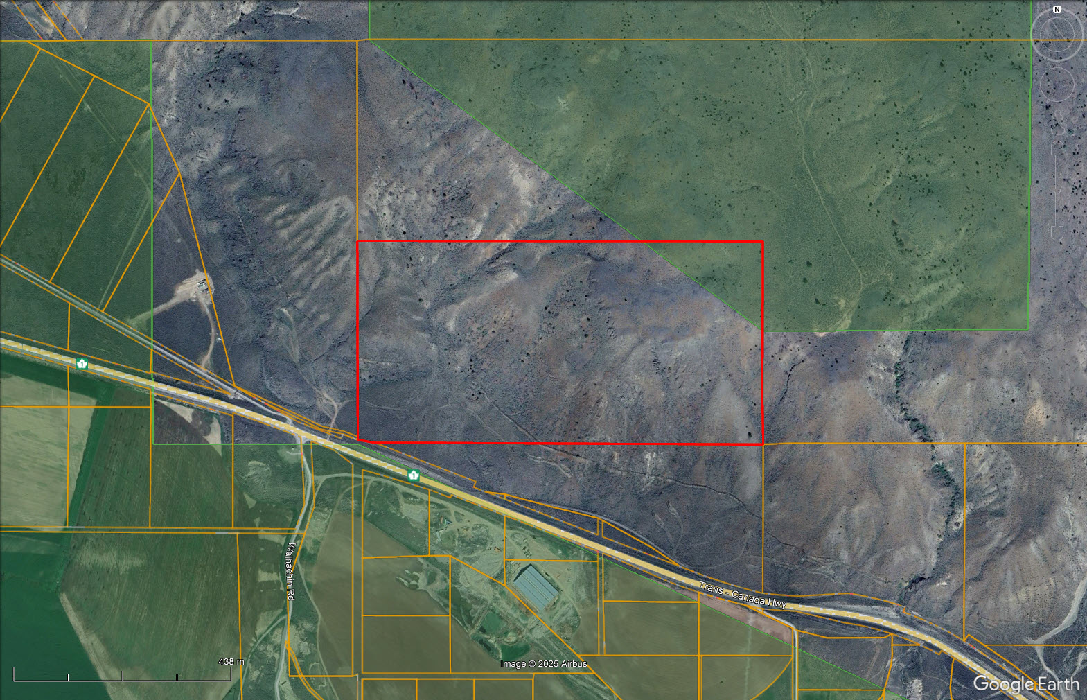
81 affordable acres in Walhachin, between Cache Creek and Kamloops. The land is arid with grass and sage brush landcover and mostly sloping. There are at least 2 building sites that have been identified:
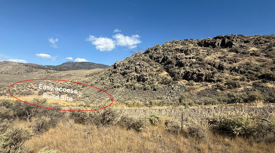
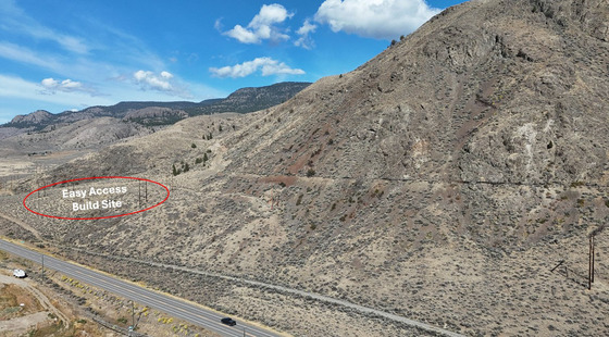
(1) an easy access site with a nice pocket of soil and a few gently sloping acres with views across the highway to some lush farm land; and
(2) an elevated site with amazing 180 degree views up and down the valley, over to the Thompson River and mountains across the valley.
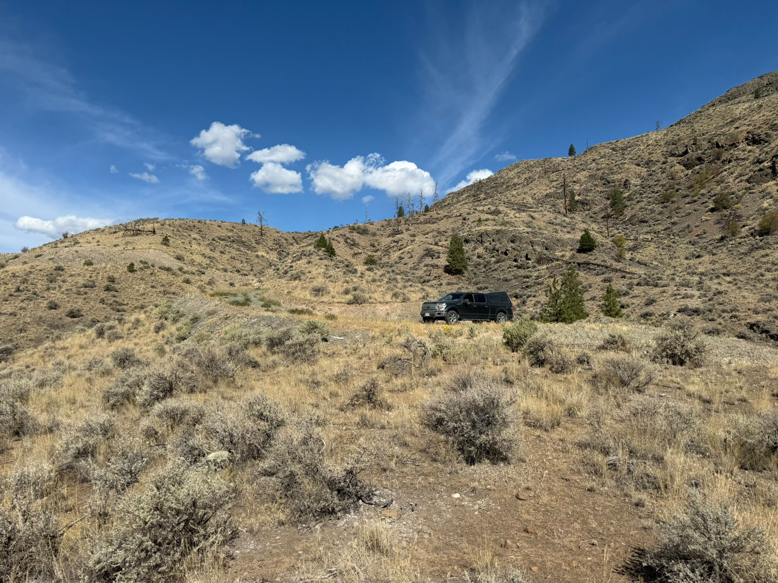
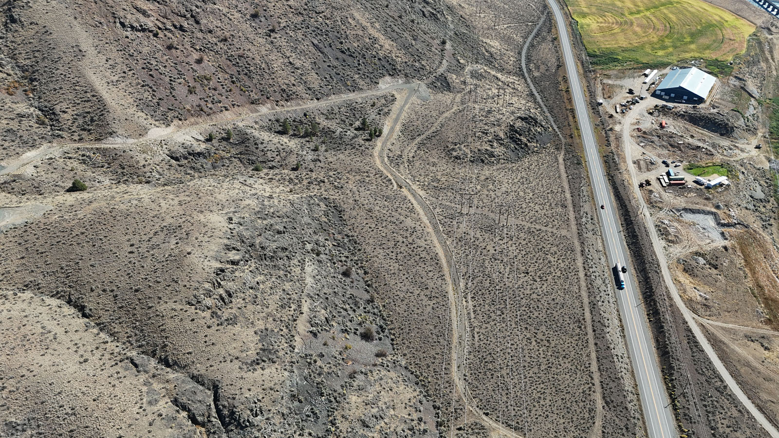
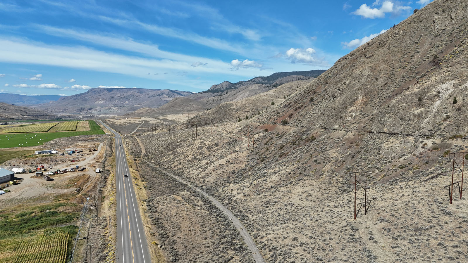
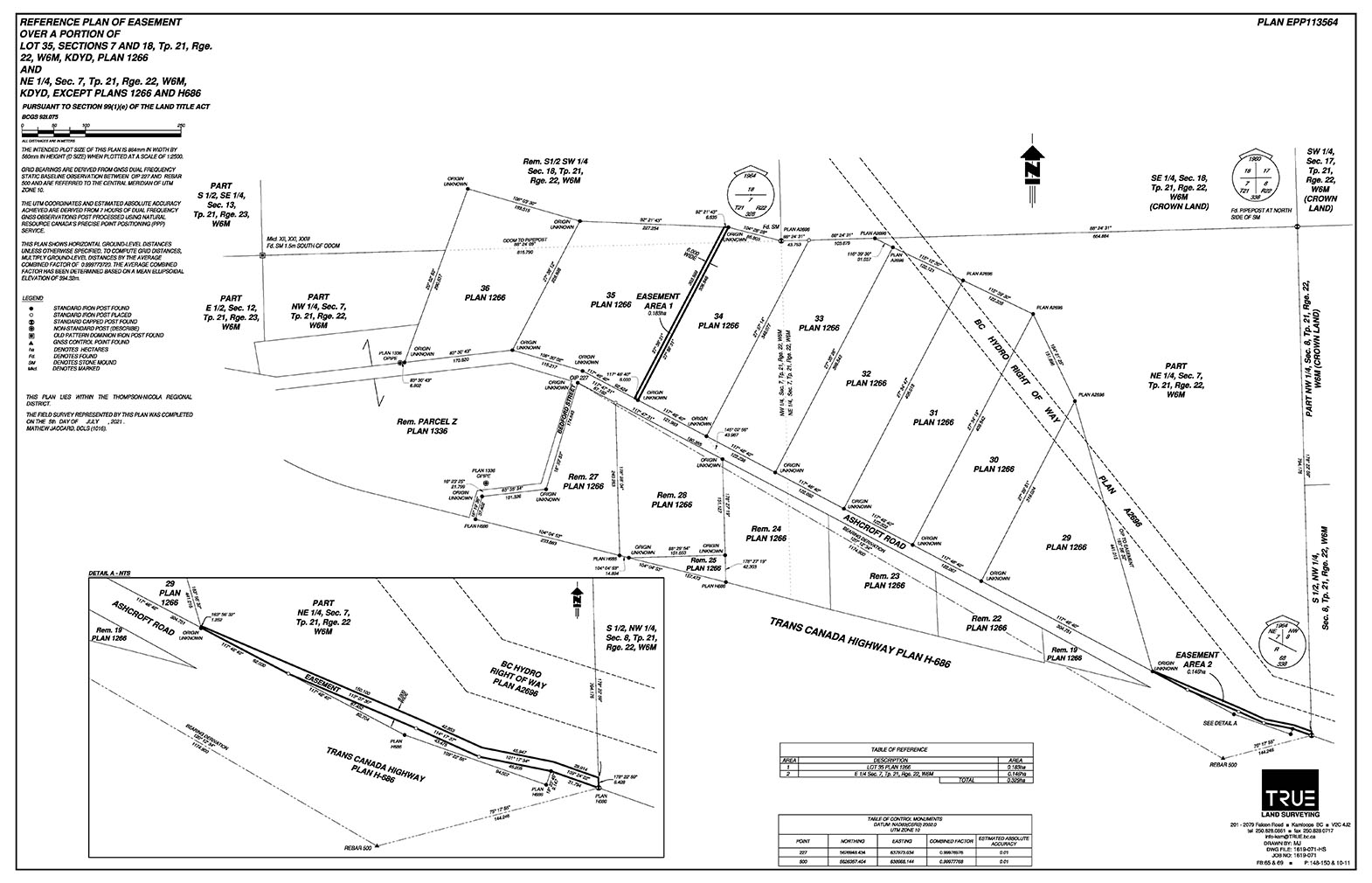
Although the land fronts on the highway a short easement provides more preferred access due to slope. Power runs along the highway, but it may be more economically feasible to set up a solar power system to be self sufficient and take advantage of the ample sunlight. A well has been drilled and could service either build site. The flow rate is low but with the large reservoir as it is a deep well it is adequate for a small residence, but adding a cistern would provide more flexibility and water for landscaping uses.
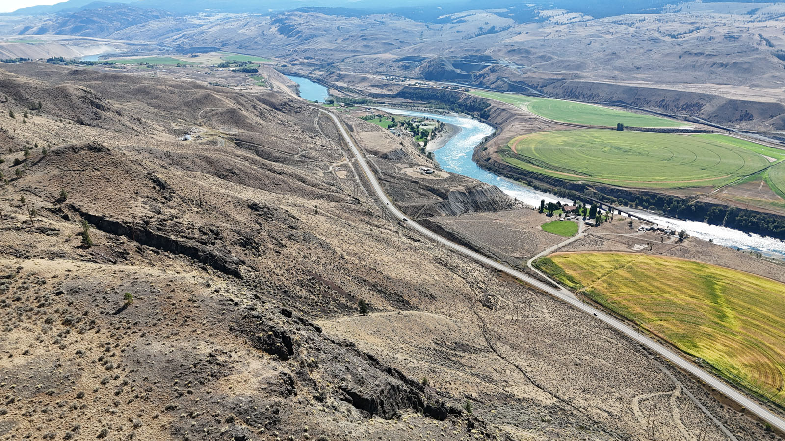
A quality internal road has been made into the land and up to both of these prime building op-tions. The land backs onto Crown land for recreational pursuits. Just down the road is Juniper Beach Provincial Park (boat launch on Thompson River) and GreenTee Country Club Tobiano golf course (one of Canada's top rated public courses) is a short drive east. Savona, a 10 mi-nute drive, has a boat launch onto Kamloops Lake and a marina at Tobiano offers seasonal moorage slips. Kamloops is 20-25 minutes away for all your amenities. GST is applicable on price.
Seller is open to finance for up to 2 years at an attractive rate of 3%. An ideal offering allowing you to set up a nice cabin/home and then refinance more easily with the bank. Priced to sell—property is assessed for over $400k.
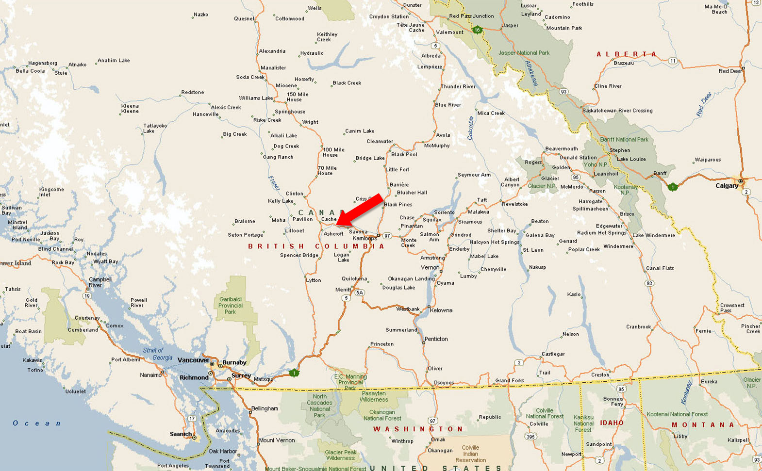
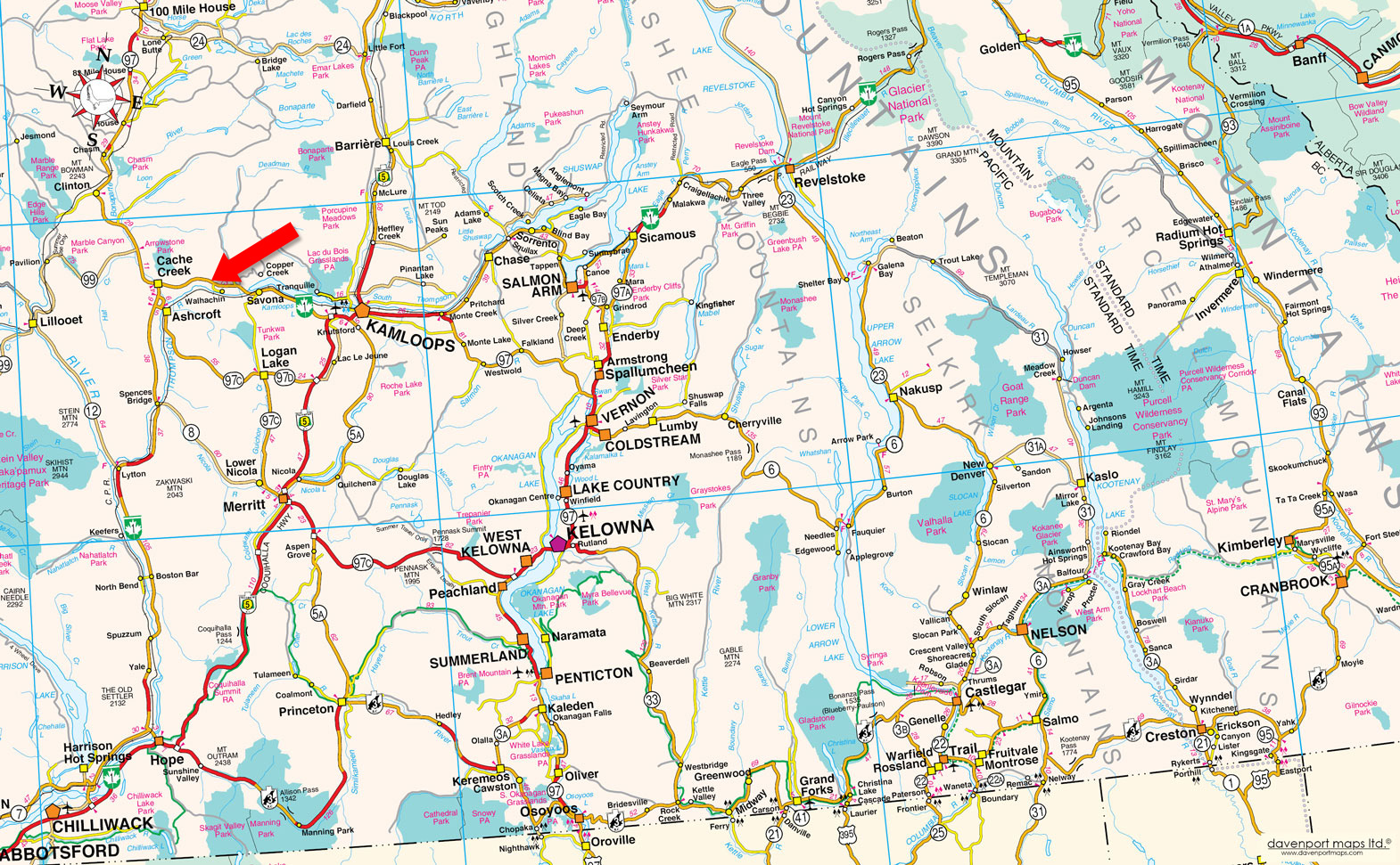
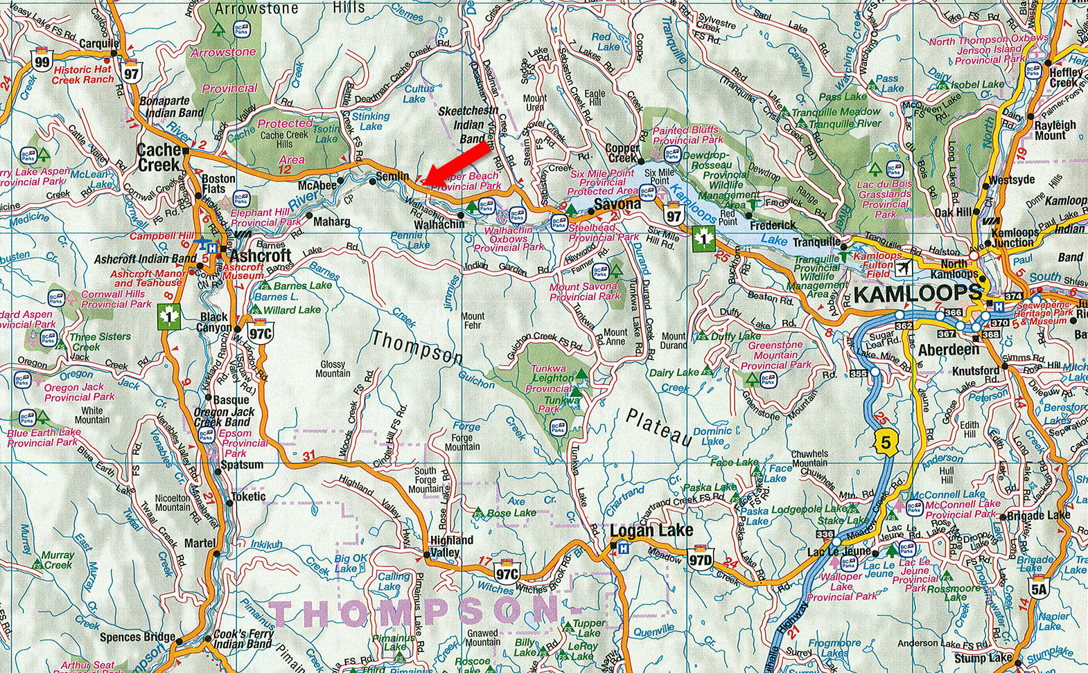
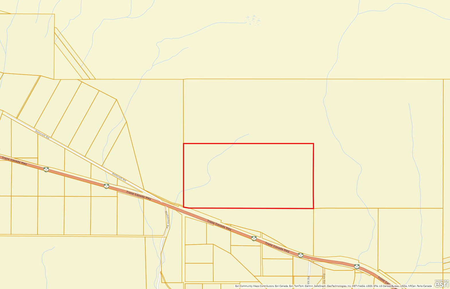
Ashcroft Road - Walhachin, BC
This acreage is accessible off of Ashcroft Road, a frontage road along the highway. Ashcroft Road is directly across from Walhachin Road and just west of the Walhachin/Museum sign. Off the frontage road there is an easement that runs for a few hundred feet across one parcel of land (listed for sale) and connecting to this acreage. Same seller owns this piece and would offer a package price for both. Please see maps.
At the turn of the century, British Columbia experienced economic prosperity, attracting upper-class Englishmen to settle in Walhachin. In 1908, the British Columbia Development Association Ltd. purchased approx. 3,500 acres of benchland properties, west of Kamloops along the South Thompson River. The intention was to create a community surrounded by orchards. During the World War I, Walhachin had the highest enlistment rate per capita of any Canadian community with 97 of the 107 able bodied men signing up during the war. Many settlers and their families returned to their aristocratic roots and fought for the “mother country.” After the war, only a few settlers returned, leading to the decline of Walhachin. Today, only remnants of the irrigation flumes, relic homes, and fruit trees remain. The flumes run through this acreage.
This property is well located to take advantage of some amazing recreational opportunities.
Less than a 20-minute drive to the east is GreenTee Country Club Tobiano, one of Canada’s top rated public courses and top 100 in the world. At Tobiano you will also find Bruker Marina where there are seasonal slips available and a gateway to Kamloops Lake. There is also a public boat launch on Kamloops Lake just 10 minutes away in Savona. Kamloops Lake has great boating and fishing.
On the west side of the land and just a 5-minute drive west is Juniper Beach Provincial Park with access/a boat launch to the Thompson River, where one could boat up into Kamloops Lake.
Please see maps and aerial photos, all boundary lines on maps and aerial photos are approximate sketches.
50°46'27.66"N and 121° 1'15.74"W
Drilled well—approximately 3 litres a minute. The well is deep and has a large capacity/reservoir to get through high use periods, but adding a cistern would add more water flexibility.
How much water does an average single family home use a day . . . The water consumption for a single-family home with three bedrooms can vary significantly based on household habits and the efficiency of appliances. However, a rough estimate for a typical household is around 375 to 450 litres per day.
Cell reception.
Although power runs along the highway and there is about 110 feet of frontage on the highway right of way, it would be more economically feasible and well suited for the area for solar power.
Bare land.
$1,545
The above taxes are based on the current assessment of $410,600, the tax rate will drop once there is a sale at a lower price or if appealed.
RL-1 (TNRD)
Permitted Uses
One single family dwelling with or without a secondary suite, or one duplex, agriculture, winery, cidery, micro brewery, etc.
Accessory Uses
Home based work, Bed and Breakfast, Kennel, riding stable, Outbuildings, etc.
Building Scheme
No single-wide mobile homes.
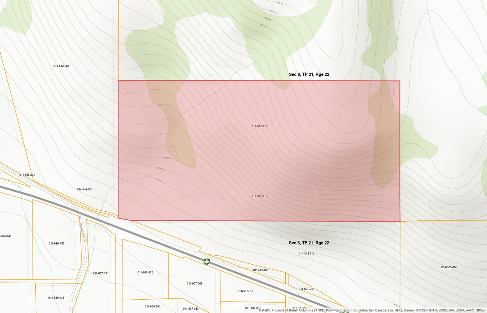
Only a small section of the property is in the Agricultural Land Reserve—approximately a few acres in the northeast corner.
PART S1/2 OF NW1/4, SECTION 8, TOWNSHIP 21, RANGE 22, MERIDIAN W6, KAMLOOPS DIV OF YALE LAND DISTRICT, EXCEPT PLAN H674
PID 014-542-111
 +10 maps
Our property descriptions and geographical information are taken from the BC Assessment Authority, Land Titles Office, government maps and other sources. While LandQuest® does not guarantee the information, we believe it to be accurate, but should not be relied upon without verification. This communication is not intended to cause or induce breach of an existing agency agreement.
Savona
 29℃
29℃
 19℃
19℃