


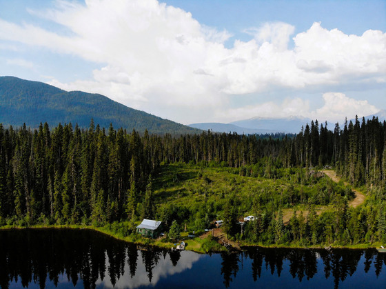
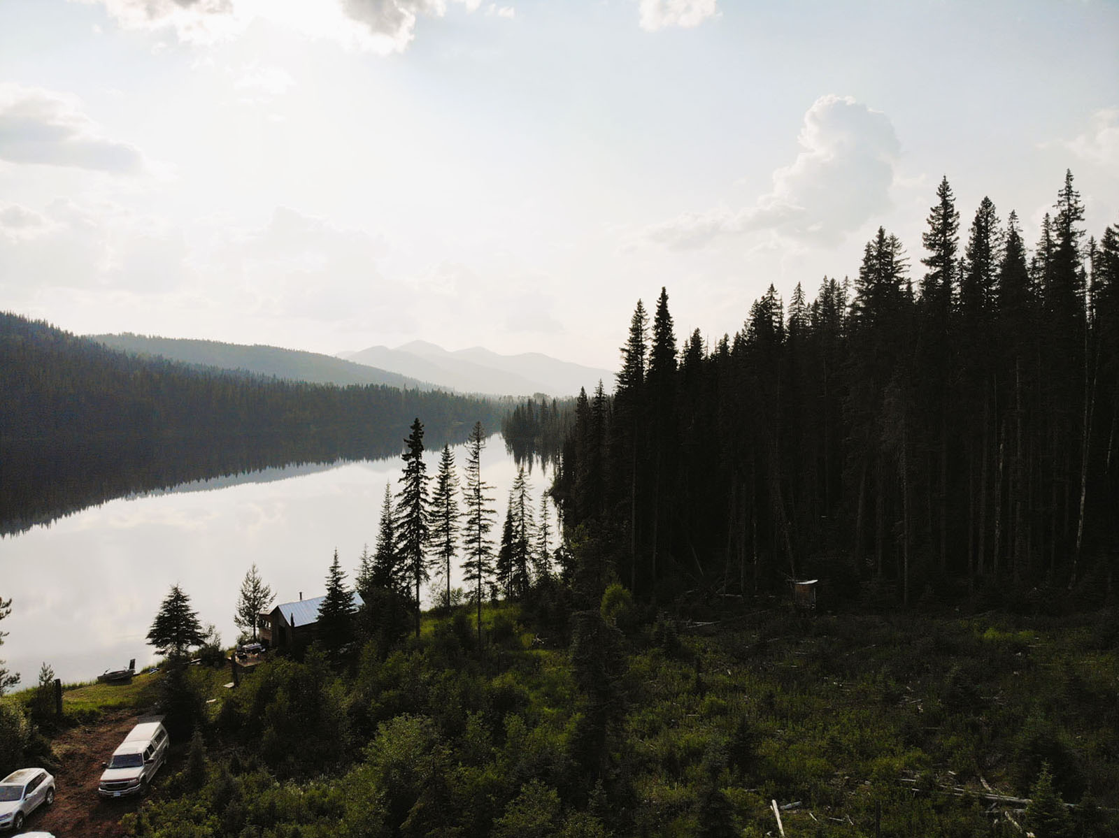
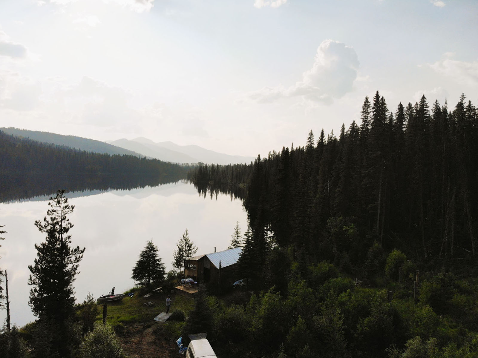
Amazing recreational property on Chisel Lake in the North Cariboo region near Bowron Lakes Provincial Park. Chisel Lake is 1.1 km long & stocked with an abundance of rainbows. Cabin has a small kitchen, living room, bedroom, sun deck & lakeside deck where you can cast your rod right out into the lake!


 +20 photos
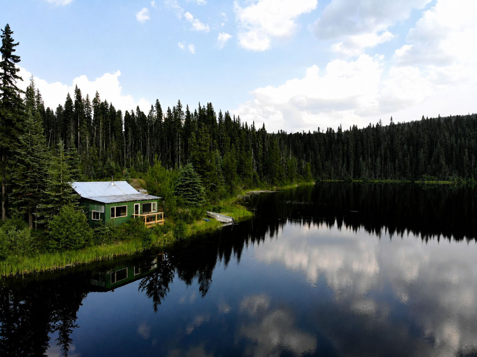


Amazing recreational property on beautiful Chisel Lake in the North Cariboo region near Bowron Lakes Provincial Park.
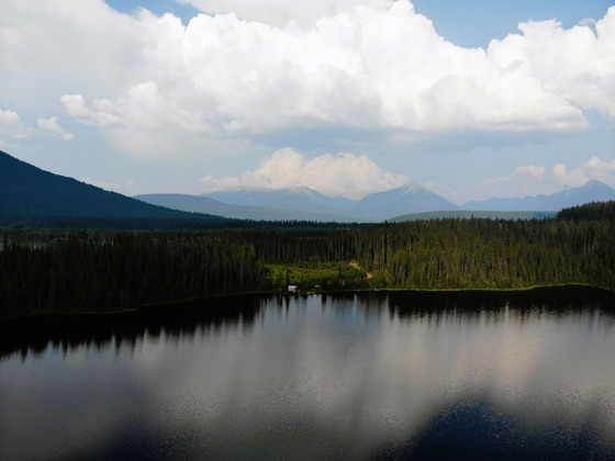
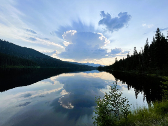
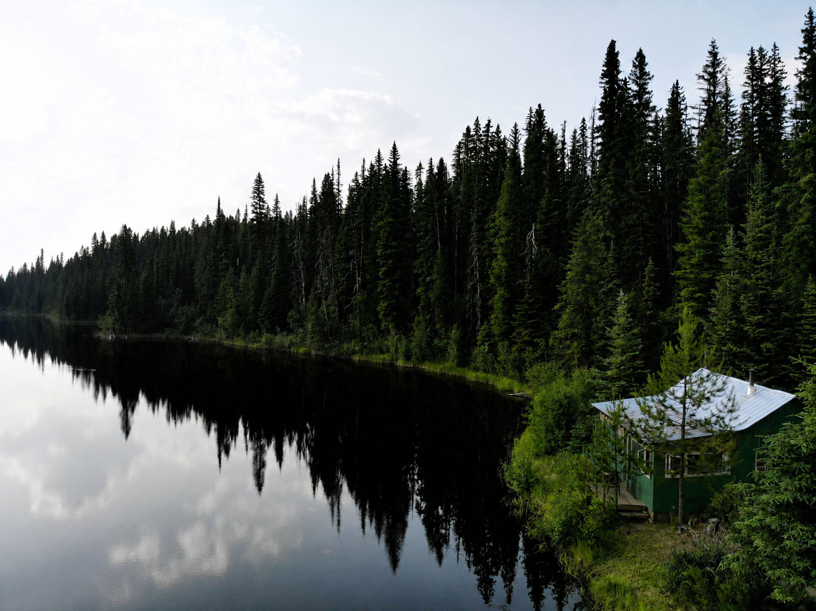
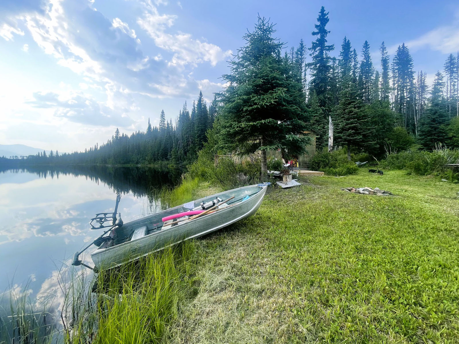
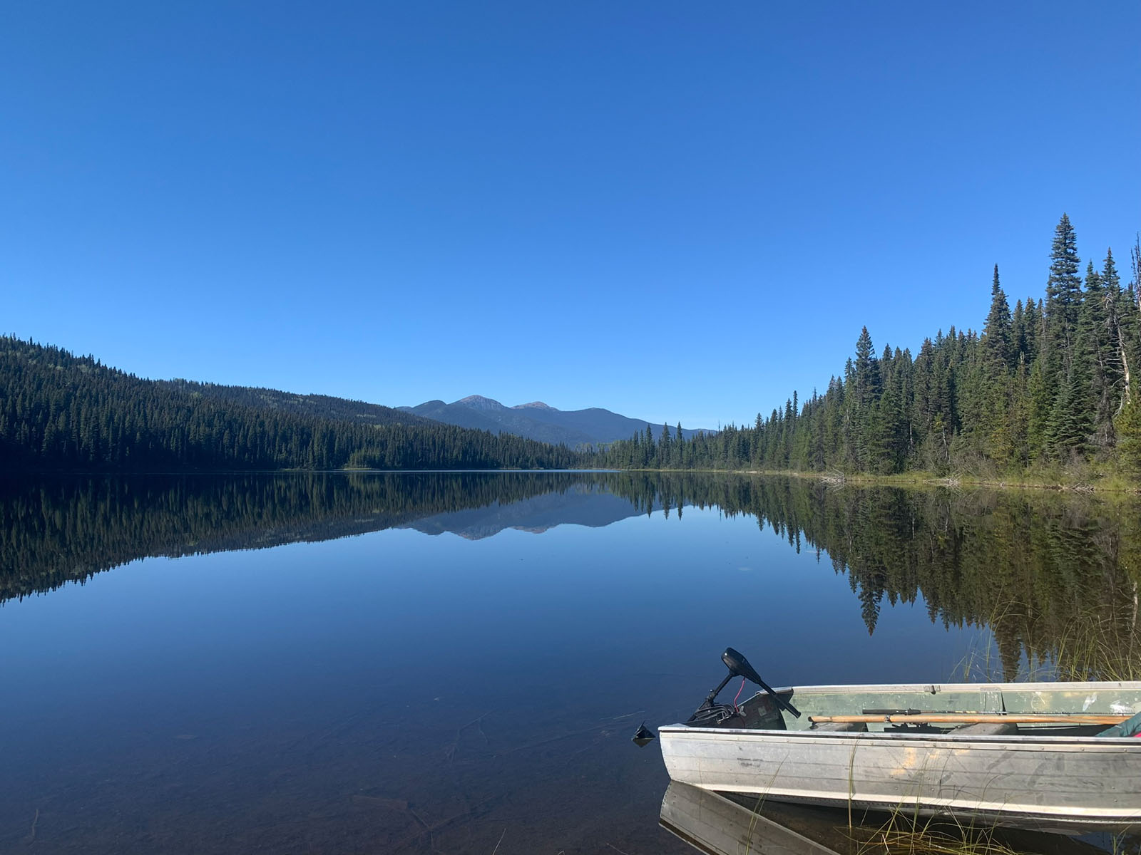
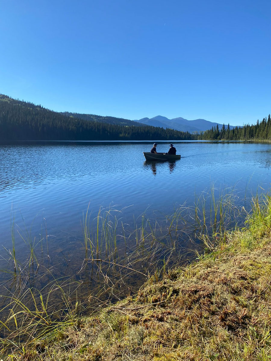
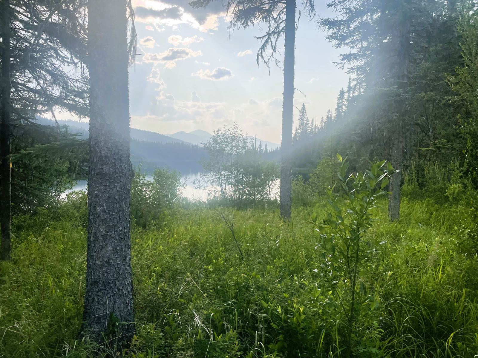
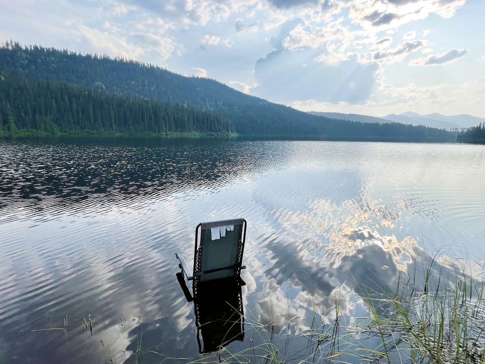
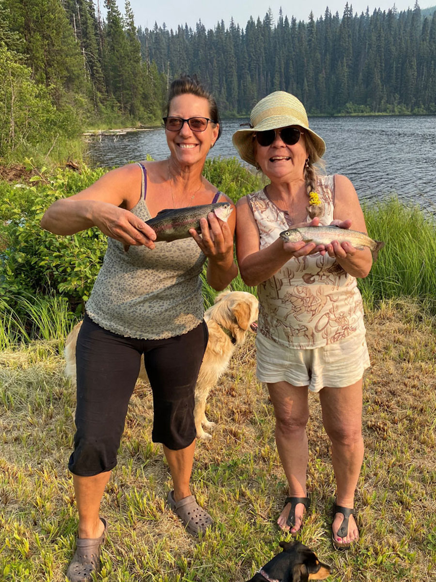
This unique and very scenic property is the only property on the lake; a naturally stocked lake with an abundance of rainbows and a great little boating and swimming lake (1.1 km long). The lake has multiple in and outflows and provides some valuable spawning grounds for the lake trout one of which is on the property.
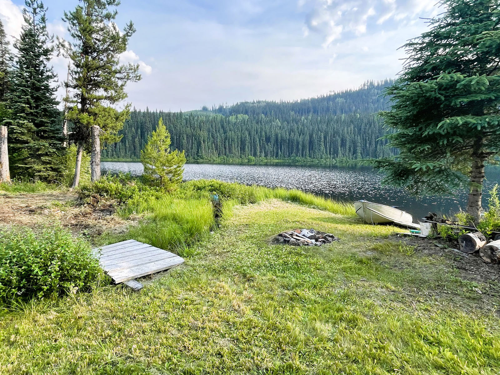
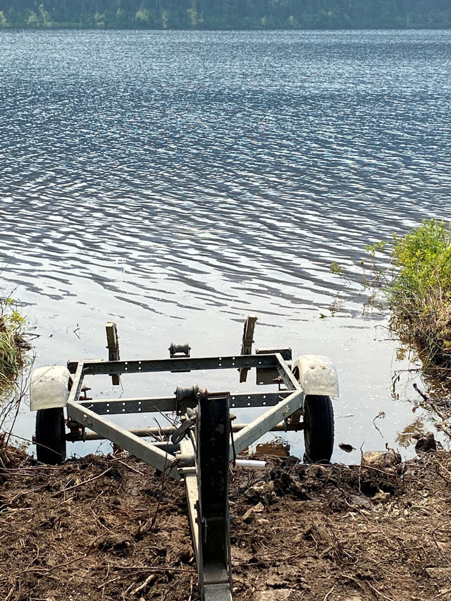
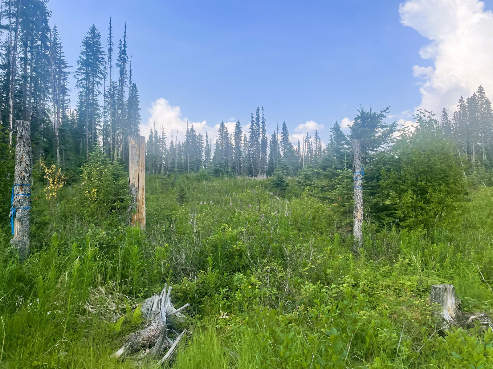
The land is mostly clear with healthy re-growth underway. Around the cabin the owners keep the grass down and recently added a simple boat launch for where you can conveniently launch an aluminum boat.
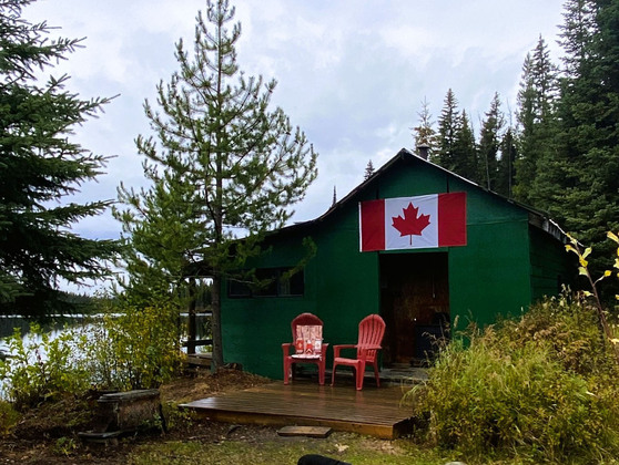
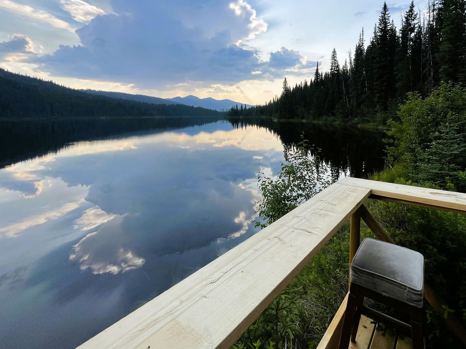
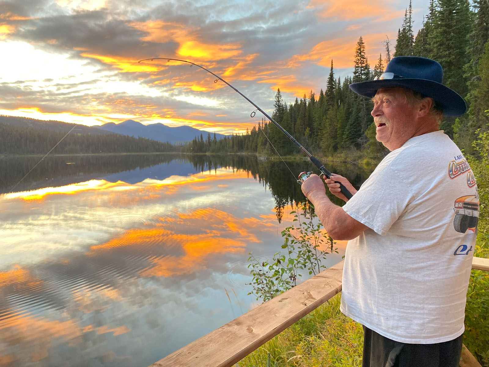
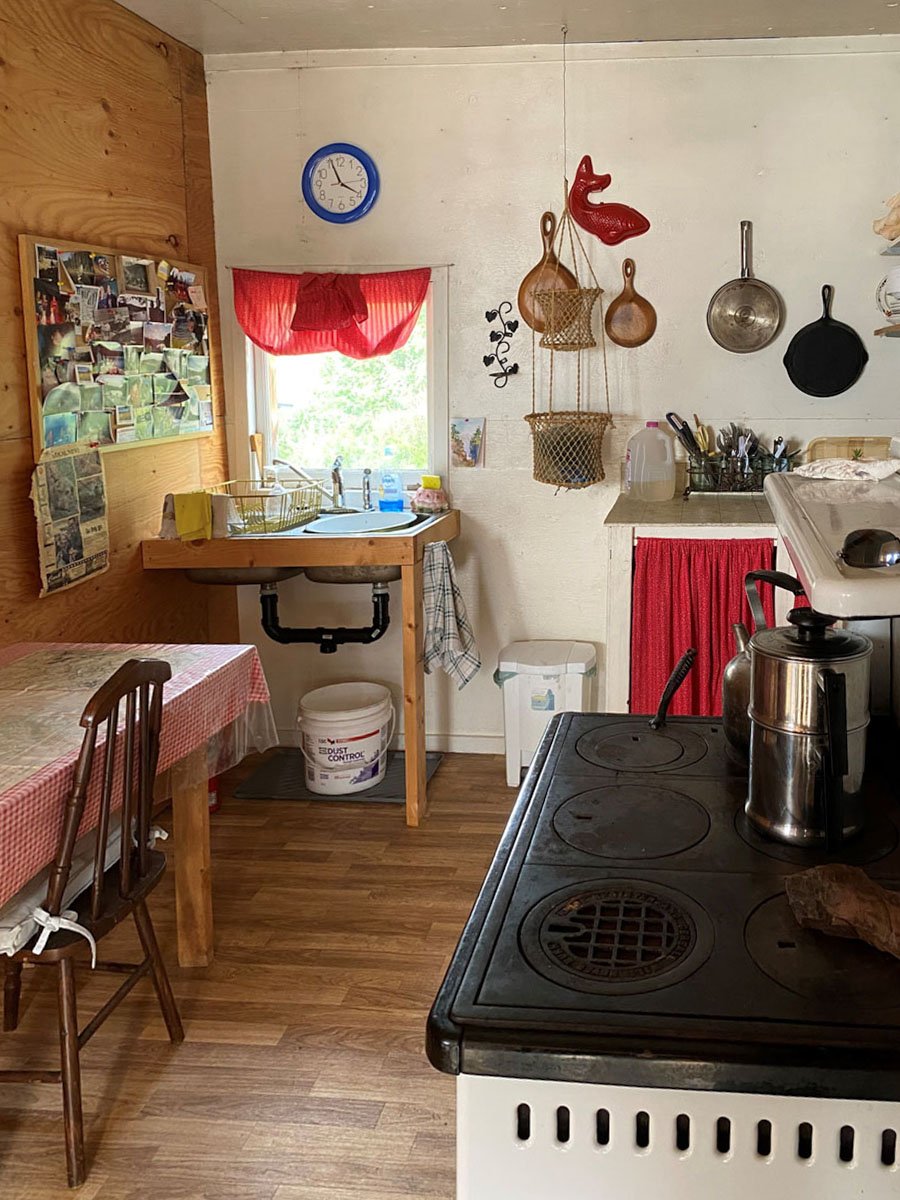
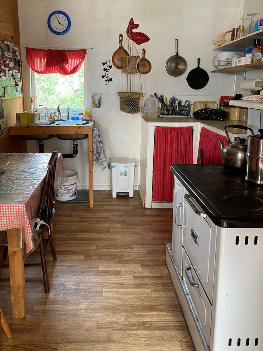
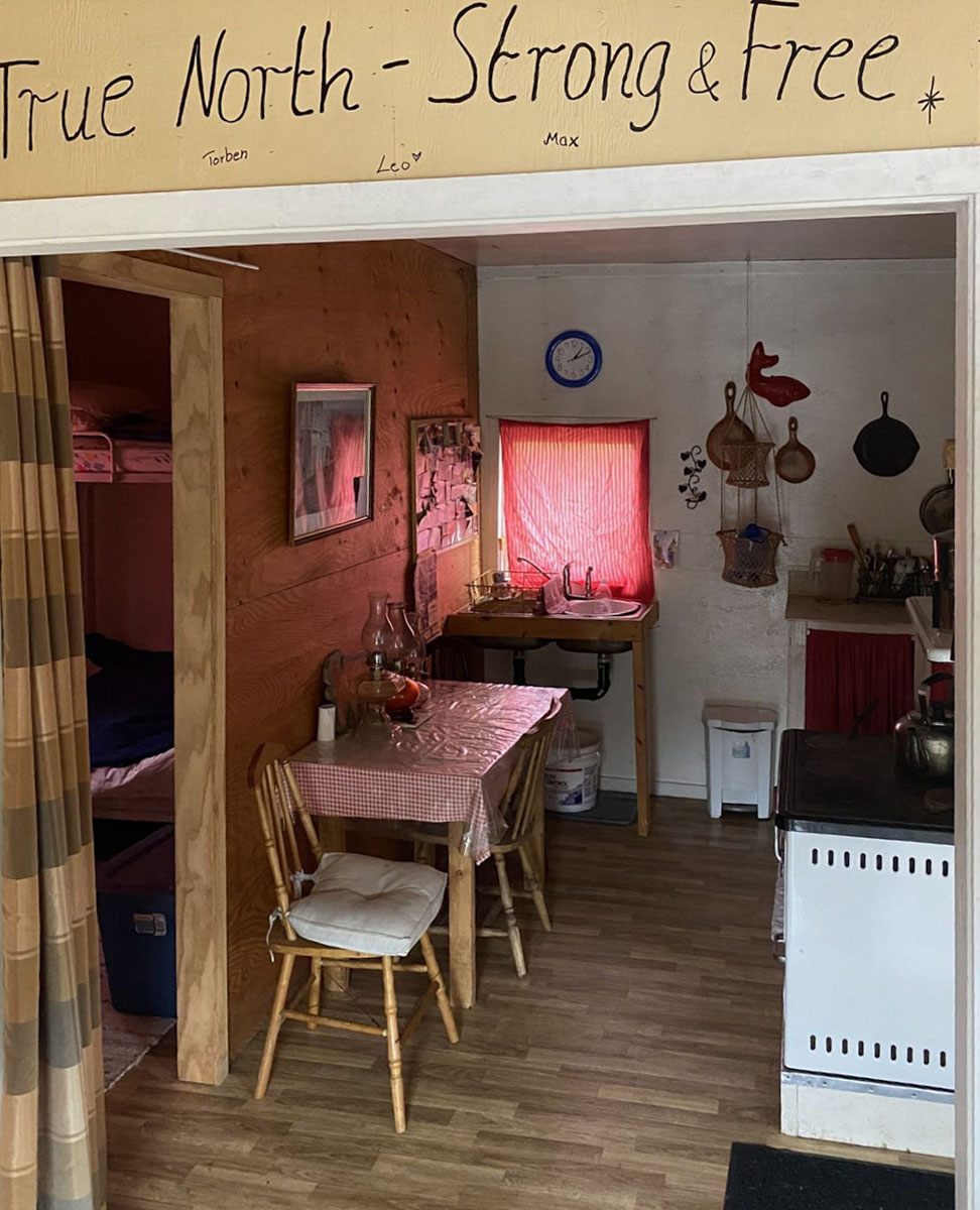
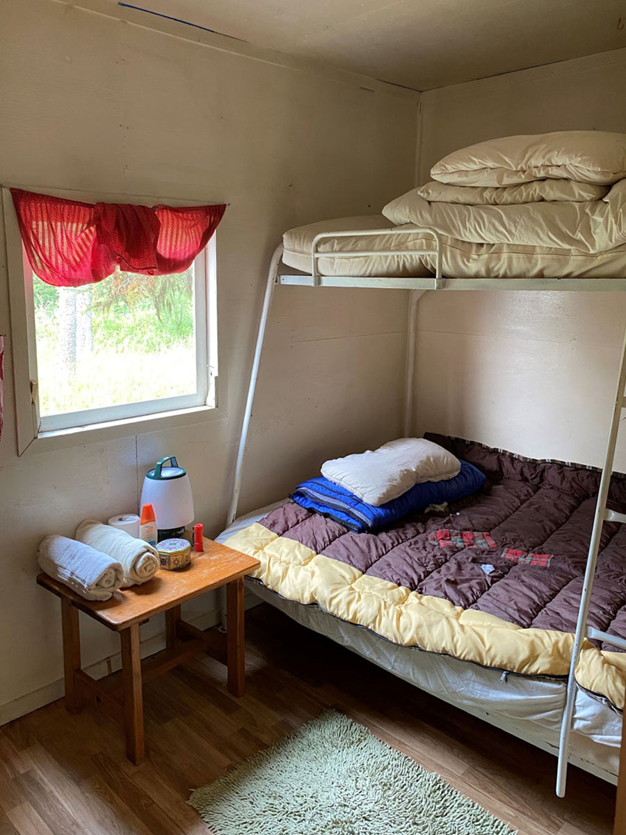
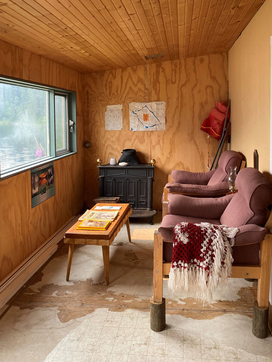
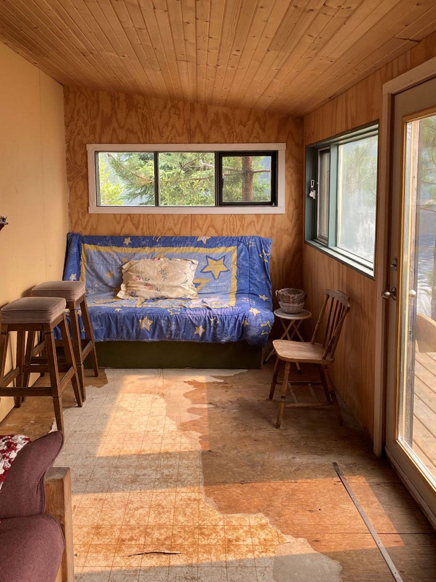
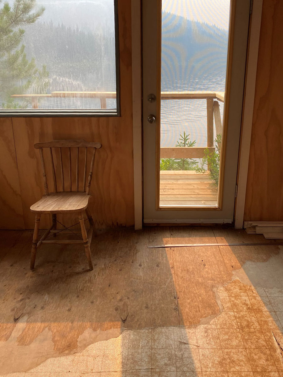
The cabin itself has a small kitchen with wood cookstove, living room, bedroom, sun deck and lakeside deck where you can cast your rod right out into the lake!
Access to the property is seasonal via approx. 10 km of forest service road, although in winter coming by sled is a great option and has been done in the past.
Updates in the past two years include:
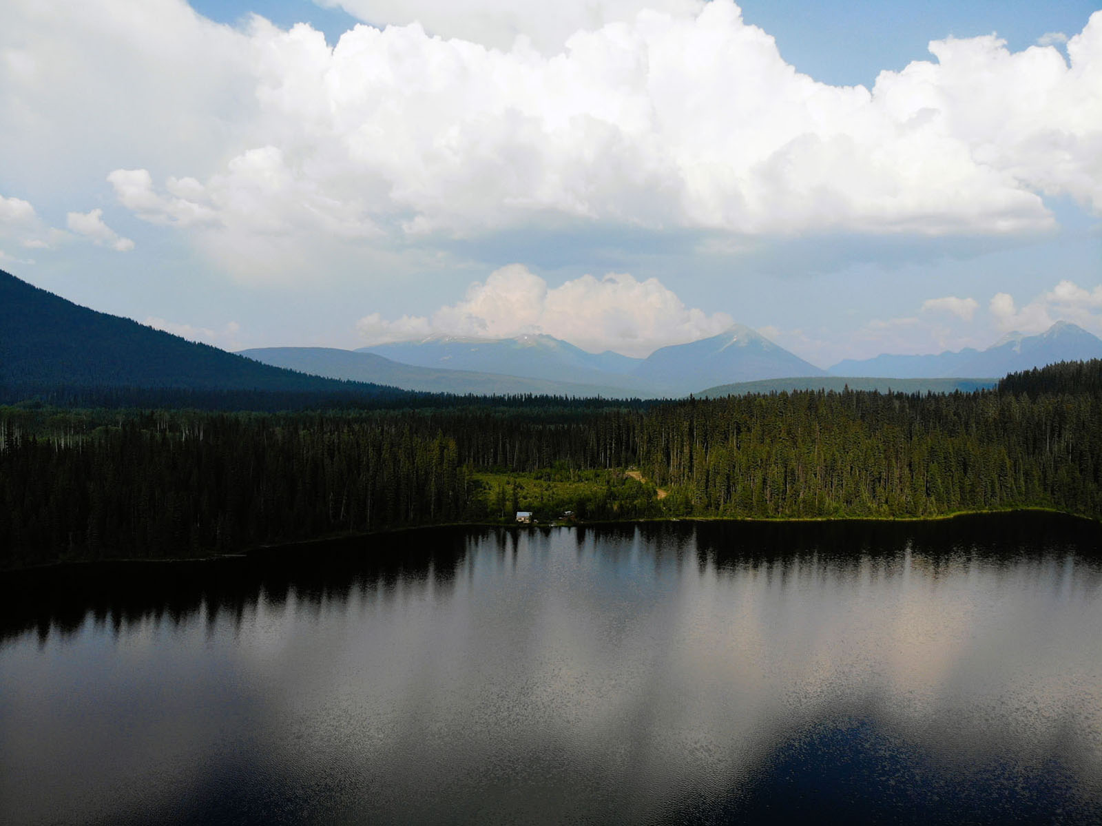
Overall, the property is surrounded by world class recreation and stunning remote mountain scenery. The boundary to Bowron Lakes Provincial Park is approx. 590 metres away, and the main lodge/infrastructure for the Canoe Circuit is just 30 minutes away. Here you can paddle for 6 to 10 days around the circuit. The Atan-Chisel Lake snowmobile loop runs by the lake, this cabin location would be amazing for a sledder. Upon arrival in winter, fire up the cook stove and you will be toasty in no time. Once on site the cross-country skiing/snowshoeing around the lake and the quiet winter days and nights is the perfect scene to rest the soul.
The wildlife flows in the area are very healthy, offering regular sightings and an excellent hunting environment. I can’t imagine a better set up for a hunting and fishing cabin anywhere in BC.
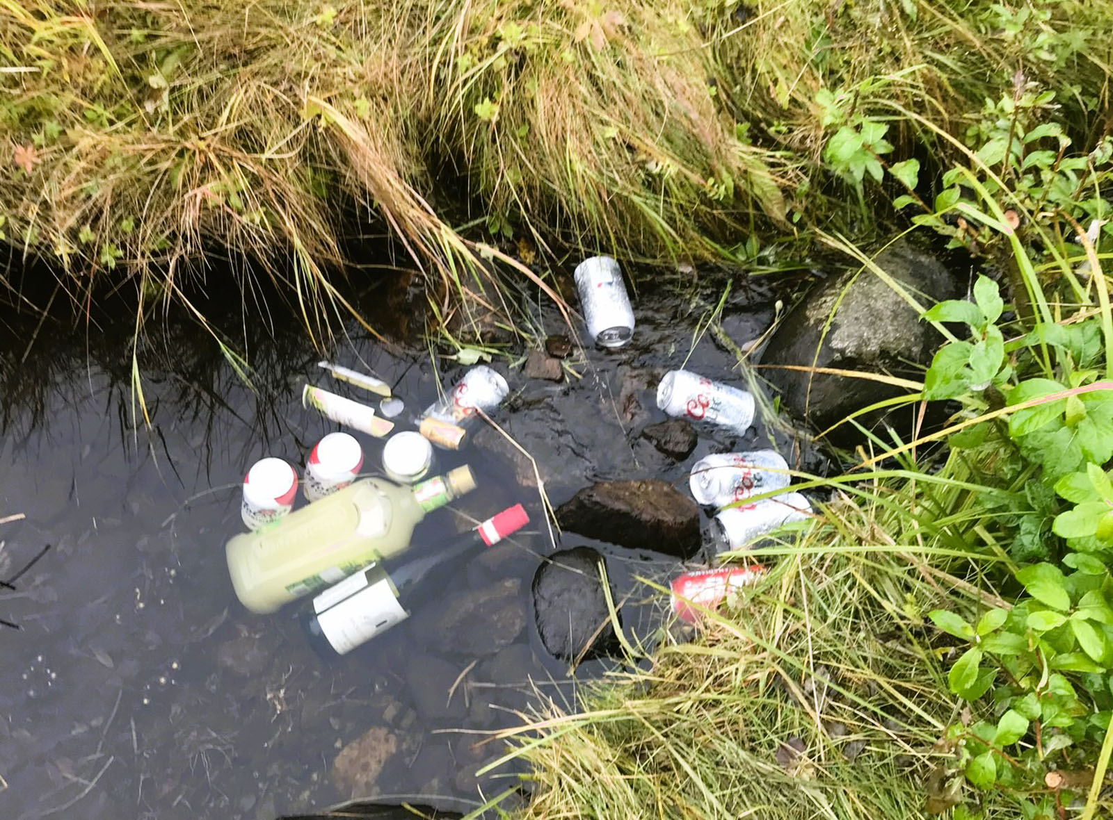
Cabin is comfortable and very functional and ready and waiting to be used on day one. Just move in, stock the creek with your favorite beverages and enjoy!
Chisel Lake is located in the North Cariboo Region of BC, approx. 80 km as the crow flies east of Quesnel.
Follow Google Maps/your GPS to Wells, BC.
Directions to get to the 2900 Road and Chisel Lake cabin:
From Wells, carry on through the town on Highway 26 for another 4.5-5 km and look for the 2900 Road toward Bowron Lakes Provincial Park. There is good signage for this turn towards Bowron Lakes.
Set your odometer to 0 and turn right on Bowron Lakes Road. This road is maintained and cleared year-round. Drive for 15.75 km and then the road will fork, take the right fork onto the 2900 Road (the less travelled route). If you did not turn you would go to Bowron Lakes Provincial Park). This is a Forest Service Road and is not usually maintained in winter. The 2900 Road is exactly across from the Sister Mountain access for hikers or bikers to ascend the Sisters Mountains.
Drive for another 9 to 9.5 km, you will cross a bridge over Antler Creek a prominent creek in the area, hen turn up a hill following the main road until you come to a three-way split. Take the middle split to Chisel Lake and Atan Lake. You’ll come to Atan Lake first and 2 km past is Chisel Lake. Continue past Chisel Lake recreation area. The next left will be at the head of Chisel Lake and here you cross about 750 metres of Crown land (permitted). That will take you around the head of the lake to the cabin. Access to the cabin is on your left before the bridge that crosses Darell Creek, which runs past the cabin into Chisel Lake.
The land was cleared a few years ago so the boundaries will be easy to see.
Four wheel/AWD drive required.
Matt can also send a file you download to your phone as long as you have Google Earth on your phone, and you can then follow the route out to the cabin even without cell. You will need to open the file in Wells and before you lose cell service. Contact the agent for details.
Barkerville is a historic town located in the North Cariboo region of British Columbia. It is one of the most famous and well-preserved examples of a 19th century gold rush town in North America. Barkerville is a designated National Historic Site of Canada and it attracts thousands of visitors each year, offering a glimpse into the exciting and challenging times of the Cariboo Gold Rush.
Key highlights of Barkerville include:
Gold Rush History
Barkerville owes its existence to the Cariboo Gold Rush, which began in 1862 when gold was discovered in the nearby Williams Creek. The news of the gold strike quickly spread, leading to a massive influx of prospectors from all over the world seeking their fortune. Barkerville became the central supply and service center for the goldfields.
Historic Buildings
Barkerville boasts over 100 original and restored buildings from the gold rush era. These buildings include general stores, saloons, hotels, Chinese eateries, blacksmith shops, and more. Tourists can explore the streets and interiors of these buildings, offering a unique and immersive experience of life during the gold rush.
Costumed Interpreters
To enhance the historical experience, Barkerville employs costumed interpreters who portray characters from the 1860s. These interpreters provide guided tours, performances, and demonstrations, bringing the town's history to life and offering insights into the challenges faced by early settlers and prospectors.
Chinese History
Barkerville was home to a significant Chinese community during the gold rush era. The town offers a Chinese Quarter, reflecting the culture and lifestyle of the Chinese immigrants who contributed to the development of the region.
Visitor Center and Museum
Barkerville has a modern visitor center that provides information about the town's history, artifacts from the gold rush period, and interactive exhibits. The museum is a great place to start a visit to gain context and understanding before exploring the historic town.
Theatre and Events
Barkerville hosts various events, including theater performances, concerts, and festivals throughout the year, which further immerse visitors in the town's history and culture.
Nearby Outdoor Activities
Barkerville is surrounded by beautiful wilderness and offers opportunities for outdoor activities such as hiking, fishing, and wildlife viewing in the Cariboo Mountains.
Wells is a small community in the North Cariboo region of British Columbia, situated in the northern part of the Cariboo Mountains. Wells has a rich history, and it played a significant role during the Cariboo Gold Rush in the late 1800s. Gold was discovered in the area in 1862, leading to a rush of miners and prospectors seeking their fortune. Barkerville, located nearby, became the main center of the gold rush and a bustling town. Wells served as a supply and transportation hub for the miners heading to Barkerville. While the gold rush era is long gone, Wells still retains its historical charm and character. Today, the town is known for its artistic community and cultural events. It has become a destination for artists, writers, and musicians, fostering a vibrant arts scene. Wells has many historic buildings and sites from the gold rush era, visitors can visit these attractions to get a glimpse of the region's past and learn about the challenges and triumphs of the early settlers. There are a few dining/café options, pub, museum and shops.
A stunning wilderness area located in the North Cariboo region of British Columbia, it is known for its interconnected chain of lakes and rivers, offering a world-class canoe circuit that attracts outdoor enthusiasts from around the globe. Here's what you need to know about Bowron Lakes:
Canoe Circuit
A 116-kilometre route that takes paddlers through a series of lakes, rivers, and portages. The circuit typically takes around 6 to 10 days to complete, depending on your pace and experience. It offers a unique wilderness experience with breathtaking scenery and opportunities for wildlife sightings.
Lakes and Rivers
The canoe circuit consists of several lakes, including Bowron Lake, Indianpoint Lake, Isaac Lake, and Lanezi Lake, among others. Paddlers will navigate the Cariboo River and the Isaac River, experiencing varying levels of difficulty along the way.
Portages
Throughout the circuit, there are several portages where canoers must carry their gear and canoes overland to the next body of water. These portages vary in length and difficulty, adding an extra challenge and adventure to the journey.
Camping
Designated camping areas along the canoe circuit. These sites are equipped with pit toilets, bear-proof food caches, and tent pads. Permits are required for camping, and reservations are highly recommended, especially during the peak summer season.
Wildlife
The park is home to a diverse range of wildlife, including moose, deer, bears, beavers, and a variety of bird species. Paddlers often have the opportunity to observe wildlife in their natural habitat during the journey.
Fishing
Fishing is permitted in the park, and some of the lakes offer excellent opportunities for catching trout and other fish. Anglers must have a valid British Columbia Fishing Licence.
Weather and Seasons
The canoe circuit is typically open from May to September, with the summer months being the most popular time for paddling.
The fishing is unbelievable on the lake. Either take the boat out or fish right off the deck.
In winter the snowmobile circuit through here is world class.
Please see mapping section, all boundaries are approximate.
53°10'51.37"N and 121°21'4.03"W
$525 (2025)
Rural 3 - Resource Agricultural (Cariboo Regional District)
Single-family residential dwelling, two-family residential dwelling unit/duplex, secondary suite and must be subordinate to a single-family residential dwelling; or carriage house and must be subordinate to a single-family residential dwelling, or a temporary dwelling unit in conjunction with a single-family residential dwelling, bed and breakfast accommodations or rooming and boarding accommodations ancillary to a permitted residential use.
Please refer to the Cariboo Regional District for the full bylaws and allowances.
Block A District Lot 12932 & 6846 Cariboo District
PID 023-321-857
Multiple Listing Service®
 +10 maps


Our property descriptions and geographical information are taken from the BC Assessment Authority, Land Titles Office, government maps and other sources. While LandQuest® does not guarantee the information, we believe it to be accurate, but should not be relied upon without verification. This communication is not intended to cause or induce breach of an existing agency agreement.
Barkerville
 24℃
24℃
 18℃
18℃