


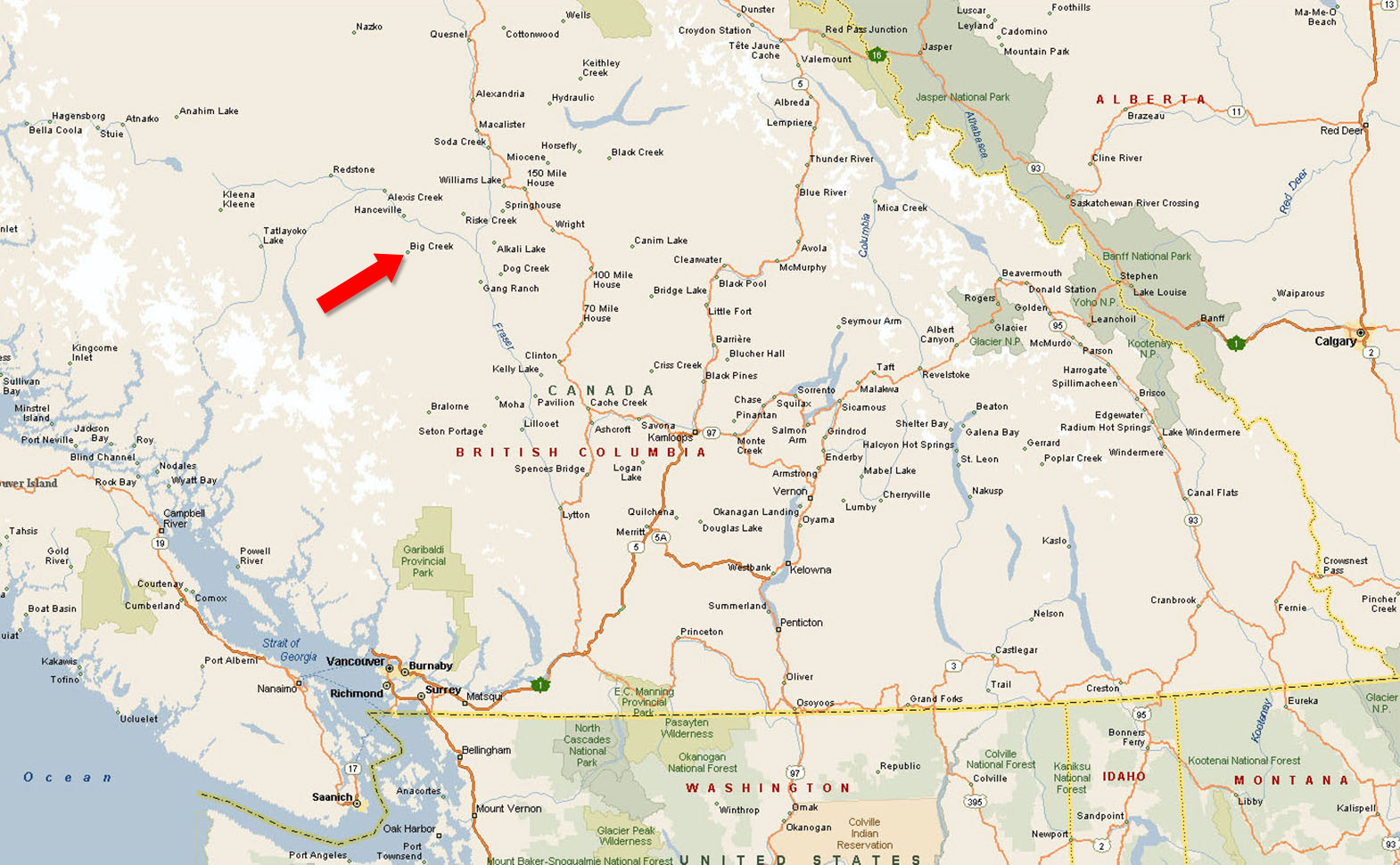
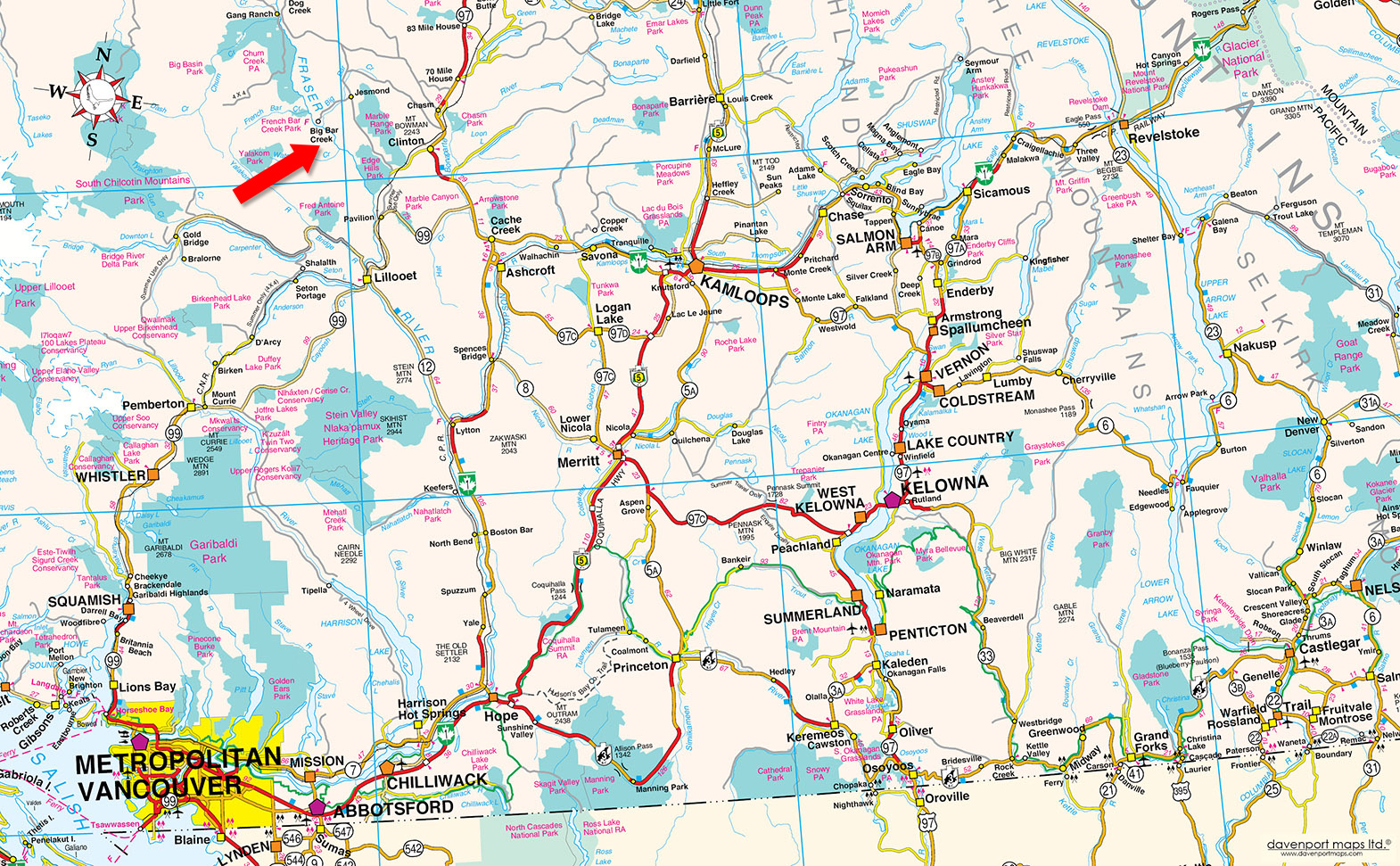
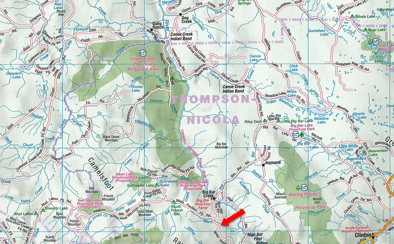
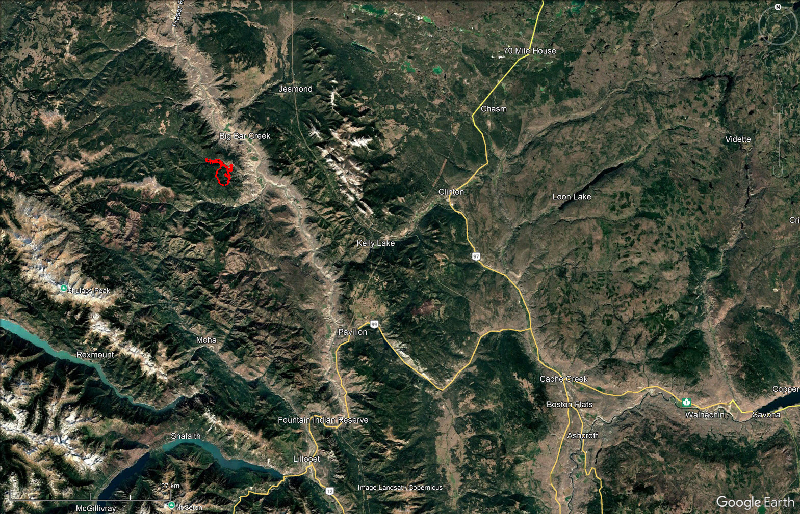
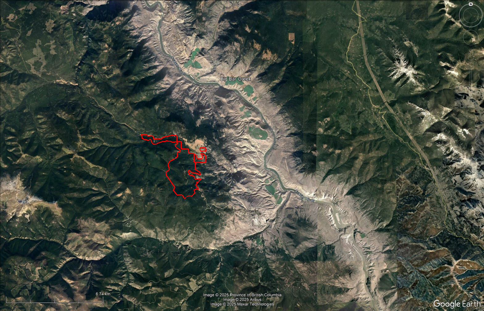
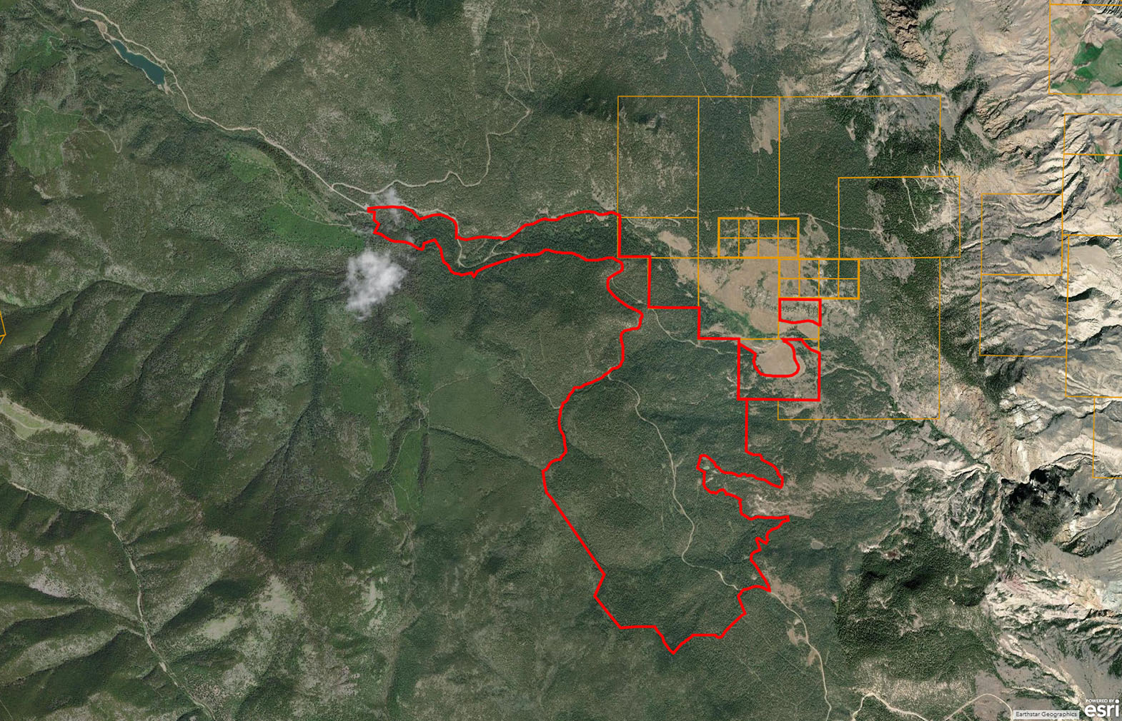
Priced for immediate sale Woodlot Licence W1478 has an annual allowable cut of 930 m3 for a total of 4,650 m3 available to be cut at any time during a 5-year period. Located on West Pavilion Road about 80 km from Lillooet.
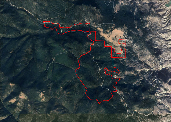
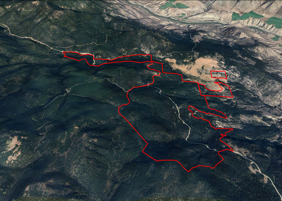
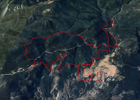
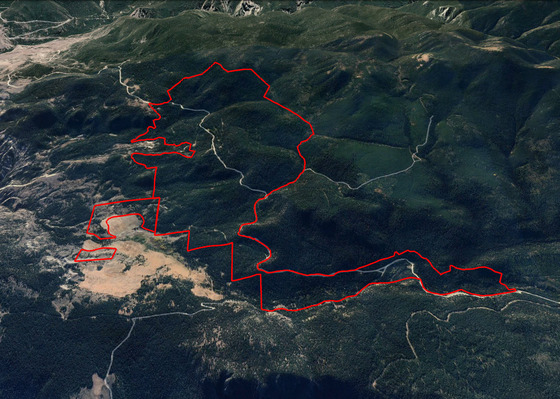
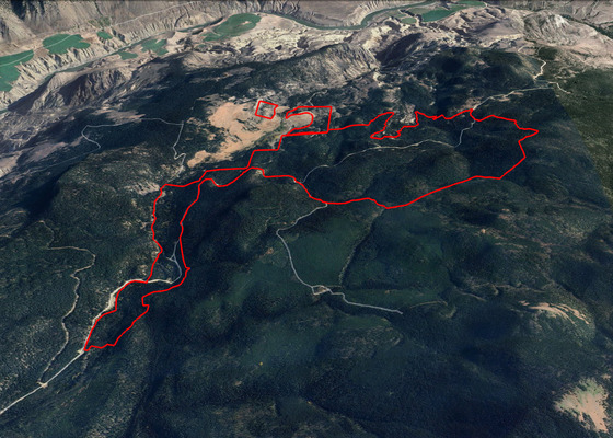
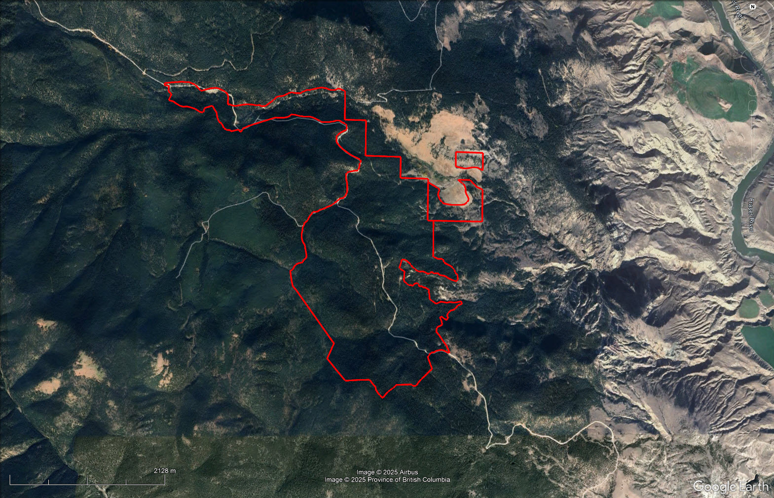
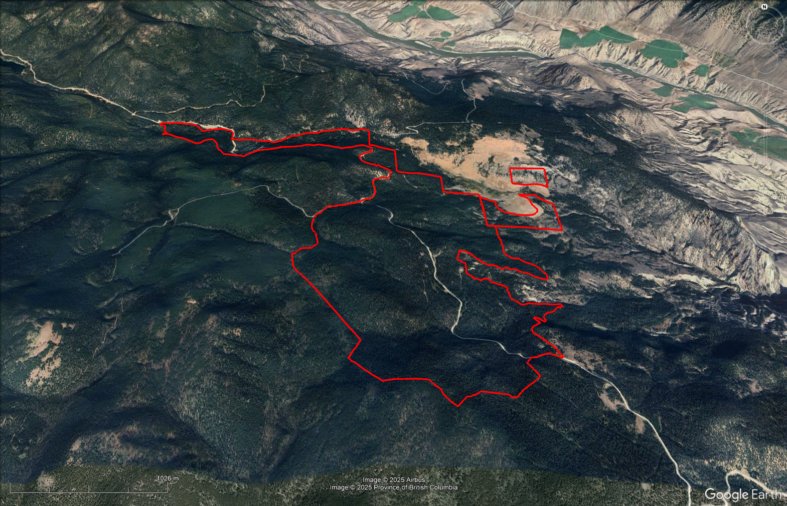
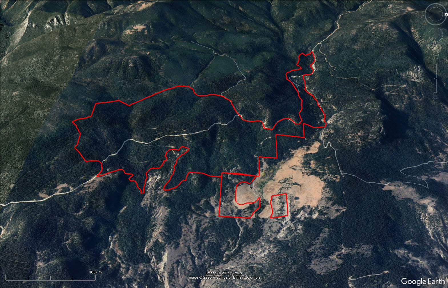
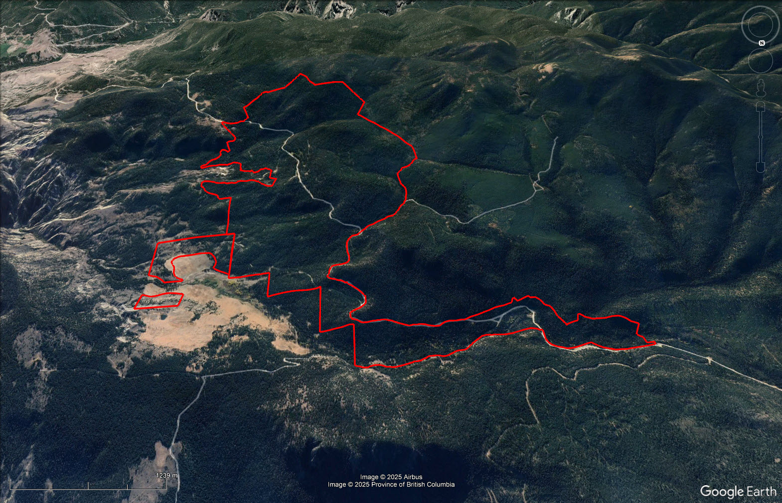
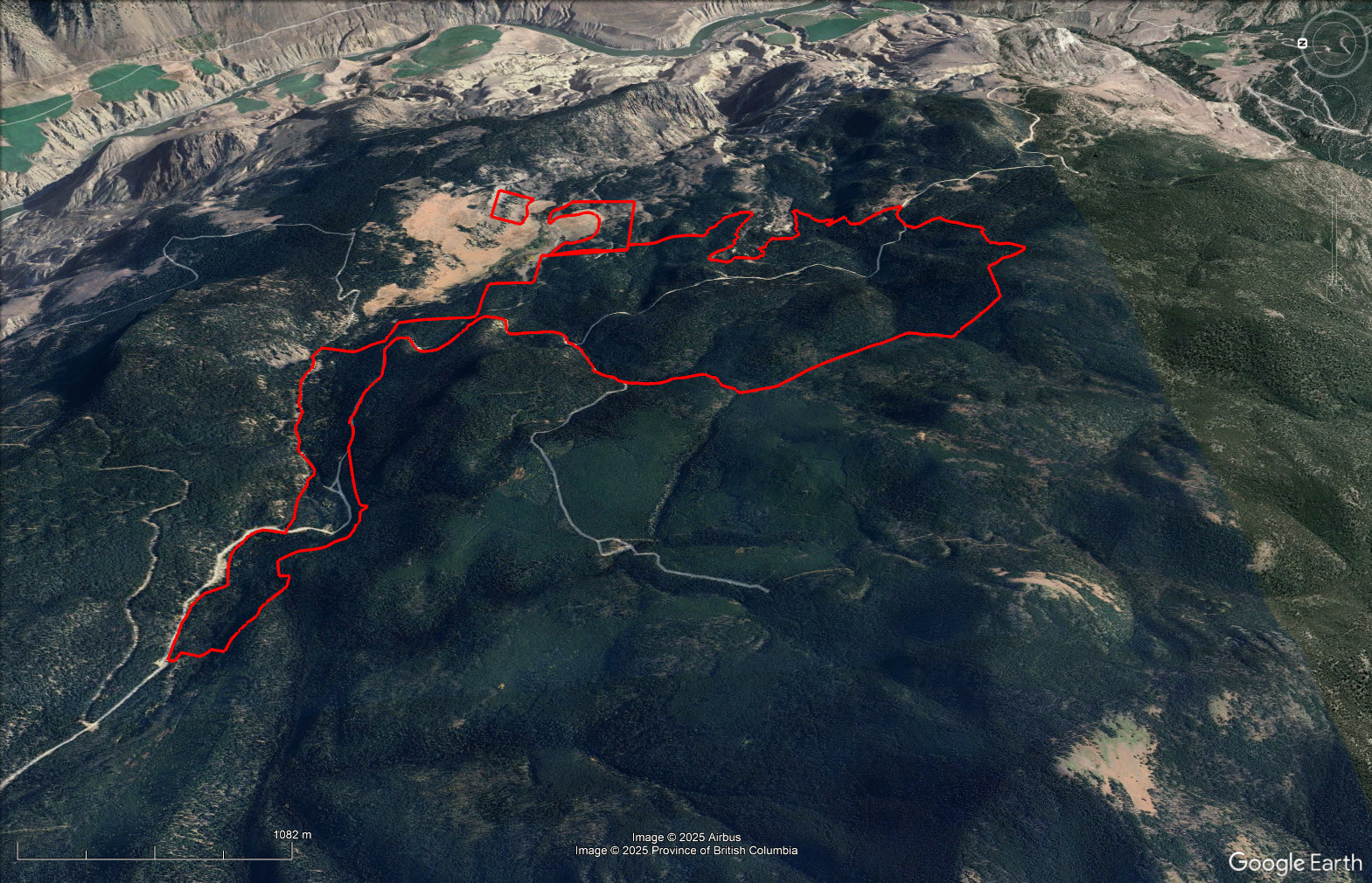
Priced for immediate sale Woodlot Licence W1478 grants the owner exclusive rights to manage and harvest Crown timber within the woodlot licence area. It has an annual allowable cut of 930 m3 making a total of 4,650 m3 available to be cut at any time during the 5-year period. There has been no logging for well over 10 years, so the AAC is available to cut at any time. Currently there are some deferrals on cutting old growth timber in the woodlot which can be discussed with the Tenures Forester.
It is located on West Pavilion Road from Lillooet on about 80 km of gravel road.
West Pavilion Road - Lillooet, BC
Please see the mapping section of this listing. It is located on West Pavilion Road from Lillooet on about 80 km of gravel road.
Lillooet, formerly known as Cayoosh Flat, is a historic community on the Fraser River in British Columbia, located about 240 kilometres from Vancouver along the old BC Railway corridor. Nestled among deep gorges in the lee of the Coast Mountains, Lillooet is defined by its striking geography and dry, semi-arid climate. The community receives just under 350 millimetres of precipitation annually, with very little snowfall, making it one of the driest and least snowy areas in the province. Summers are extremely hot, often placing Lillooet in competition with Lytton and Osoyoos for the title of “Canada’s Hot Spot.” Temperatures have reached as high as 46.8°C, and the town holds provincial records for hottest April, May, and December days.
Lillooet’s fertile benchlands and long growing season once made it a hub for prolific orchards and market gardens, and while agriculture is smaller in scale today, vineyards, farms, and local food producers remain part of the community’s identity. The surrounding wilderness provides year-round recreation, from fishing, canoeing, hiking, and mountain biking in the warmer months to snowmobiling and ice climbing in winter. Wildlife viewing and birdwatching opportunities abound, while nearby protected areas such as the South Chilcotin Mountains Provincial Park highlight the region’s rugged alpine terrain, pristine lakes, and rich biodiversity. Lillooet today offers a rare blend of dramatic natural landscapes, outdoor adventure, and living history, making it one of the most unique small communities in British Columbia.
Lillooet and Pavilion lie in a dry, semi-arid zone where sagebrush, bunchgrass, and ponderosa pine dominate the valley floors, while higher elevations transition into Douglas fir and mixed forest.
Lillooet offers an abundance of outdoor recreation thanks to its dramatic landscapes, hot dry climate, and access to the Fraser River and surrounding mountains. In the warmer months, visitors and locals enjoy:
Winter in Lillooet is milder than many Interior communities, but still provides opportunities for snowmobiling in the surrounding backcountry, cross-country skiing and snowshoeing on local trails and alpine areas, or scenic winter hikes in the semi-arid valleys that often remain snow-free.
Pavilion, located between Lillooet and Clinton, is surrounded by sweeping ranchlands, mountains, and lakes, offering quieter but equally appealing recreational options. Visitors can enjoy:
Pavilion takes its name from its striking appearance during the gold rush era, when a large white banner was flown over the community, visible to travelers moving along the River Trail and the Old Cariboo Road. During the Cariboo Gold Rush, Pavilion developed into a small but important boomtown, serving as a key junction between the Old Cariboo Road—climbing over Pavilion Mountain to Clinton—and the route through Marble Canyon to the Bonaparte River, which later became part of the Cariboo Road. The settlement quickly grew with miners’ huts, packtrain encampments, and ranch houses that doubled as hostelries for Cariboo-bound travelers.
Some of the ranches established at Pavilion are among the oldest land grants in British Columbia. The most notable was staked by Captain Martley under a military-officer settlement program, and the property later became part of the Diamond S Ranch, which continues the ranching tradition of the area today.
In nearby Lillooet, the community’s gold rush past is preserved through a self-guided walking tour of 14 historic sites, a collection of artifacts at the Lillooet Museum, and historic landmarks such as the Miyazaki House and the Lillooet Suspension Bridge. For those who want to experience the dramatic landscape firsthand, the Kaoham Shuttle provides a memorable trip along the shores of Seton Lake, passing through areas of natural beauty and historic significance.
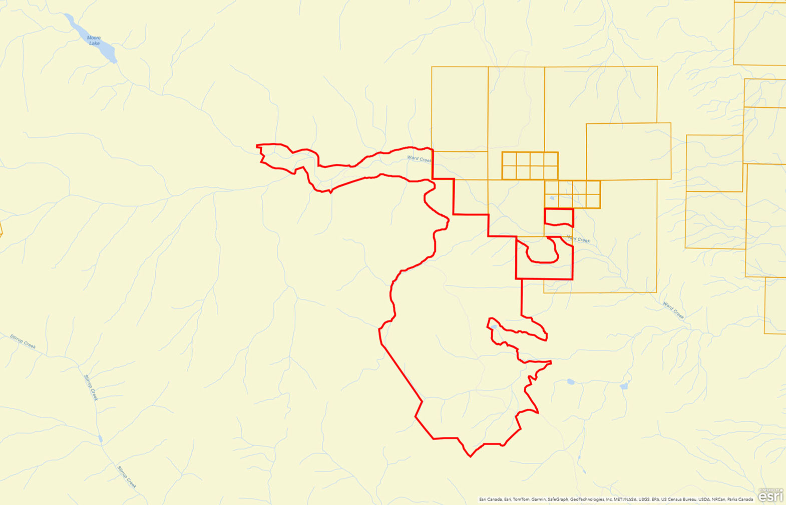
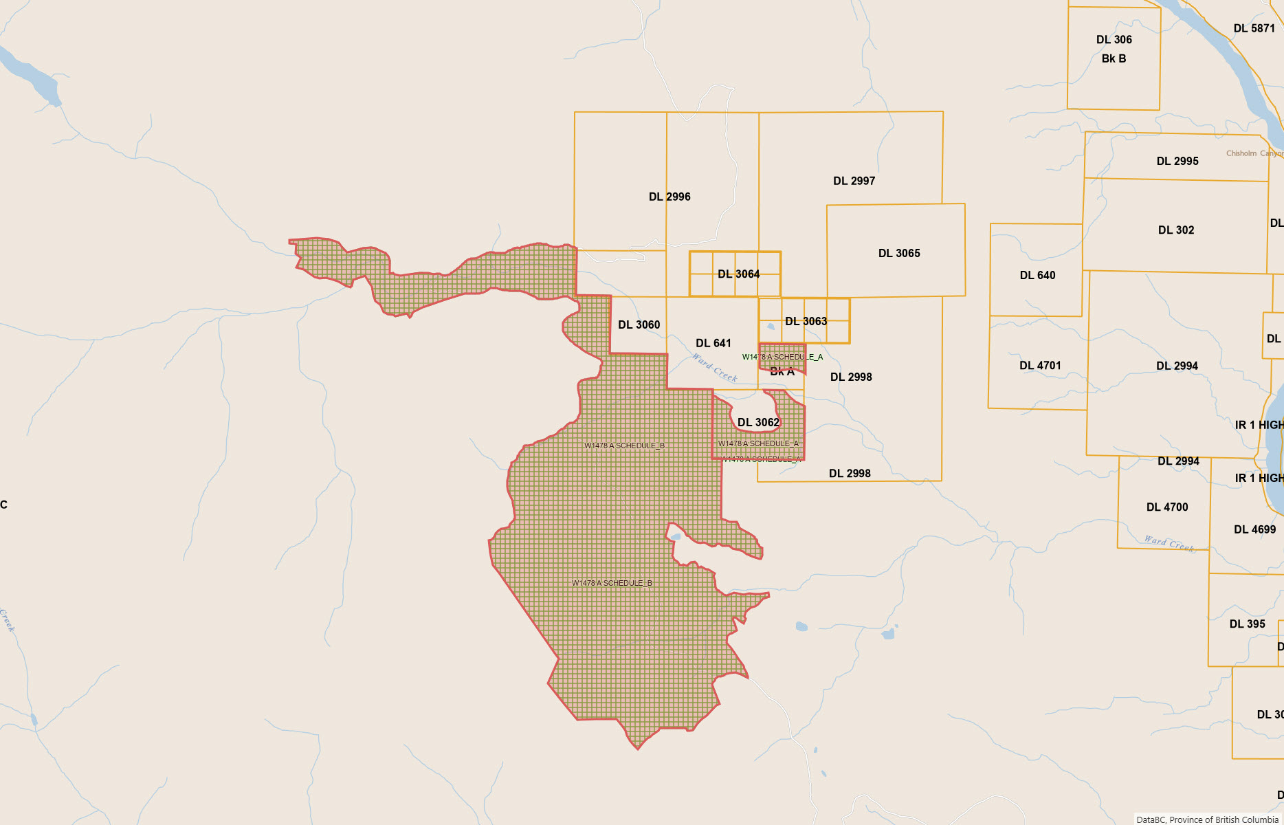
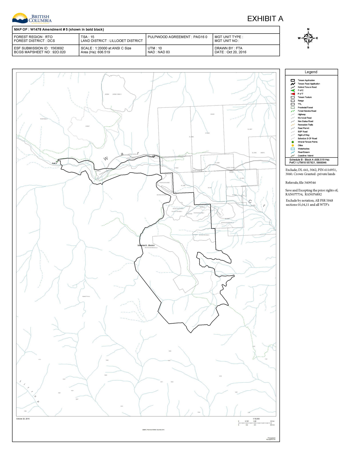
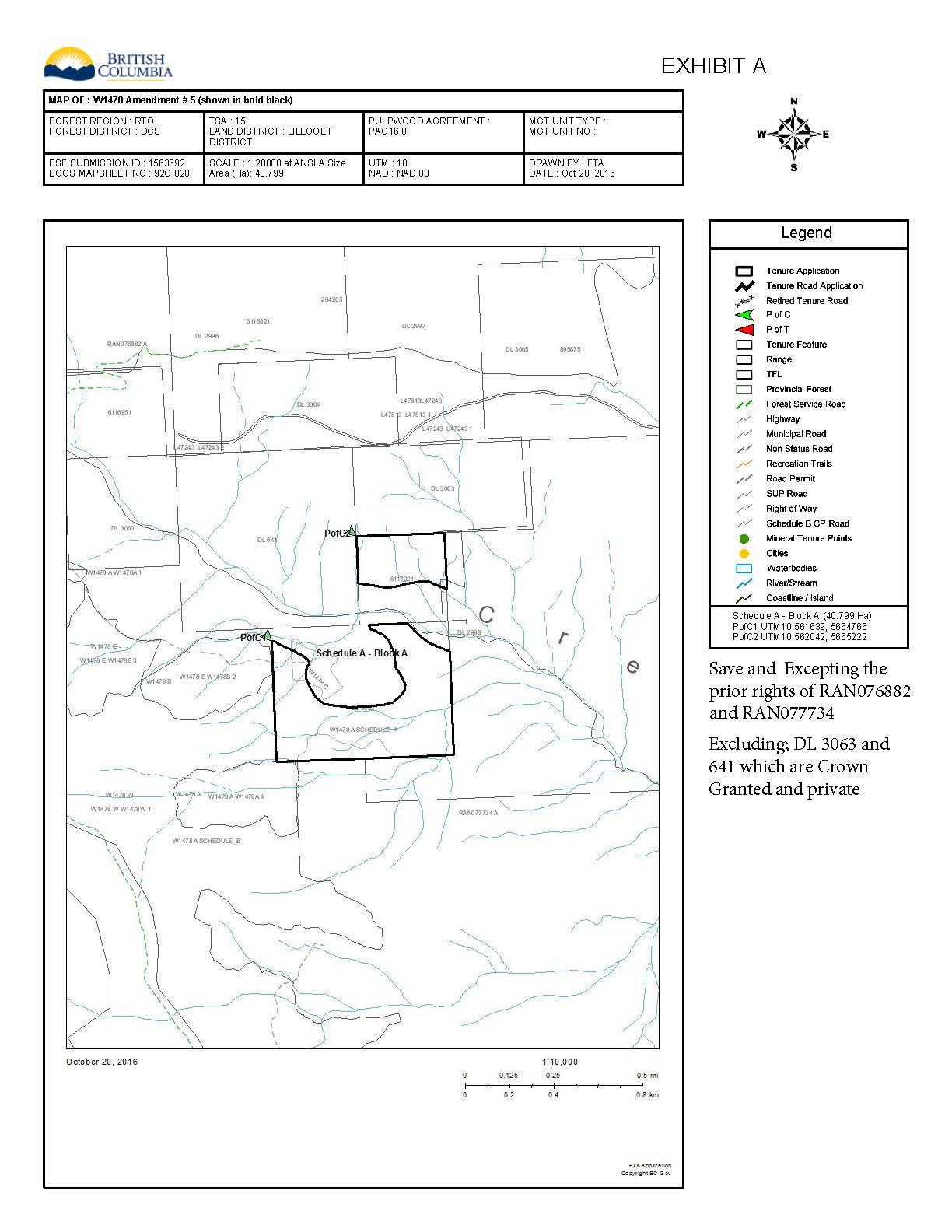
Please see the mapping section of this listing, all boundaries are approximate.
51° 7'27.71"N and 122° 7'58.73"W
Crown Land Woodlot
Woodlot Licence W1478
 +10 maps
Our property descriptions and geographical information are taken from the BC Assessment Authority, Land Titles Office, government maps and other sources. While LandQuest® does not guarantee the information, we believe it to be accurate, but should not be relied upon without verification. This communication is not intended to cause or induce breach of an existing agency agreement.
Clinton
 19℃
19℃
 12℃
12℃