


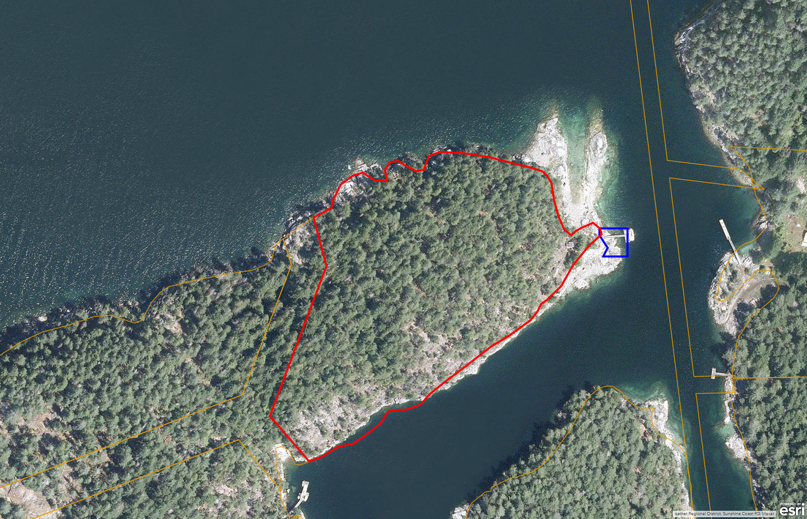
2,300 ft of shoreline in desirable Blind Bay on the Sunshine Coast. Licensed dock with two outbuildings and prime elevated build sites offering panoramic views. Nice clam and oyster beds and surrounded by recreation. RU-2 zoning permitting 3 dwellings.
Foreign Buyer Ban does not apply to this property

 +37 photos


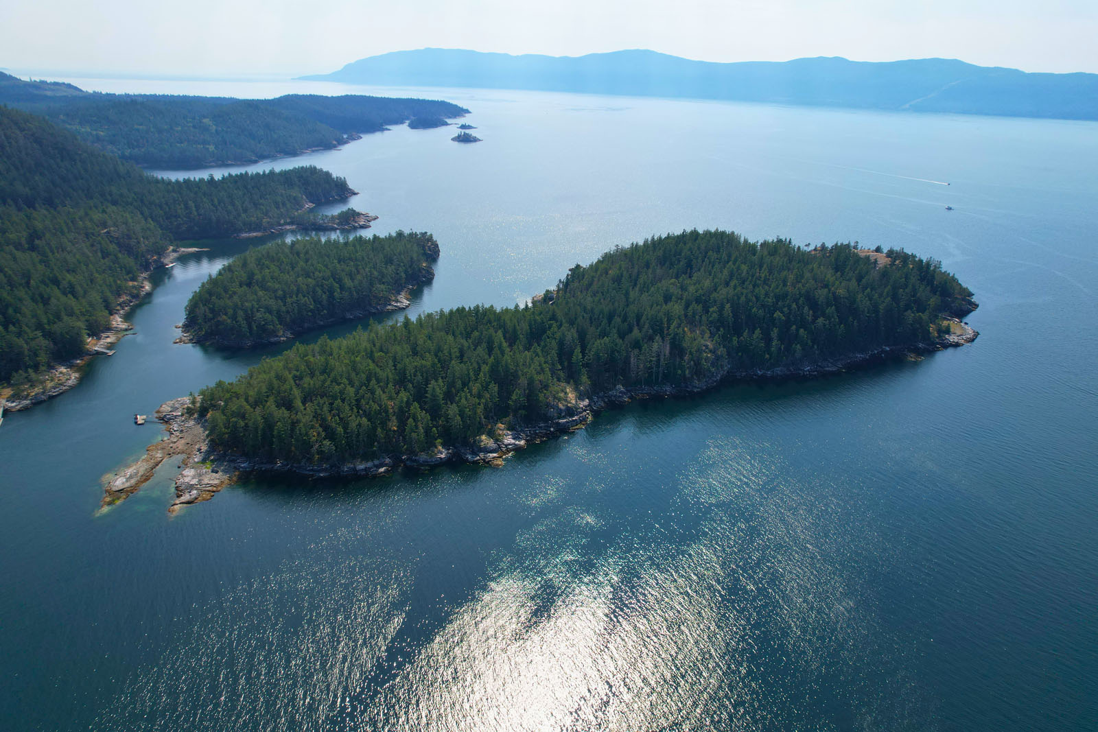

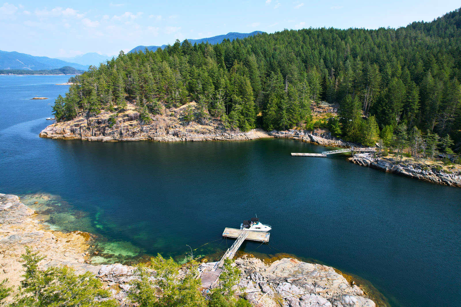
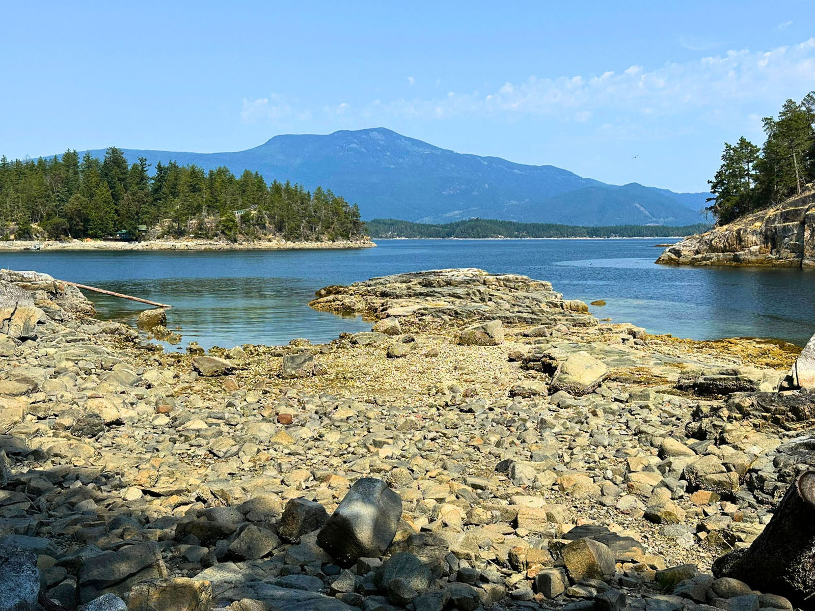
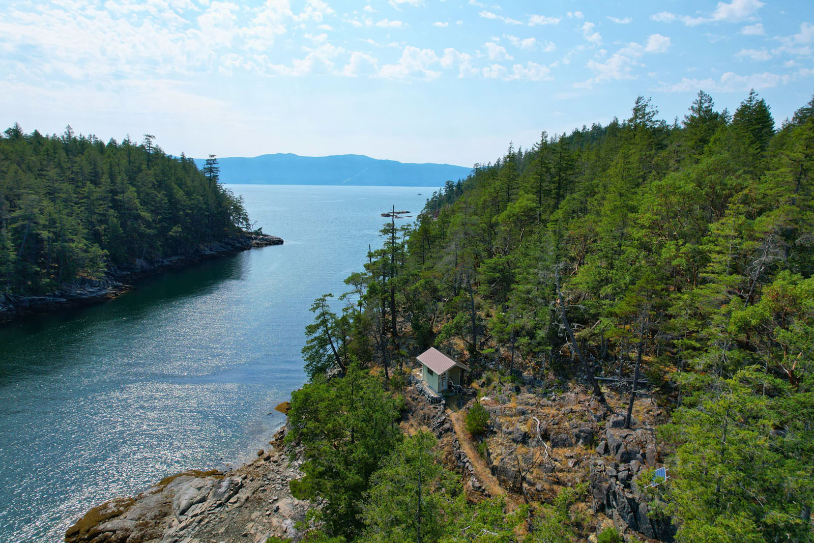
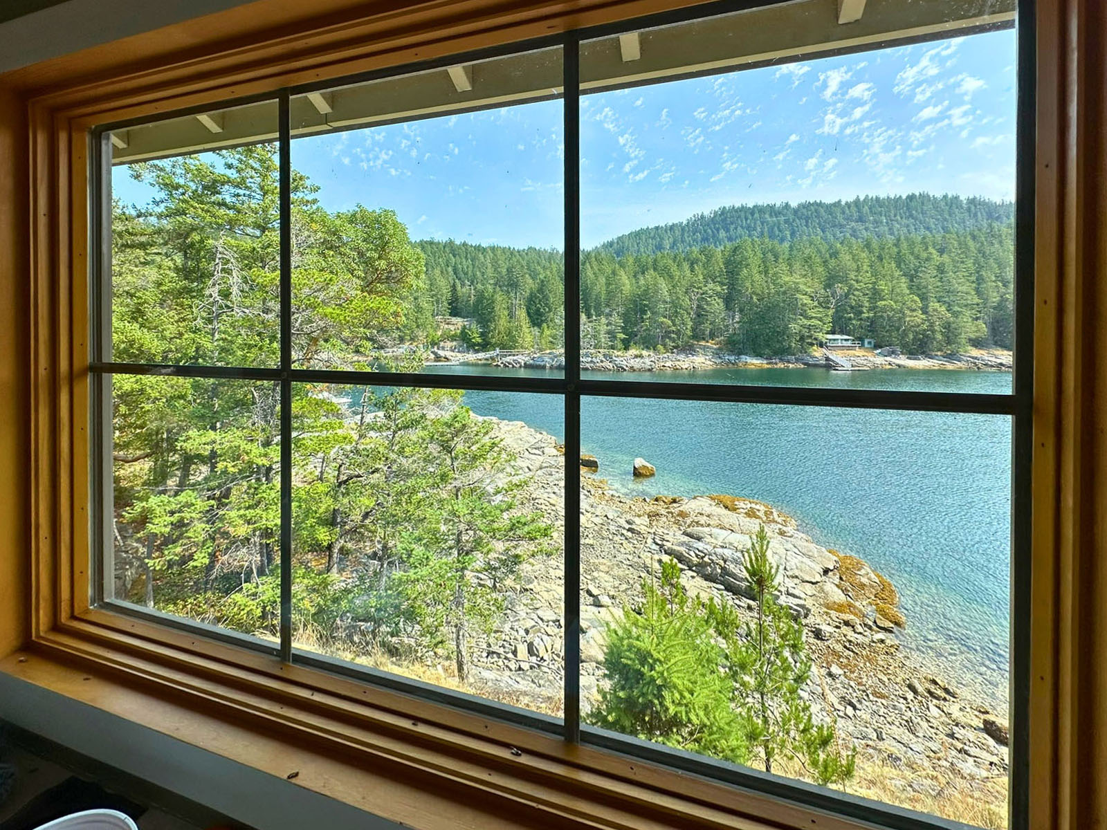
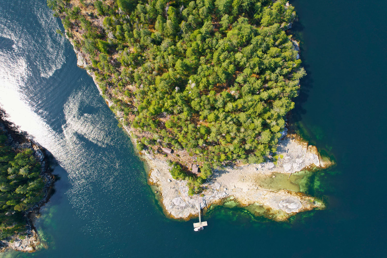
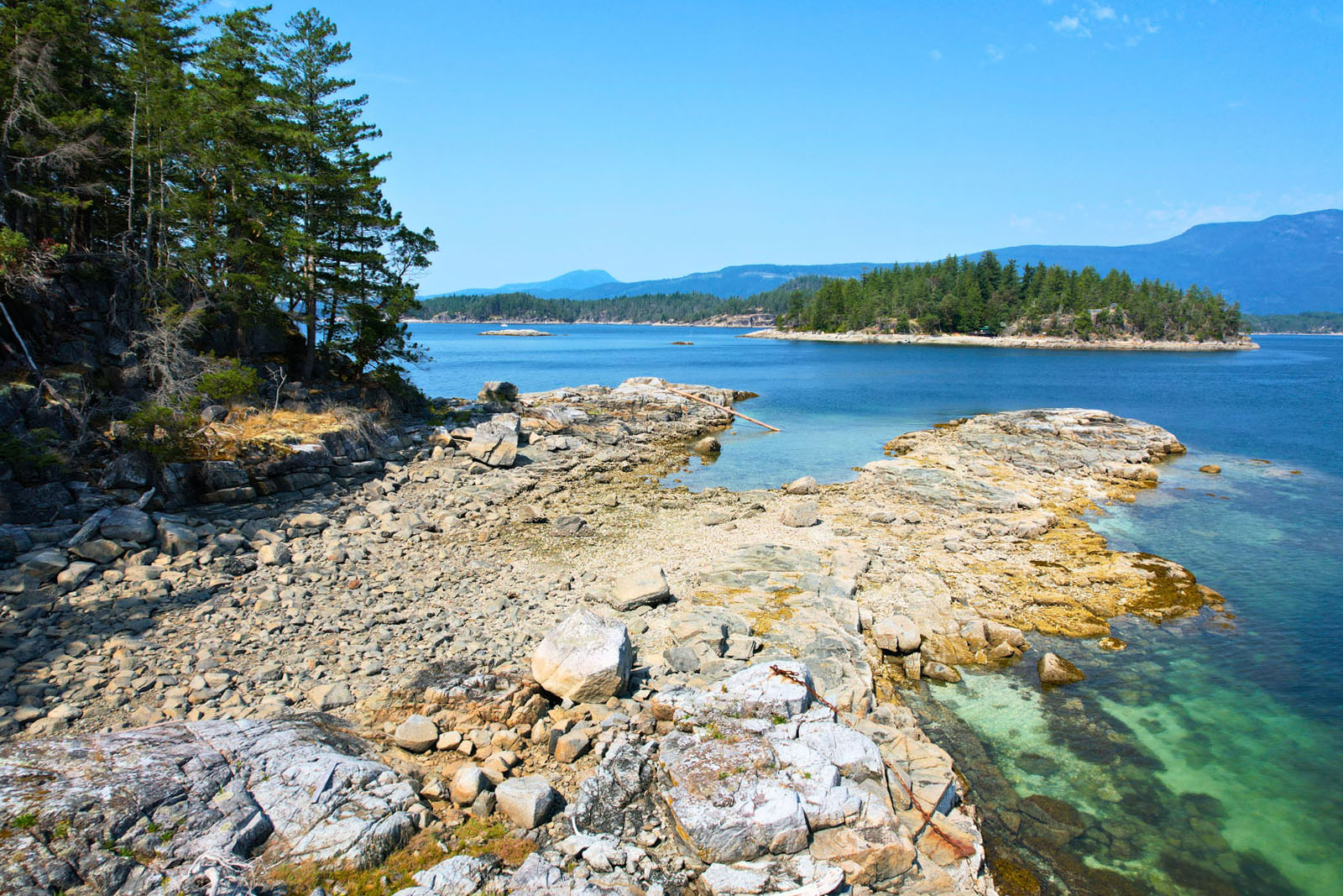
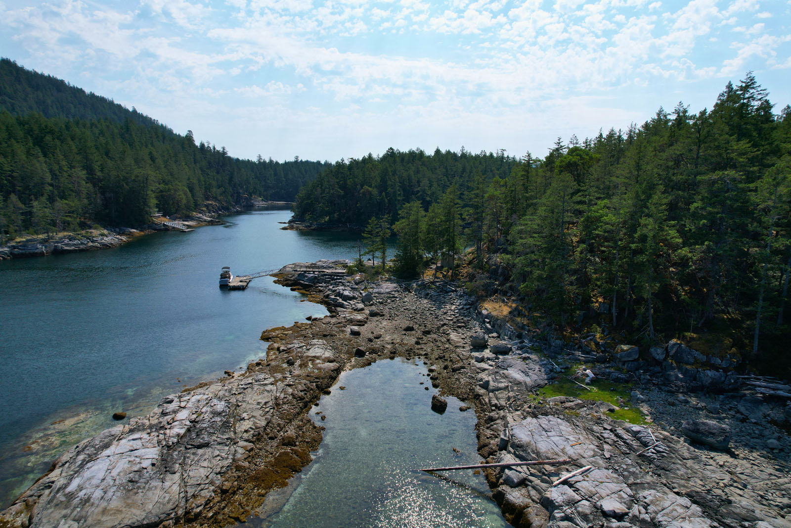
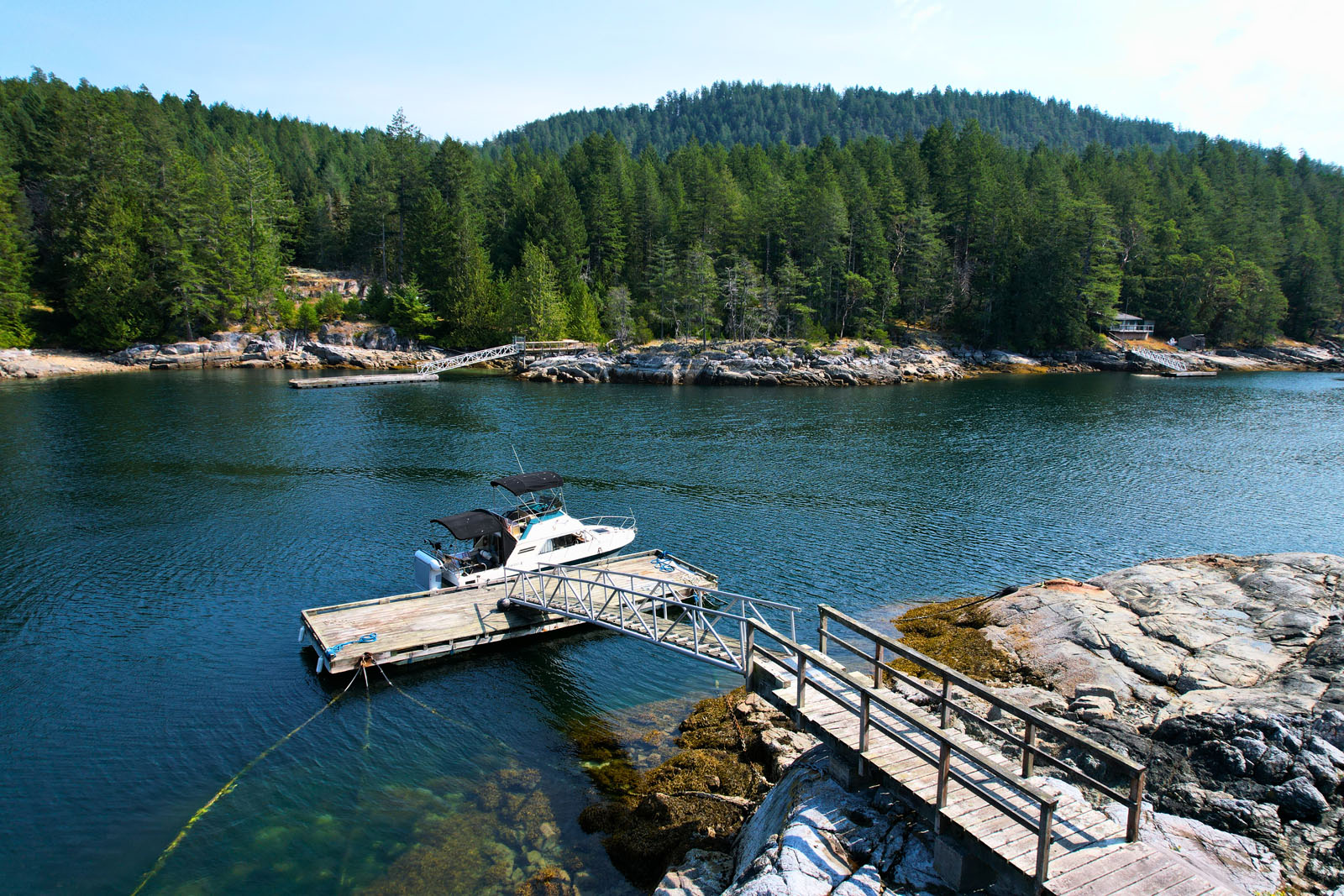
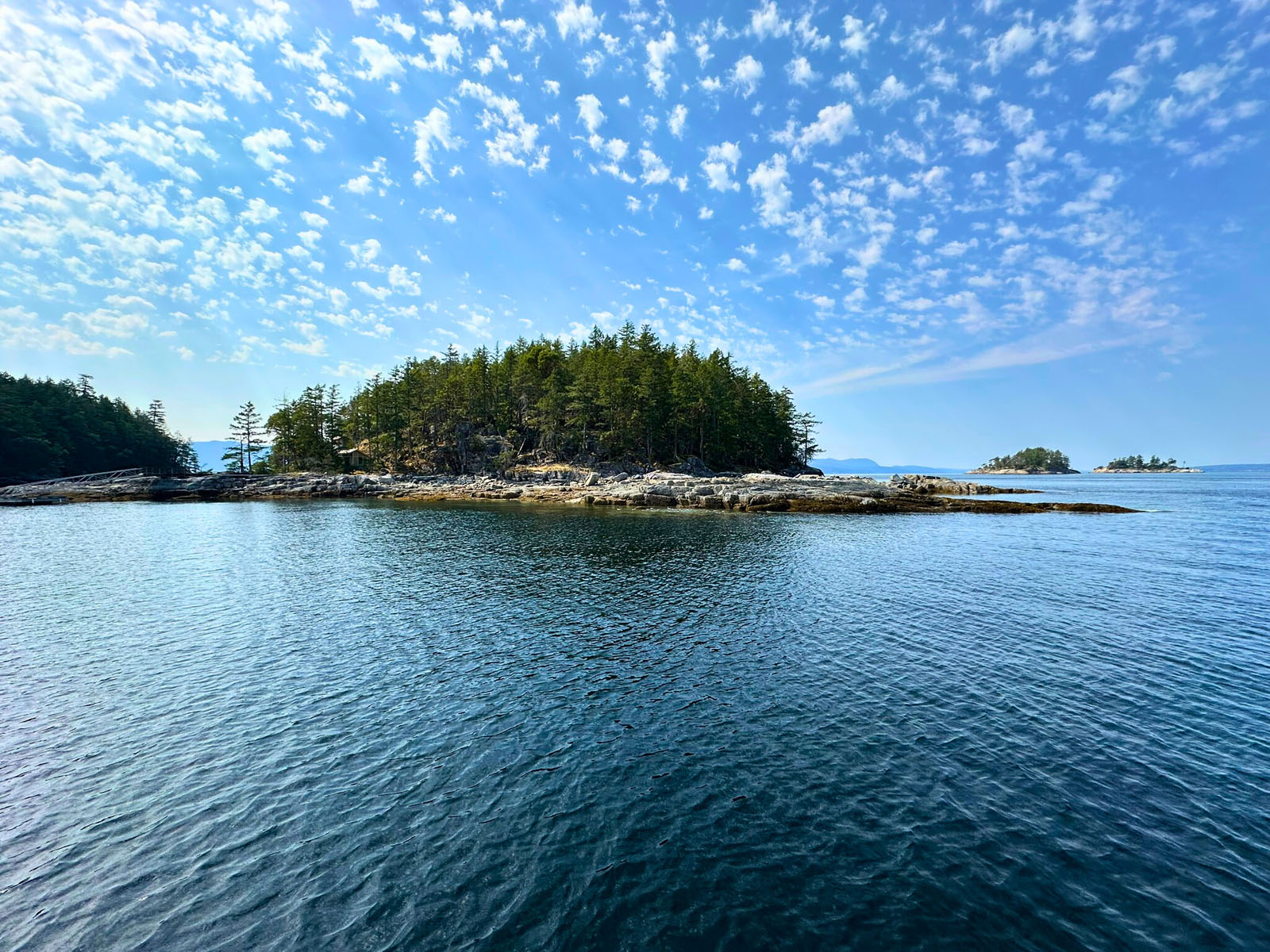
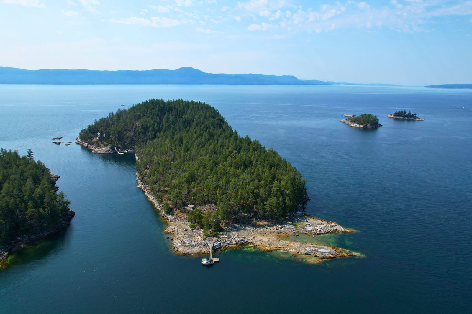
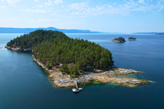
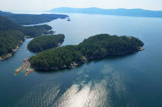
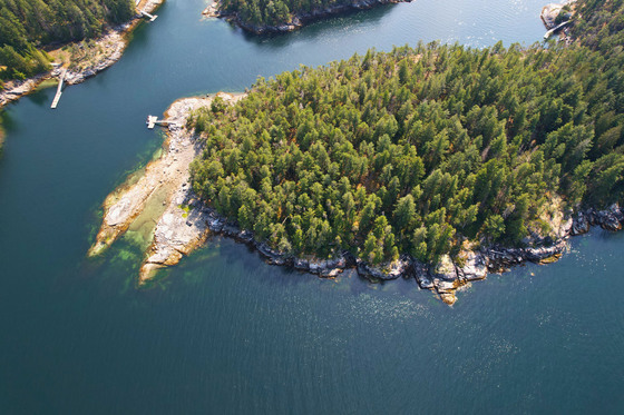
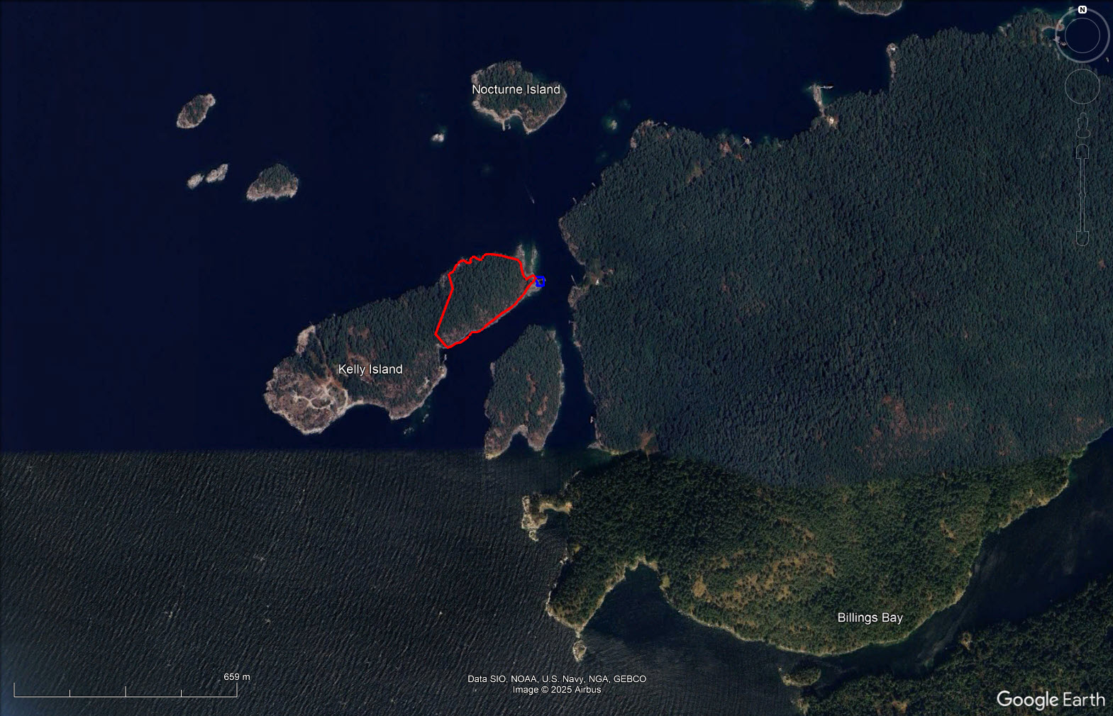
A rare chance to secure 10.8 acres with approximately 2,300 feet of oceanfront at the south end of Blind Bay, one of only four lots of comparable size on Kelly Island, perfectly positioned on the island’s eastern tip facing Nelson Island. Easily accessed by boat from Saltery Bay, Pender Harbour, or Egmont, this is classic Sunshine Coast recreation, renowned for fishing, prawning, kayaking, and boating, wrapped in privacy and panoramic views.
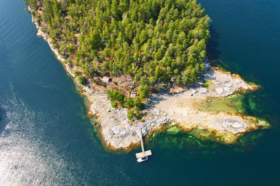
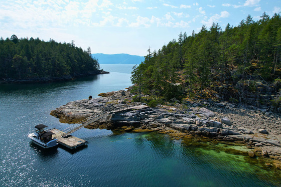
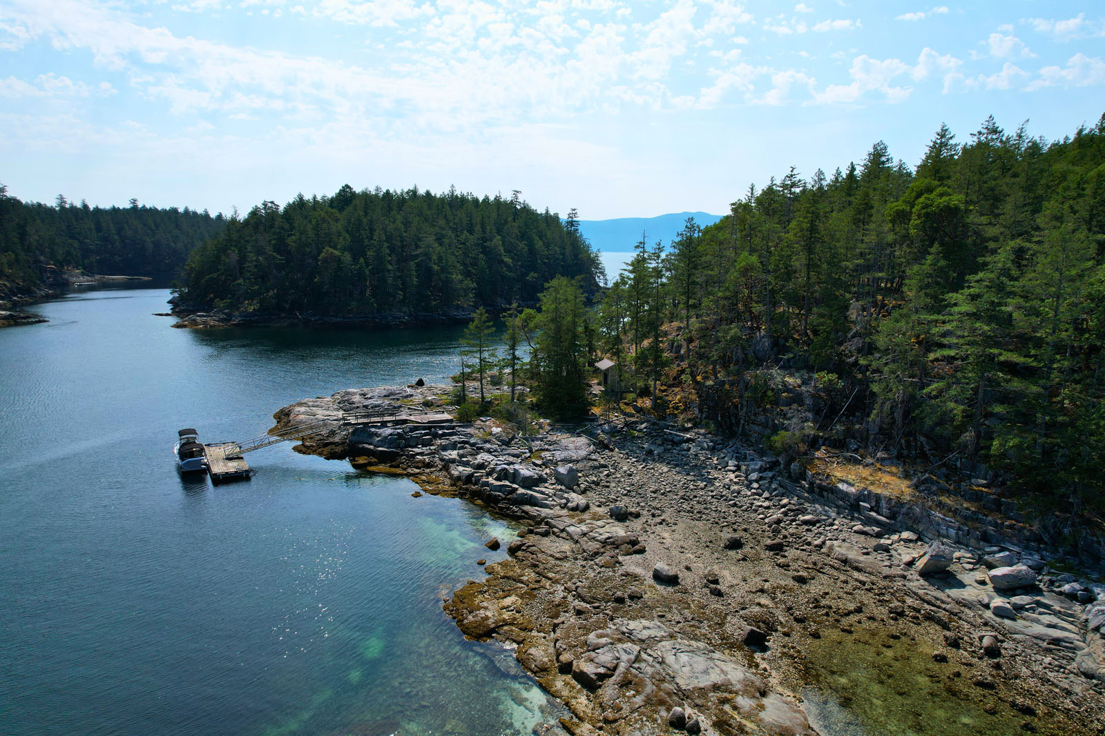
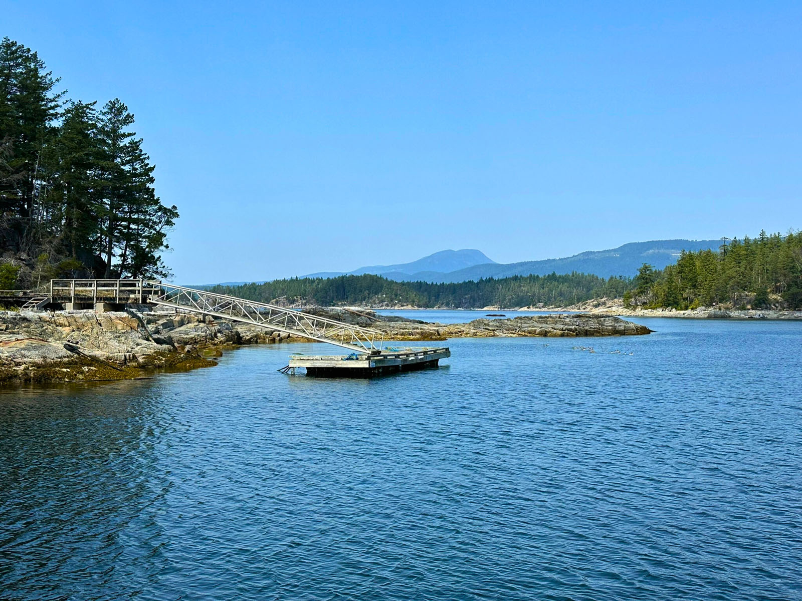
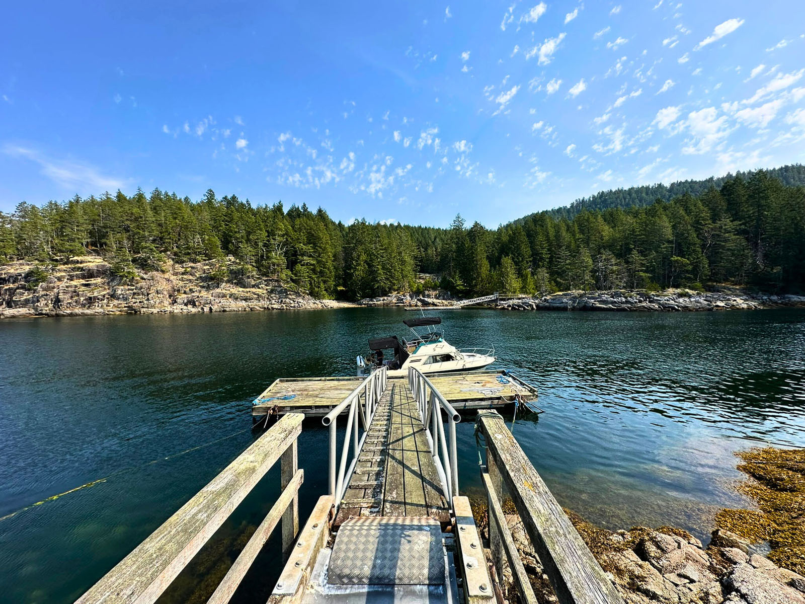
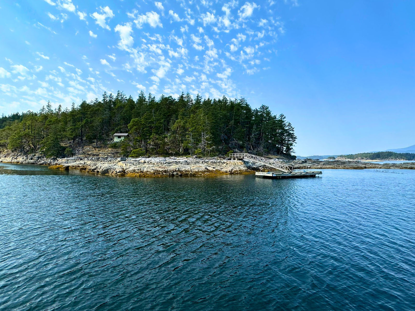
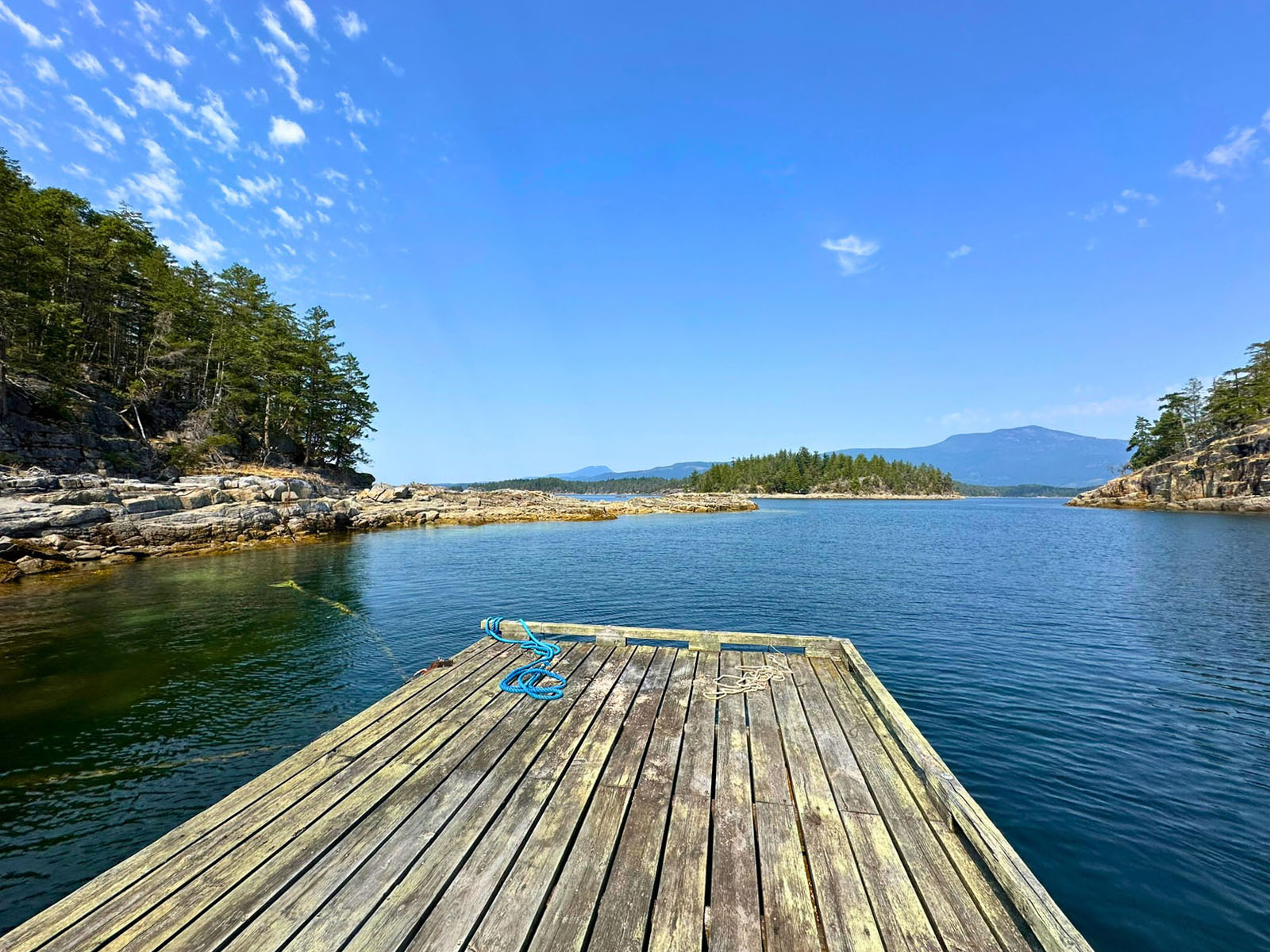
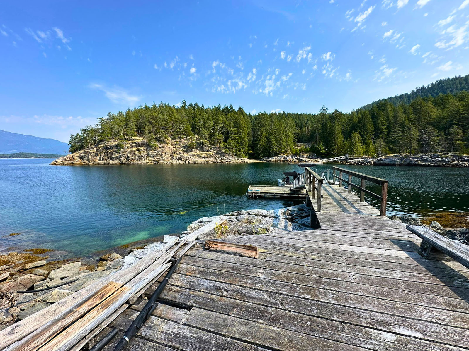
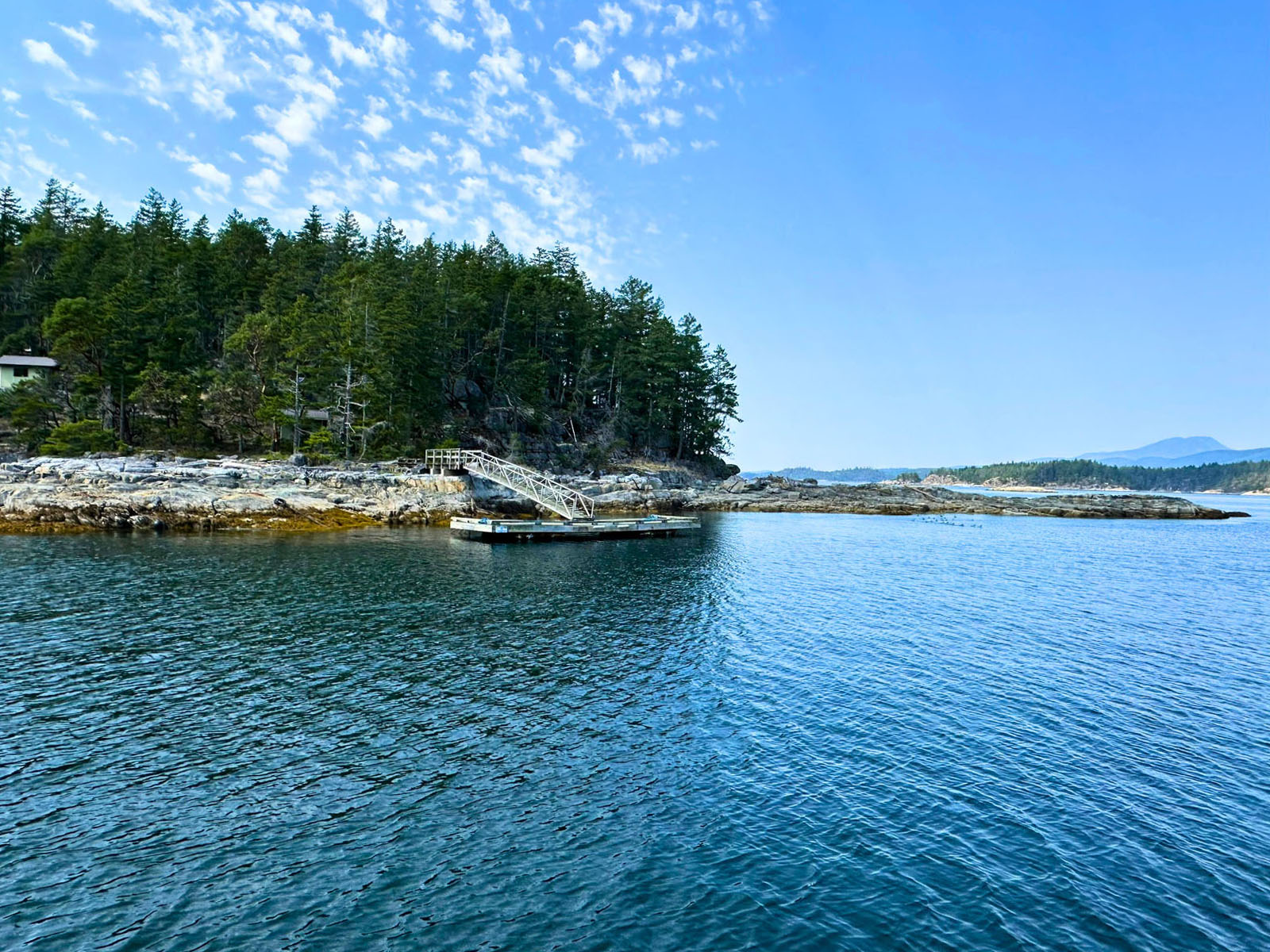
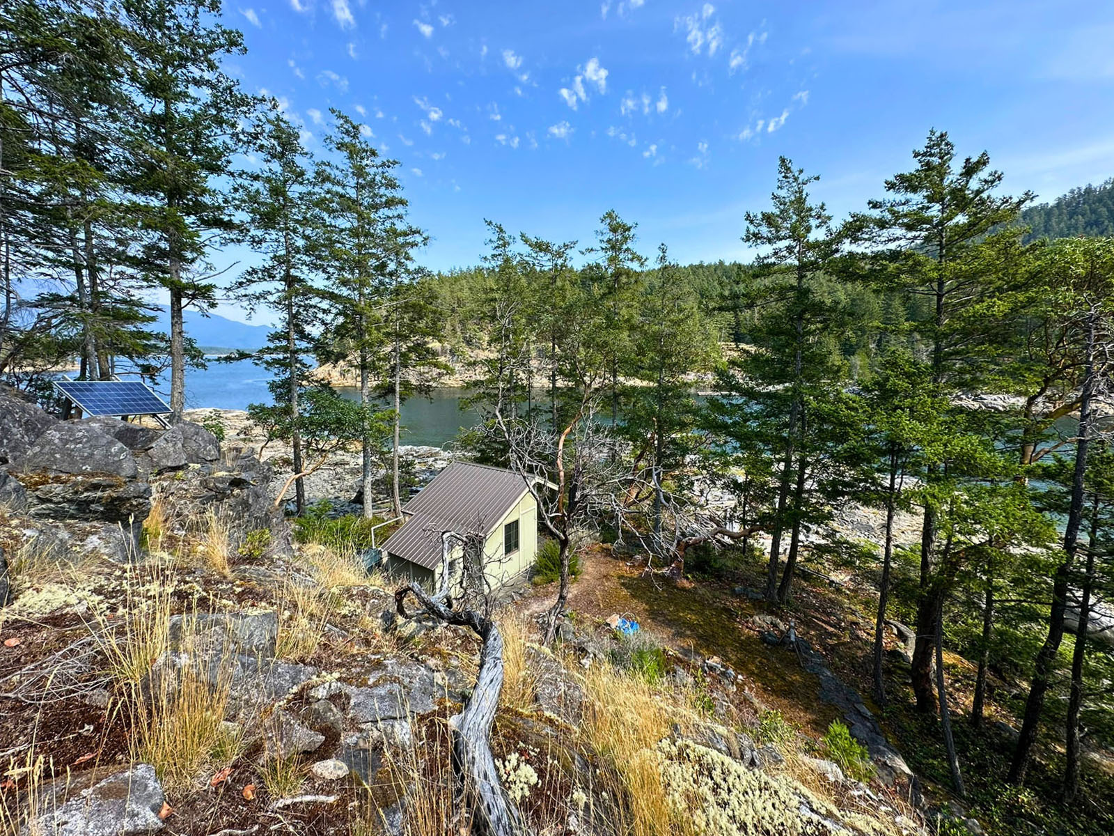
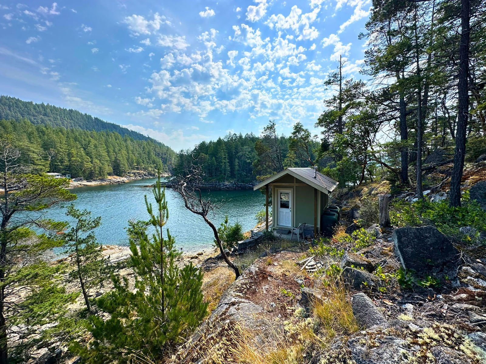
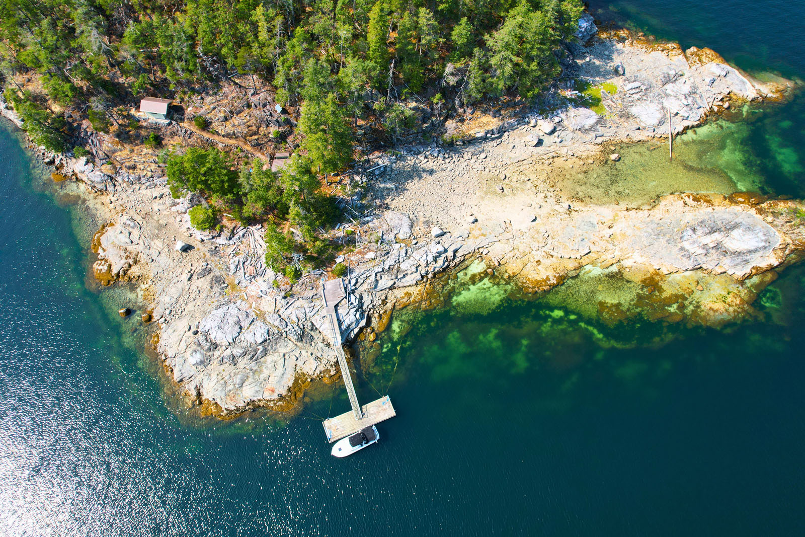
Arrive to your own permitted private moorage: a 12' × 30' dock linked by a 4' × 45' ramp to shore, offering protected, deep-water anchorage sheltered from prevailing storm waves. RU-2 zoning allows up to three single-family dwellings plus one auxiliary dwelling, an ideal, affordable group purchase with room to create a family compound.
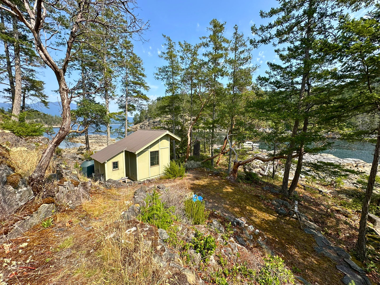
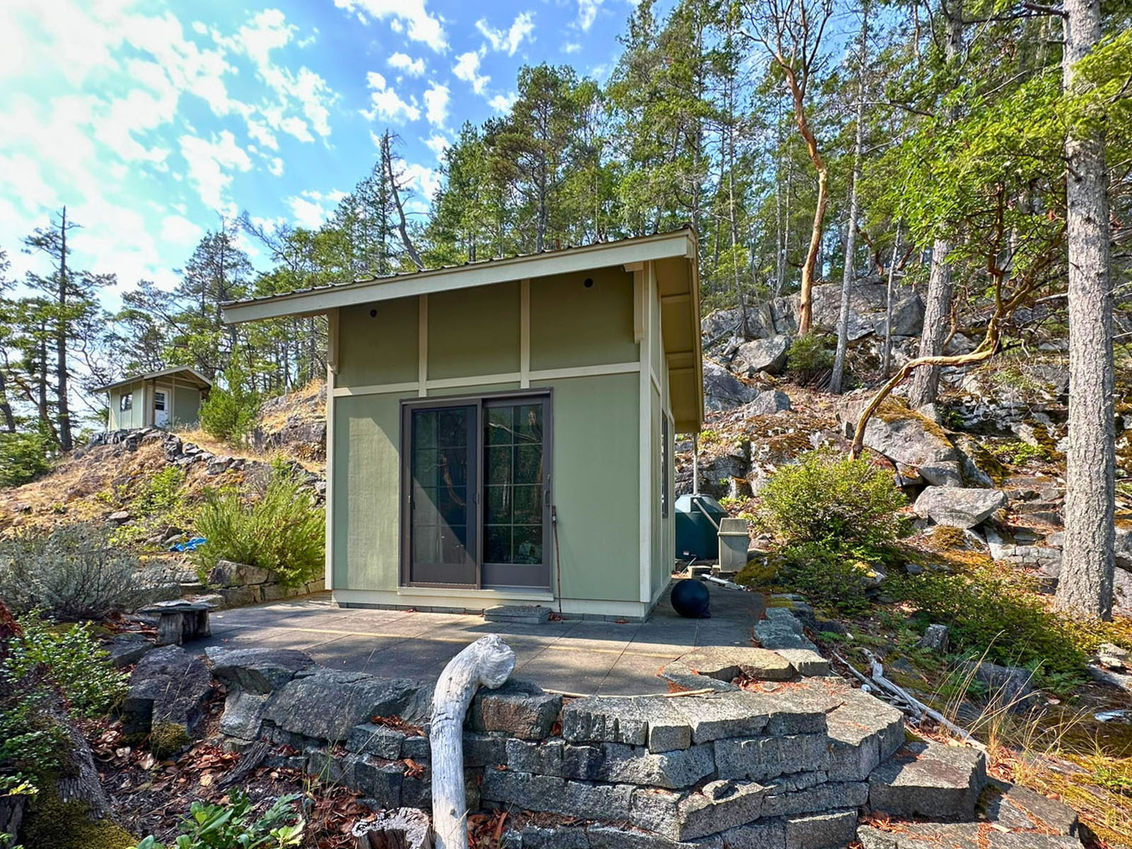
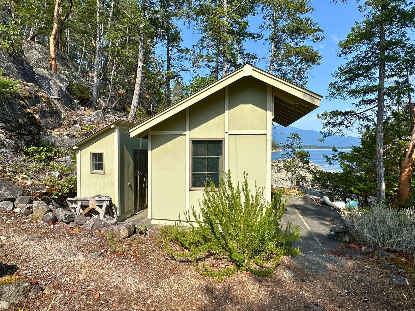
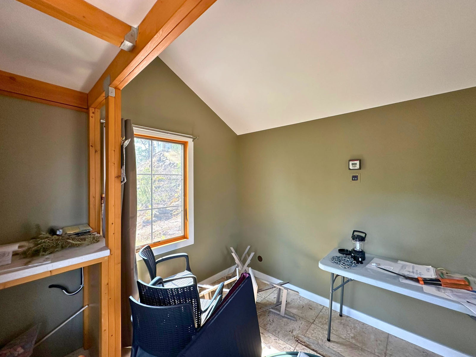
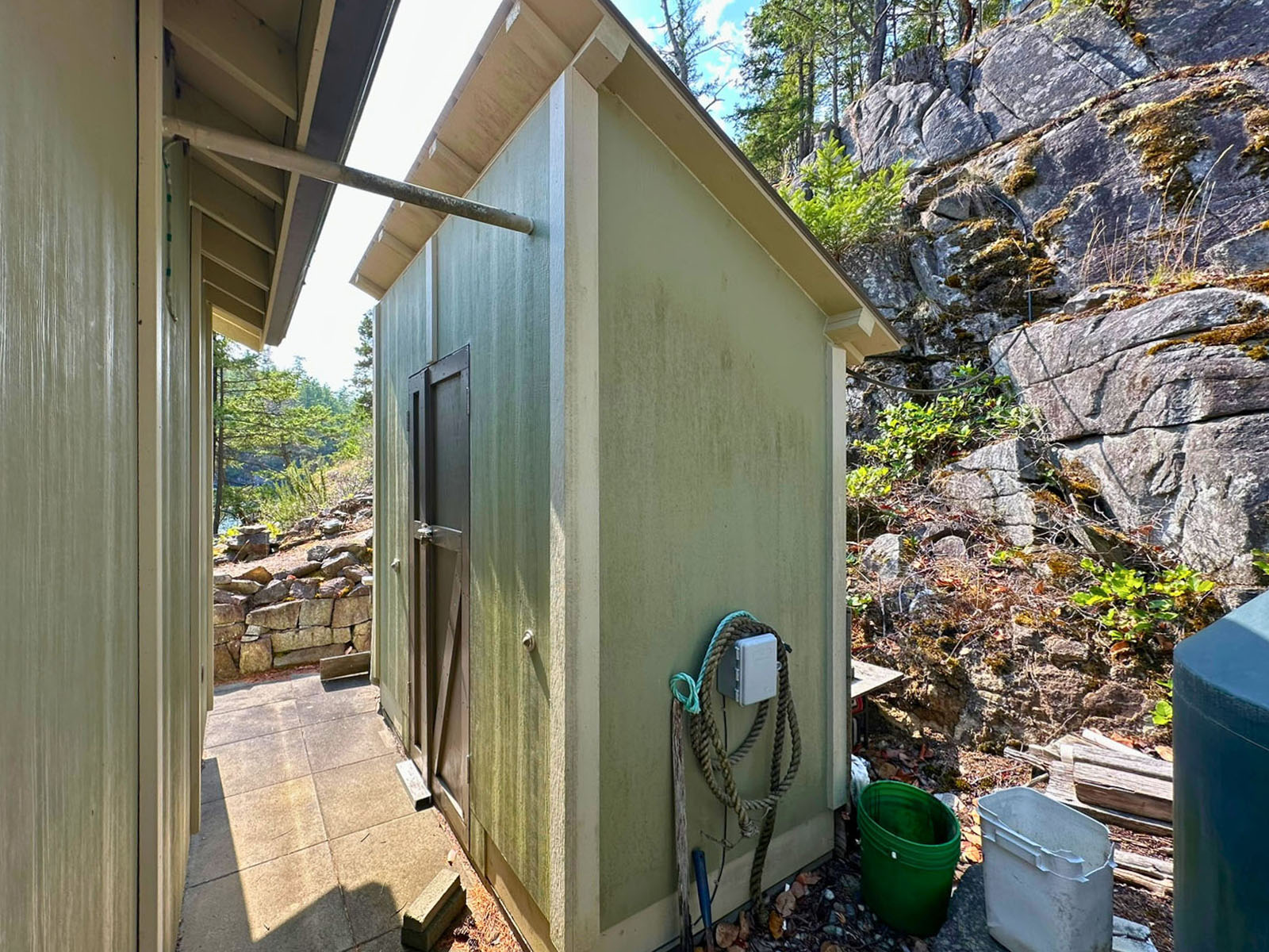
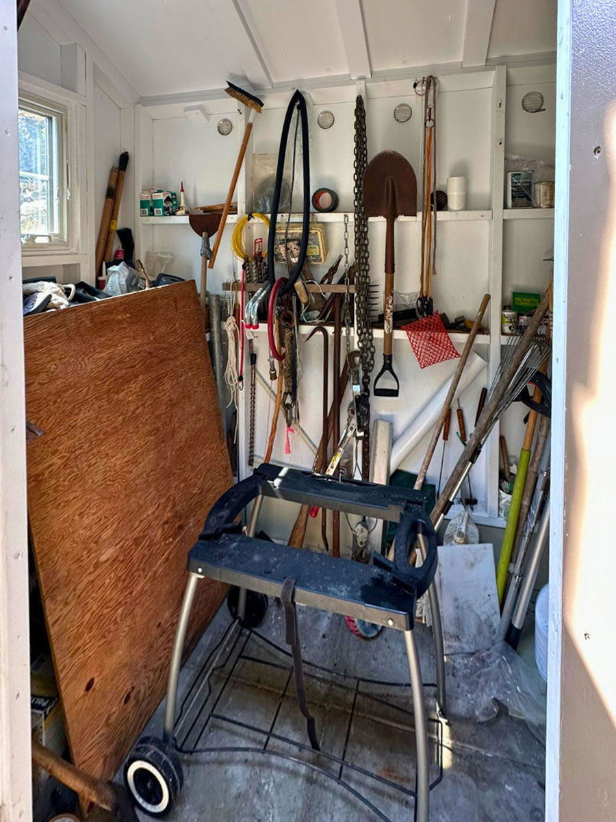
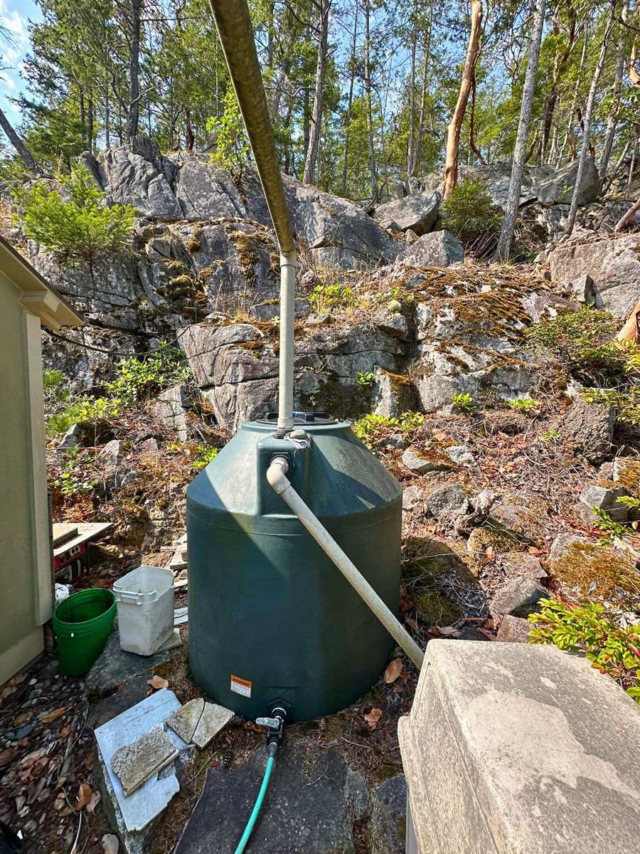
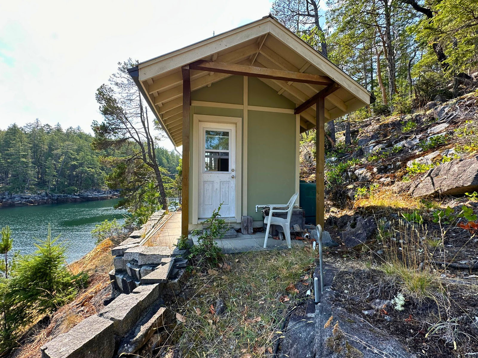
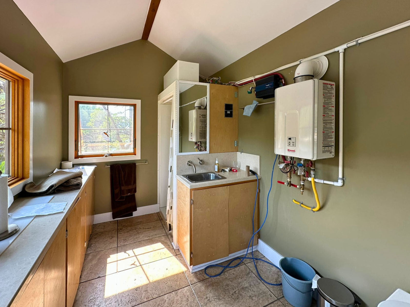
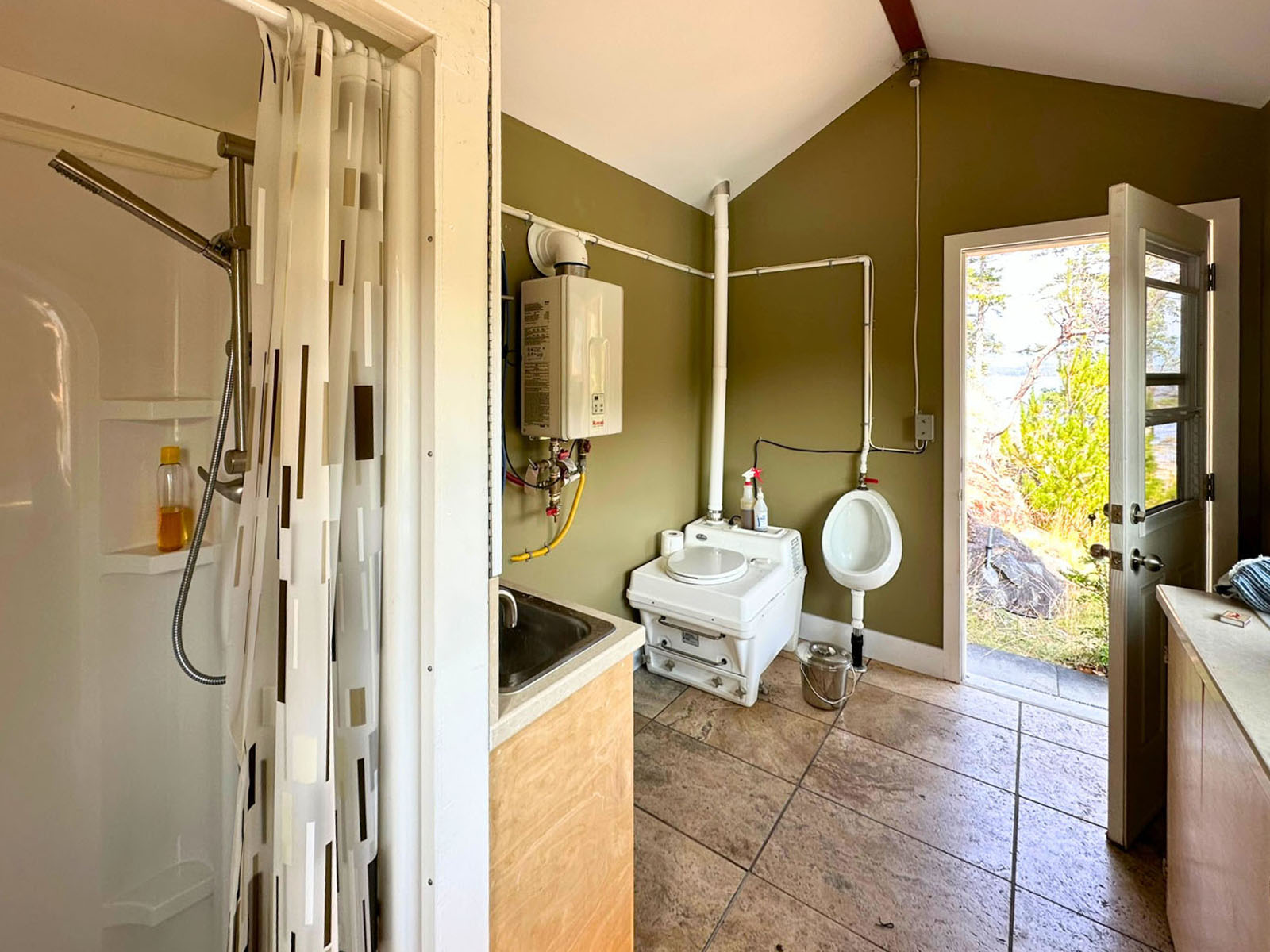
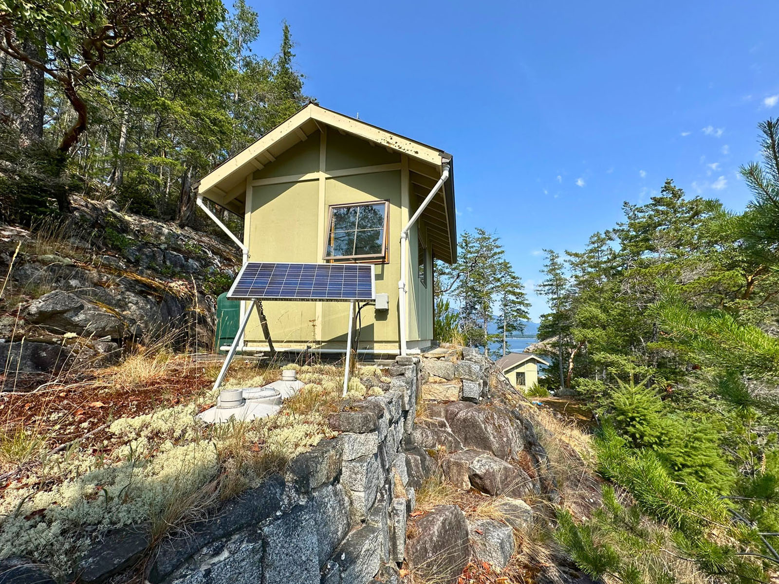
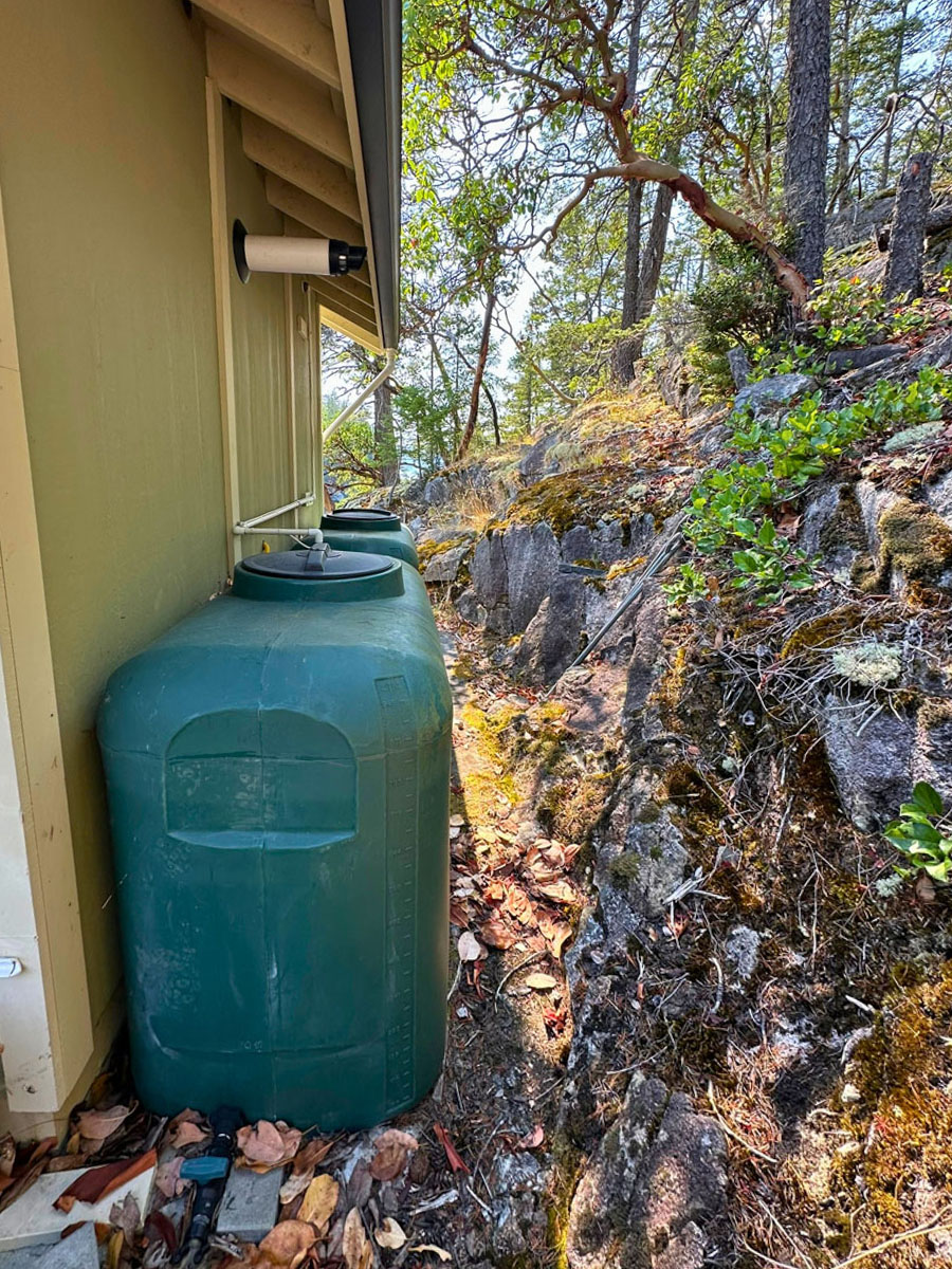
Two small outbuildings let you start enjoying the property right away. The bathhouse includes a septic tank and field, composting toilet, sink, and shower, powered by solar with battery bank and on-demand propane hot water. Water is supplied via roof catchment to a storage tank. The second building is a storage shed with solar power, catchment water, and a fridge, with an adjacent tool shed for gear.
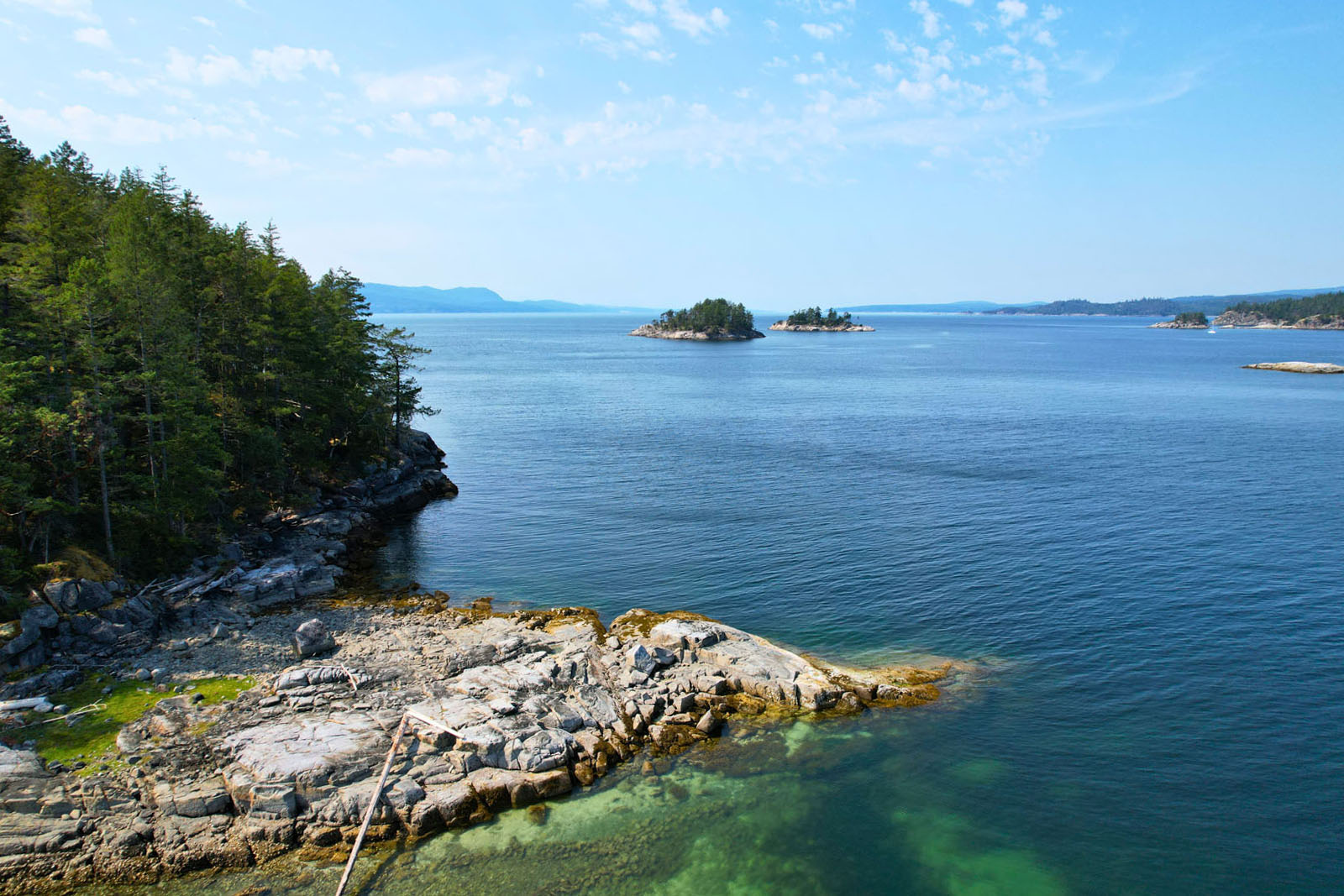
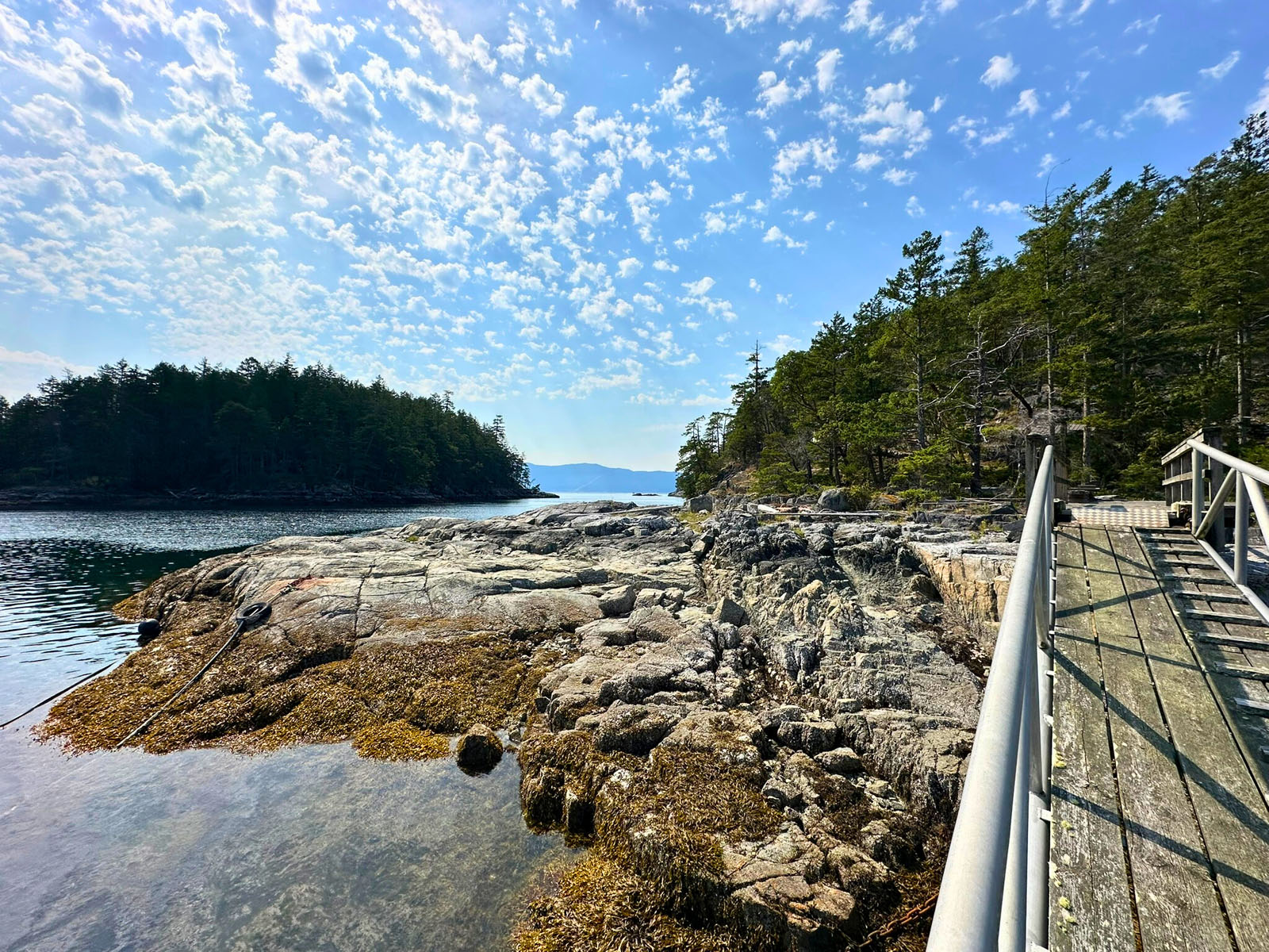
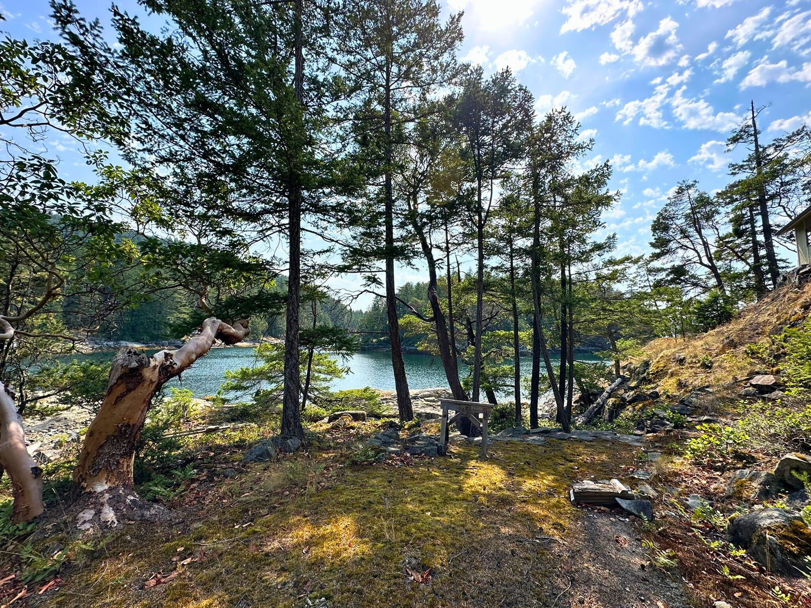
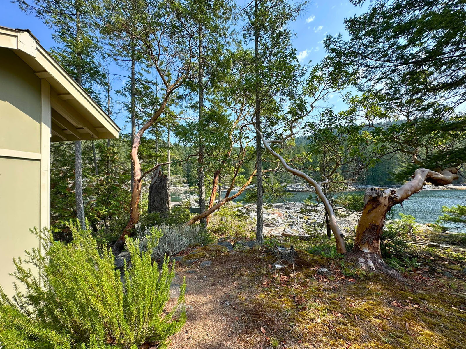
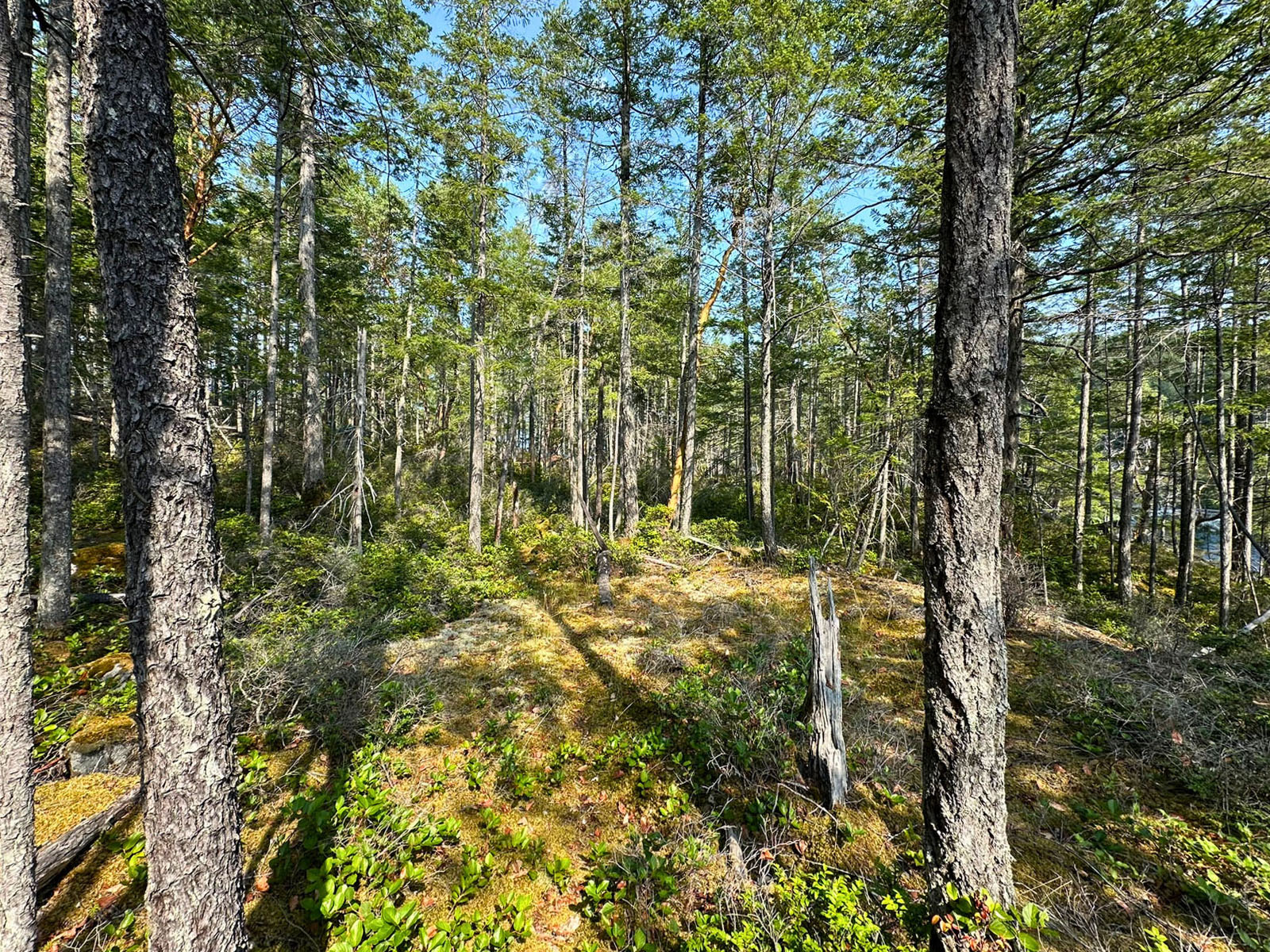
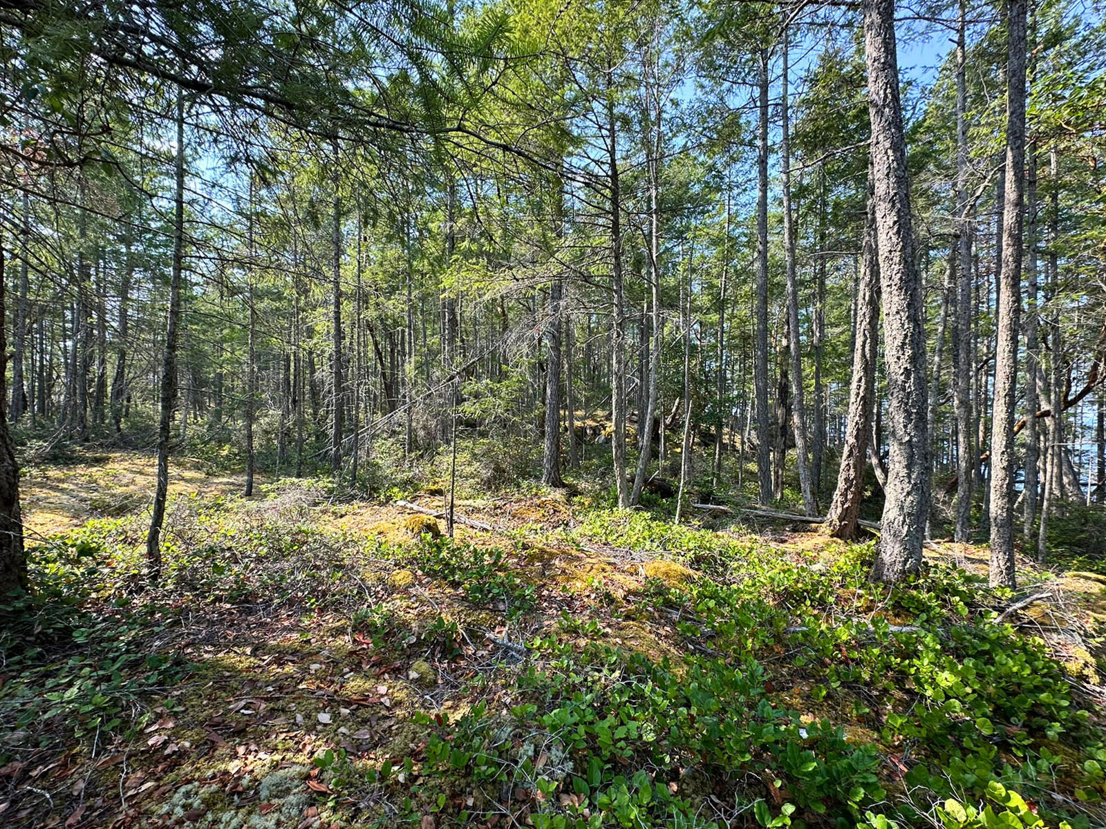
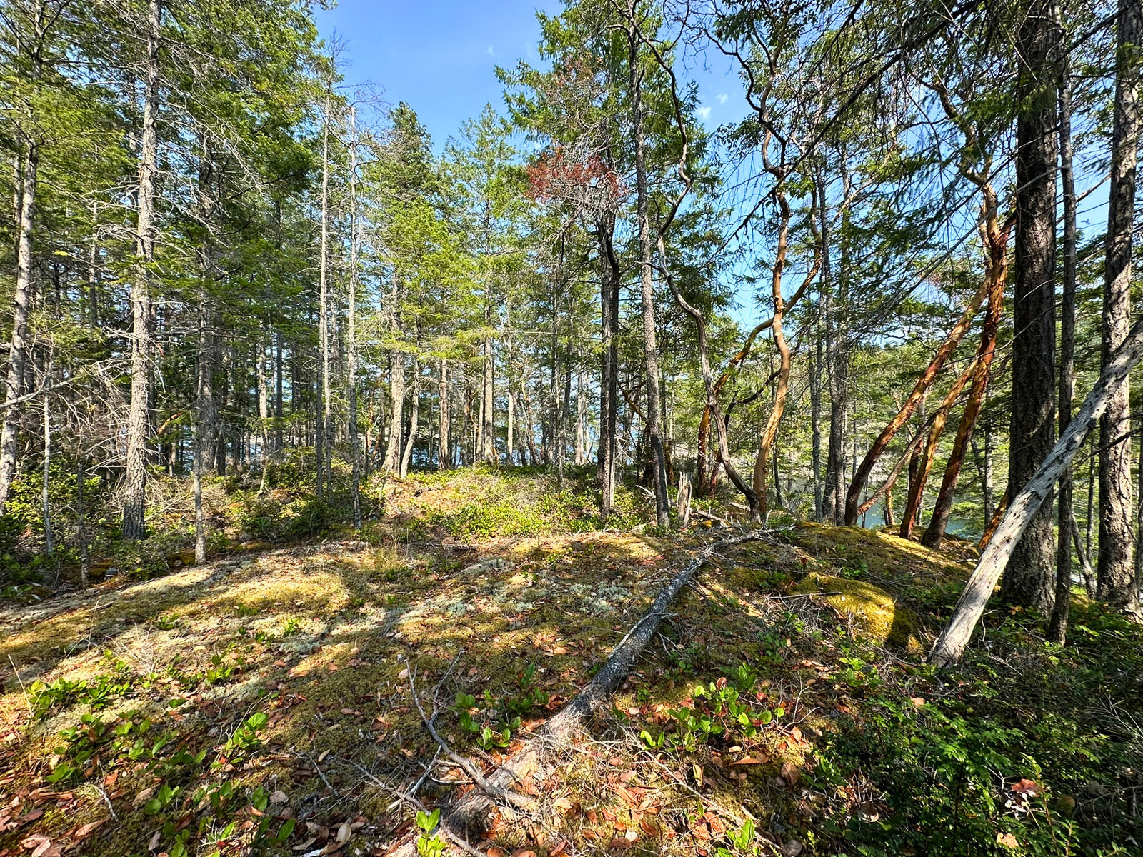
The shoreline is superb for summer fun with excellent swimming, a tidal clam garden immediately north of the cabin, prime oyster habitat, and warmer water on incoming tides. A gently elevated, flat building site approximately 40 feet above the outbuildings offers spectacular vistas west over Blind Bay and toward Malaspina Strait. Use the existing structures as a convenient staging area while you build. A trail loops the property for a scenic walk through native coastal forest.
The current owners kept their primary accommodations on their boat and used the outbuildings for utilities and storage, keeping the main site open for your vision.
Call Jamie or Jason to book your appointment to view today.
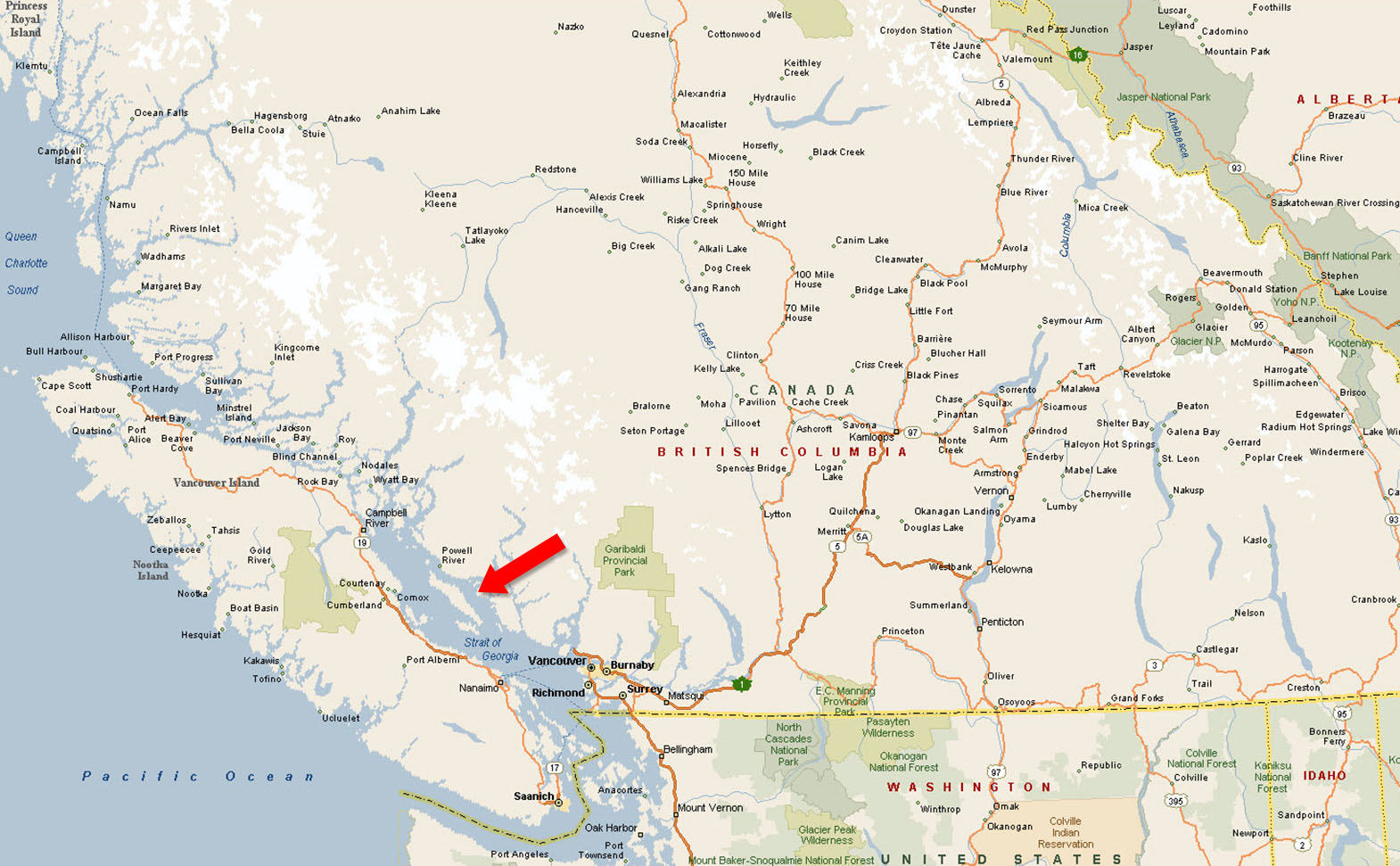
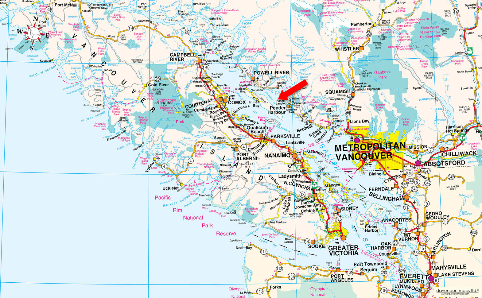
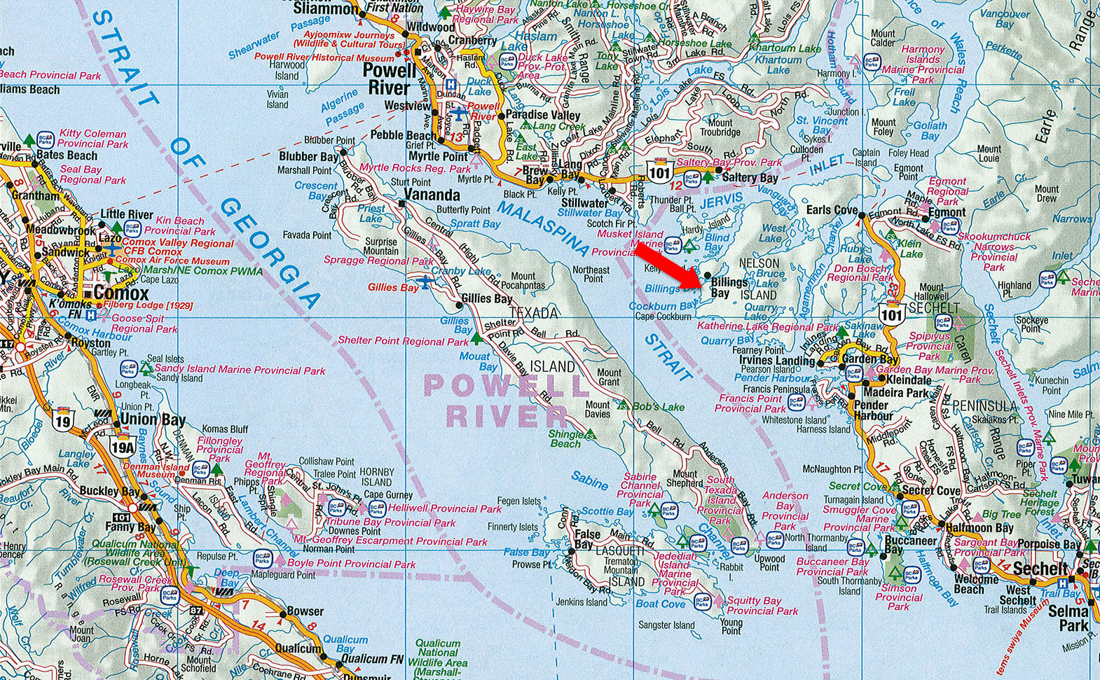
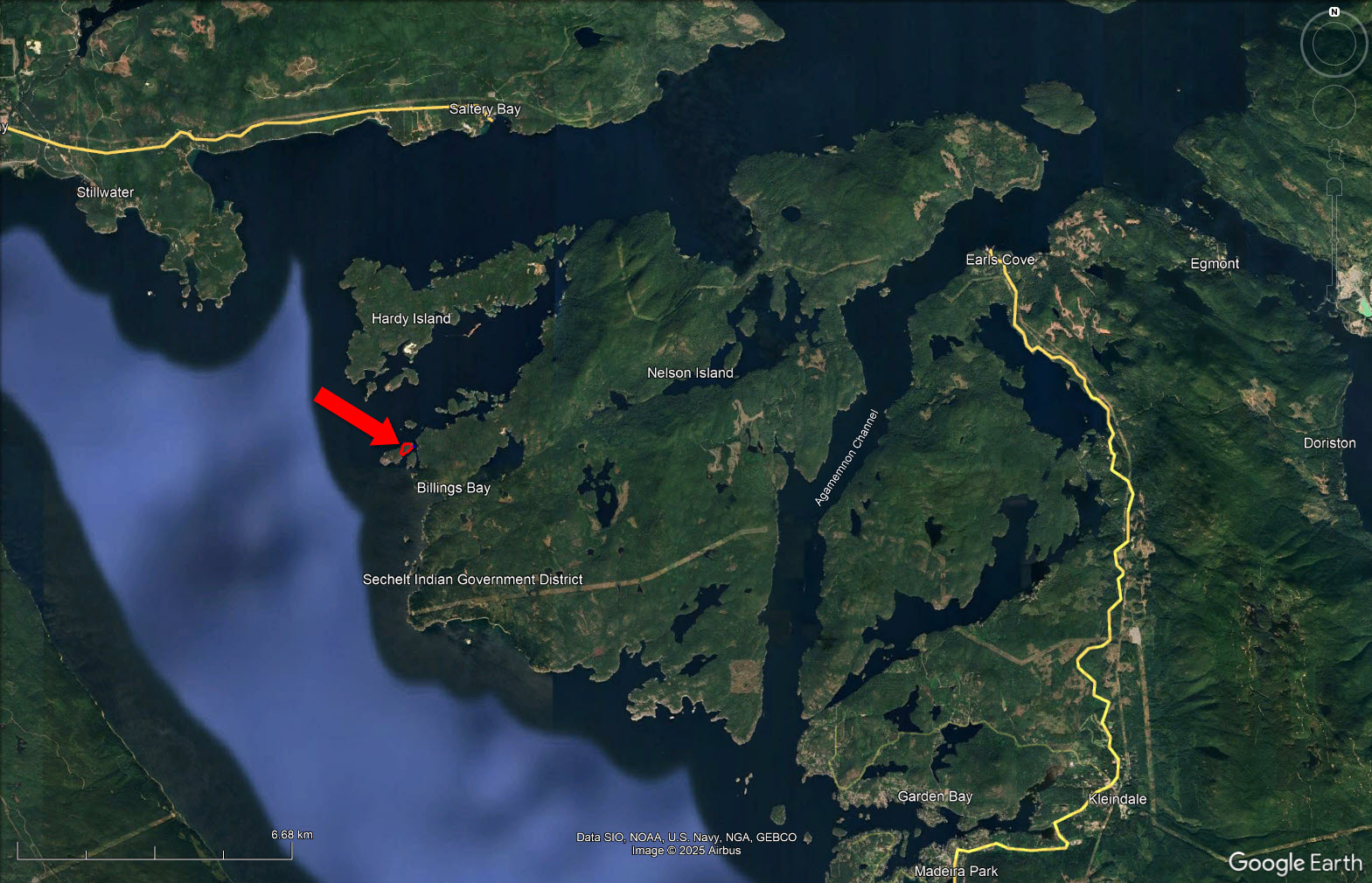
Kelly Island is in Blind Bay in between Nelson and Hardy Island, approximately 80 miles North of Vancouver. The closest access points are from Pender Harbour to the South or Saltery Bay to the North, both a close boat ride away.
Contact the listing agent.
Nelson Island is in the Sunshine Coast region of the South Coast region of British Columbia. It is surrounded by Hotham Sound, Agamemnon Channel and Malaspina Strait. The closest communities are Pender Harbour and Egmont, both on the Sechelt Peninsula.
The island is mostly forested, although there are some clear-cut areas inland. Lakes and large mountainous hills define the geography. Hardy Island sits alongside Nelson Island with Blind Bay in between the two. Logging operations and granite quarries were early features of the island, and many buildings in BC were built out of Nelson Granite, including the Parliament Buildings in Victoria.
There were once a few homesteads and small logging operations, most of which are now summer cabins. As a consequence, the permanent population is quite small.
Pender Harbour is a harbour on British Columbia's Sunshine Coast, on the east side of Malaspina Strait. The harbour is an intricate amalgam of bays and coves that encroach inland for 5 kilometres and provide over 60 kilometres of shoreline. Once a steamer stop, a fishing village and an important logging and medical waypoint, it is now an unincorporated community within the Sunshine Coast Regional District (SCRD).
Pender Harbour's population is under 3,000, with over 40% of the property owners being non-resident (one of them Joni Mitchell, since early 1970s). Pender Harbour includes the small villages of Madeira Park, Garden Bay, Irvine's Landing and Kleindale. You can view a portion of Pender Harbour from the shore at Irvine's Landing.
Tourism is an important part of the local economy. The area has an arts community and several annual music festivals. It hosts the second-oldest May Day celebration in British Columbia and the biggest and longest-running downhill longboard race in Canada, Attack of Danger Bay.
Powell River a full-service community with a population of 22,000 is a year-round sea-to-sky recreation area. It is North America’s premiere boating, trophy fishing and diving destination, and includes world famous Desolation Sound Marine Park, award-winning marine and wilderness parks, golf courses, recreational facilities, services, shopping, dining, arts and culture.
Miles of hiking trails lead to beautiful lookouts, waterfalls, or peaceful lakes which can be viewed along the 180 km Sunshine Coast Trail and numerous recreational areas can be reached by logging roads, which are owned by logging companies. Boating and sports fishing are ardently pursued as all season sports. Marinas and Government docks are available to residents and visitors.
Powell River is known as the "HOT SPOT" for winter diving in North America. The "Mermaid" at Mermaid Cove in Saltery Bay Provincial Park is an extra special attraction. The area also has some of the largest wolf eel and octopus in the world. Canoeing may also be enjoyed on the quiet lakes of Powell River or you can take in the Powell Forest Canoe Route Circuit. Ocean canoeing and kayaking are very popular in Jervis Inlet, the Copeland Islands Marine Park, Malaspina Inlet with Okeover Arm and Desolation Sound. For all the nature lovers and sightseers, Powell River has many parks, viewpoints and beaches to explore, and the hiking club will help you take advantage of the many beautiful trails. Bird watching is also unprecedented.
Kelly Island is a Mecca for marine recreational activity, including boating, fishing, kayaking, scuba diving, site seeing and swimming in an area characterised as one of BC’s popular outdoor playgrounds. Kelly Island is centered between some of BC’s best boating territories, Jervis Inlet and Desolation Sound Marine Park. There are endless amounts of shoreline to explore, but one does not have to venture any further than your own dock to catch your daily limit in prawns, crabs, oysters and clams.
Named after Viscount Horatio Nelson, the hero of the British Navy, Nelson Island sits at the mouth of Jervis Inlet guarding the secrets of Prince of Wales Reach and Queens Reach. Famous with the yachting crowd for the scenery and anchorages in Blind Bay and Hidden Basin, the area has a lot to offer boaters.
Nelson Island offers several beaches, sandstone cliffs and inter-tidal pools. It is also a place rich with relics telling the history of the Sunshine Coast. From aboriginal rock paintings to abandoned logging camps and washed-up shipwrecks, this island, as isolated as it seems, tells the story of hundreds of years of civilization on the Sunshine Coast.
Nelson Island was once a busy place. A granite quarry was opened on the island in 1887 by Chandler and Sons and its stone was used to build the BC Legislature in Victoria, The Empress Hotel, the Vancouver Law Courts, Victory Square and the library at the University of British Columbia (UBC).
Nelson Island rests at the heart of the sublimely scenic Sunshine Coast, at the confluence of Jervis Inlet, Malaspina Strait and Agamemnon Channel. Nelson Island and its tiny twin, Hardy Island, are somewhat well-kept secrets in the kayaking community. The islands have an array of marine and wildlife. Visitors can expect to see seal colonies, sea lions, river otters, bald eagles and kelp beds teeming with benthic fauna. Depending on the season, they may even glimpse the dorsal fins of a migrating orca pod.
Nelson Island is defined by Hotham Sound, Agamemnon Channel and Malaspina Strait near Pender Harbour, BC. It is largely depopulated and forested, and the hilly island is quite remote. Lakes and large mountainous hills define the layout. Hardy Island sits alongside Nelson Island with Blind Bay in between the two. Log booms and granite quarries are featured on the island.
Harry Roberts, the namesake to Roberts Creek in Sechelt, built a sawmill in Sechelt which provided lumber for most of the new houses in the area and for the government wharf and timbers for the 13 bridges necessary to construct Lower Road. He was well known for his unique house and boat designs, and much of the lumber he produced was used in their construction. He also built and furnished small cottages to rent to vacationers and eventually subdivided as the demand for land grew.
In 1923 Harry leased out his mill and store and moved with his family to Merry Island and then moved to a retirement home on Nelson Island in 1929. The house he built there, called Sunray, was a charming cottage with south-facing walls of glass. It still stands in its idyllic cove at Cape Cockburn. It was Harry who originated the term Sunshine Coast. He painted a huge sign, visible from the ocean, on the side of the steamer company's freight shed near his Roberts Creek store.
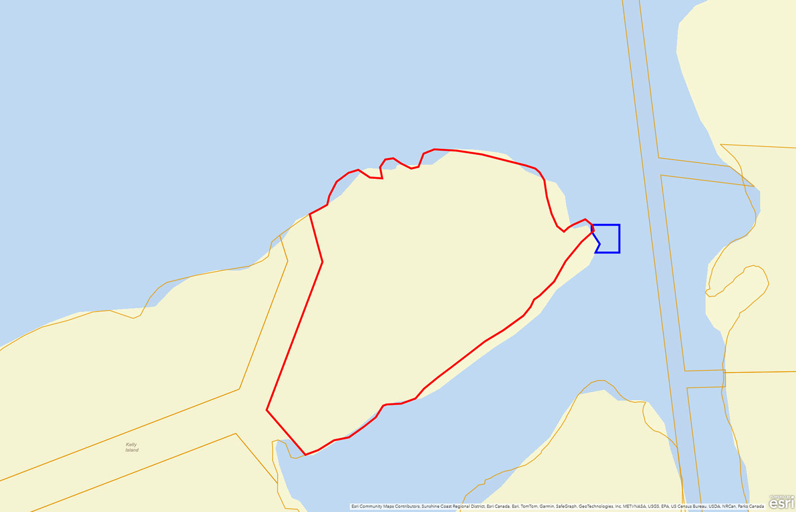
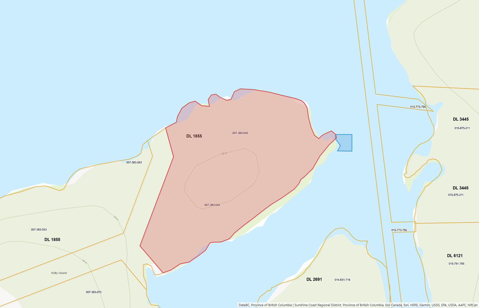
Please see mapping section, all boundaries are approximate.
49°42'35.52"N and 124°12'20.28"W
Total: $988.10 (2025)
RU2 (Rural Resource)
Sunshine Coast Regional District Zoning Bylaw No. 337, 1990
Additional zoning information can be found on the Sunshine Coast Regional District website.
Lot A District Lot 1855 Plan 16677
PID 007-383-045
Specific Moorage Permission, File #2406377, Document #243053
 +8 maps
Our property descriptions and geographical information are taken from the BC Assessment Authority, Land Titles Office, government maps and other sources. While LandQuest® does not guarantee the information, we believe it to be accurate, but should not be relied upon without verification. This communication is not intended to cause or induce breach of an existing agency agreement.
Irvines Landing
 19℃
15℃
19℃
15℃