


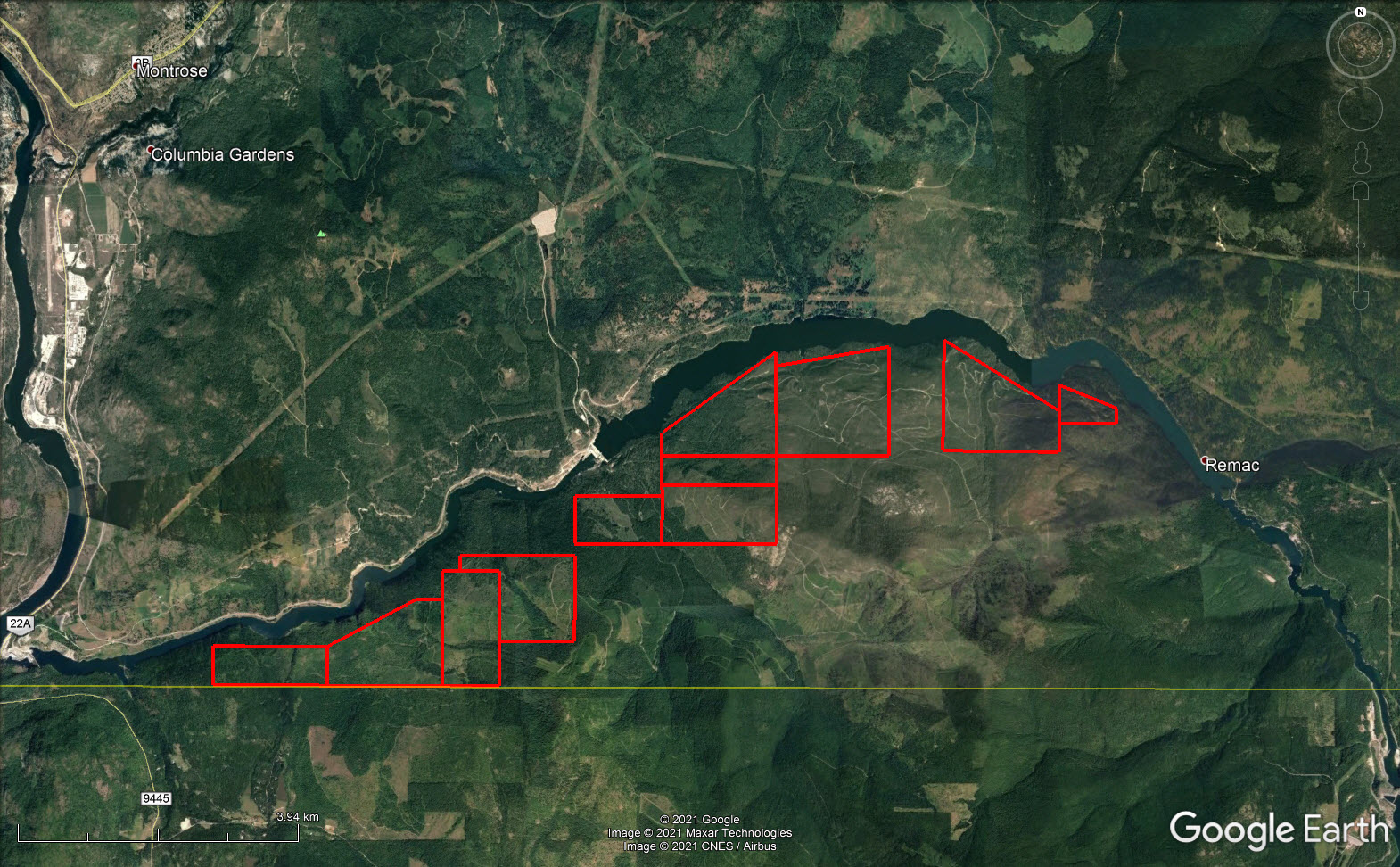
3,346.61 acres spanning 13.7 km along Pend d’Orielle River. Gated private access across hydro dam with exclusive access to 12,538 acres of BC backcountry. Approx. 30,000 m3 timber + second growth. Trophy elk, whitetail, mule deer, bears and wild turkeys.


 +25 photos
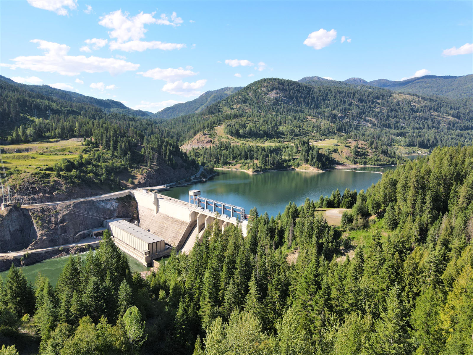
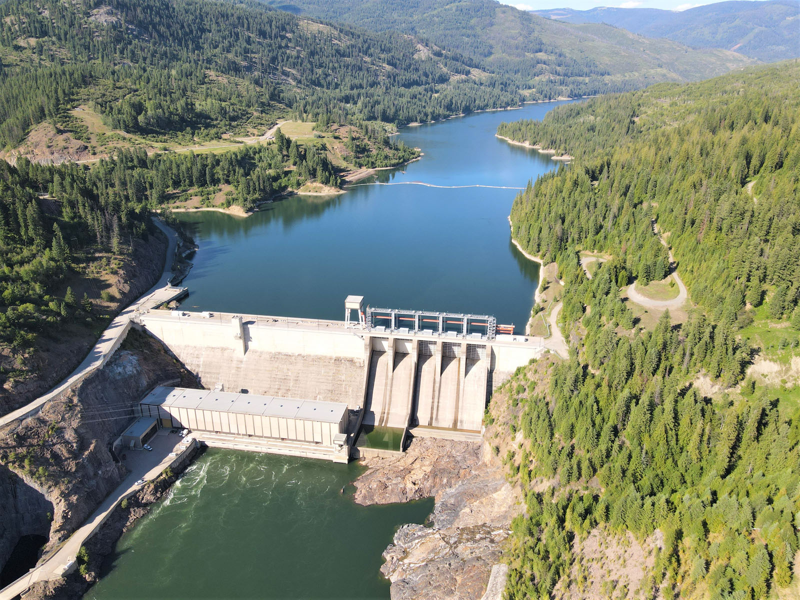


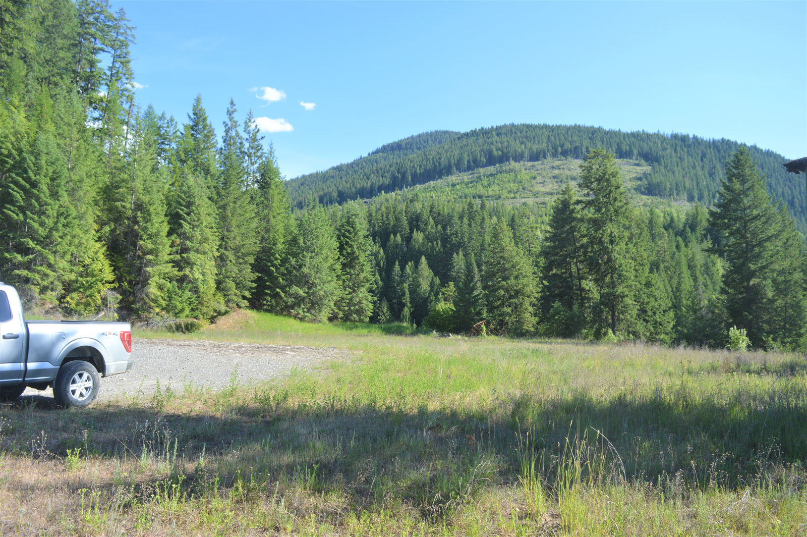
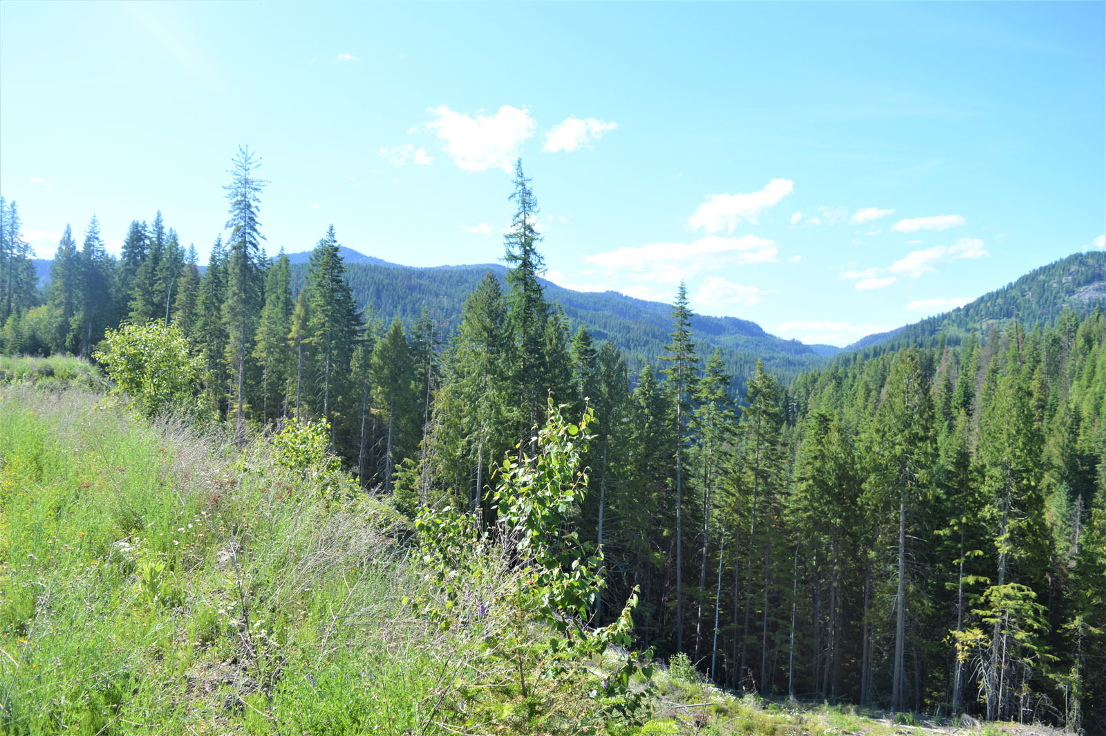
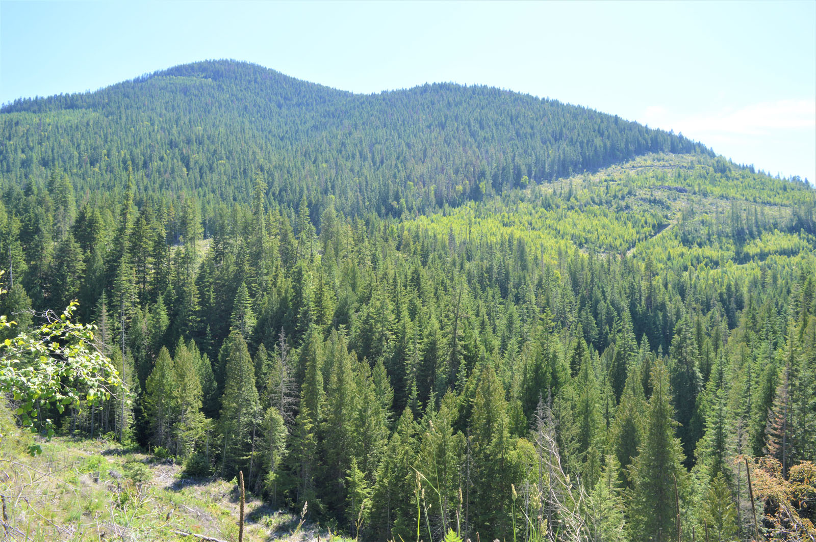
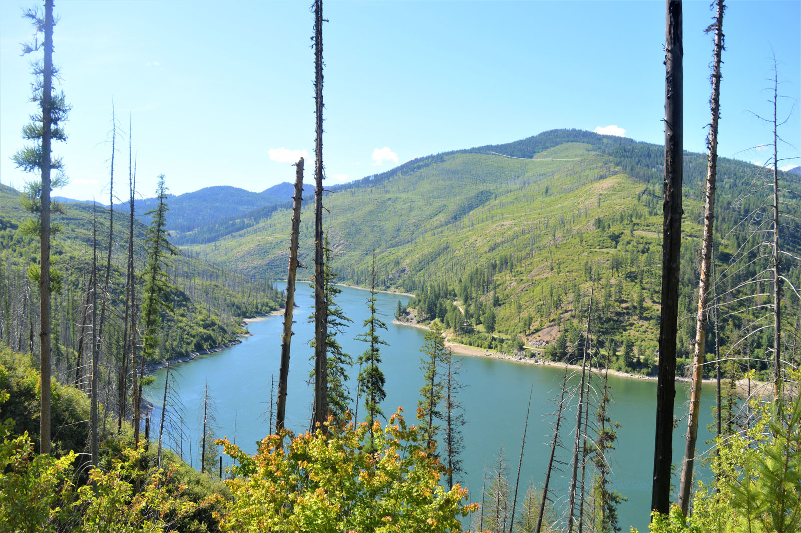


One of the most exclusive and private land portfolios in southern British Columbia. Bordered by the Pend d’Orielle River to the north and the United States to the south, this land holding spans 13.7 kilometres from east to west and covers an impressive 3,346.61 acres. The only access point to the property other than by water is across the BC Hydro’s Seven Mile Dam. Access across the dam is only for persons that own property on the south side of the dam, with secured electronic FAB key access to get through the gate and across the dam. This secured single access point makes this property one of British Columbia's most private wilderness sanctuaries. Although you are purchasing 3,346.61 deeded acres, the real opportunity exists with the access you gain to this landlocked chunk of BC's backcountry with approximately 12,538 acres to explore on the south side of the river. There is an incredible array of wildlife that remains undisturbed and call this area home, with giant wild turkeys, some of BC's largest elk, white-tailed deer, mule deer, bears and grouse.
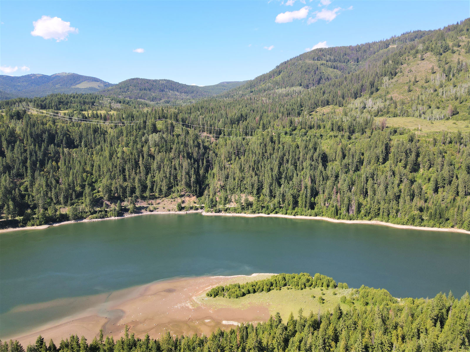
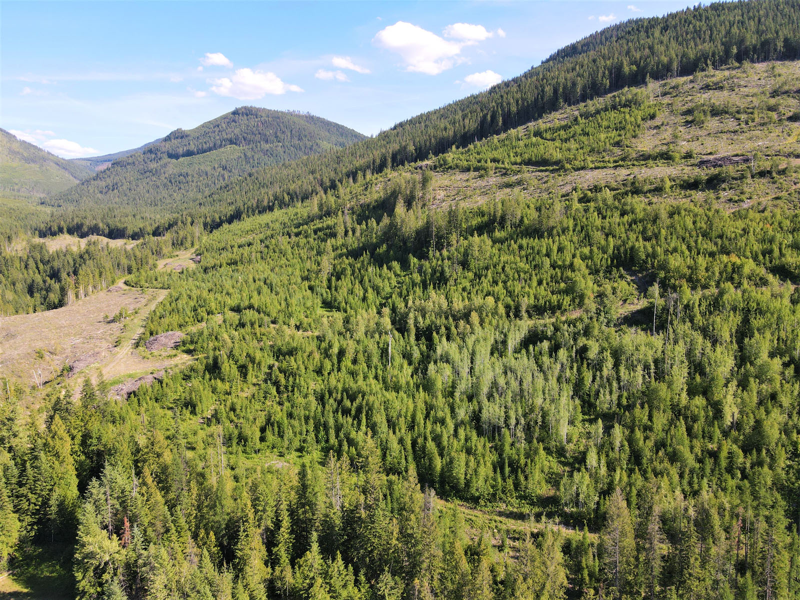
In addition to frontage on the Pend d’Orielle River there are a couple smaller creeks that run through the acreage. There is approximately 30,000 m3 of timber available for a purchaser to harvest. In addition to the merchantable timber large portions of the property have been replanted and juvenile timber at different stages or growth provide you with significant future harvest potential. The remainder of the merchantable timber on the properties has been harvested in recent years.
This is one of the most desirable areas of British Columbia from a climate perspective. Mild winters and warm summers produce excellent conditions for self-sufficient living, gardening and general enjoyment of the backcountry. The fishing on the Pend d’Orielle River is excellent with rumours of big smallmouth bass, perch, black crappies, whitefish and even sturgeon lurking in the waters below the Seven Mile Dam. The mouth of the river, where it flows into the Columbia River, is a very popular area for local fishermen looking for walleye and larger rainbow as well as the odd bull trout.
Landholdings such as this do not come available very often so don't wait to book a time to go by for a look, or call the listing REALTOR® today for more information. Potential buyers looking to view the property must meet prequalification requirements prior to viewing the property.
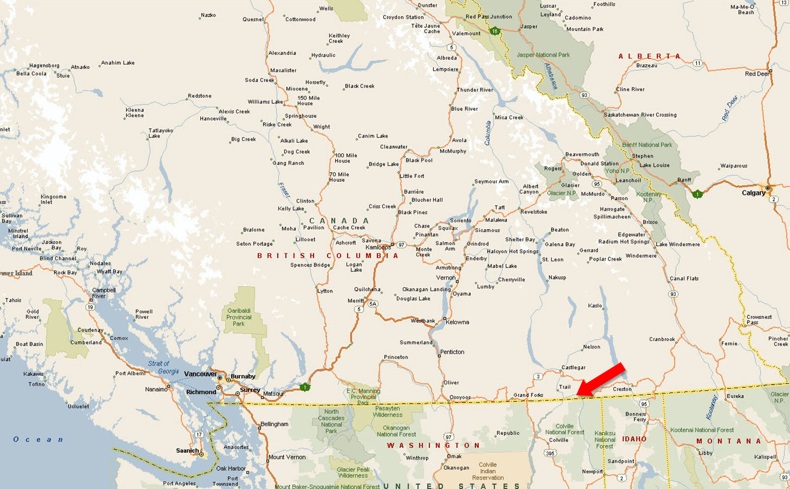
Seven Mile Dam Road - south of Fruitvale, BC
The only access point to the property other than by water is across the BC Hydro dam. Access across the dam is only for persons that own property on the south side of the dam, with secured electronic FAB key access to get through the gate and across the Dam.
The Pend-d'Oreille River is a tributary of the Columbia River, approximately 209 km long, in northern Idaho and northeastern Washington in the United States, as well as southeastern British Columbia. In its passage through British Columbia its name is spelled Pend-d'Oreille River. It drains a scenic area of the Rocky Mountains along the U.S.-Canada border on the east side of the Columbia. The river is sometimes defined as the lower part of the Clark Fork, which rises in western Montana.
Summer climate in Trail is generally hot and dry with moderately cool nights. Temperatures often exceed 35°C (95°F) during summer afternoons, average 29°C (84.2°F). Thunderstorms are common during the late-spring and summer season, often moving into the valley from the south. The fall months bring dense river fog, especially overnight and in the morning, as a cold air inversion lingers above the relatively warm river surface. Winters are mild to cold, with periods of moderate snowfall. Nearby villages such as Warfield and Fruitvale often receive greater amounts of snow due to higher elevation.
The Monashee Mountains are the first major mountain range east of the Coastal Mountains to intercept moisture laden westerly flow from the Pacific Ocean. As a result, areas west of Trail, including the Christina Range, Rossland Range, the city of Rossland, and the Blueberry-Paulson section of the Crowsnest Highway (Highway 3) receive greater amounts of winter precipitation, mostly in the form of heavy snow. Vegetation in the Trail area, although fairly lush, is noticeably drier than other areas with a more westerly aspect.
Fruitvale was originally named Beaver Siding because it was a railway stop for the great Northern Railroad. In 1906, Fruitvale Limited purchased a great deal of land on both sides of this stop and changed the name to Fruitvale. Fruitvale was incorporated as a Village on November 4, 1952.
Today, Fruitvale is mainly a residential area for the employees working in the industries located in and around the area. However, in the downtown core, there are some great stores that will surprise and delight visitors. They have full service amenities such as, a grocery store, a pharmacy, a medical clinic, dental clinics, veterinary services, gas stations, auto services, a post office, cafes and places to eat, BC Liquor Store, and a “real” country store with feed and gifts.
In the early 1900s a large influx of Italian immigrants lent a distinctive character to "The Gulch," which is located at the entrance to Trail accessed by the Schofield Highway which drops down the long grade down from the city of Rossland and the village of Warfield and sub-division of Annabel onto Rossland Avenue. This neighbourhood which runs the length of Rossland Avenue is known as "the Gulch." Originally called the "Dublin Gulch" in the very early days, it eventually became known as "The Gulch" as it filled up with Italians who chose not to live on the original Trail townsite. The Gulch starts as throat of Trail Creek narrows between the high, sandy slope of Smelter Hill on its left bank and the West Trail bank where early pioneer houses were built by immigrants as the purchased properties along the west bank steep terrain.
In the early pioneer days, industrious Chinese launderers and cooks spent time gardening in the defile of the Gulch. Few of these immigrants ever acquired rights to own land in the Gulch and their gardens were gradually displaced by Italians and other European working families who terraced their properties into level plots. Despite the steep terrain, these immigrant families planted vegetable gardens reminiscent of the old country, fed by plenty of water from Trail Creek and the hot summer sun.
The Gulch is home to shops and the Terra Nova hotel, located at the entrance to Trail’s central business district at the foot of Rossland Avenue.
Please see mapping section (all boundaries are approximate).
49° 1'23.66"N and 117°28'43.66"W
None.
$7,314.63 (2023)
FR - Forest Resource Zone
RA - Resource Area
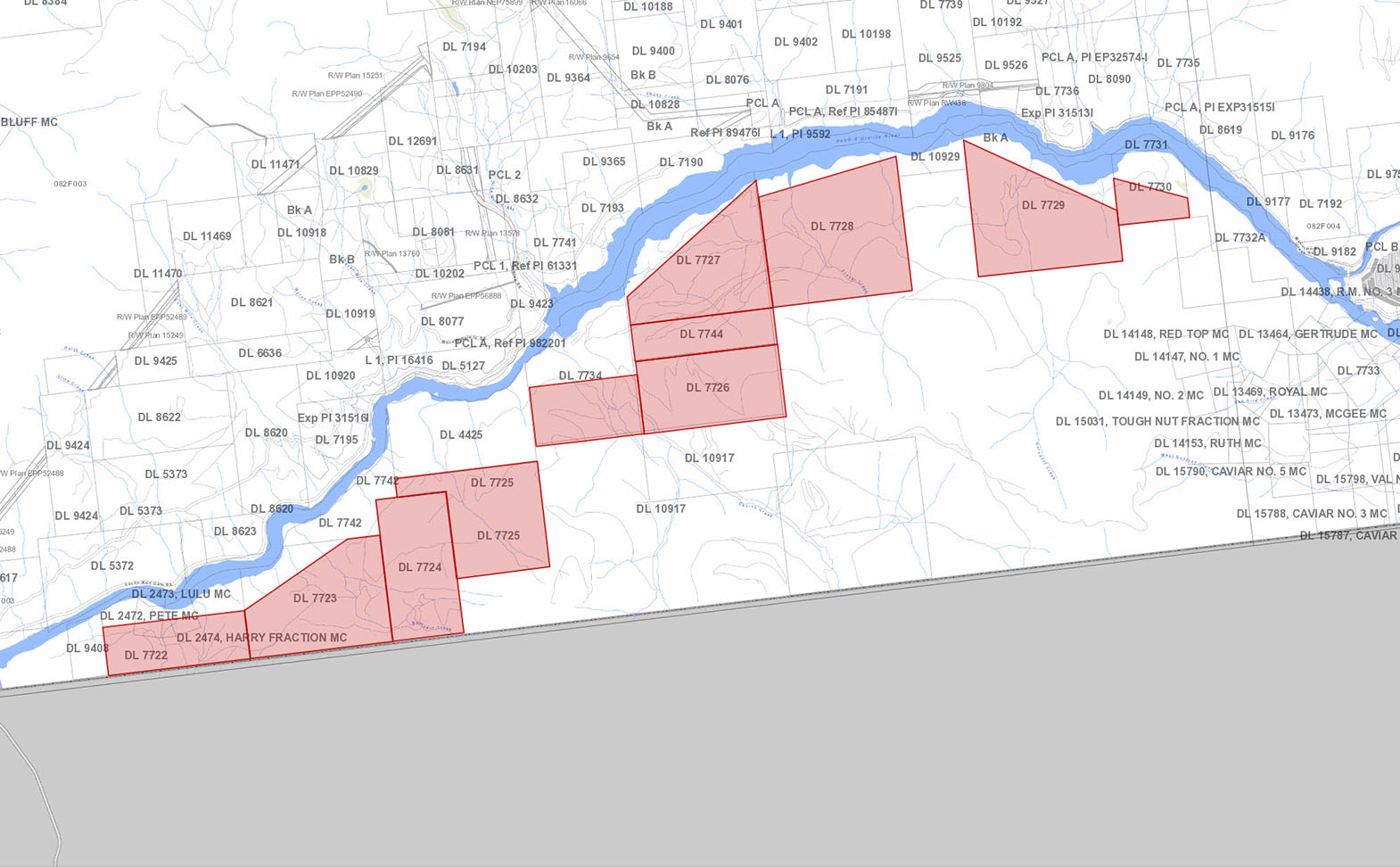
District Lot 7724, Kootenay Land District
PID 016-425-081
District Lot 7744, Kootenay Land District
PID 016-425-103
District Lot 7734, Kootenay Land District, Except Plan 102461-I
PID 016-425-120
District Lot 7728, Kootenay Land District, EXC EXPL PL 102461I
PID 016-425-146
District Lot 7727, Kootenay Land District, Except Plan 102461-I
PID 016-425-162
District Lot 7726, Kootenay Land District
PID 016-425-171
District Lot 7730, Kootenay Land District, EXC EXPL PL 102460I
PID 016-426-266
Lot 7729, Kootenay Land District, EXC EXPL PL 102460I
PID 016-426-380
Parcel A, District Lot 7723, Kootenay Land District, (SEE 155719)
PID 016-426-550
Parcel A, District Lot 7722, Kootenay Land District, (SEE 155719)
PID 016-426-657
District Lot 7725, Kootenay Land District
PID 016-426-665
 +8 maps


Our property descriptions and geographical information are taken from the BC Assessment Authority, Land Titles Office, government maps and other sources. While LandQuest® does not guarantee the information, we believe it to be accurate, but should not be relied upon without verification. This communication is not intended to cause or induce breach of an existing agency agreement.
Fruitvale
 21℃
21℃
 12℃
12℃