


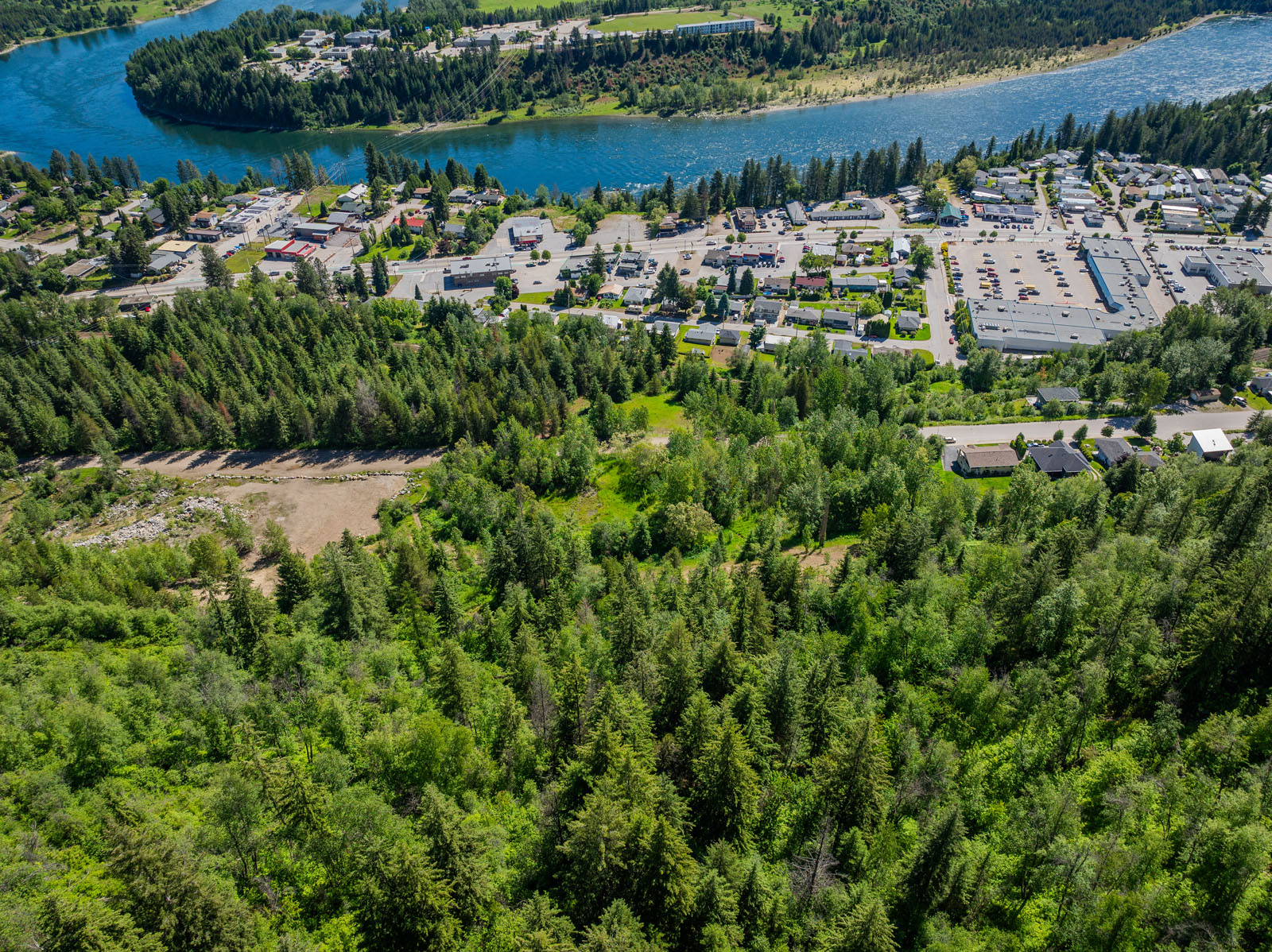
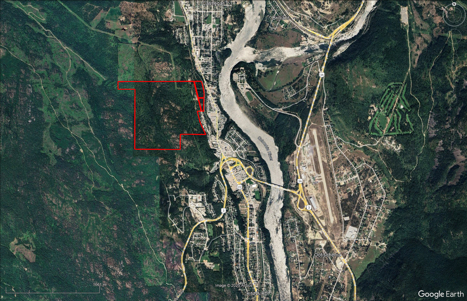
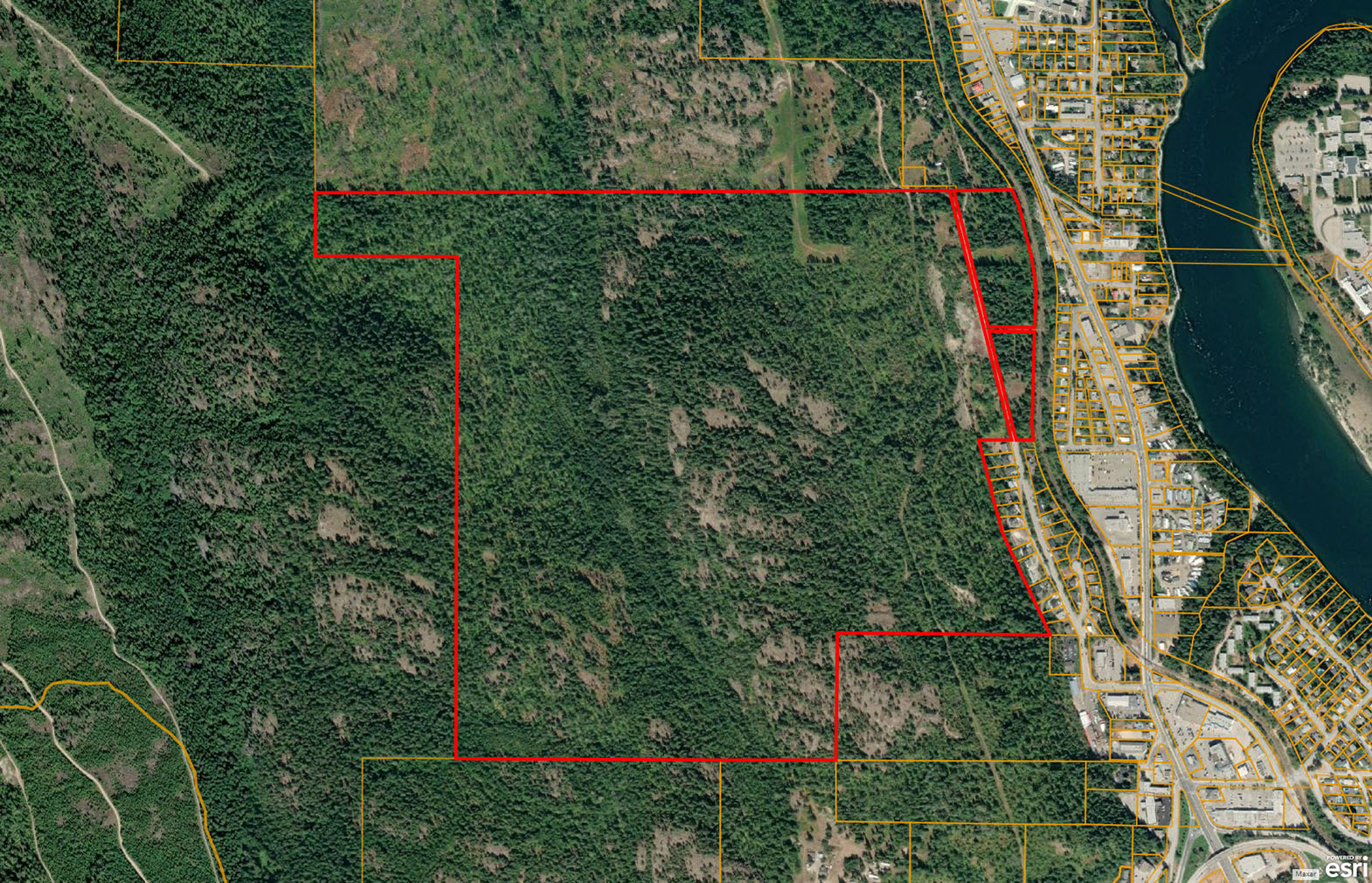
One of the largest parcels in Castlegar—338.74 acres with significant timber, development, and investment value. 30 acres on lower bench zoned for medium-density townhomes. Upgrades to city water and sewer needed. Walking distance to town and all amenities.


 +46 photos


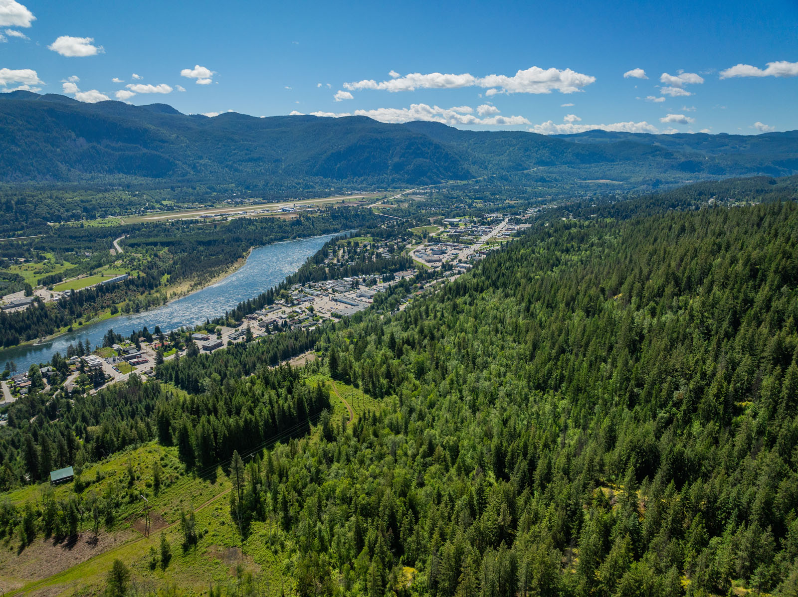
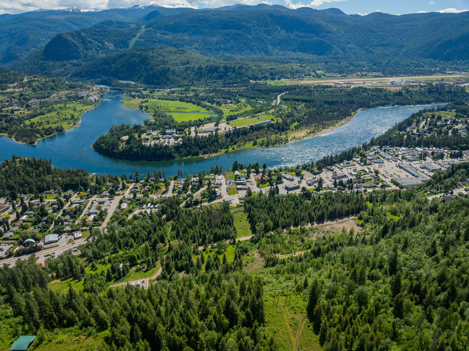

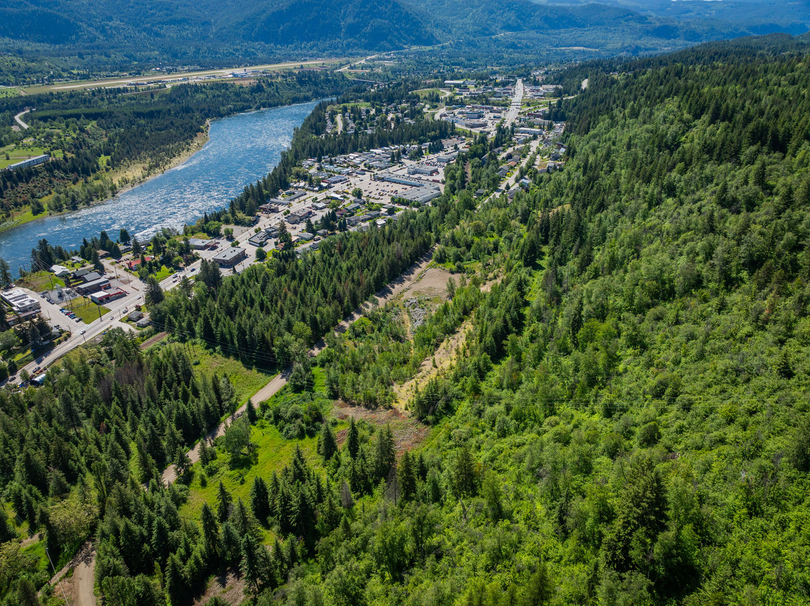
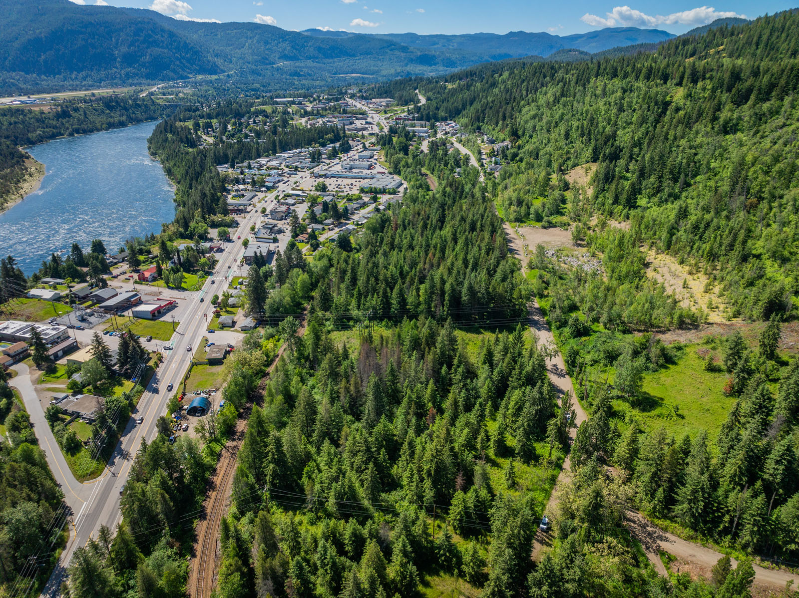
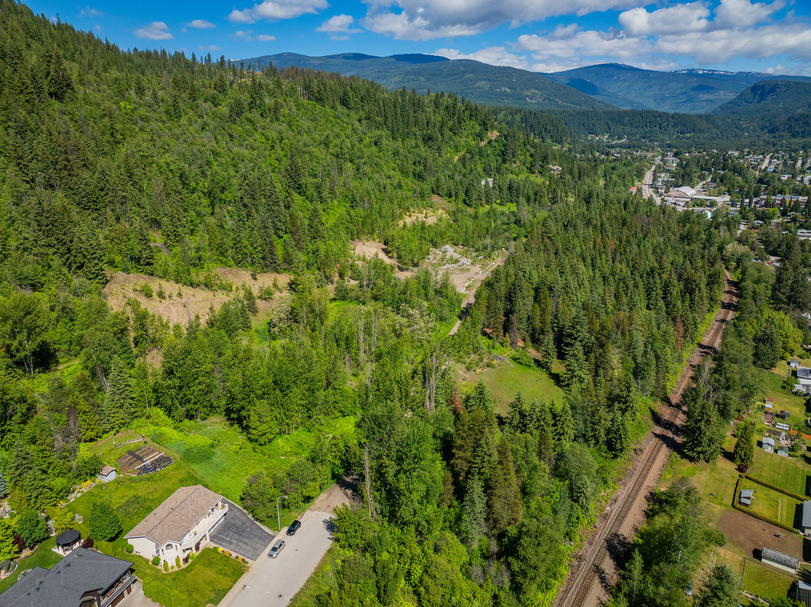
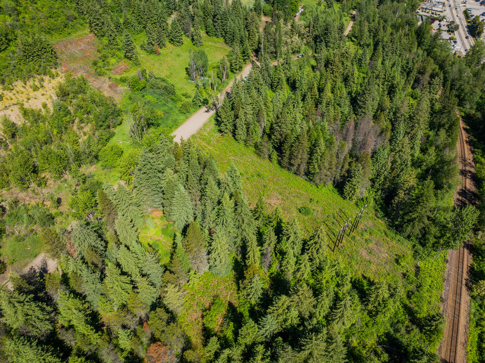
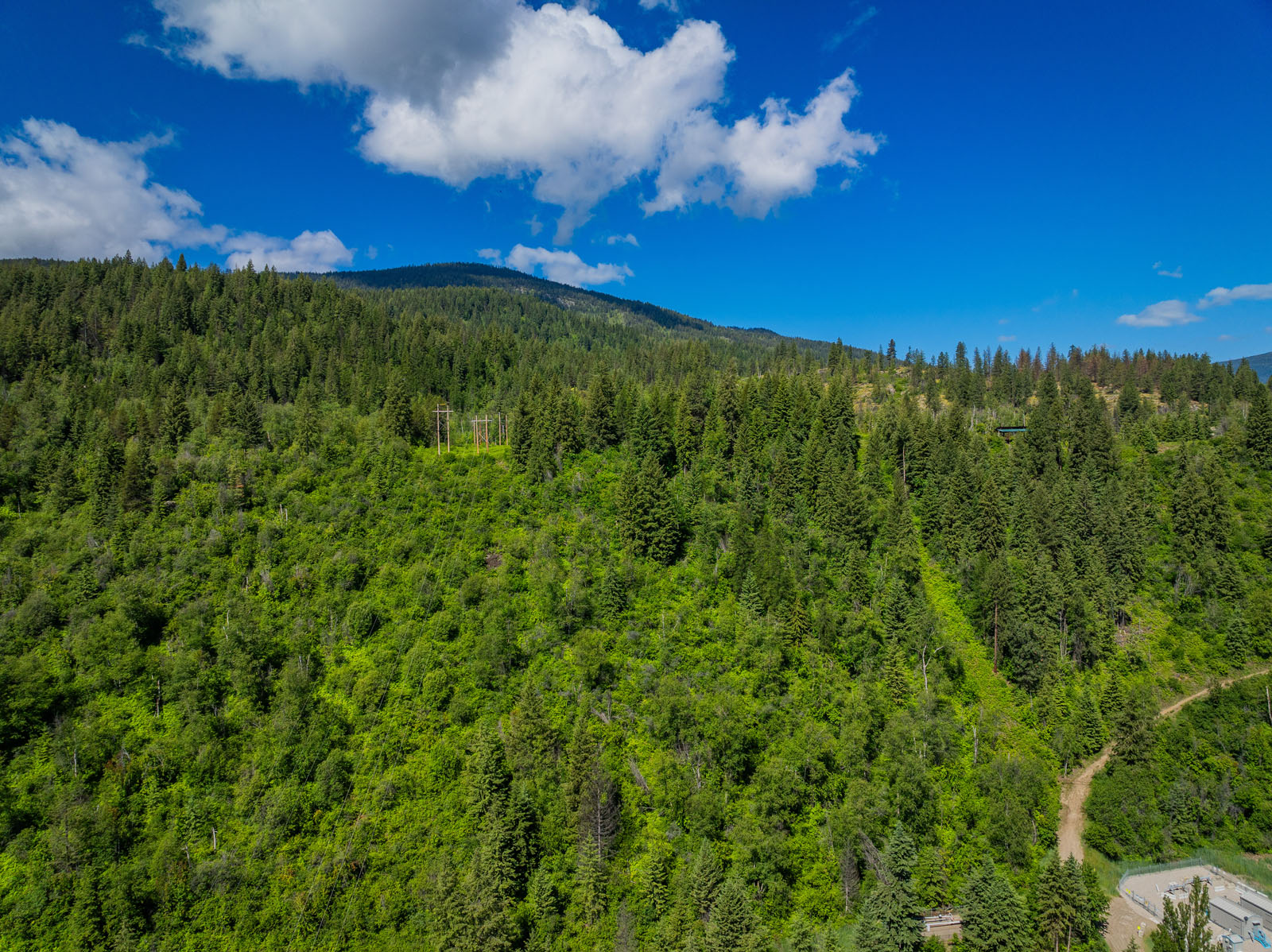
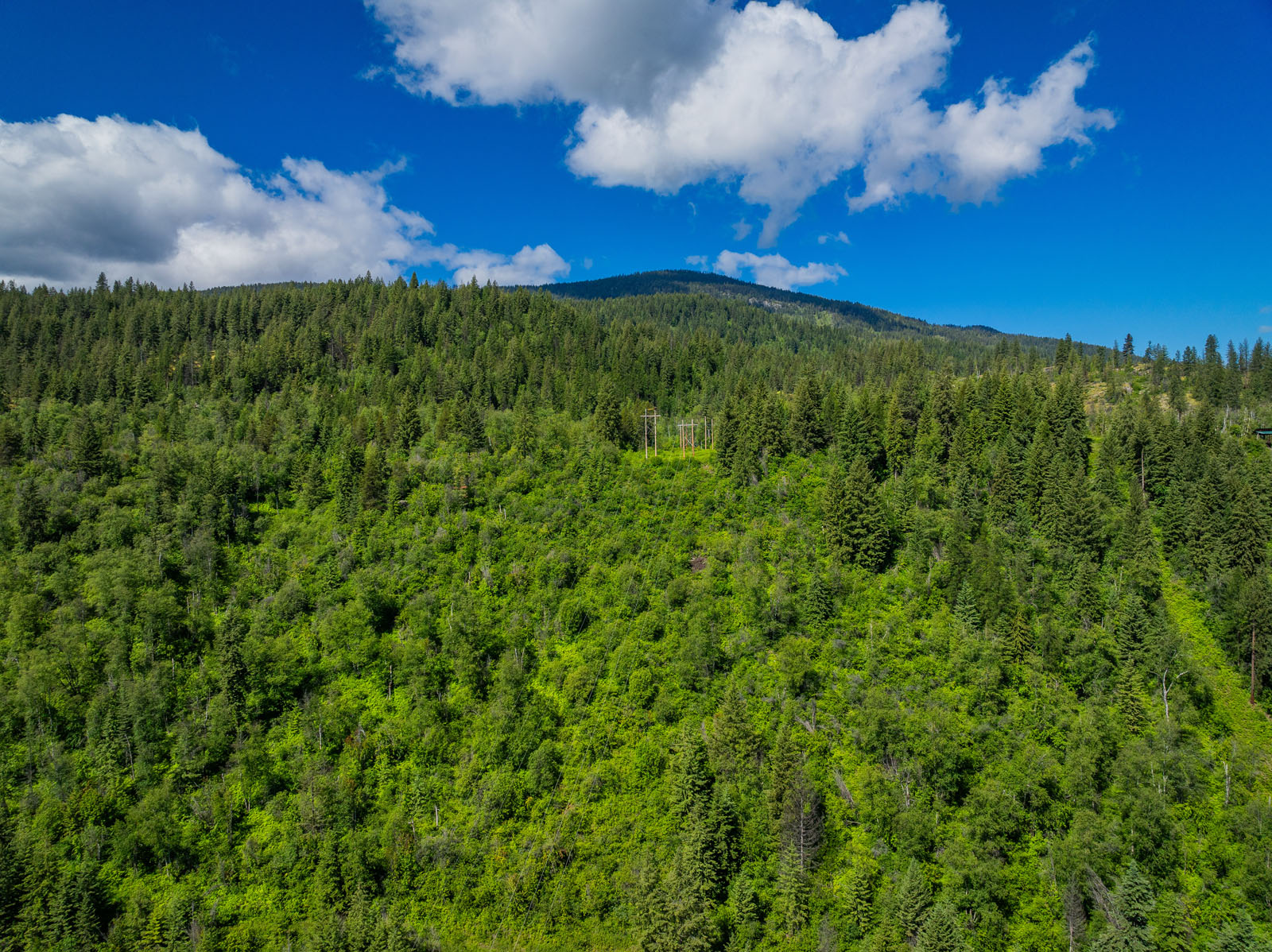
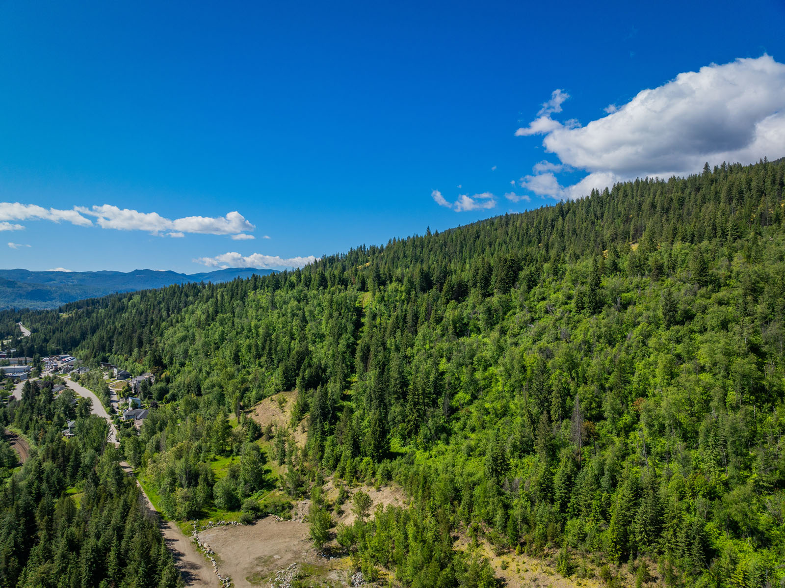
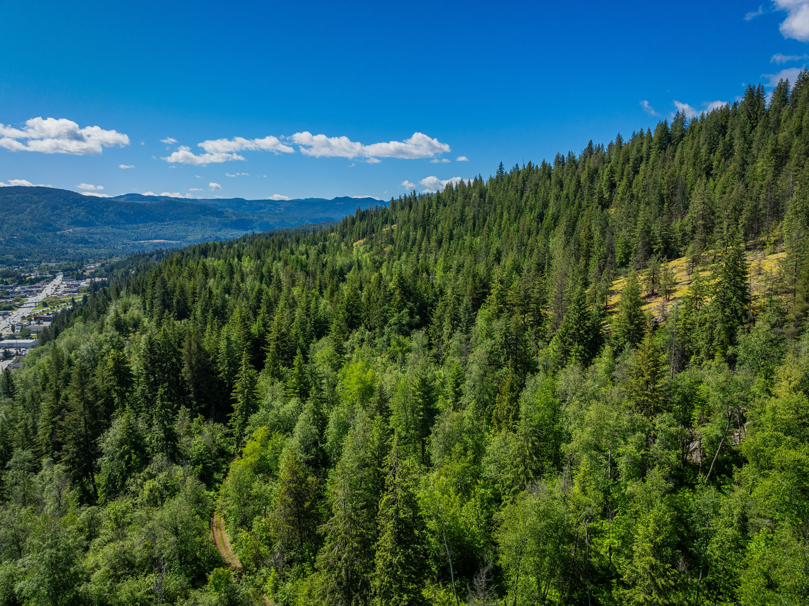
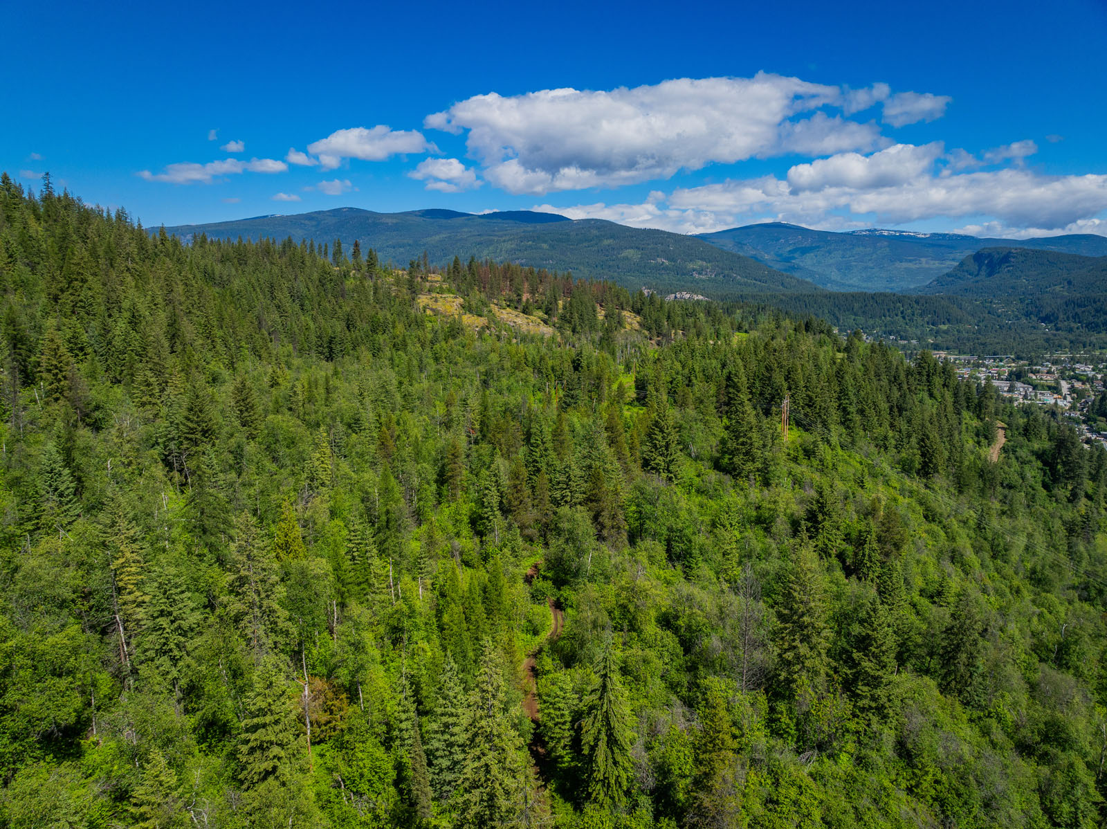
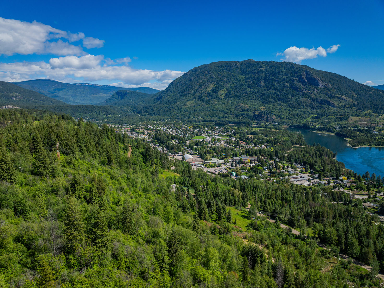
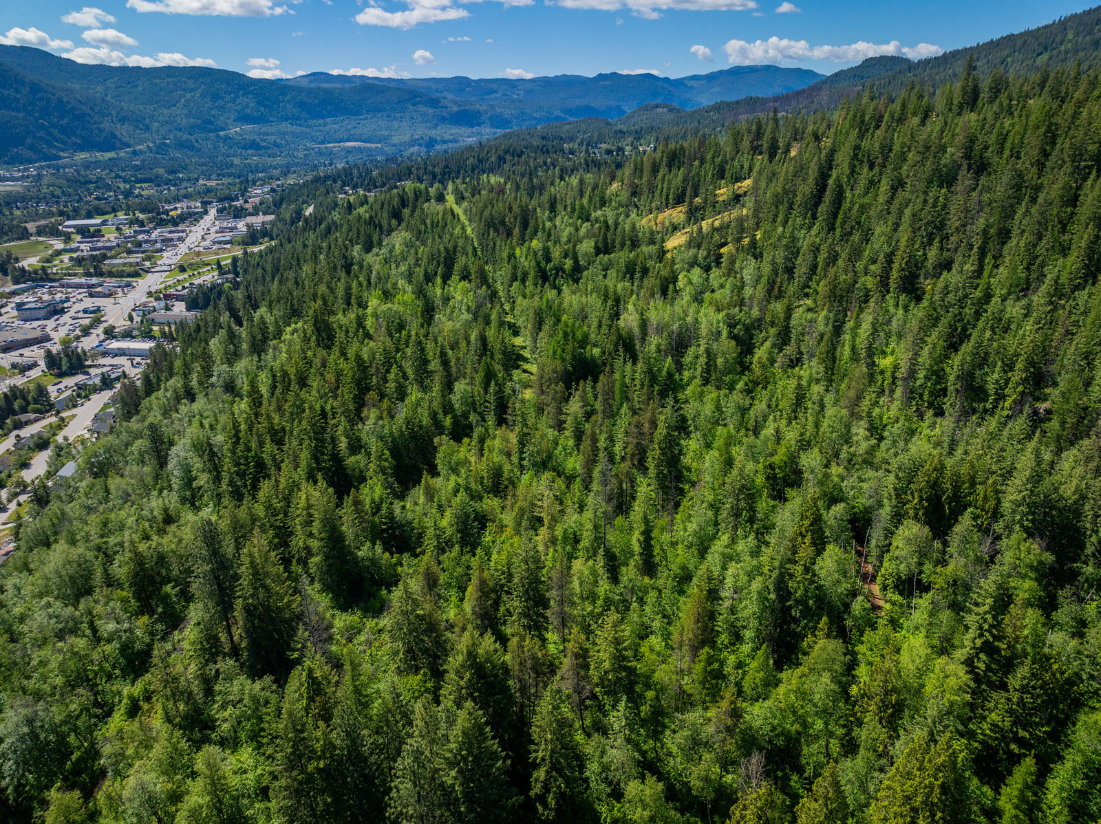
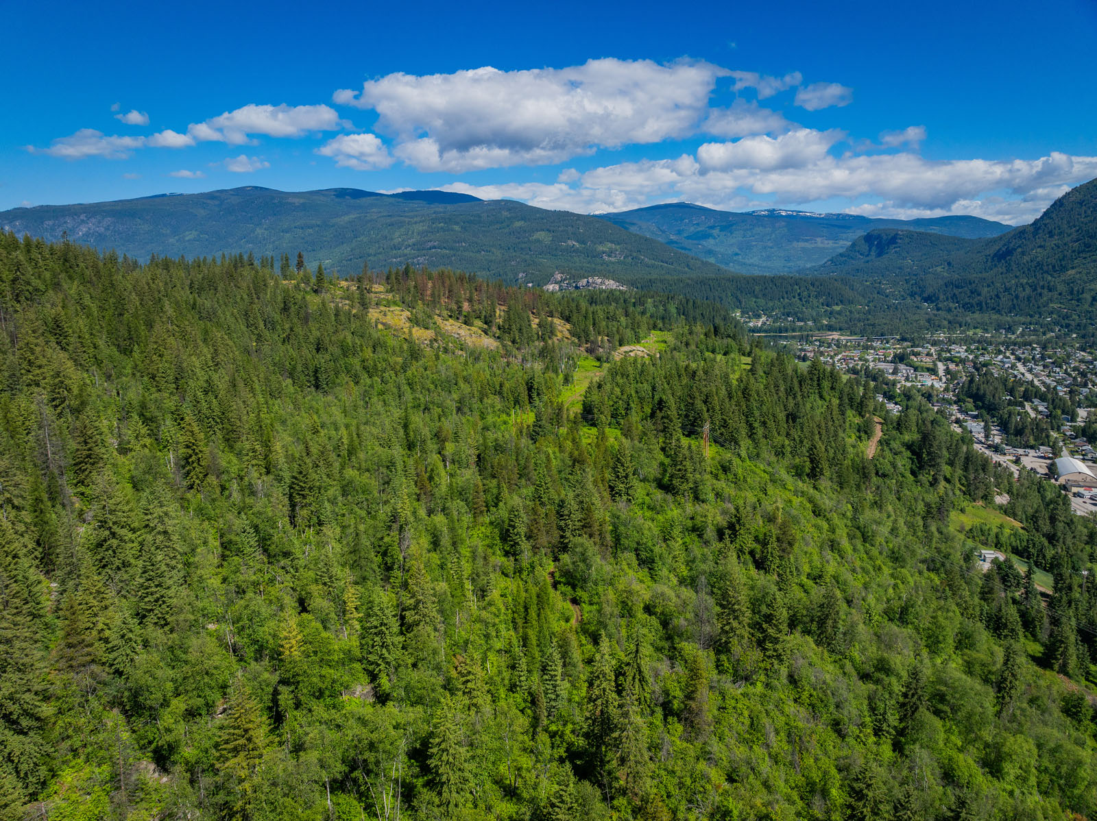
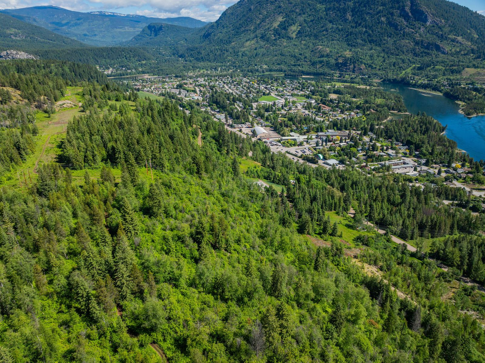
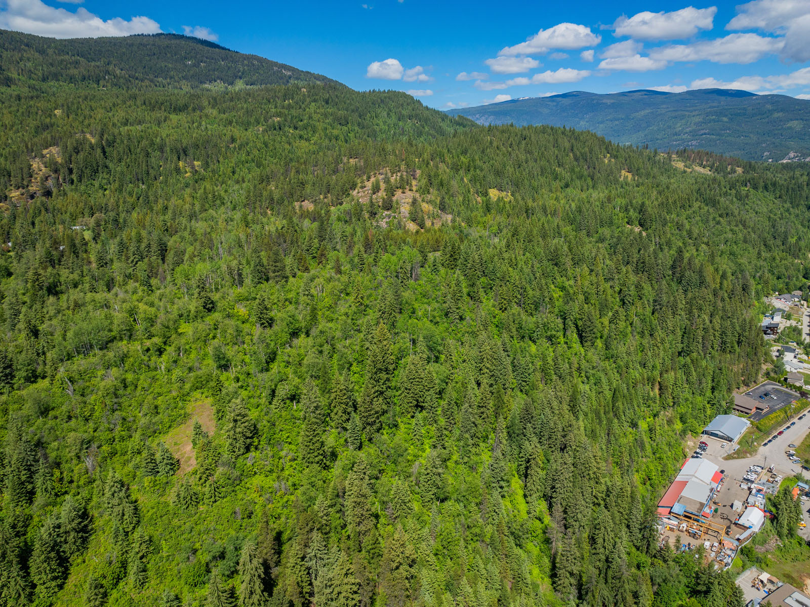
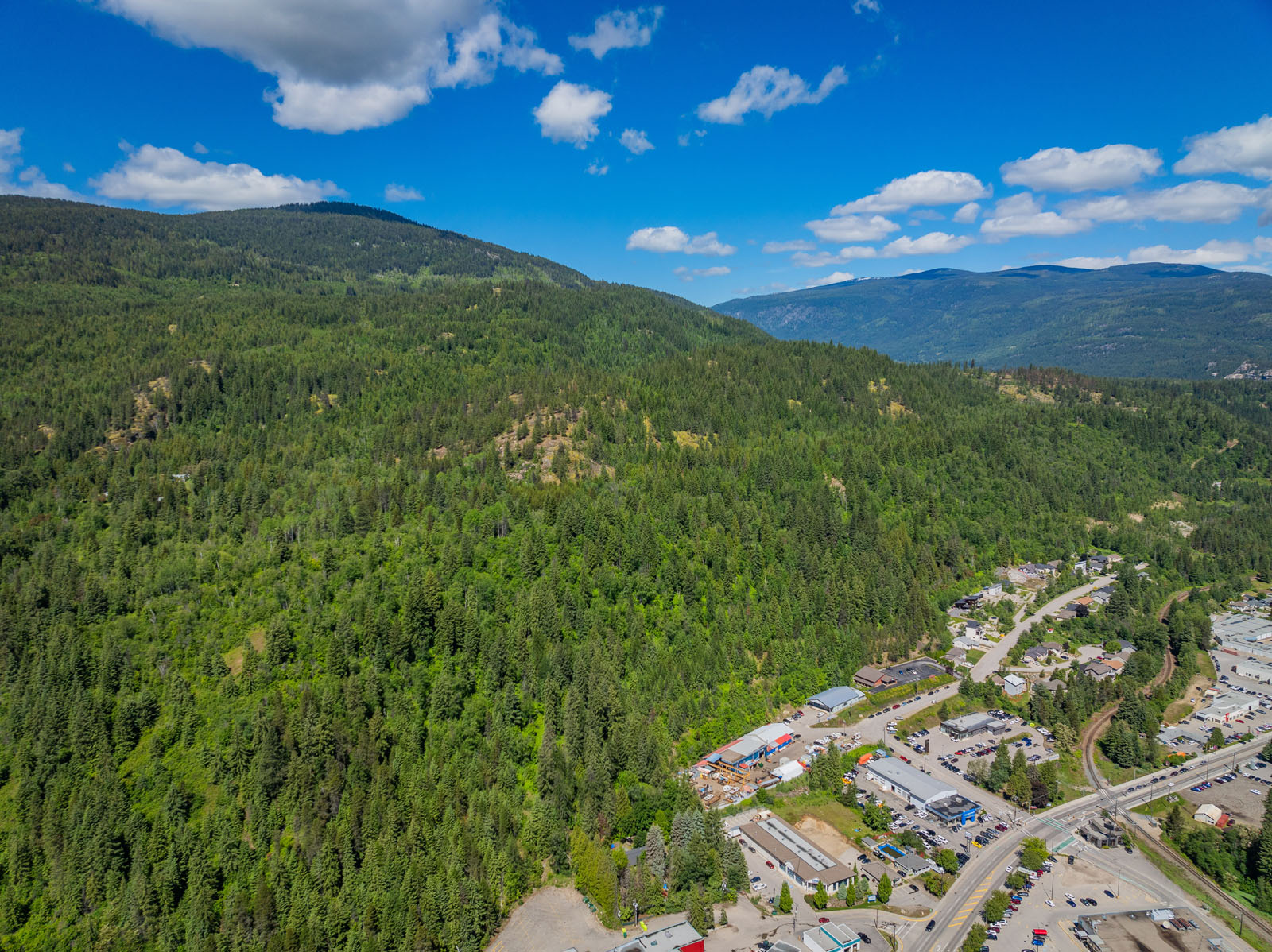
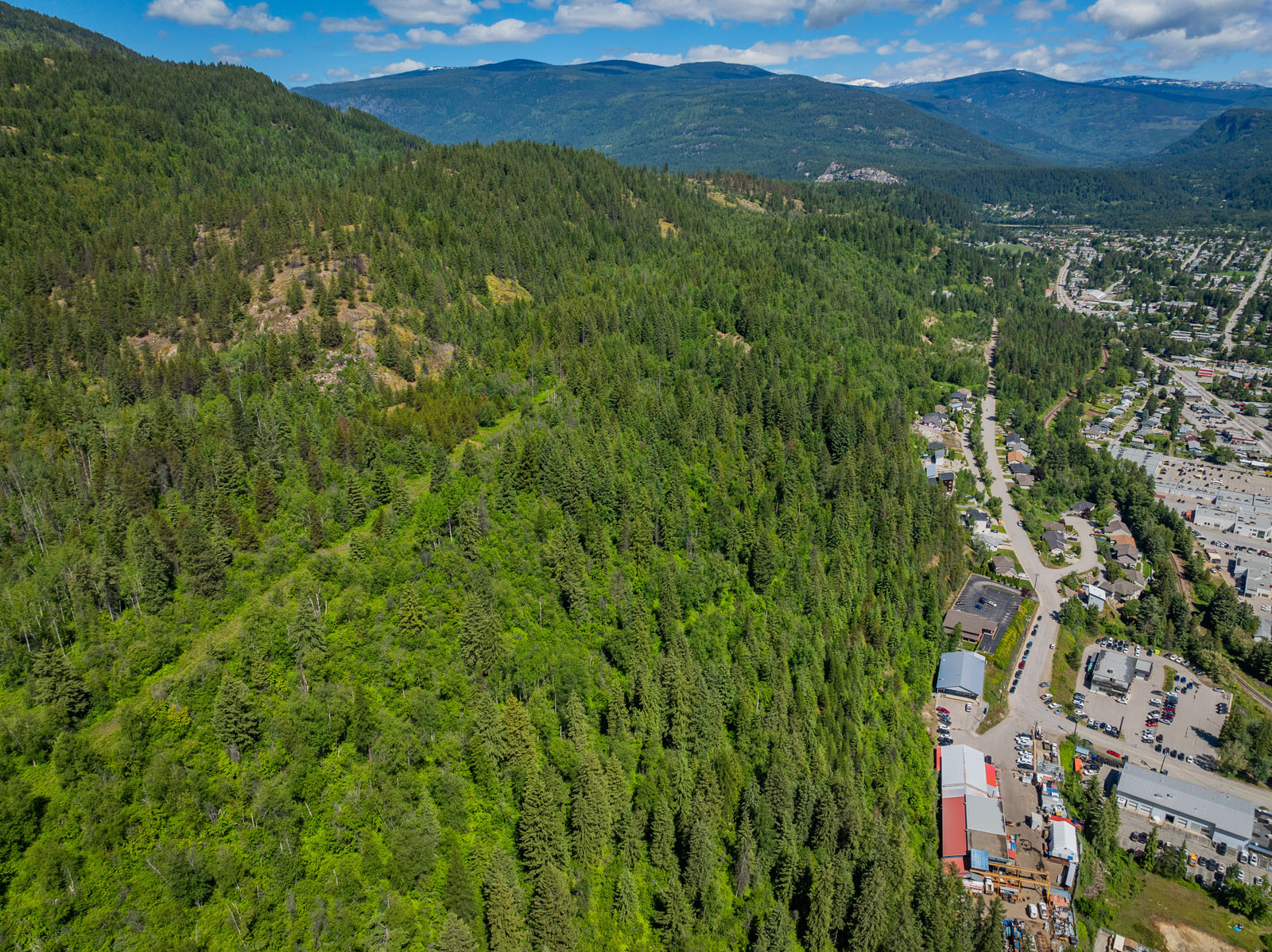
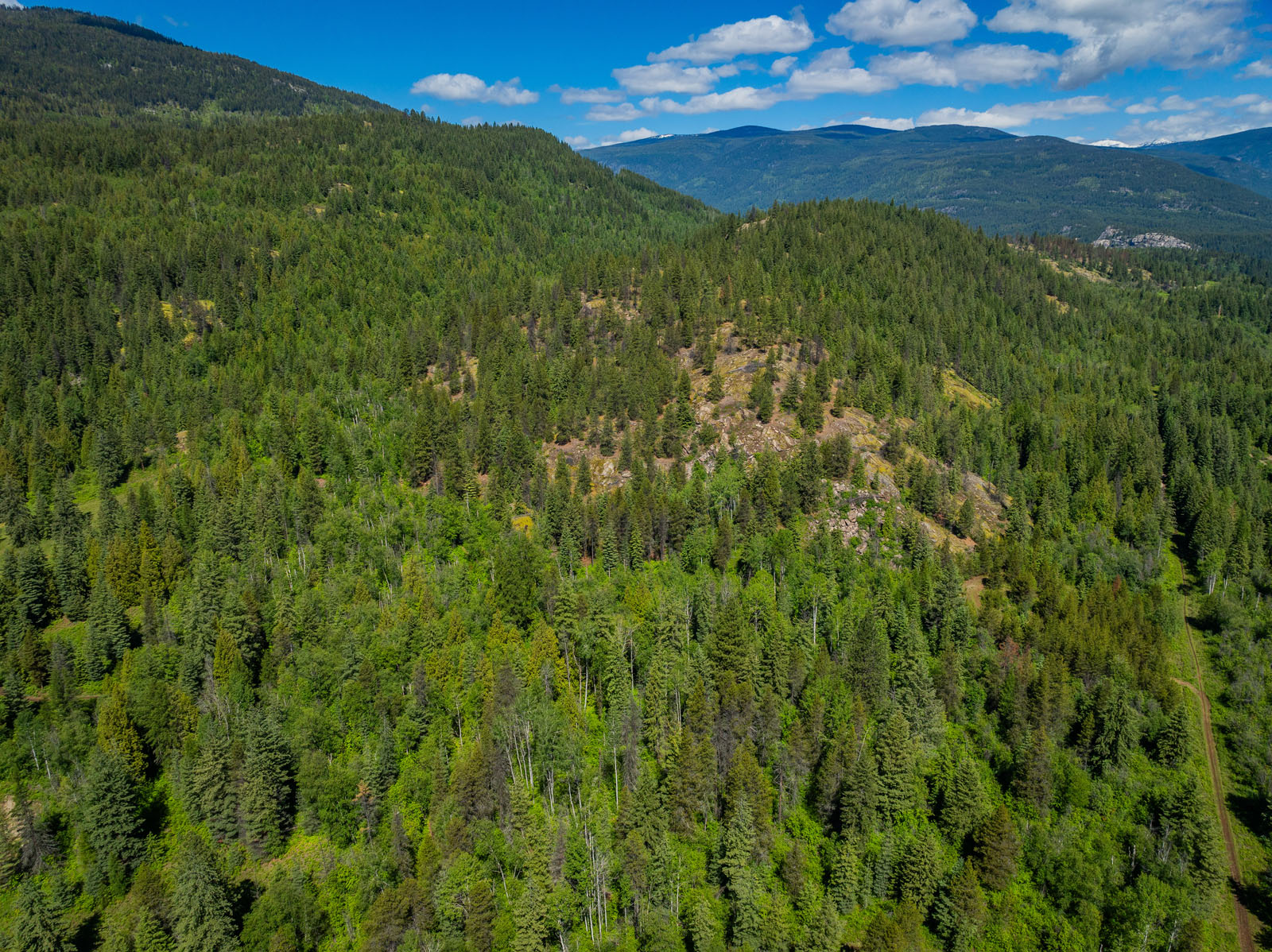
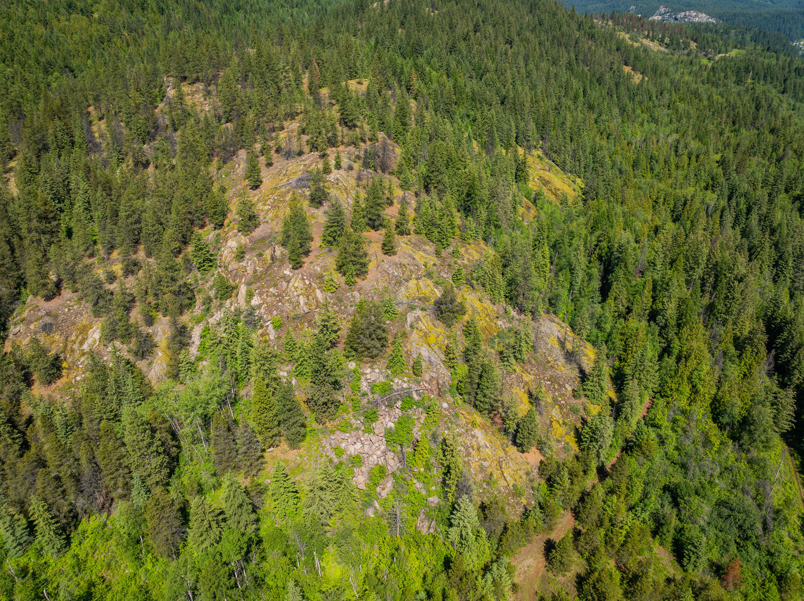
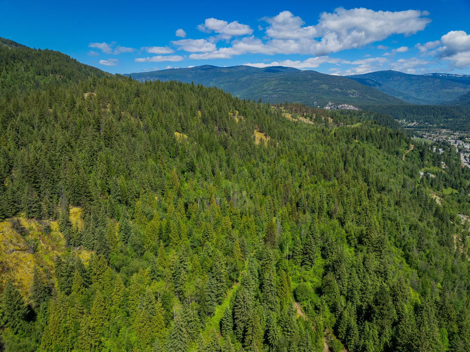
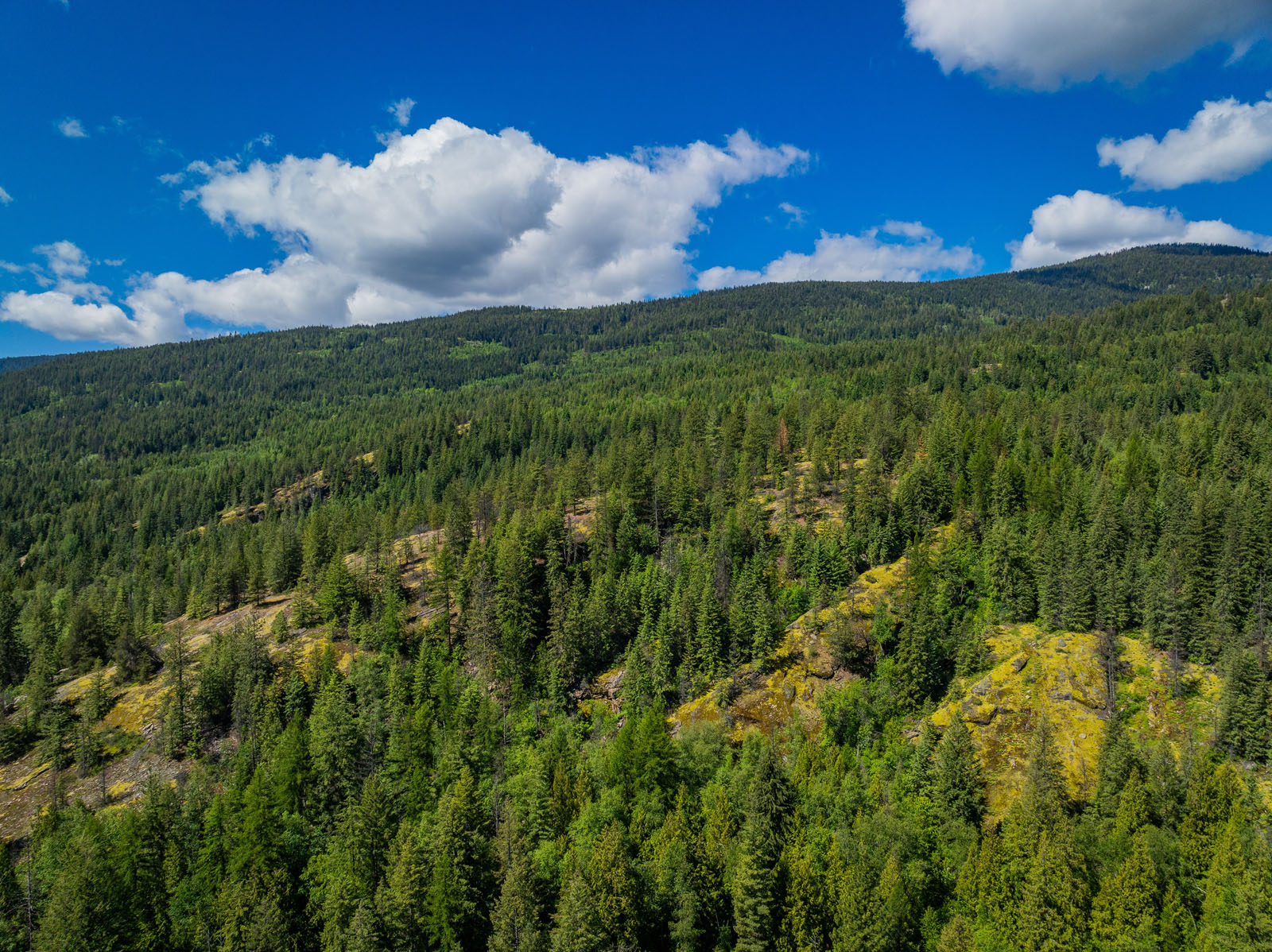
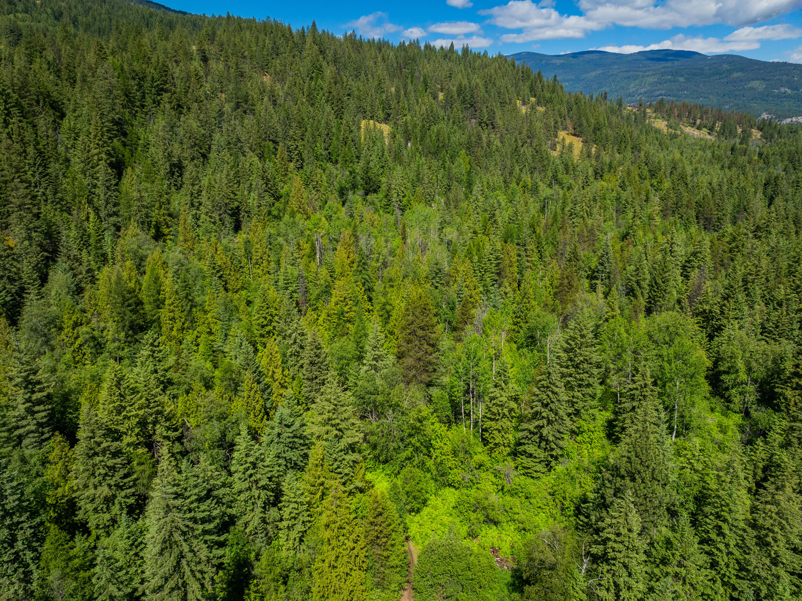
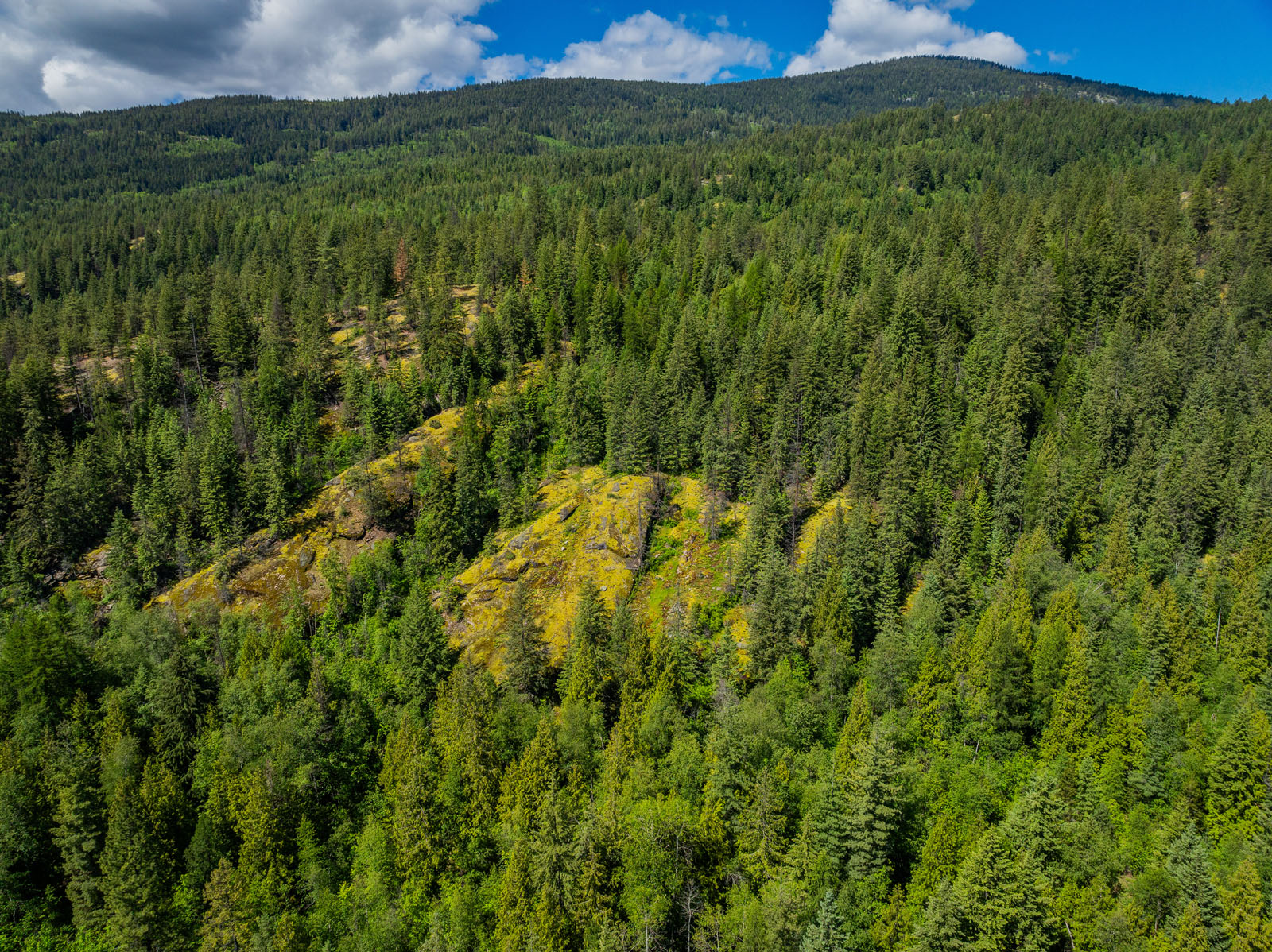
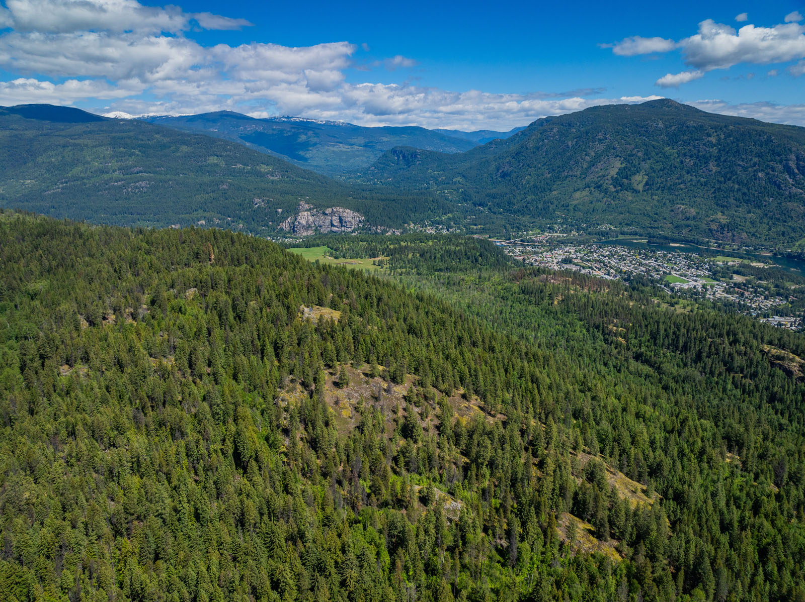
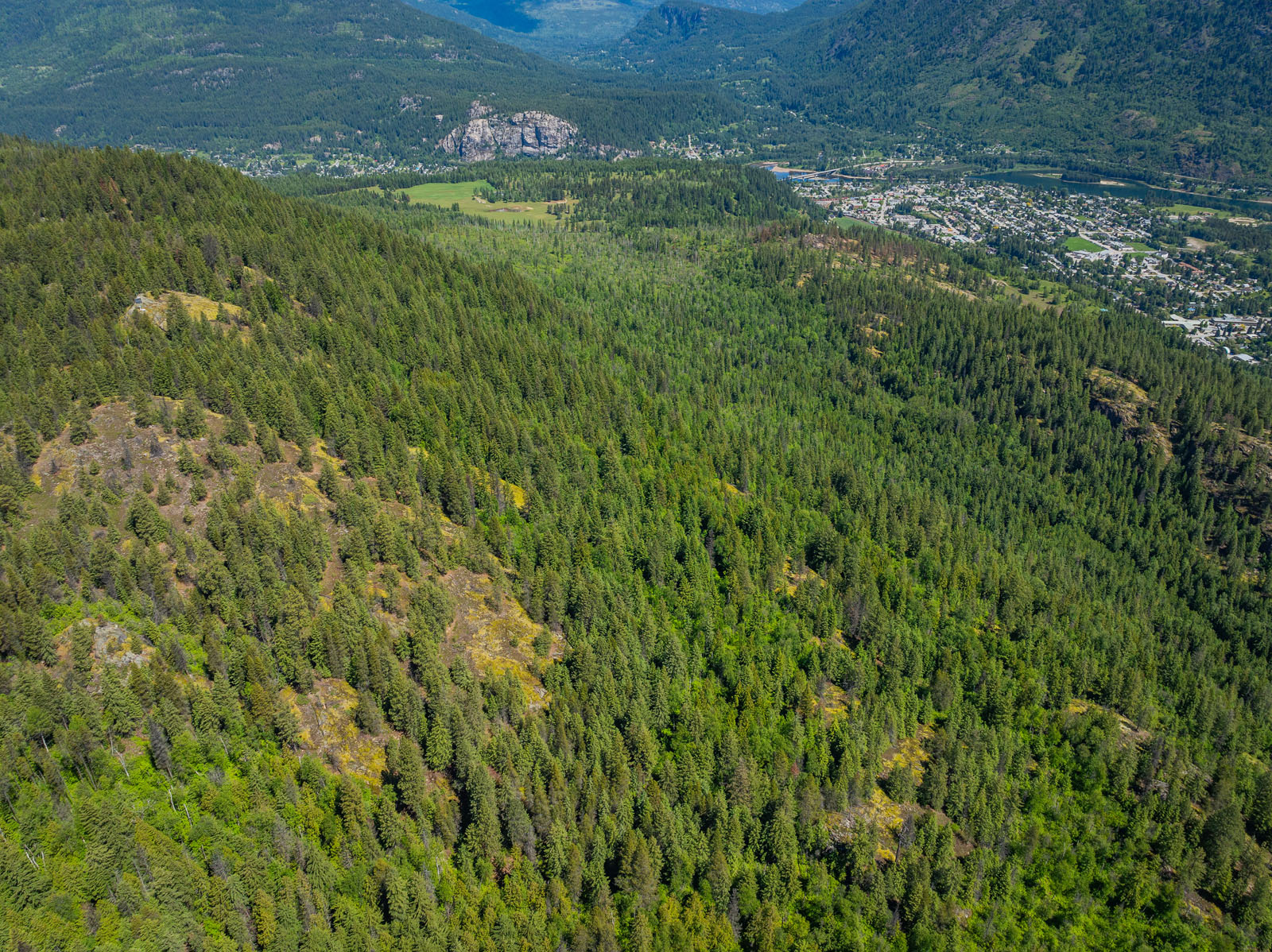
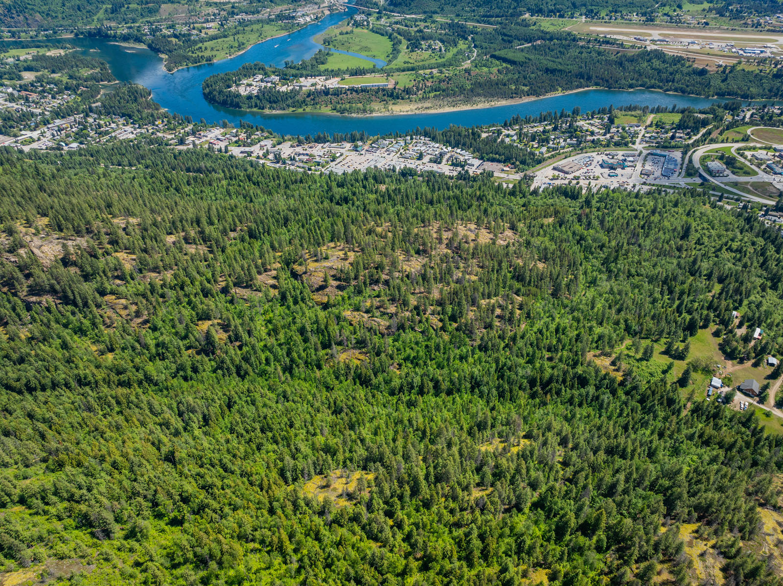
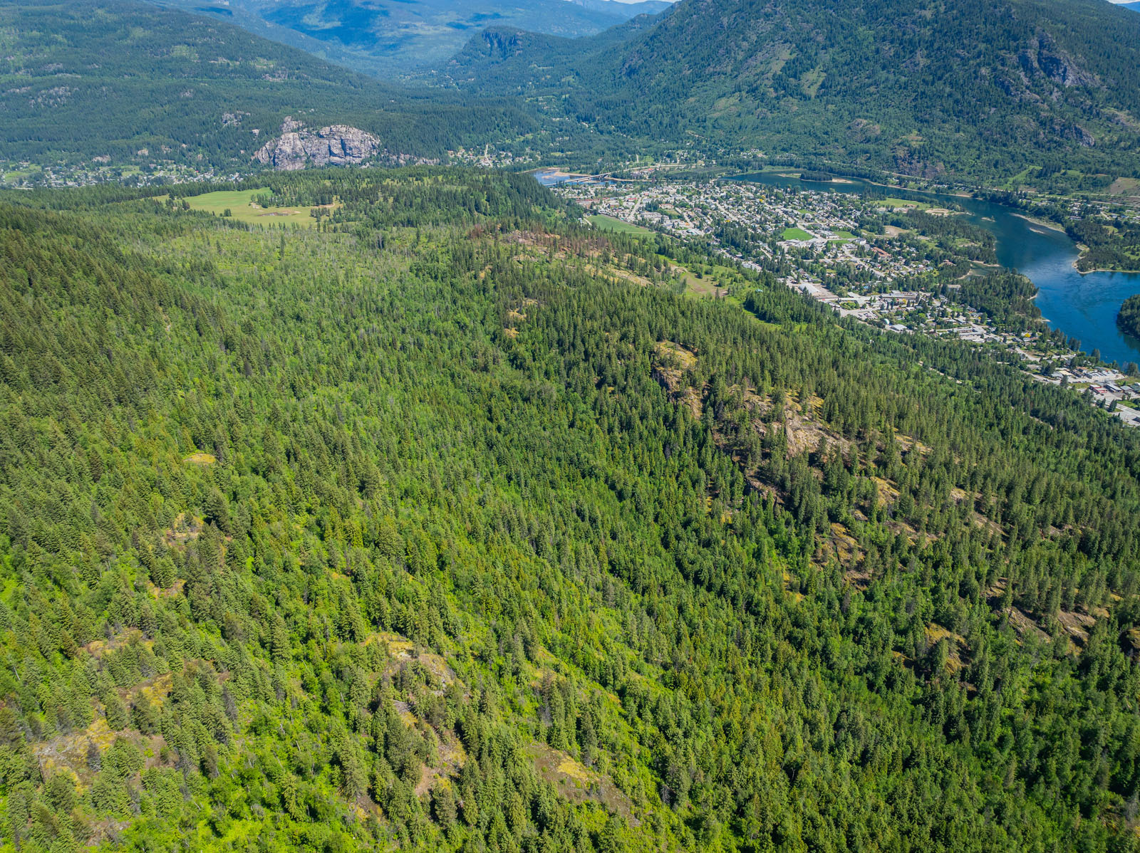
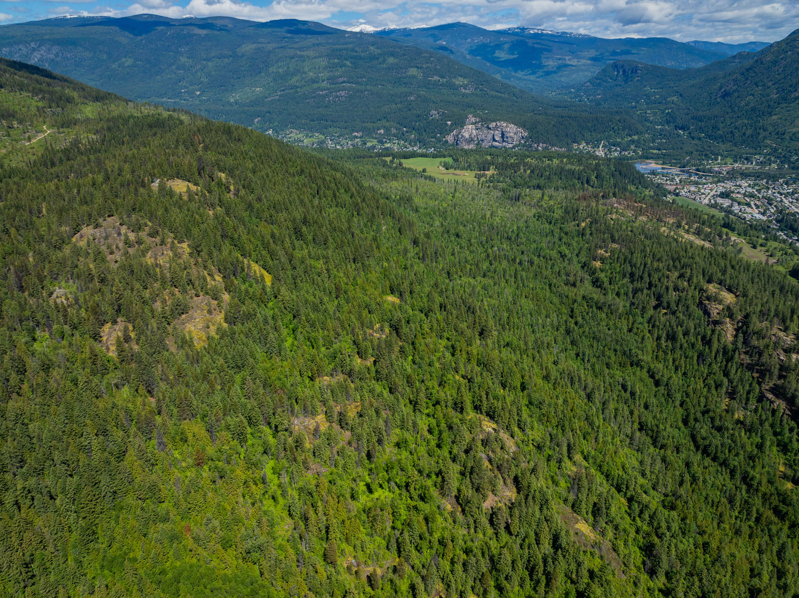
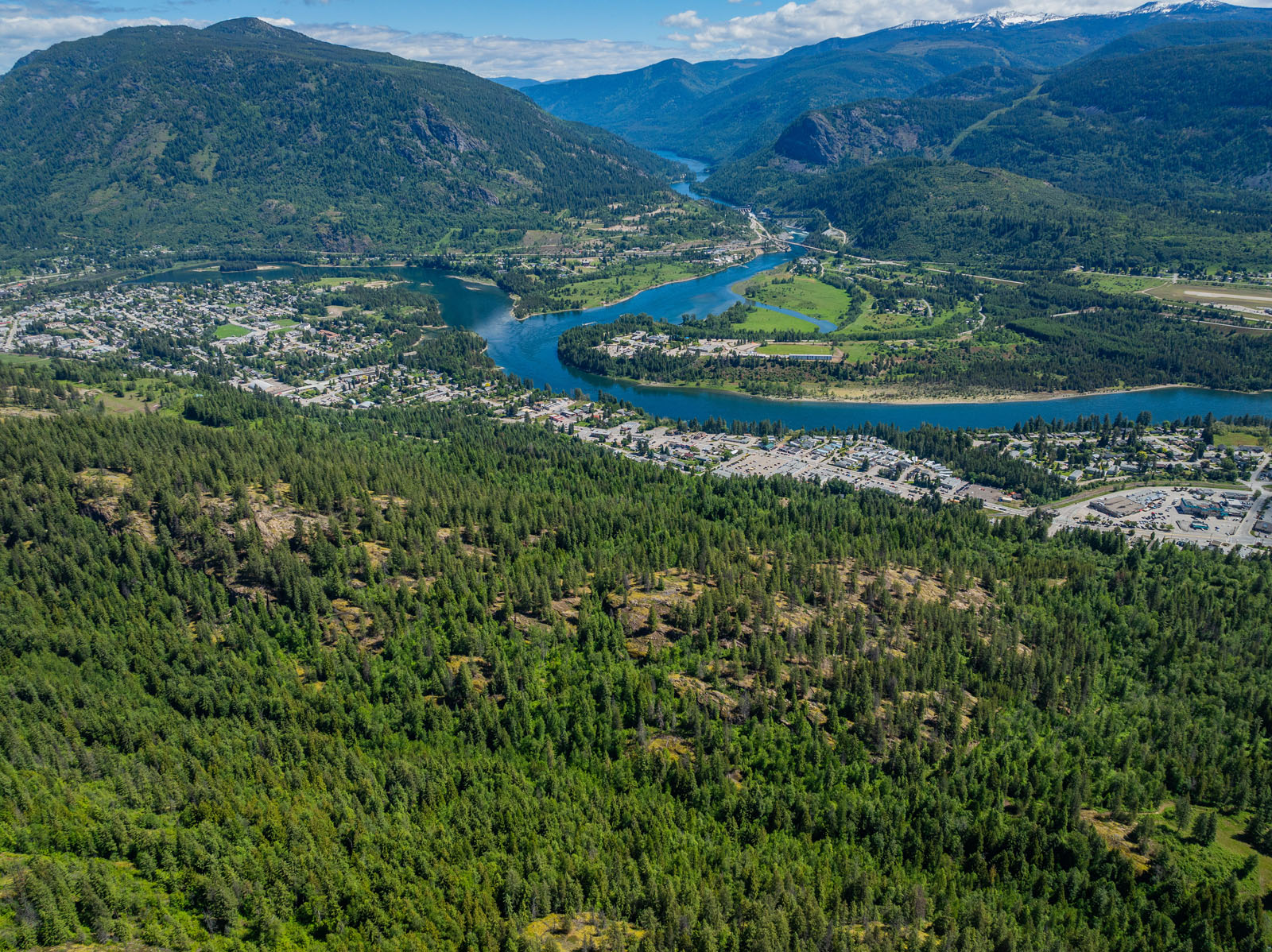
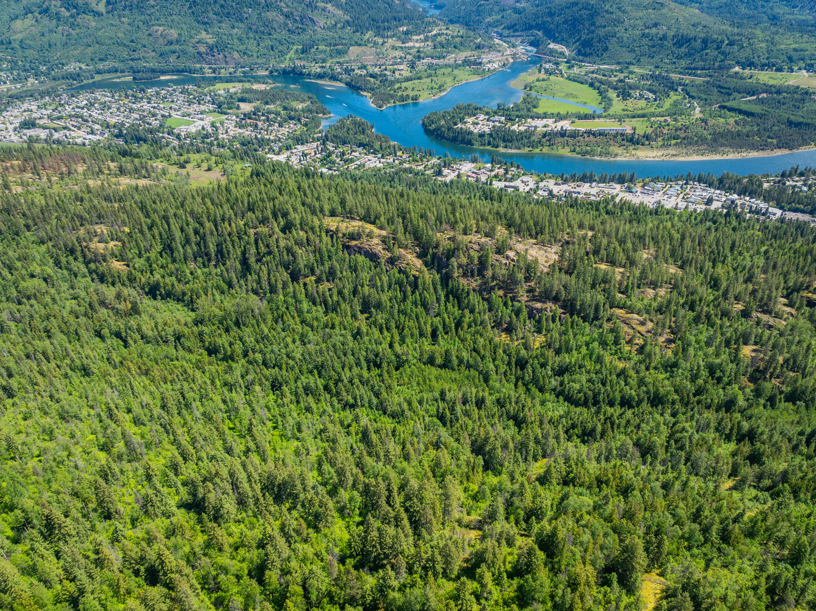
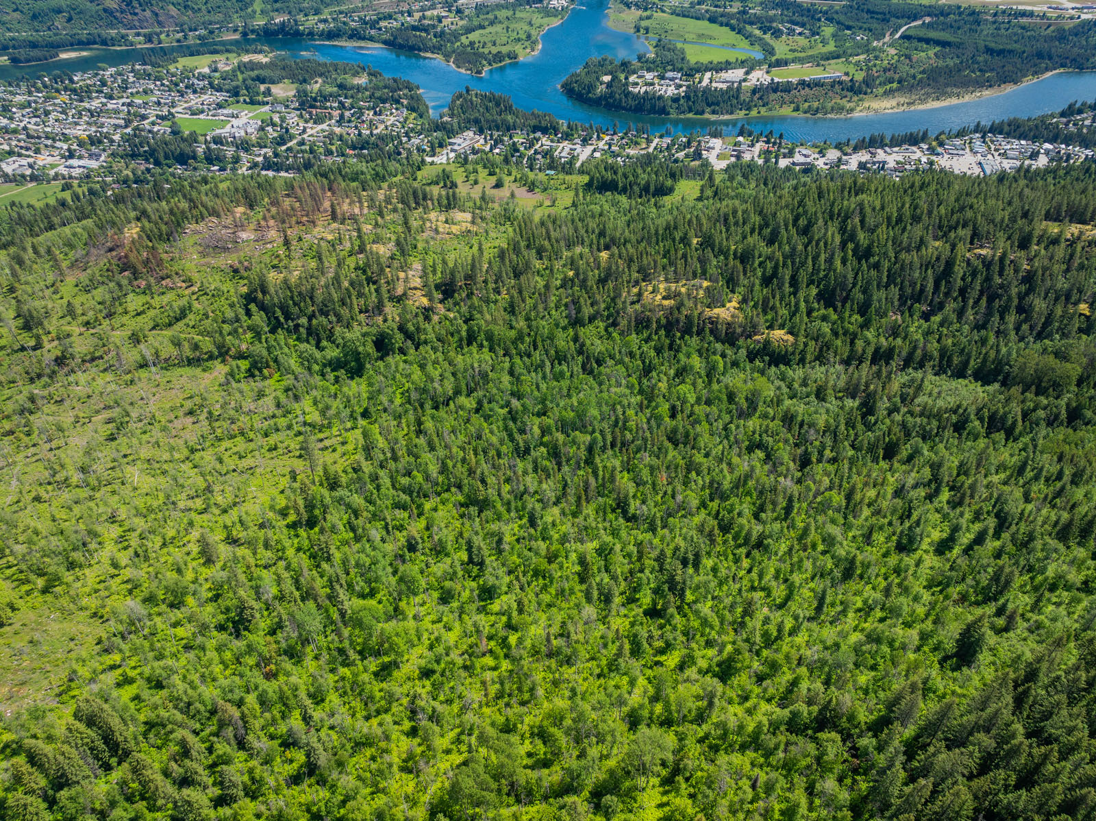
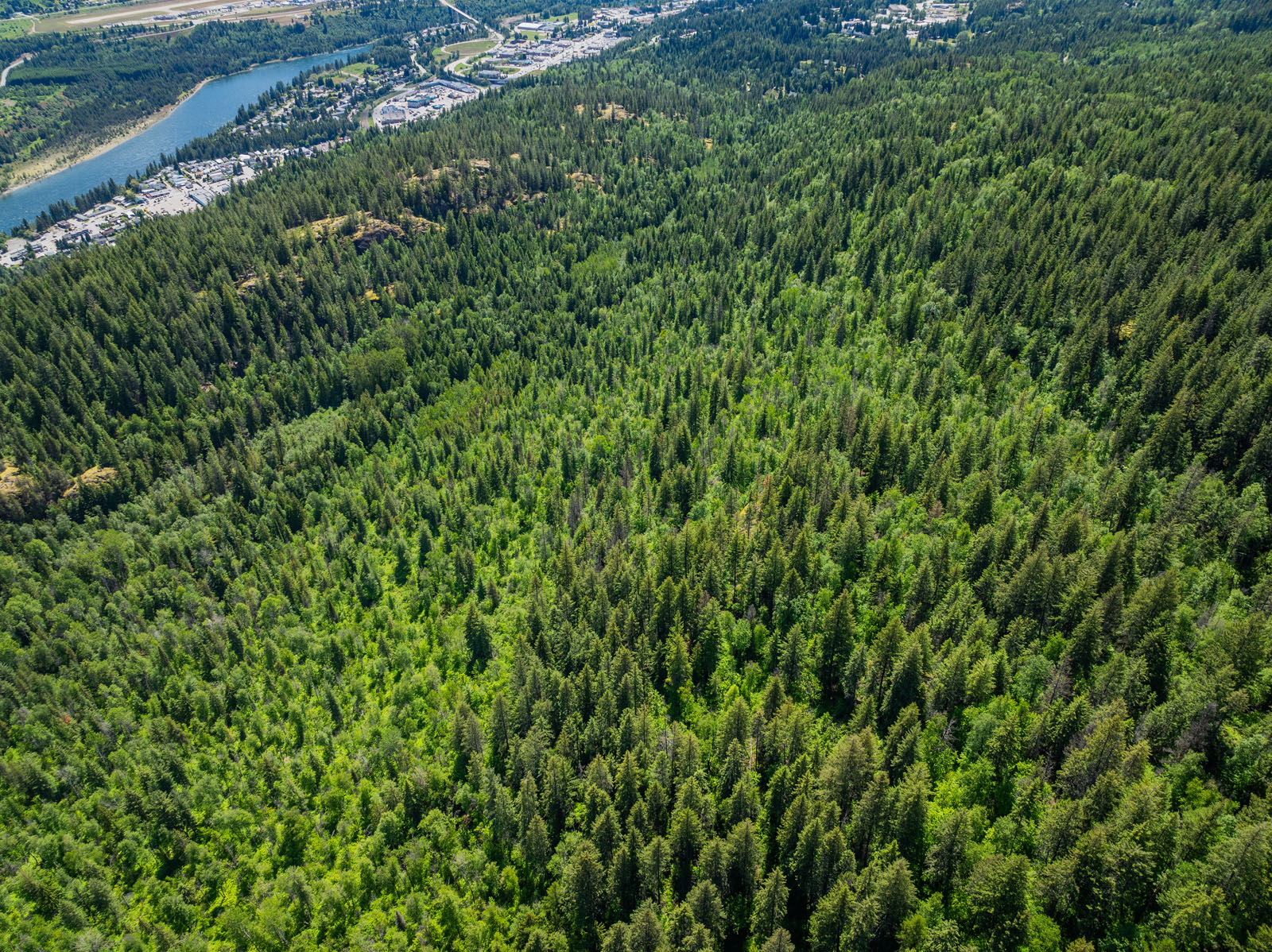
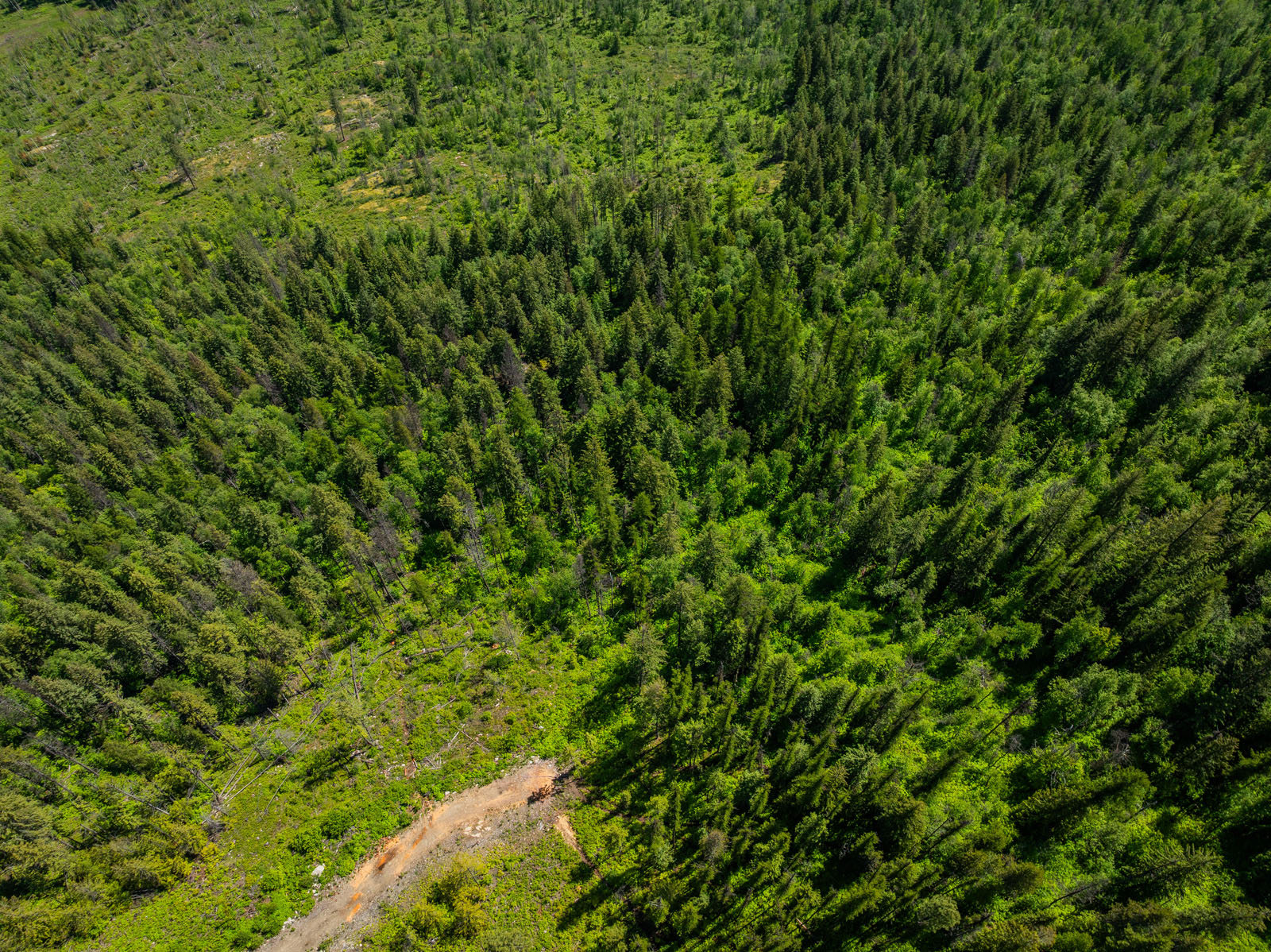
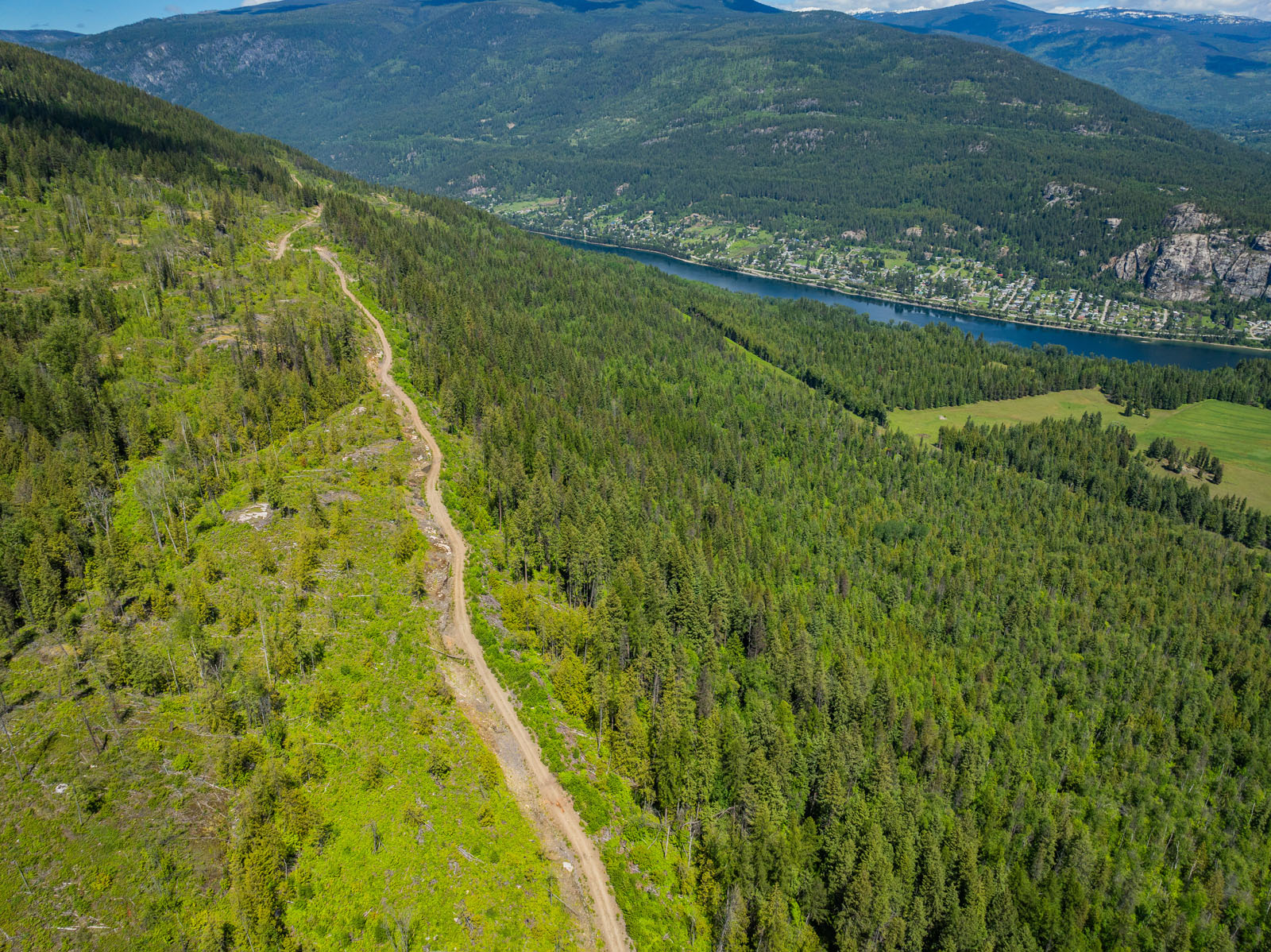
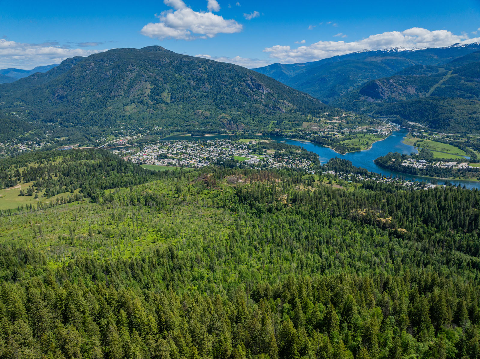
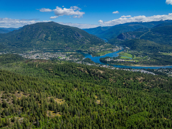
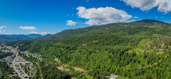
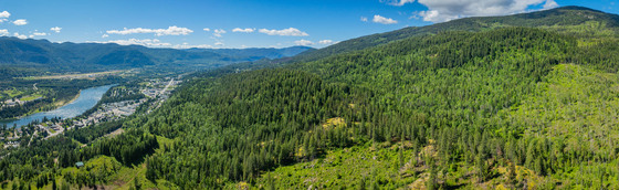
Now offered for sale is one of the largest parcels in the Castlegar area. This 338.74-acre property has many different layers of value, including timber value, development value and overall is a fantastic investment property in both the short and longer term. There are so many possibilities.
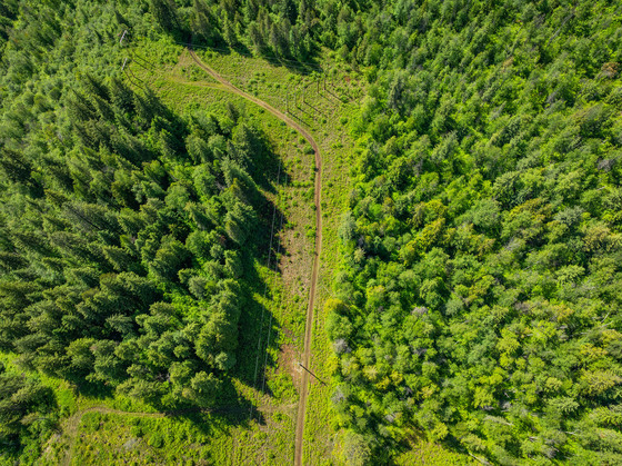
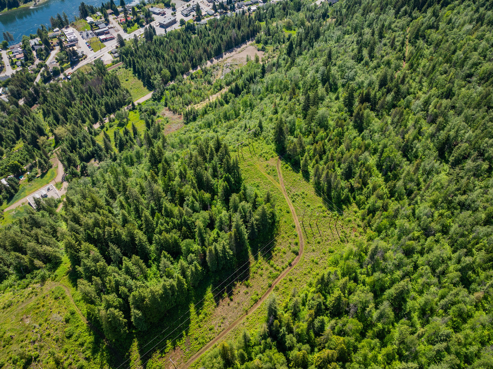
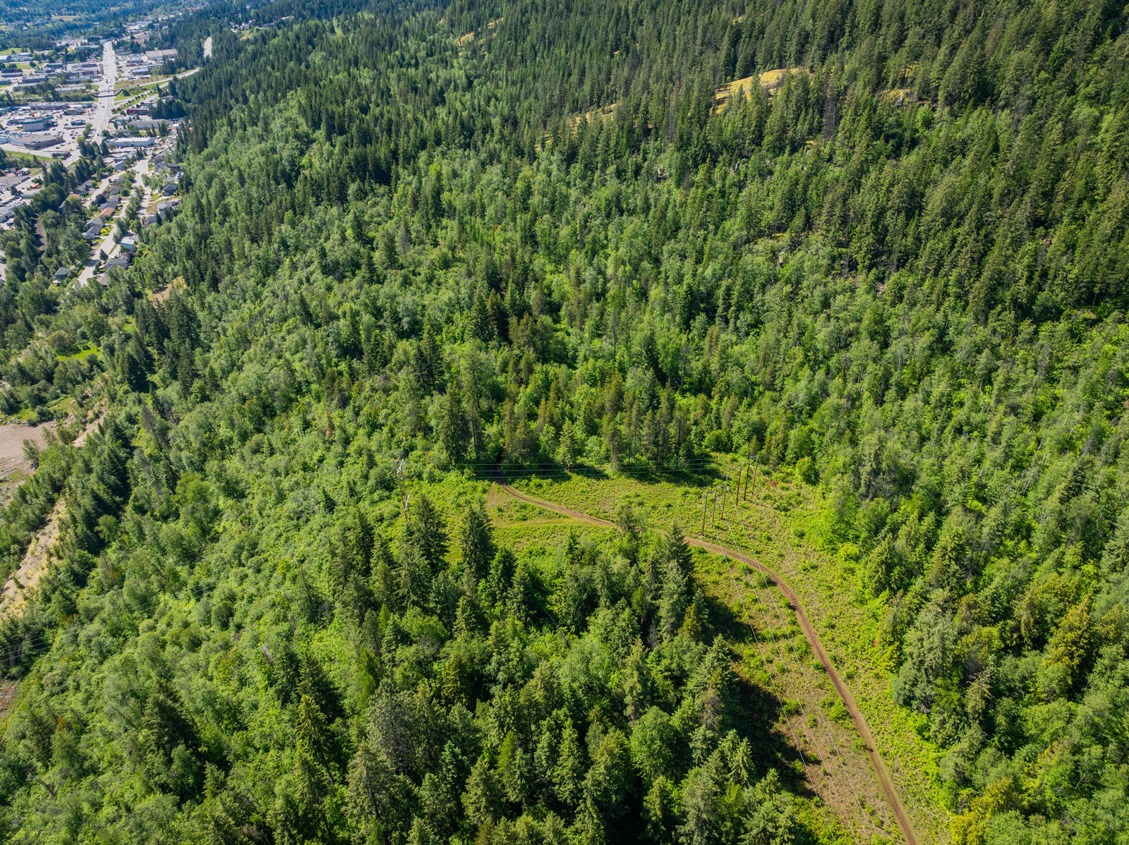
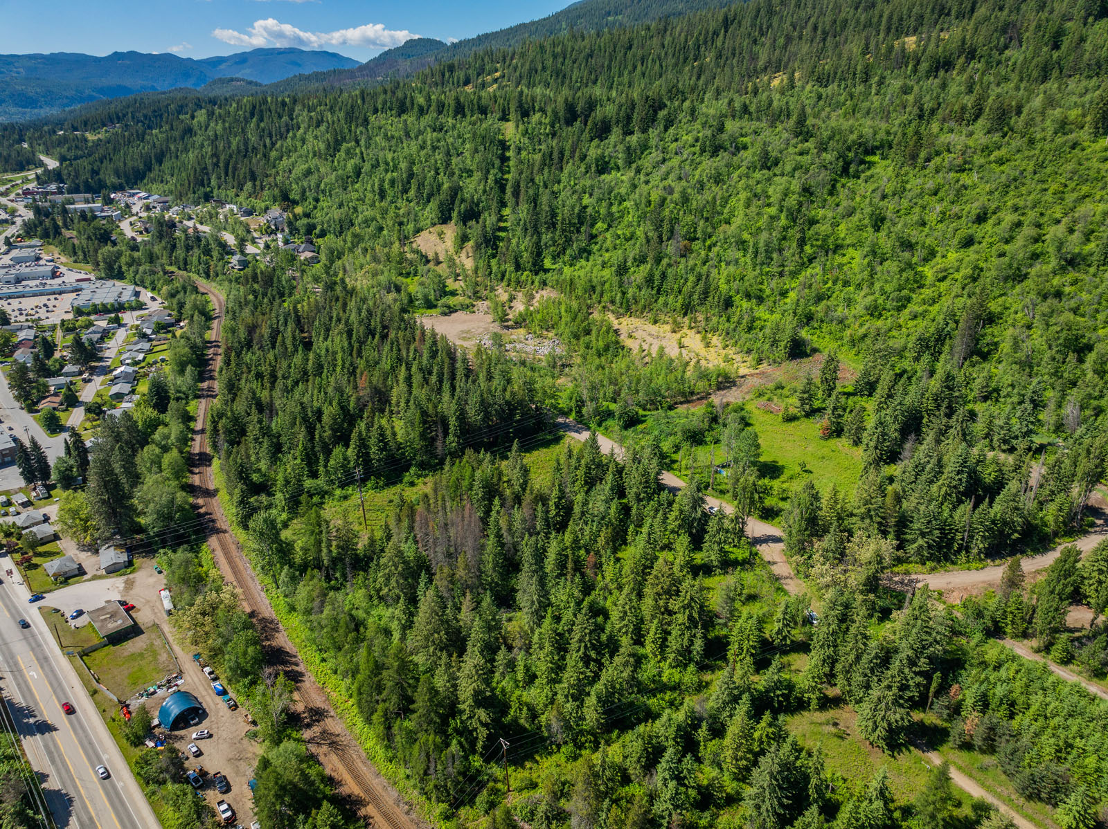
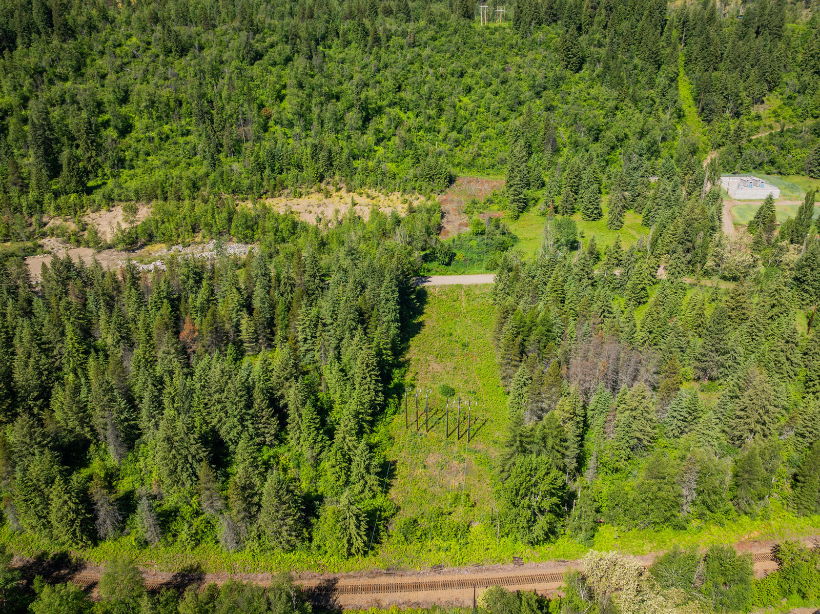
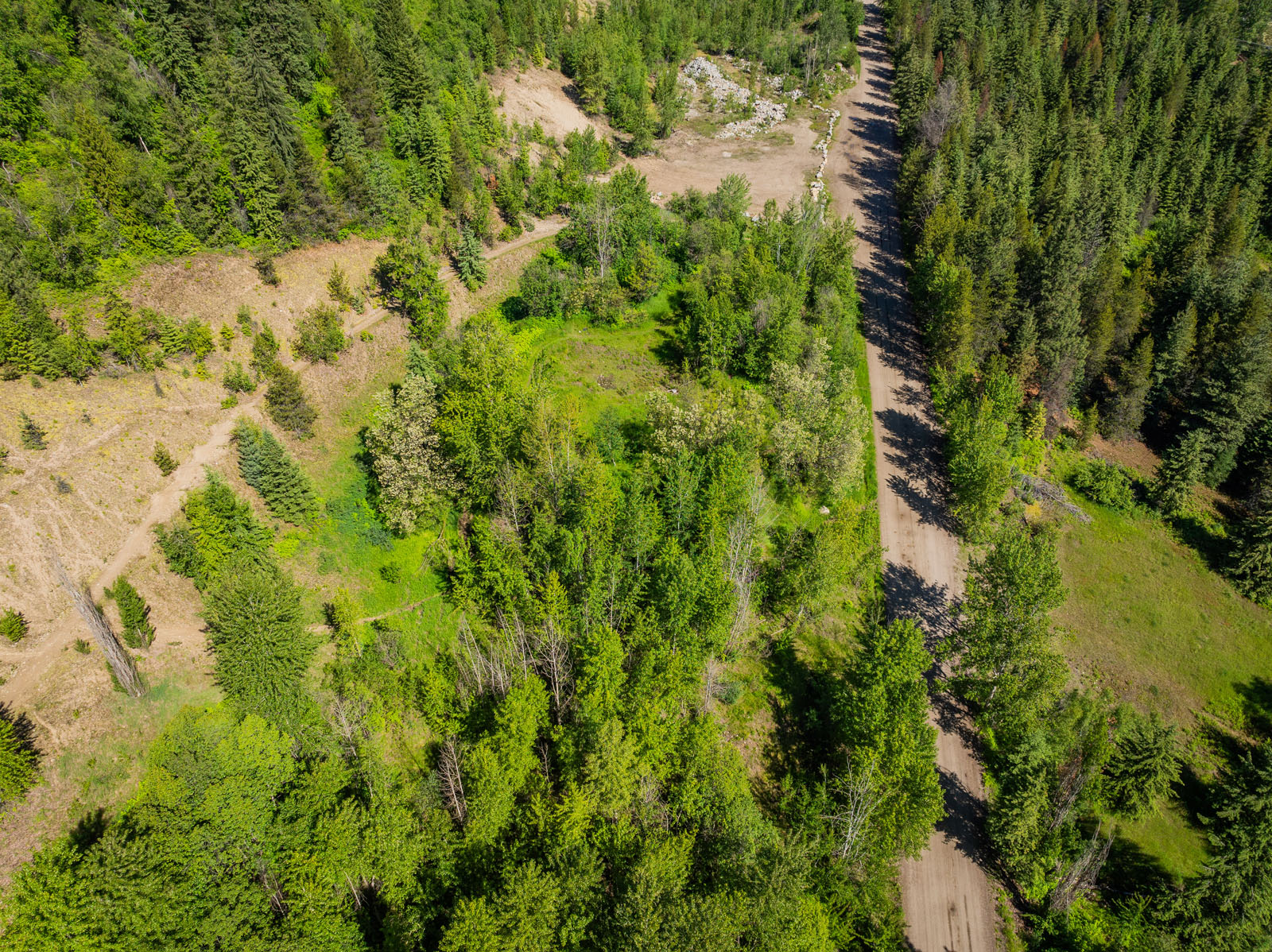
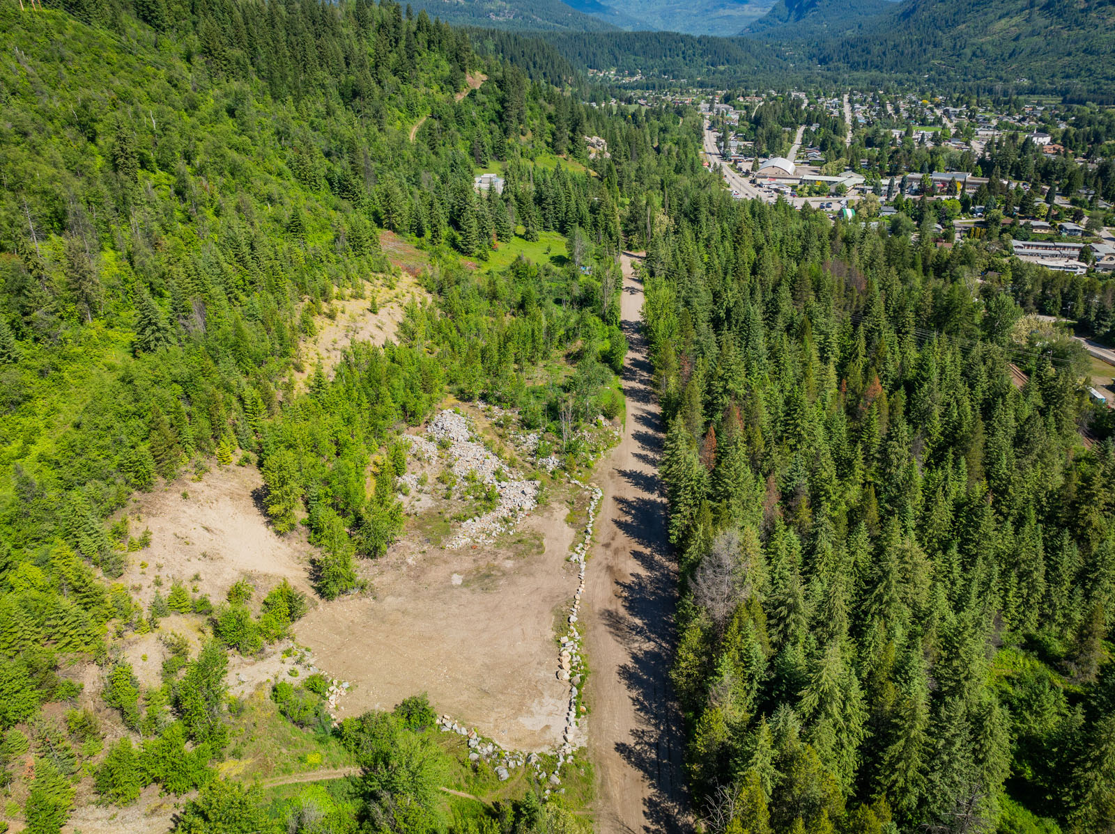
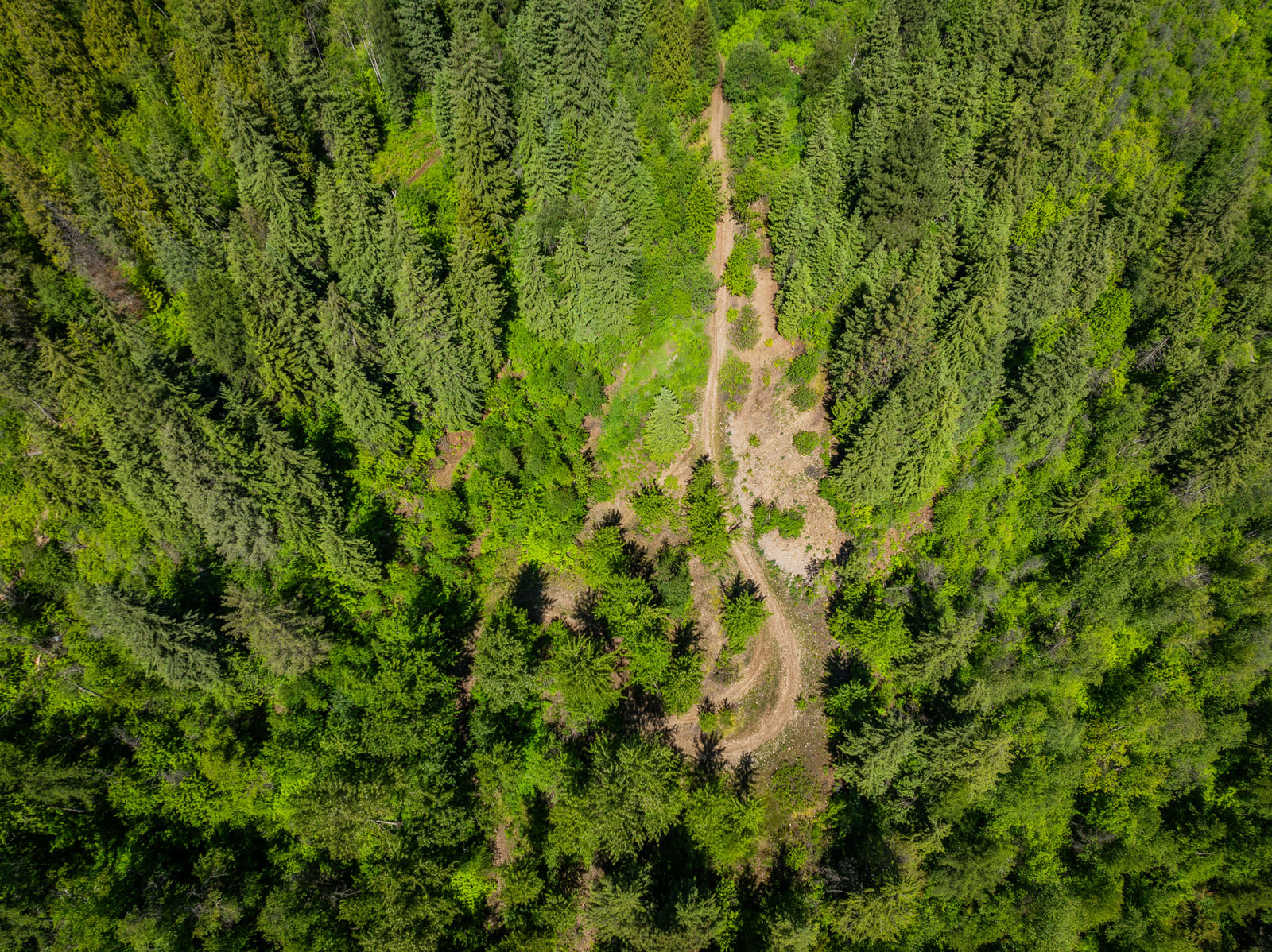
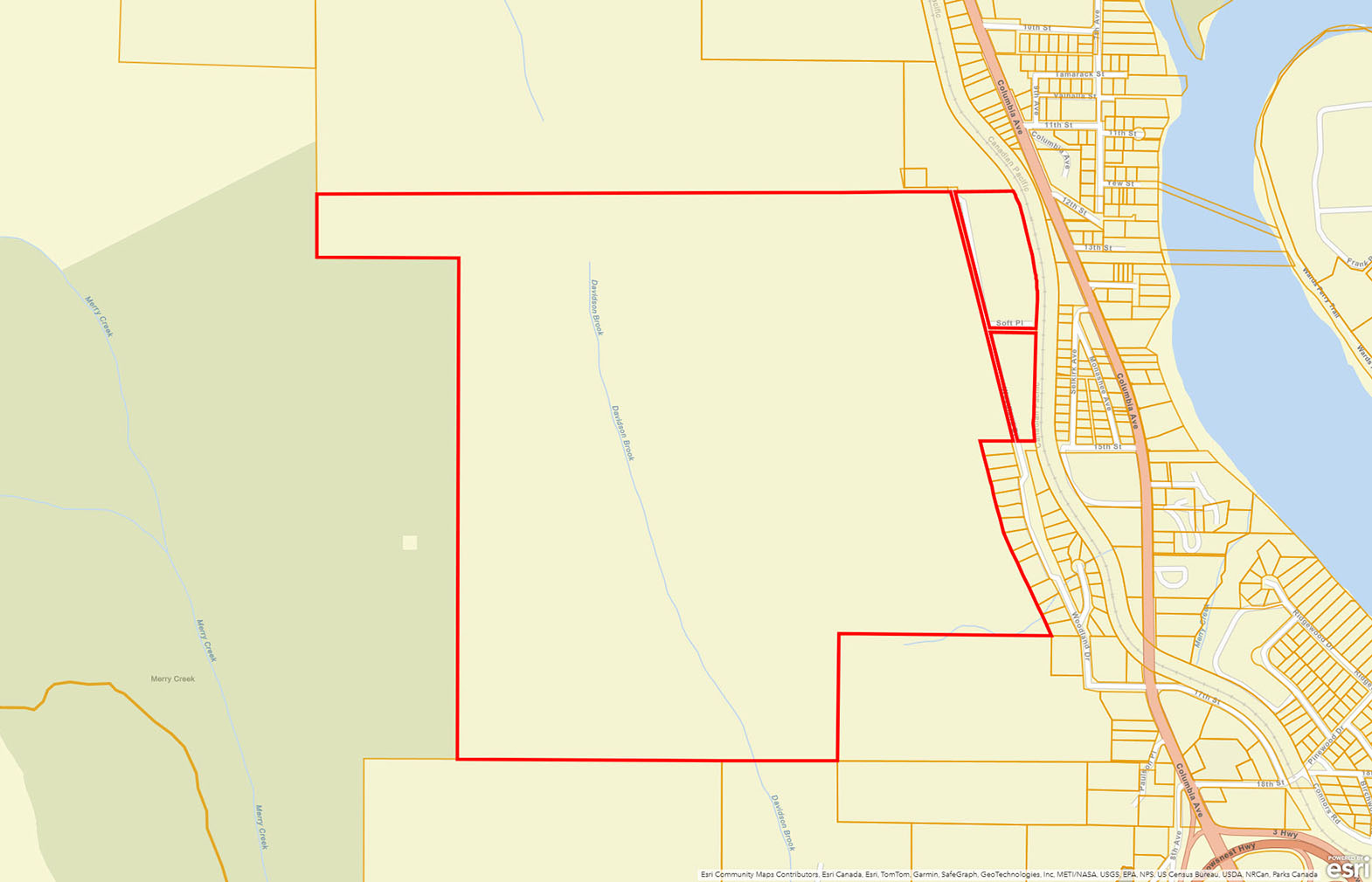
The lower bench that lies on both sides of Woodland Drive is approximately 30 acres. This property is slated for a medium density townhome development where new zoning allows up to 120 units per hectare. There is a 32-lot subdivision just to the south of this property with underground servicing. The City of Castlegar would require a development permit and city infrastructure may need to be upgraded to supply water and sewer to the lower bench. The larger portion of this property is to the west of Woodland Drive, with a logging road to the top bench. Approximately 40 level acres are accessible from the top of the road. Access to the balance of the property would require extensive site work and road building. The new zoning would allow 3-acre lots that allows for 3 dwelling units per lot and a multitude of uses. Developer could implement a building scheme to add uniformity to the development and limit some of the uses that are allowed. The location of this property is ideal for homeowners that don't drive, as all amenities are within a few blocks of this property. Plans and topographical mapping are available.
Call the listing agent today for more information, or to book a time to go by for a look.
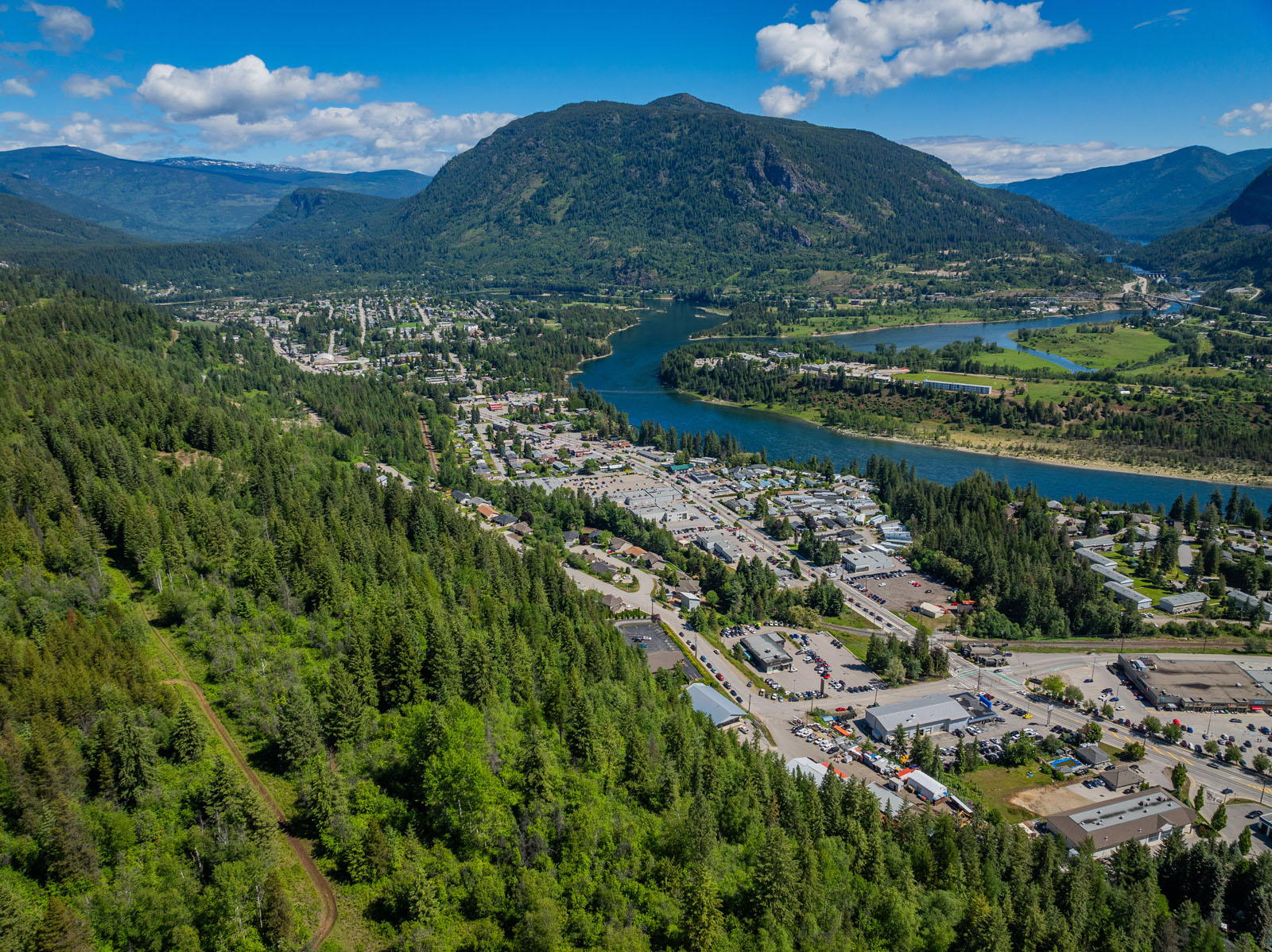
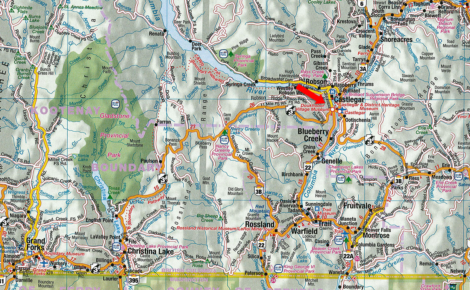
1402 Woodland Drive - Castlegar, BC
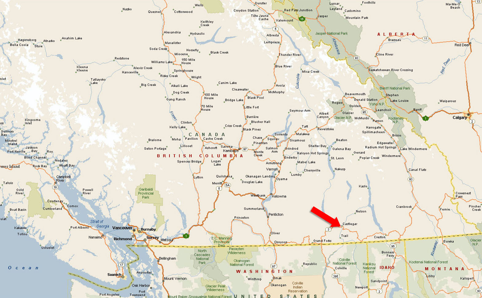
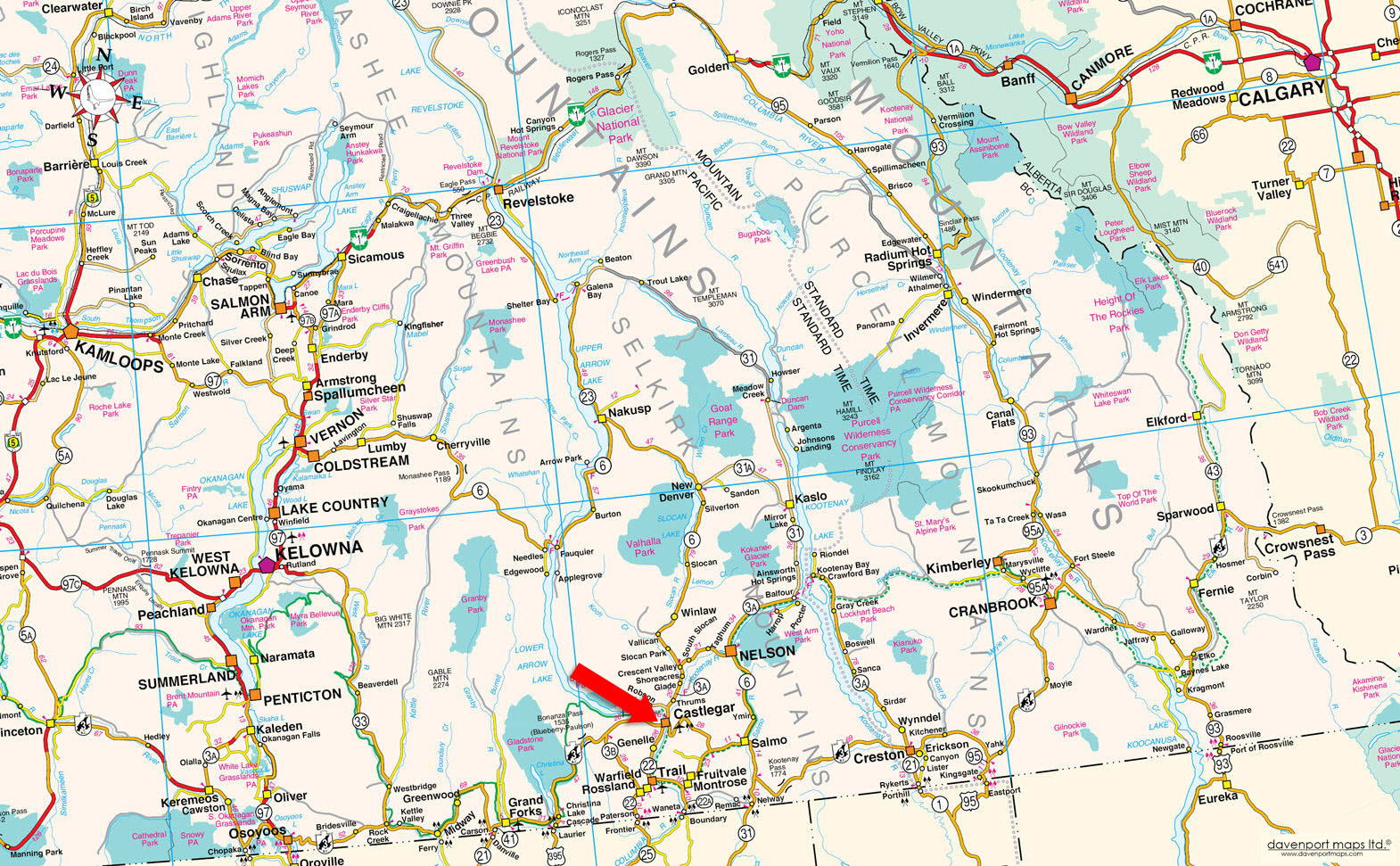
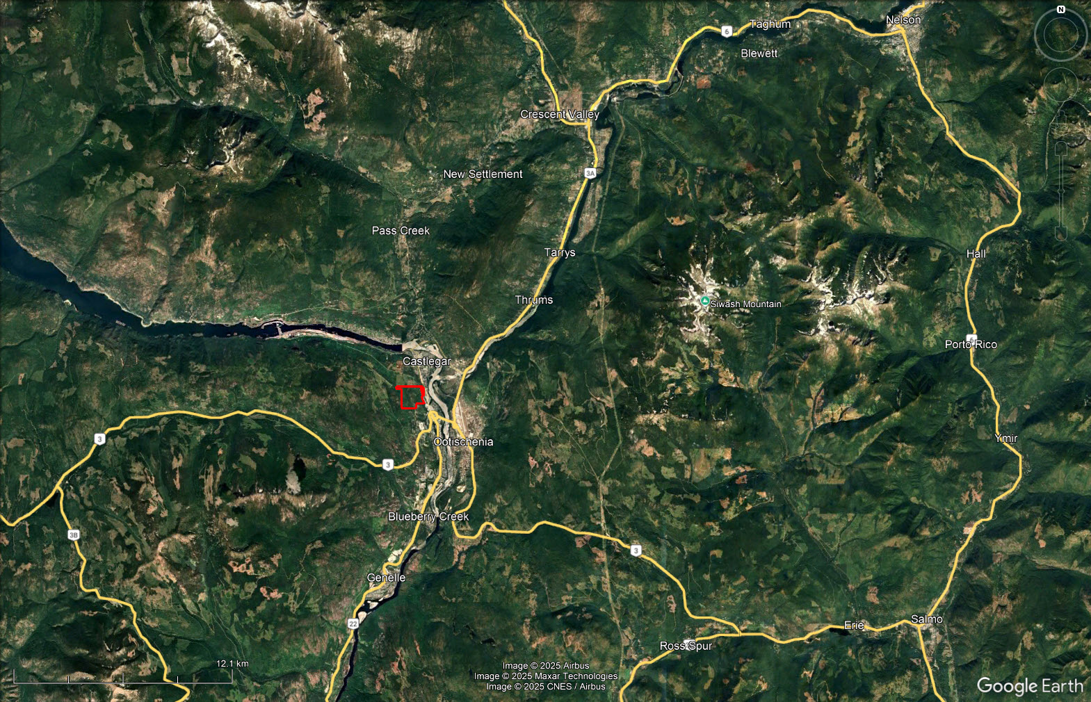
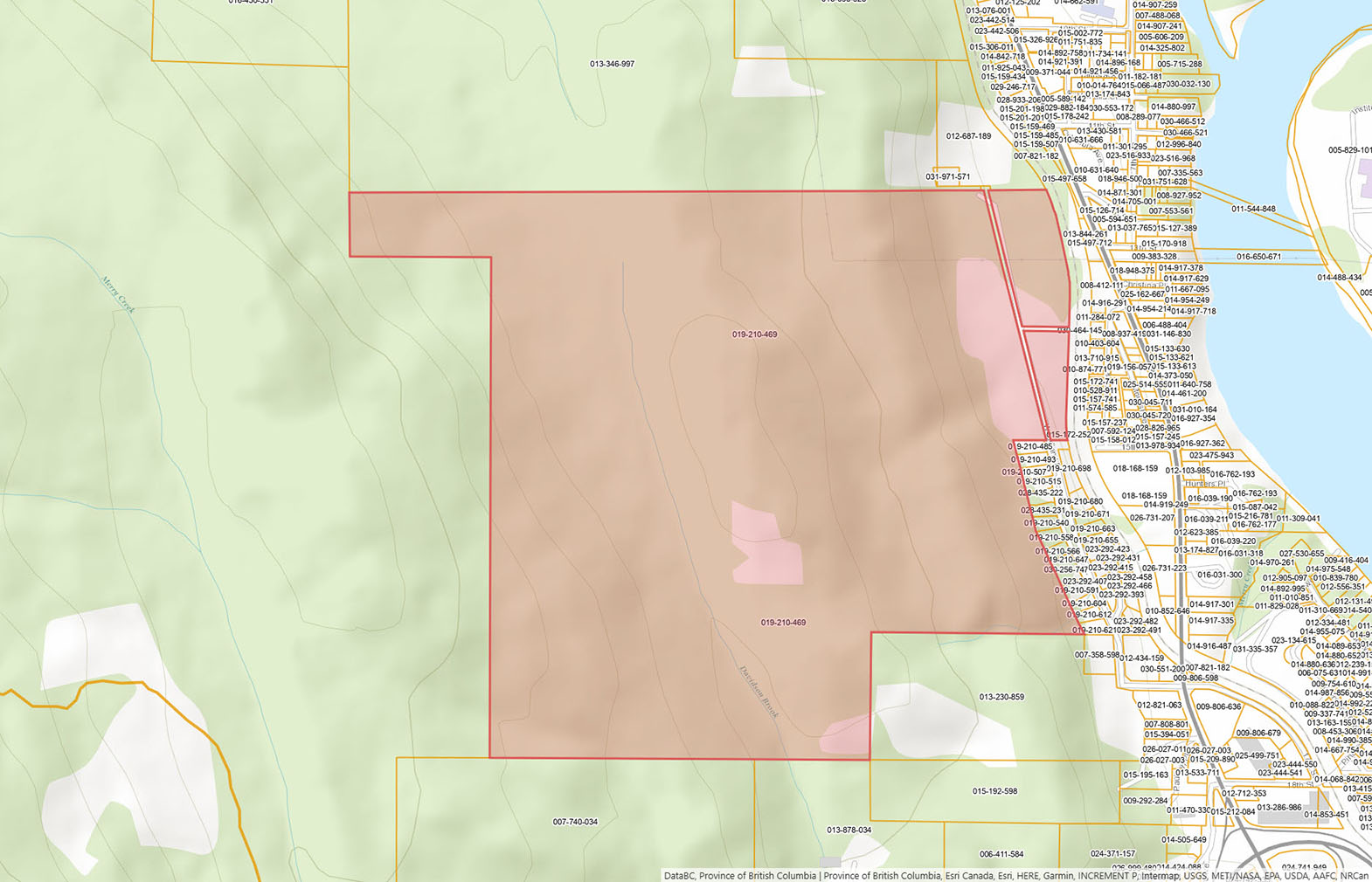
Please see the mapping section of this listing for detailed location and directions.
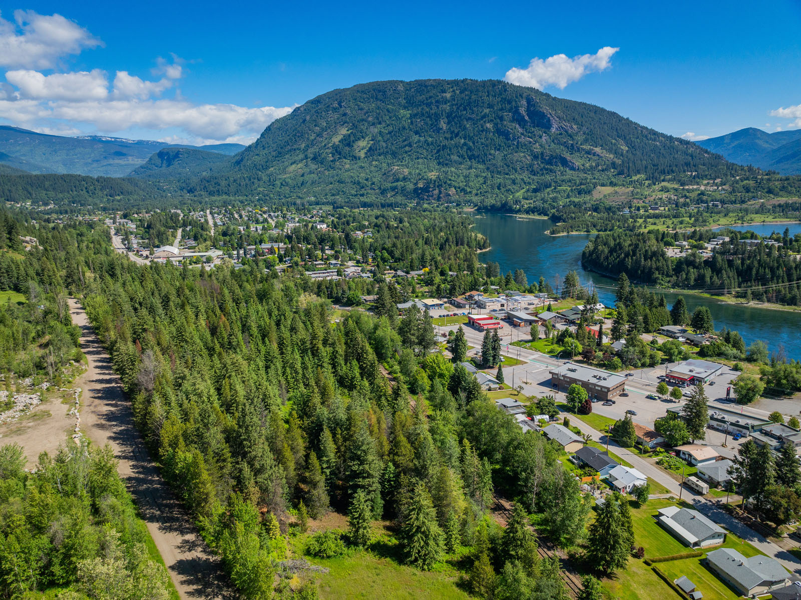
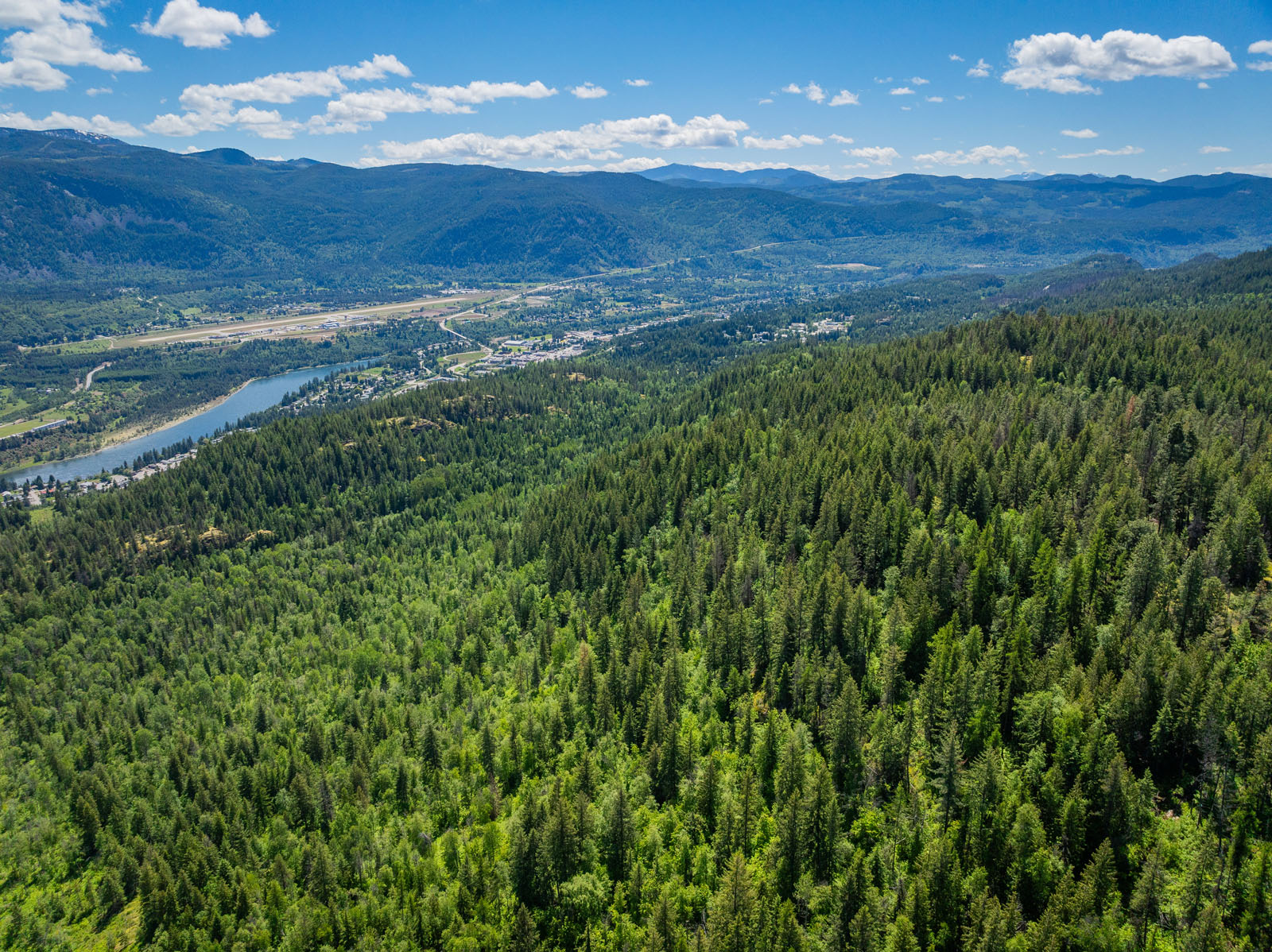
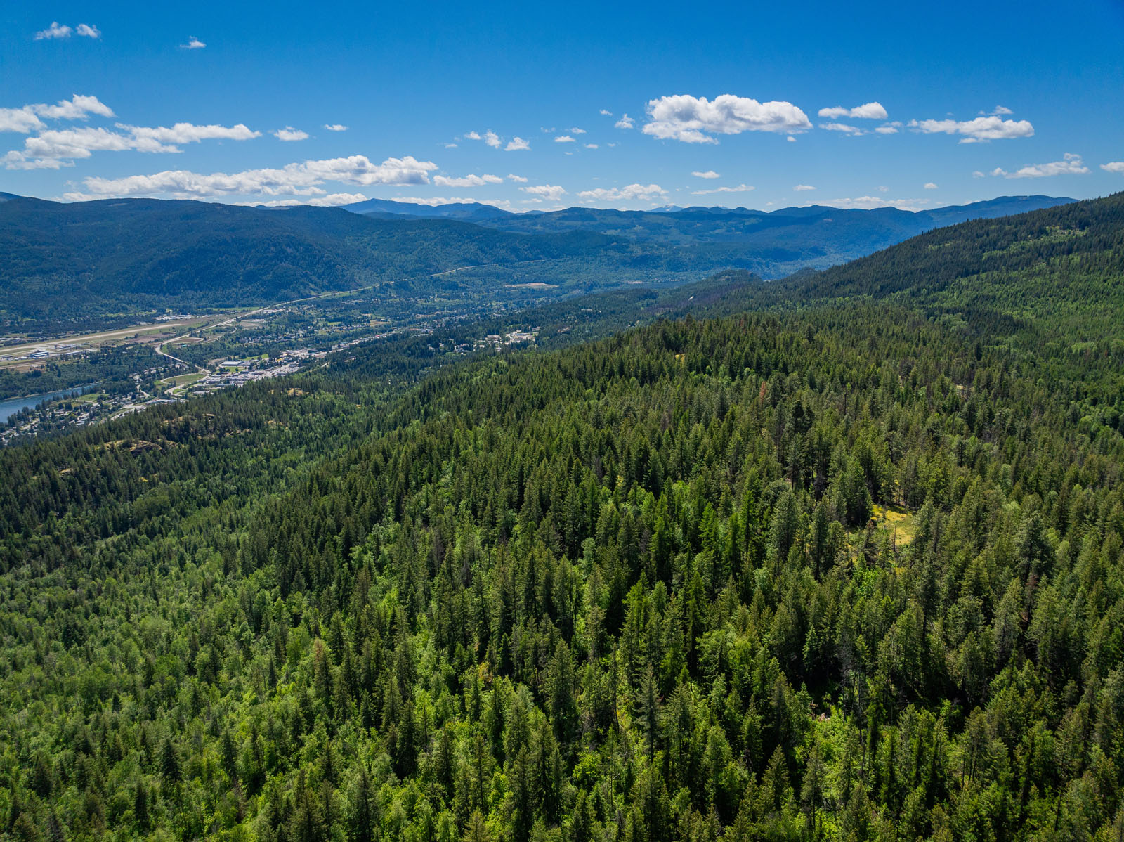
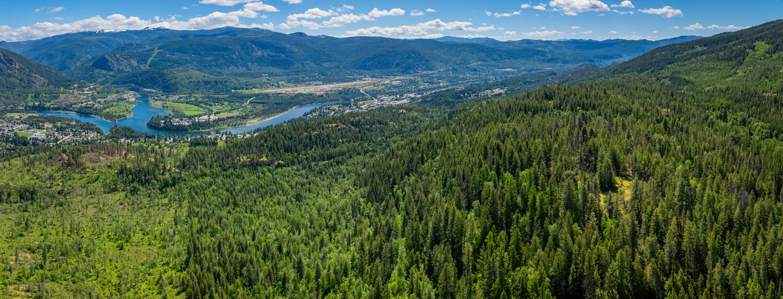
Castlegar is situated at the confluence of the Columbia and Kootenay Rivers in the West Kootenay region of British Columbia. It serves as a trade and service hub for roughly 70,000 people across the surrounding valleys.
The local economy is supported by forestry, hydro power, mining, and a growing commercial services sector, complemented by institutions like Selkirk College and the regional airport. Population growth in recent years has been steady, with surrounding rural areas seeing particularly strong increases, and housing remains relatively affordable compared to larger BC centres.
The community vibe in Castlegar is friendly, down-to-earth, and family-oriented, often described as a small city with a big heart. Residents enjoy a slower pace of life with strong ties to their neighbours and an emphasis on connection through community events, markets, and cultural gatherings. Creativity, sustainability, and entrepreneurship are strong values, and the setting between rivers and mountains fosters a lifestyle that blends a relaxed pace with an appreciation for the outdoors and a welcoming, inclusive spirit.
In Castlegar, recreation shifts naturally with the seasons. During spring and summer, the Columbia and Kootenay Rivers, along with Lower Arrow Lake, are busy with fishing, boating, kayaking, and swimming, while Syringa Provincial Park draws many for camping and water-based activities. Trails such as the Columbia and Western Rail Trail offer popular hiking and biking routes, and the Castlegar Golf Club sees steady use through the warmer months. In fall, hiking and cycling remain common, with many taking advantage of the changing scenery along local trails and river valleys. Winter recreation turns to skiing and snowboarding at Red Mountain Resort in nearby Rossland, along with snowshoeing and cross-country skiing on local trails. Throughout the year, residents and visitors also engage with cultural sites like the Doukhobor Discovery Centre, Zuckerberg Island Heritage Park, and the Castlegar Sculpturewalk, which provide options beyond outdoor activity.
Castlegar’s history began to take shape in the late 19th and early 20th centuries as European settlers moved into the West Kootenay region. The city developed at the junction of the Columbia and Kootenay Rivers, initially serving as a transportation and trade hub. Early industries included mining, forestry, and agriculture, which attracted workers and families to the area. The arrival of the Canadian Pacific Railway and the expansion of road networks helped Castlegar grow as a regional service centre, connecting nearby communities and fostering commerce.
The city was officially incorporated in 1946, and post-war development brought infrastructure improvements, schools, and healthcare facilities. Over time, Castlegar expanded as a cultural and economic centre for the West Kootenay, supporting industries like hydroelectric power, forestry, and manufacturing, while also developing educational institutions such as Selkirk College. Today, Castlegar reflects a mix of its industrial roots and community-oriented growth, with a focus on both economic development and cultural life.
Please see the mapping section, all boundaries are approximate.
49°18'21.28"N and 117°40'18.84"W
$17,066.42 (2025)
Rural Mixed Use (RMU), Parks & Open Space (P3), and Ground-Oriented Multi-Unit Residential (R2)
LOT A PLAN NEP22241 DISTRICT LOT 7199 KOOTENAY LAND DISTRICT & DL 7721, 8072
PID 019-210-469
 +8 maps
Our property descriptions and geographical information are taken from the BC Assessment Authority, Land Titles Office, government maps and other sources. While LandQuest® does not guarantee the information, we believe it to be accurate, but should not be relied upon without verification. This communication is not intended to cause or induce breach of an existing agency agreement.
Castlegar
 6℃
4℃
6℃
4℃