


Stunning lakefront acreage, 160 acres set over 2 titles with 3,000± ft of lakeshore. Land is mostly forested with a few open clearings. Dual zoning—Remote Residential and Tourist Commercial. Prime campground/resort property location or private recreational retreat. Borders Crown land.
Foreign Buyer Ban does not apply to this property


 +23 photos


A stunning lakefront acreage in the beautiful West Kootenays only a few kilometres north of the US border.
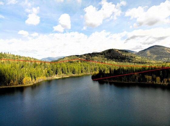
This mostly forested acreage has almost 3,000 feet of frontage on Rosebud Lake; a small fishing and great little swimming lake that is approx. 40 acres in size with a healthy population of rainbows. The lake frontage extends for approx. 2,000 feet long the north shore of the lake where there are two simple docks in place, one with a gazebo structure. There is an additional 1,000 feet lakeshore along the south end of the lake’s north arm—please see maps. It is an amazing set up for a campground/resort or personal recreational retreat.
The property is comprised of two titles each with some frontage on the lake. One title is almost 43 acres and the second title 117+ acres (160 acres in total). There is an excellent internal road stretching through the land with a couple branch roadways providing good access throughout the land to a couple nice little clearings along the lake.
The property offers ample privacy bordering on Crown land to the north and east as well as an undeveloped Regional District Park along its southeast boundary. Just beyond the east boundary of the land there are power lines offering excellent access into the backcountry for hunting and other outdoor recreation pursuits.
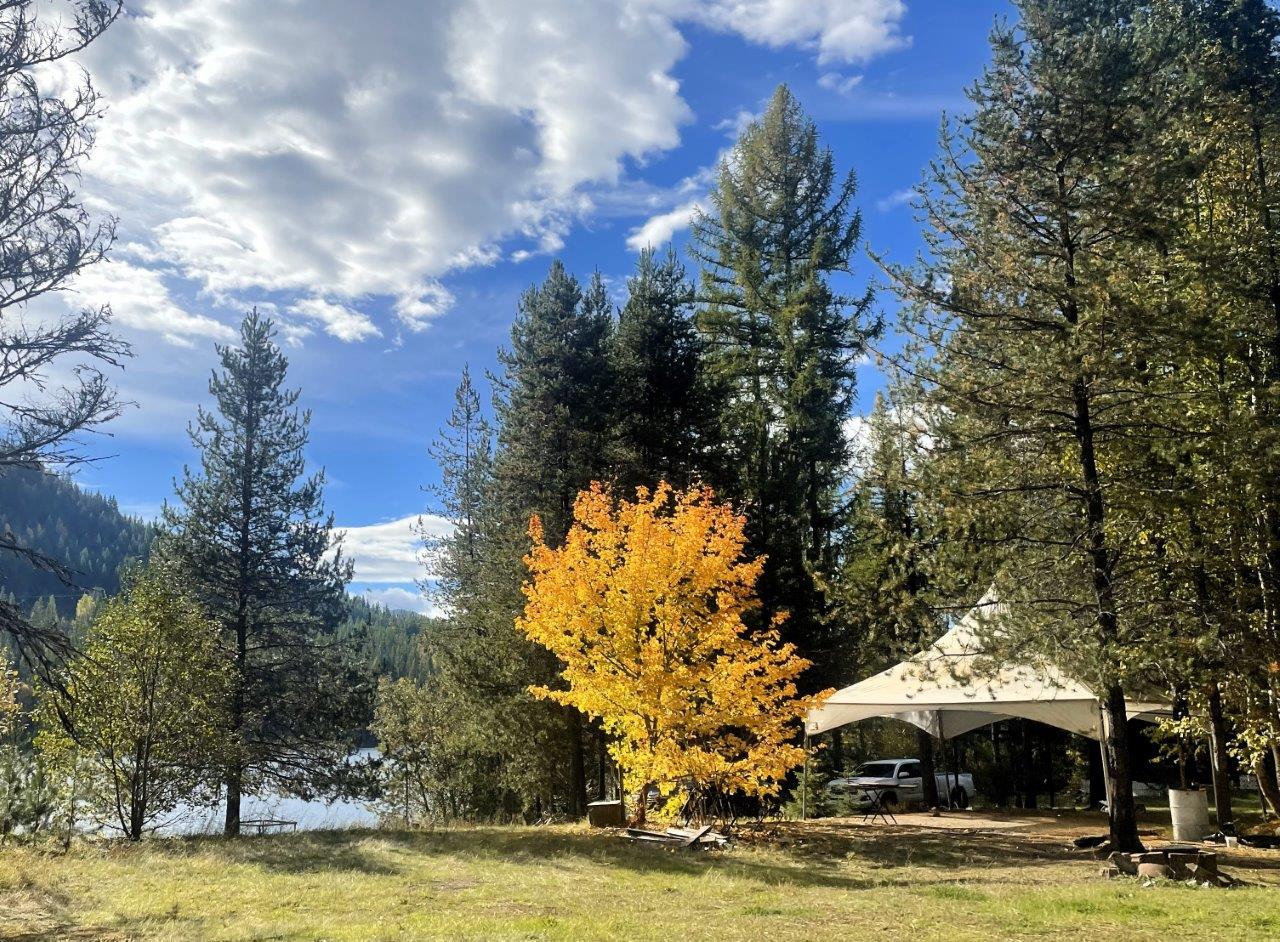
Access to the property is via a maintained year-round road. There are no services on the land, although several decades ago when the land was owned by the Catholic Church there was a rural church camp that had a septic system (no longer operable).
The land is mostly zoned R4 (Remote Residential) with approx. 14 acres of land zoned C2 (Tourist Commercial).
The lake is a dammed lake created in the 1960s by the Canadian Army Engineers, the license holder for the dam is the owner of this property, transferable to a new owner. The owner has paperwork on the engineering components and is guaranteed for life.
Located at the end of Rosebud Lake Road a few kilometres north of the US Border Crossing at Nelway, BC.
Search Google Maps for the US Canada Border crossing at Metaline Falls/Nelway, BC. On Highway 6, a few kilometres north of the border, look for Rosebud Lake Road on the east side/left side of the road if travelling south. Then drive another 4.3 km to the property. There is a metal gate marking the beginning of the land. Contact the REALTOR® for access and to book showing. Please see maps.
I can also send a file you download to your phone as long as you have Google Earth installed on your phone, and you can then follow the route out to the property. Ask agent for details.
Salmo is a small village located in the West Kootenay region of British Columbia. It is situated in the southeastern part of British Columbia approximately 30 kilometres (18.6 miles) south of the city of Nelson. Has a population that is just under a thousand people. The area around Salmo is known for its outdoor recreational opportunities. The surrounding mountains and forests offer a range of activities, including hiking, fishing, camping, and hunting. Additionally, the Salmo River, which runs through the area and is popular for fishing, particularly for trout and salmon. While the local economy has historical ties to natural resource industries, the region has diversified, and tourism is becoming increasingly important. The Kootenay Pass, located nearby, is a mountain pass that connects Salmo to Creston. It is known for its scenic beauty and is a part of the Salmo-Creston Highway.
Please see mapping section, all boundaries are approximate.
49° 3'7.59"N and 117°16'7.54"W
Off the grid.
Off-grid cabin on skids that will be removed upon a sale as it belongs to the caretaker.
$3,593.27 (2023)
Dual zoning - please see maps to see the area that is zoned C2 (approx. 14 acres). The majority of the land is zoned R4 (Remote Residential).
R4 Zoning Permitted Uses
Cabin, One Family Dwelling, Two Family Dwelling, Horticulture, Portable Sawmill
R4 Zoning Secondary Uses
Accessory Camping Accommodation, Accessory Tourist Accommodation, Kennel, Micro Cultivation of Cannabis, Micro Processing of Cannabis, Nursery Cannabis, Keeping of Farm Animals, Accessory Dwellings, Accessory Buildings and Structures
C2 Zoning Permitted Uses
Campground, Tourist accommodation, Dwellings including multi family, Commercial Backcountry Recreation, Resort, Vacation Rental, Eating & Drinking Facilities, Brewery and Distillery, Mixed use Development.
C2 Zoning Secondary Uses
Laundry, Liquor Store, Retail, Personal Services
PARCEL A (REFERENCE PLAN 119634I) OF DISTRICT LOT 9061 KOOTENAY DISTRICT
PID016-449-843
DISTRICT LOT 9061 KOOTENAY DISTRICT, EXCEPT PARCEL A (REFERENCE PLAN 119634I)
PID 016-450-965
 +8 maps


Our property descriptions and geographical information are taken from the BC Assessment Authority, Land Titles Office, government maps and other sources. While LandQuest® does not guarantee the information, we believe it to be accurate, but should not be relied upon without verification. This communication is not intended to cause or induce breach of an existing agency agreement.
Salmo
 6℃
6℃
 9℃
9℃