


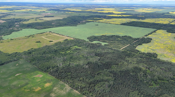
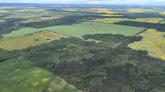
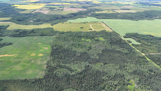
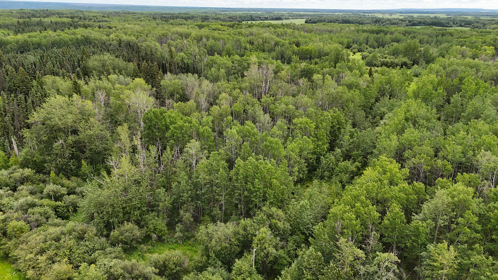
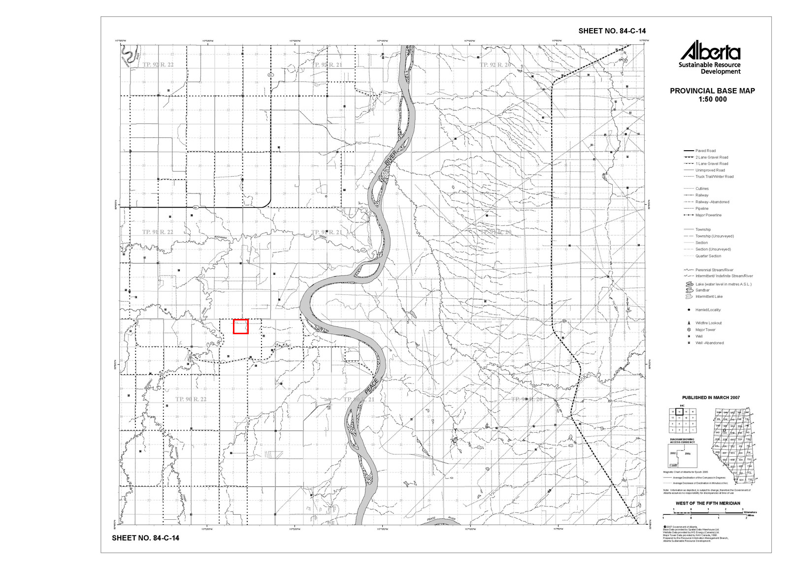
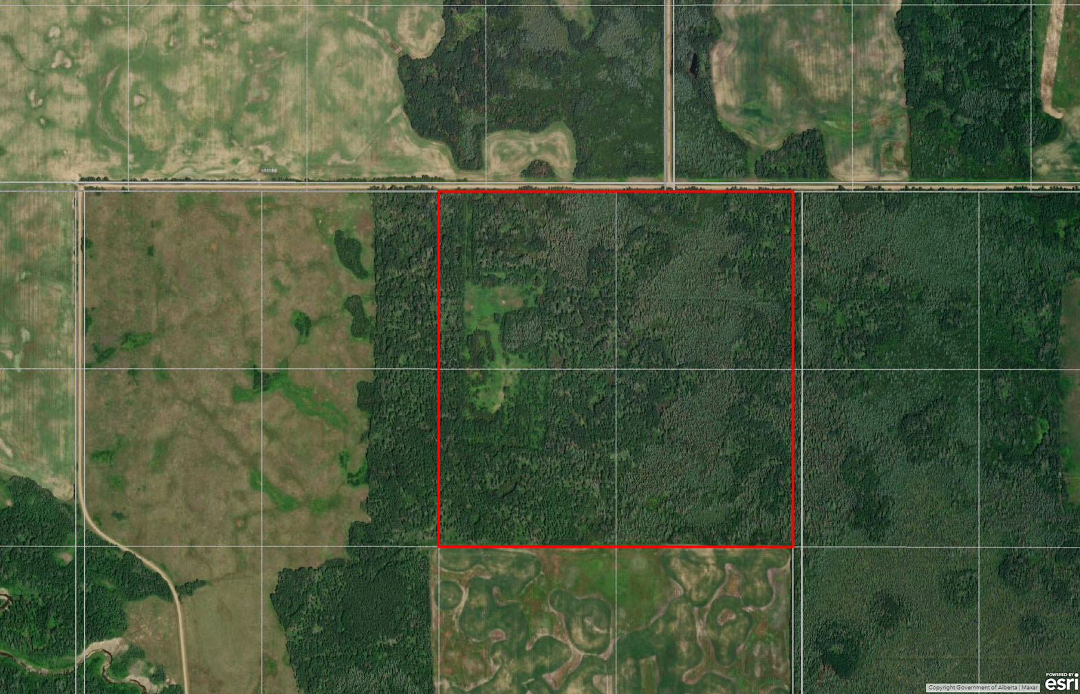
159-acre agricultural parcel near Manning & Deadwood, AB. Mostly forested with poplar & spruce. Power brought onto the property. Roughly 30 acres were previously cleared for a homestead, with a grown-over foundation still in place. Land is rich in wildlife.


 +29 photos
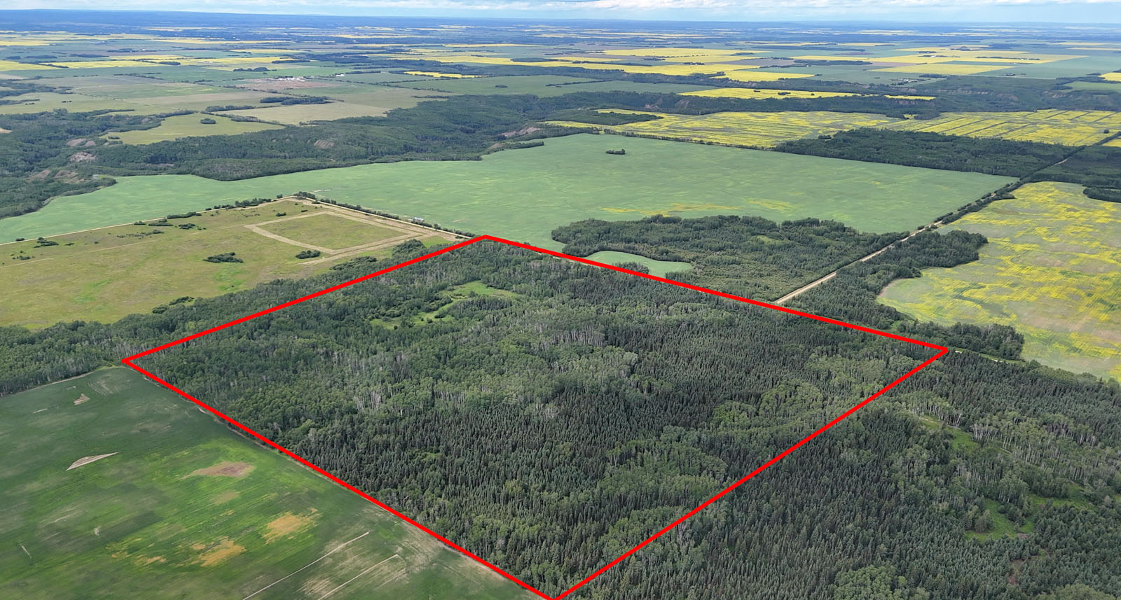


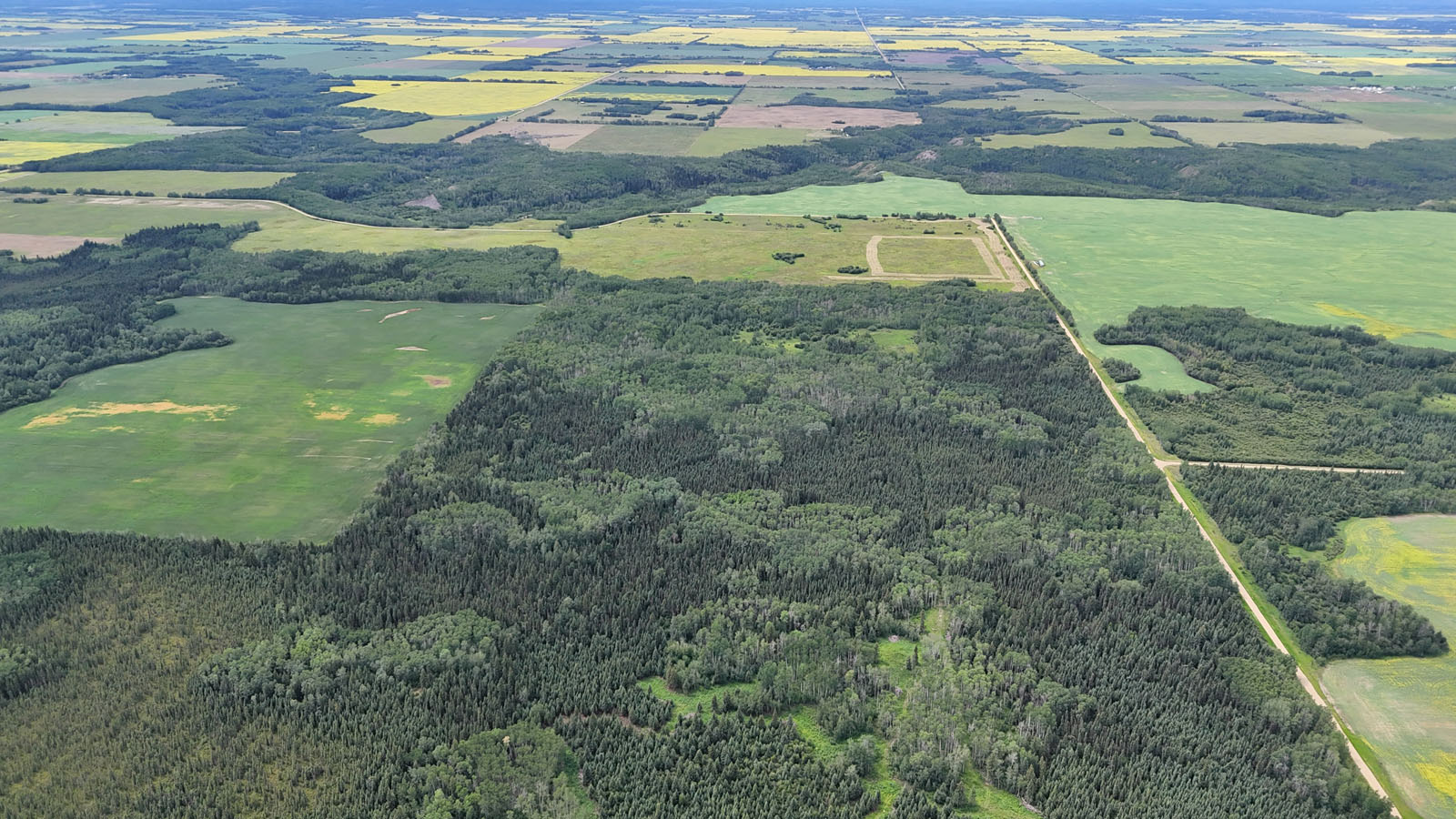

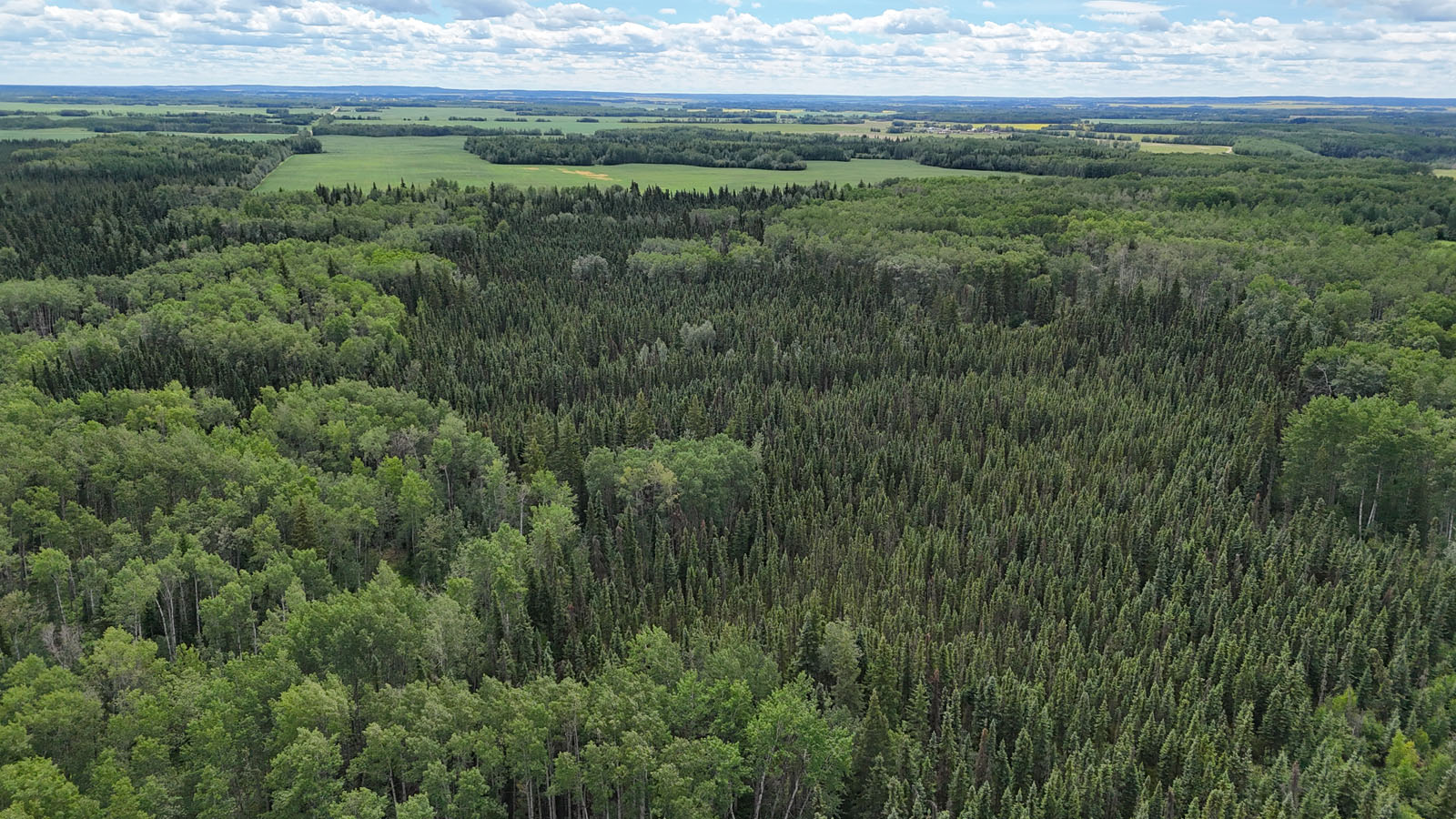
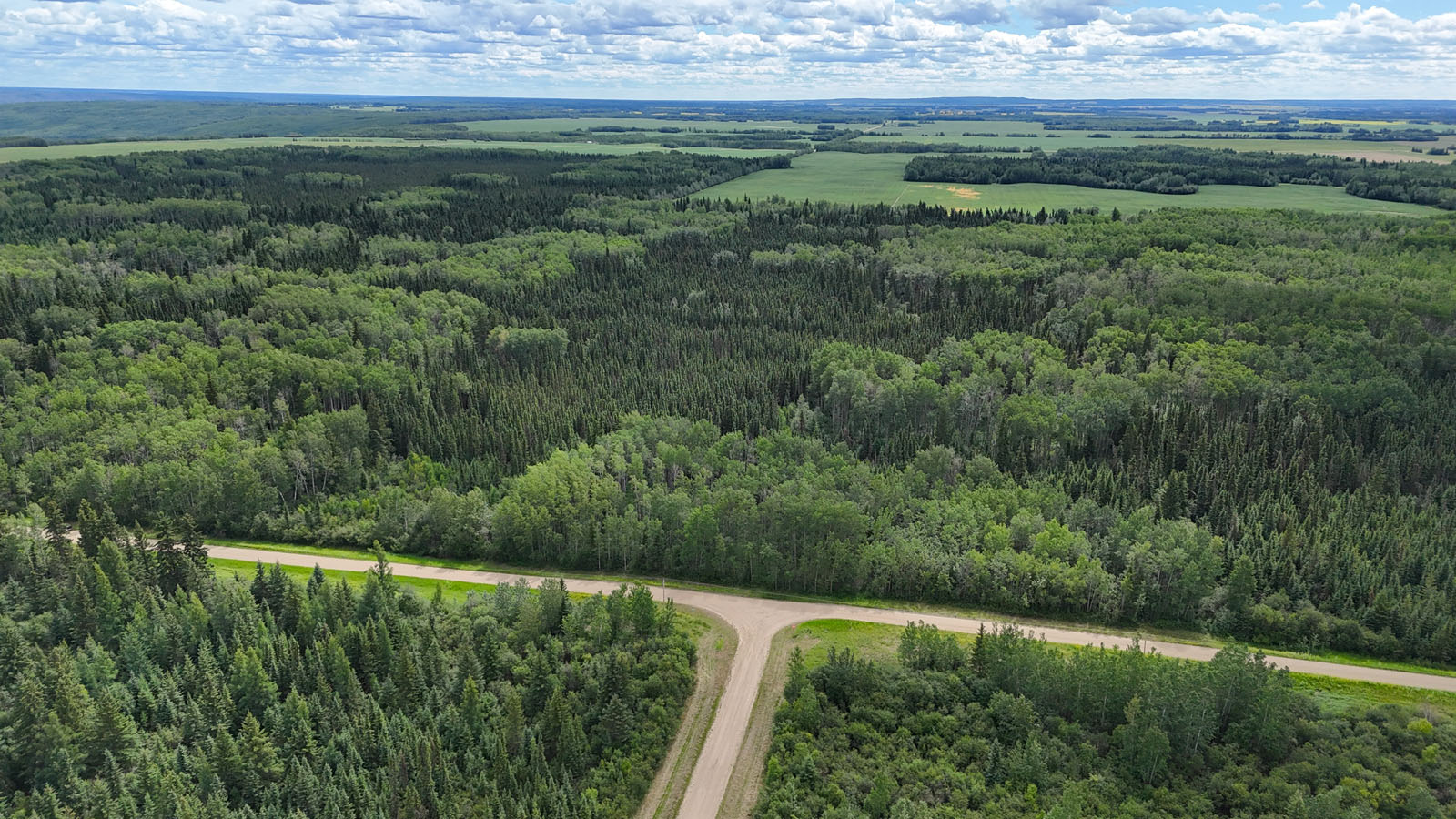
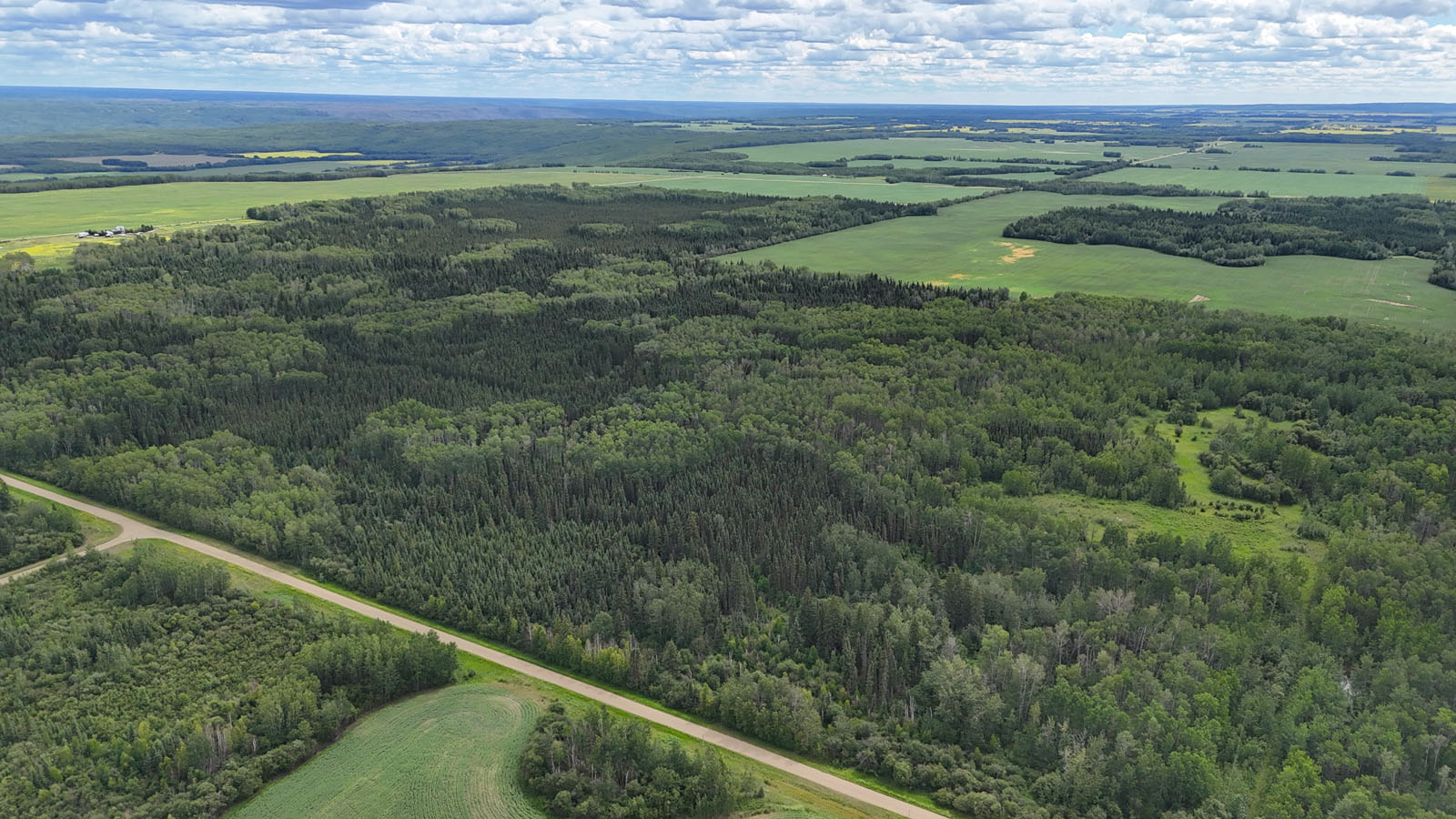
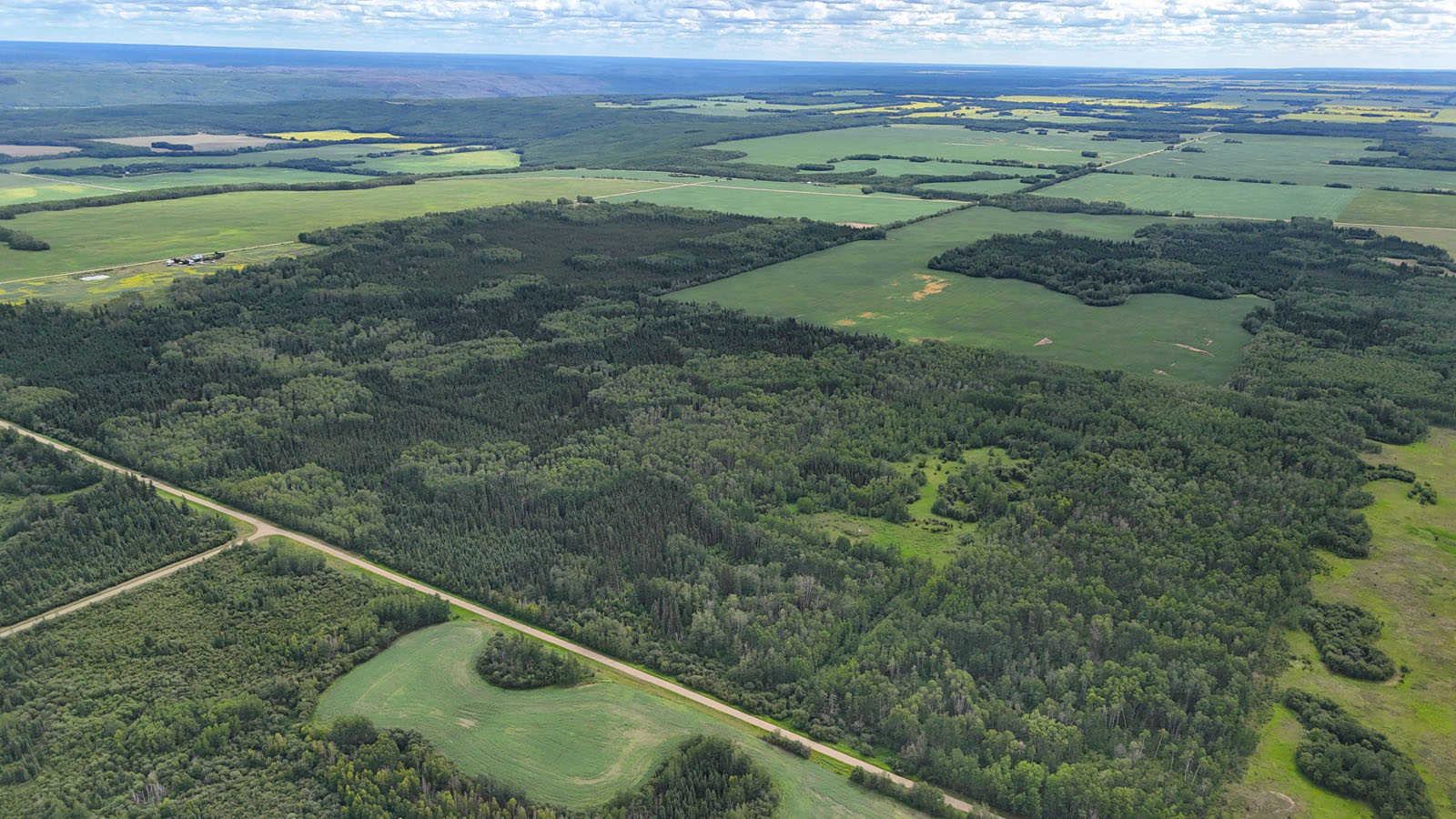
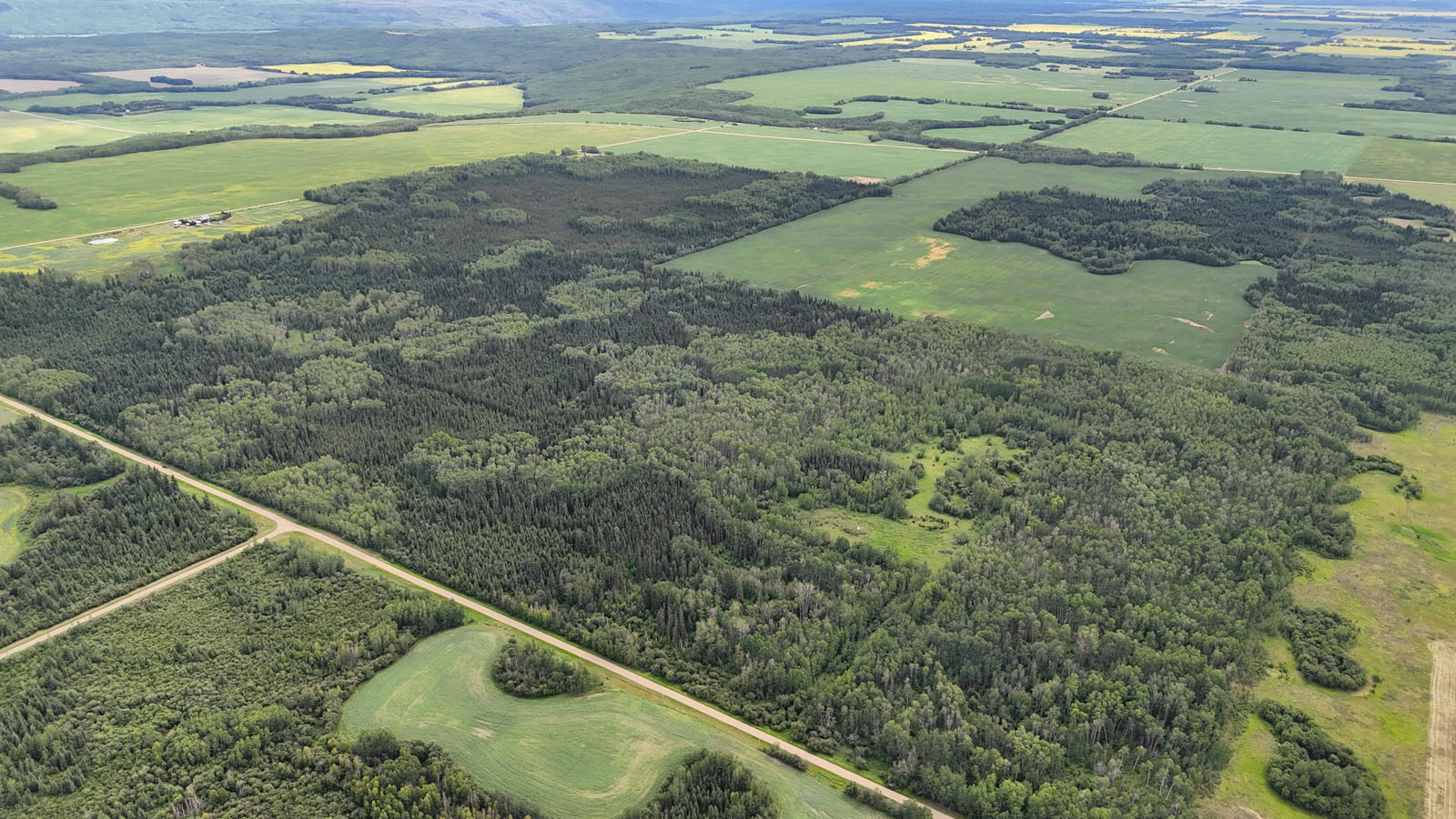
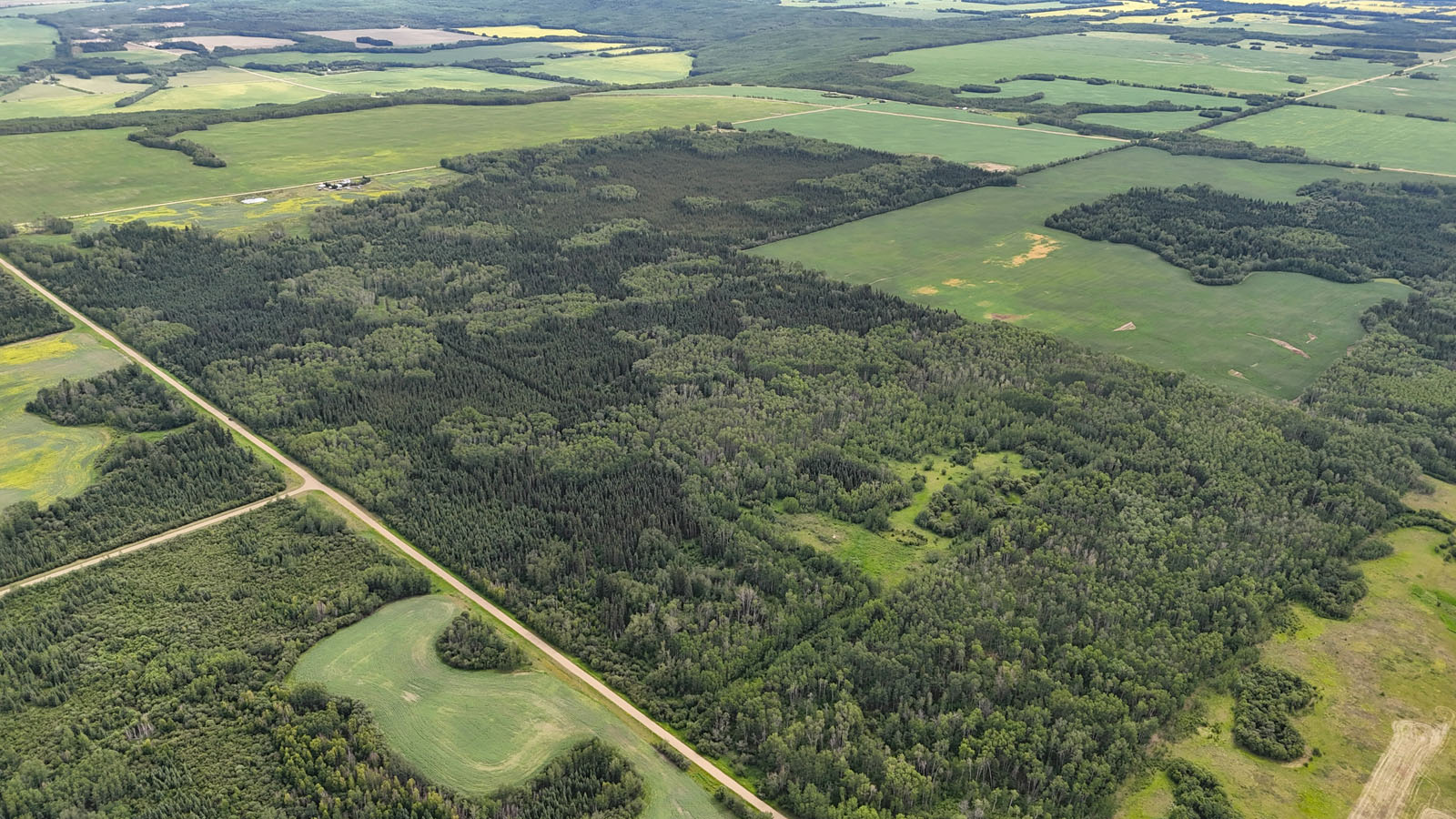
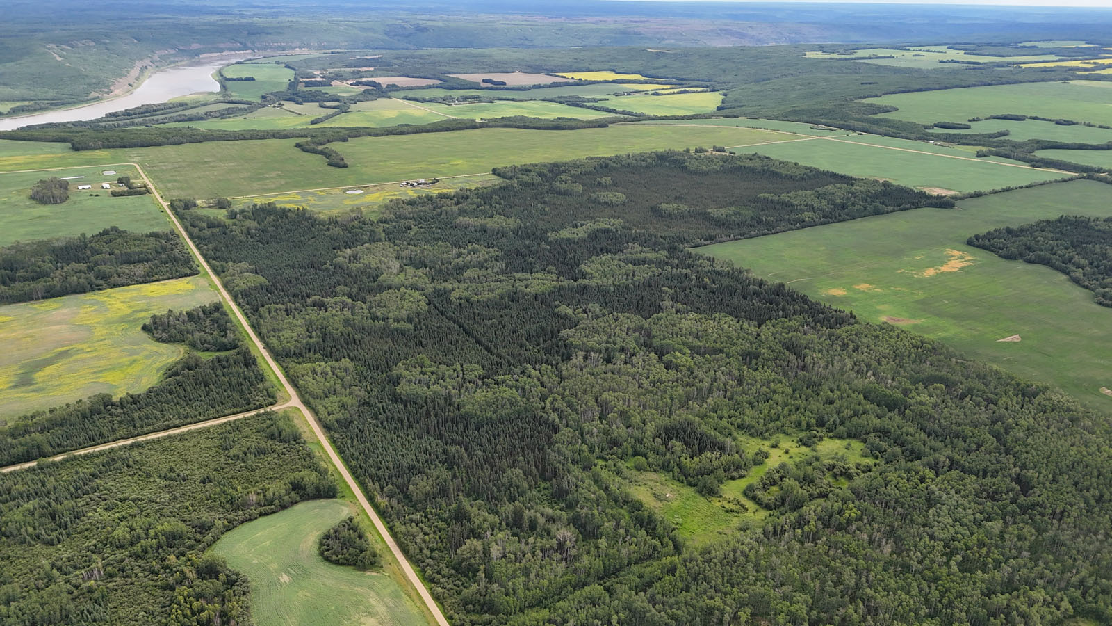
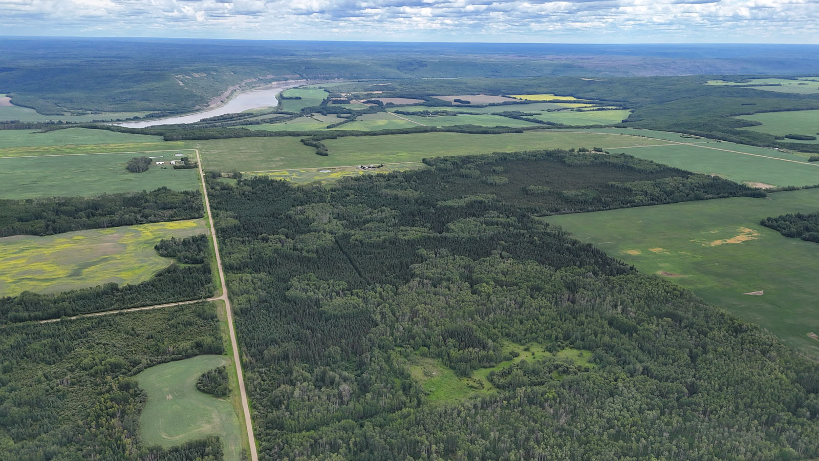

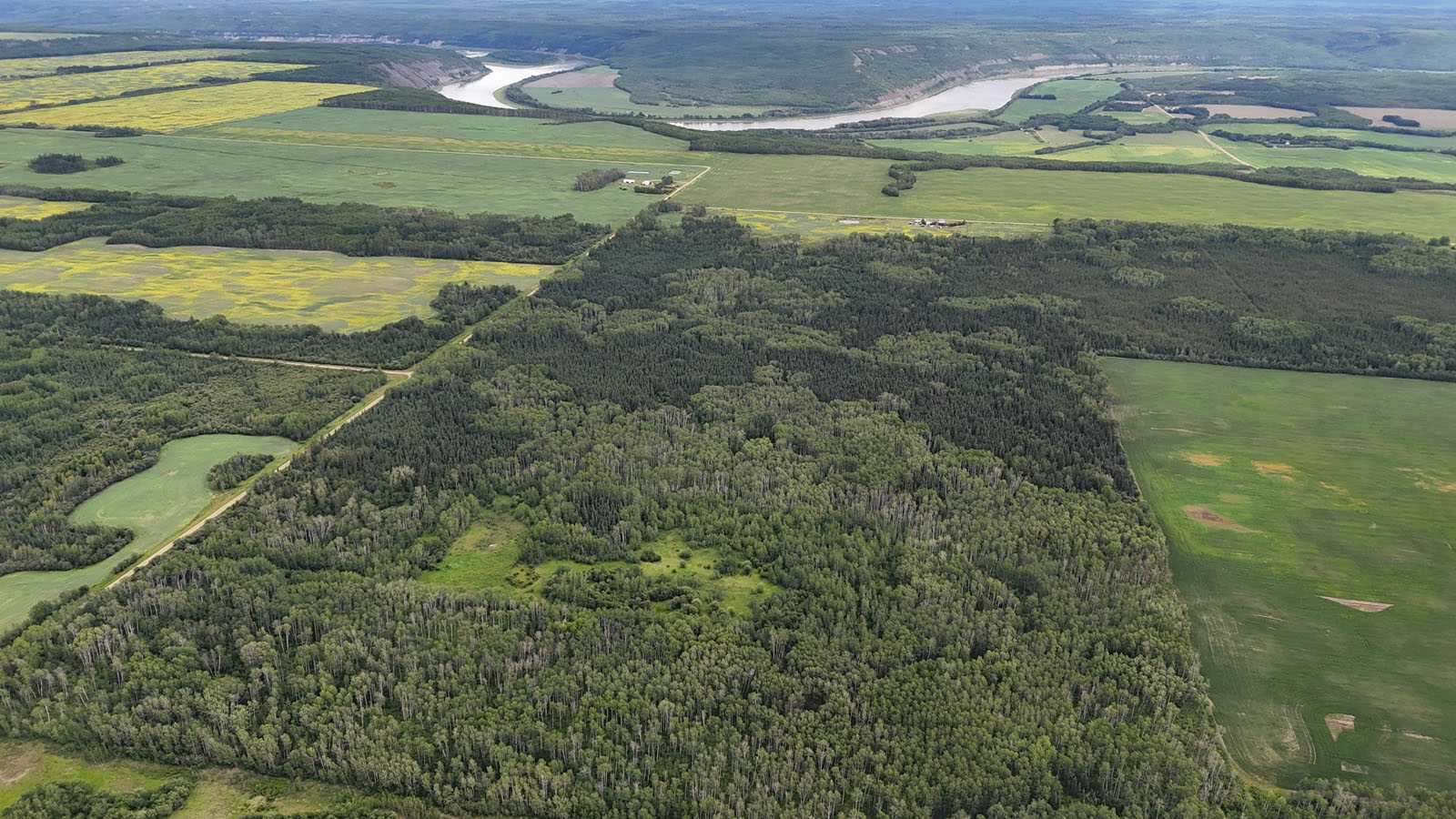
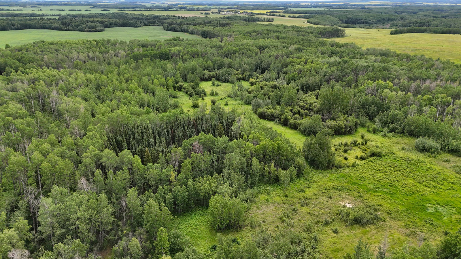
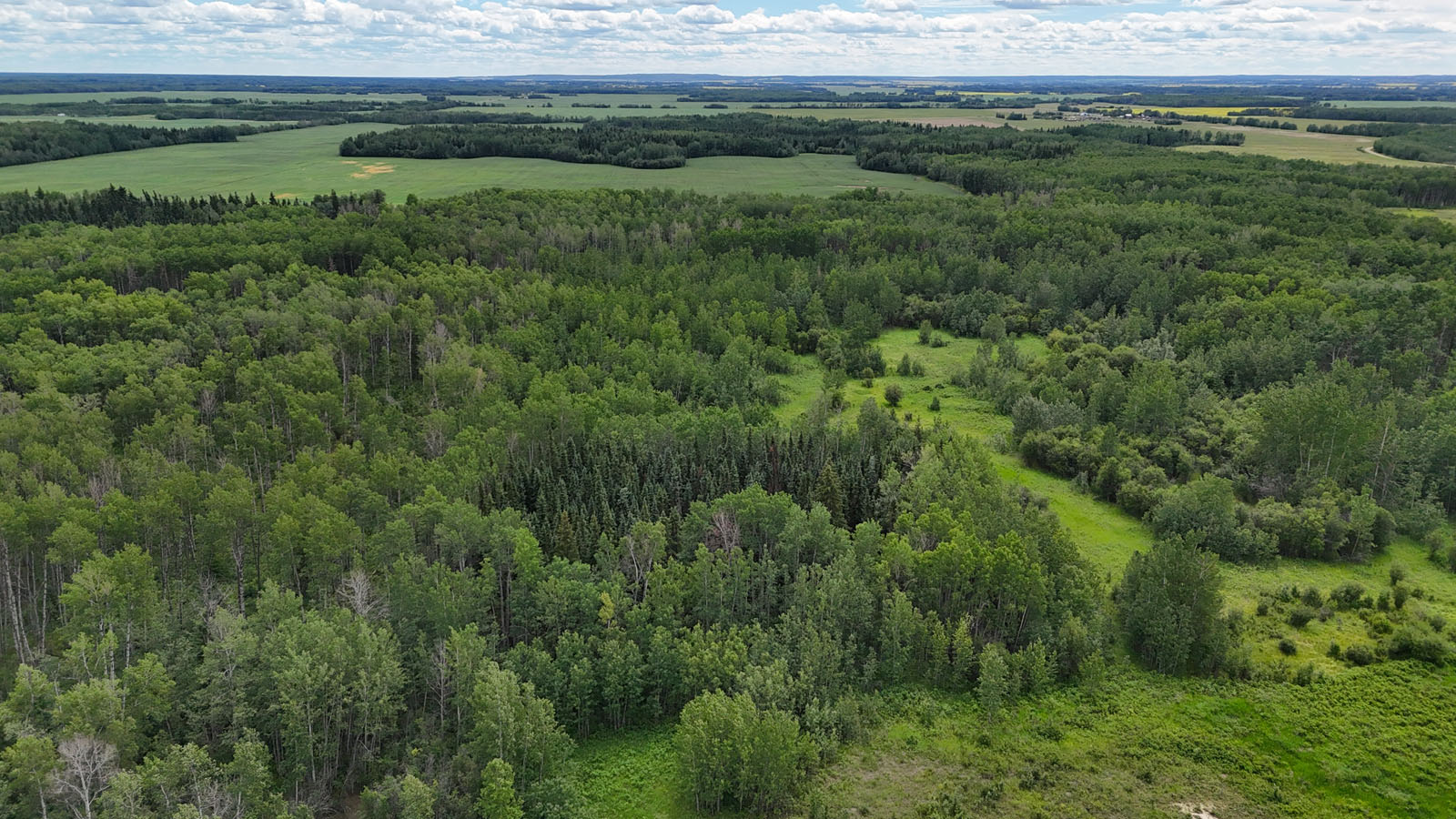
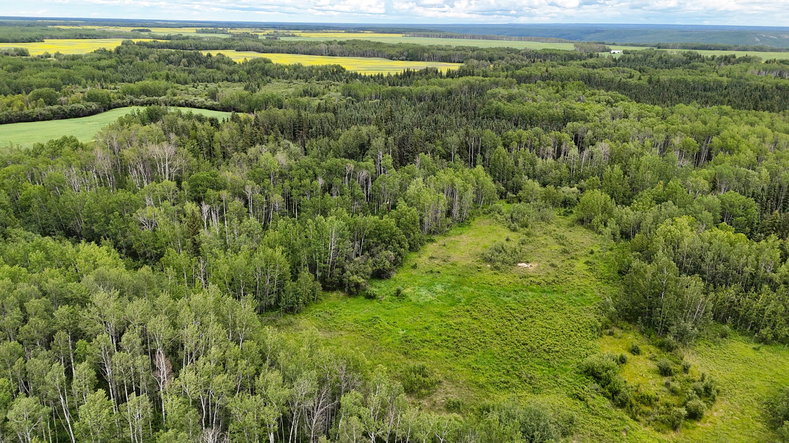
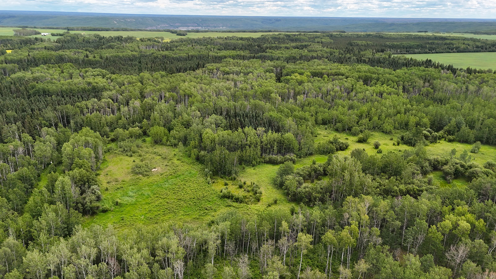
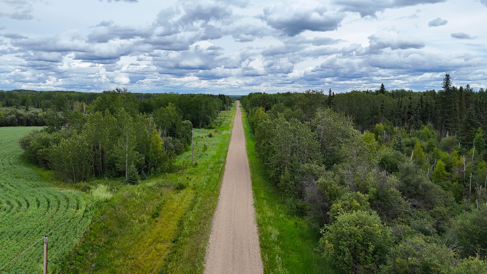
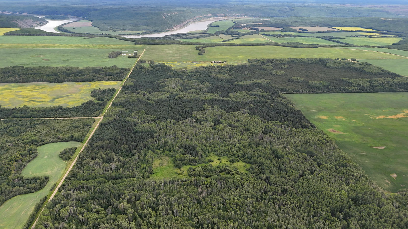
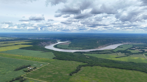
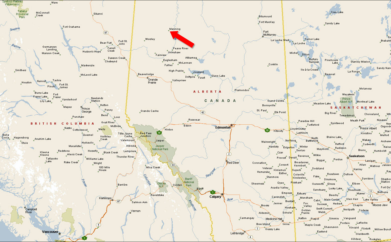
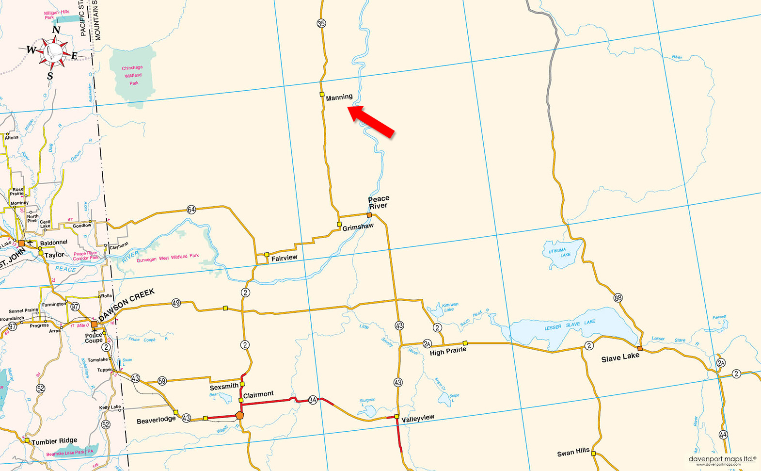
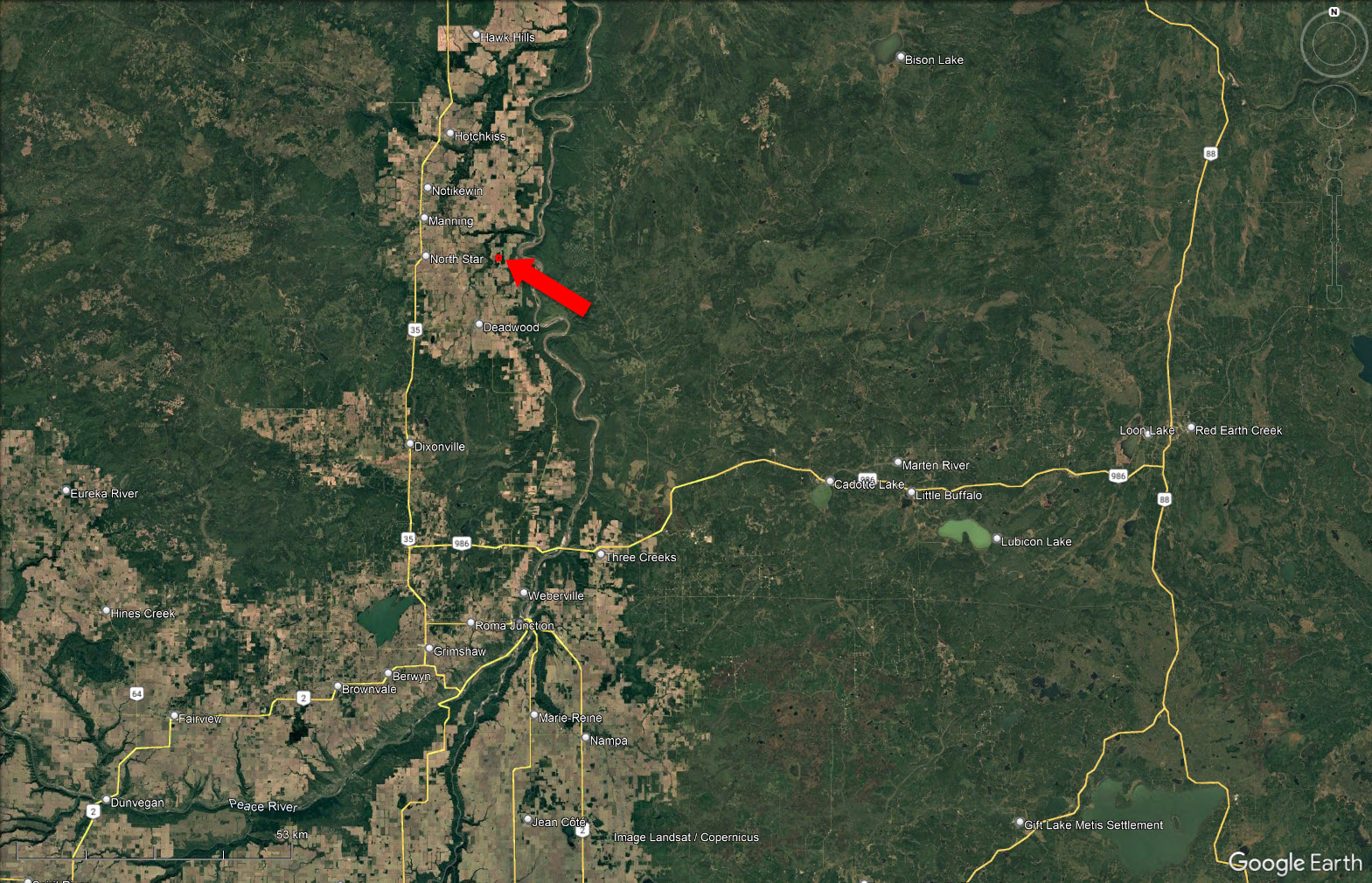
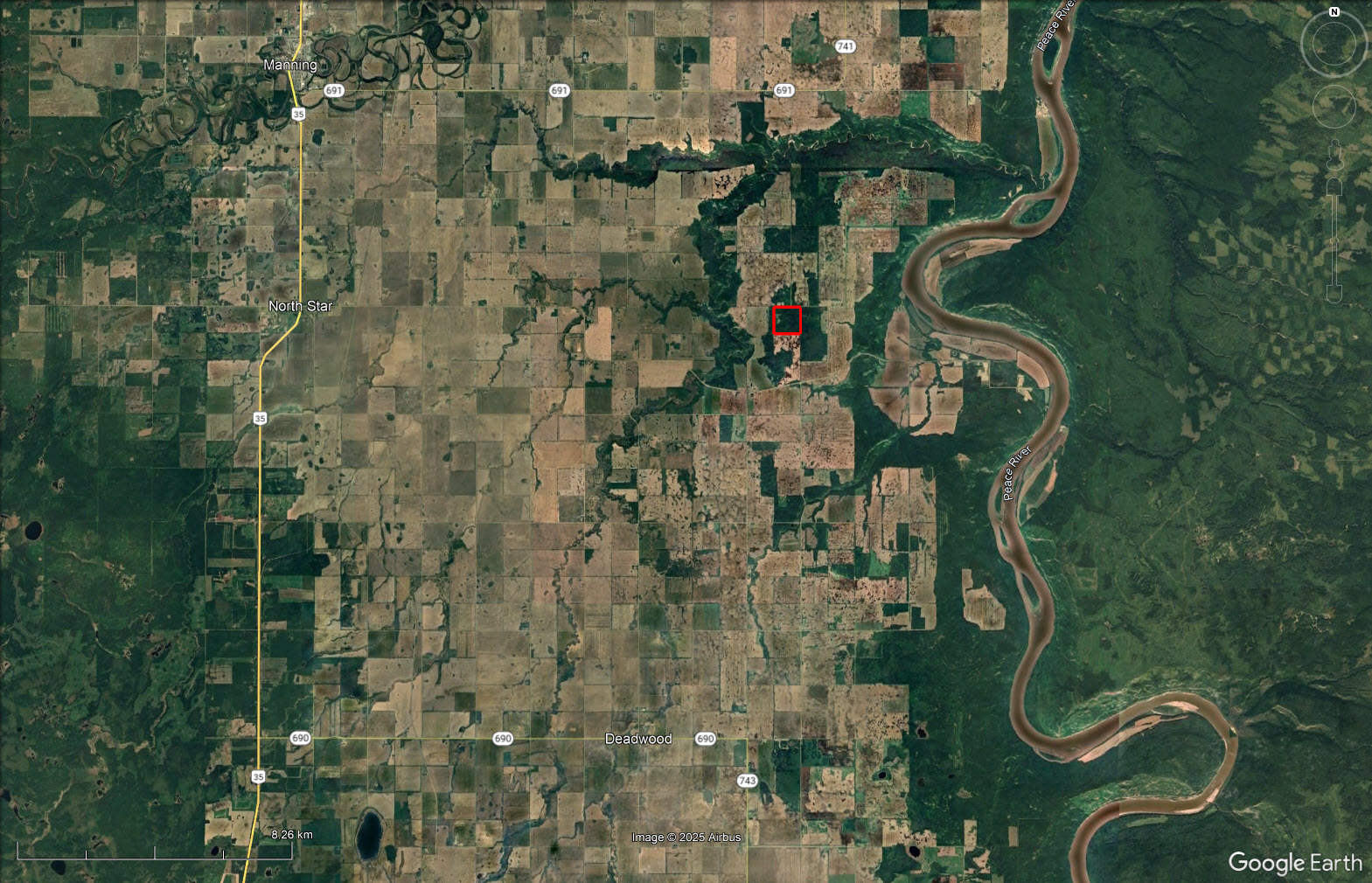
This 159-acre property offers a unique opportunity to own a well-situated and predominantly forested quarter section in a quiet area of northern Alberta. Located just off Township Road 910 and Range Road 220, the property enjoys easy access via well-maintained gravel roads and is close to the Peace River, as well as the communities of Deadwood and Manning.
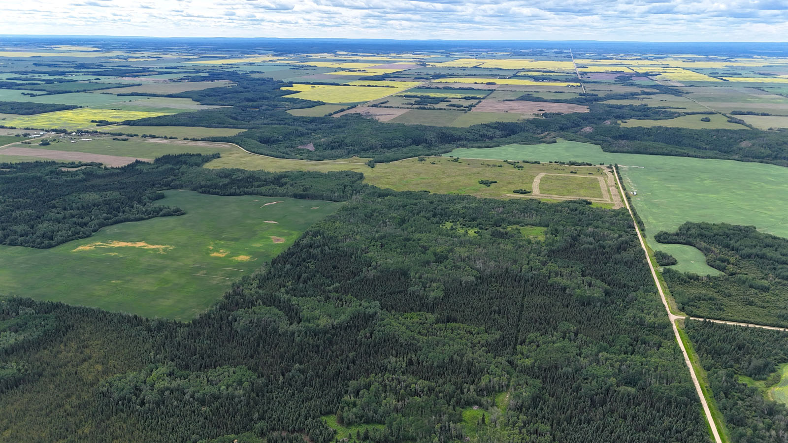
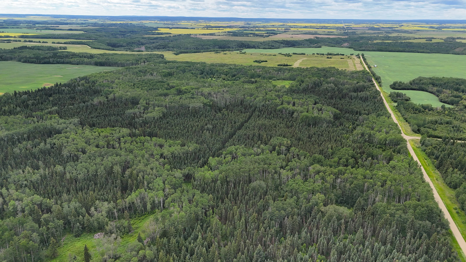
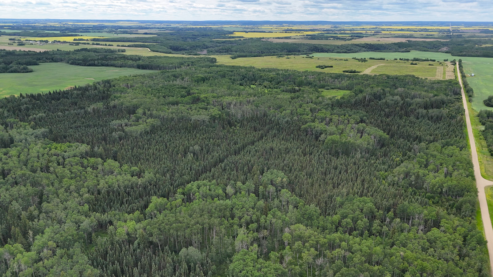
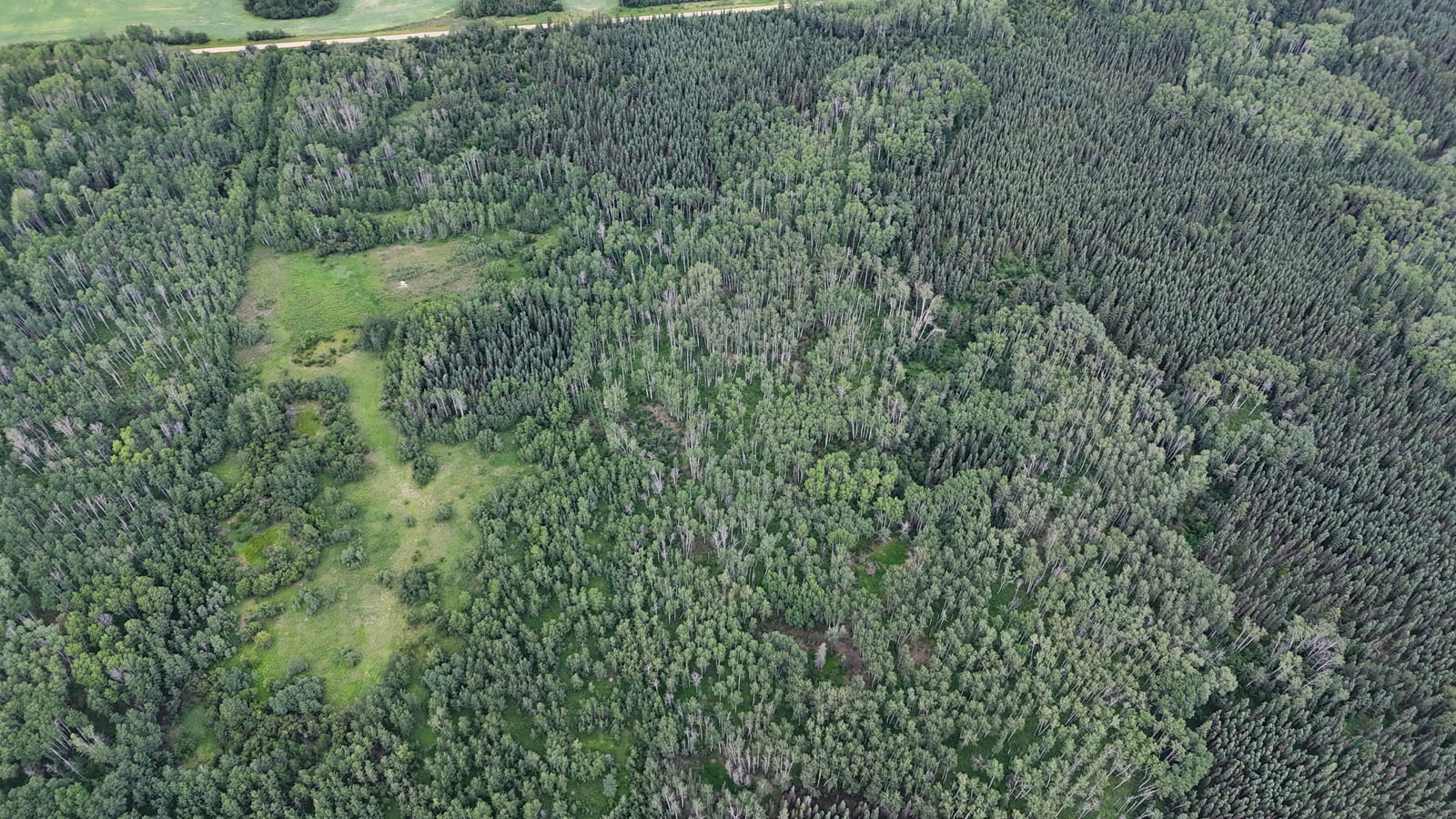
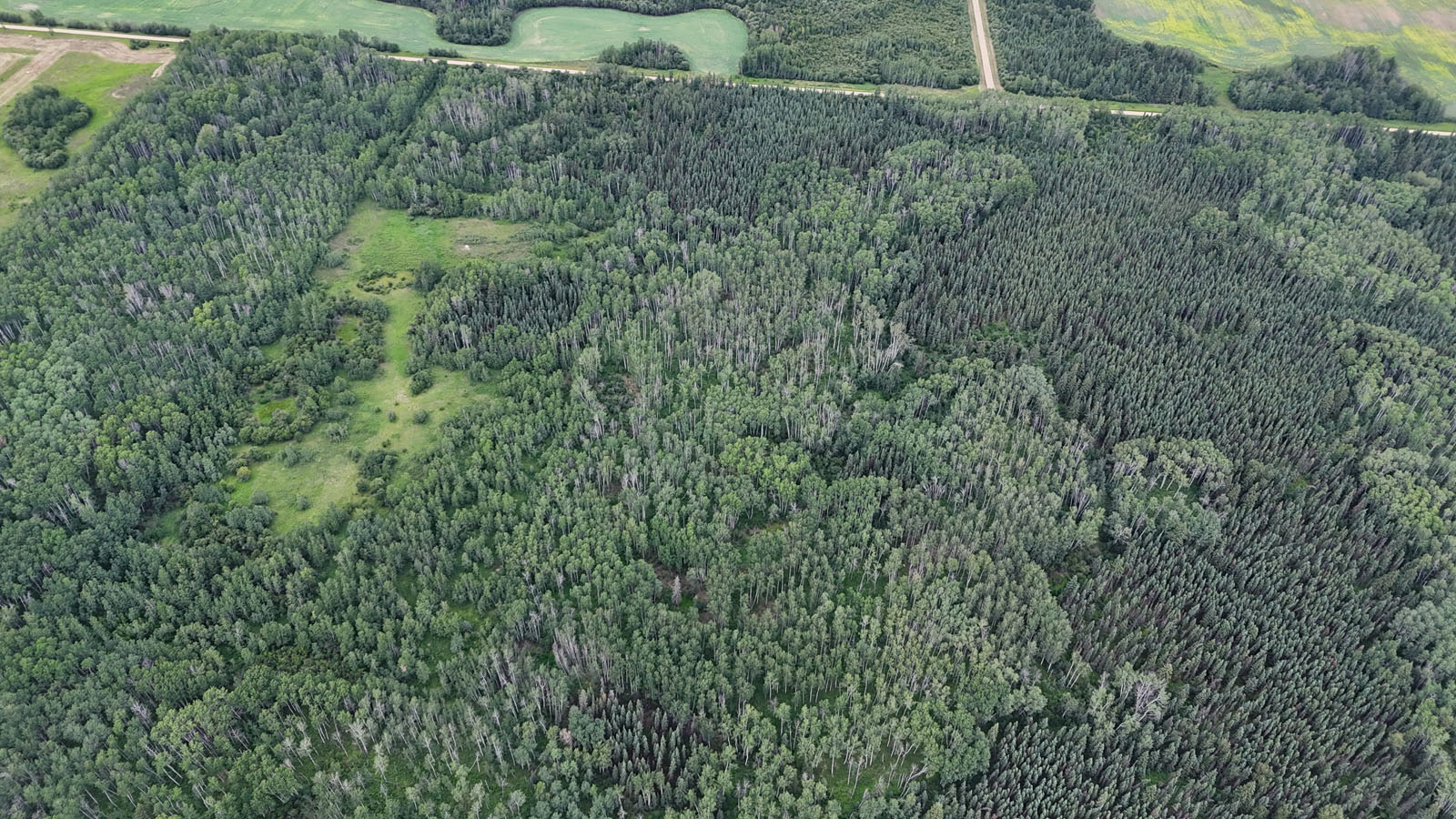
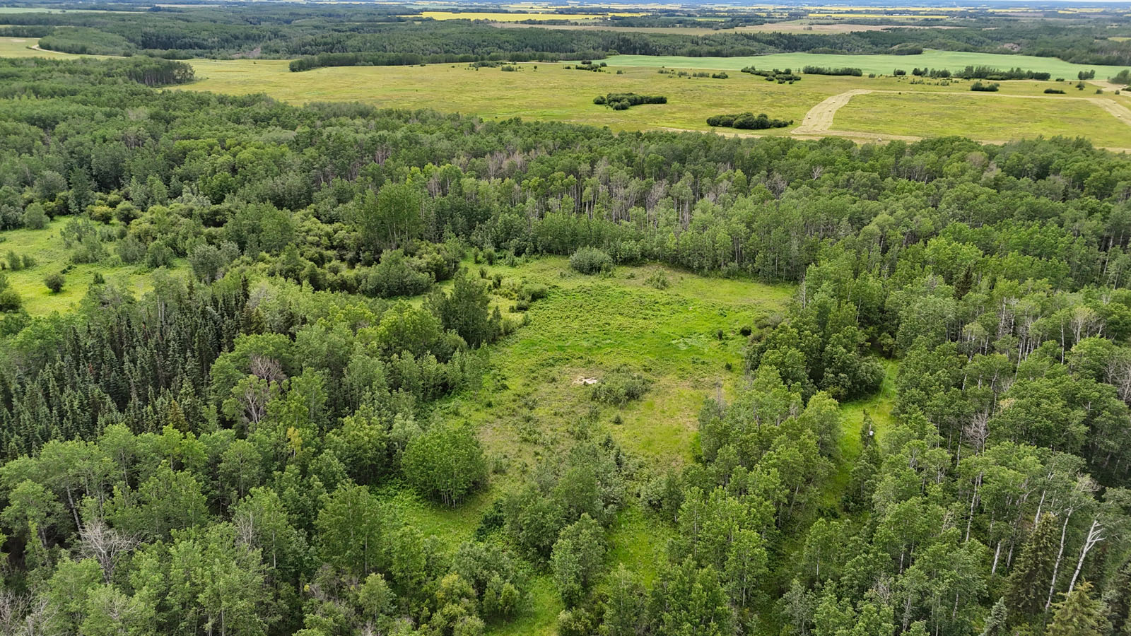
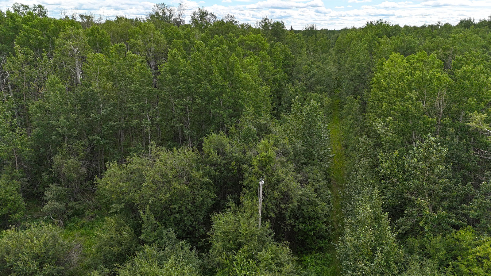
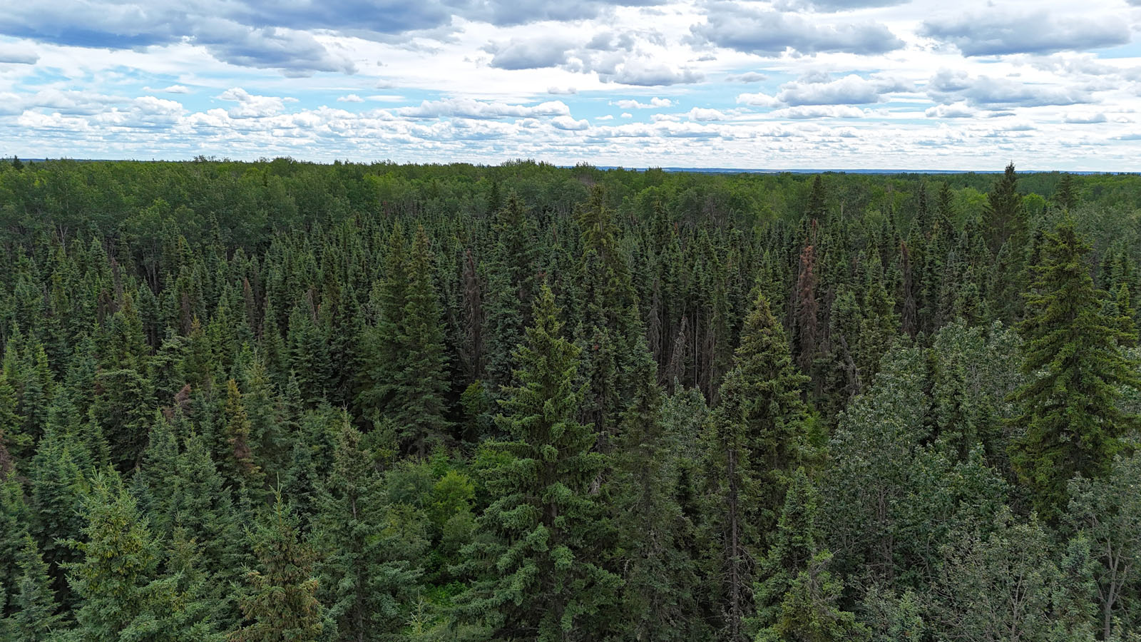
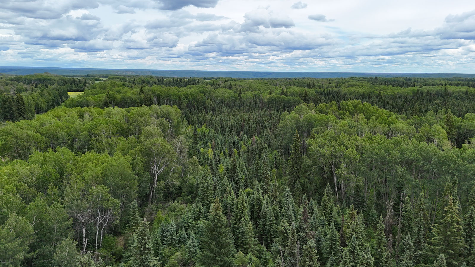
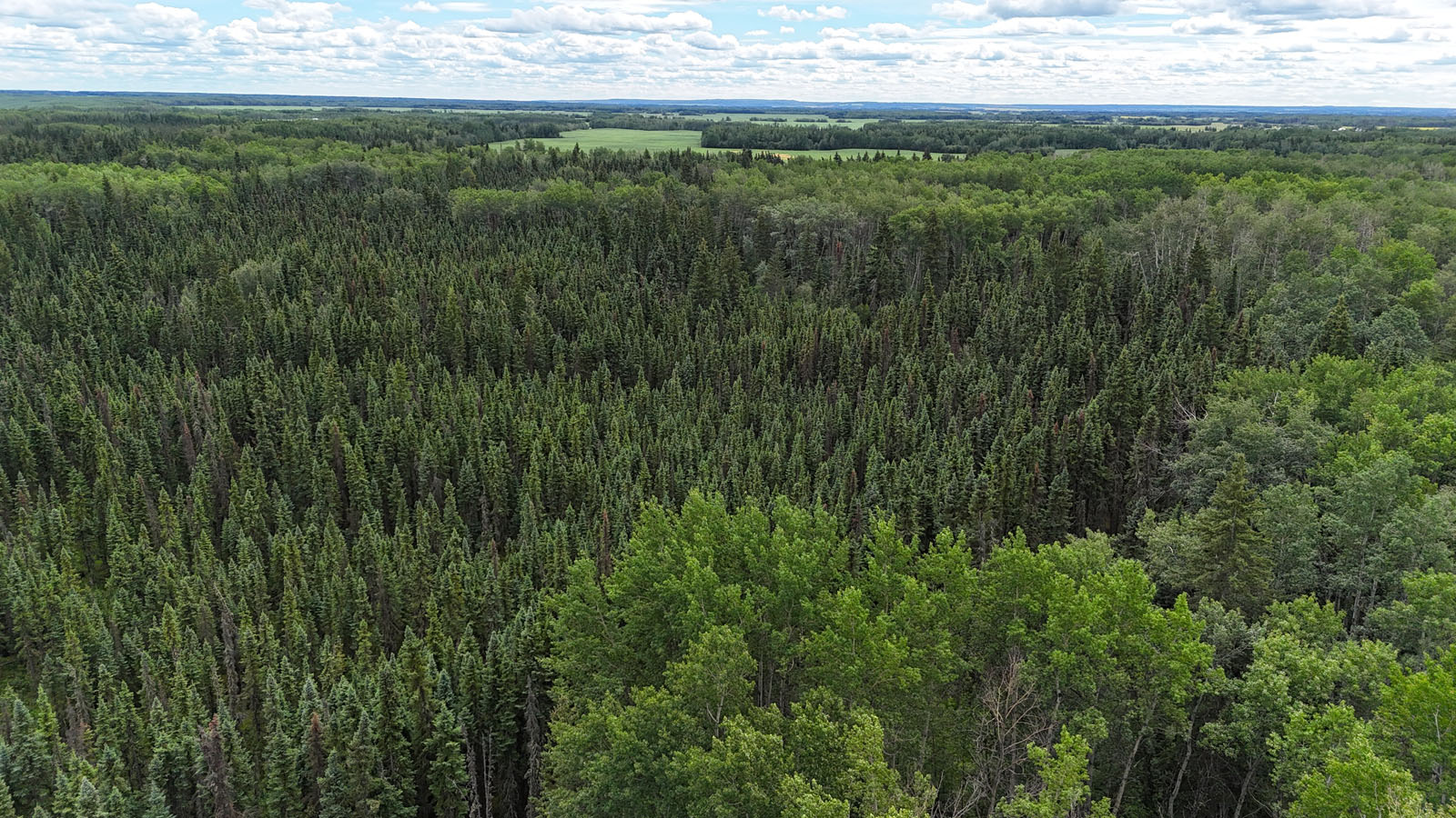
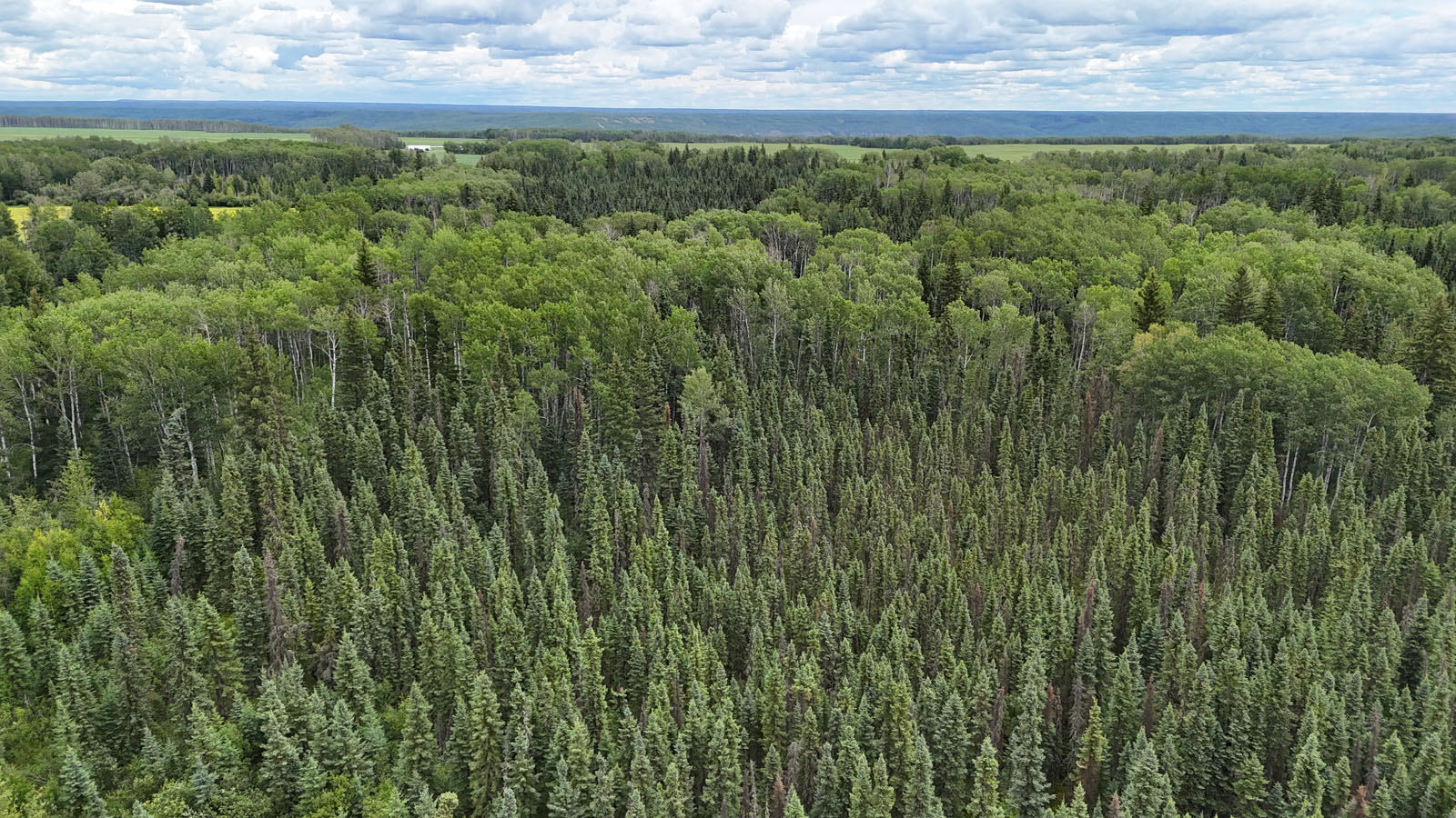
The land is mostly covered with a healthy mix of poplar and spruce, providing excellent privacy, shelter, and natural habitat. Approximately 30 acres were previously cleared and cultivated for a homestead site. While the site has since regrown with brush and young growth, remnants of the original foundation remain, offering a potential starting point for redevelopment.
Power has been brought into the property, with a line running several hundred feet along the driveway to the homesite. The power line was recently maintained and brushed, ensuring continued reliability.
Zoned agricultural, the land holds potential for further clearing and conversion into productive farmland. The area supports a variety of agricultural uses, including grains, canola, and ranching. Wildlife is abundant, with elk, moose, and deer regularly seen throughout the region.
This is a versatile quarter section with natural beauty, existing infrastructure, and development potential—ideal for recreation, homesteading, or agricultural use.
Located near Deadwood, AB
Contact the listing agent.
The region surrounding Manning and Deadwood, Alberta is part of a well-established agricultural corridor in the County of Northern Lights. Manning, with a population of just over 1,100, serves as the primary service and administrative centre for the area, offering essential amenities such as healthcare, schools, equipment dealers, and grain handling facilities. The nearby hamlet of Deadwood, though much smaller, is surrounded by productive farmland and has long supported traditional agricultural operations.
The local landscape supports a mix of boreal forest and arable land, making it ideal for both cropping and livestock operations. Farmers in the area commonly grow canola, spring wheat, and barley—crops well-suited to the northern Alberta climate and soil conditions. Cattle ranching is also a significant activity, with Alberta holding the largest beef cow herd in the country. In the Manning–Deadwood region, farms tend to be larger in scale, but the area also supports smaller mixed farms and hobby operations.
Agriculture is a major driver of the local economy, complemented by the forestry and energy sectors, particularly natural gas. Infrastructure is well developed for a rural setting, with reliable gravel road access, power services extended to many rural properties, and proximity to provincial highways. Wildlife is abundant throughout the region, with frequent sightings of moose, elk, and deer—highlighting the balance between agricultural activity and natural habitat.
Overall, this region offers a strong foundation for both traditional and modern agricultural operations. With access to services, a supportive farming community, and the flexibility to pursue grain, forage, or livestock production, the Manning and Deadwood area remains an attractive destination for agricultural investment and rural living.
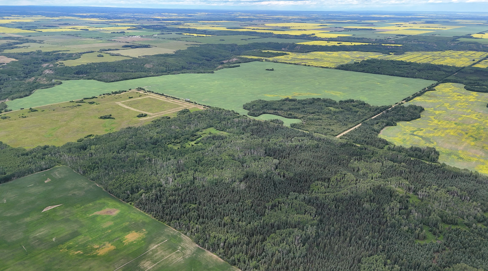
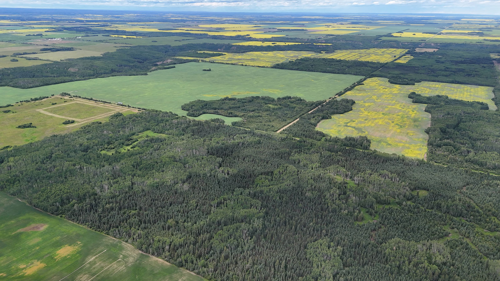
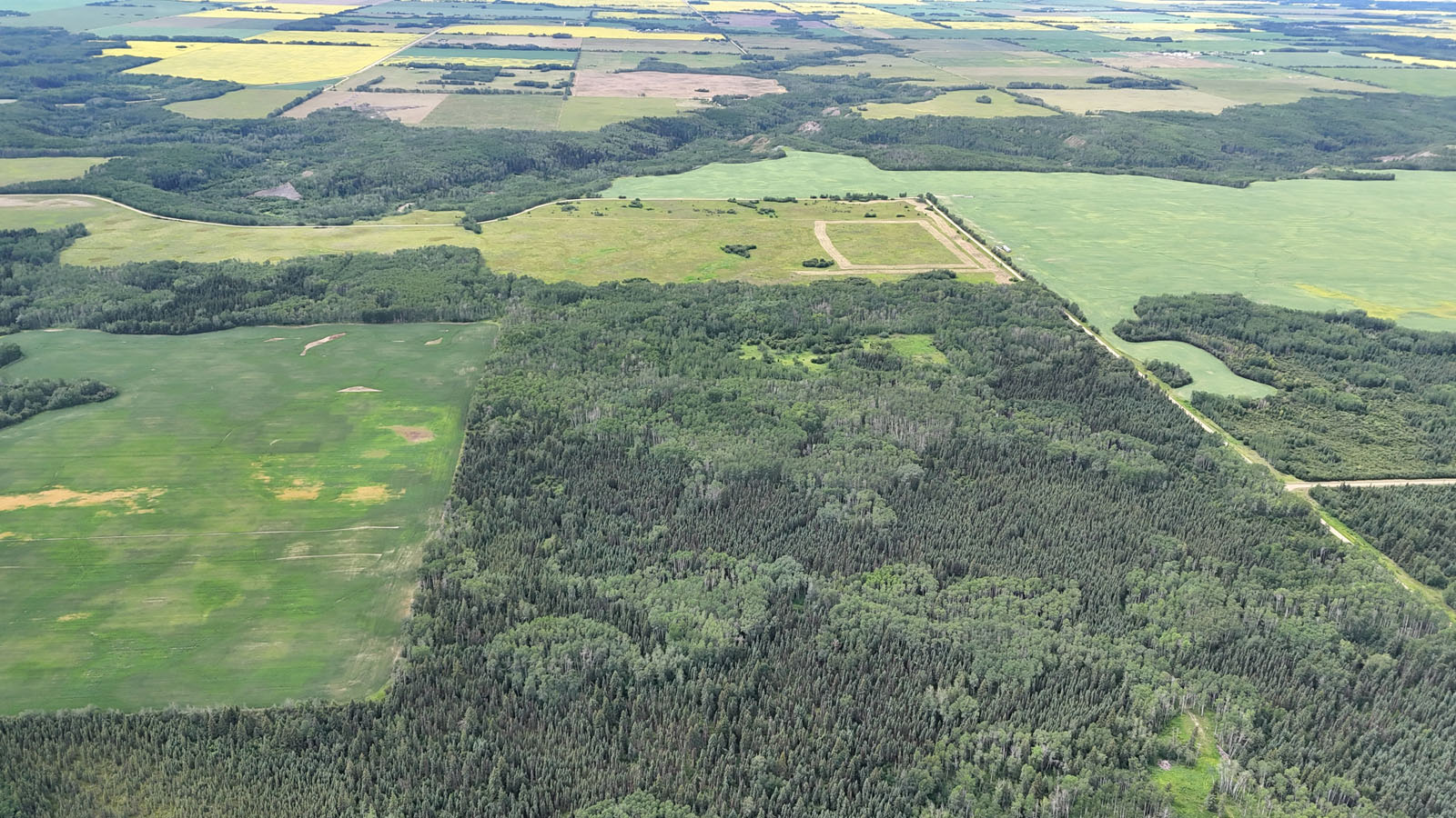
The property is dominated by mature poplar and spruce trees. The region surrounding the property is well suited for canola and cereal production.
The Manning and Deadwood area offers a wide range of recreational opportunities suited to both outdoor enthusiasts and families. In Manning, residents enjoy a well-equipped recreation centre that includes a skating and hockey arena, curling rink, indoor pool with a splash pad, squash courts, baseball diamonds, soccer fields, and a 9-hole golf course with an adjoining campground. A small ski hill just outside town adds to the winter activity options.
The surrounding region provides excellent access to outdoor recreation. Notikewin Provincial Park, located nearby, offers opportunities for camping, hiking, wildlife viewing, and boating along the Peace and Notikewin Rivers. Twin Lakes Provincial Recreation Area to the north is a popular destination for trout fishing, canoeing, swimming, and nature walks.
Winter brings excellent snowmobiling, cross-country skiing, and ice fishing across the Peace Country. The local trail systems and open landscapes make it easy to enjoy backcountry excursions and seasonal wildlife observation year-round. Whether it’s organized sports in town or exploring the boreal wilderness, the Manning region delivers a full spectrum of recreational activities.
The history of the Manning and Deadwood area is rooted in northern Alberta’s frontier development during the early to mid-20th century. Originally home to fur trading routes and early trapping activity, the region saw its first wave of permanent settlers arrive during the 1930s and 1940s, many of whom came north seeking farmland and new opportunities during the Great Depression. Homesteaders worked to clear the dense boreal forest, build access roads, and establish small farms and ranches, laying the foundation for the area's agricultural identity.
Manning, known early on as Notikewin, was renamed in 1947 in honour of Premier Ernest Manning. The town grew as a key service and transportation centre for the expanding agricultural and forestry industries, supported by the construction of Highway 35 and improved access to the Peace River region. Deadwood, a smaller rural community to the east, was similarly settled by pioneers carving out farmland from the forest. Though its population has remained modest, it played an important role as a local gathering point for farm families in the surrounding countryside.
Over the decades, the region developed a strong sense of resilience and community, anchored by its agricultural roots, a commitment to self-reliance, and the challenges of northern living. Today, while farming and ranching remain central to the local economy, the area also reflects the steady influence of forestry, energy, and outdoor recreation—each a chapter in its evolving rural history.
56°51'12.97"N and 117°23'6.65"W
Electrical grid power brought onto property.
Old foundation located near cleared site on property.
$642 (2025)
Agricultural
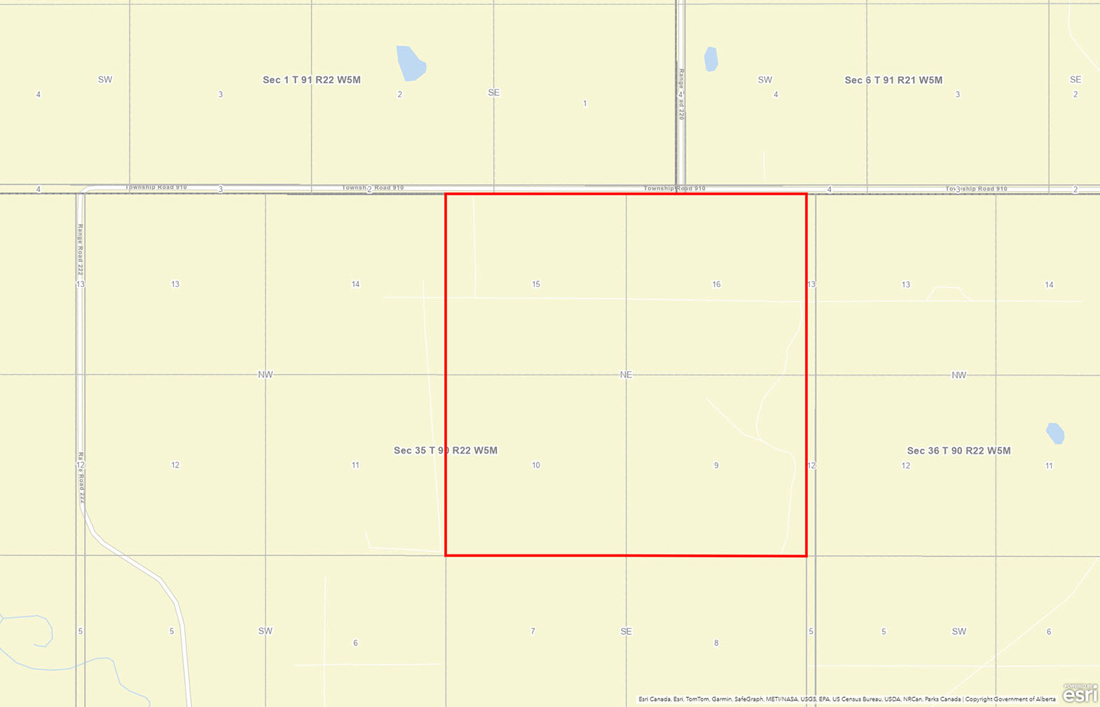
Meridian 5 Range 22 Township 90 Section 35 Quarter North East
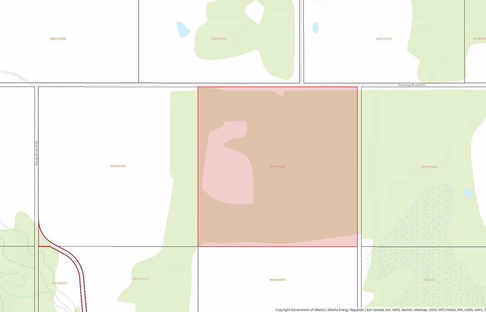
LINC 0017-411-380
 +8 maps
Our property descriptions and geographical information are taken from the BC Assessment Authority, Land Titles Office, government maps and other sources. While LandQuest® does not guarantee the information, we believe it to be accurate, but should not be relied upon without verification. This communication is not intended to cause or induce breach of an existing agency agreement.
Deadwood
 24℃
24℃
 15℃
15℃