


4 acres of lakefront, bare land on Big Lake. Crown land north and south, lake to the west, and no neighbours to the east! Ultra privacy and tranquility within 30 minutes of Chetwynd. Zoning allows two single-family dwellings and ancillary accommodations.


 +7 photos


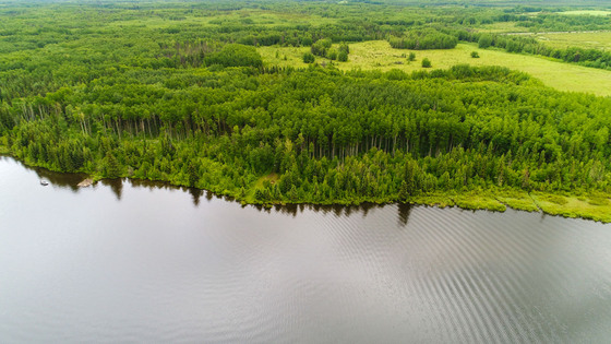
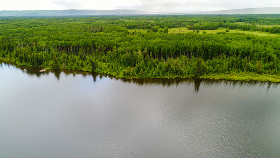
Big Lake acreage—private lakefront property. This exceptional 4-acre lakefront parcel offers unparalleled privacy, with no neighboring residences on the east, Crown land to the north and south, and direct frontage on Big Lake to the west. The result is a secluded and serene setting, ideal for a recreational retreat or permanent residence.
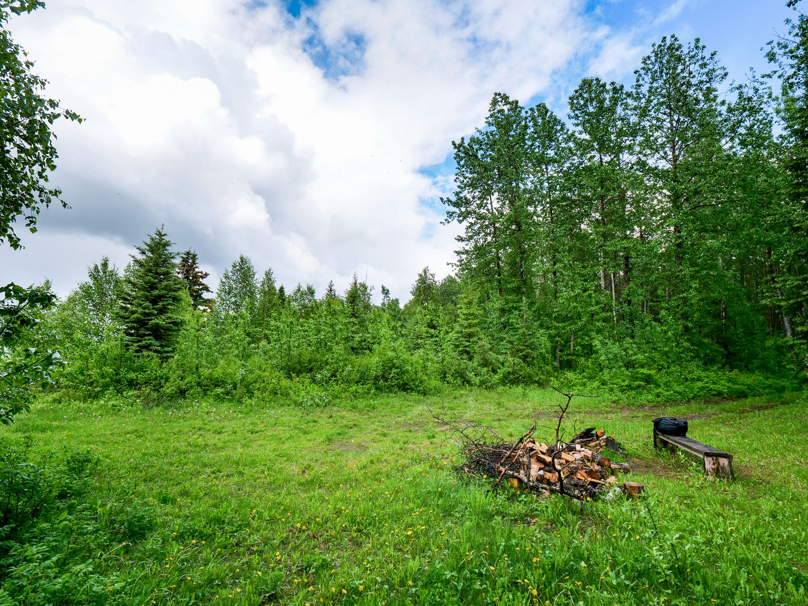
The acreage is zoned Agricultural A2, allowing for the development of up to two single-family dwellings along with ancillary accommodations. A cleared area near the lake provides a scenic building site, complemented by a well-maintained road with legal access. The remainder of the property is beautifully forested, offering a natural backdrop and added privacy. Big Lake is renowned for its excellent pike fishing and does not have motorized boating restrictions.
Conveniently located approximately 30 km northwest of Chetwynd, the property remains within easy reach of local services and amenities while retaining its peaceful, rural character.
Jackfish Lake Road - Chetwynd, BC
From Central Chetwynd, head north on Highway 19 to Hudson’s Hope. About 4 km turn northeast on Jackfish Lake Road and travel another 26 km. The driveway is on the left half a kilometre north of Pruckl Road (on the right). Morton Road is another 800 m north on the left. (If you went too far and need to turn around.)
The Peace River Regional District is in northeastern British Columbia. The district has seven municipalities and four electoral areas. Its members are the cities of Fort St. John and Dawson Creek, the districts of Tumbler Ridge, Chetwynd, Taylor, Hudson's Hope, and the village of Pouce Coupe. The district's administrative offices are in Dawson Creek.
East of the Rockies, the regional district is characterized by rolling hills with grain and cattle farms. About 40% of the province's Agricultural Land Reserve is within the local area. The Peace River flows west-to-east through the middle of the eastern half of the district. West of the Rockies, the terrain is rugged mountain wilderness with few roads and only a handful of inhabitants.
Chetwynd, formerly known as Little Prairie, has a population of approximately 3,100 and serves the greater area of 7,000. The town offers many community and visitor services with multiple school opportunities: elementary, secondary, Montessori, Northern Lights College, and a library. Emergency services include a hospital, fire department, ambulance, and RCMP. A well-equipped Recreation Centre includes a swimming pool, curling rink, climbing wall, squash and racquetball courts, and a skate park. There are three helicopter services within the town. The closest regional airport is in Dawson Creek and North Peace.
In 2005, Chetwynd hosted the first annual Chetwynd International Chainsaw Carving Championship, hosting seven carvers from British Columbia and the United States. Chetwynd is now drawing international attention, with sculptors coming as far away as Wales, North Wales, Japan, and the United States. This competition is an exciting spectator event. The first carvings were 3 bears, which now form part of the Welcome to Chetwynd sign. There are now more than 120 carvings located in various places around town.
Outdoor exploration within the many lakes and parks is seemingly endless. Each lake and river provides its own unique experiences. Whatever your passion, from caving/rappelling, golfing, lake sports, trails and hiking, trophy fishing, hunting, and winter sports, it’s an outdoor person’s ‘feast’! Moberly Lake, East Pine Gwillim Lake, and Sukunka Falls are only a few of the Provincial Parks near Chetwynd. All are well-maintained and offer camping with extensive trails.
The earliest history during the 18th and 19th centuries showed the westward movement of the First Nation groups, where they battled with each other for resources. European-Canadian explorers penetrated the area during the 19th century by canoe. Along the Peace River, trading posts were established at Fort St. John and Hudson's Hope. The government surveyed out its land as the Peace River Block in 1907 and opened it to homesteading in 1912. Pioneer Hector Tremblay and a few others helped cut trails and opened more stores and lodges to help incoming settlers.
Industrial development began with provincially funded megaprojects. They included the extension of transportation and utility infrastructure through the Rocky Mountains to Chetwynd. In 1957, a crowd of 3,000 people awaited the arrival of the first train over the Pacific Great Eastern Railway from Vancouver. Two hydroelectric dams opened, the WAC Bennett Dam completed in 1972 and the smaller Peace Canyon Dam opened in 1980. Both are in the proximity of Hudson’s Hope.
55°54'52.46"N and 121°24'13.38"W
No services. Power approximately 500 m away from the property.
$72 (2024)
A2 Rural Agriculture
DISTRICT LOT 2120 PEACE RIVER DISTRICT
PID 013-713-655
 +8 maps


Our property descriptions and geographical information are taken from the BC Assessment Authority, Land Titles Office, government maps and other sources. While LandQuest® does not guarantee the information, we believe it to be accurate, but should not be relied upon without verification. This communication is not intended to cause or induce breach of an existing agency agreement.
Moberly Lake
 17℃
17℃
 13℃
13℃