


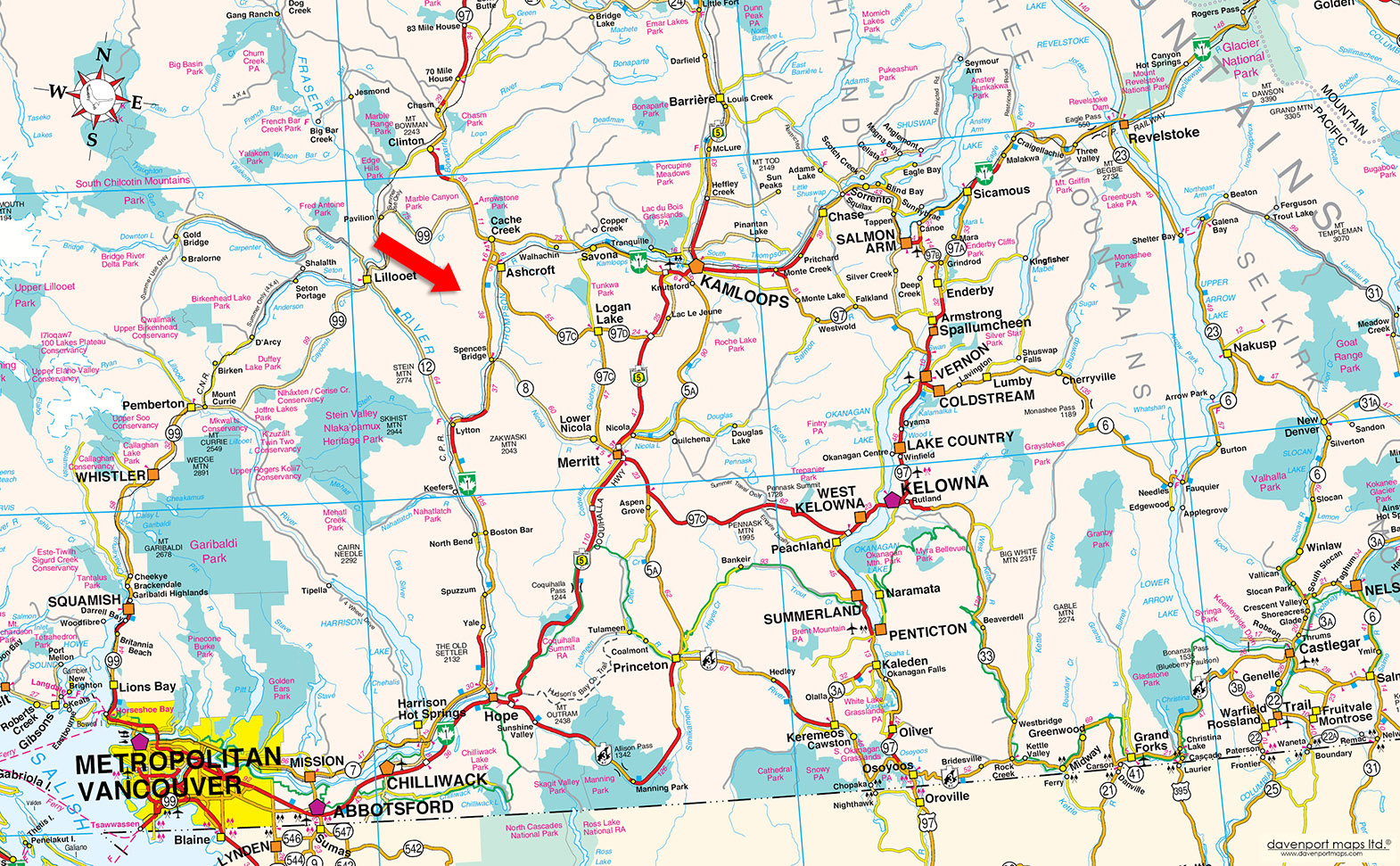
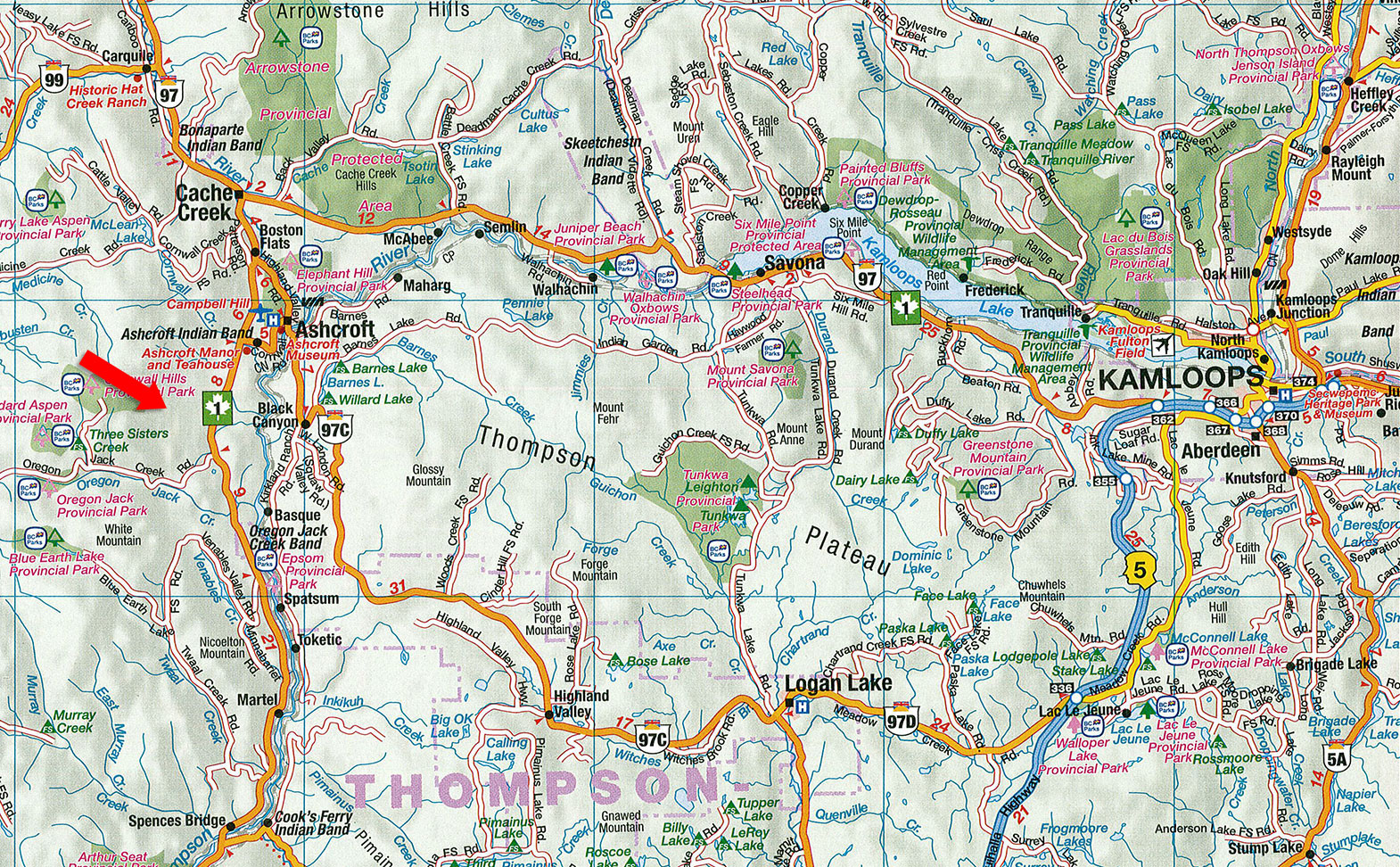
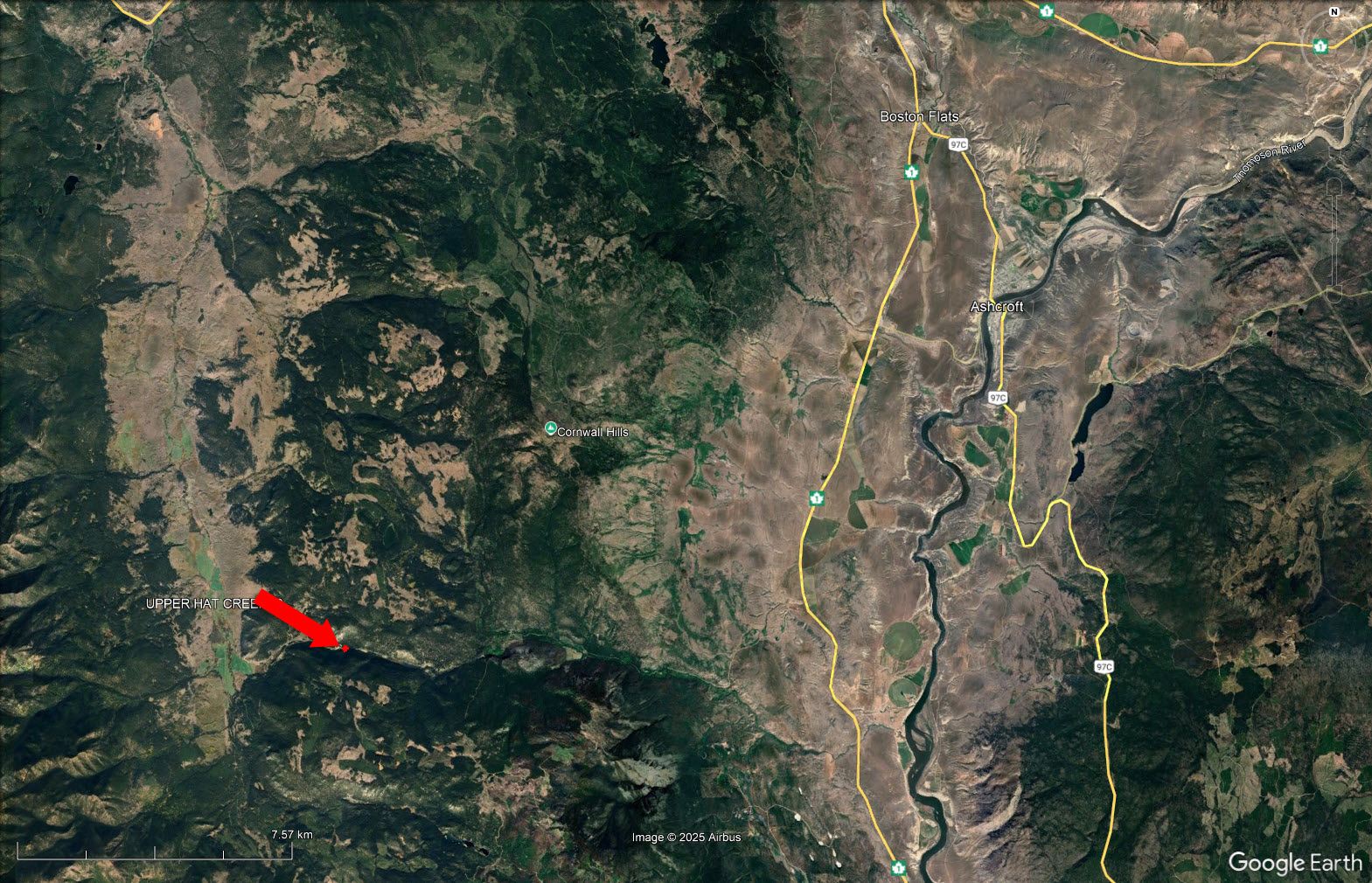
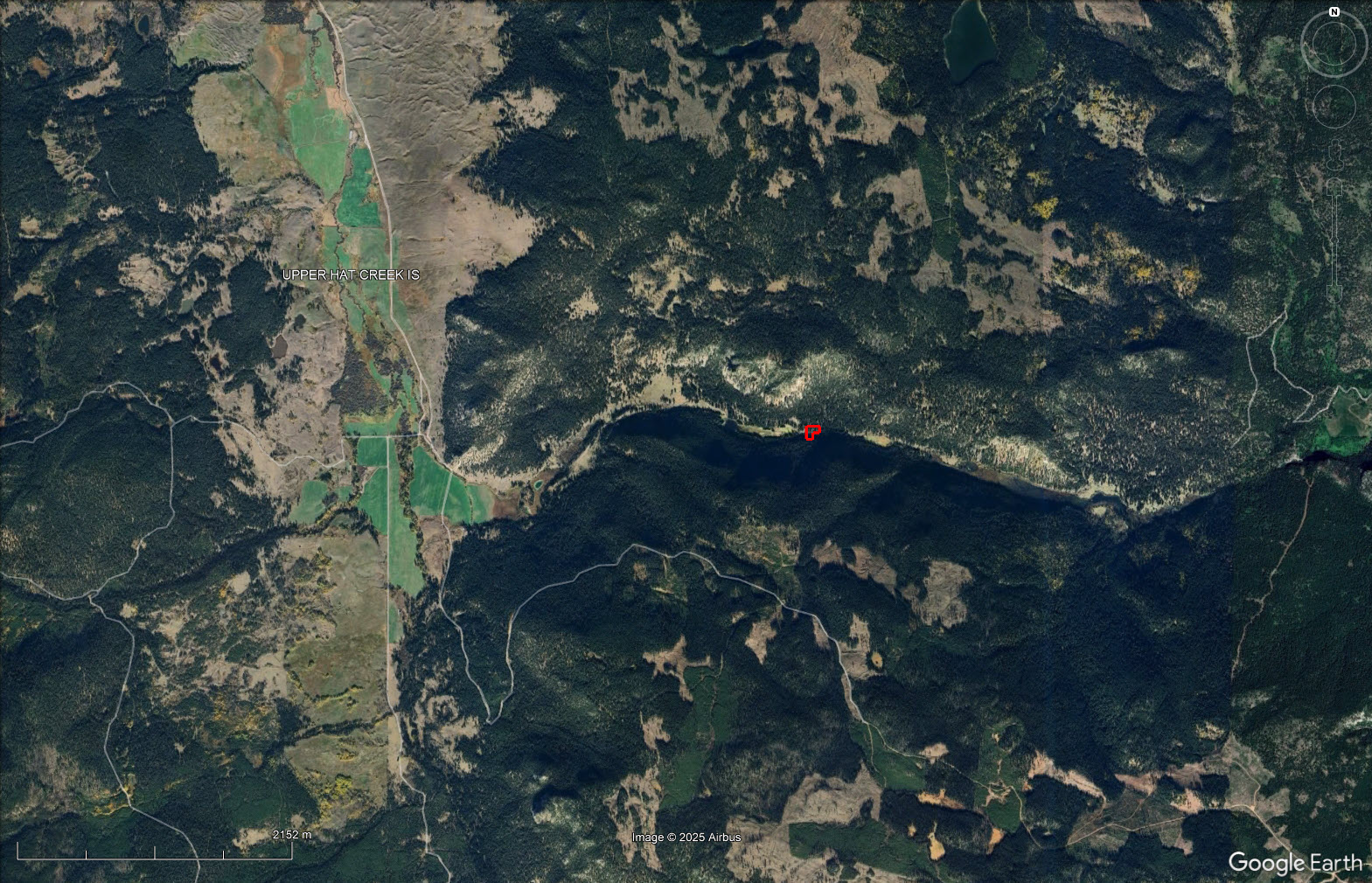
1.91-acre off-grid parcel surrounded by Crown land and near provincial parks. Seasonal Access. One of only two private properties within more than 2 km. Area has ATV and horseback trails, good hunting. Access to quality fishing lakes such as Blue Earth Lake, 5.6 km away.


 +5 photos
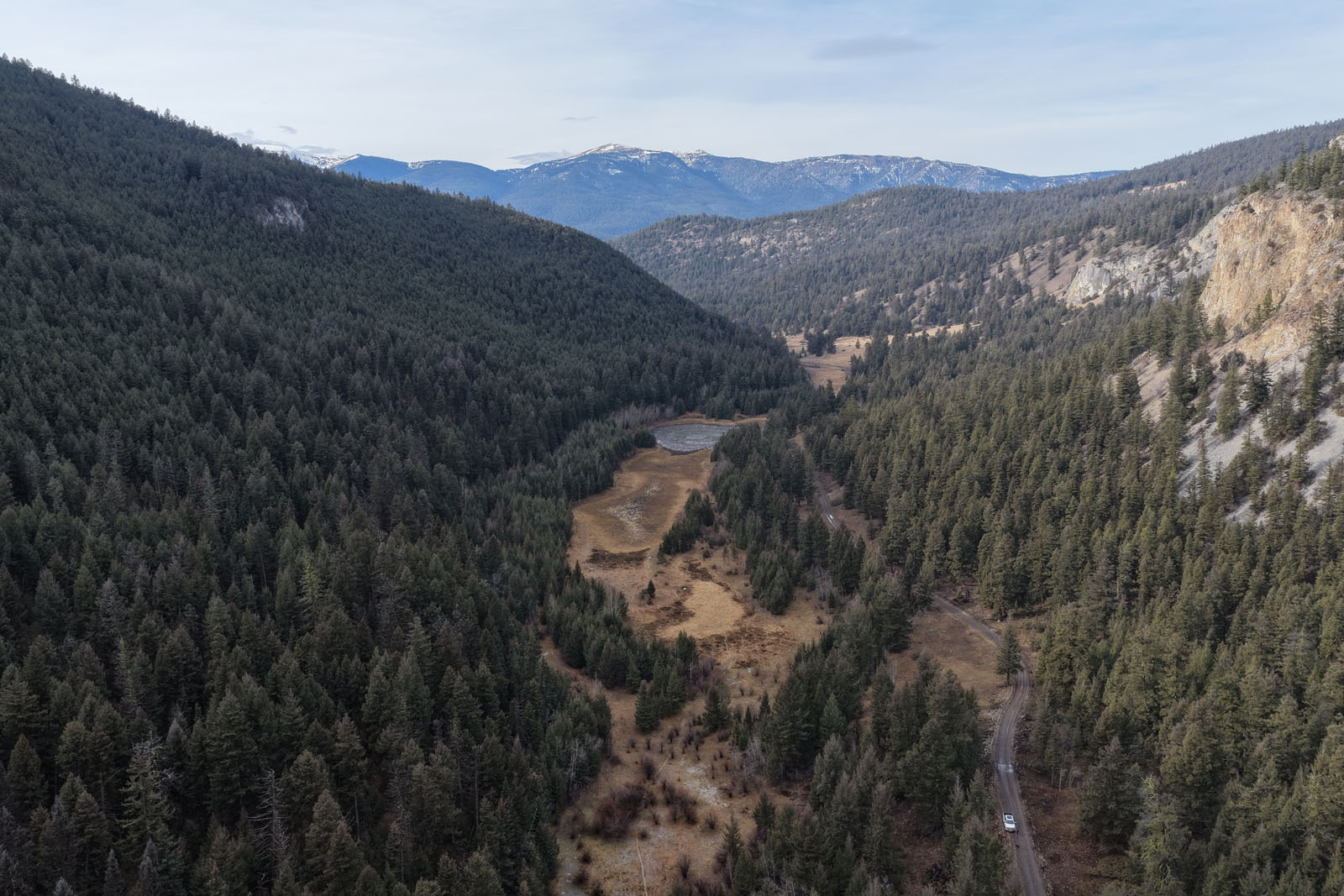
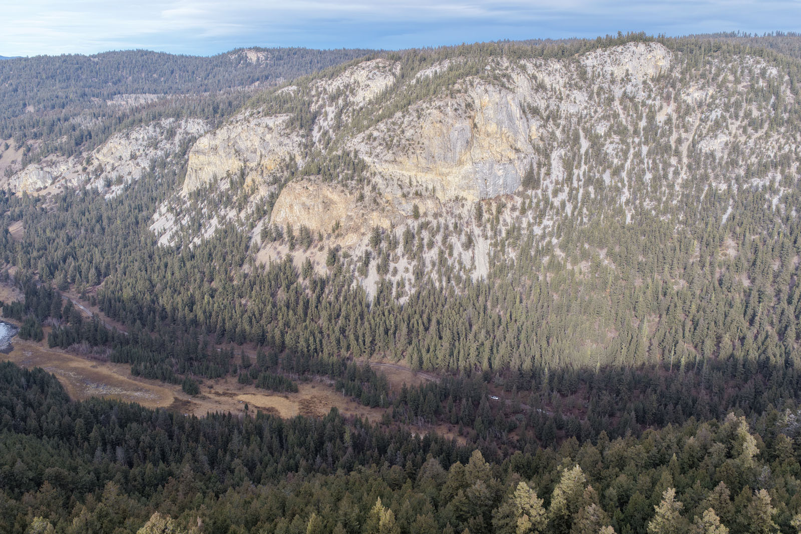
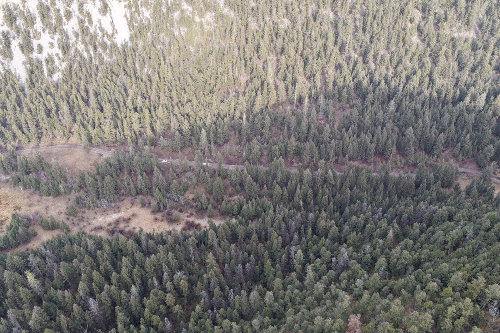
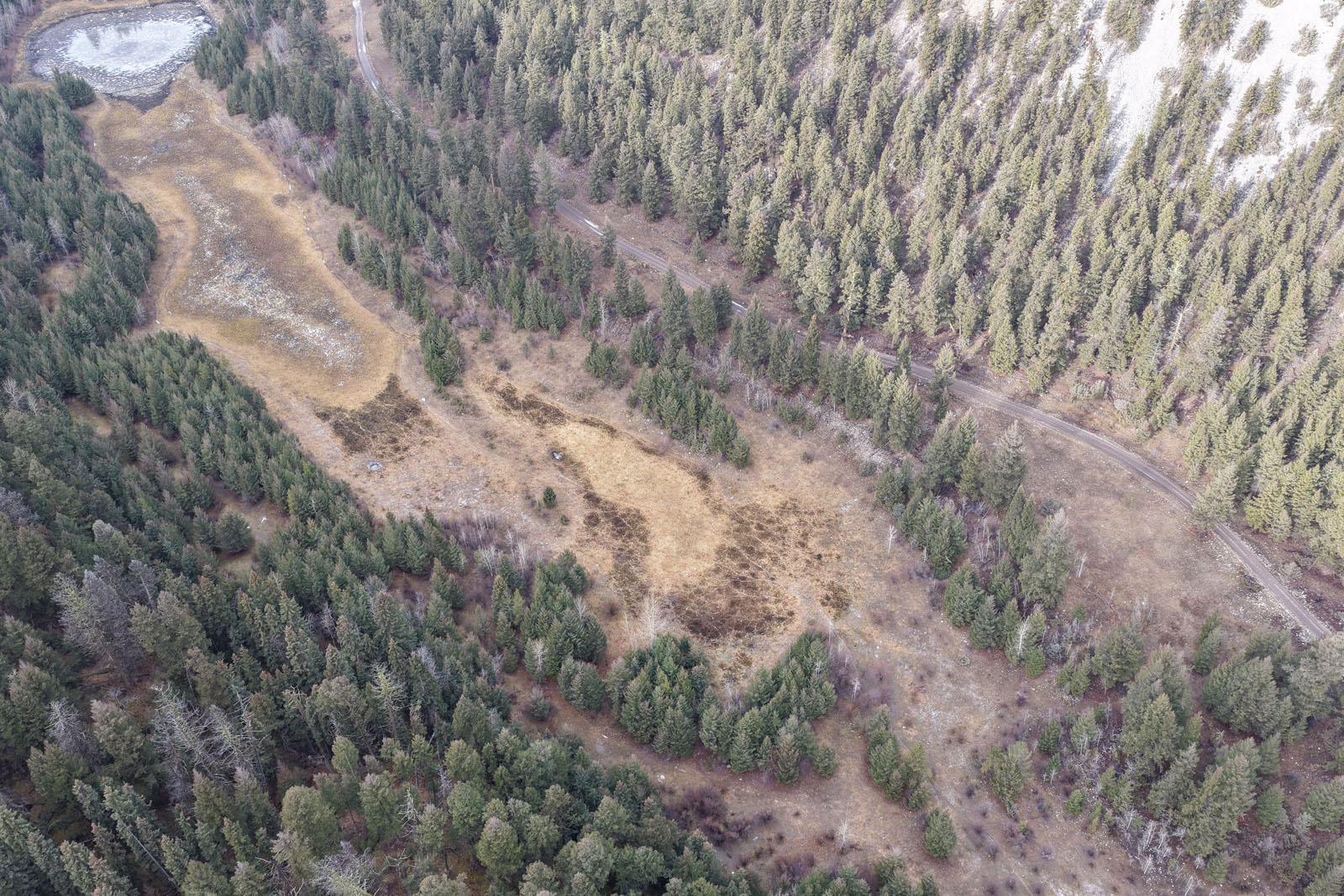
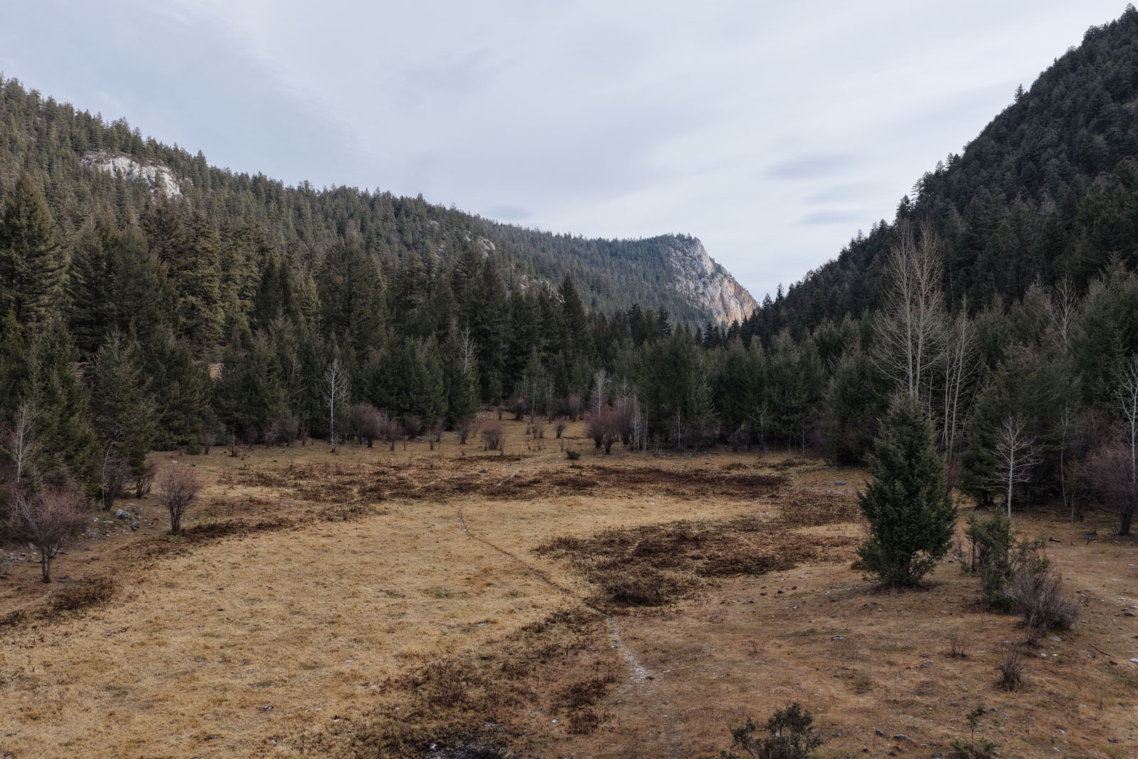
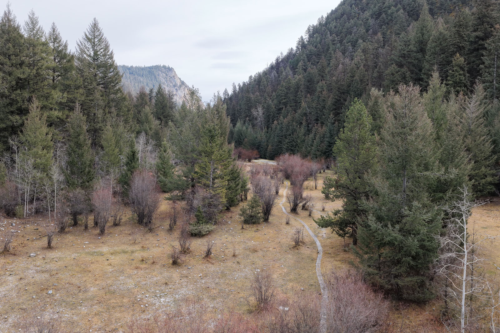
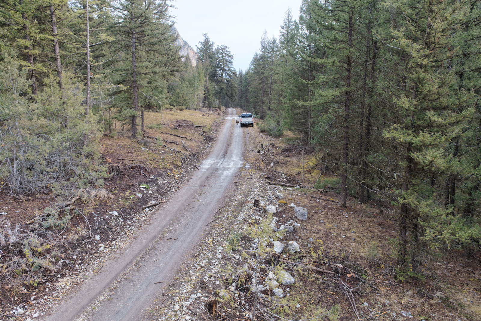
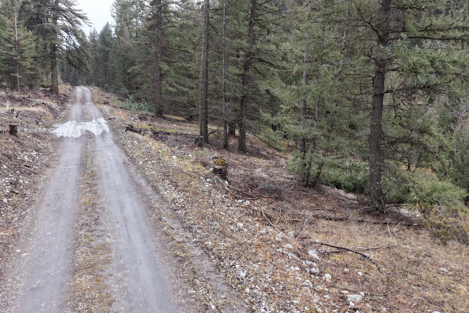
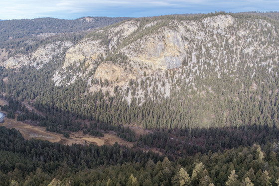
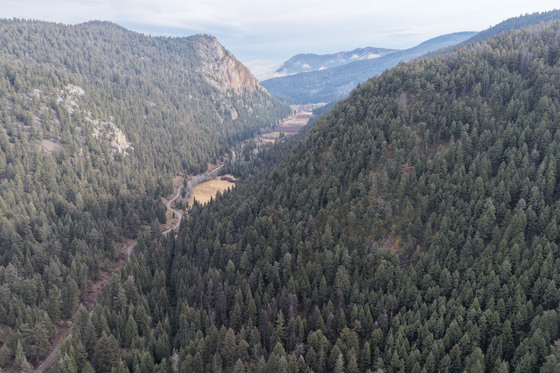
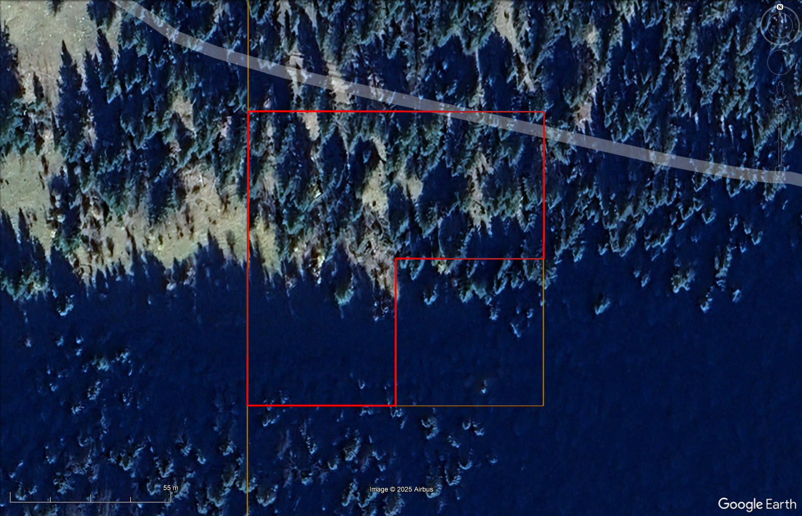
1.91-acre vacant parcel of land surrounded by Crown land and nearby multiple provincial parks, including Oregon Jack Park protects a spectacular limestone canyon and falls (the Notch) on Oregon Jack Creek, as well as wetlands above the falls. The property is located along Hat Creek Road, where the section of road that runs past the property is seasonally accessible. The road in not maintained in the winter months and is in average shape.
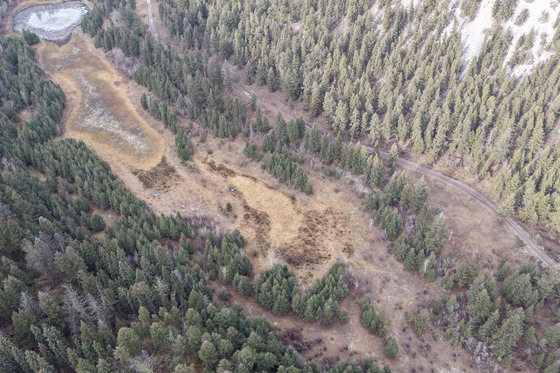
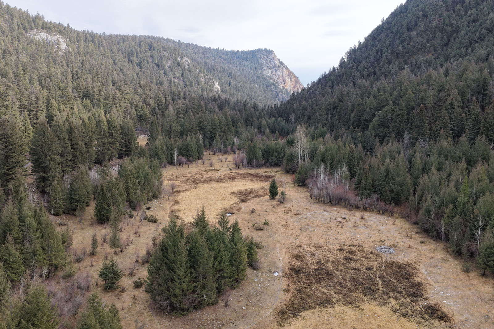
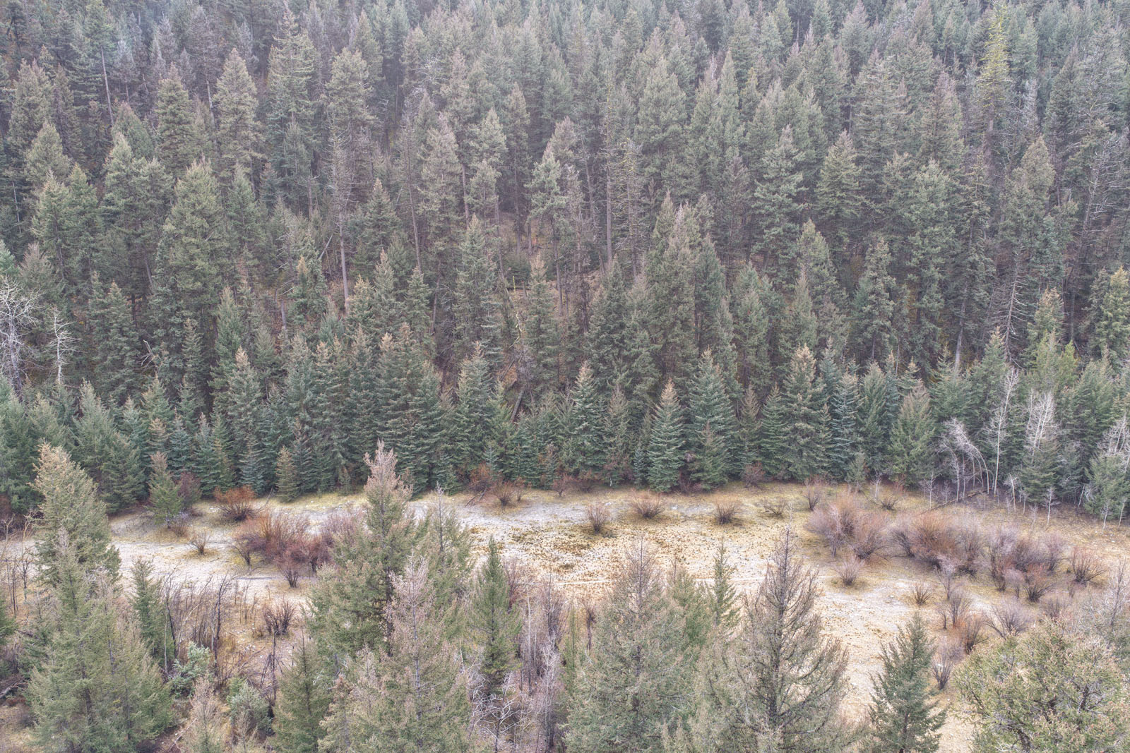
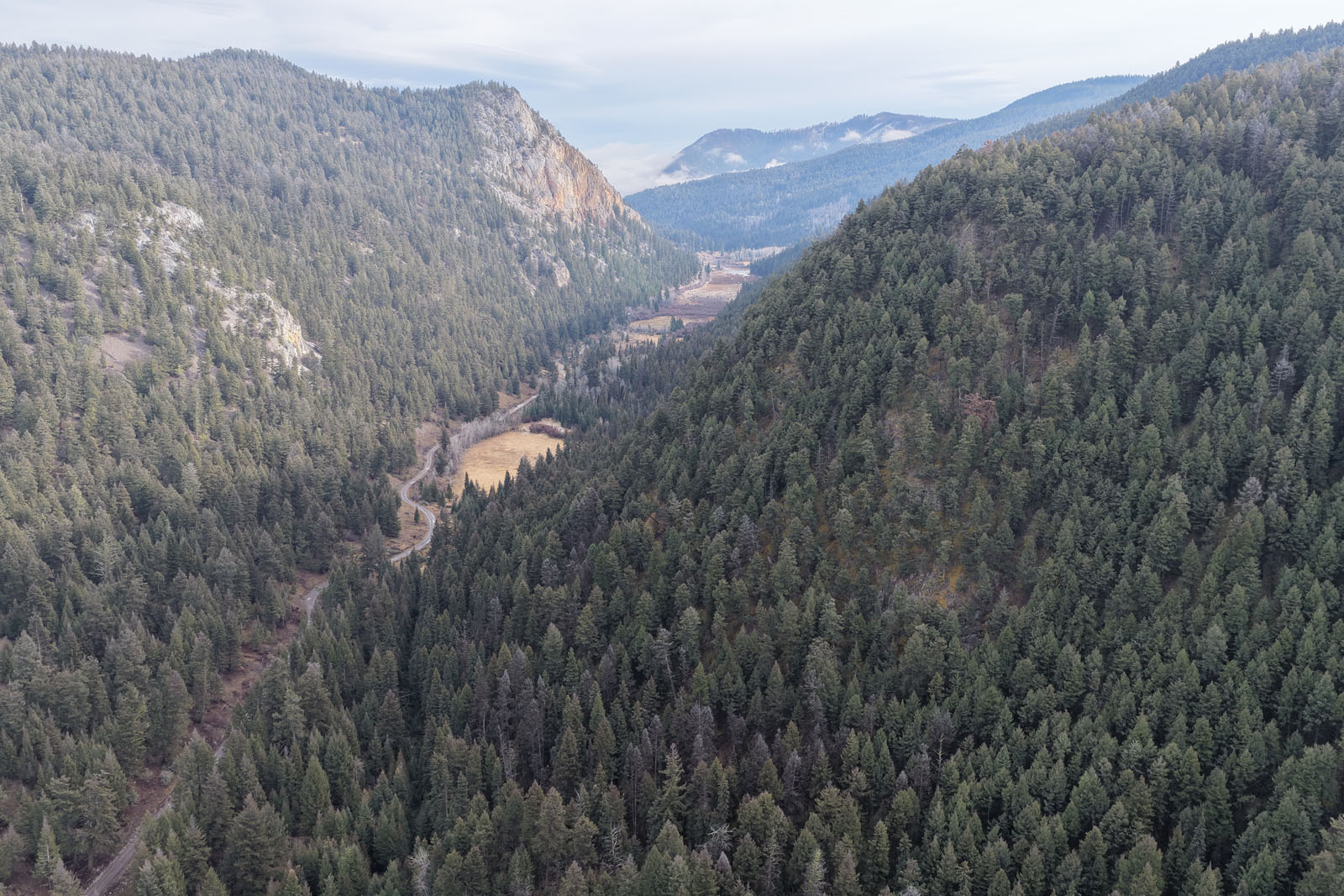
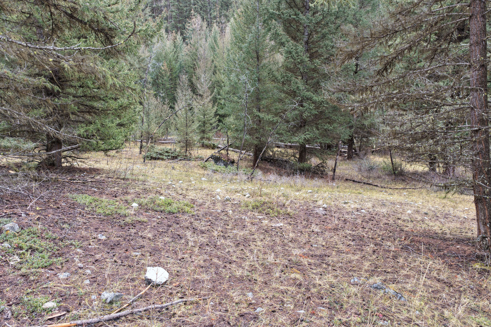
This property and a small half-acre neighboring lot are the only privately owned properties for over 2 km in every direction. The views are excellent taking in the valley which runs east west with dramatic cliffs towering on the north side of the valley. There are plenty of roads and ATV trails to explore with a vehicle, snowmobile or on horseback. The hunting in the area is good with a healthy population of mule deer, moose and bears. The property is also close to good fishing lakes, including Blue Earth Lake, which is only 5.6 km from the property as the crow flies. The property itself was actually lakefront many years ago on a lake called Langley Lake, however the lake level has dropped dramatically over the years as the water was redirected from the lake for agricultural purposes, and now only a small pond remains at the far west side of the former lake bed. The property used to have an old historic cabin; however, it unfortunately burnt down several years ago. The property is off the grid, with no servicing.
This is the perfect affordable option to use as you homebase and launch point for exploring the incredible outdoor recreation the area has to offer.
Call the listing agent today for more information or to book a time to go by for a look.
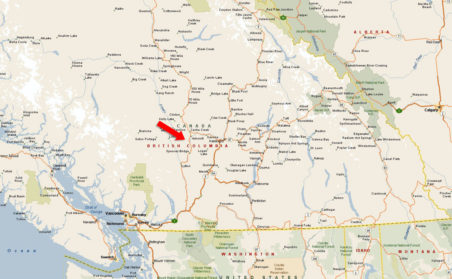
SE 1/4 Hat Creek Road - Ashcroft, BC
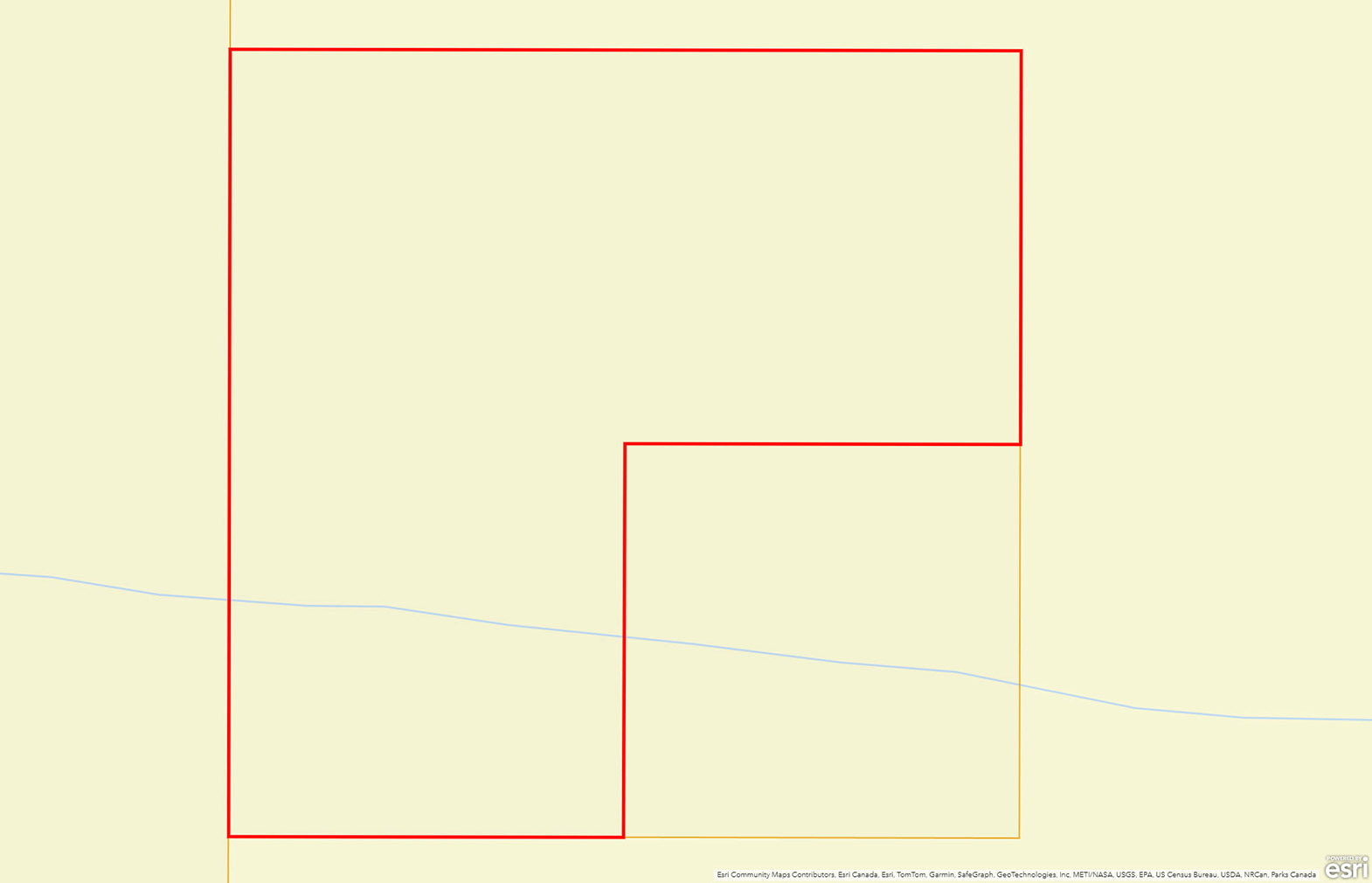
Please see the mapping section of this listing for detailed location and boundaries.
Ashcroft is a village in the southern Interior of British Columbia, located in the Thompson Country region. The climate is exceptionally dry, with the hills surrounding the village covered in sagebrush rather than forest, a landscape often described as Canada’s only true desert environment. Residents enjoy a gentle-paced, affordable rural lifestyle—close enough to larger centres to access amenities when needed, yet still offering a quiet small-town feel. The community vibe is characterized by friendly neighbours, a strong sense of place, and a natural setting that invites outdoor living. Because of its unique climate and terrain, living in Ashcroft means embracing openness, dry air, wide skies, and a landscape unlike that of coastal or dense forested regions.
Hat Creek Valley, including the Upper Hat Creek area, lies within the same southern Interior region of British Columbia and is characterized by broad open grasslands, rolling woodland hills, and ranching-based land use. Rather than a dense village, this community is spread out, with large parcels of land used for grazing cattle and hay production. In terms of lifestyle, the vibe is deeply rural: life is shaped by the land, the seasons, and long-standing ranch families. The setting is quiet, expansive, and grounded in nature and open space. Residents value the connection to wide-open skies, the rhythm of ranching, and a strong sense of heritage tied to the land. Service levels are more limited compared to village centres, and the community leans toward solitude, deep connection with nature and wide-ranging views rather than a compact town centre.
Recreation around Ashcroft and Hat Creek is diverse and closely tied to the region’s natural landscapes. The desert climate and scenic hills create excellent terrain for hiking, horseback riding, and off-road exploration, with popular local trails and viewpoints overlooking the Thompson River canyon. In warmer months, the nearby Bonaparte and Thompson Rivers are known for fishing, canoeing, and wildlife viewing, while the Ashcroft and Cornwall Hills areas attract photographers and birdwatchers with their sweeping views and unique vegetation. Within a short drive, visitors can enjoy Marble Canyon Provincial Park with its turquoise lakes and limestone cliffs, or Juniper Beach Provincial Park for camping and river access. The nearby town of Cache Creek offers additional outdoor amenities, and the wider region provides opportunities for winter recreation such as snowshoeing and cross-country skiing in the higher elevations surrounding the valley. Together, Ashcroft and Hat Creek offer a balance of quiet rural charm, heritage tourism, and easy access to some of the most scenic outdoor destinations in the southern Interior of British Columbia.
Established in the late 1800s, Ashcroft was a key supply and transport hub during the Cariboo Gold Rush. When the Canadian Pacific Railway arrived in the 1880s, it transformed the area into a major shipping point for goods headed north to the Cariboo and beyond. The village grew around agriculture, ranching, and trade, becoming one of the more enduring settlements in the Thompson River Valley. Hat Creek, located northwest of Ashcroft, also rose to prominence during the gold rush era as a rest stop for travelers and freight wagons along the Cariboo Wagon Road. The area’s open grasslands became home to ranches that continue to operate today, many tracing their roots back to the mid-19th century. The Historic Hat Creek Ranch, preserved as a heritage site, offers a glimpse into early pioneer and stagecoach life in the Interior.
Please see mapping section, all boundaries are approximate.
50°38'31.01"N and 121°32'4.65"W
None
$344.71 (2025)
RL-1
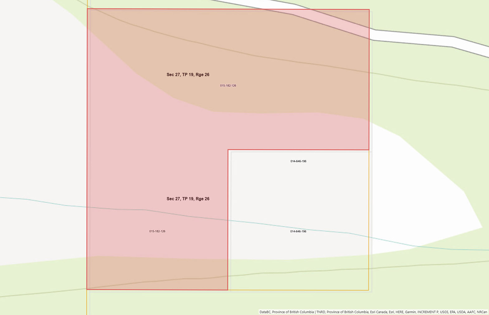
THE FRACTIONAL SOUTH WEST 1/4 OF THE FRACTIONAL SOUTH WEST 1/4 OF FRACTIONAL LEGAL SUBDIVISION 12 OF SECTION 27 TOWNSHIP 19 RANGE 26 WEST OF THE 6TH MERIDIAN KAMLOOPS DIVISION YALE DISTRICT AS SHOWN ON THE PLAN OF THE NORTH EAST 1/4 OF SAID TOWNSHIP DATED AT OTTAWA THE 10TH DAY OF MAY 1921, EXCEPT THEREOUT THE FRACTIONAL SOUTH EAST 1/4 THEREOF
PID 015-182-126
 +8 maps
Our property descriptions and geographical information are taken from the BC Assessment Authority, Land Titles Office, government maps and other sources. While LandQuest® does not guarantee the information, we believe it to be accurate, but should not be relied upon without verification. This communication is not intended to cause or induce breach of an existing agency agreement.
Ashcroft
 0℃
0℃
 -4℃
-4℃