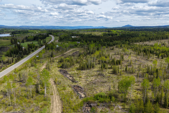
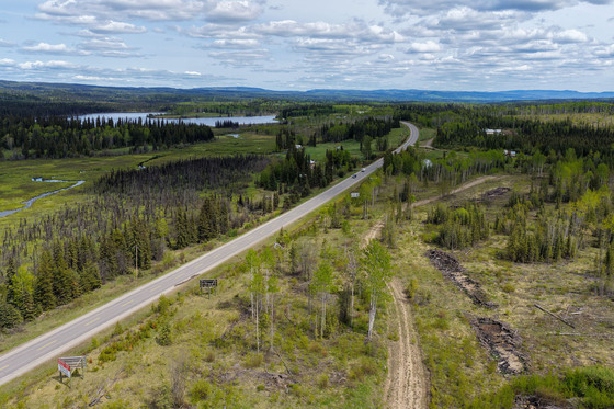
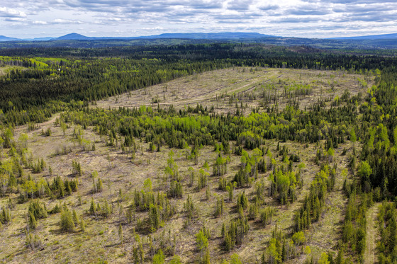
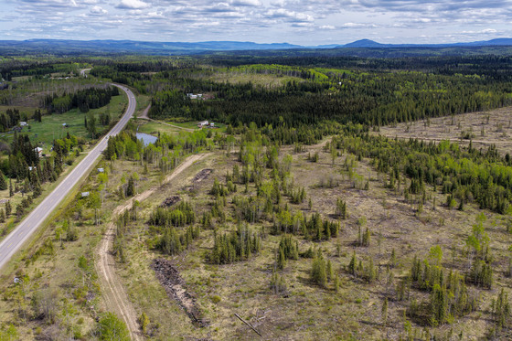
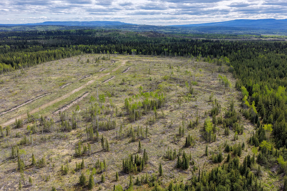
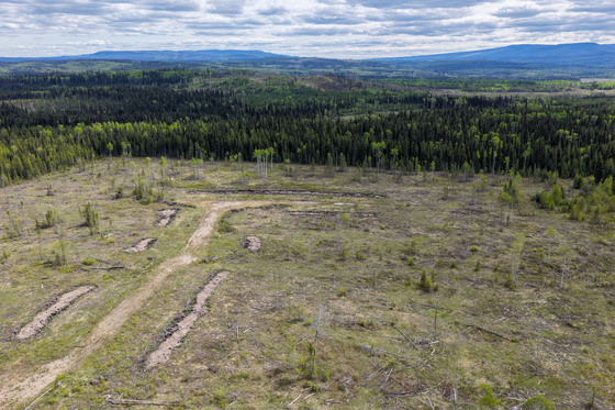
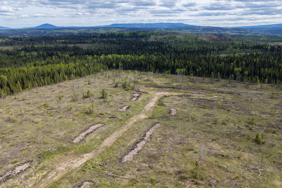
Located along Highway 16 between Burns Lake and Topley, cleared lot perfect for building a country home, with flexibility for barns, shops, or agricultural use. profitable billboard business generating $11,000 annually. Expansion opportunities in a prime, accessible location.
Foreign Buyer Ban does not apply to this property
 +17 photos
Located along Highway 16 between Burns Lake and Topley, Sturgeon Road offers a unique opportunity to combine rural living with a reliable income-generating business. This large, cleared lot is ideal for building your dream country home while supporting additional developments like barns, shops, or farm equipment storage. Zoned H2 and not in the Agricultural Land Reserve (ALR), the property provides significant flexibility for residential and small-scale agricultural use, making it perfect for those seeking a balance between work and leisure. Its prime location along a well-traveled highway ensures excellent visibility and accessibility, enhancing its appeal for both personal and business use.
The property features an established billboard business that generates consistent annual income, with 12 of 16 billboard slots currently rented, bringing in $11,000 per year and potential to reach $16,000 at full occupancy. Each 8' x 16' billboard side rents for $1,020 per year (plus GST). With easy road access and ample space for expansion, this turnkey business offers stability and the opportunity to further maximize revenue while enjoying the serenity of rural living.
GST is applicable on the price.
DL 3513 - Sturgeon Road - Burns Lake, BC
Contact the listing agent.
The Lakes District of Northern BC is a stunning region with over 300 wilderness fishing lakes and 3,000 miles of pristine shoreline, stretching from the Stikine Mountains to the Omineca Range, with Ootsa Lake in the south and Babine Lake to the north. Burns Lake, with a population of 2,800, serves as the commercial hub for over 8,000 residents in surrounding communities like Francois Lake, Grassy Plains, and Granisle. The town supports industries such as logging, mining, and tourism and offers a variety of services, including pubs, cafés, stores, hotels, and a hospital. It also houses the Bulkley-Nechako Regional District offices. Burns Lake Airport is nearby, with connections to larger airports in Smithers and Prince George, and VIA Rail stops here on its scenic Jasper-to-Prince Rupert route. The area enjoys abundant sunshine, including a record 376.5 hours in June 1982, with warm summers averaging 21°C in July and snowy winters averaging -15.3°C in January.
Burns Lake has gained world-renowned recognition from the International Mountain Biking Association for its network of trails on Boer Mountain. The trails, maintained by a volunteer group called Burns Lake Mountain Biking Association, include 20 km of downhill and 40 km of cross-country trails. The trails continue to draw mountain bikers from all over the world and are expanding every season.
In the winter months cross-country skiing is very popular at the Omineca Ski Club. Its facilities have hosted several national championships and are considered to rank among western Canada's best trail networks. The facilities include 25 km of groomed trails, four km of which are lit for nighttime skiing. There is also a facility for biathlon skiing.
In 2014 The Village of Burns Lake completed work on the Lakeside Multiplex and renovations to the Tom Forsyth Memorial Arena. This facility includes a hockey rink, curling rink, rock climbing gym, a squash/racquetball court, a fitness facility and multi-use rooms. The facility is located on Spirit Square, a large outdoor park with a playground, a beach, a walking path, outdoor fitness equipment, two tennis courts and a skateboard park.
The 1.9-kilometre Opal Bed Trail leads to an active rock hounding destination, where users can look for precious minerals. Burns Lake is considered to be the gateway to Tweedsmuir North Provincial Park and Protected Area. The North Park is a wilderness area with no services or supplies; it cannot be accessed by road. Fly-in tours for sightseeing, hunting and fishing are offered by local outfitters.
54°24'39.35"N and 126° 6'47.83"W
Minimum parcel size for this zoning classification is 19.77 acres.
Hydro
$582.94 (2025)
Large Holdings Zone (H2)
LOT A DISTRICT LOT 3513 RANGE 5 COAST DISTRICT PLAN PRP14930, EXCEPT ANY PORTION OF THE RIGHT OF WAY OF THE DOMINION TELEGRAPH LINE HAVING A WIDTH OF 100 FEET WHICH MAY LIE WITHIN THE BOUNDARIES OF THESE LANDS.
PID 023-651-539
Multiple Listing Service®
 +8 maps
Our property descriptions and geographical information are taken from the BC Assessment Authority, Land Titles Office, government maps and other sources. While LandQuest® does not guarantee the information, we believe it to be accurate, but should not be relied upon without verification. This communication is not intended to cause or induce breach of an existing agency agreement.