


Own one of Vancouver Island’s last great coastal holdings. Over 8 km of oceanfront. This extraordinary property includes a professionally planted 25-year-old forest, campground, marina, boat launch, creeks, beaches, sheltered coves. Unmatched opportunity for long-term growth.


 +32 photos
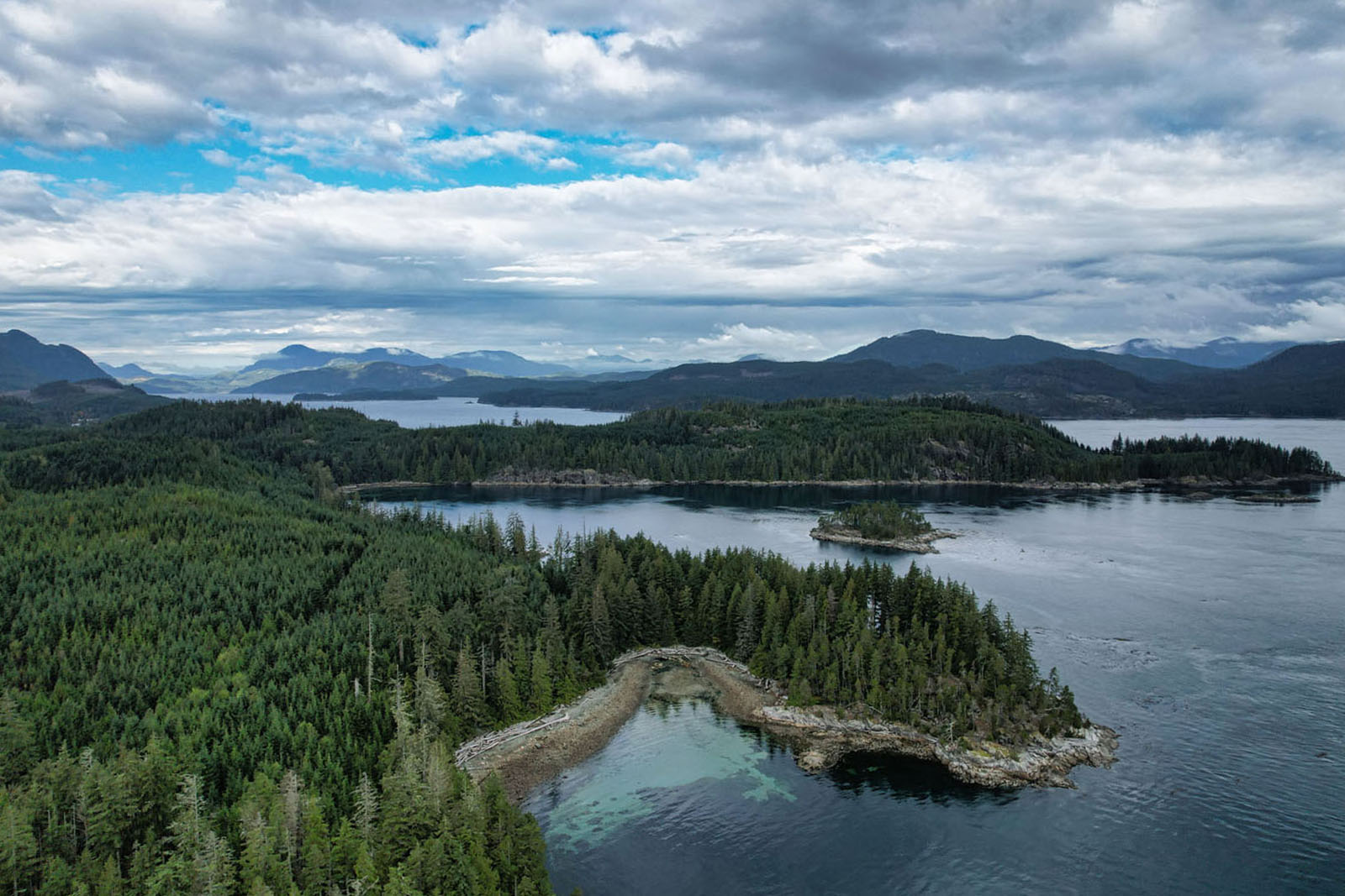
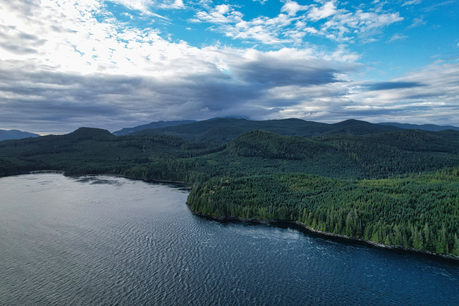
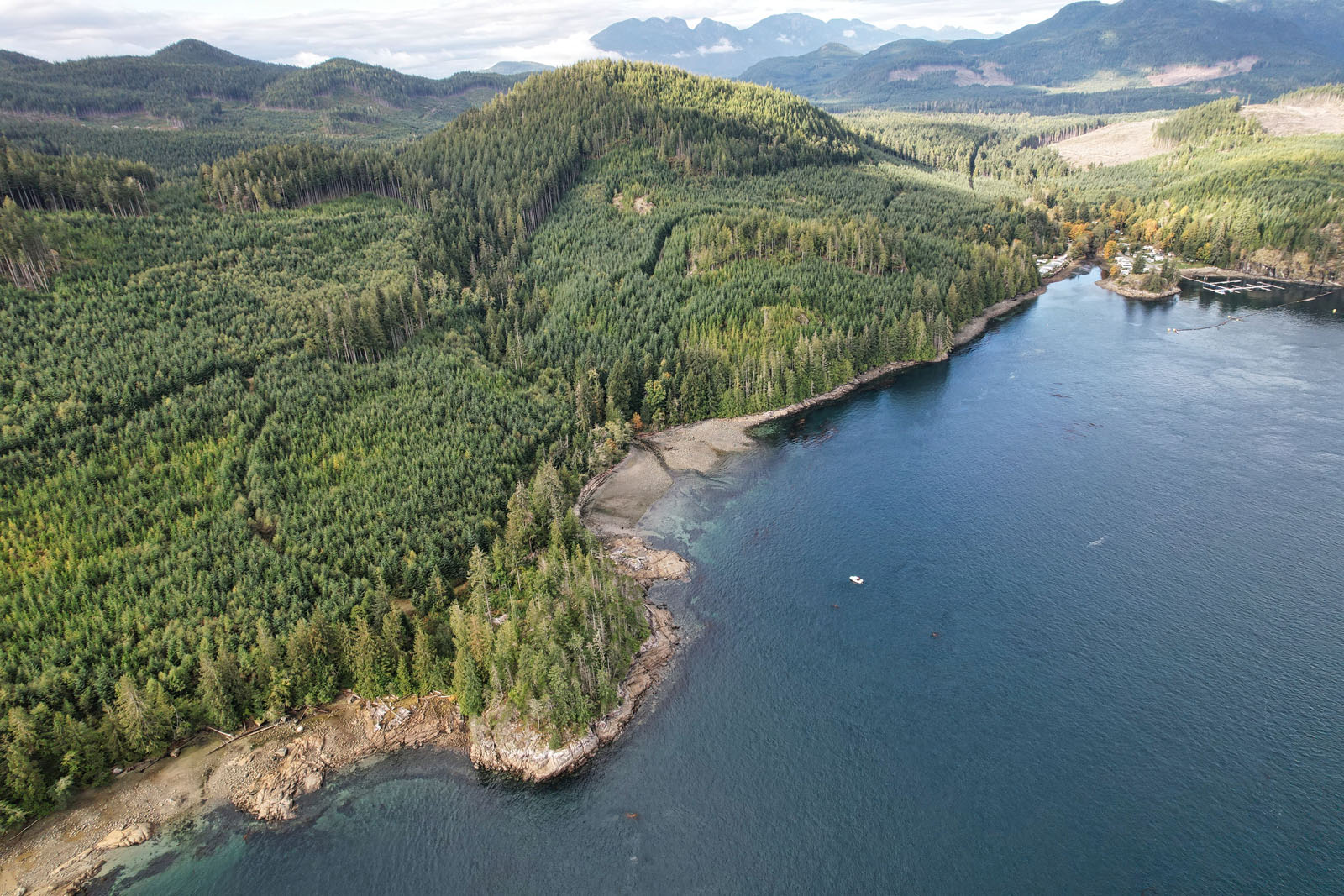

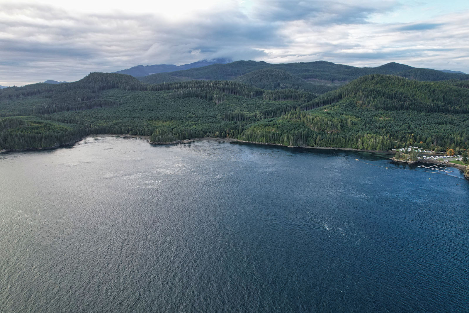
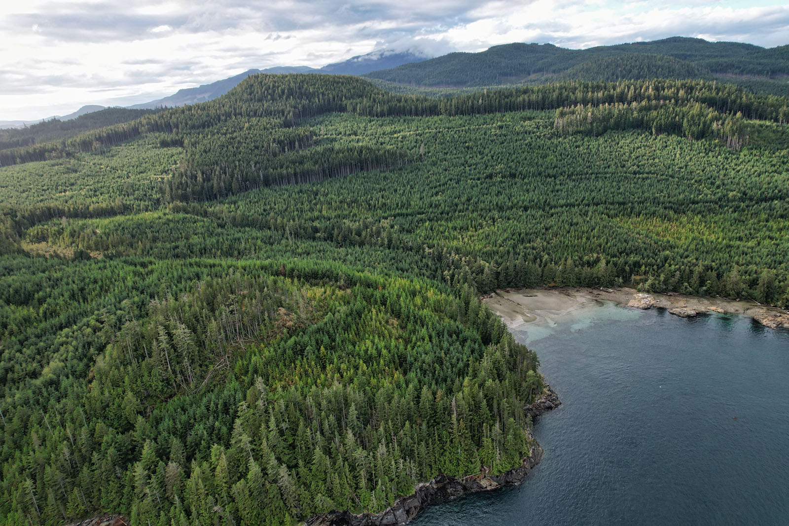
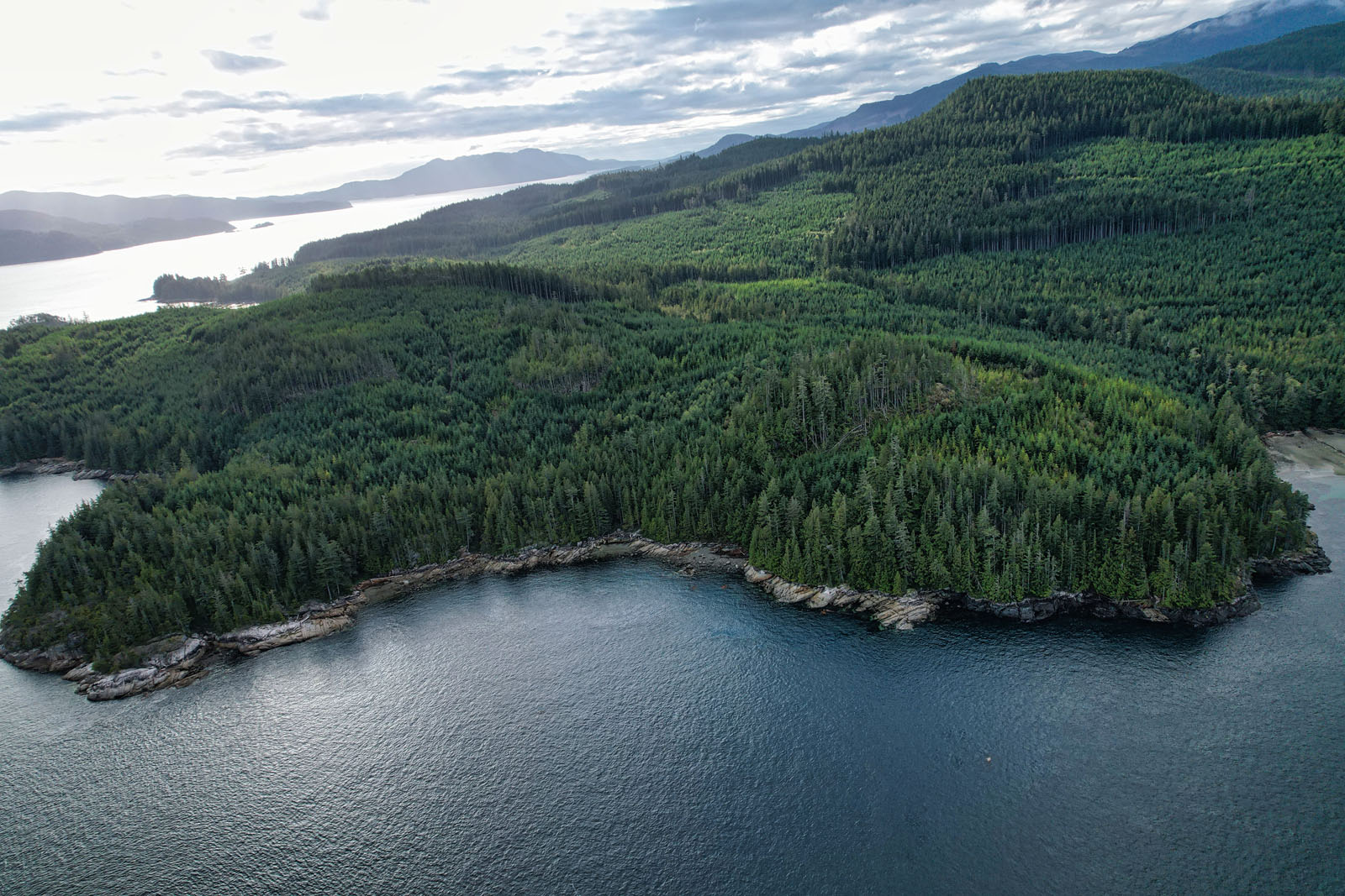
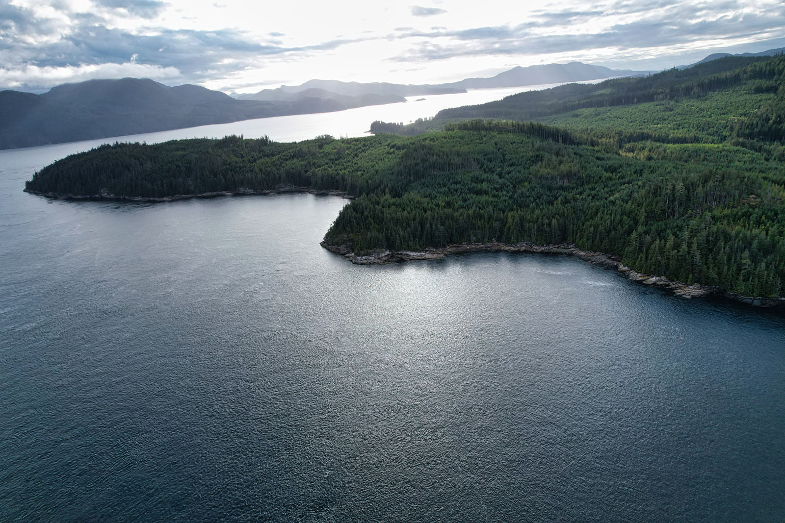
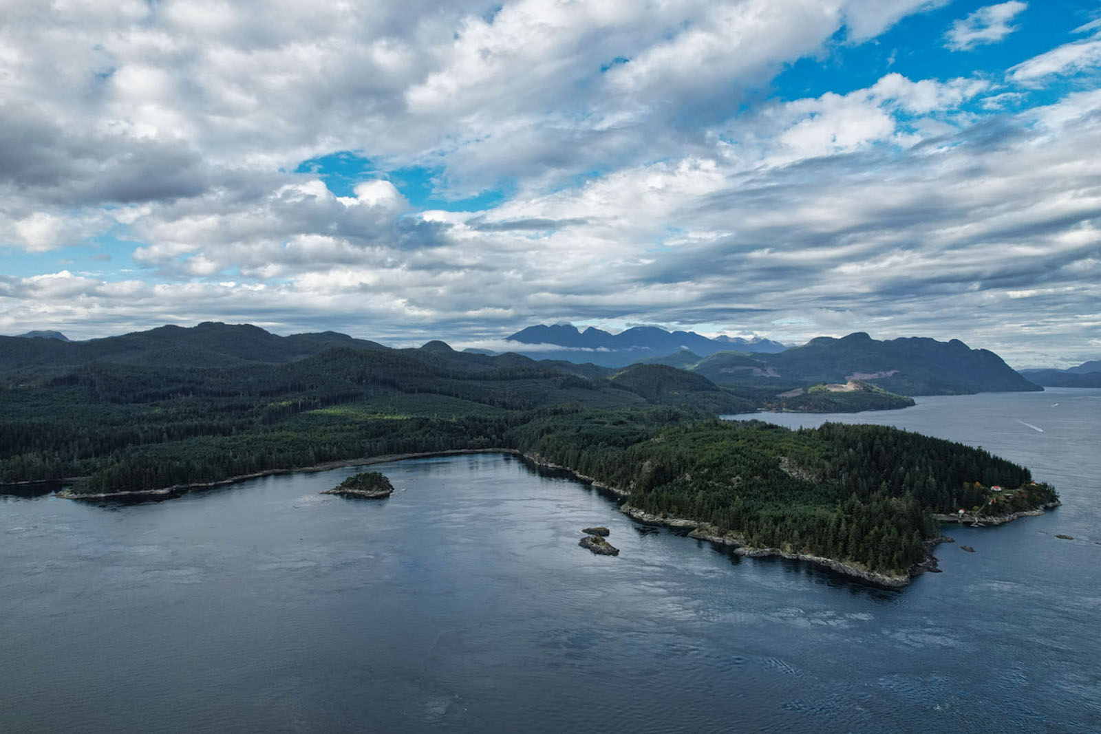
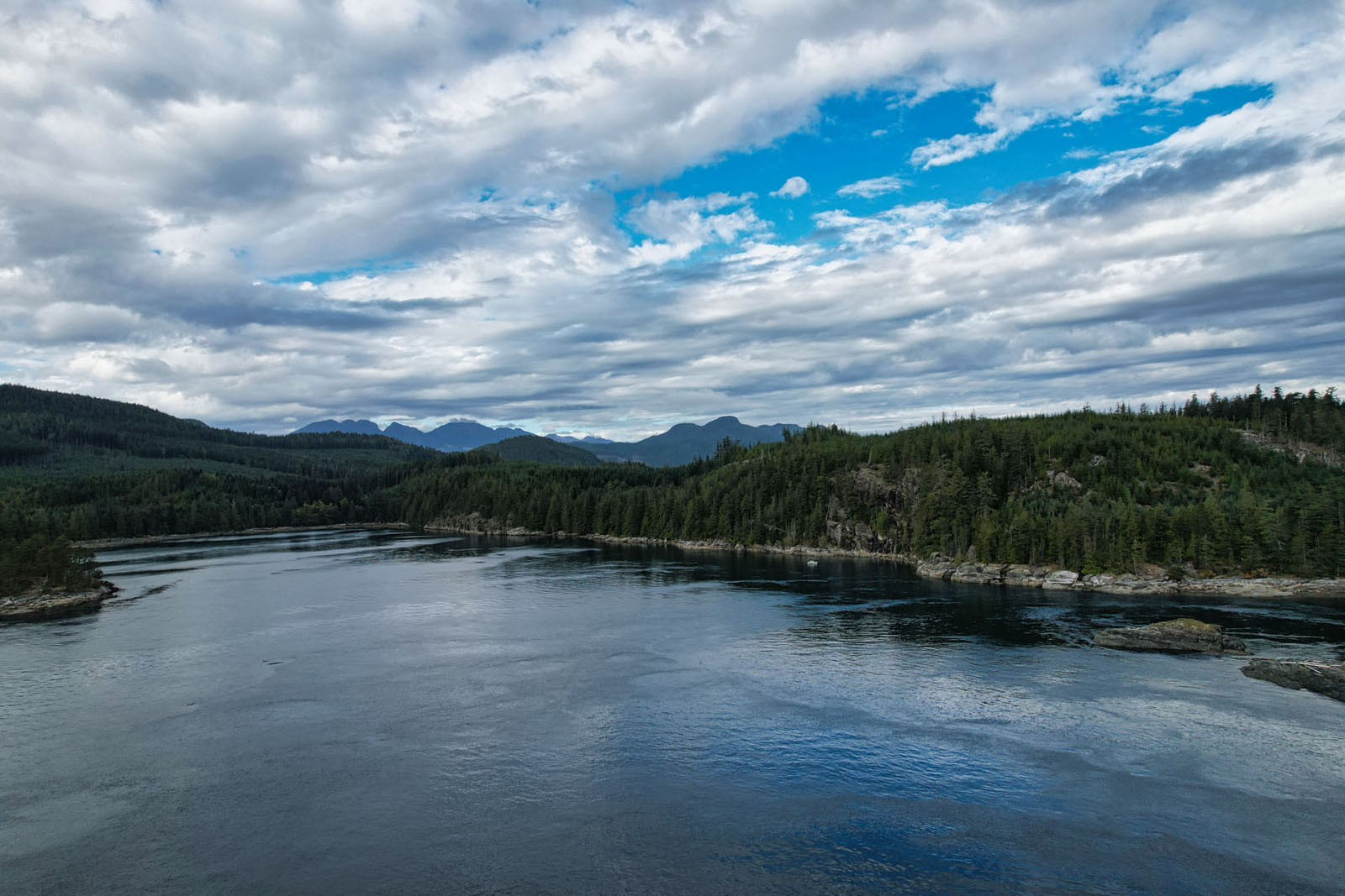
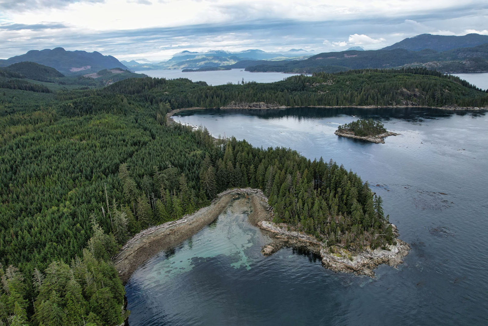
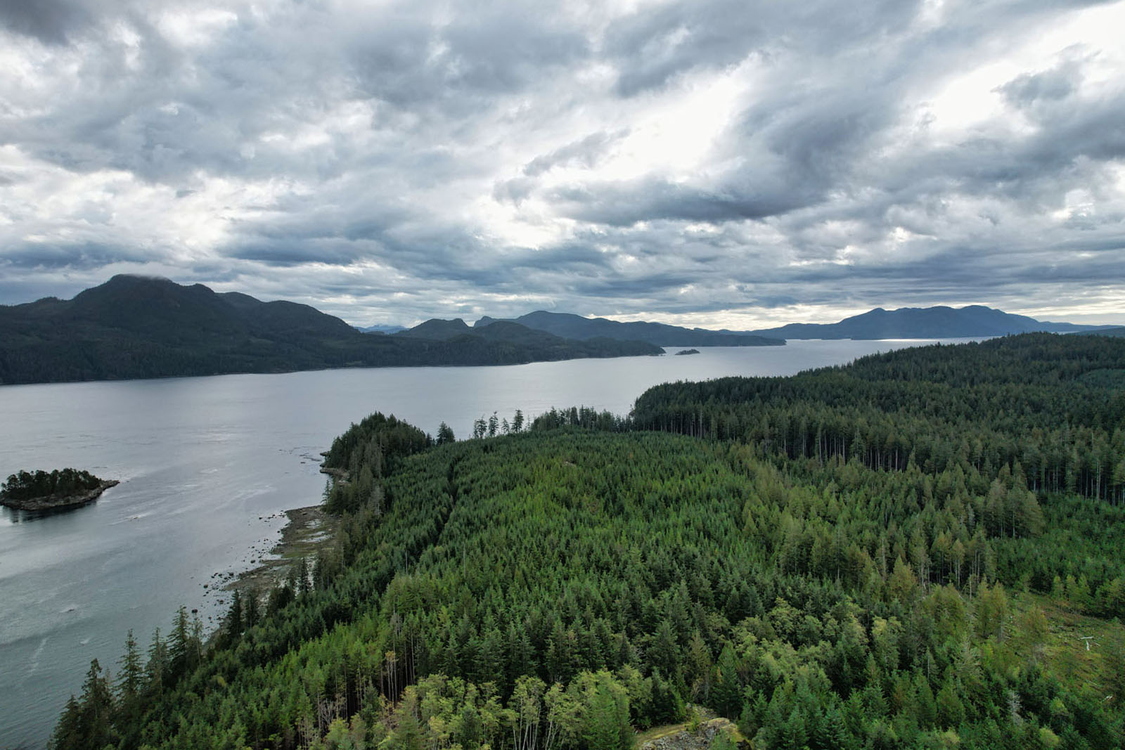
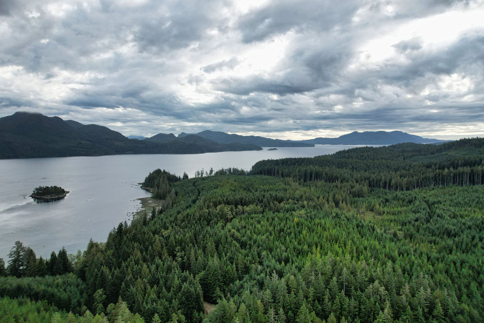
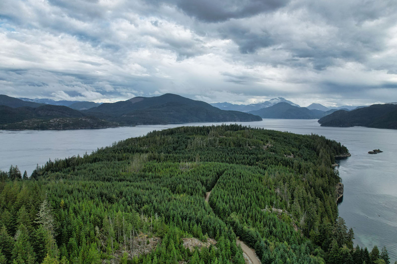
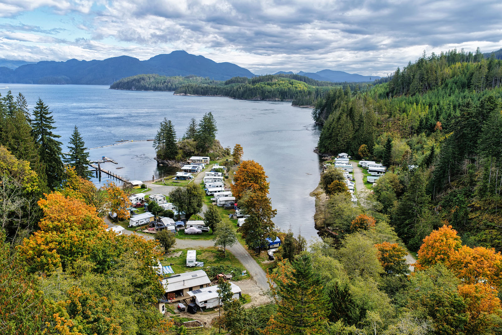
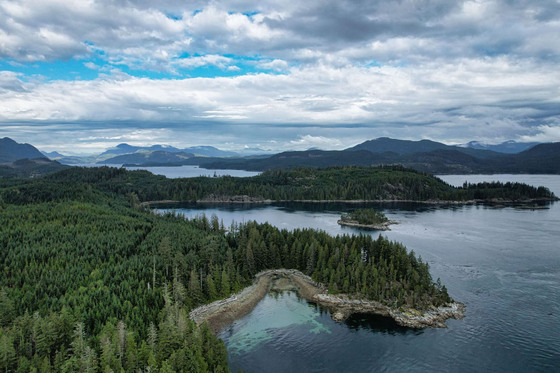
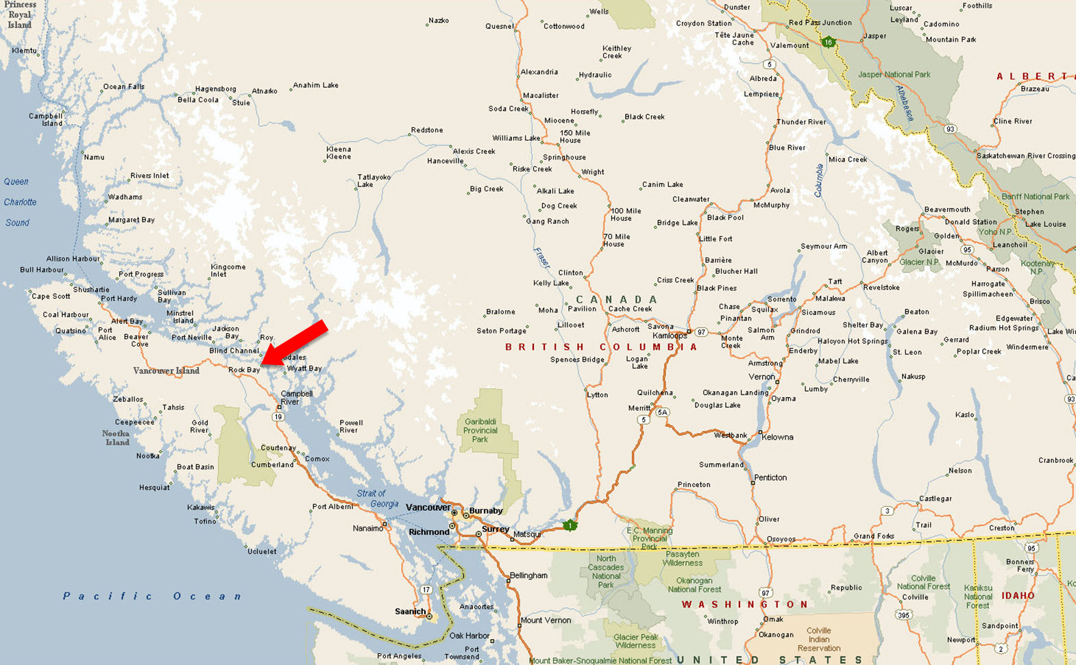
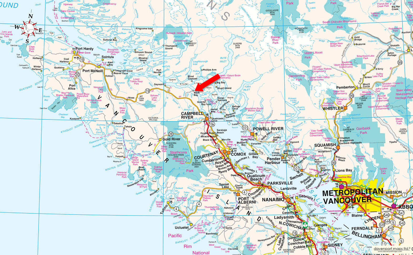
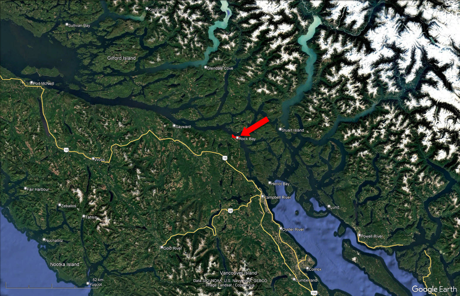
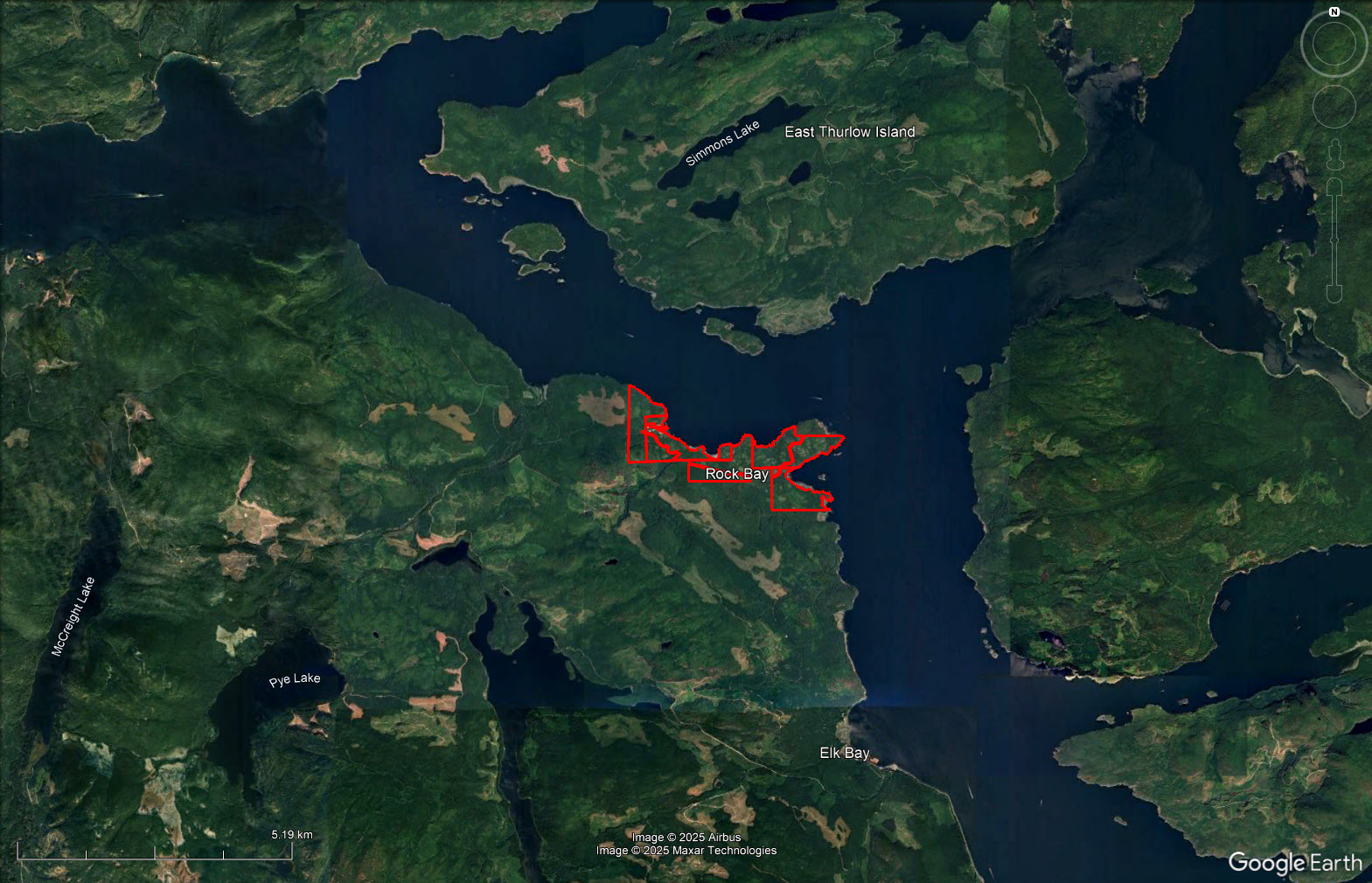
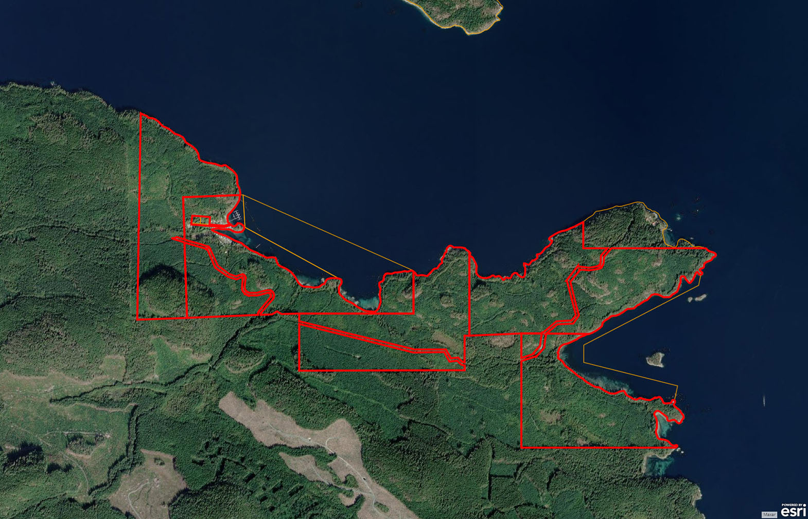
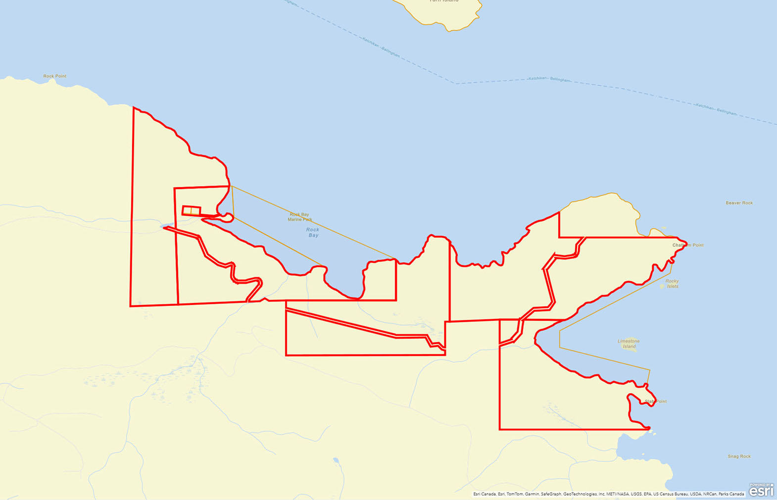
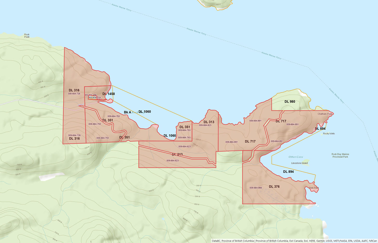
Situated approximately 60 kilometres north of Campbell River, Rock Bay occupies a dramatic point of land along Johnstone Strait, offering an extraordinary 785 acres across five titles and more than eight kilometres of pristine oceanfront. Much of the surrounding foreshore forms part of Rock Bay Marine Park, preserving the area’s wild coastal character for generations to come.
Access is by Rock Bay Forest Service Road, a gravel route maintained seasonally. connecting to Highway 19 roughly 26 kilometres to the south.
This balance of accessibility and seclusion ensures privacy without isolation, an increasingly rare combination on Vancouver Island’s coastline.
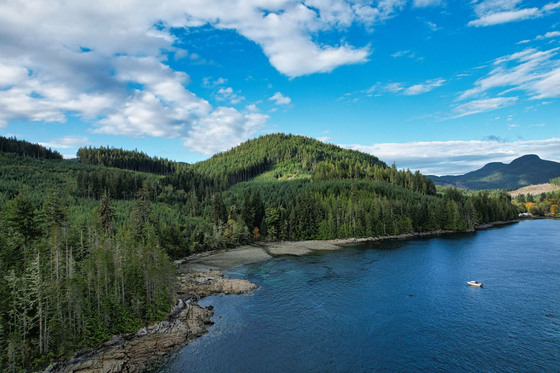
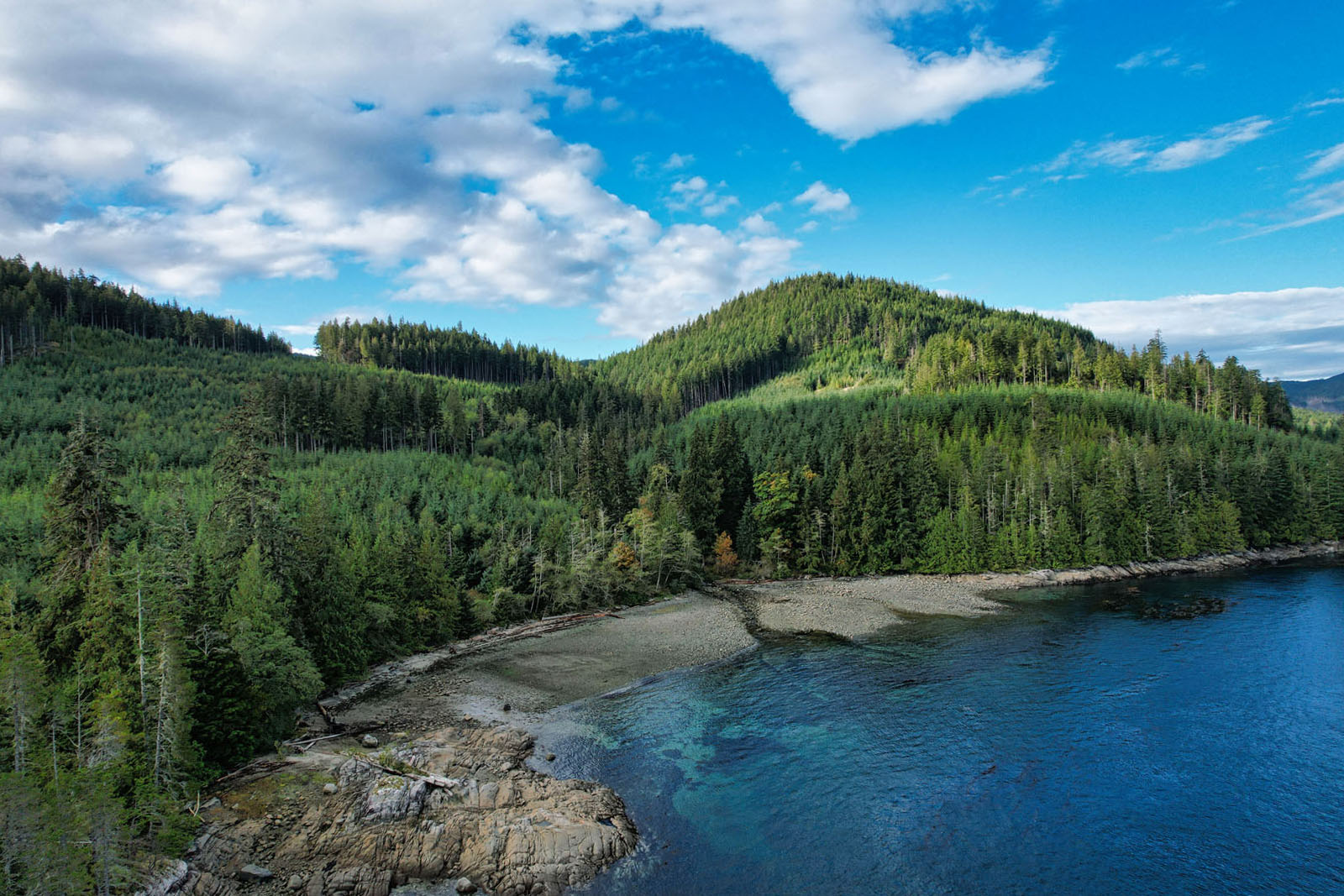
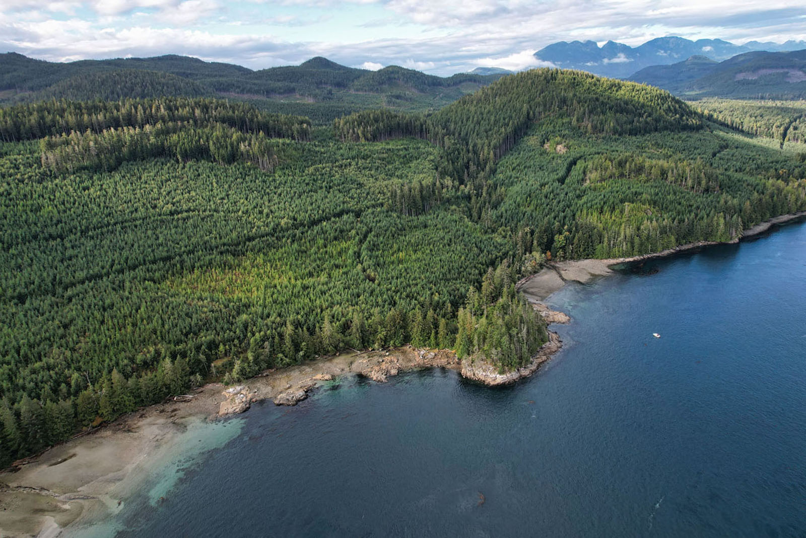
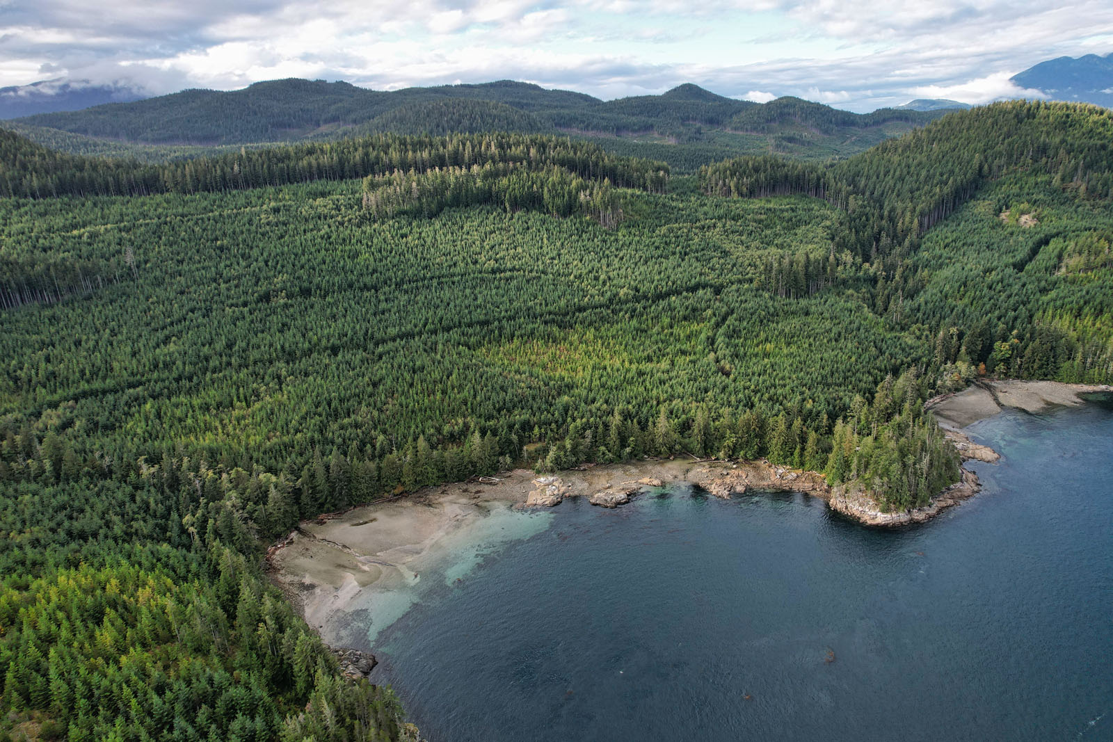
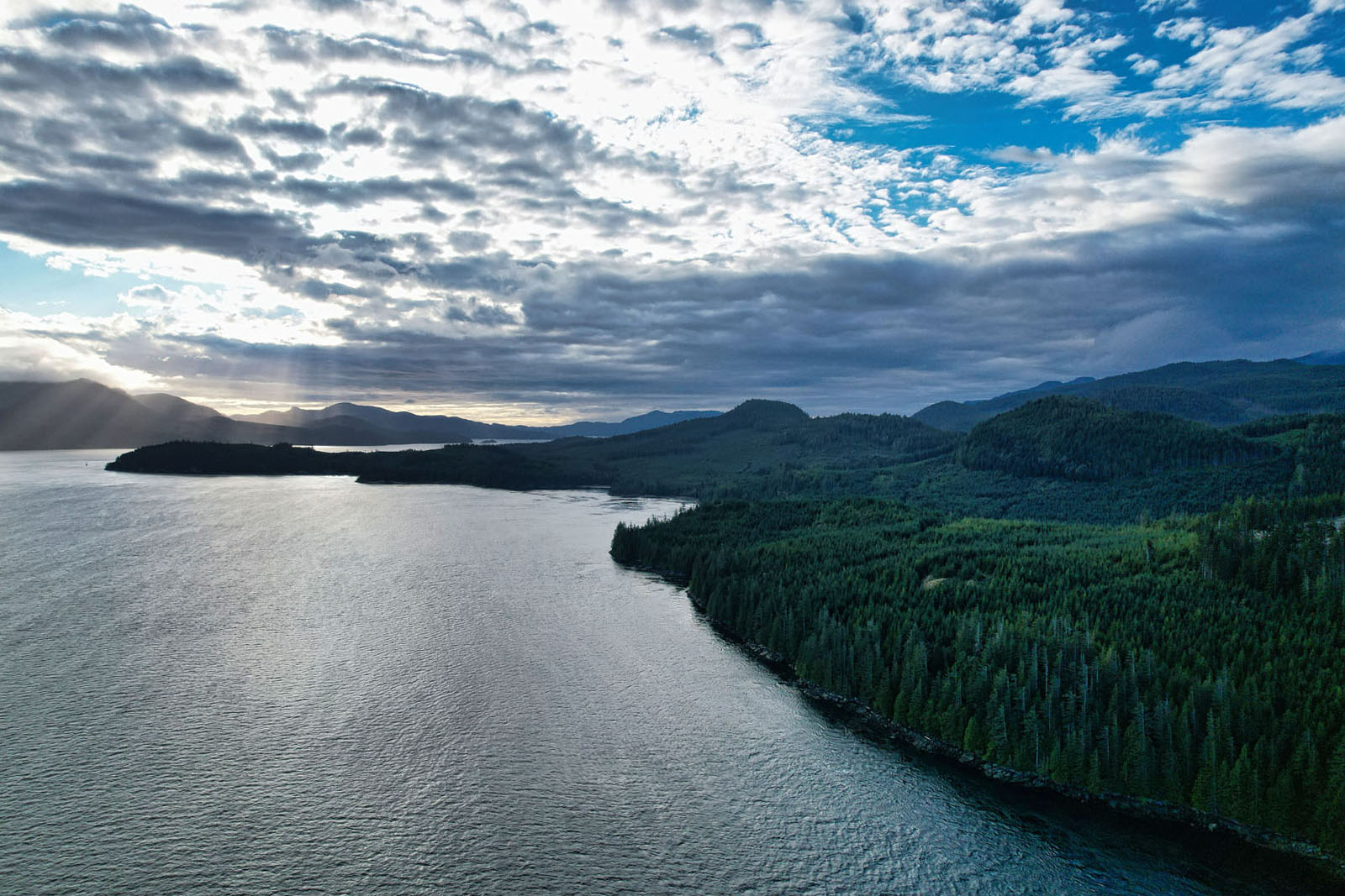
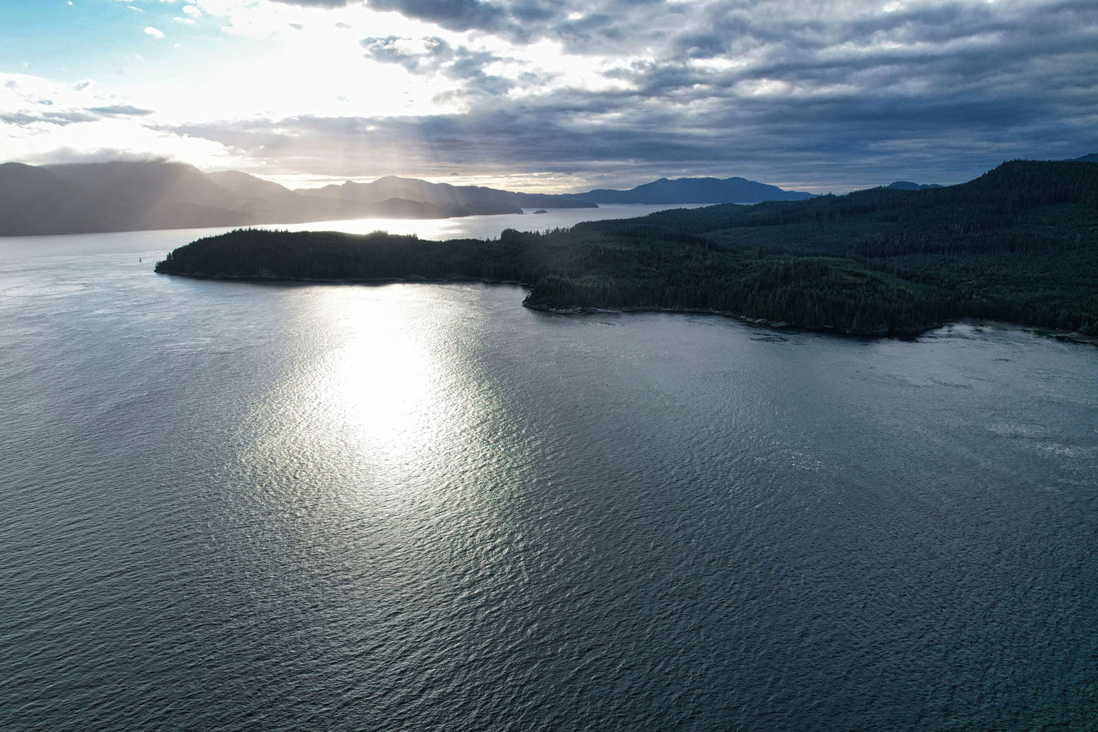
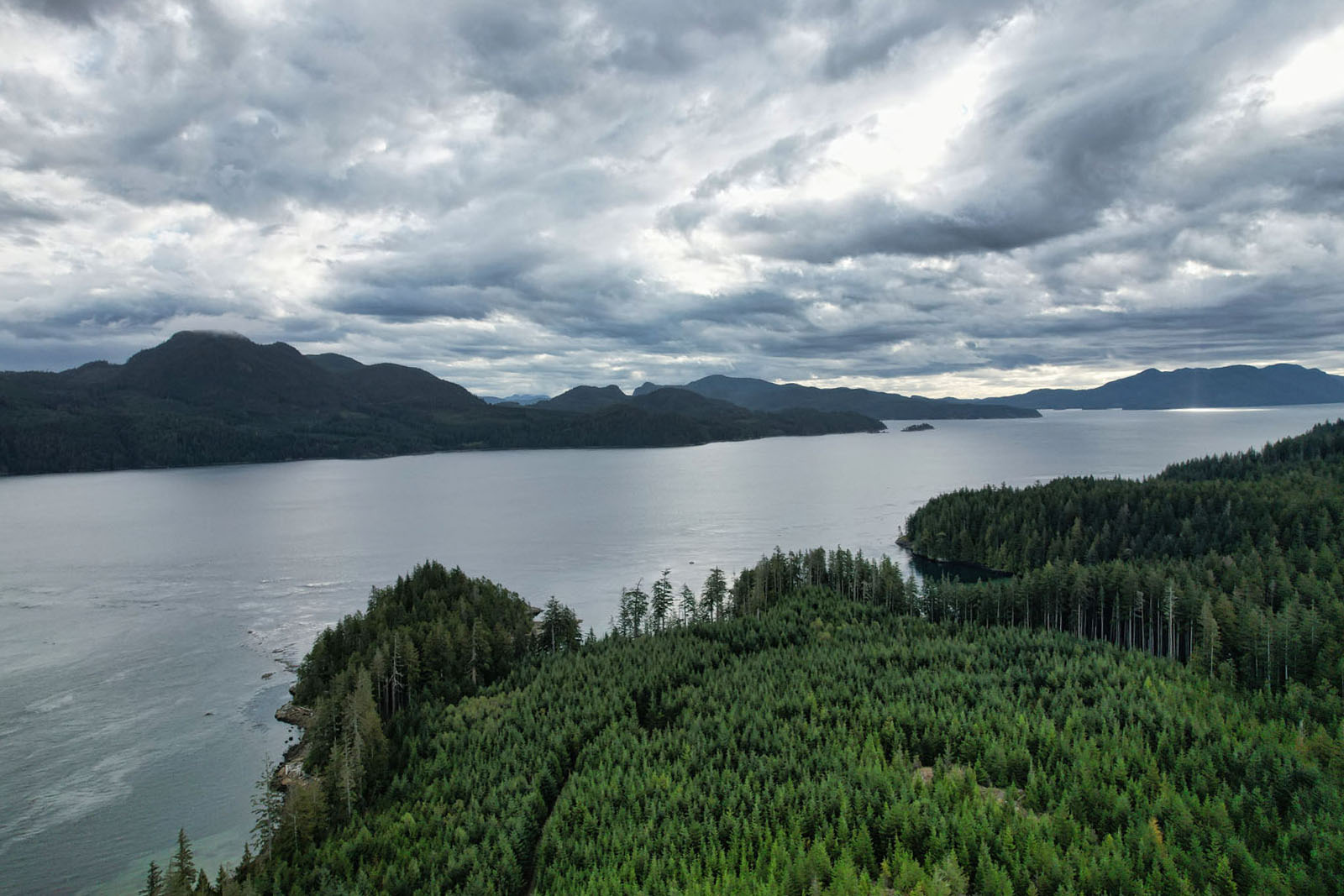
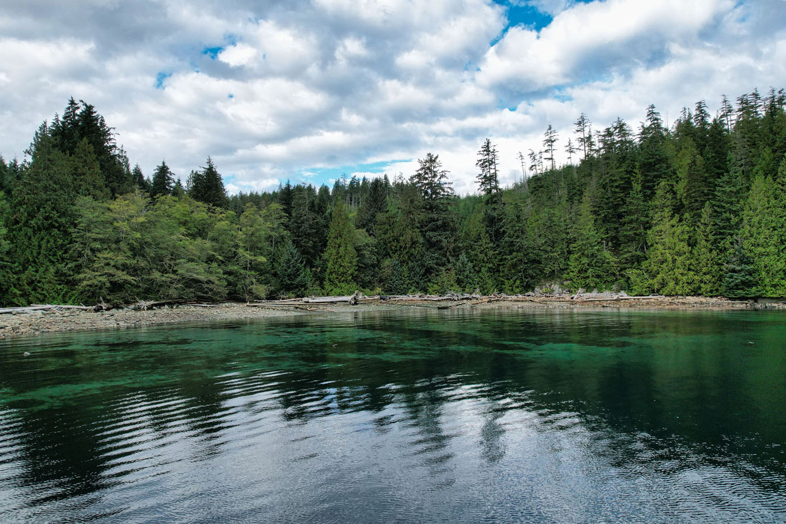
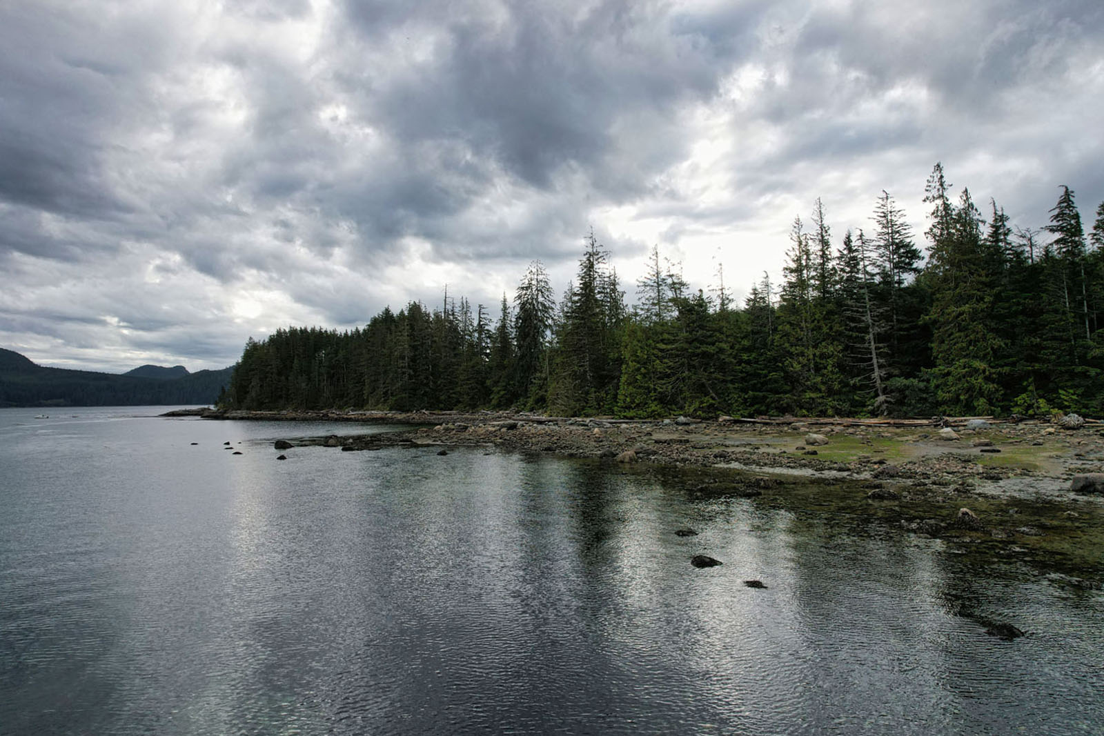
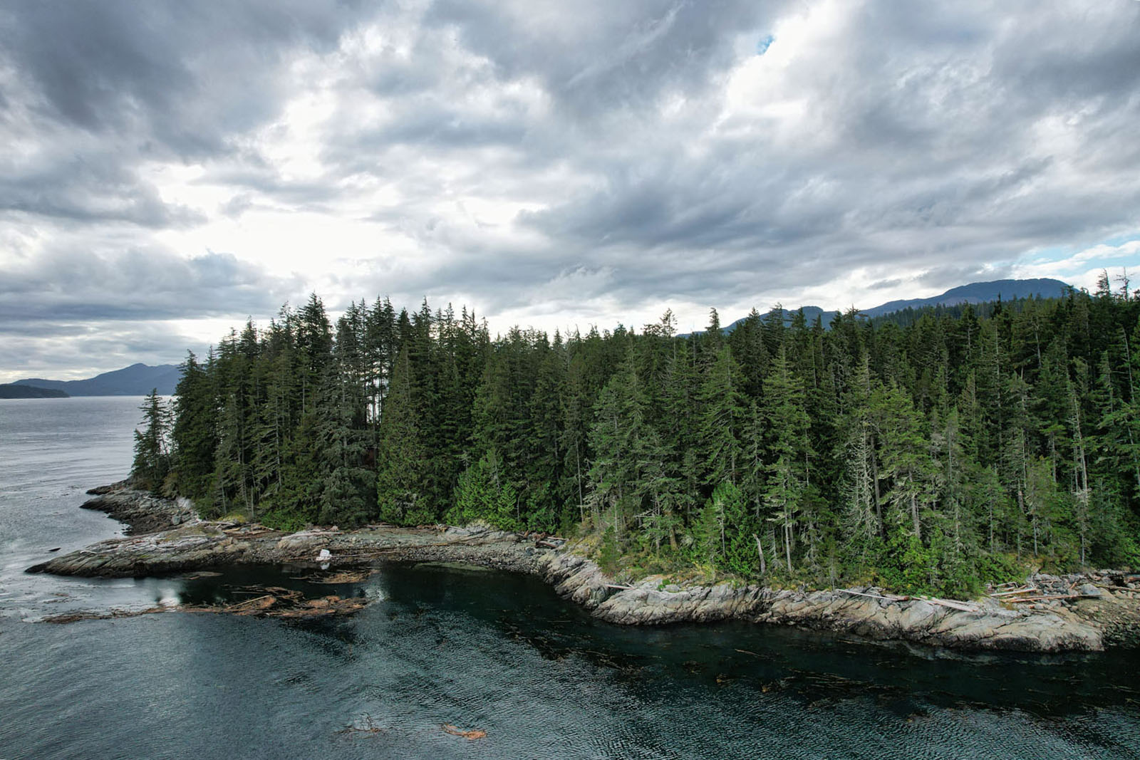
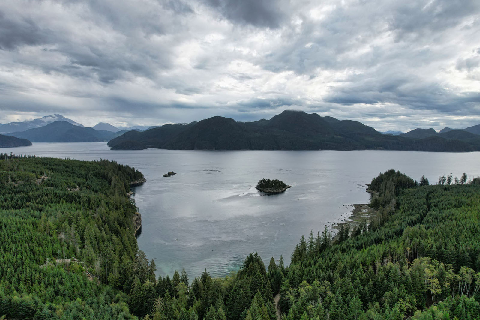
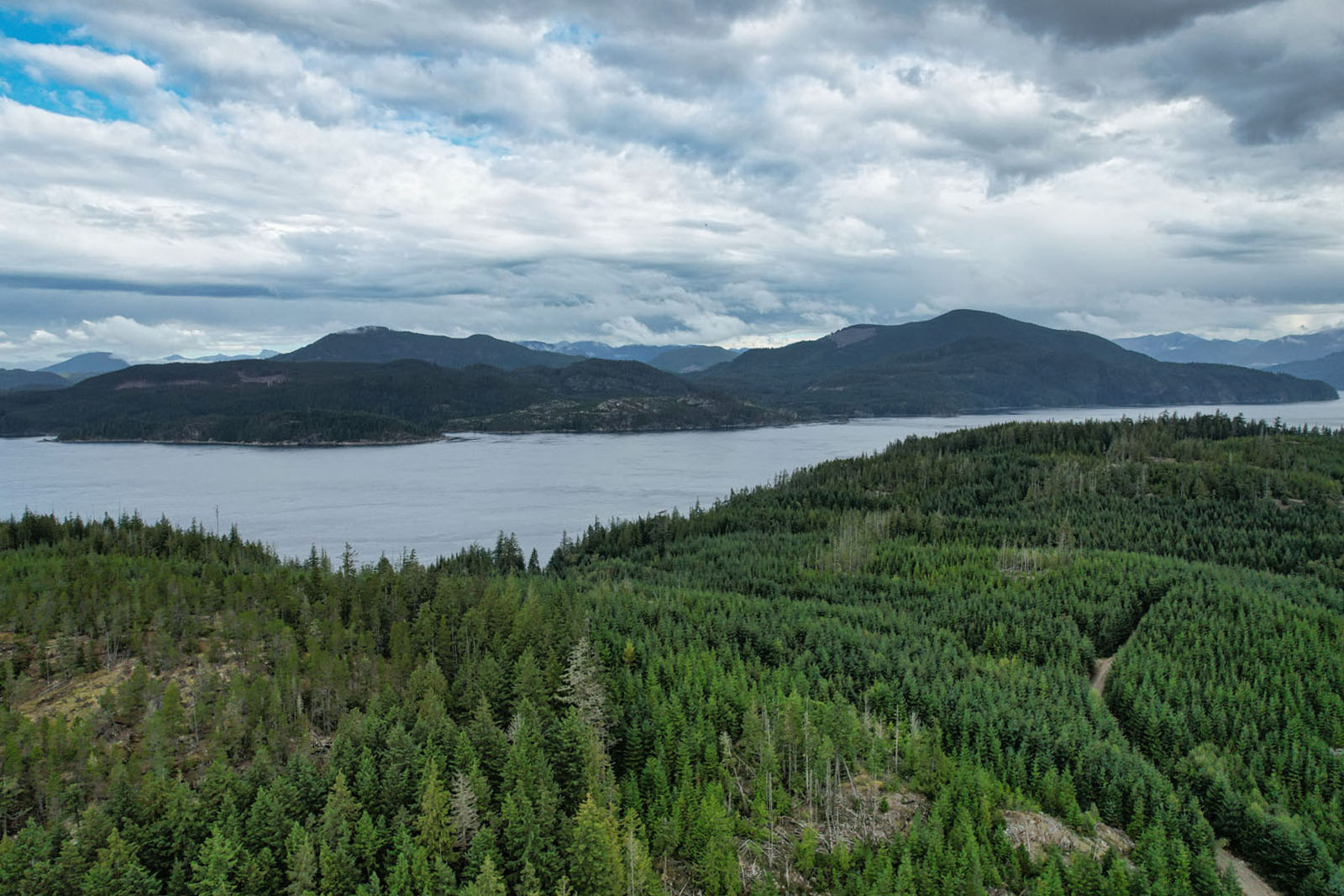
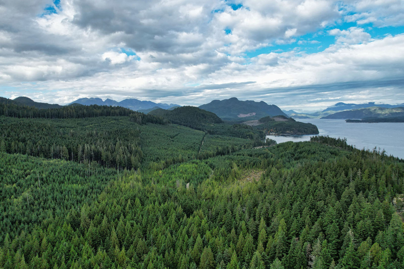
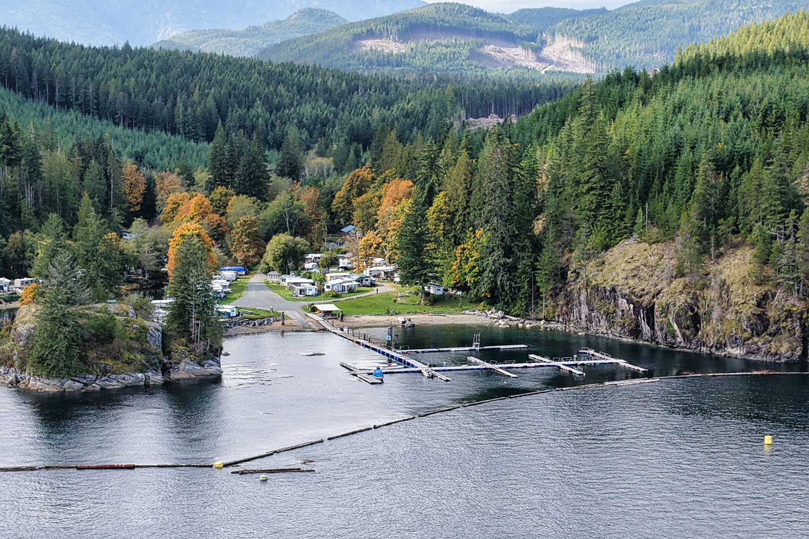
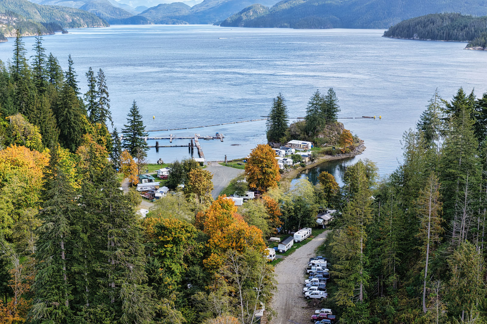
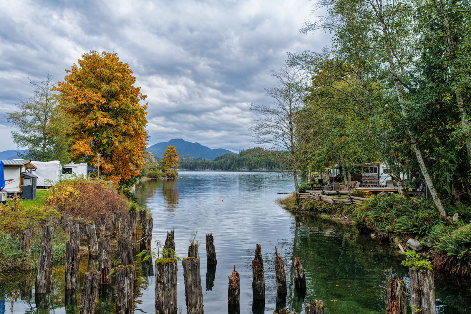
The land itself is a remarkable blend of usable topography and natural beauty. Gently contoured terrain rises from walk-on beaches and protected coves to granite bluffs with sweeping ocean views.
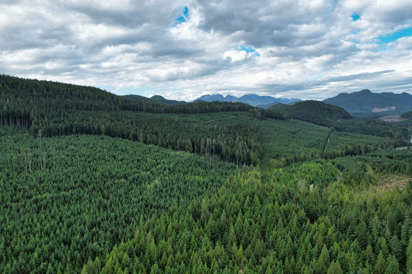
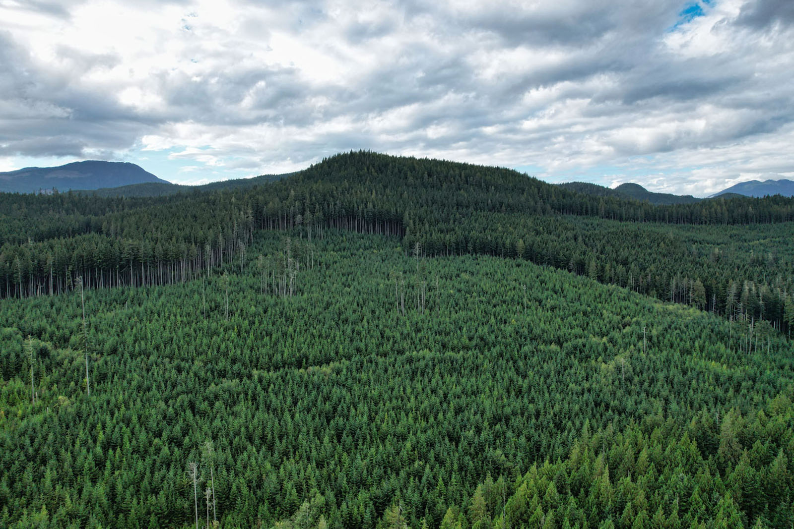
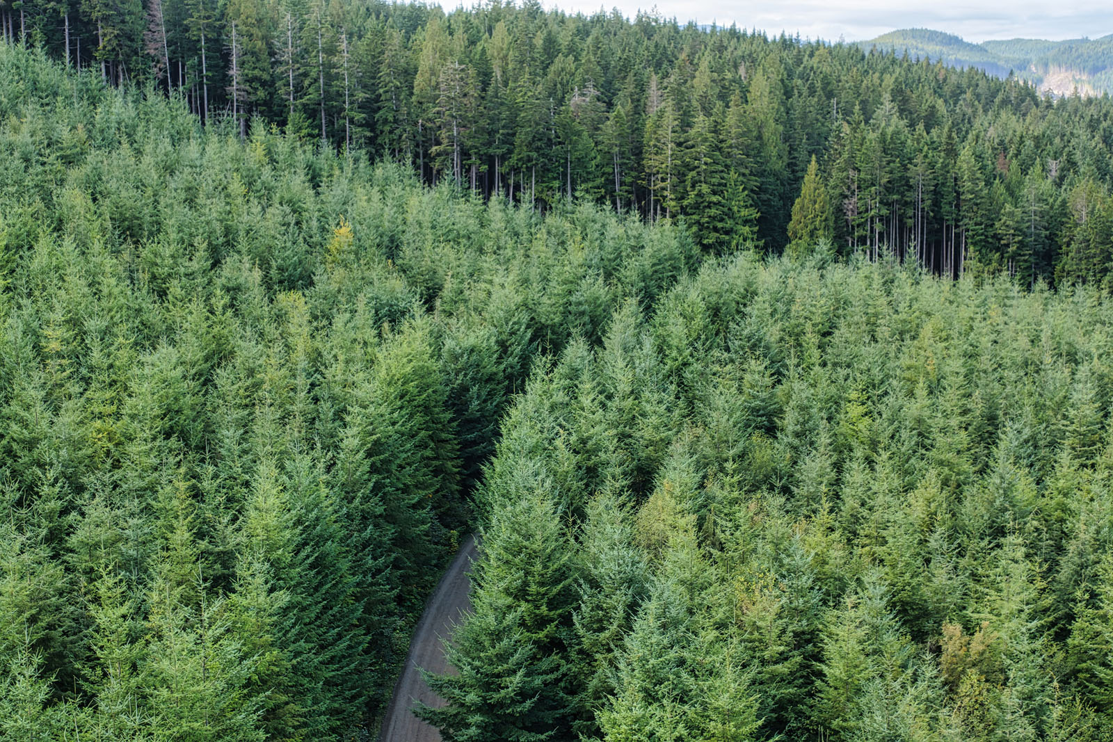
Three freshwater creeks flow through the forested landscape—a professionally planted and maturing stand, now over 25 years old and reaching 40 feet in height. The result is a living, growing investment that quietly compounds in both natural and economic value.
Governed by the Strathcona Regional District, the property lies outside of typical zoning and building permit requirements, providing rare flexibility for future development or private estate use. The current configuration includes five freehold titles, offering potential for subdivision (minimum 2.47-acre parcels, subject to standard approvals).
Notably, at least one title was Federally Crown granted prior to 1906, exempting it from the Provincial Raw Log Export Ban—an uncommon attribute adding to long-term asset value.
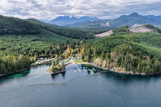
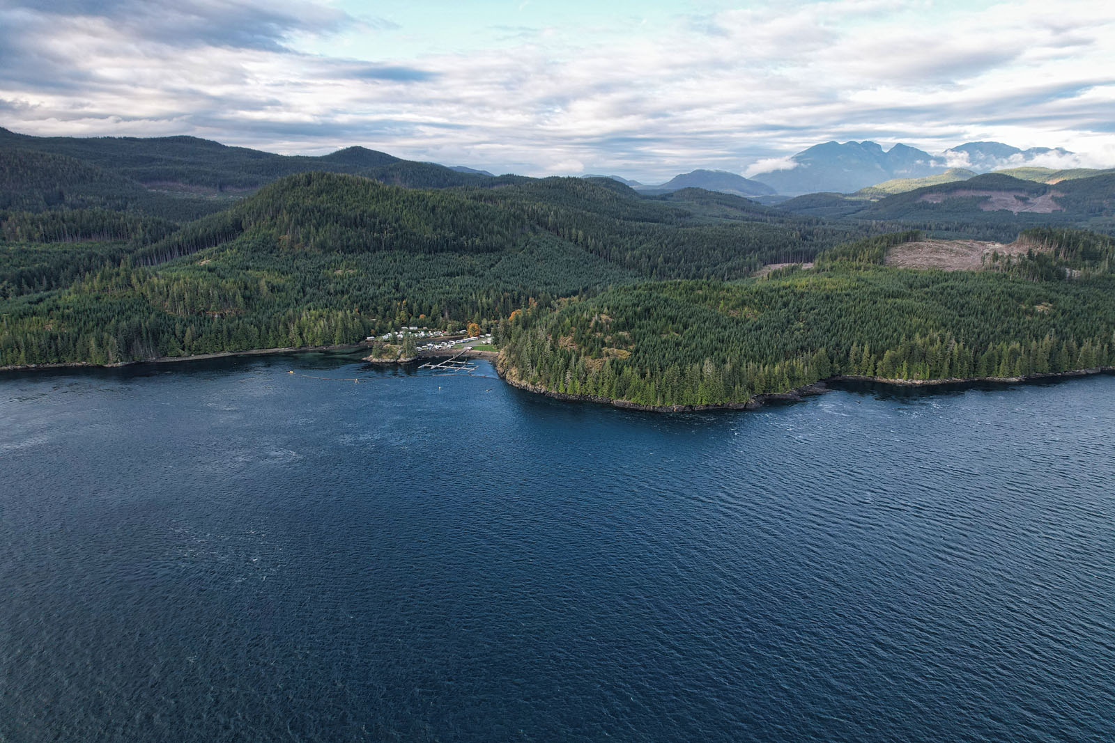
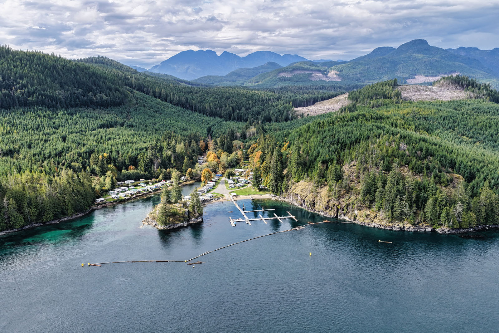
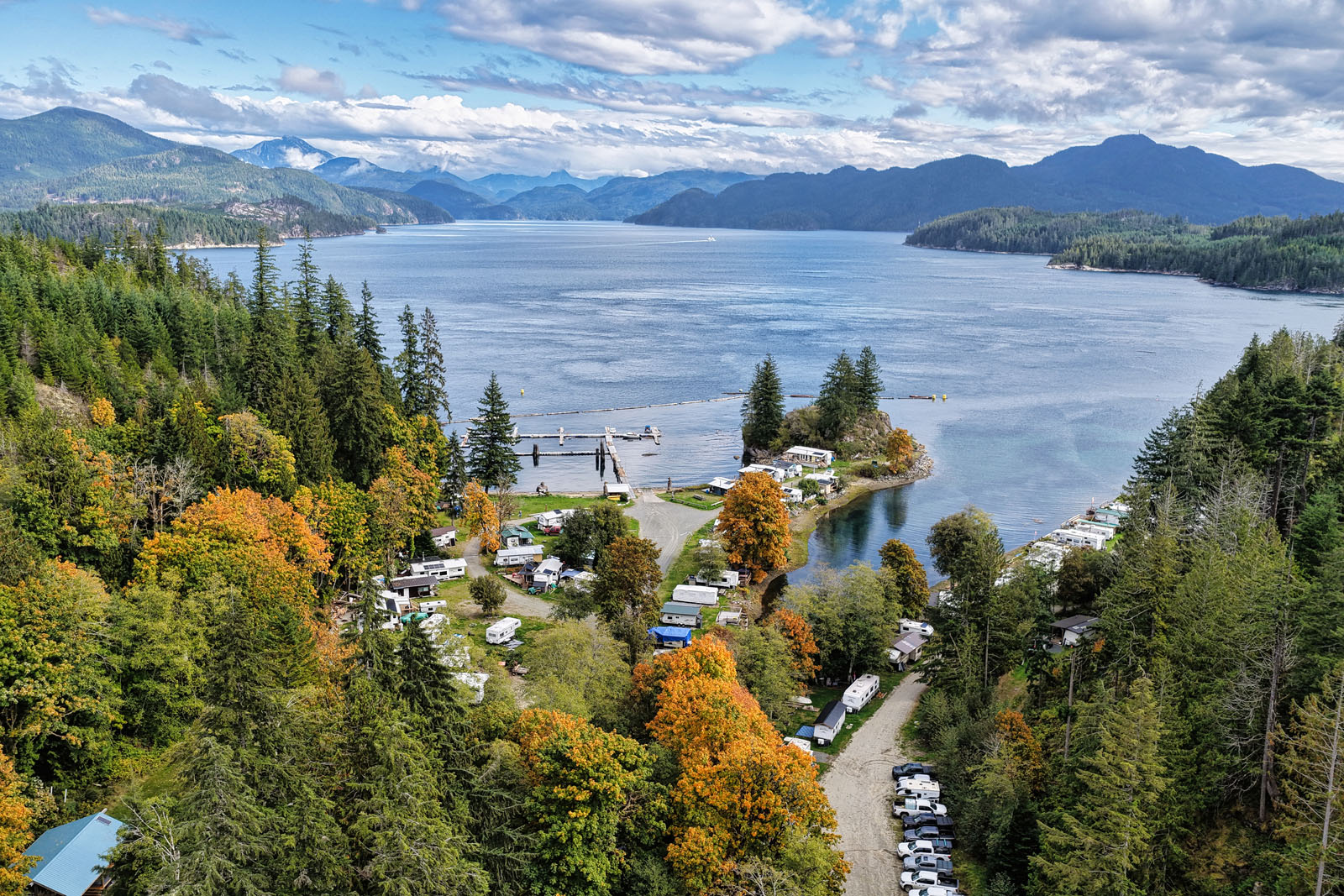
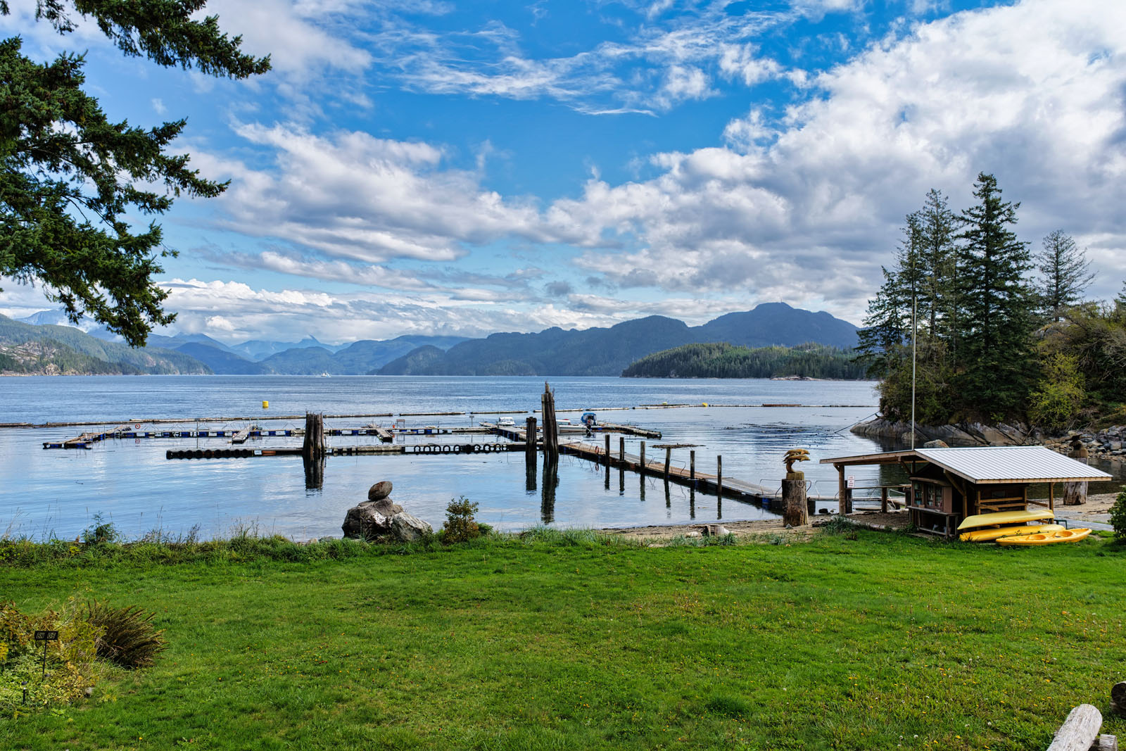
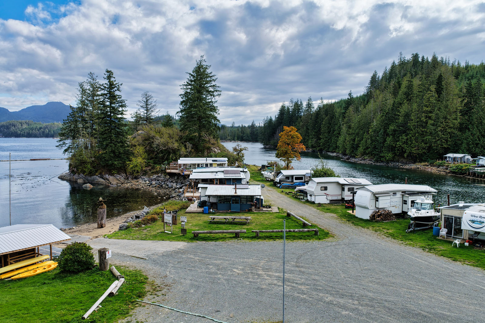
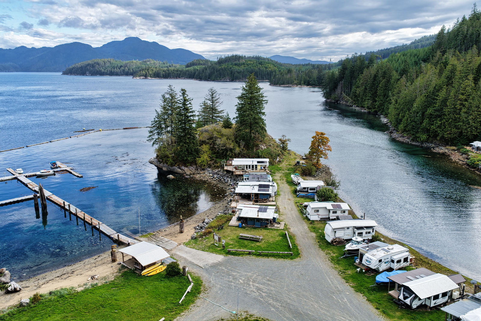
At the heart of the property lies a small seasonal marina, boat launch, and campground currently operated under lease by a third party. While modest, these facilities provide established infrastructure and income potential for future owners.
The adjacent Rock Bay also serves as a key coastal waypoint for local mariners, water taxis, and nearby island traffic.
Together, the Rock Bay Properties represents a rare opportunity: a vast, road-accessible oceanfront landholding with growth, security, and legacy potential.
In an era where land and stability are increasingly scarce, this property stands as a natural safe haven—a place to hold, to use, and to trust.
Rock Bay and Otter Cove - Sayward Valley, Rural Campbell River, BC
Contact the listing agent.
Rock Bay lies within one of British Columbia’s richest coastal ecosystems, stretching along Johnstone Strait toward Bute Inlet.
Johnstone Strait is a globally recognized marine corridor, drawing resident and transient orcas, humpback whales, Pacific white-sided dolphins, and minke whales during summer months. Its nutrient-rich currents feed salmon and forage fish, sustaining a thriving marine food web—while kelp forests and intertidal reefs hug the shoreline, teeming with smaller life forms that give structure to this ecological sanctuary.
A short journey inland reveals Bute Inlet’s reputation as one of the premier grizzly bear viewing destinations. Every autumn, bears descend to salmon-rich rivers like Orford and Algard, capitalizing on nature’s seasonal abundance. Thanks in part to habitat restoration efforts spearheaded by the Homalco Nation, the salmon runs remain robust and the bear populations strong.
Nearby, Sonora Resort serves as proof of the region’s appeal. Guests arrive from around the world for wildlife tours, remote lodges, sport fishing, and immersive wilderness experiences. The fact that high-end operators anchor themselves here speaks volumes about the ecological value and visitor demand inherent in this corridor.
Yet this is not a distant wilderness disconnected from life’s necessities. Campbell River, just over 60 km to the south, is a full-service hub, a vital link between the wild and the community. It offers grocery chains, major banks, building supply centers, contractors, skilled trades, and a labour force large enough to support development or operational needs. The community supports a regional hospital, marinas, retail, fine dining, and an airport with customs facilities for private and charter flights. From this hub, Rock Bay is accessible but still secluded.
Here, nature and infrastructure meet in balance. Whales breach offshore. Eagles ride the thermals above the forest. The tides carry life to shore. And behind it all, just a short drive away, lies the strength and capacity of an established community—making Rock Bay not just a refuge of beauty, but a secure, supported sanctuary for investment and use.
The Rock Bay area provides direct access to a wide range of recreation opportunities on both land and water. Located between Johnstone Strait and Bute Inlet, the region supports world-class boating, fishing, hiking, and backcountry exploration.
Johnstone Strait is internationally recognized for its marine wildlife and sheltered waterways. The area is popular for boating, kayaking, and sport fishing, with regular sightings of orcas, humpback whales, dolphins, and sea lions. Nearby anchorages and routes through the Broughton Archipelago offer protected waters for extended cruising and exploration.
Several major parks are within reach. Strathcona Provincial Park, west of Campbell River, provides extensive alpine hiking, backcountry trails, and skiing. Elk Falls Park offers easy access trails, a suspension bridge, and waterfalls near town. Schoen Lake Provincial Park, north of Woss, includes wilderness campsites and lake access for fishing and paddling.
The surrounding coastline and inlets are known for salmon, halibut, and bottom fishing. In nearby Bute Inlet, grizzly bears gather each fall to feed on spawning salmon in the Orford and Algard rivers. Guided wildlife viewing is available through established operators from Campbell River and Sonora Island.
Old forestry roads and trail systems around Campbell River provide mountain biking, ATV riding, and hiking routes. Higher elevation areas in Strathcona Park and surrounding ranges offer backcountry skiing and snowshoeing during winter months.
Together, these features make Rock Bay part of a well-supported and diverse recreation corridor—a location where access to wilderness and essential services are both within reach.
Rock Bay occupies a coastline shaped by both Indigenous stewardship and British Columbia’s early industrial history. The area lies within the traditional territory of the Kwakwaka’wakw peoples, whose presence on this part of the coast extends back thousands of years.
The surrounding islands, inlets, and estuaries provided important seasonal harvesting and travel routes, supporting communities through access to salmon, shellfish, cedar, and other coastal resources. Evidence of this long-standing relationship with the land and sea can still be found in archaeological and cultural sites throughout the broader region.
In more recent history, Rock Bay became part of British Columbia’s coastal logging frontier. Its sheltered waters and deep anchorage made it an ideal base for early forestry operations, log sorting, and marine transport. Through the early to mid-20th century, the bay supported working tugs, booms, and small industrial outposts that served the region’s timber trade. Several of the property’s land titles were Federally Crown granted prior to 1906, a legacy that continues to provide unique advantages today, including exemption from the Provincial Raw Log Export Ban.
Remnants of this working past—old pilings, log dumps, and access clearings—remain as quiet markers of the region’s industrial heritage. Over the years, as forestry activity declined, the land began to return to its natural state. The replanted and maturing forest that now defines the property reflects that evolution—from working waterfront to a regenerating landscape of stability and growth.
Today, Rock Bay stands as a rare coastal holding that bridges the deep history of Indigenous land use, the legacy of British Columbia’s resource economy, and the enduring value of the natural landscape itself—a property that continues to evolve with time while remaining rooted in the story of the coast.
Please see the mapping section, all boundaries are approximate.
50°19'35.52"N and 125°28'0.87"W
None.
None.
Total: $7,997.42 (2025)
SD-64
Subdivision Servicing Standards Bylaw No. 64, 2010
Additional zoning information can be found on the Strathcona Regional District website.
District Lot 316, Sayward District
PID 009-664-726
District Lot 351, Sayward District, Except that Part Shown in Red and Marked 'A' on Plan 635R
PID 009-664-793
District Lot 313, Sayward District
PID 009-664-823
District Lot 376, Sayward District
PID 009-664-866
District Lot 717, Sayward District
PID 009-664-891
 +8 maps

Our property descriptions and geographical information are taken from the BC Assessment Authority, Land Titles Office, government maps and other sources. While LandQuest® does not guarantee the information, we believe it to be accurate, but should not be relied upon without verification. This communication is not intended to cause or induce breach of an existing agency agreement.
Elk Bay
 10℃
10℃
 6℃
6℃