


Private acreage in Roberts Creek, featuring a creek, some mature forest, drilled well, power to property line. Close to Crown land and trail networks. Country feel but easy access within minutes to all major amenities.
Foreign Buyer Ban does not apply to this property


 +12 photos
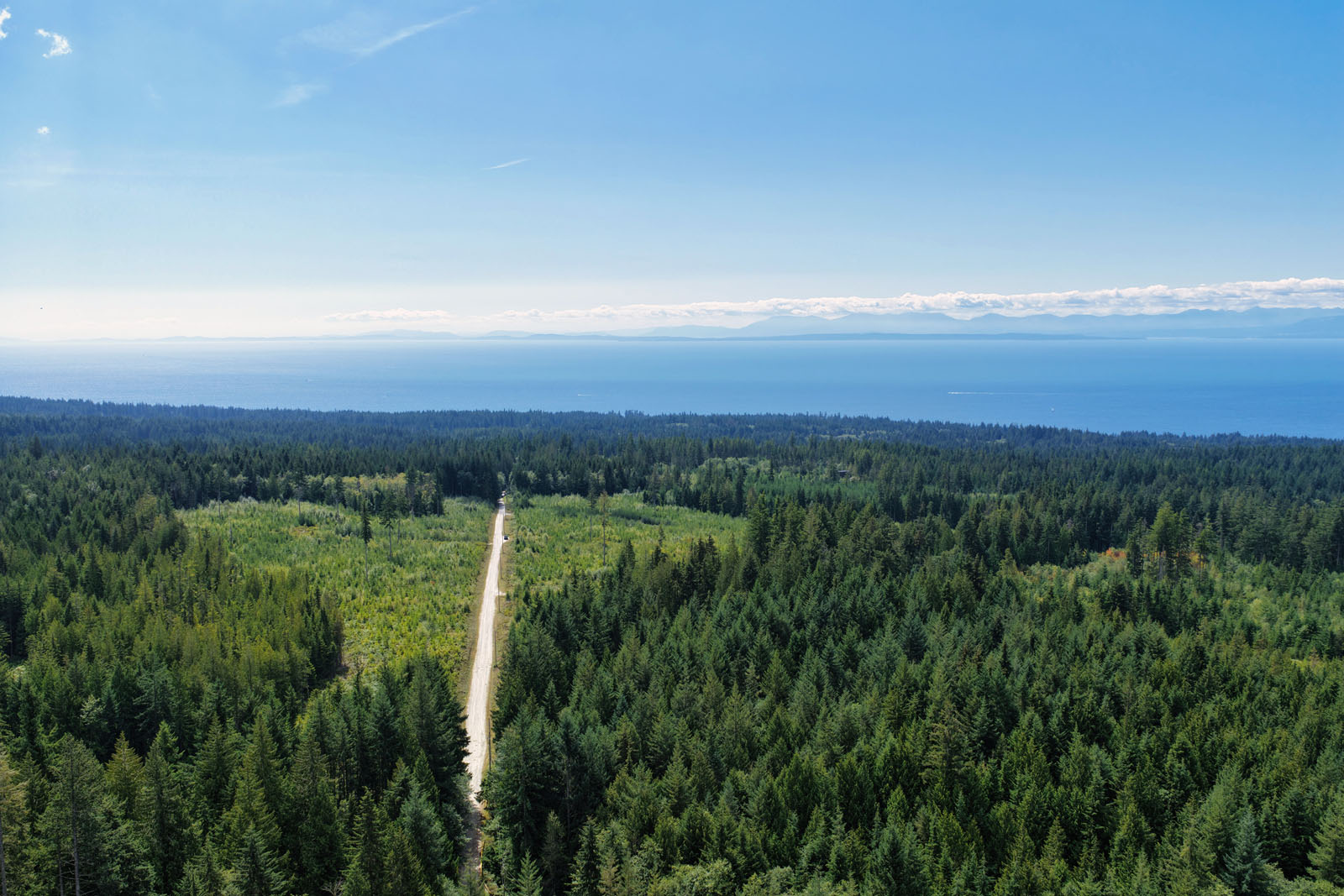


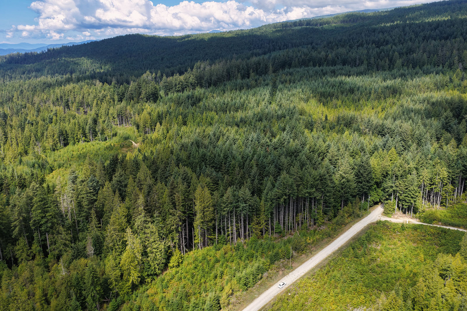

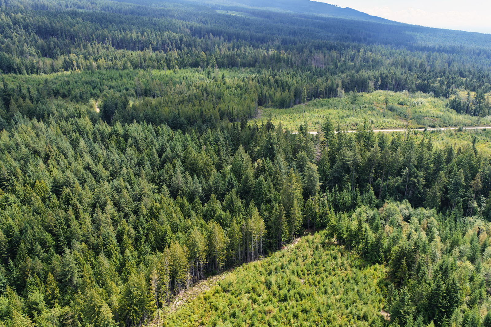
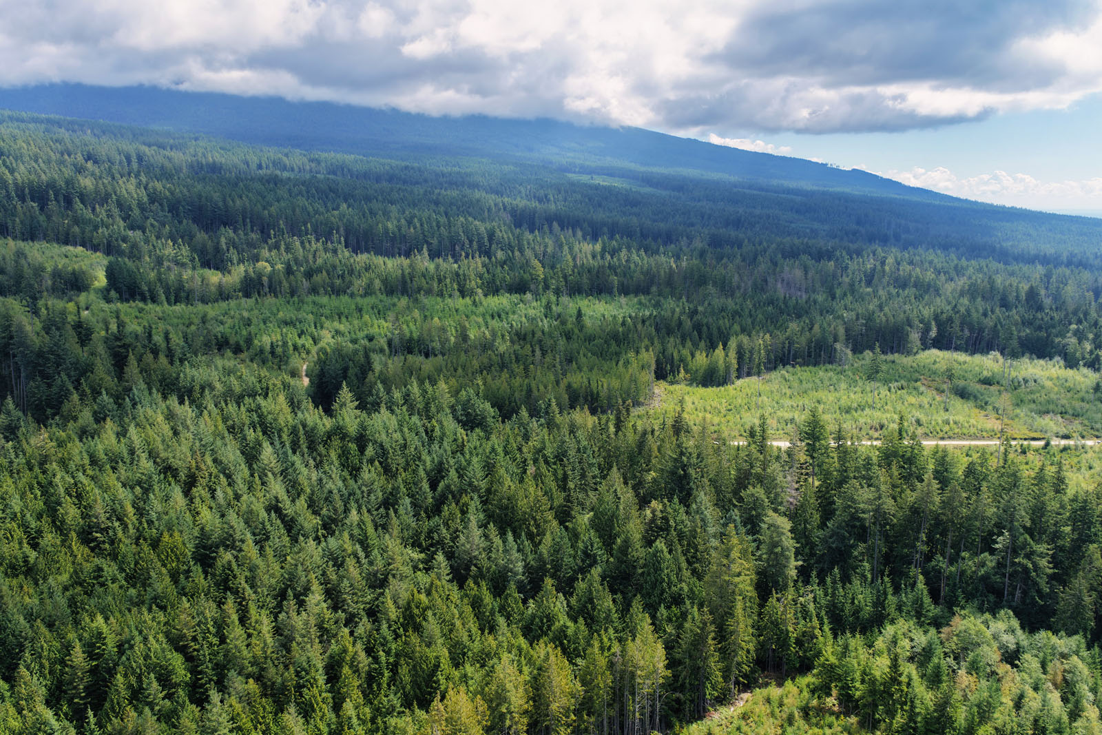
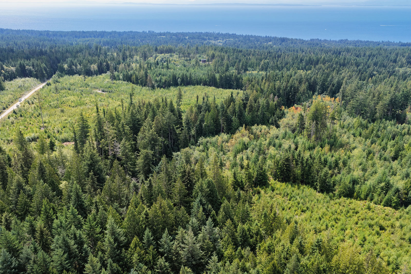
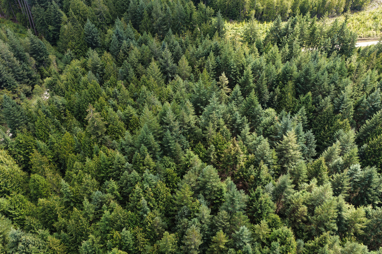
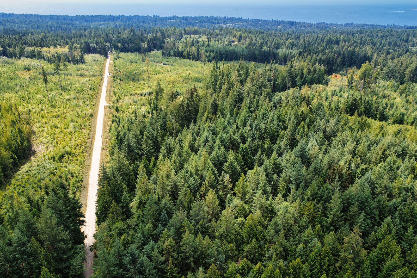
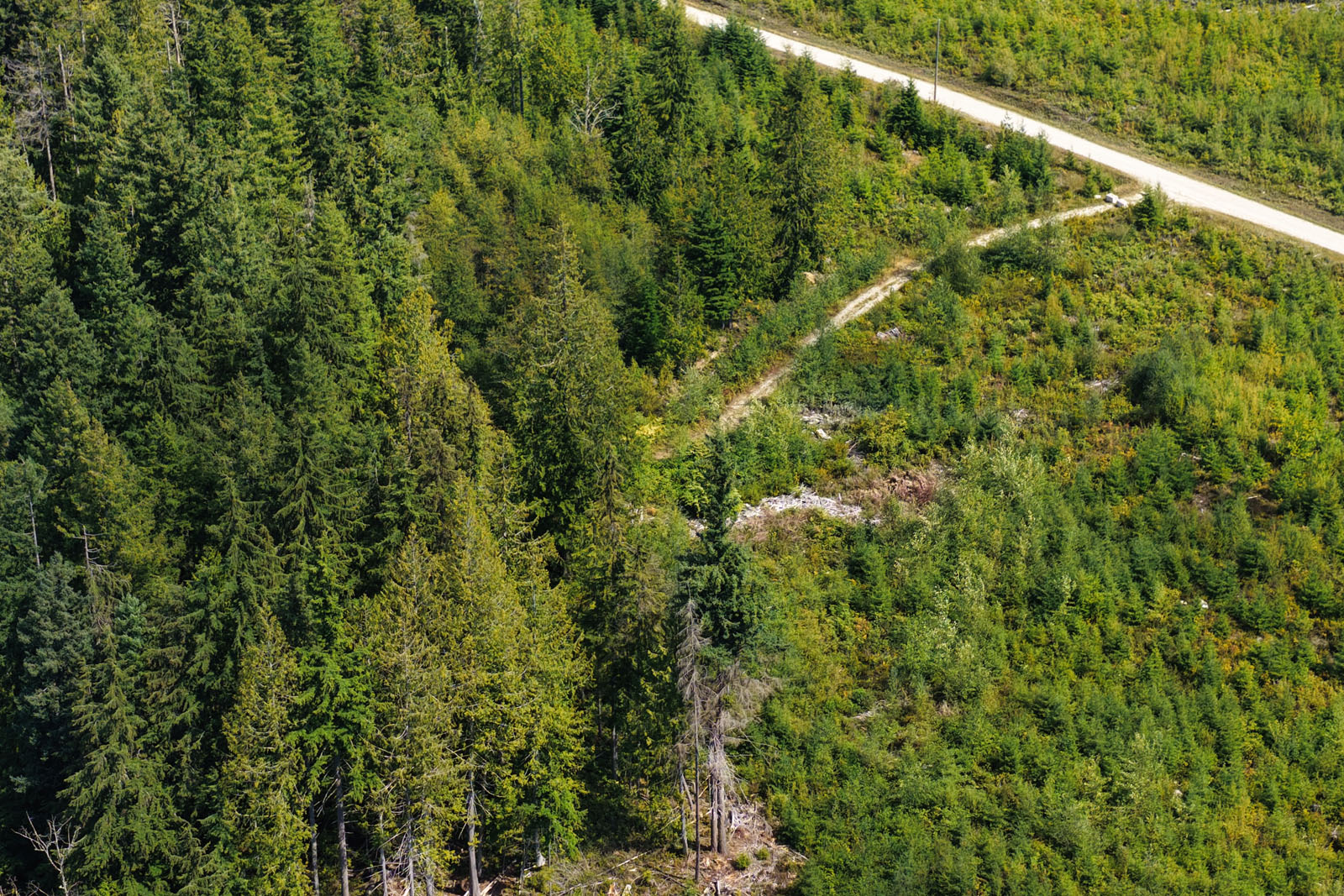
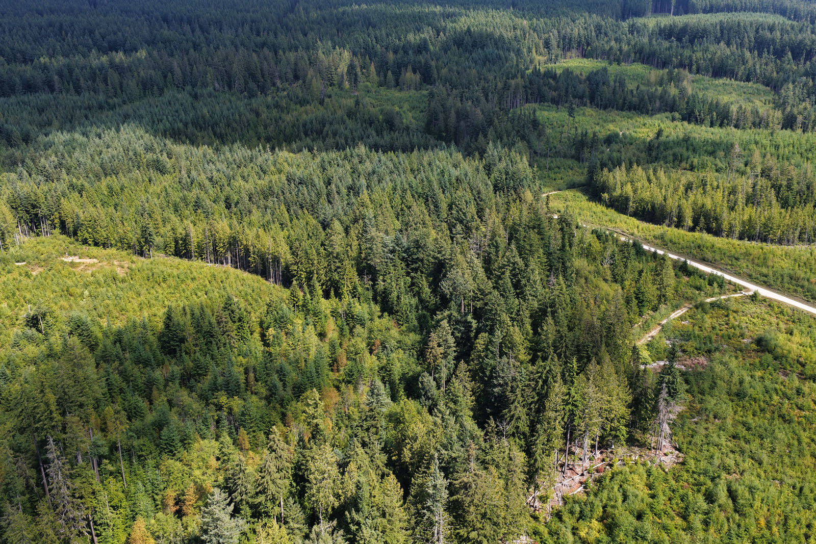
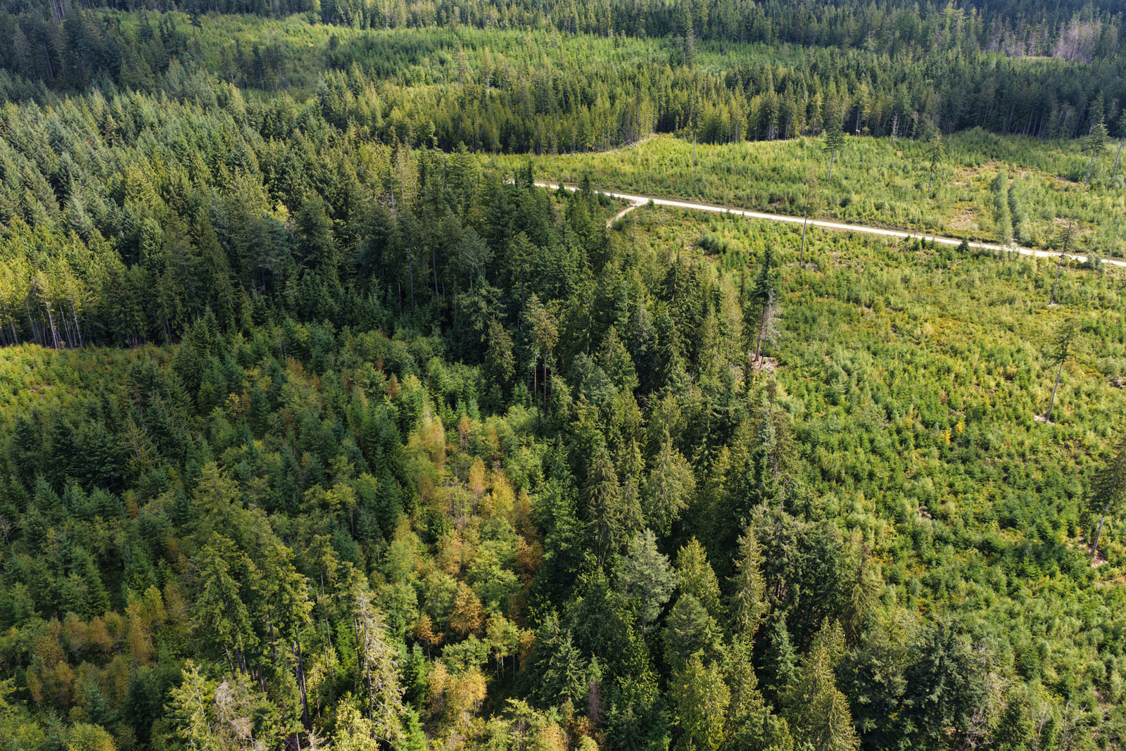
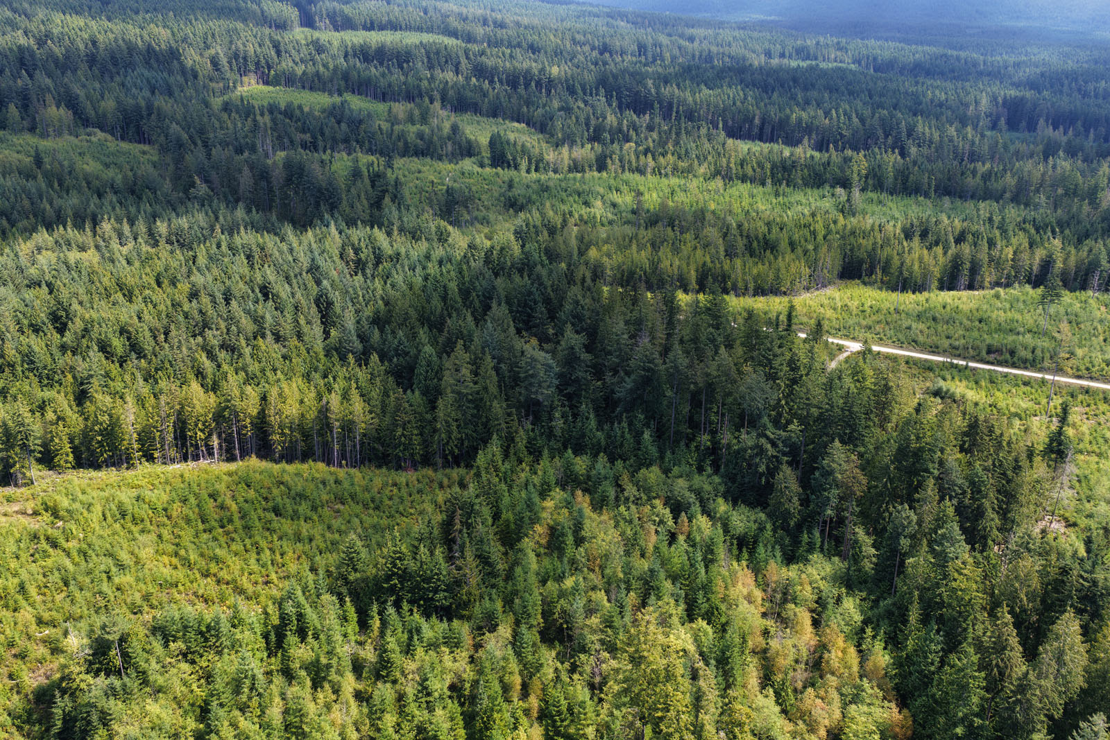
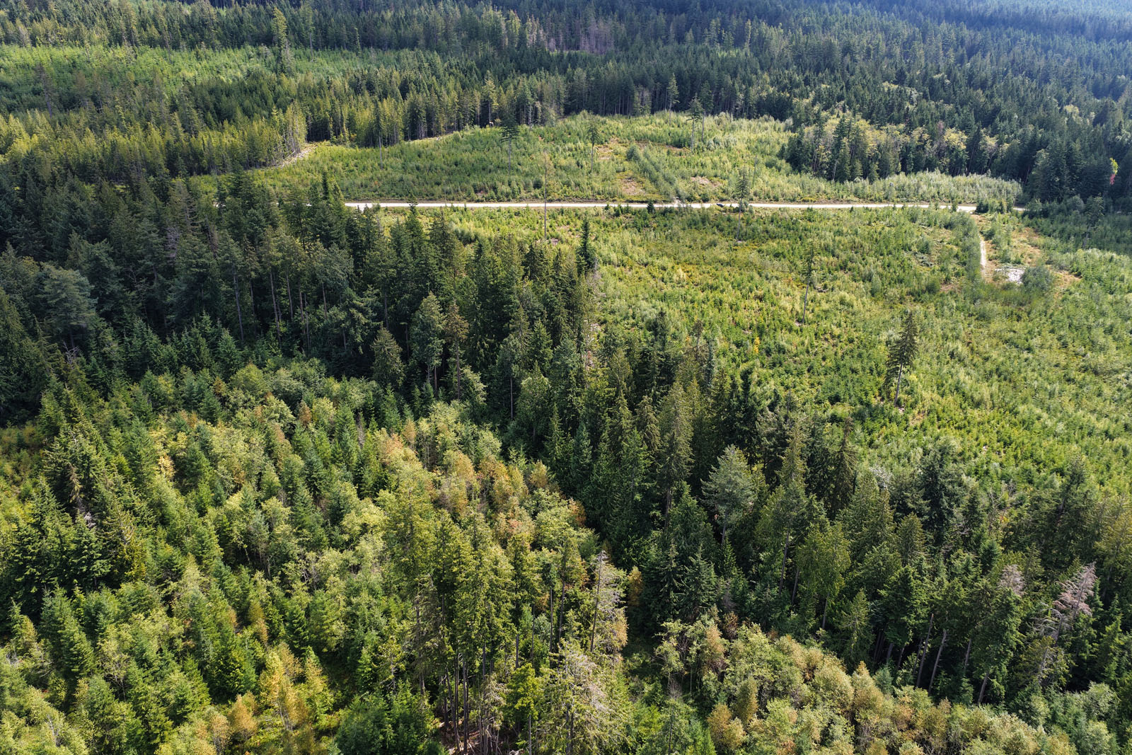
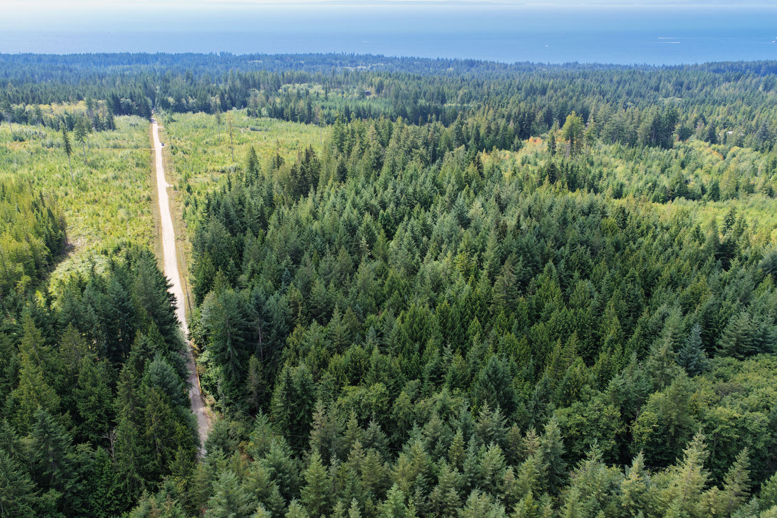
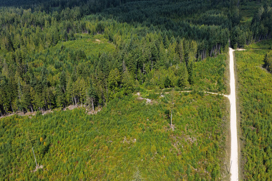
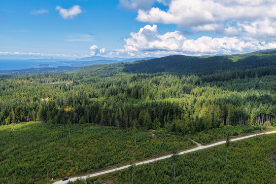
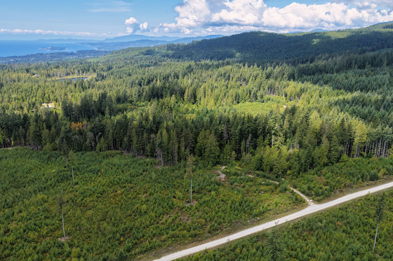
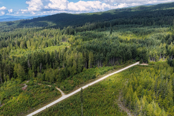
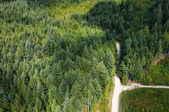
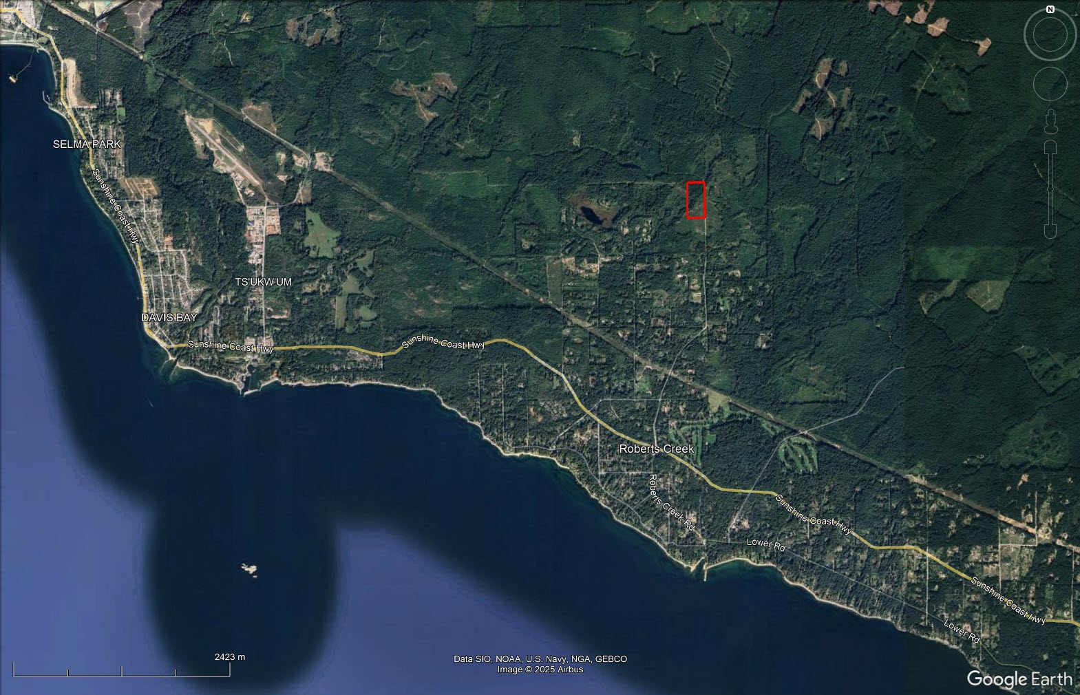
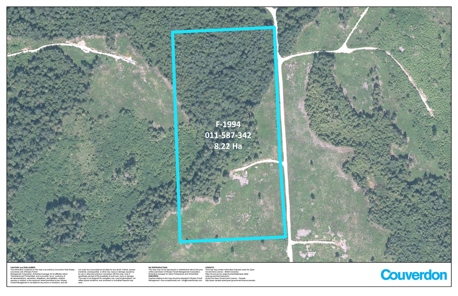
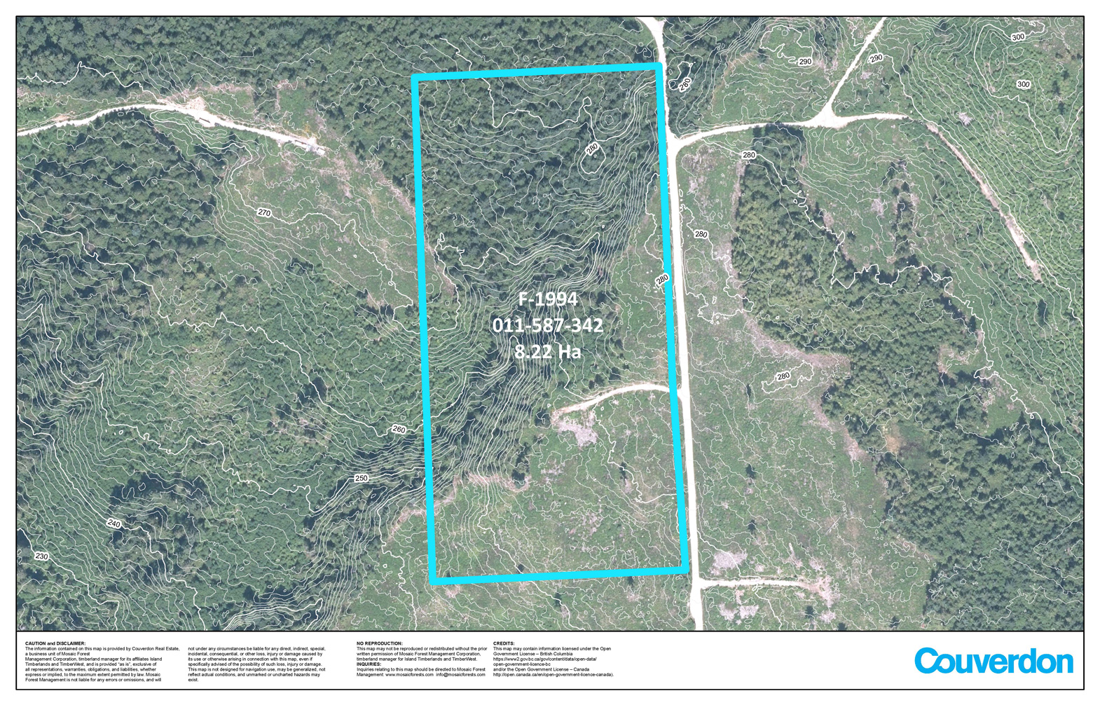
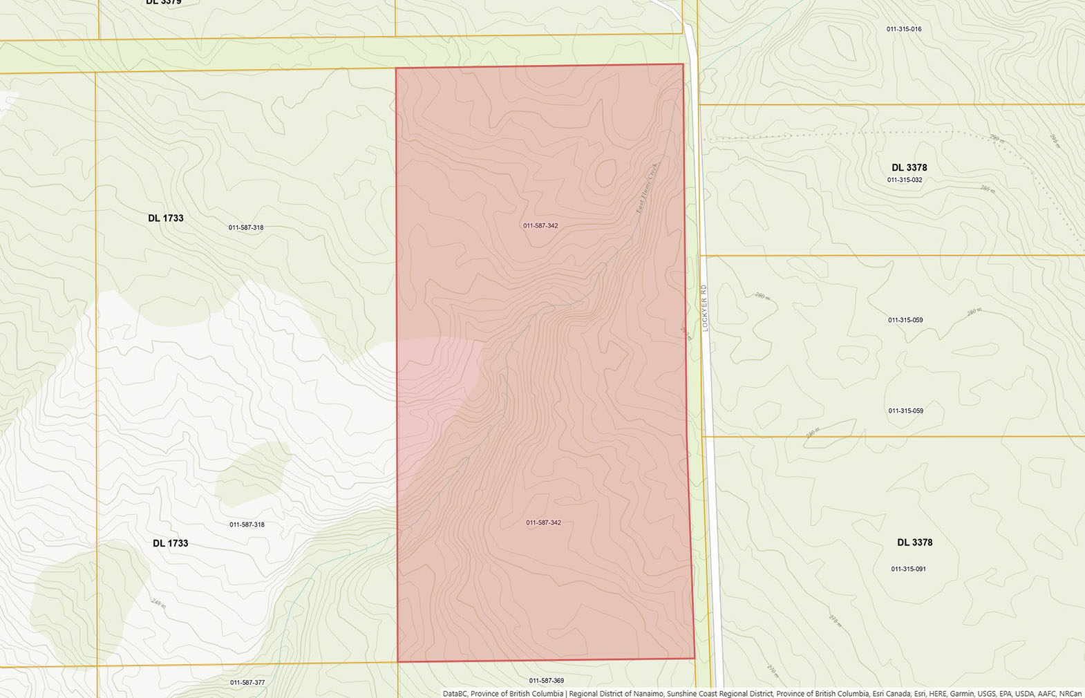
Positioned to capture stunning distant ocean views and set amidst forested surroundings, this 20.3-acre property offers the perfect blend of seclusion and convenience. Zoned RF1, the property permits a single-family home with a suite and supports forest management uses—making it ideal for a private estate or sustainable living venture. A beautiful creek winds through the riparian zone, adding natural charm and biodiversity. At the northern boundary to the other side of the creek the area is beautifully forested which represents just under half of the total acreage. The balance is a planted immature forest with trees ranging from 6 to 8 feet in height.
The land has a gentle topography and has ample space to be developed into your intended use. The aspect is west facing and has excellent sun exposure.
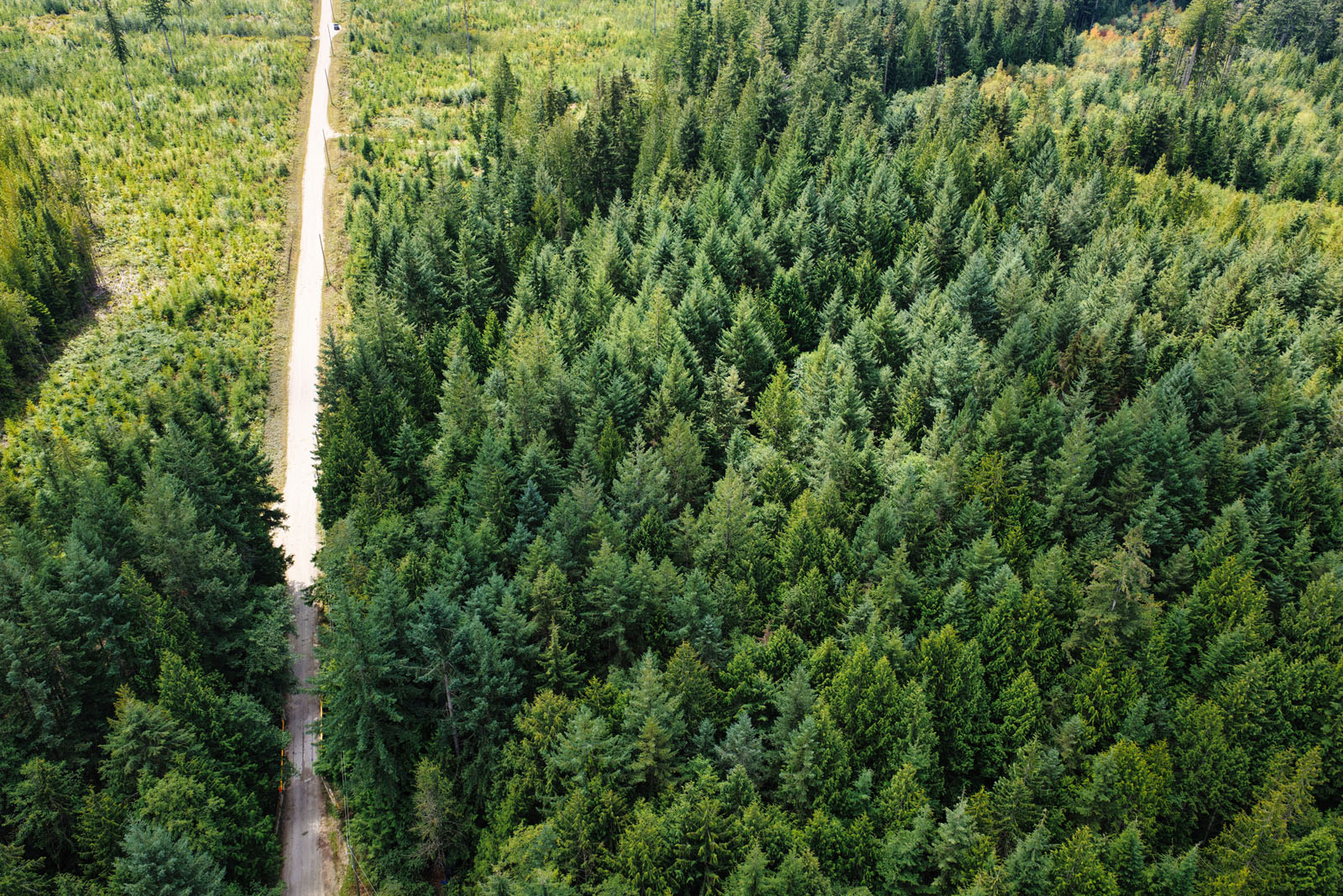
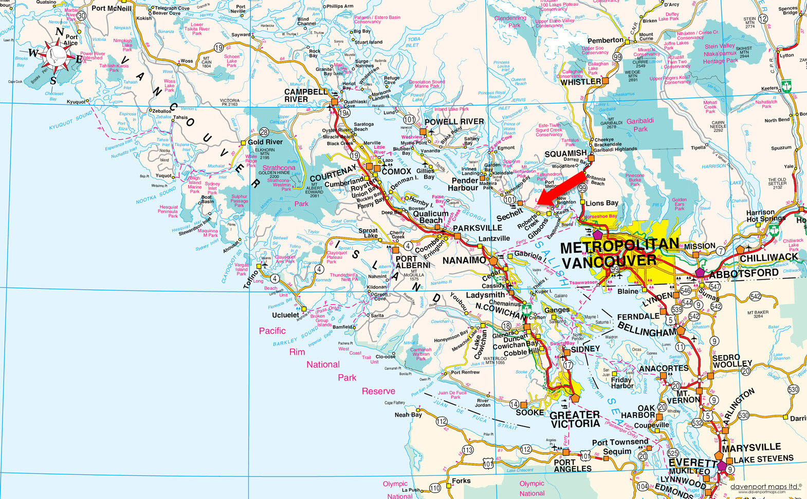
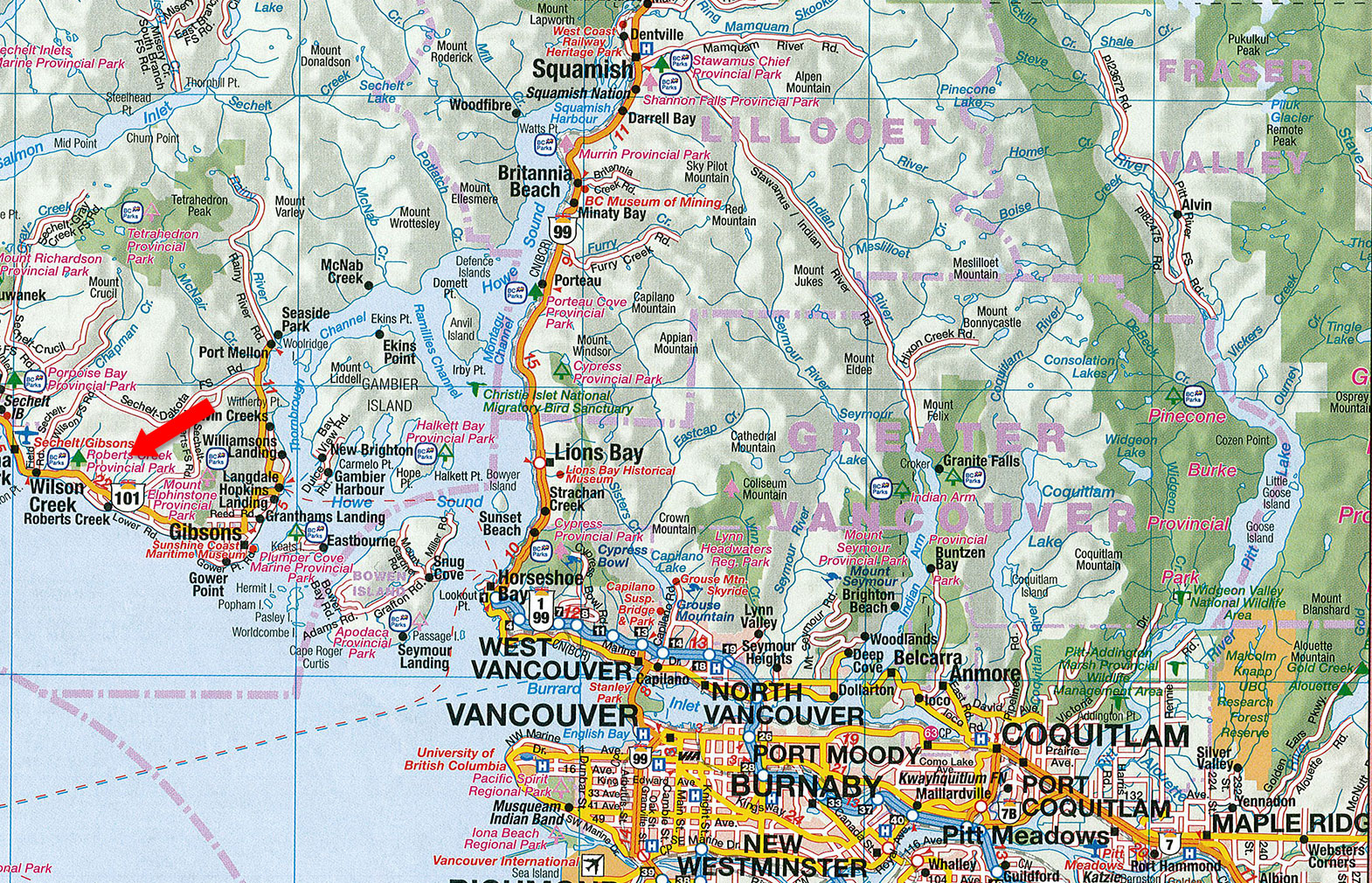
Additionally, the property has a drilled well and power to the property line. Access is approximately 3 km up Lockyer Road off Highway 101.
With easy access to trails and Crown land, and proximity to shops, schools, and ferries, this acreage is a peaceful with endless potential—just 40 minutes from the Lower Mainland.
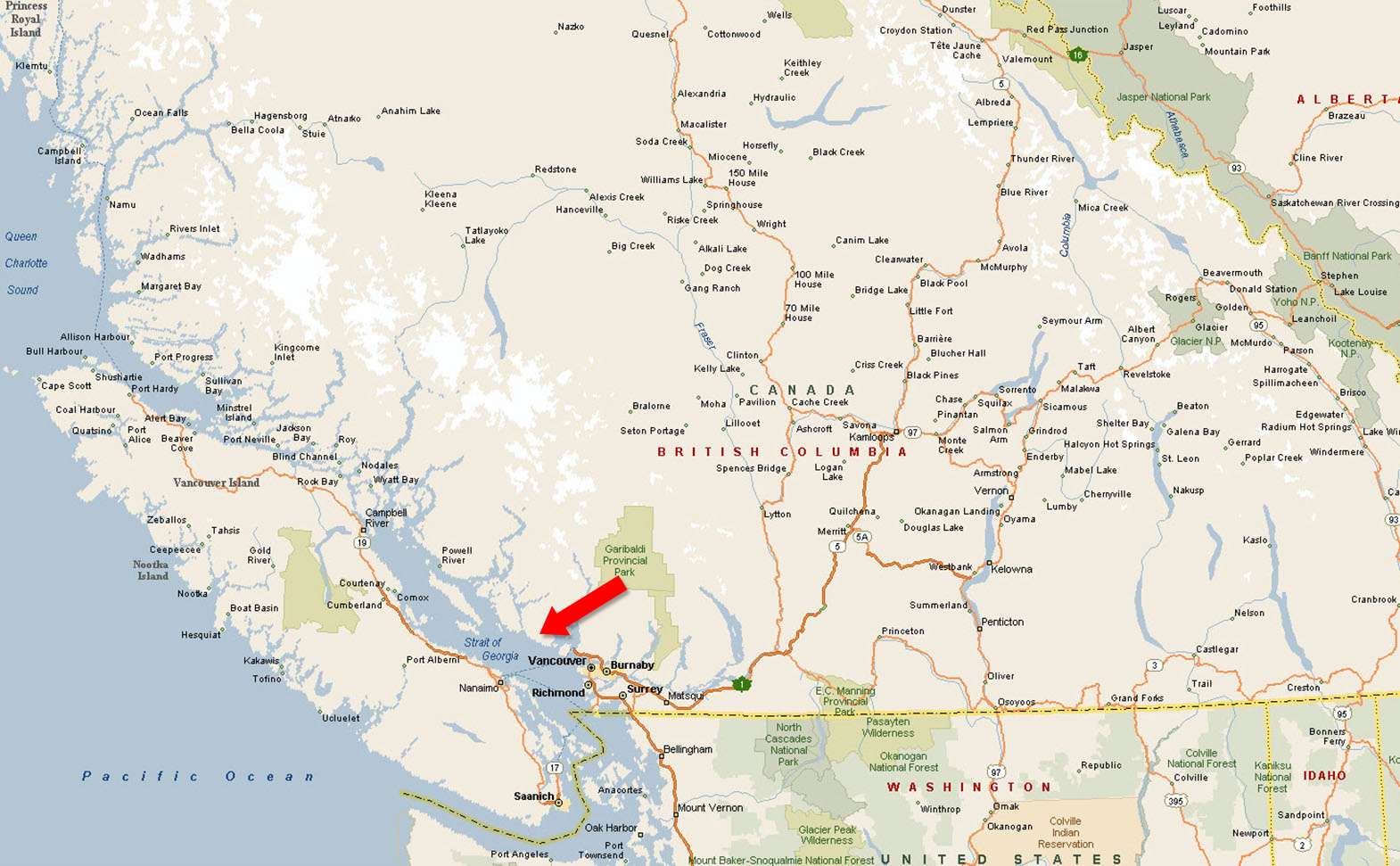
Roberts Creek, BC
Contact the listing agent.
Roberts Creek (xwesam/Stelḵáya) is a small residential community of about 3,553 people located between Gibsons and Sechelt on the southern Sunshine Coast in British Columbia. It is a short drive from both Gibsons and Sechelt, making it a quick trip for anyone visiting the Sunshine Coast or a convenient day trip from Vancouver.
It is known for its 9 km of shoreline, much of which includes sandy swimming beaches, and the Roberts Creek Mandala which is re-painted each year by 300 residents and visitors. The Roberts Creek community is centered around small shops and restaurants which provide a distinct village ambiance. The Roberts Creek Community Hall, a popular venue for dances, meetings and other events, was built in 1934 and is owned, operated and maintained by the community.
The area includes a paved bike path that runs parallel to the highway; a golf course, Cliff Gilker Park, a family-oriented hiking area.
Roberts Creek is also the location for several important regional amenities including Dakota Ridge, a winter recreation area offering 12 km of groomed snowshoe and cross-country ski trails, the “Sechelt” landfill, the Sunshine Coast Regional District’s water intake and the Seaview Cemetery.
Mature and immature forest.
Hiking, mountain biking, cycling, paddling, boating, fishing, rock climbing, swimming, scuba diving, golfing and snowshoeing.
Please see mapping section, all boundaries are approximate.
49°27'18.71"N and 123°38'36.20"W
Drilled well, power to property line.
None.
$248.88 (2025) - Managed Forests
RF1 (Rural Forest One)
Sunshine Coast Regional District Zoning Bylaw No. 722
Additional zoning information can be found on the Sunshine Coast Regional District website.
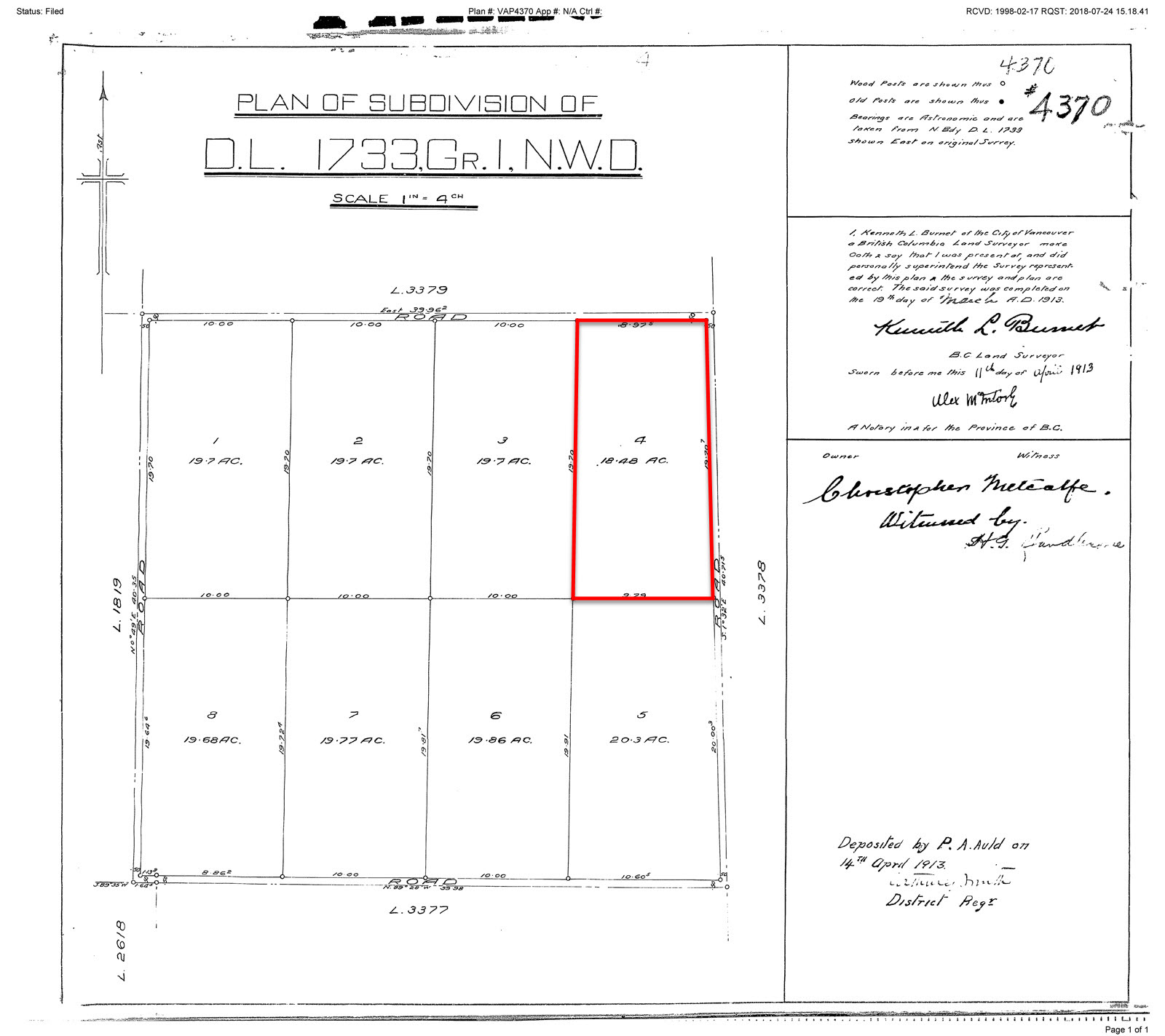
Block 4 District Lot 1733 Plan 4370
PID 011-587-342
 +8 maps
Our property descriptions and geographical information are taken from the BC Assessment Authority, Land Titles Office, government maps and other sources. While LandQuest® does not guarantee the information, we believe it to be accurate, but should not be relied upon without verification. This communication is not intended to cause or induce breach of an existing agency agreement.
Roberts Creek
 8℃
4℃
8℃
4℃