


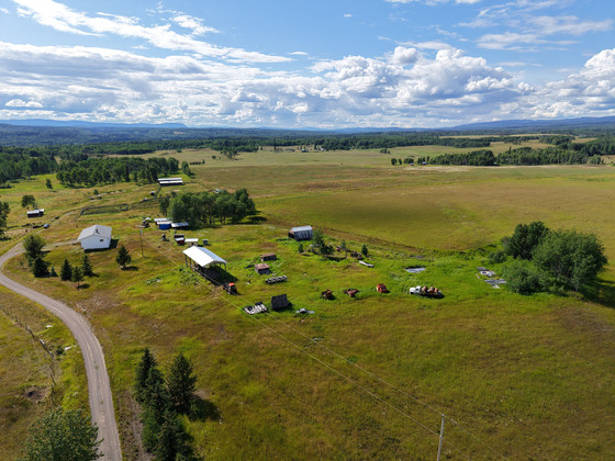
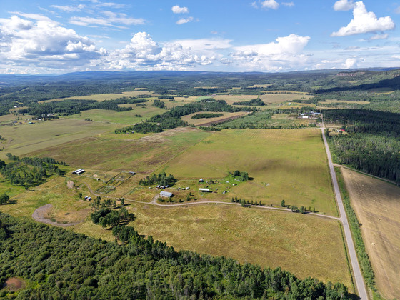
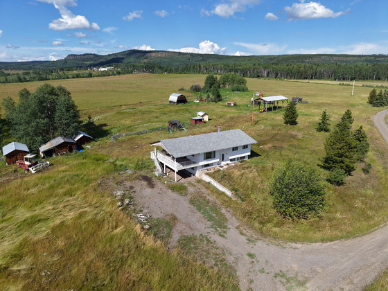
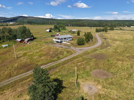
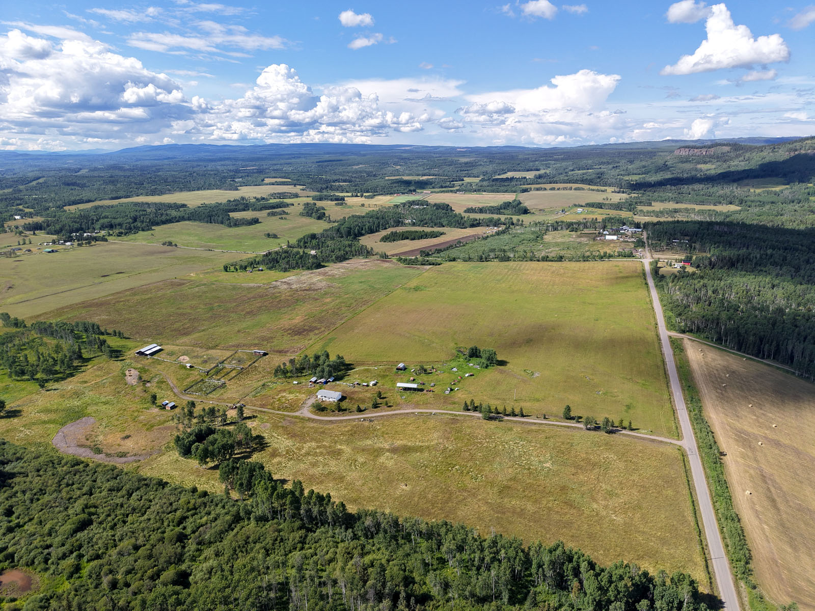
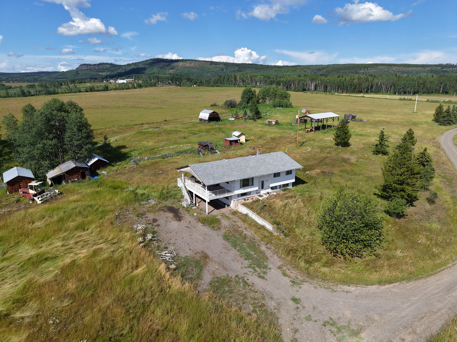
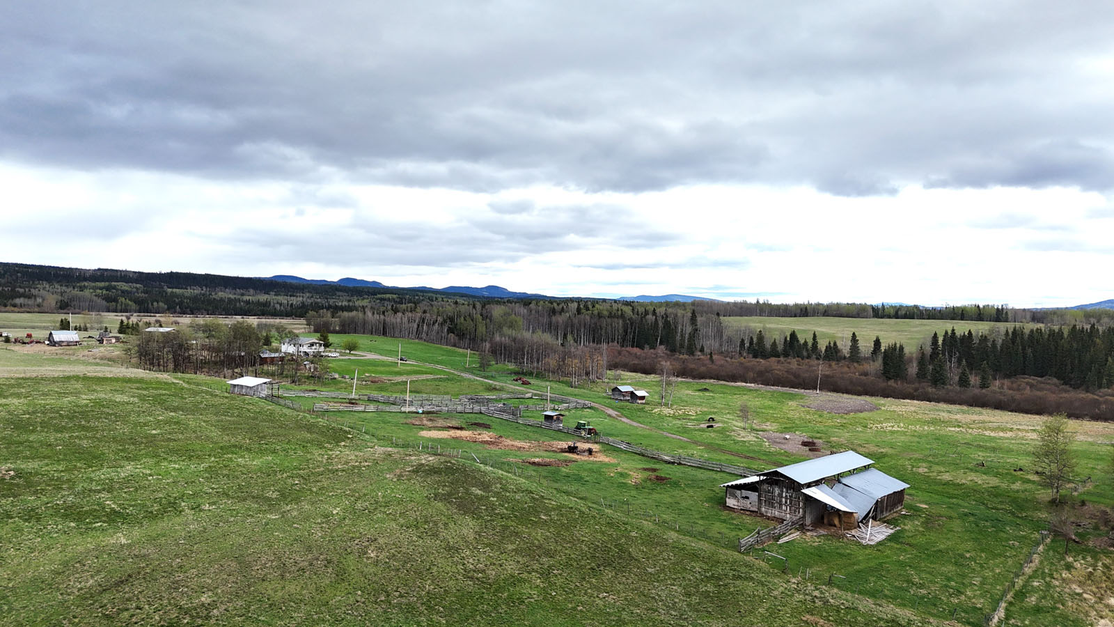
Looking for peace & respite only a short distance from urban convenience? This manicured quarter section is the ideal property. 157 acres of fertile farmland, country home with new roof, storage outbuildings, pole barn, hay shed (with lean-tos), corral system & 3 livestock waterers.
Foreign Buyer Ban does not apply to this property


 +48 photos
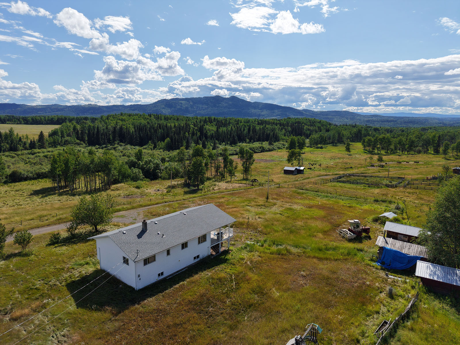


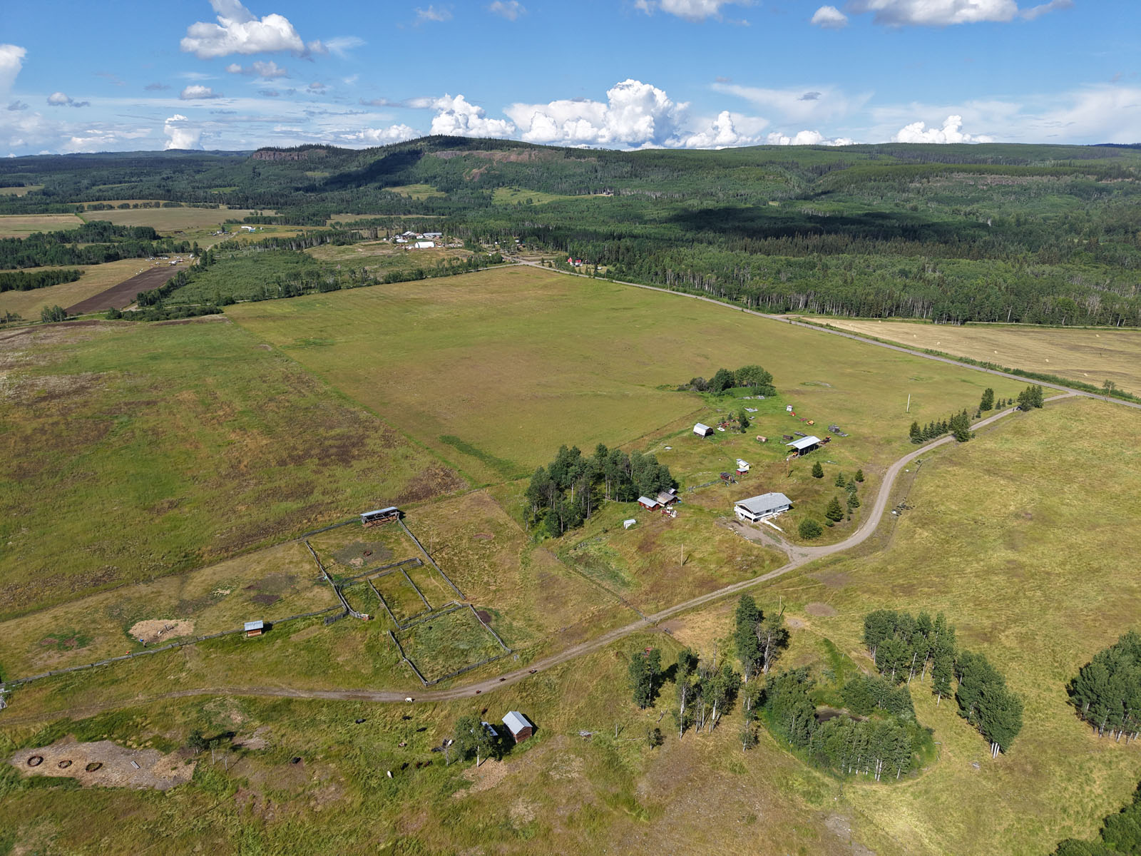
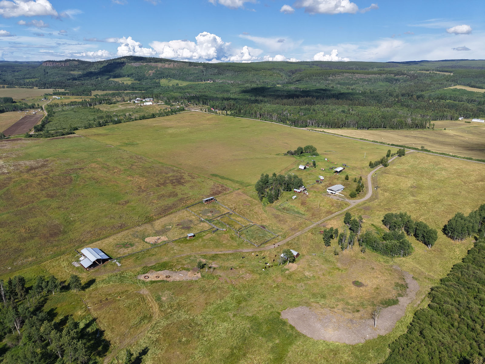
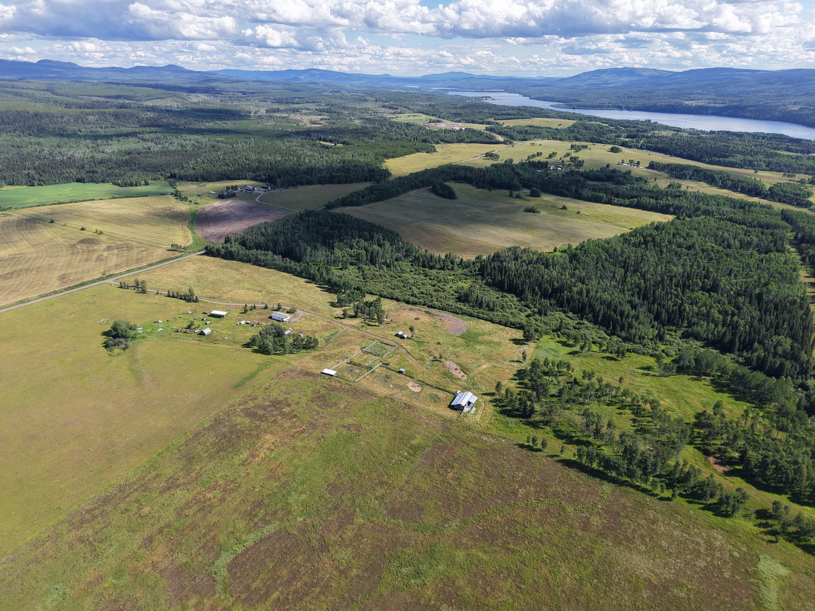
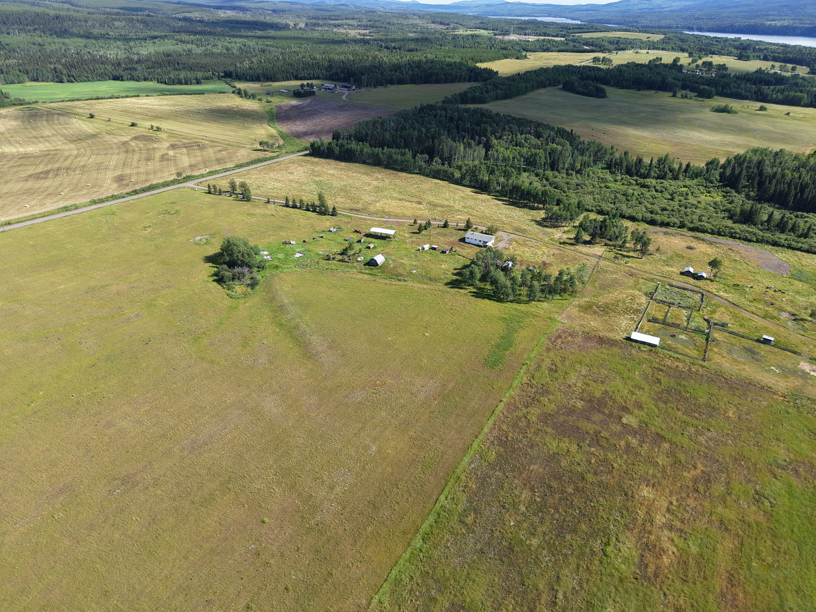
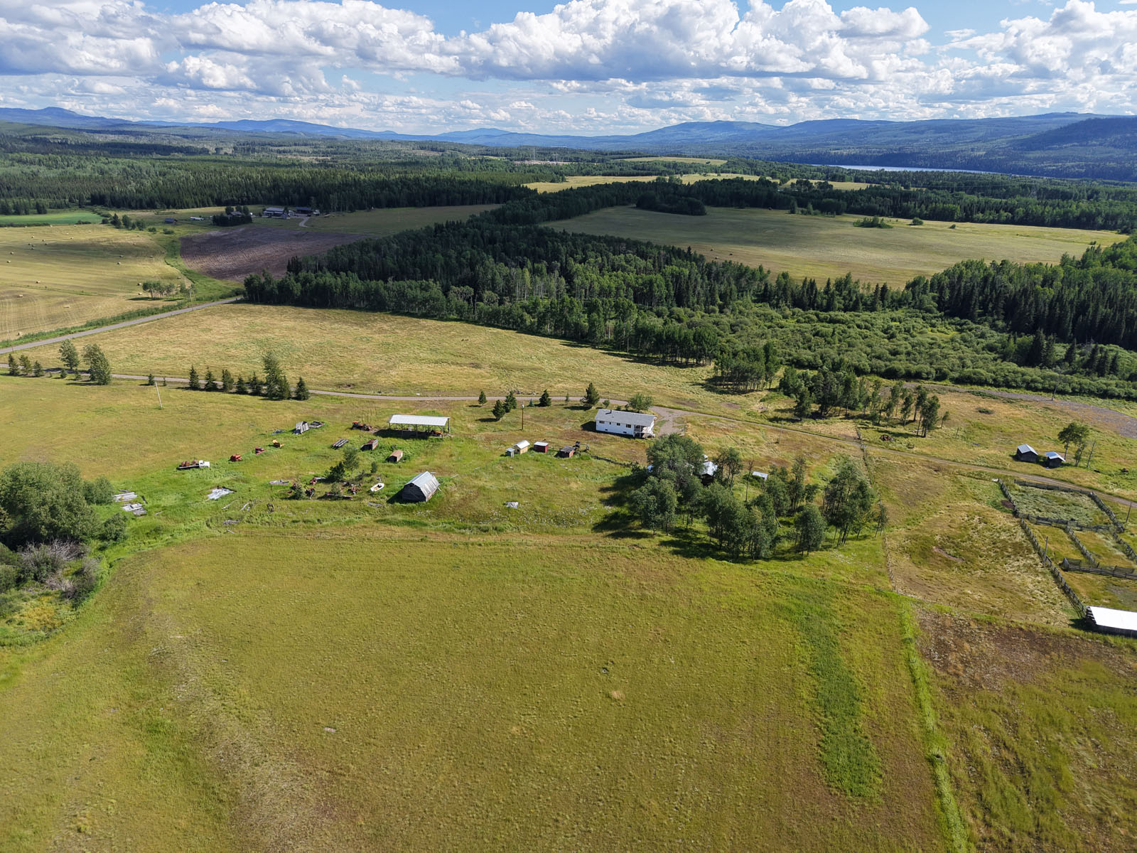
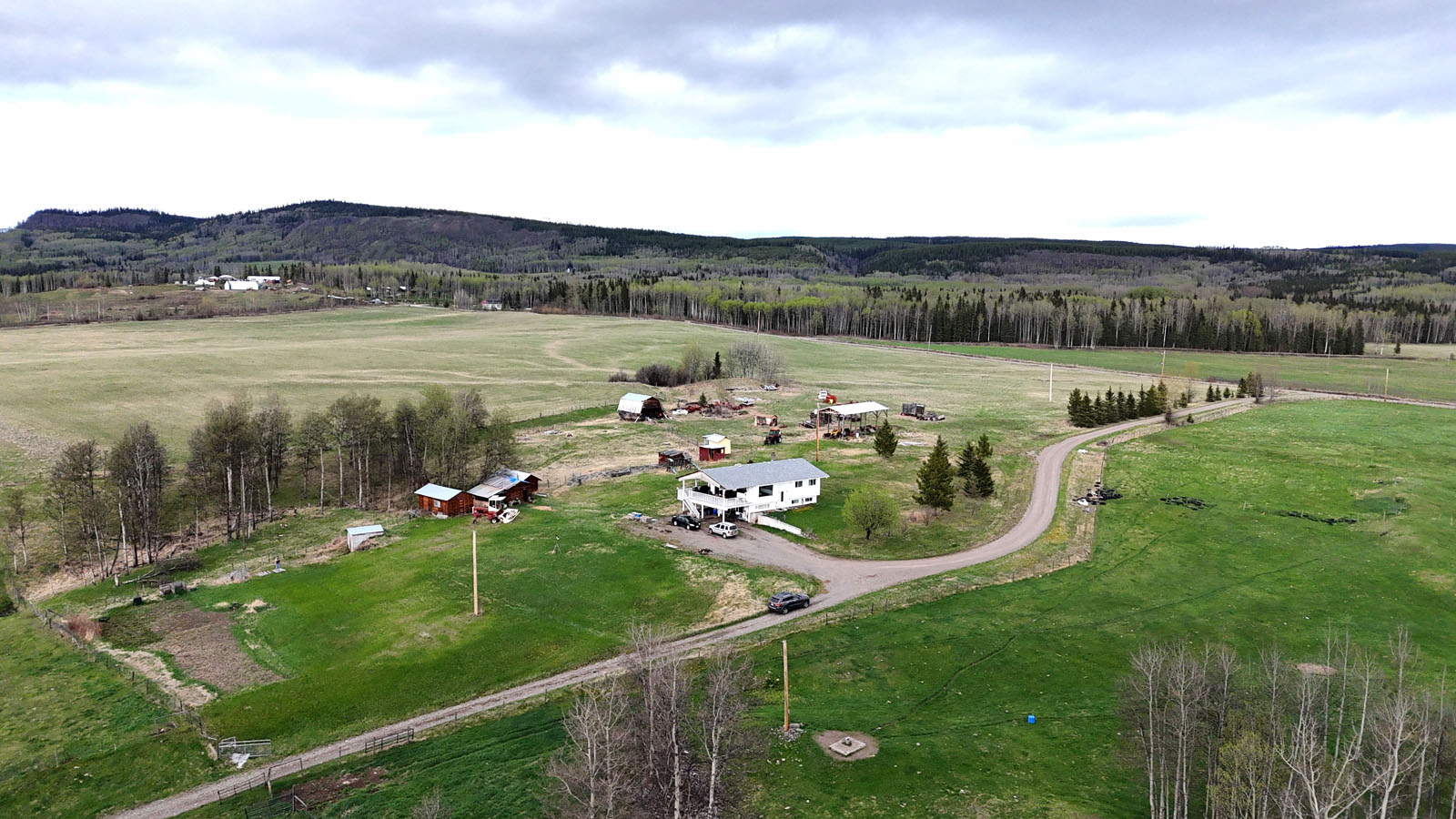
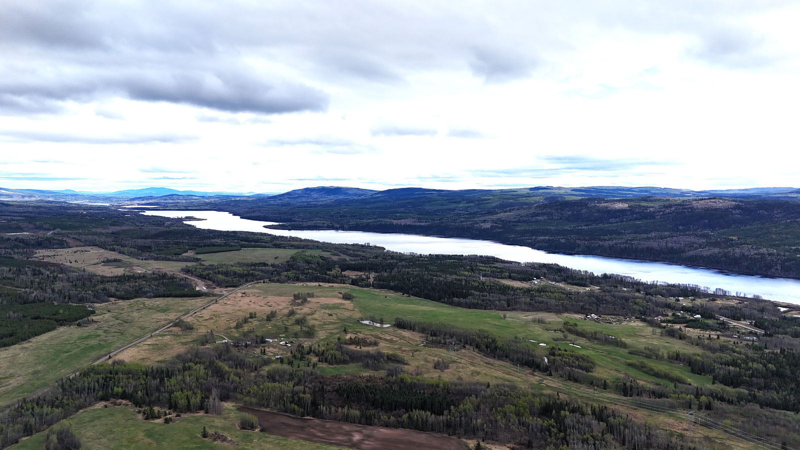
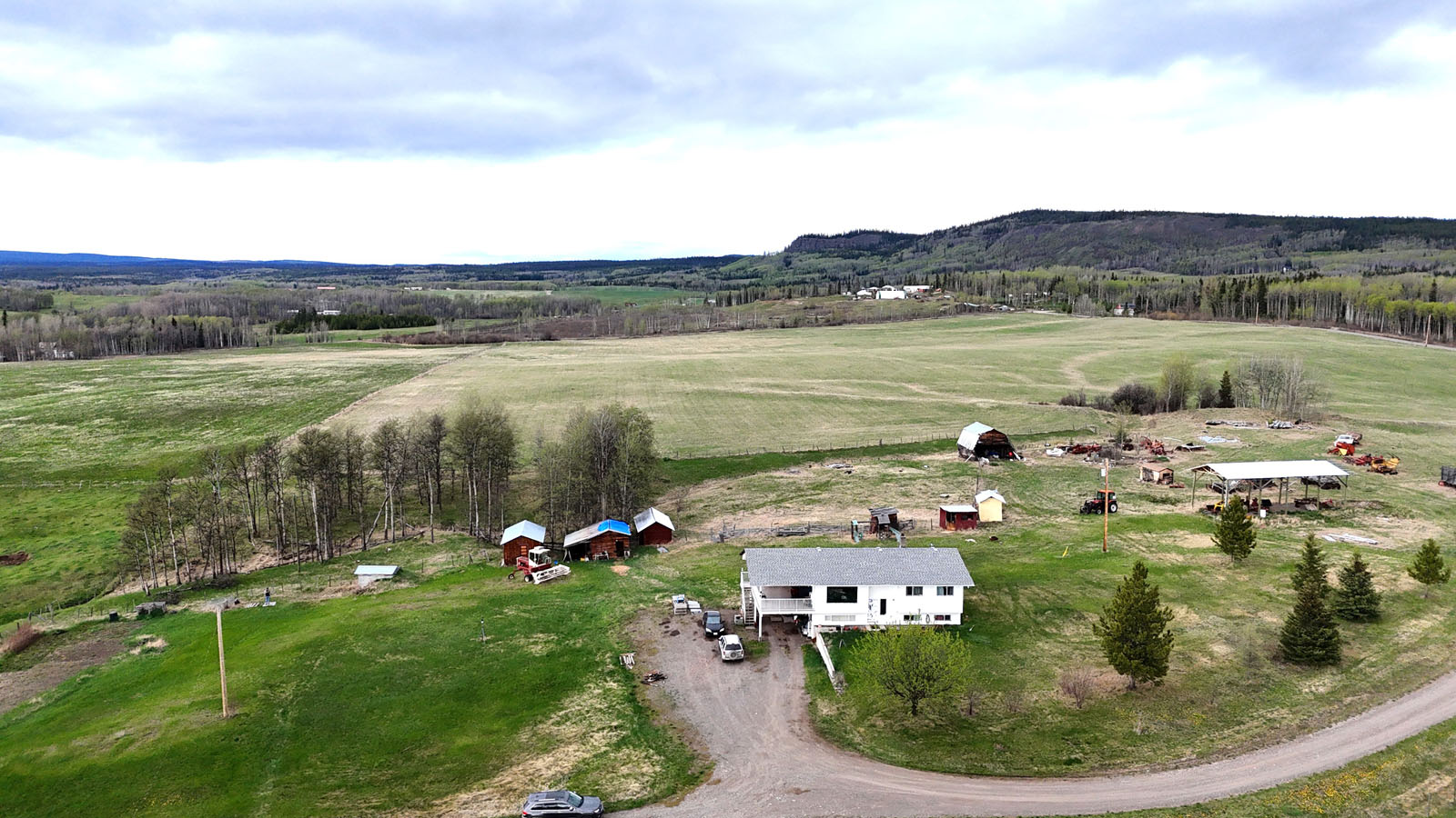
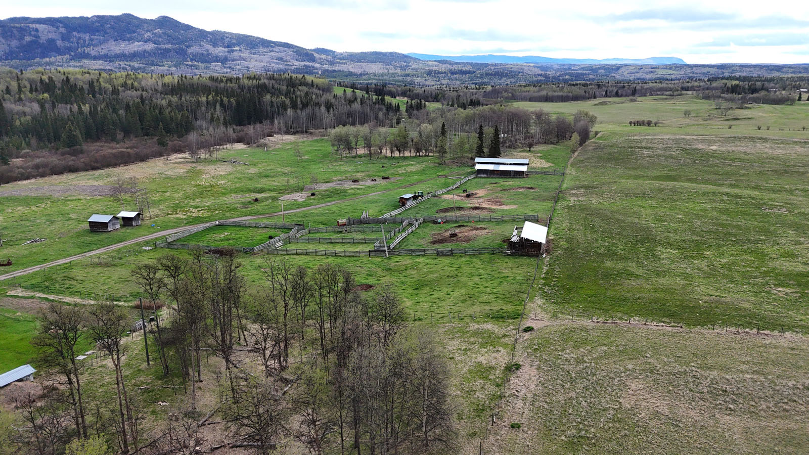
Home, home on the range. This 157-acre property offers rural solitude and urban convenience with the town of Burns Lake, BC a short drive away. Set in British Columbia’s idyllic north country, the property is in close proximity to lakes, snow-capped mountains and pristine forests.
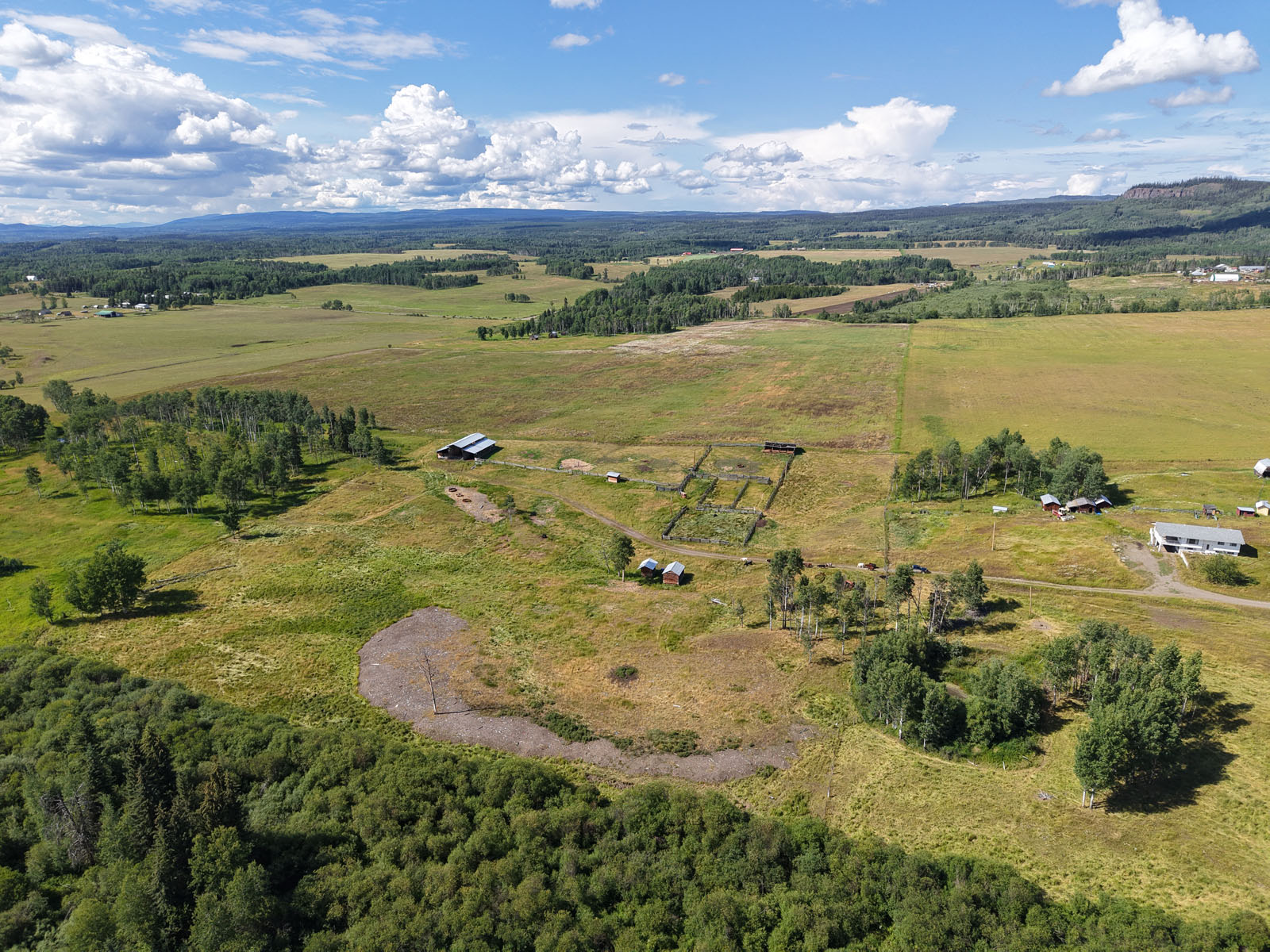
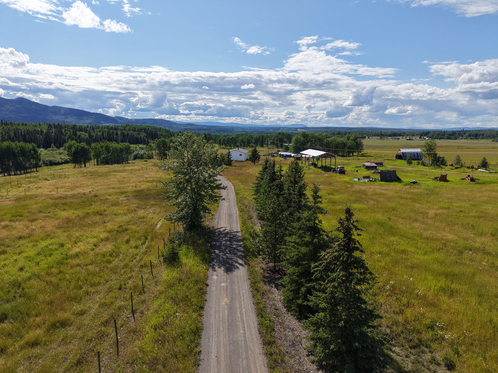
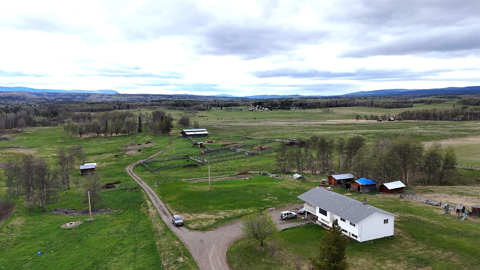
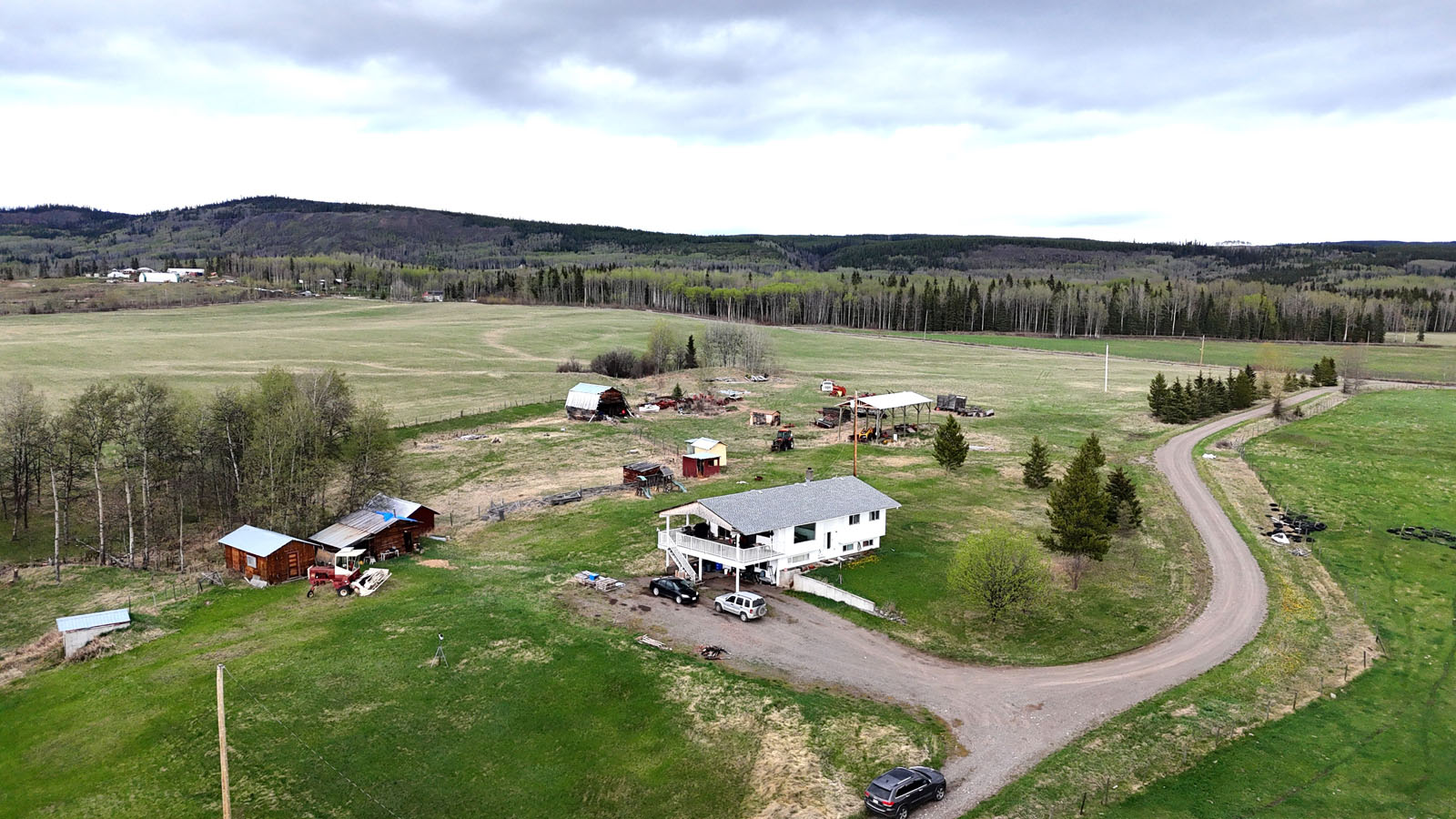
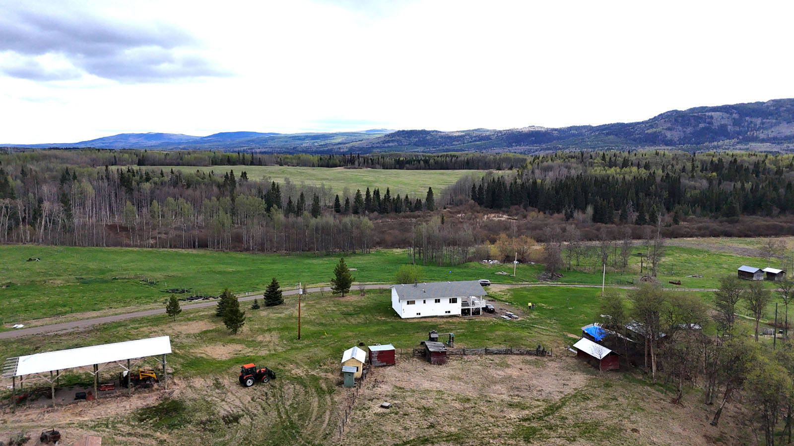
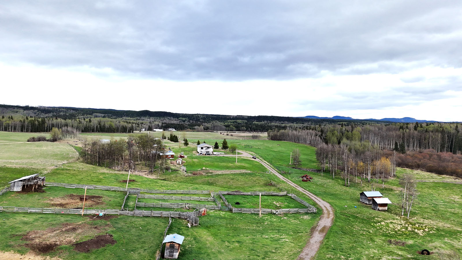
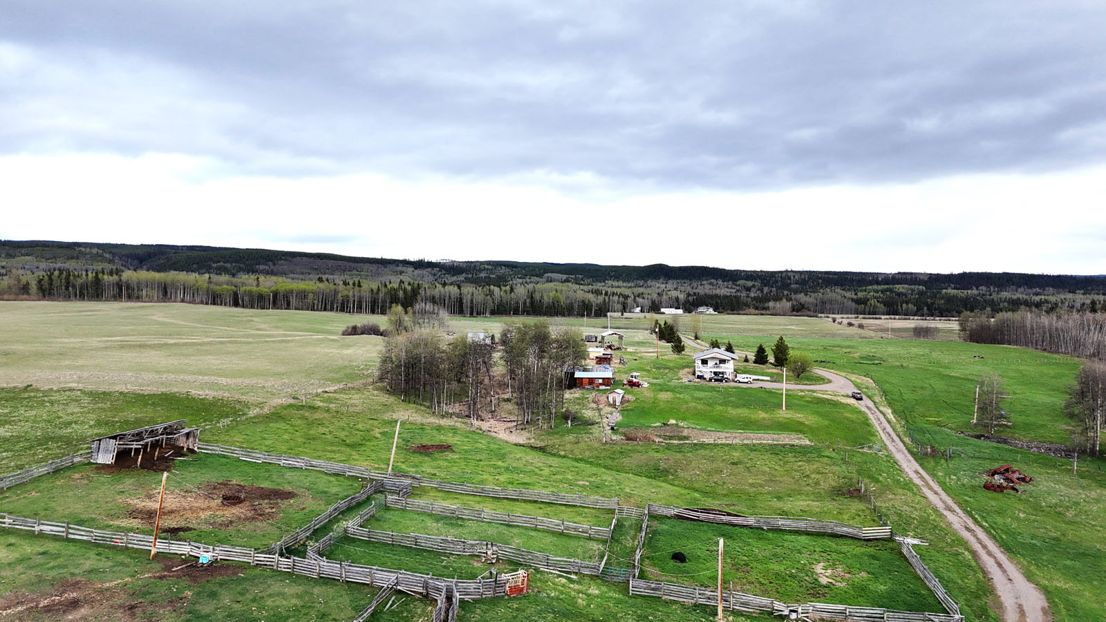
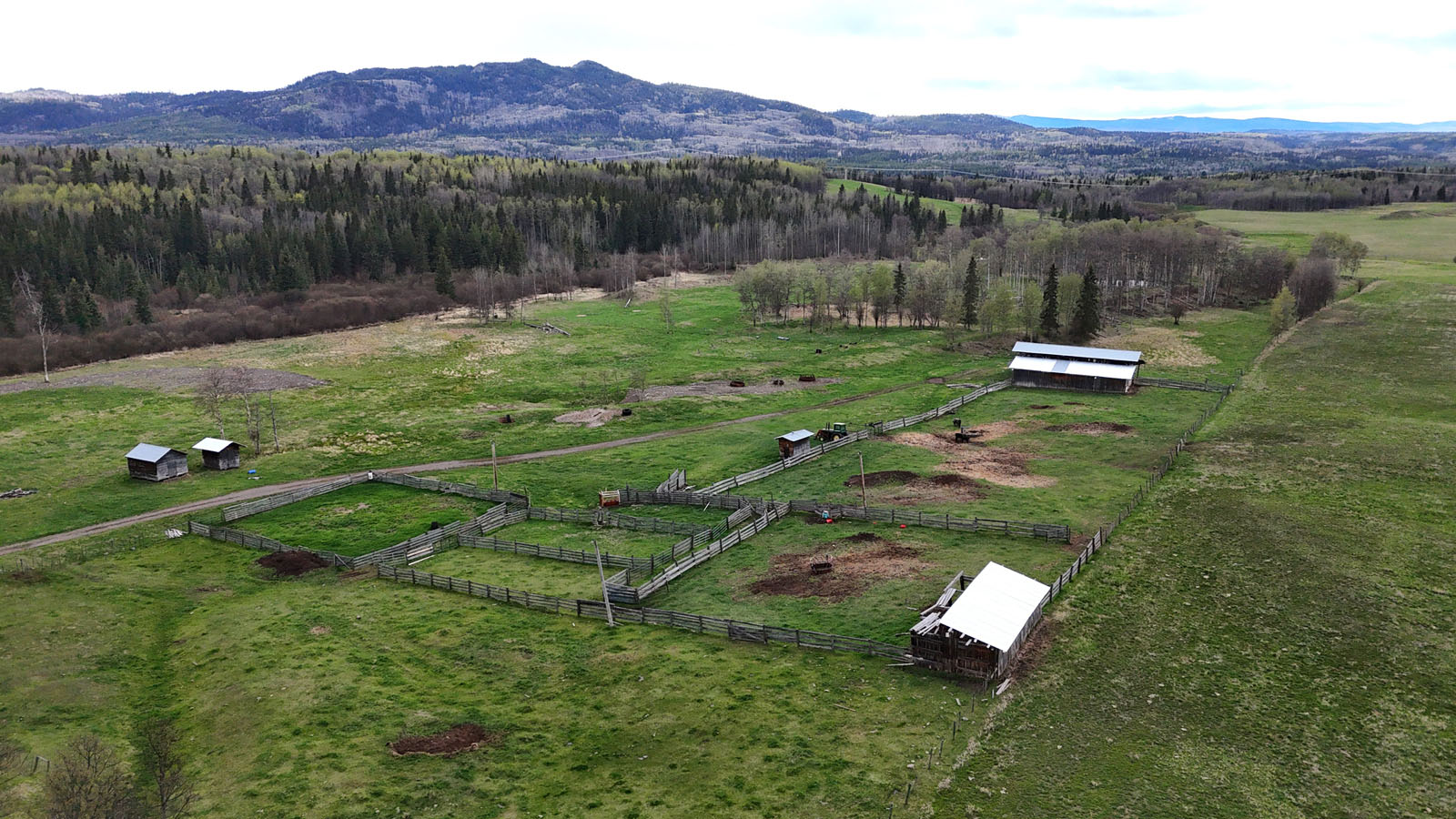
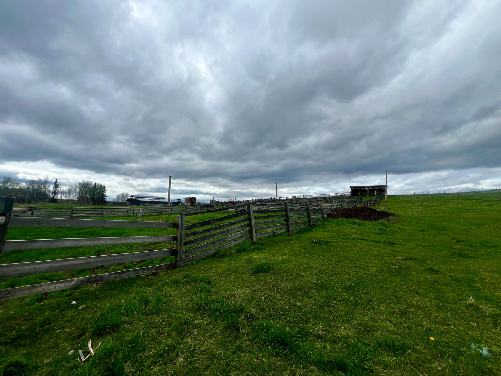
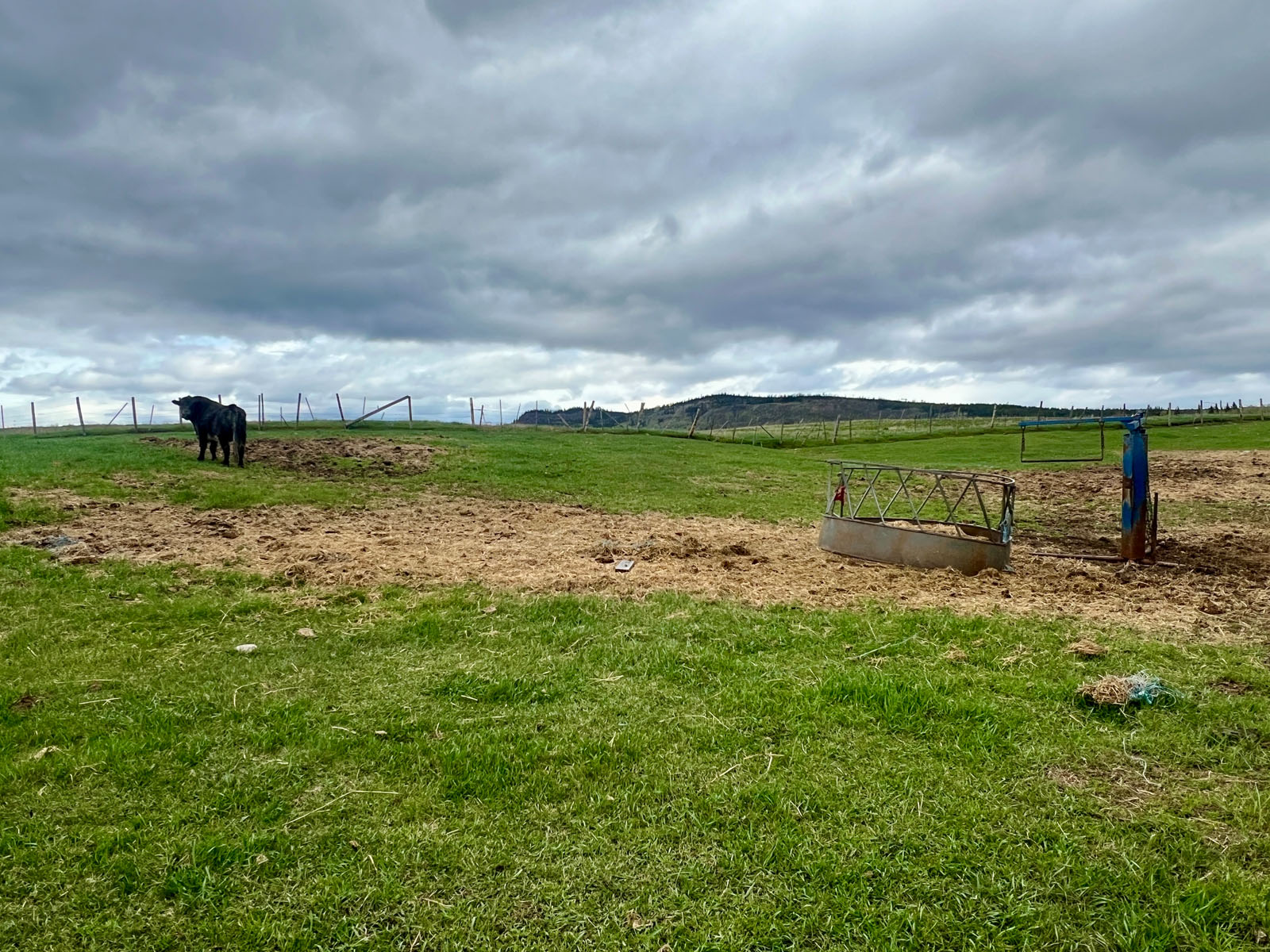
The property itself consists of 157 acres of fertile farmland where there are currently 105 acres in hay production (yielding 1.5 tonnes per acre). The remainder of the property is pastured for livestock. The property is flat with fencing and cross-fencing to allow rotational grazing. Whether you wish to graze cattle, or horses the infrastructure is already in place to immediately start grazing livestock.
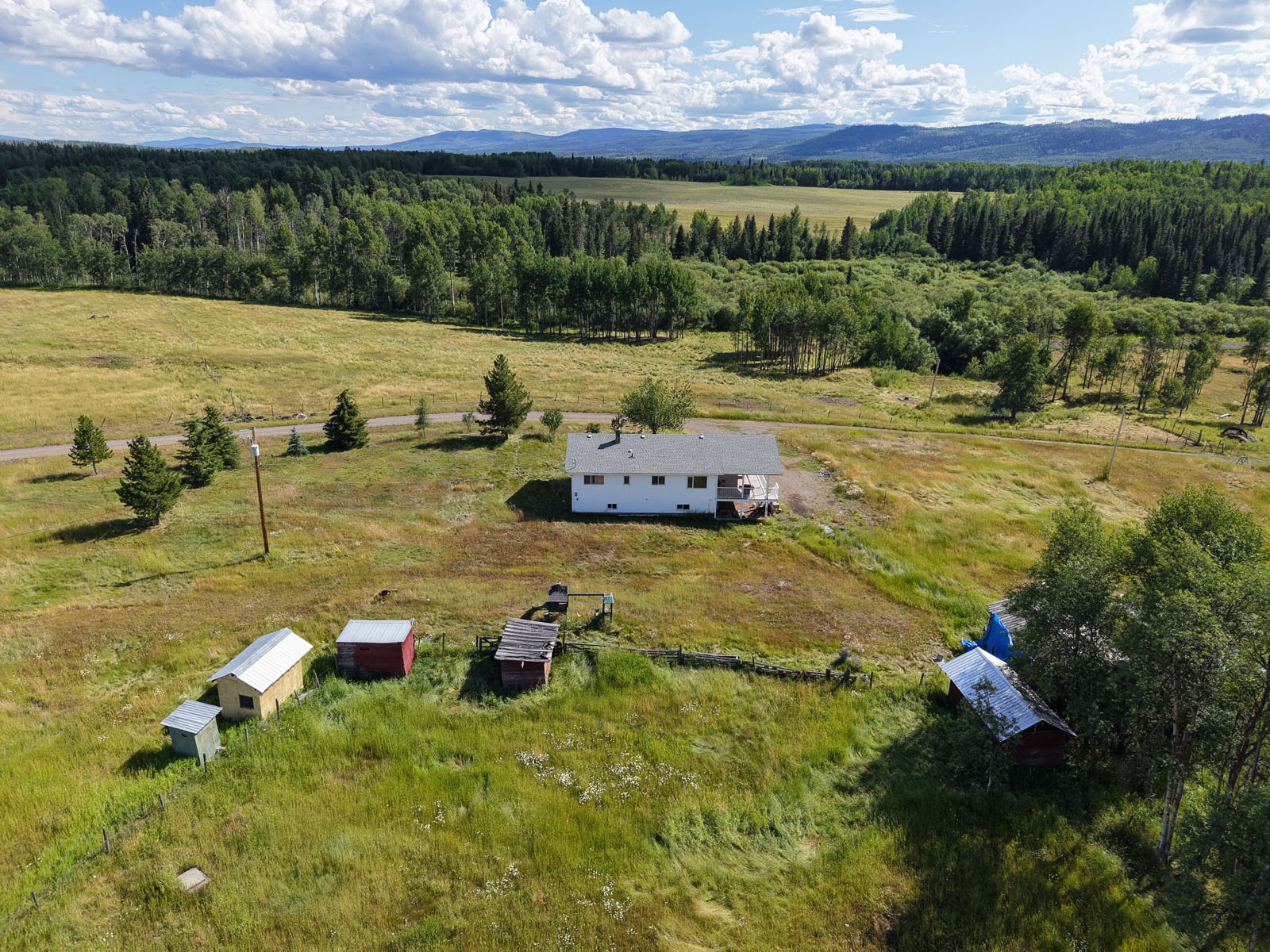
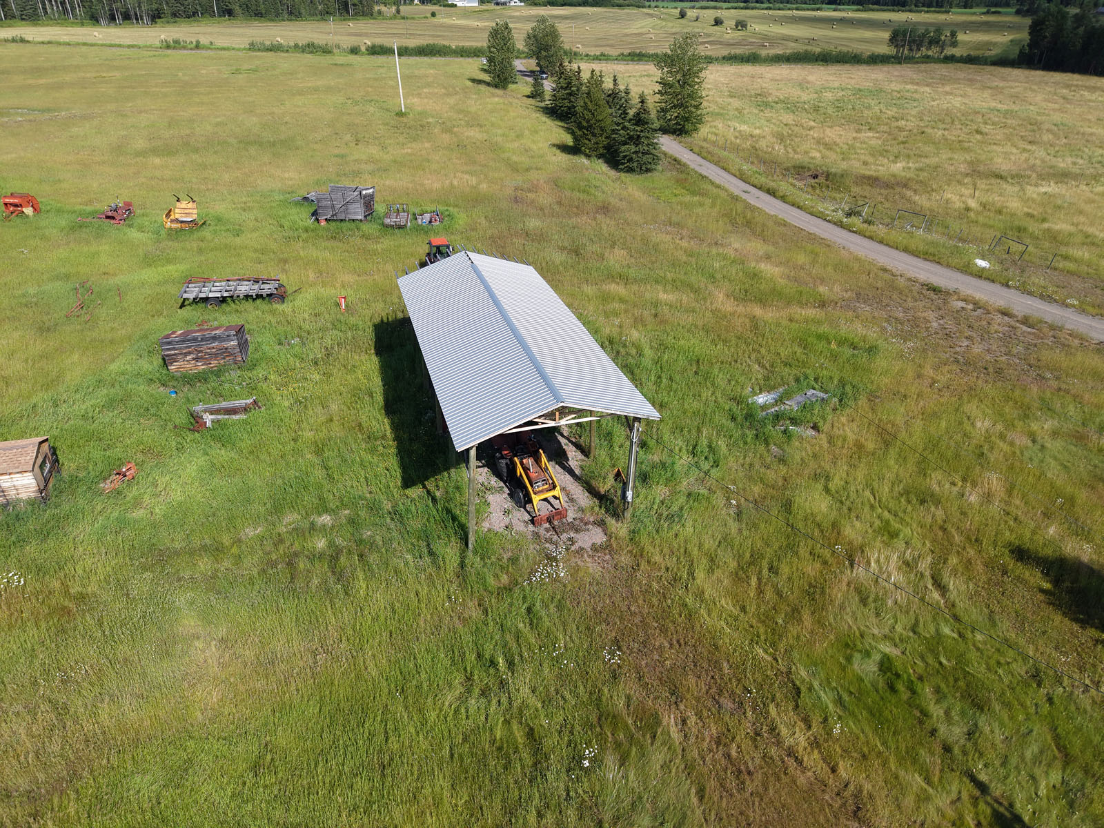
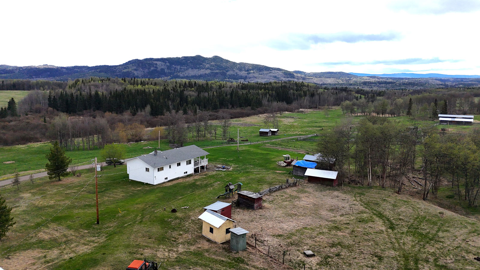
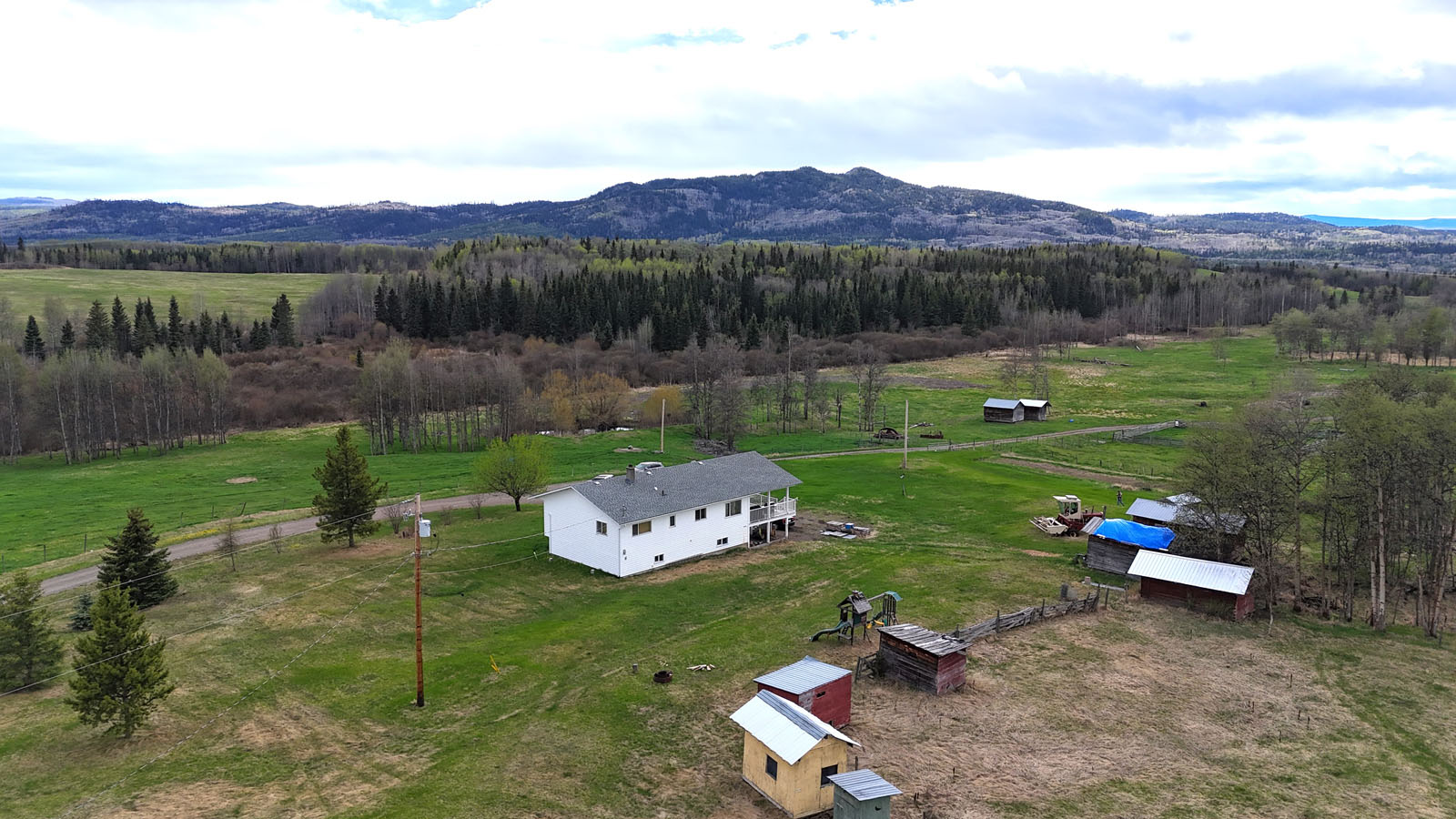
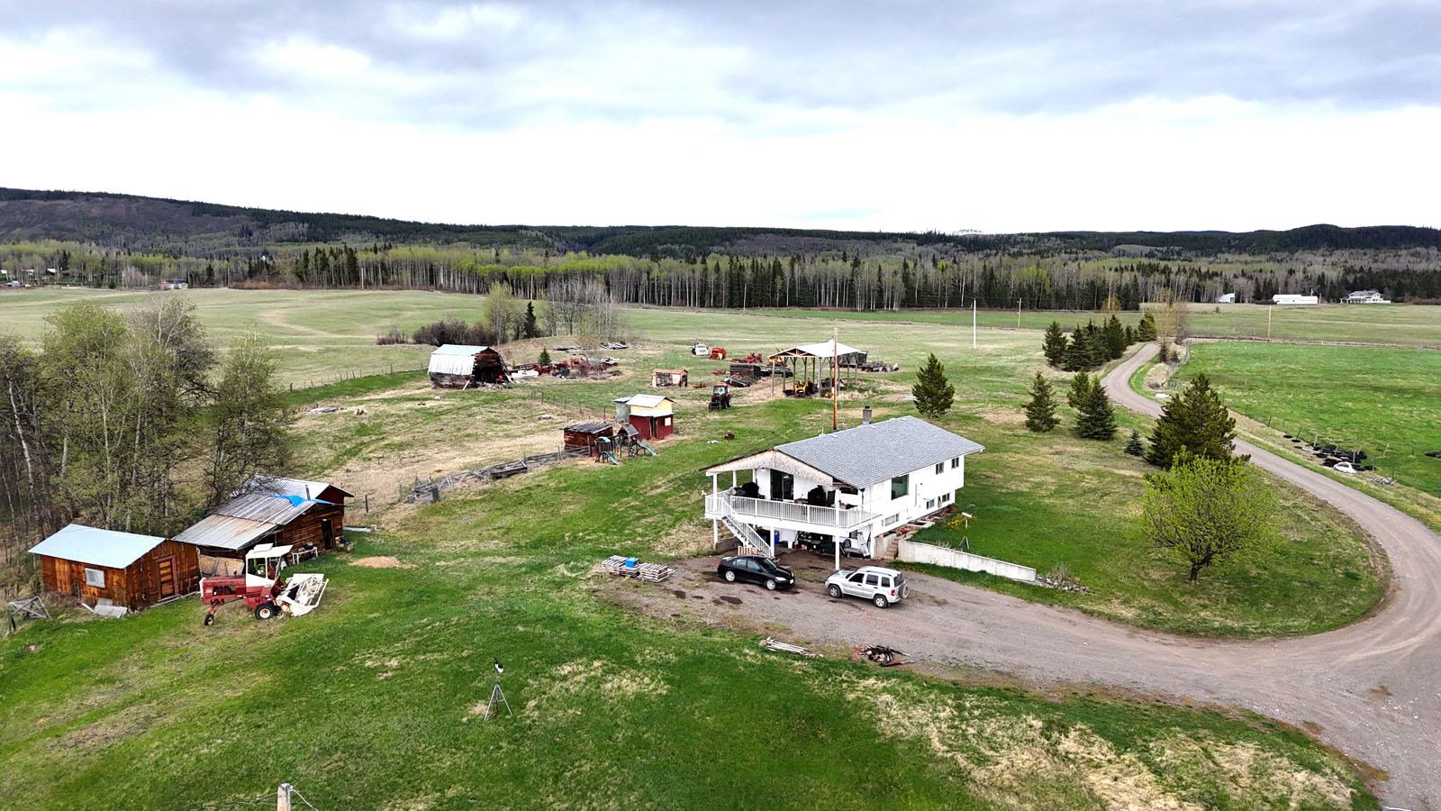
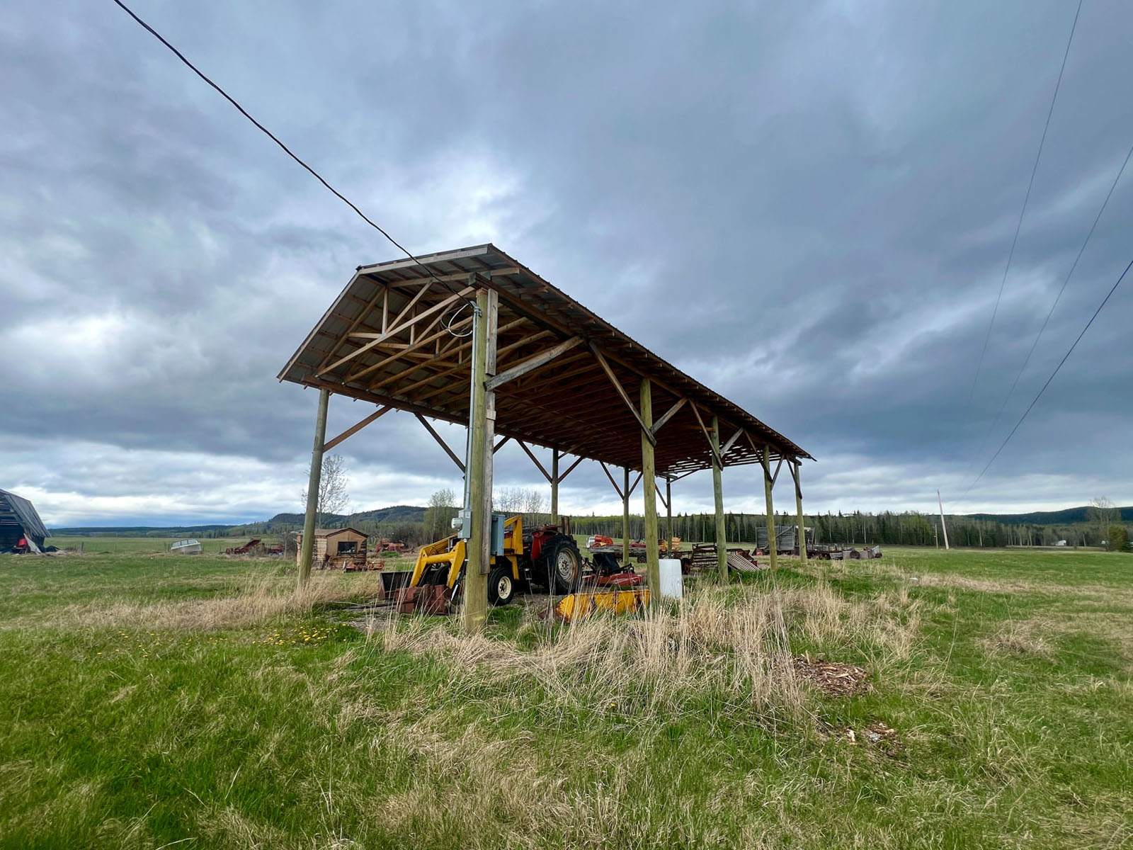
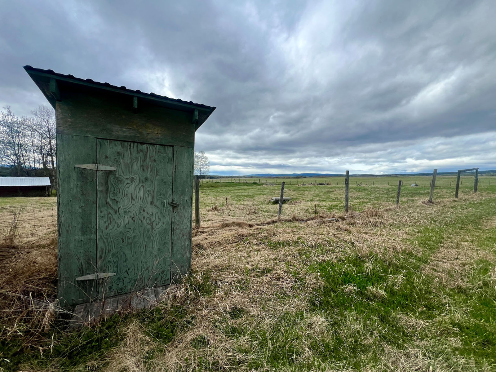
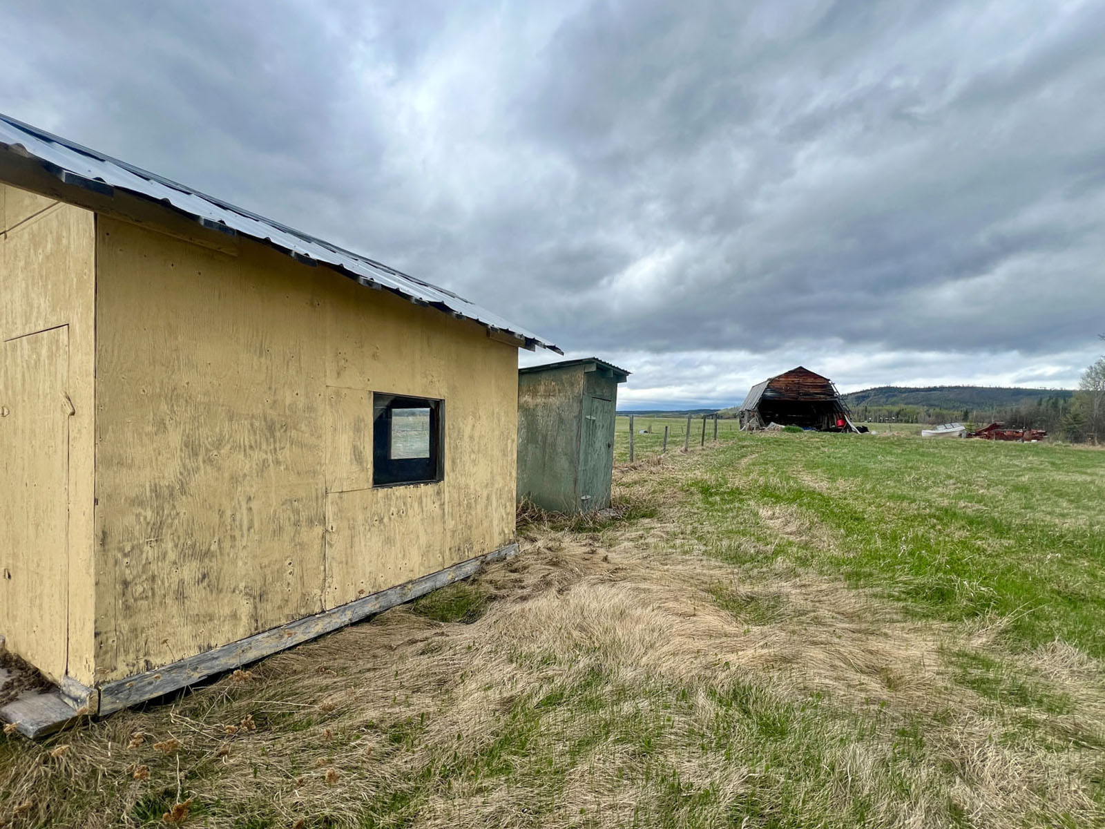
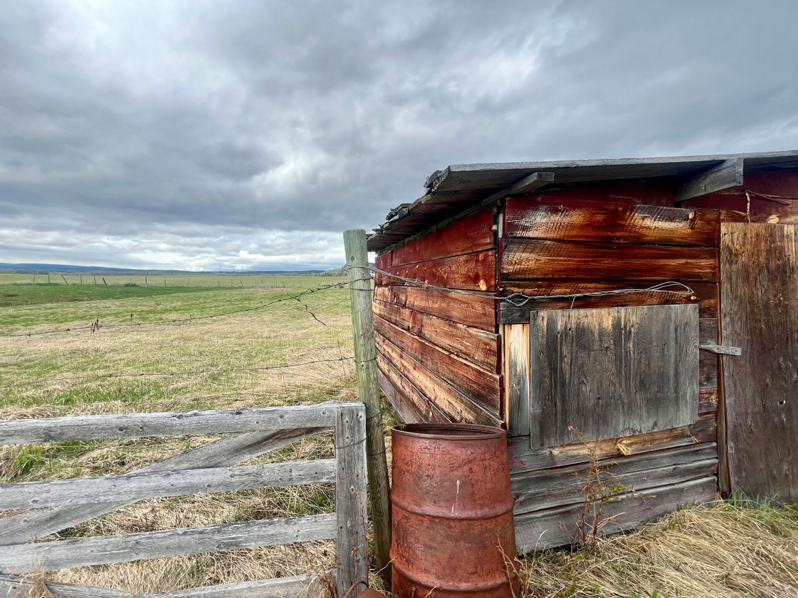
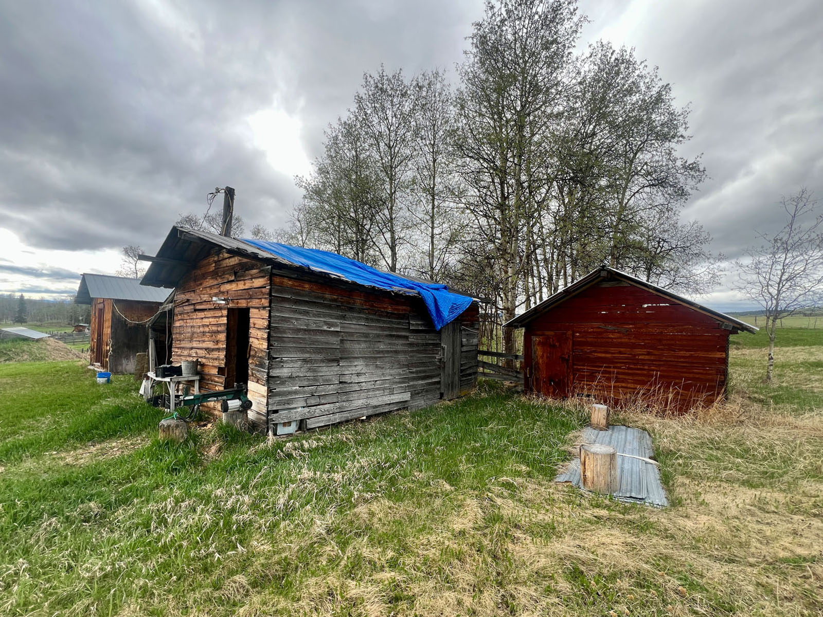
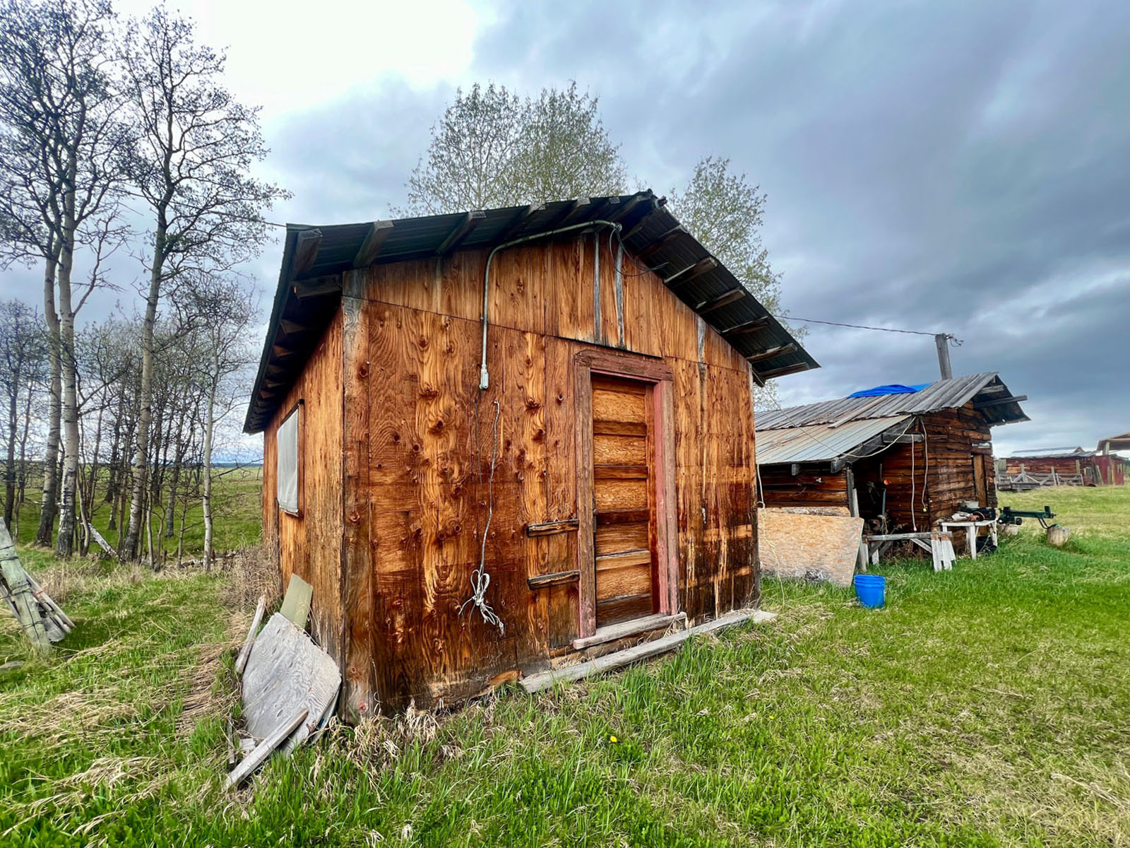
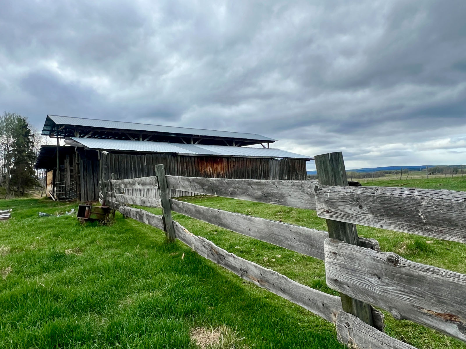
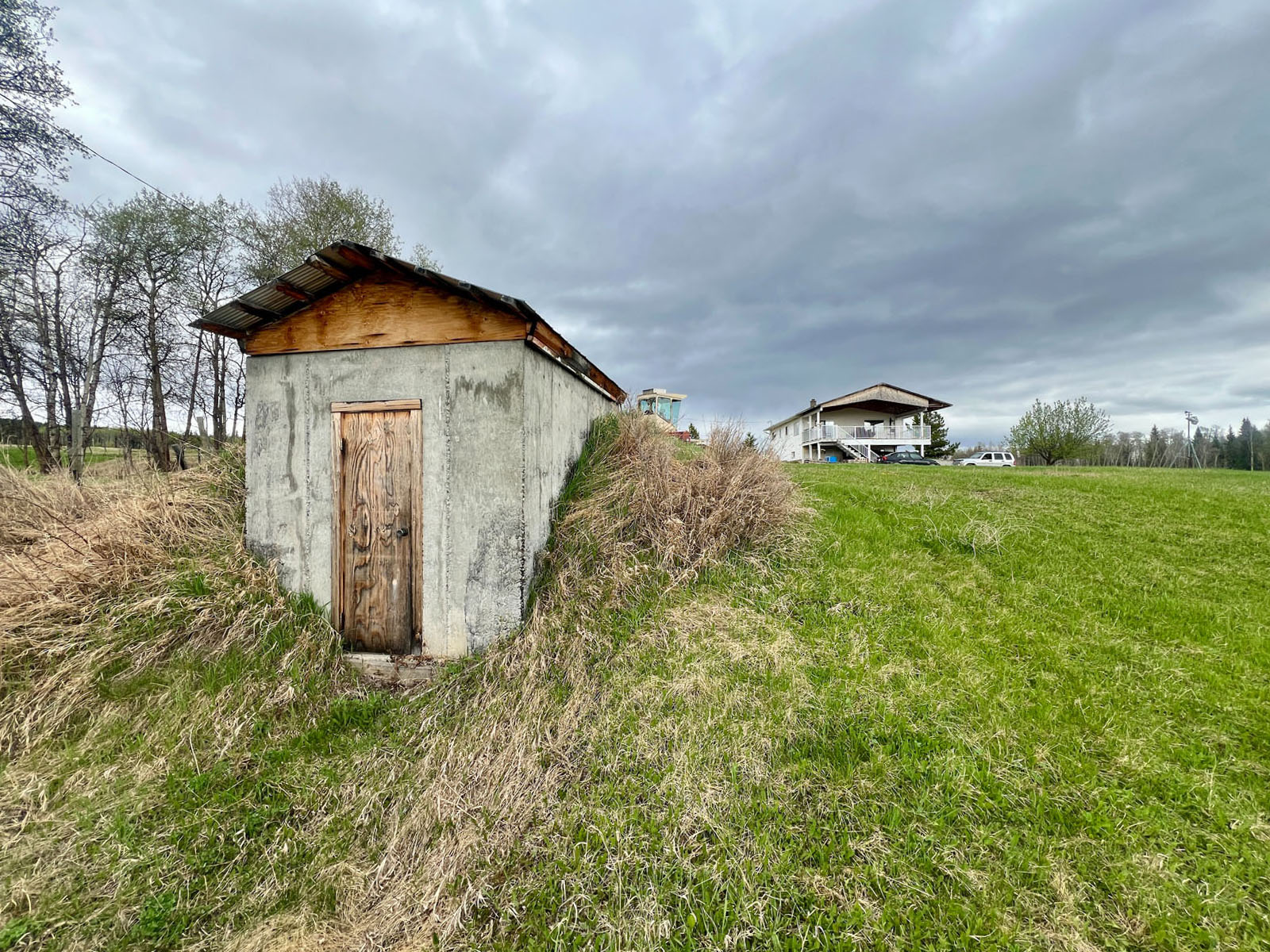
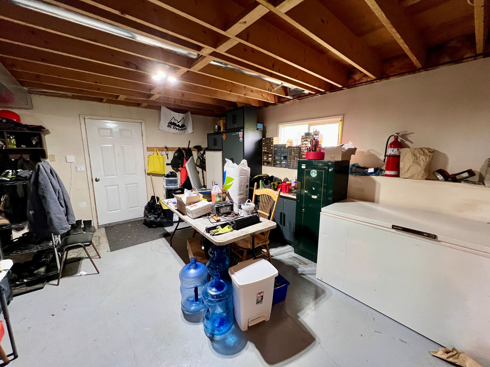
The main yard has a corral system for calving and sorting. There are several animal shelters throughout the yard and 3 electric stock waterers to keep animals hydrated. There is a 20’ x 60’ hay shed with dual attached 16’ x 60’ lean-tos for additional storage. The owners have constructed an additional 20’ x 60’ pole barn with wiring hook-ups for an RV. This structure can be used to house recreational vehicles, boats, or farm related equipment. It could also be utilized for additional hay storage. There are numerous older outbuildings throughout the farmyard. These could be used to house chickens and pigs, or simply be used for storage.
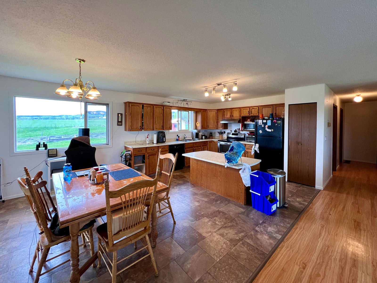
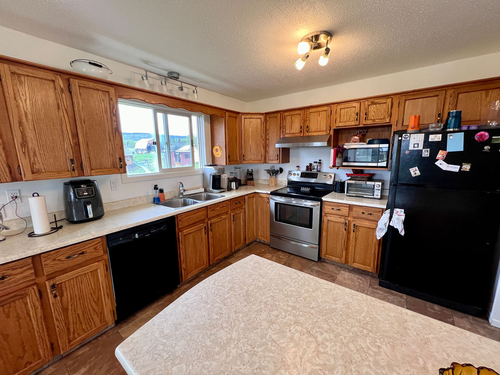
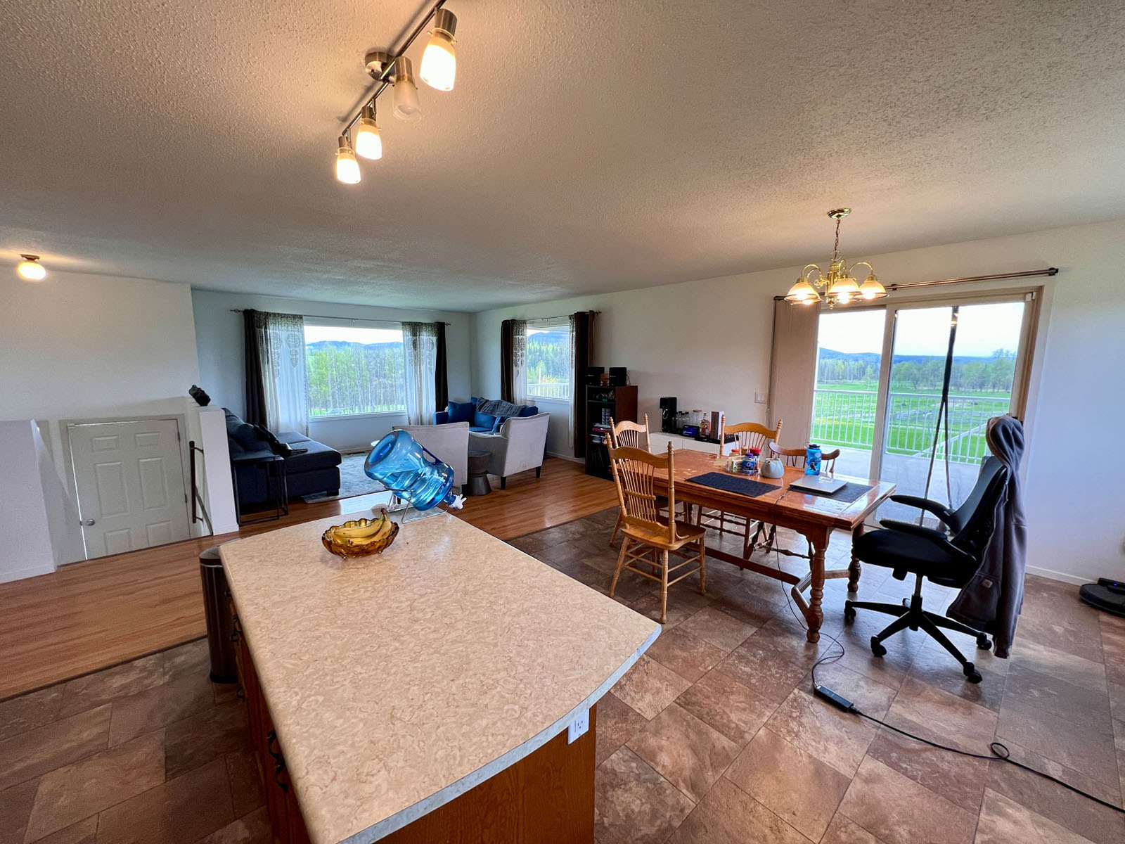
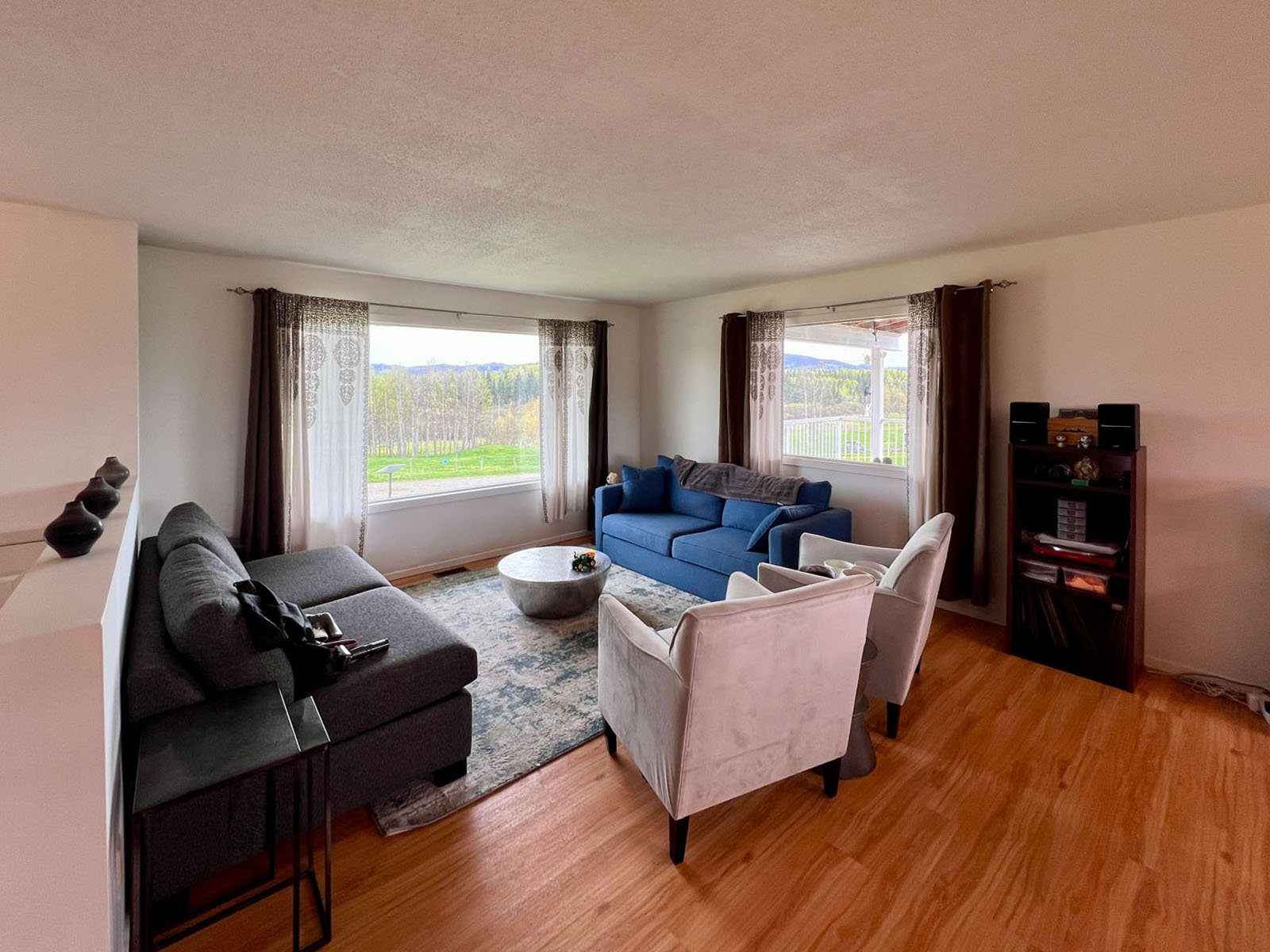
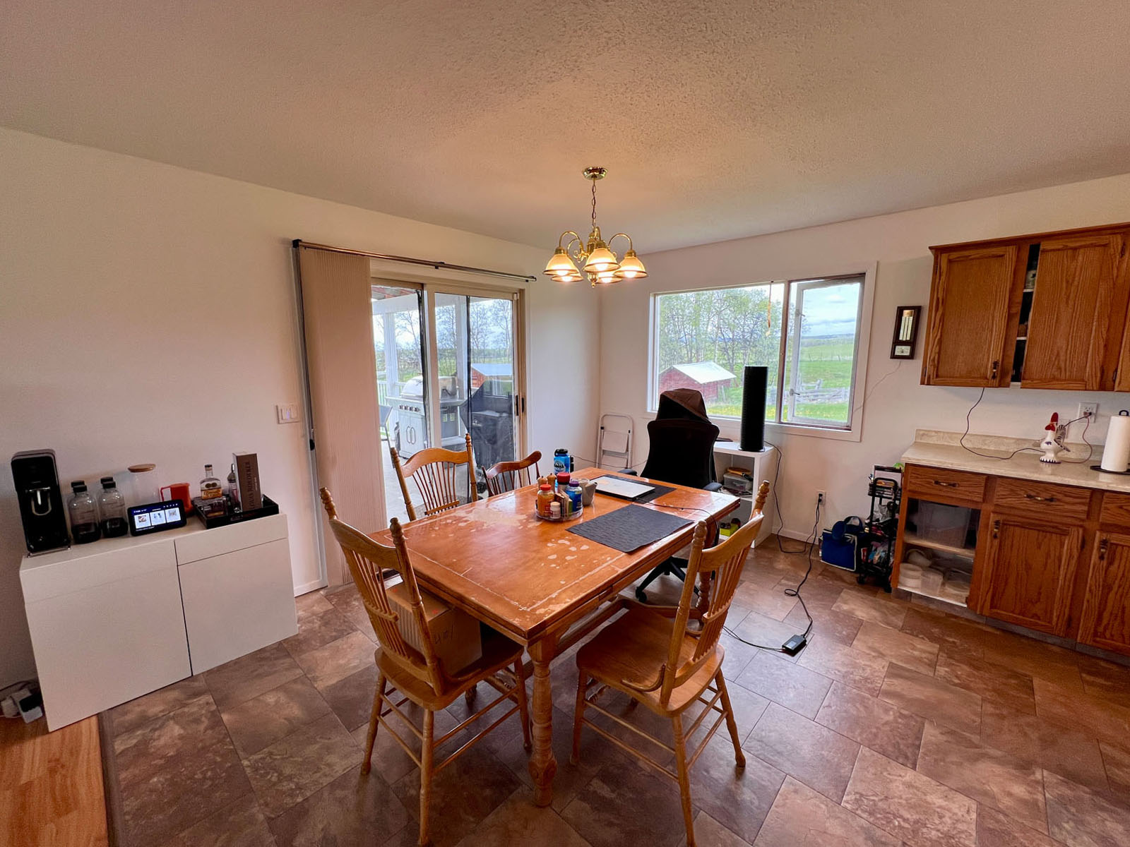
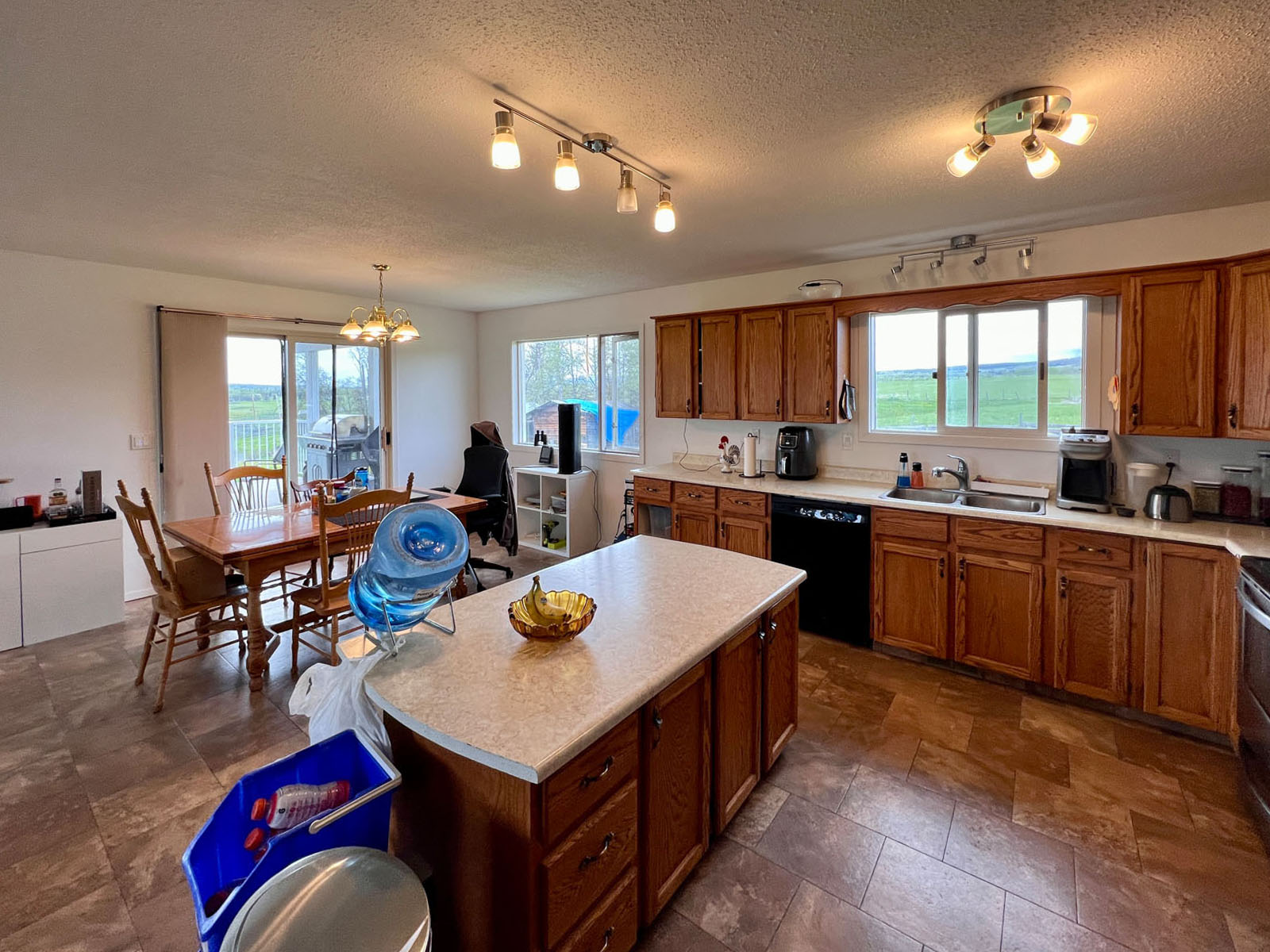
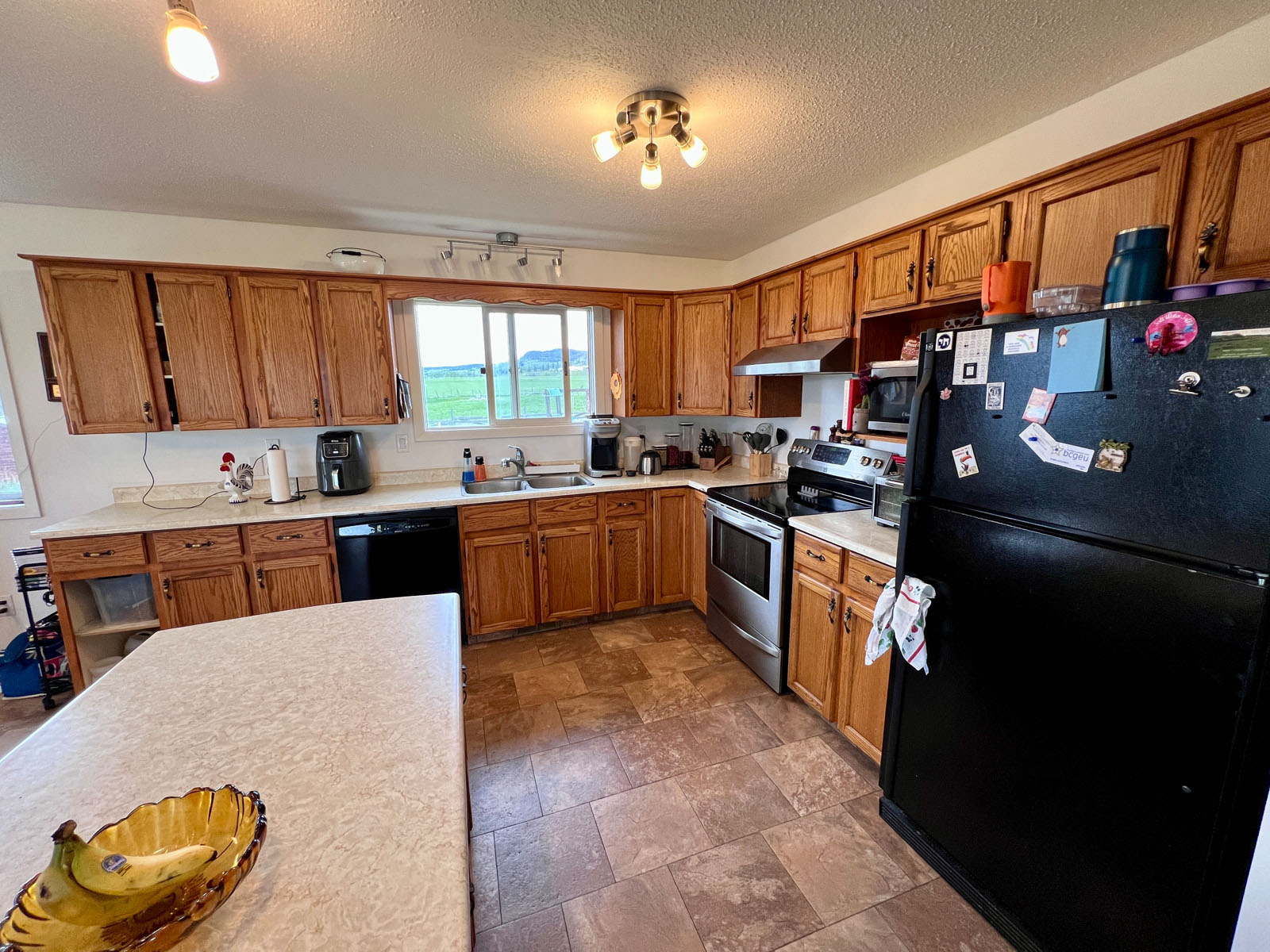
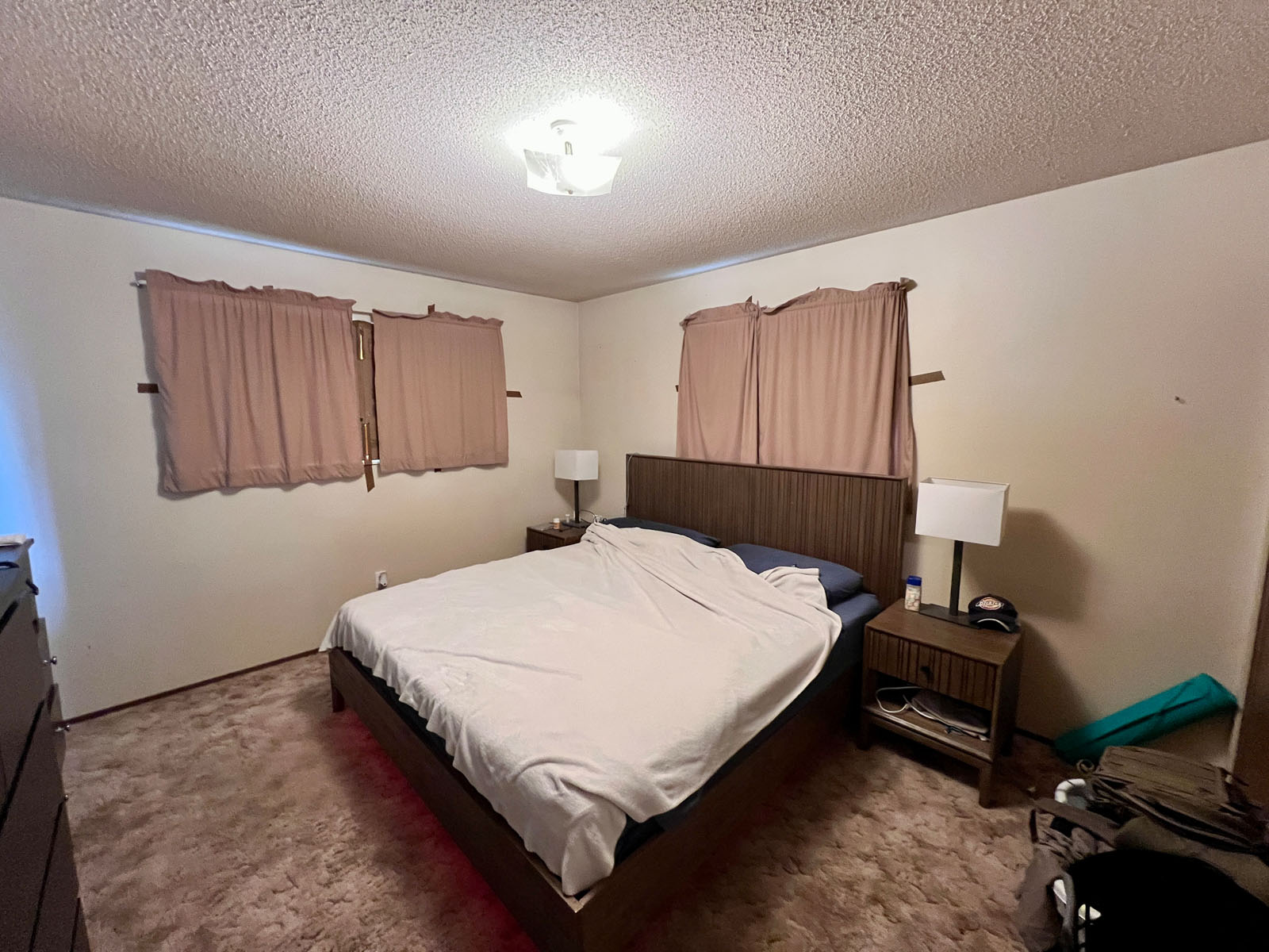
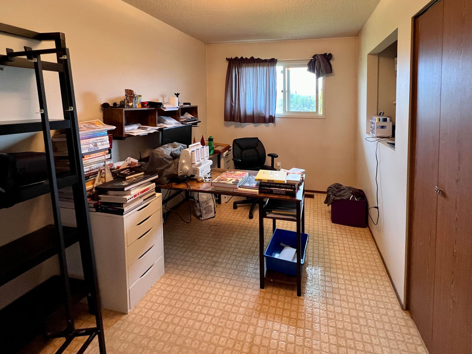
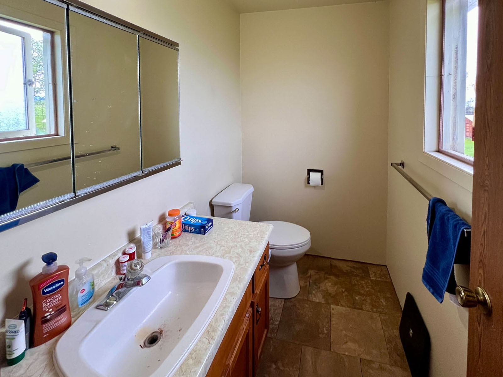
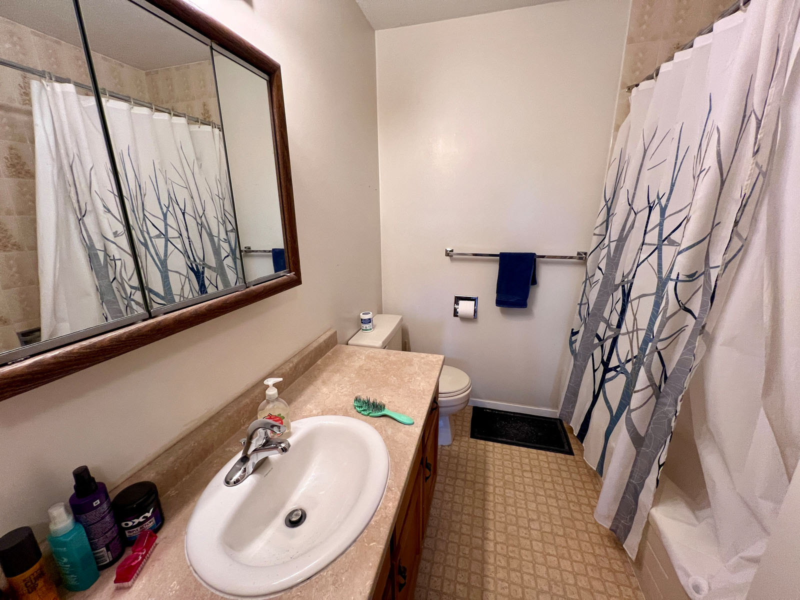
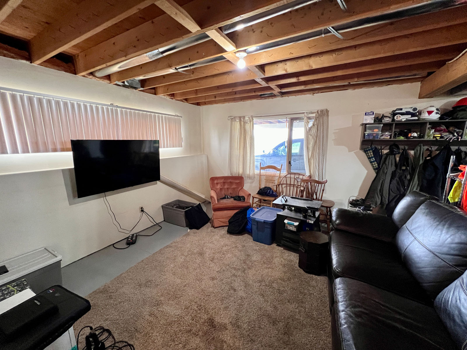
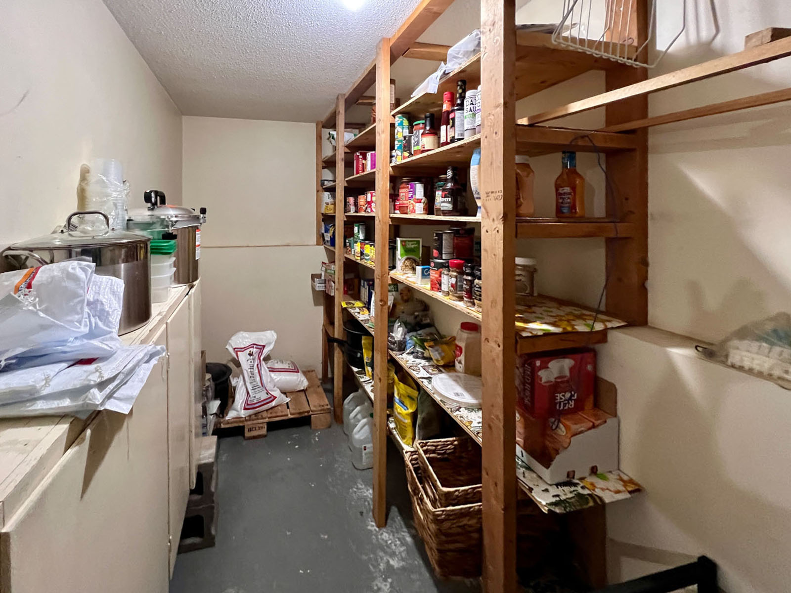
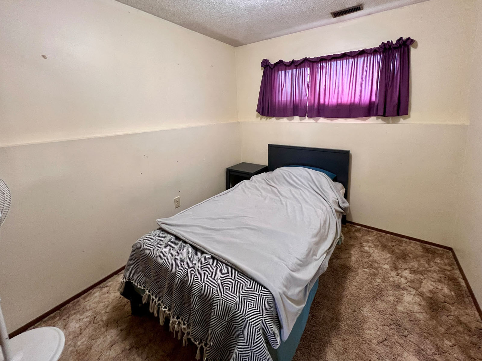
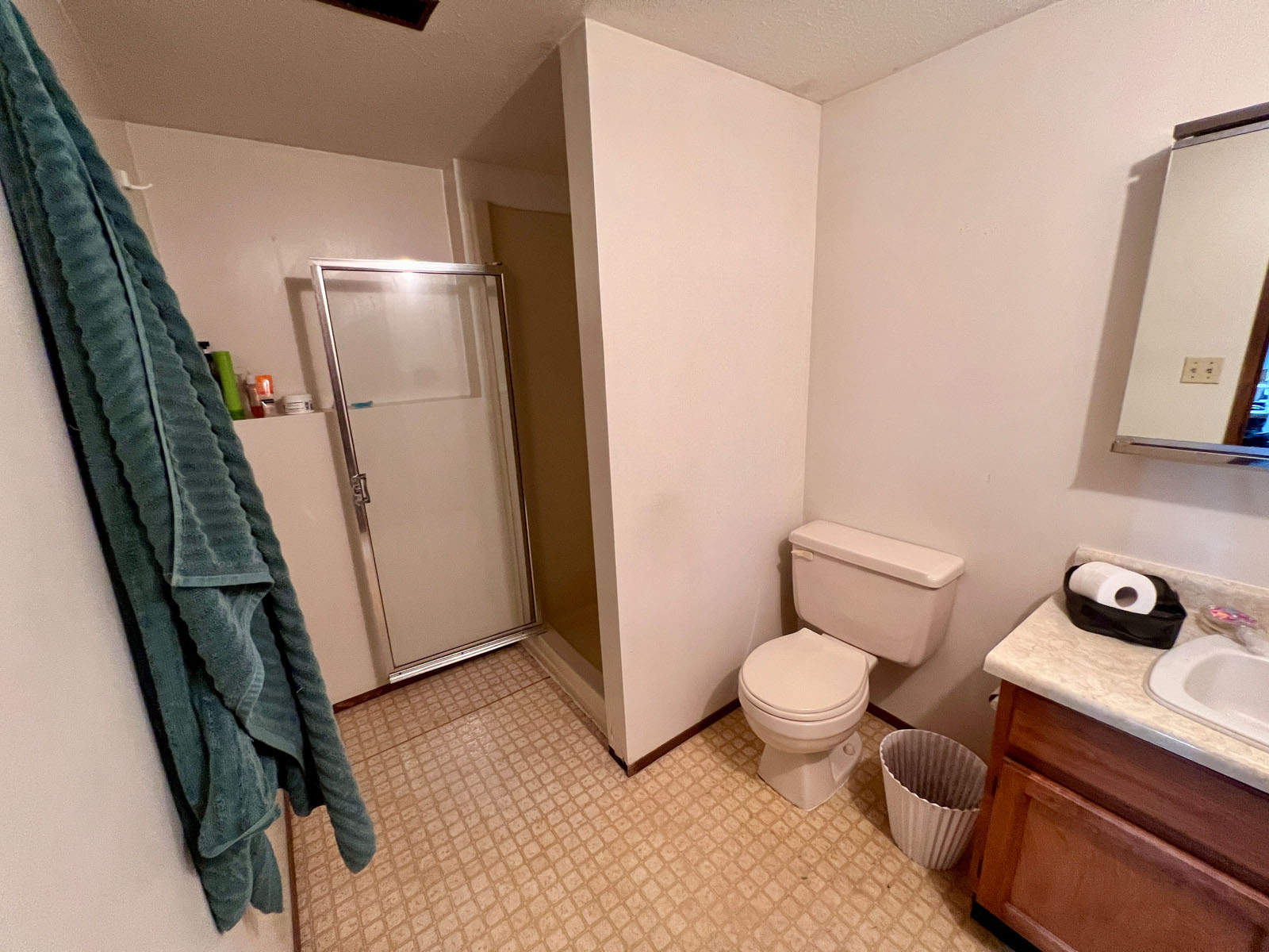
The country home offers 2,500 ft2 with a new roof and a large covered outdoor living space. The covered balcony sits on the second level and provides panoramic views of the farmyard and mountains beyond. The home was built in 1984 and has been well maintained. The home comes complete with 5 bedrooms and 3 bathrooms (including powder room en suite). The basement is used for storage/recreational purposes and features a spacious cold room for canned goods. There is also a carport underneath the second floor deck to keep vehicles out of the snow.
14187 Palling Road E - Burns Lake, BC
From Burns Lake, head west on Highway 16 for 12 km until the intersection with Palling Road. Turn to head north on Palling Road and proceed for just under 3.5 km at which point the driveway will be on the west ride of the road.
The Lakes District of Northern BC embraces over 300 wilderness fishing lakes and 3,000 miles of pristine shoreline. The district extends from the Stikine Mountains to the Omineca Mountain Range in the east. Ootsa Lake borders the southern area and then extends northward to Babine Lake.
Burns Lake (pop. 2,800) serves the greater surrounding areas' population of over 8,000 within the Regional District of Bulkley Nechako. The town is a hub for the local logging, saw-milling, mining, and tourist industries. It also serves as the main commercial center for the surrounding area, including Francois Lake, Colleymount, Grassy Plains, Rose Lake, Topley, and Granisle. Several pubs, cafés, restaurants, a broad selection of stores and services, numerous hotels and motels, a library, and a hospital. It is also the location of the head offices of the Regional District of Bulkley-Nechako.
Burns Lake Airport is 20 kilometres northwest of the town. Commercial airlines fly into Regional Smithers Airport, 143 km west of Burns Lake, and International Prince George Airport, 237 km to the east. VIA Rail Canada stops at Burns Lake on the iconic trip from Jasper to Prince Rupert.
Overall, the area receives an above-average of sunshine than other BC areas. In June 1982, Burns Lake recorded a whopping 376.5 hours of sunshine. This is the most sunshine ever recorded during the month of June. The warmest month is July, with an average high of 21°C. The average snowfall is approximately 190 cm, with the chilliest month in January having an average low of -15.3°C.
Burns Lake has gained world-renowned recognition from the International Mountain Biking Association for its network of trails on Boer Mountain. The trails, maintained by a volunteer group called Burns Lake Mountain Biking Association, include 20 km of downhill and 40 km of cross-country trails. The trails continue to draw mountain bikers from all over the world and are expanding every season.
In the winter months cross-country skiing is very popular at the Omineca Ski Club. Its facilities have hosted several national championships and are considered to rank among western Canada's best trail networks. The facilities include 25 km of groomed trails, four km of which are lit for nighttime skiing. There is also a facility for biathlon skiing.
In 2014 The Village of Burns Lake completed work on the Lakeside Multiplex and renovations to the Tom Forsyth Memorial Arena. This facility includes a hockey rink, curling rink, rock climbing gym, a squash/racquetball court, a fitness facility and multi-use rooms. The facility is located on Spirit Square, a large outdoor park with a playground, a beach, a walking path, outdoor fitness equipment, two tennis courts and a skateboard park.
The 1.9-kilometre Opal Bed Trail leads to an active rock hounding destination, where users can look for precious minerals.
Burns Lake is considered to be the gateway to Tweedsmuir North Provincial Park and Protected Area. The North Park is a wilderness area with no services or supplies; it cannot be accessed by road. Fly-in tours for sightseeing, hunting and fishing are offered by local outfitters.
54°21'7.22"N and 125°52'18.16"W
$1,904.25 (2024)
Agricultural (AG1)
DISTRICT LOT 568 RANGE 5 COAST DISTRICT EXCEPT PLAN PRP13272
PID 014-991-721
Multiple Listing Service®
 +8 maps


Our property descriptions and geographical information are taken from the BC Assessment Authority, Land Titles Office, government maps and other sources. While LandQuest® does not guarantee the information, we believe it to be accurate, but should not be relied upon without verification. This communication is not intended to cause or induce breach of an existing agency agreement.
Rose Lake
 9℃
0℃
9℃
0℃