


Four separately titled parcels totaling 70+ acres with Eagle River frontage, Crown land boundary and outstanding mountain views just 15 minutes west of Revelstoke. Flexible zoning allows a home and secondary dwelling on each title. Recently logged with multiple buildings sites. Excellent recreational property.
 +29 photos
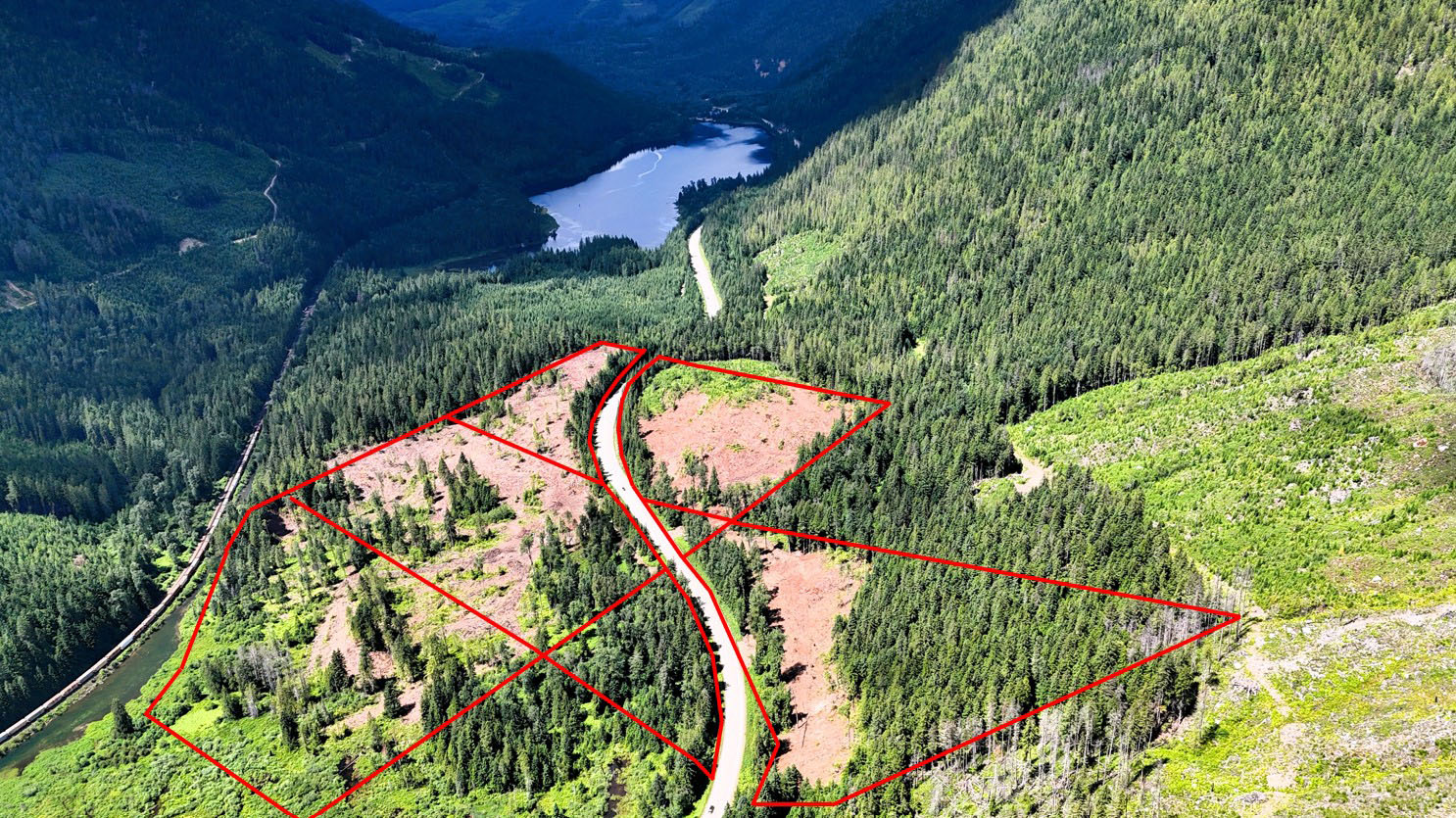
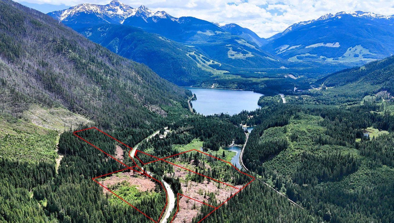
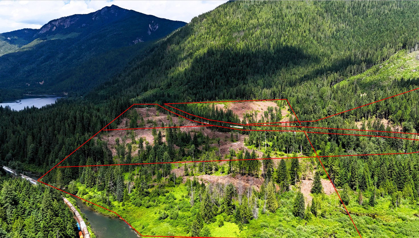
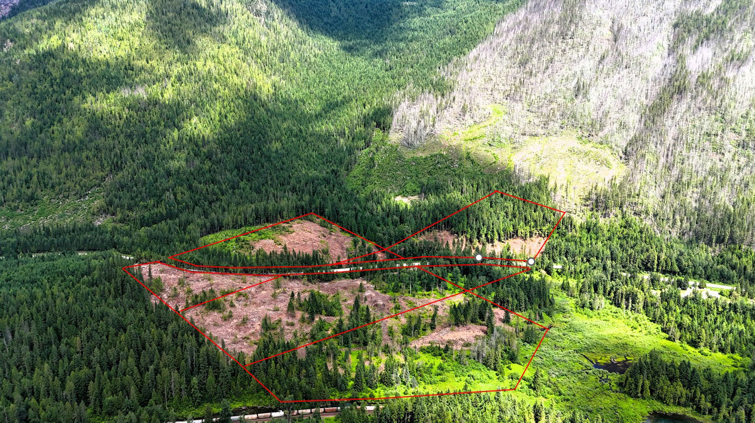
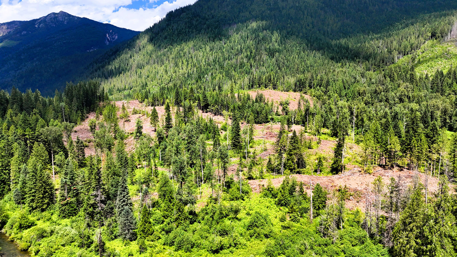
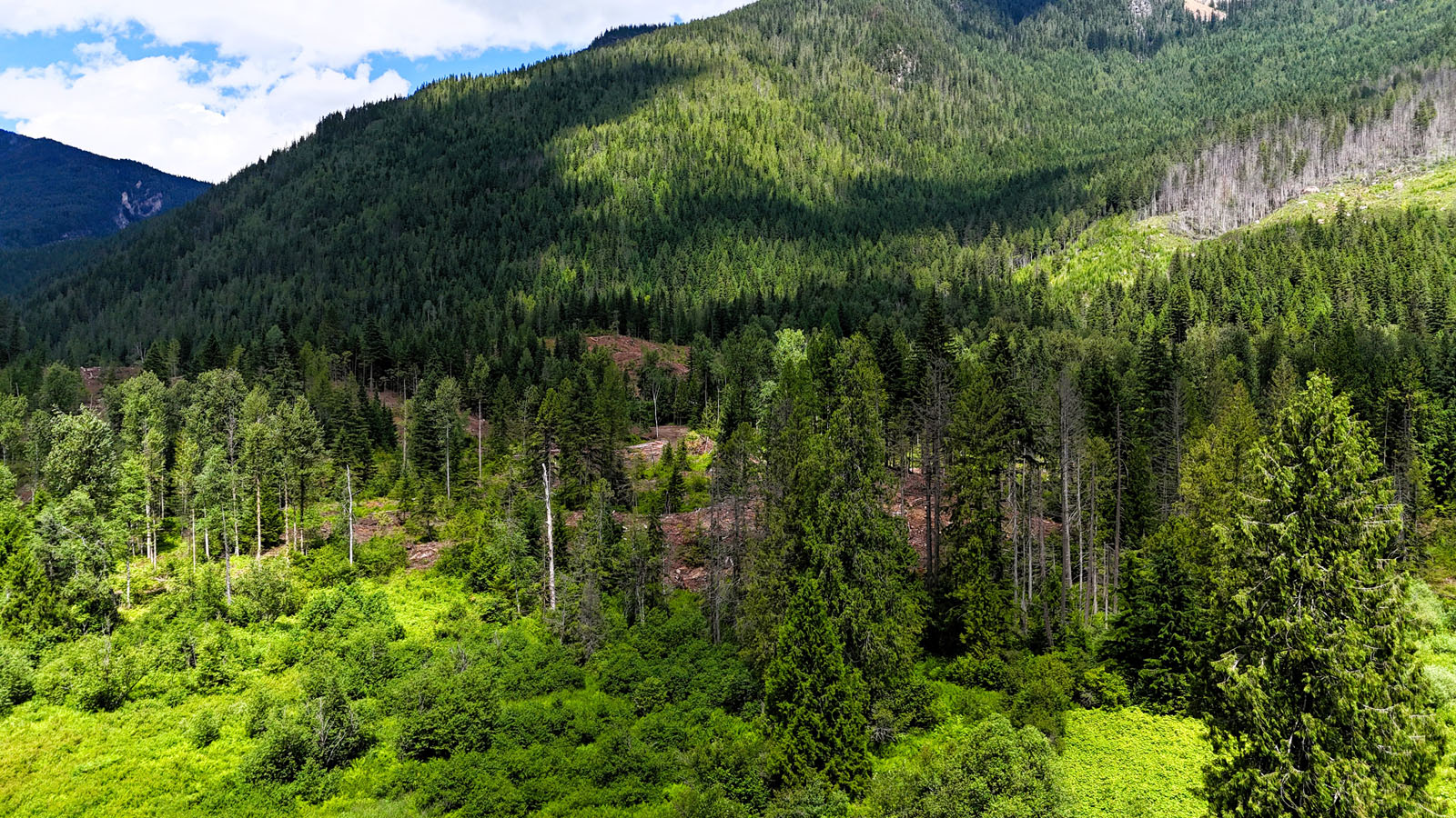
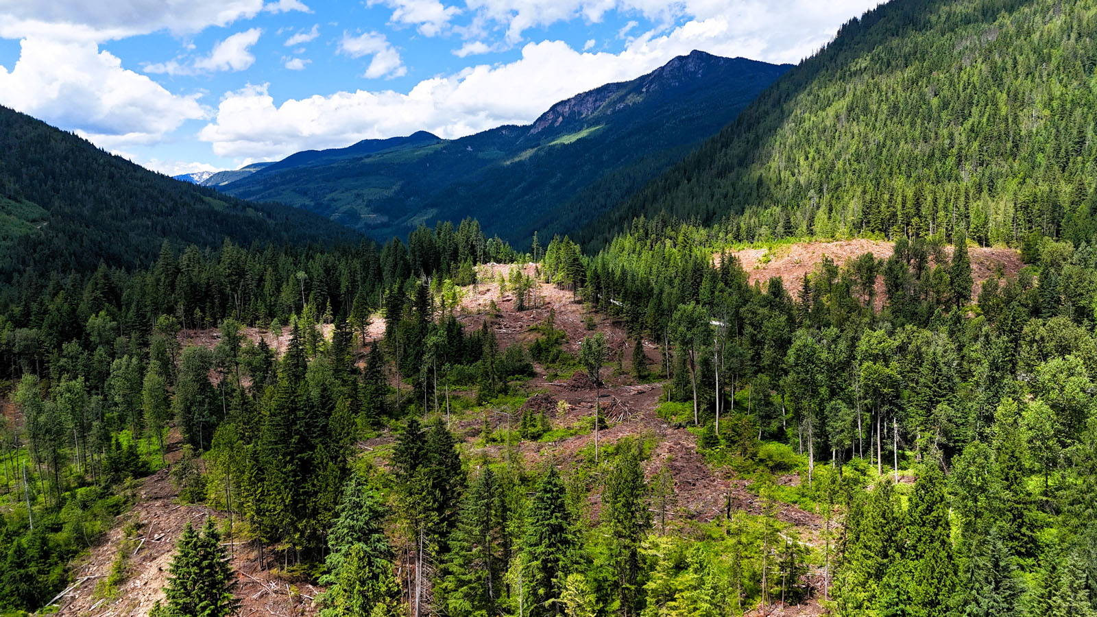
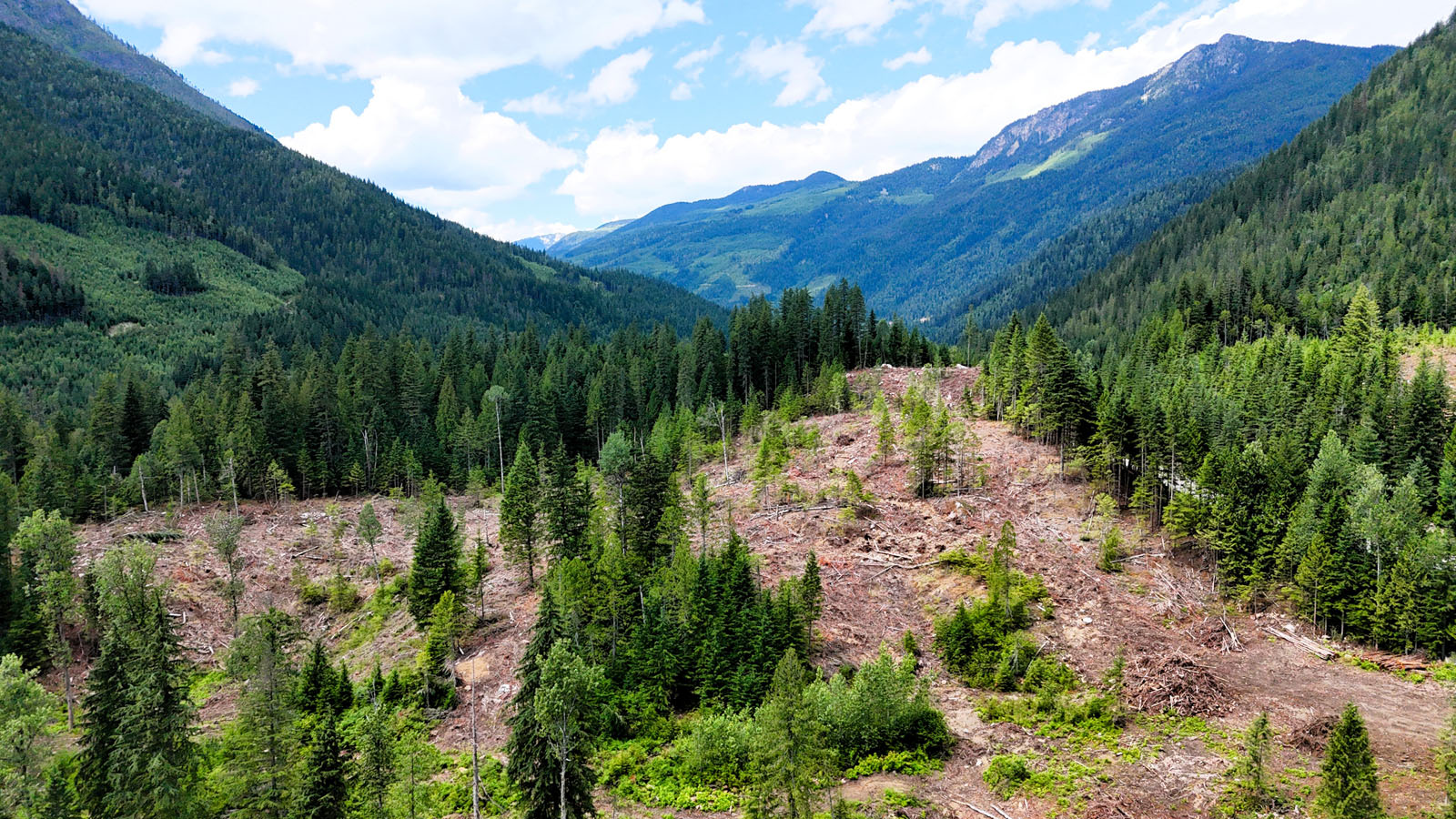
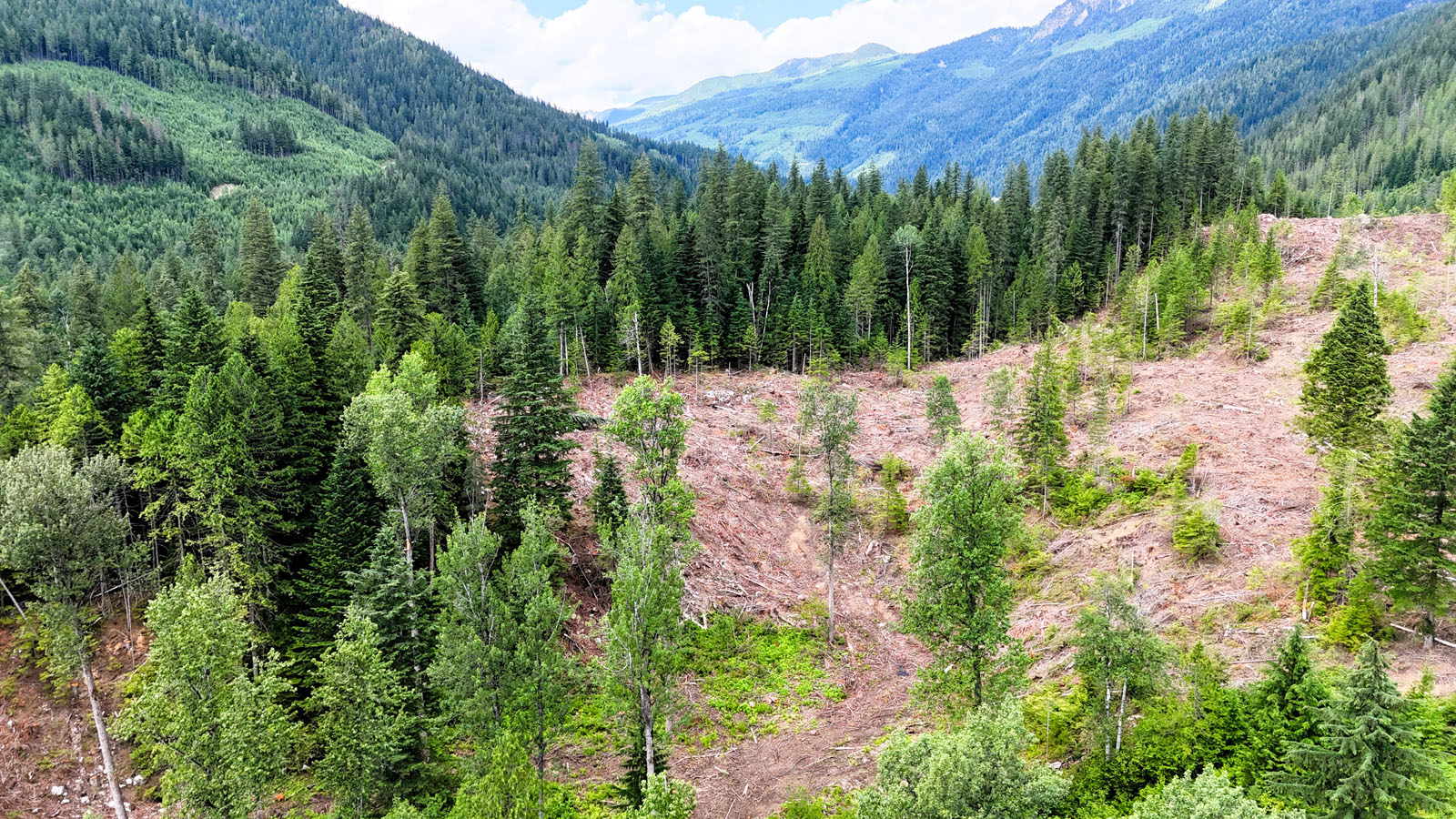
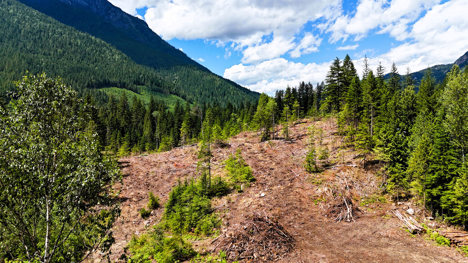
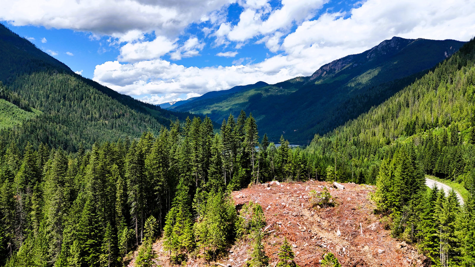
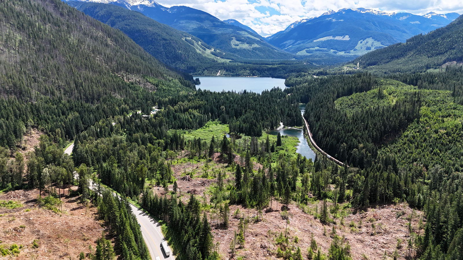
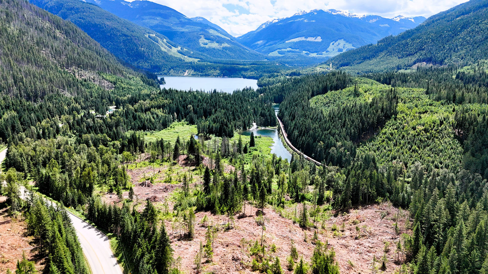
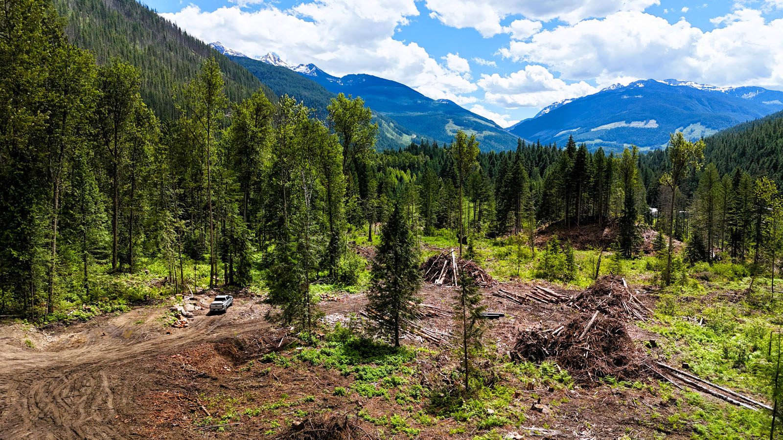
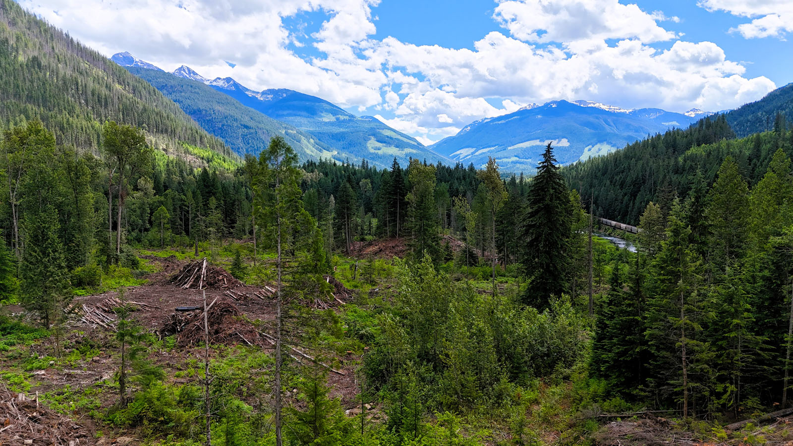
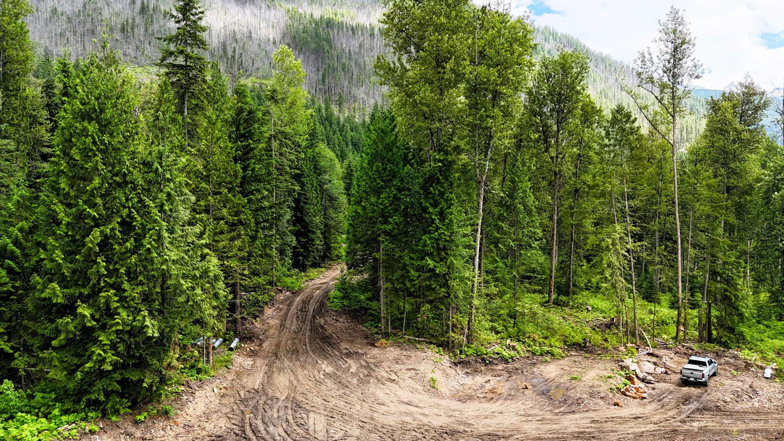
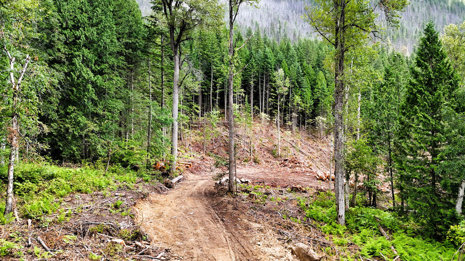
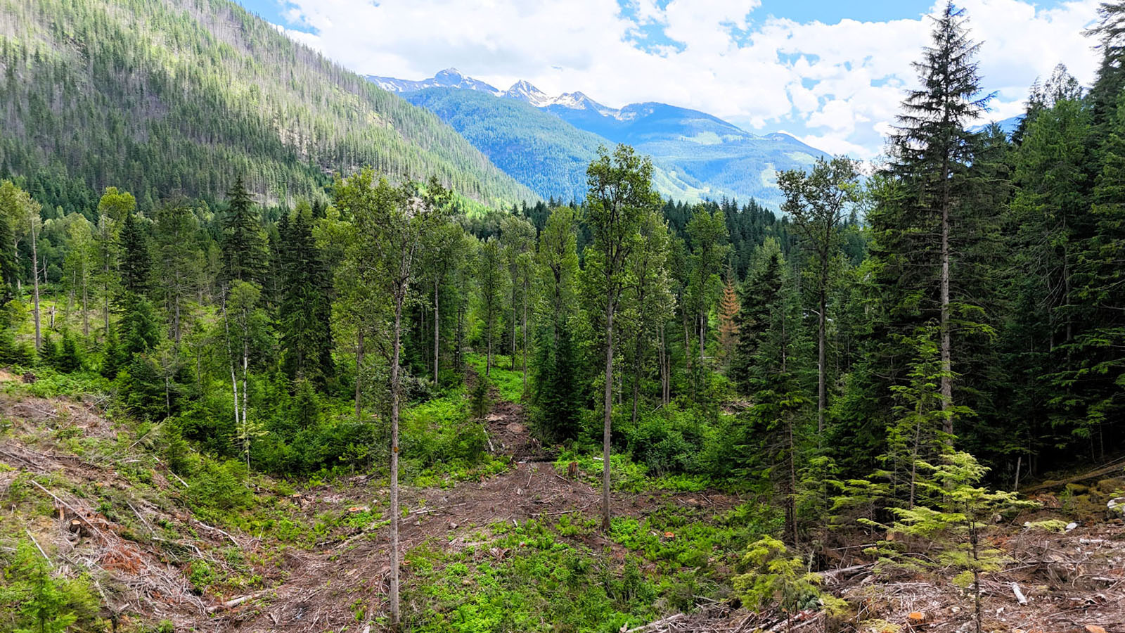
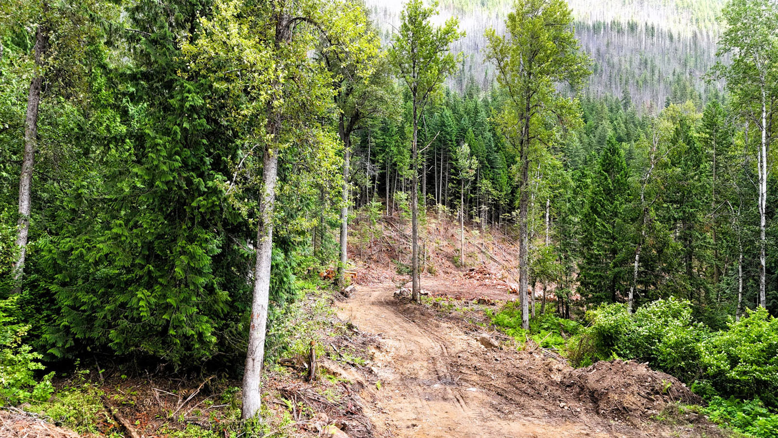
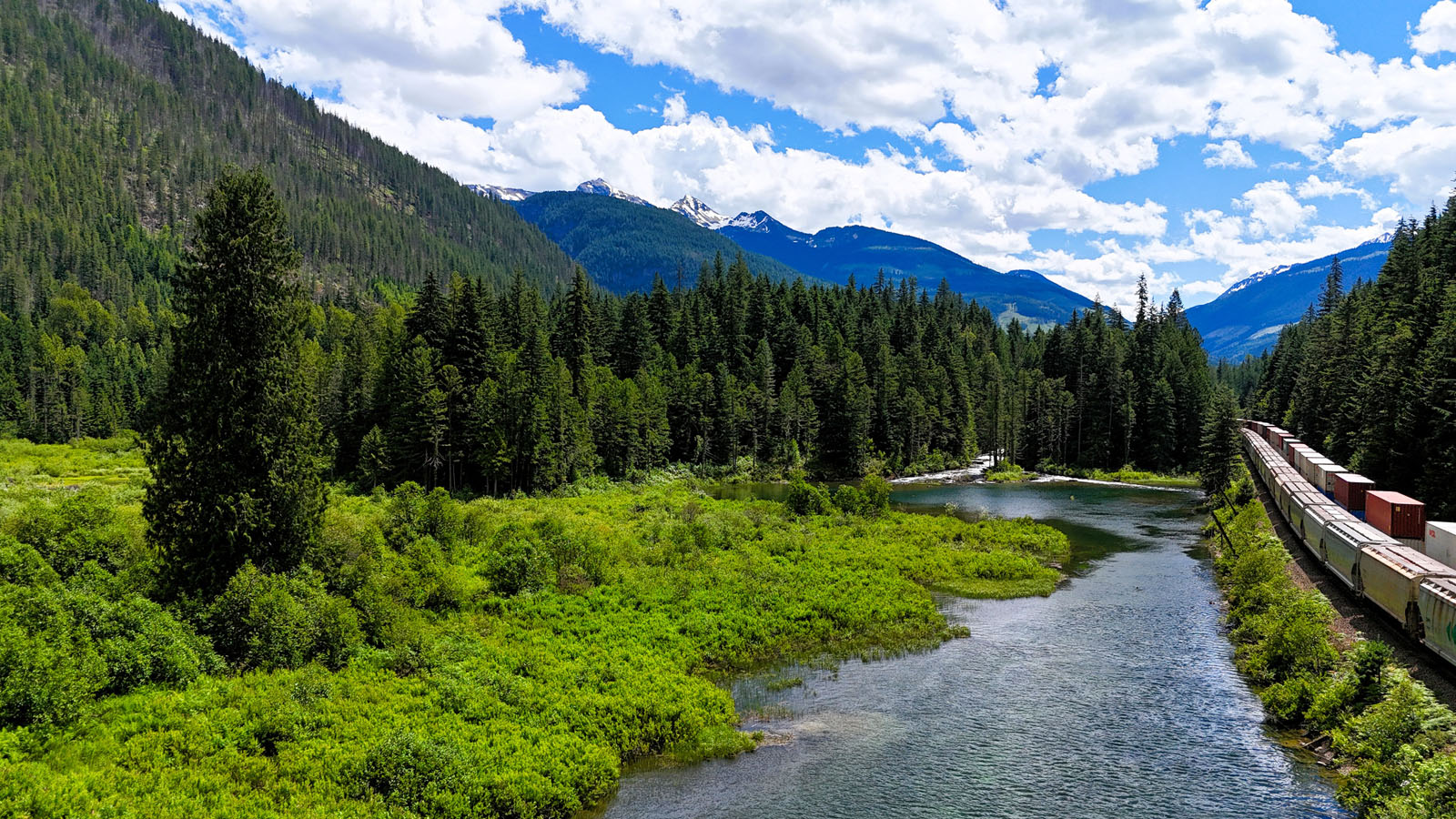
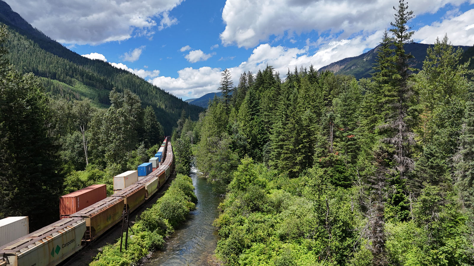
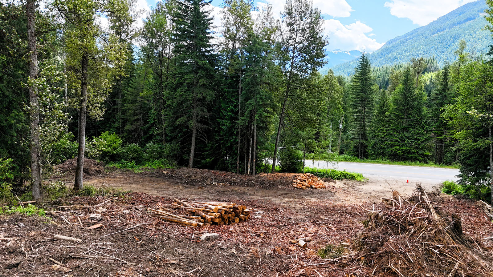
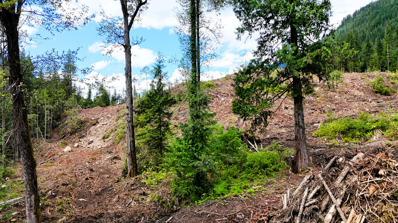
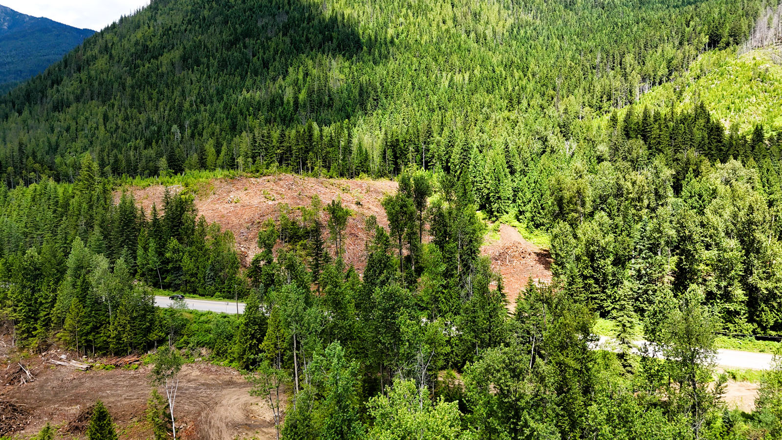
Opportunities to acquire larger acreages with multiple titles in the Revelstoke area are becoming increasingly difficult to find. This unique offering consists of four separately titled parcels totaling more than 70 acres, with each title just under 20 acres, providing exceptional flexibility for future use, investment, or a multi-generational family property.
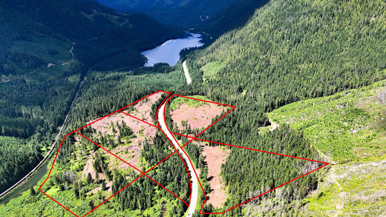
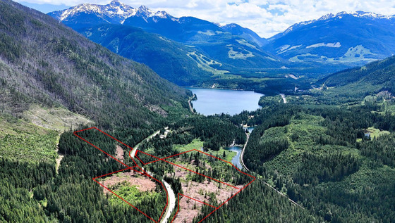
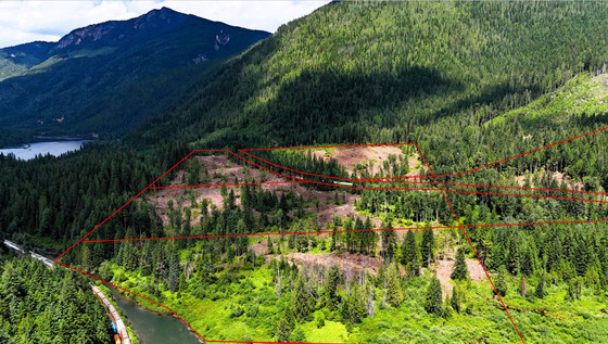
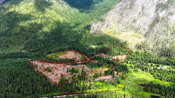
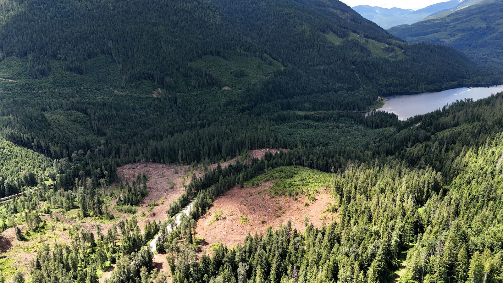
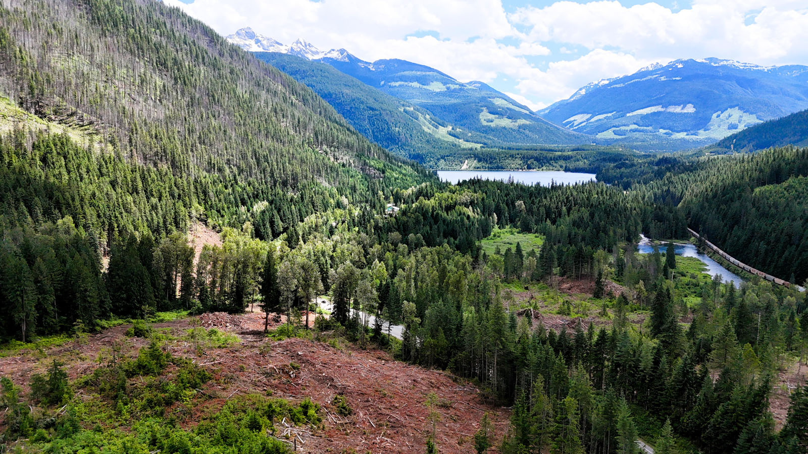
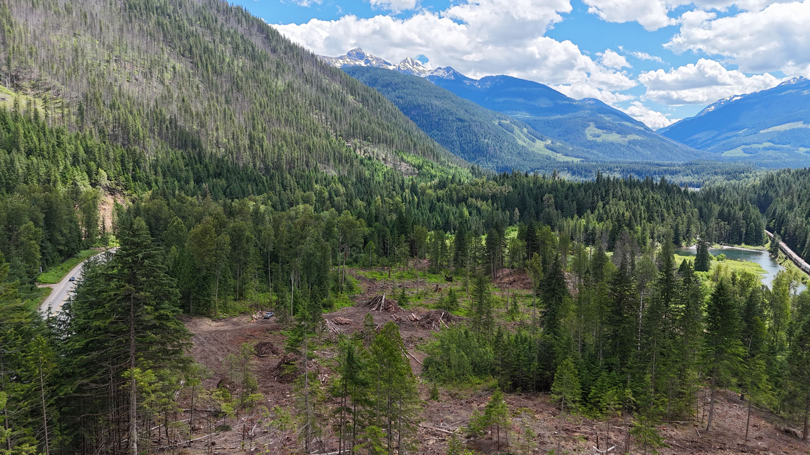
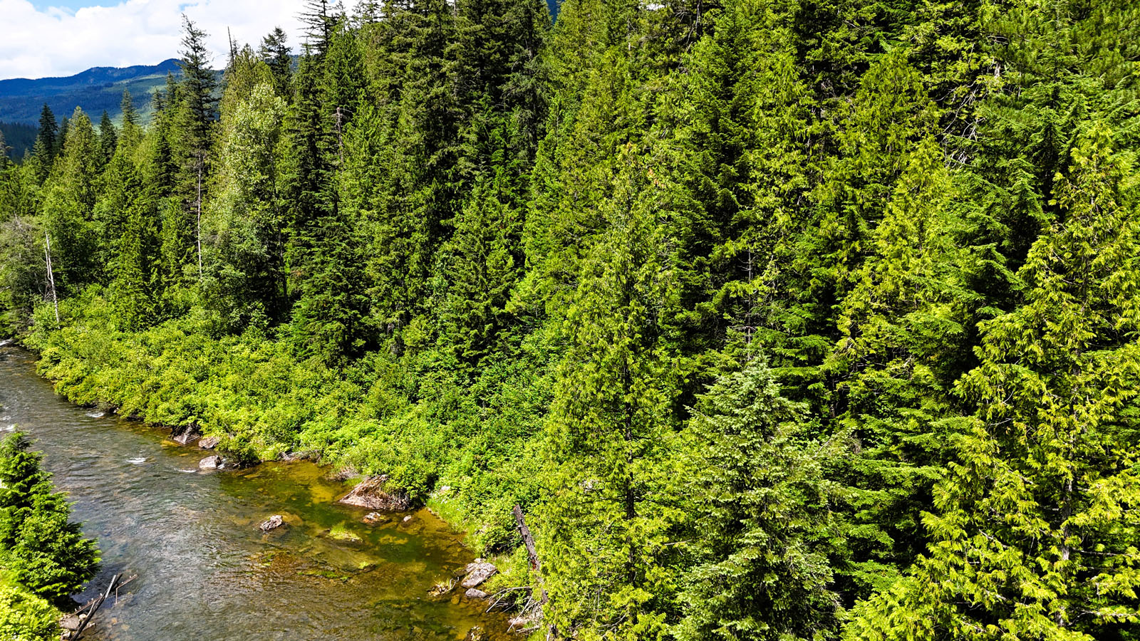
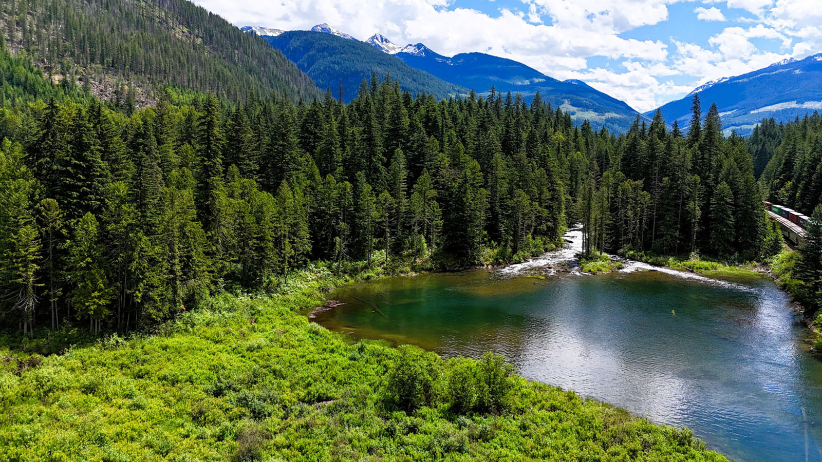
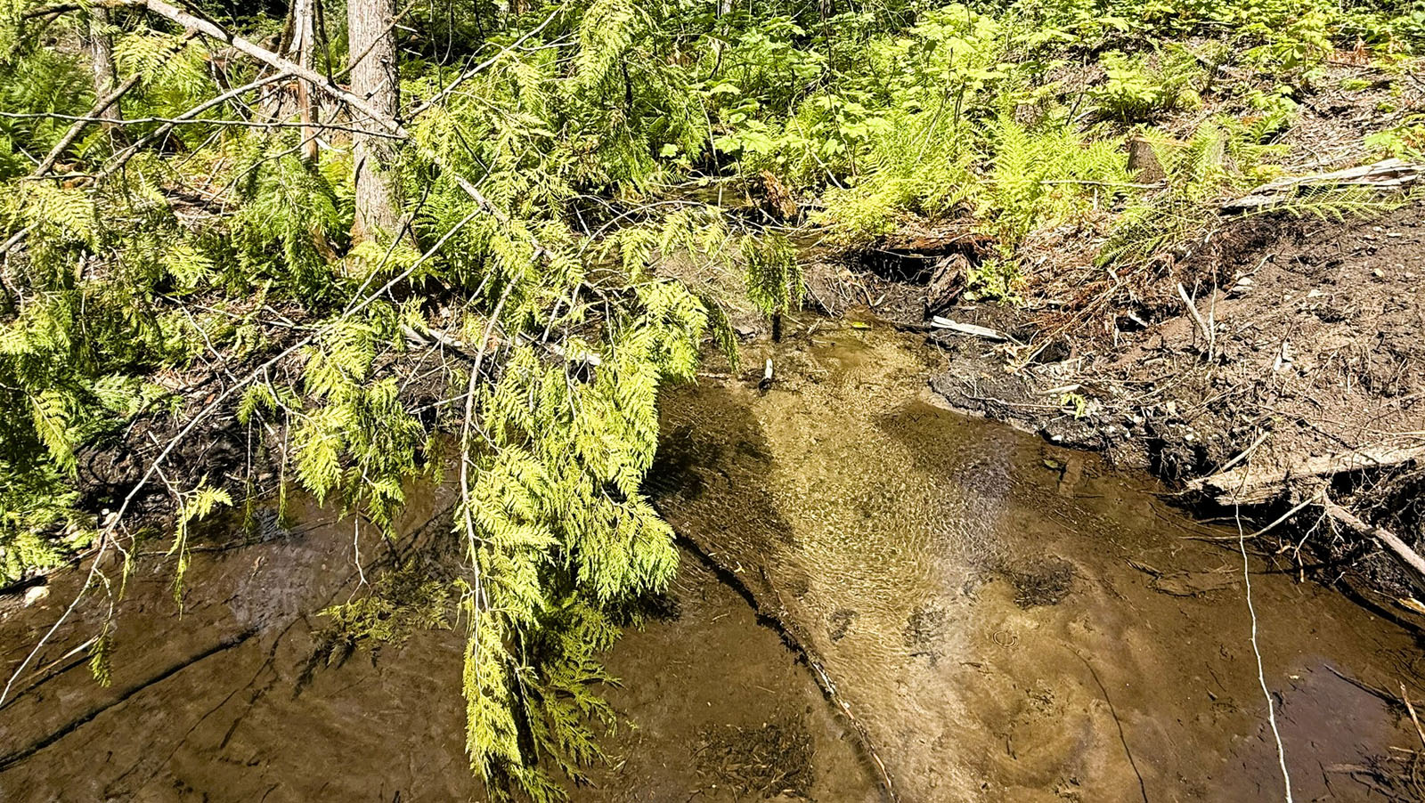
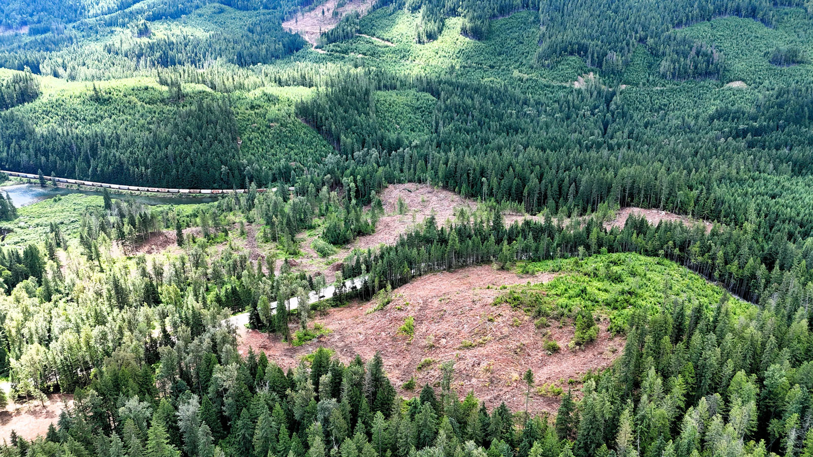
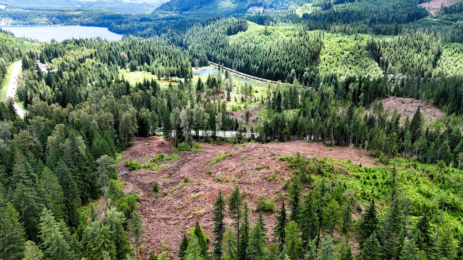
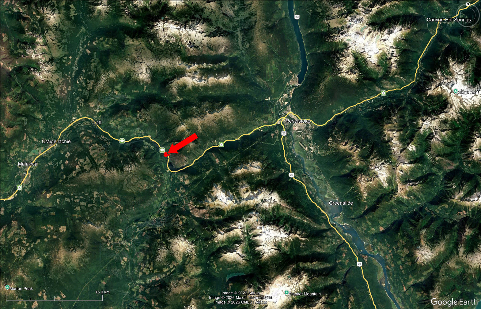
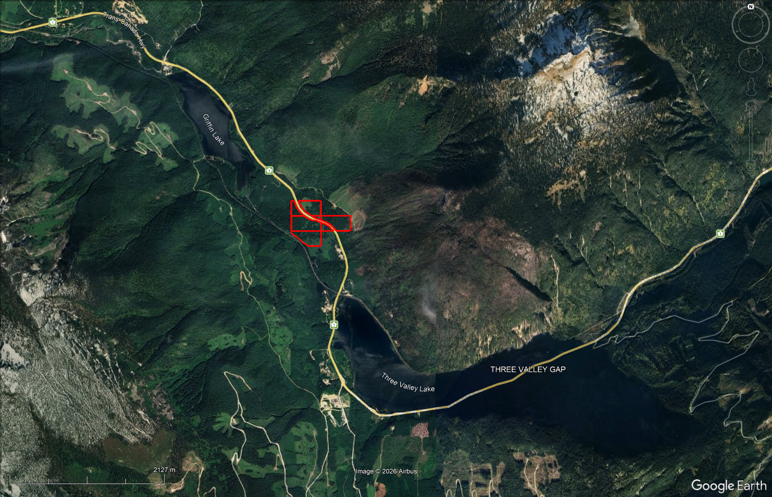
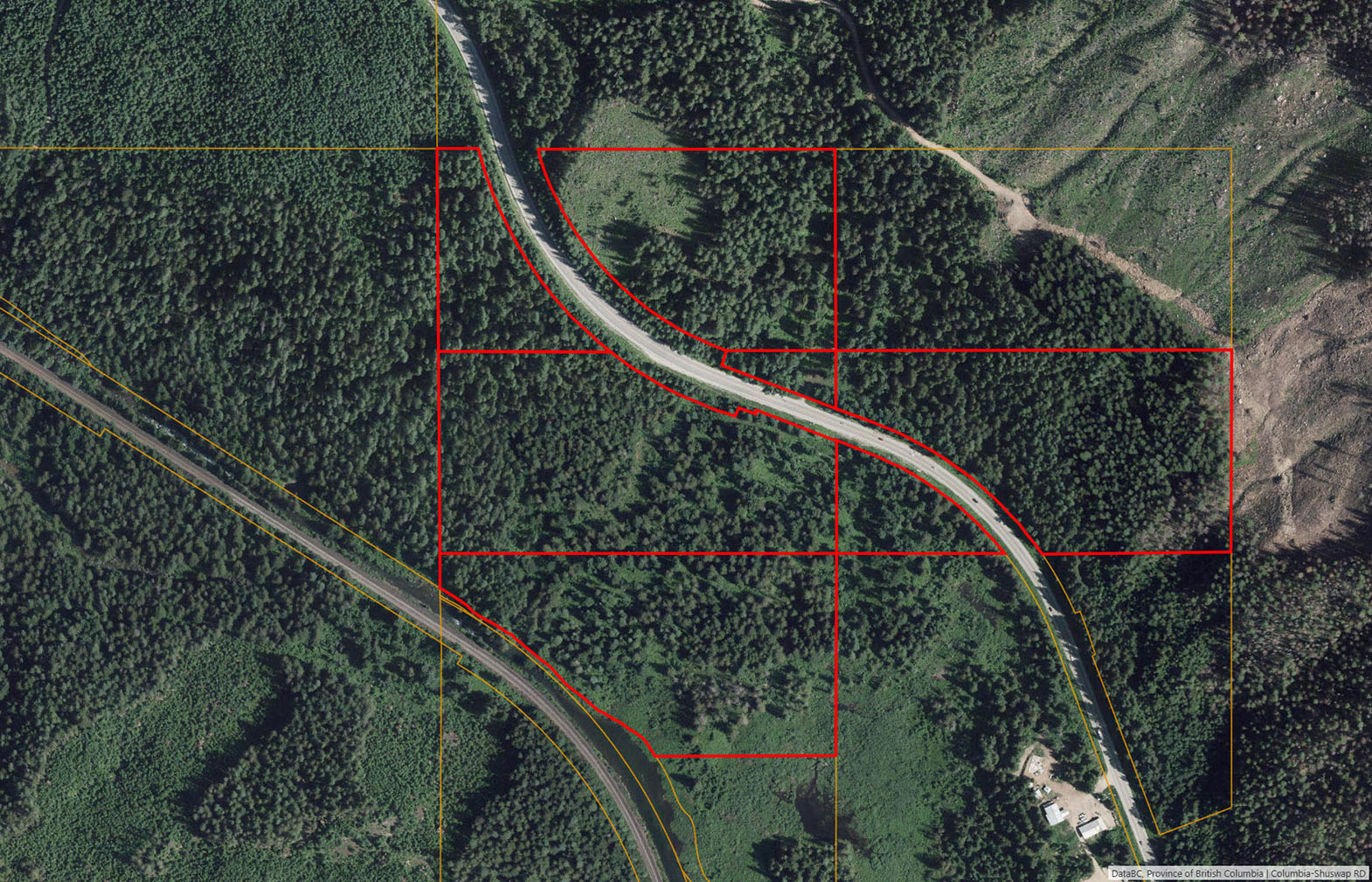
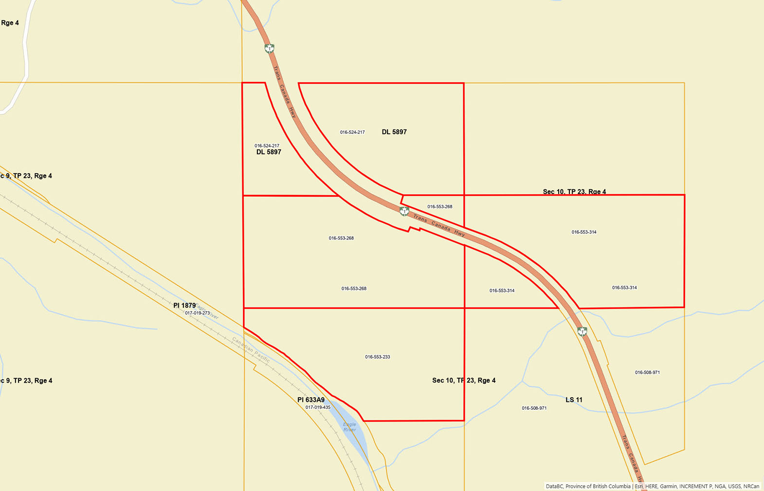
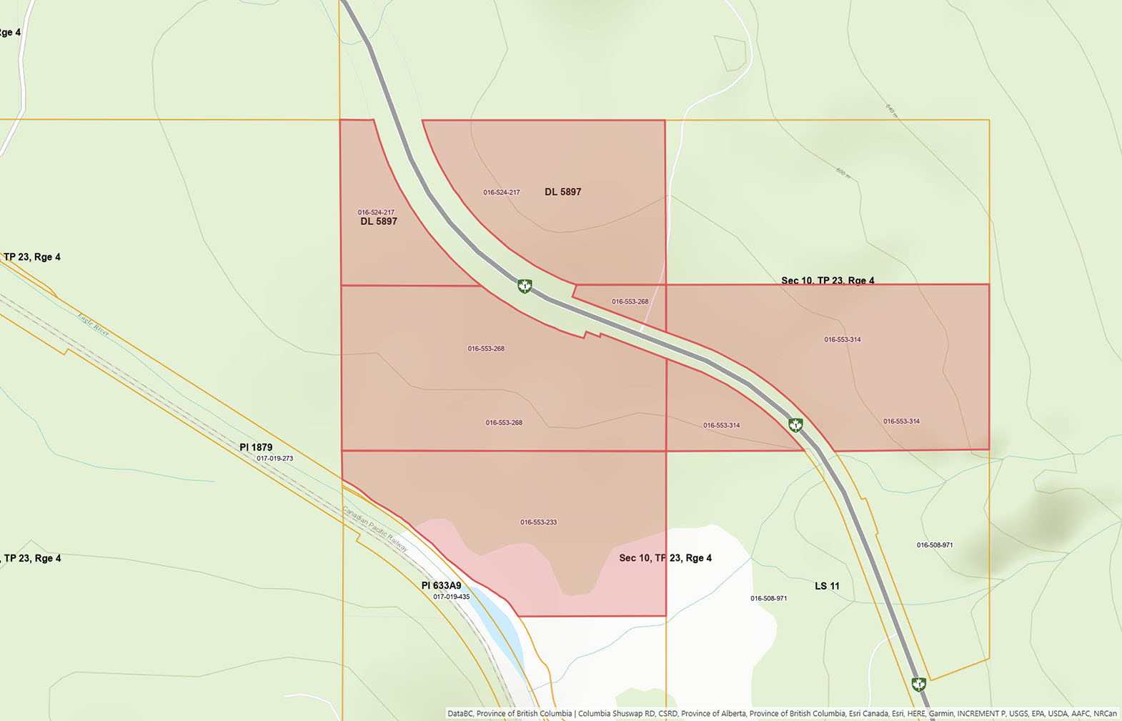
Located approximately 15 minutes west of Revelstoke, the property spans both sides of the Trans-Canada Highway. There are approx. 30 acres on the northeast side of the highway and 40 acres on the southwest side of the highway. The character of the land changes dramatically below the highway where the sounds of traffic fades. The terrain is gently undulating, with a stream winding through the lower half of the property before flowing toward approximately 900 feet of frontage along the Eagle River. The property also borders Crown land, expanding the sense of privacy while providing direct access to endless backcountry recreation. A large pond area just off the land is a great fishing area.
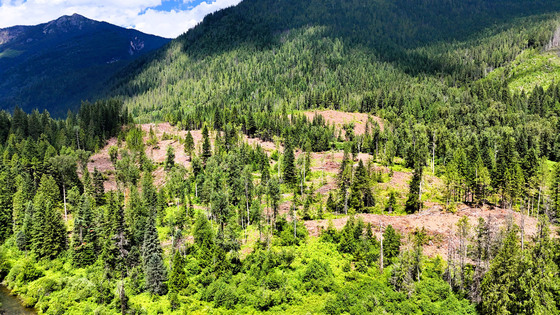
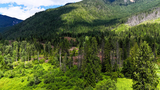
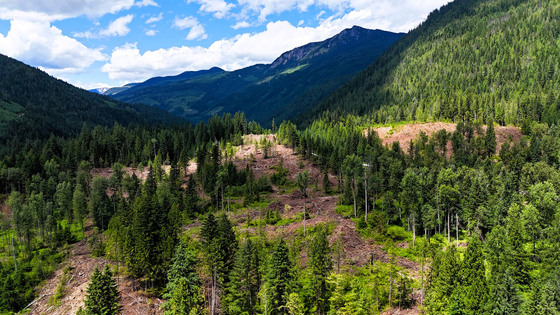
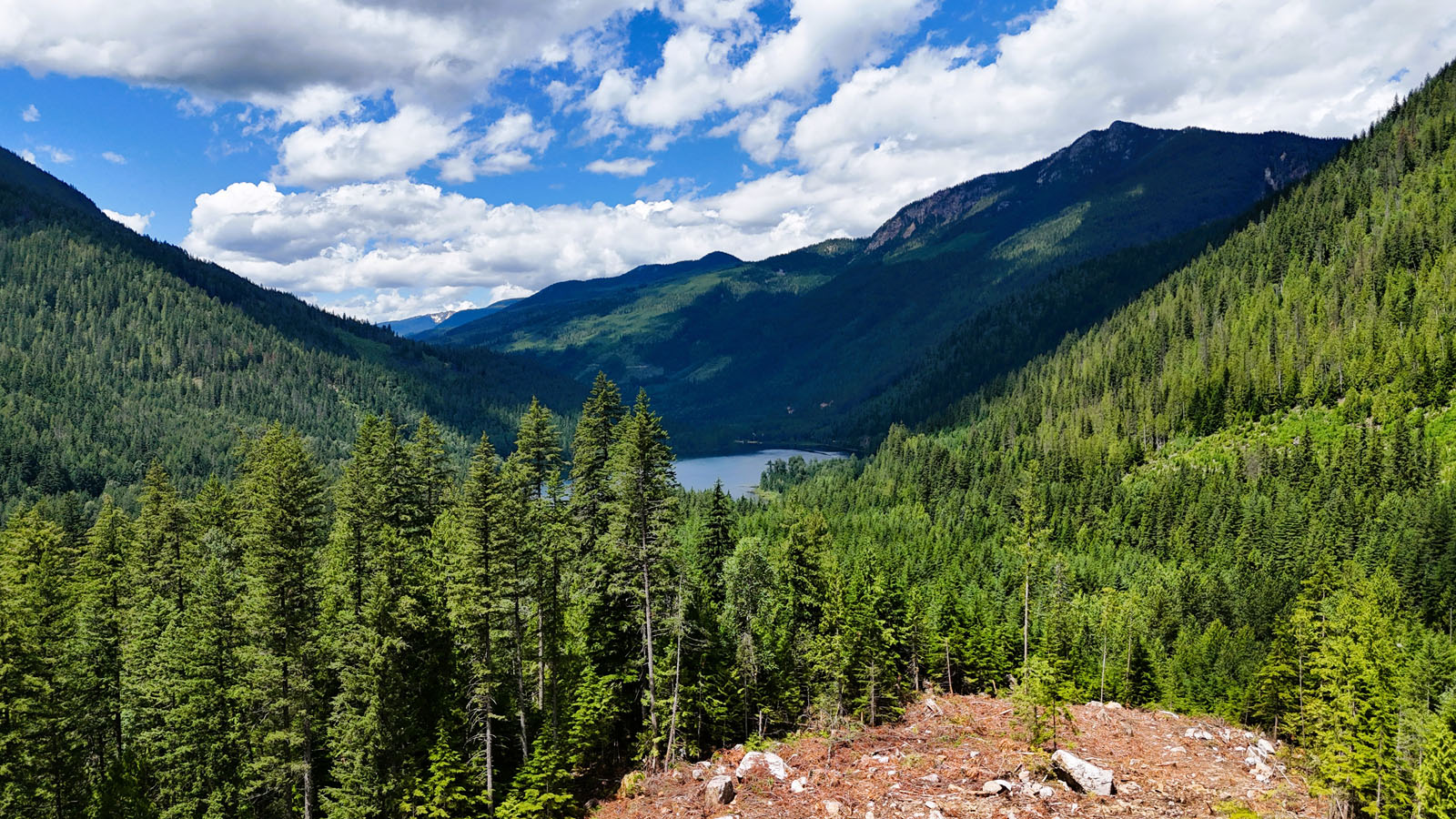
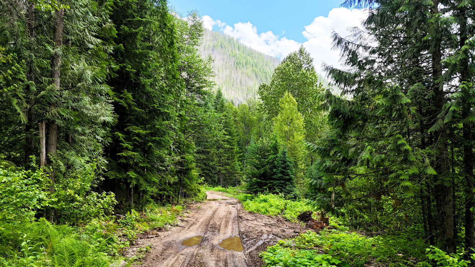
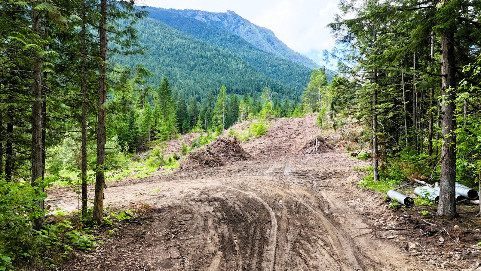
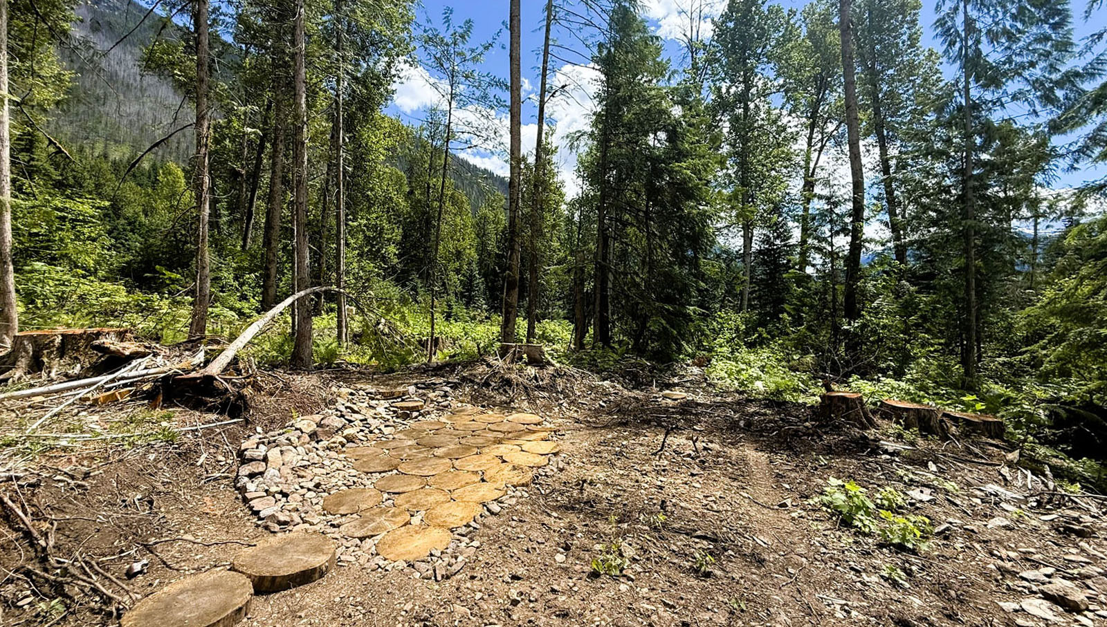
The land has been recently logged, with some additional timber still to be removed. This has opened up numerous potential building sites that take advantage of impressive mountain views while making it easier to visualize future homes, shops, gardens, or recreational improvements. The surrounding landscape offers an outstanding blend of open space, mature forest, water features, and natural beauty.
Zoning permits one single-family residence plus a secondary dwelling unit on each title creating the potential for up to four principal homes and four secondary dwellings across the property (subject to applicable regulations) or one could set up a residential campsite and use it more recreationally. Whether you're looking for a private recreational retreat or a long-term investment with flexibility for the future, this is a rare opportunity to secure a substantial landholding in one of British Columbia's most spectacular mountain regions.
PID 016-524-217 - 17.03 acres
PID 016-553-233 - 15.86 acres
PID 016-553-268 - 18.8 acres
PID 016-553-314 - 19 acres
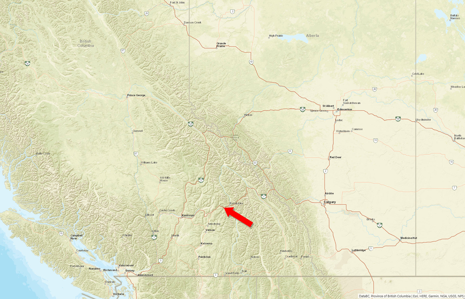
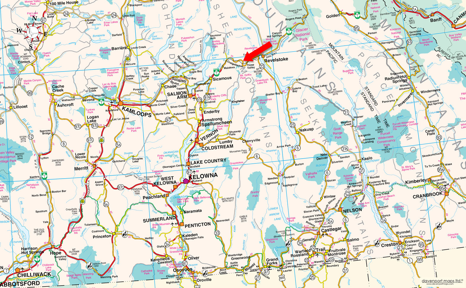
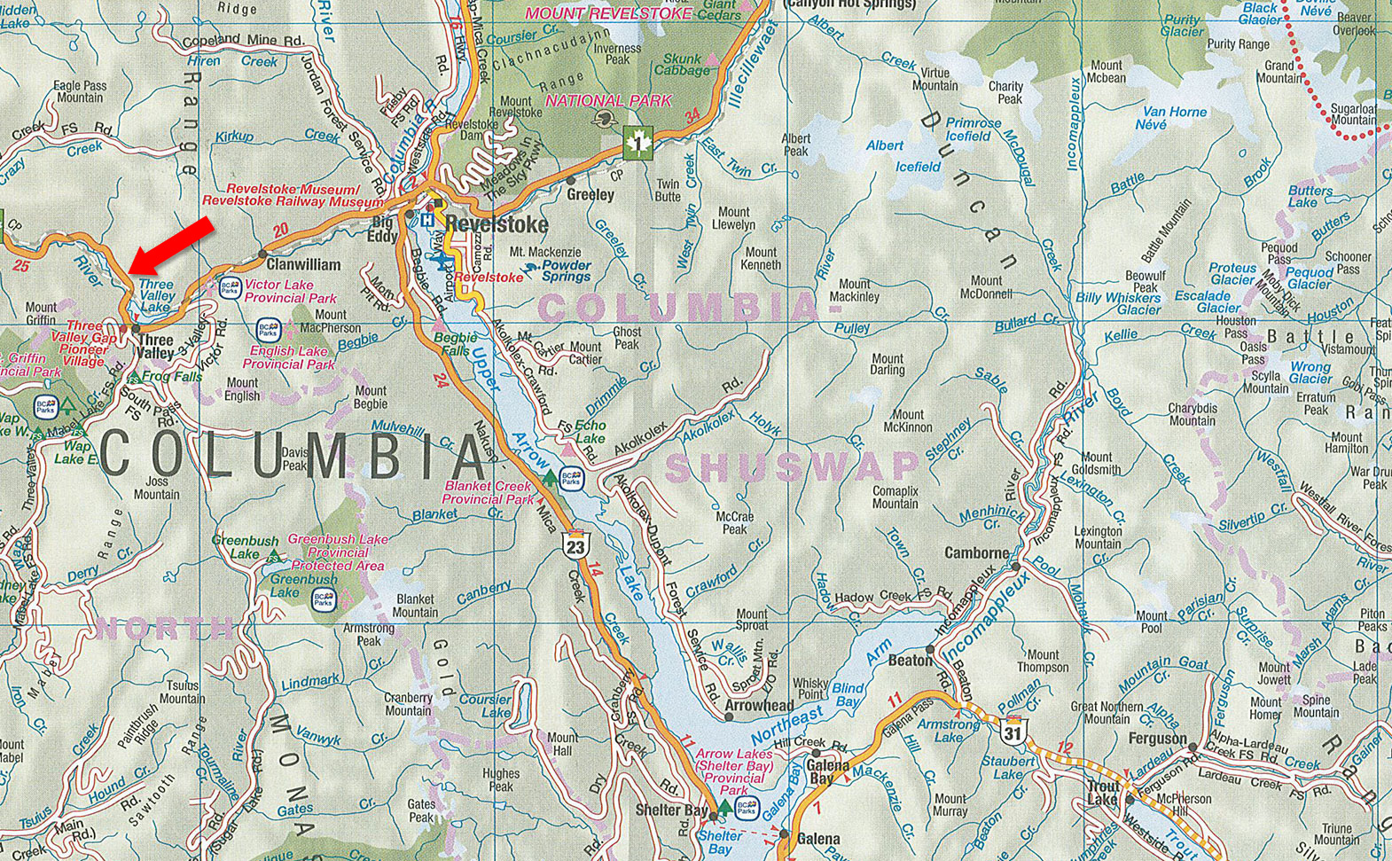
Highway 1 - Three Valley Gap, BC (20 km west of Revelstoke)
The property enjoys an exceptional geographic setting 20 km west of Revelstoke and positioned within the Monashee Mountains, a sub-range of the Columbia Mountains. The area is surrounded by towering forested peaks, steep rock faces, cascading waterfalls and glacier-fed waterways with the Eagle River forming the land’s western boundary. Originating high in the Monashee Mountains, the river flows through a chain of deep, cold lakes including Griffin Lake, Three Valley Lake, Victor Lake and Clanwilliam Lake before eventually reaching Shuswap Lake at Sicamous. The clear, fast-flowing river supports fish and wildlife while creating a picturesque backdrop on the Property’s western edge.
Very near the property is Three Valley Lake, a beautiful glacier-fed mountain lake named by explorer Walter Moberly in 1865 after observing three valleys converging at its headwaters. The lake is renowned for its crystal-clear water, impressive mountain scenery and striking reflections, making it a highly photographed location along the Trans-Canada Highway. Just to the west lies Griffin Lake, another pristine mountain lake connected by the Eagle River. Although smaller, Griffin Lake offers a quieter setting surrounded by mature forest and rugged mountain terrain, further enhancing the area's natural beauty.
The climate reflects its mountain location, with warm summers, abundant snowfall through the winter and four distinct seasons. Spring runoff brings impressive waterfalls to the surrounding cliffs, while autumn colours contrast beautifully against the evergreen forests. The combination of reliable winter snow and comfortable summer temperatures supports a true four-season lifestyle with hiking, mountain biking, fishing, paddling, snowmobiling, backcountry skiing and sightseeing all available within minutes of the property.
Despite its peaceful setting, the property benefits from excellent accessibility. Revelstoke, just a 20-minute drive east, provides full shopping, services, schools, healthcare, restaurants and the internationally renowned Revelstoke Mountain Resort. To the west, Sicamous and Shuswap Lake are approximately 50 kilometres away, offering additional recreation, boating and amenities. The result is a unique opportunity to own land in one of British Columbia's most scenic mountain corridors, where spectacular natural surroundings are combined with year-round access and convenience.
Please see maps and aerial photos—lines sketched in on aerial images are approximations only.
50°57'5.23"N and 118°29'20.42"W
Multiple titles, and each title allows for a home plus secondary dwelling.
Power along Highway 1.
Bare land.
$302 (2026). Property is Managed Forest Land. Taxes are not accurate for future use if not used in a forestry related use—currently assessed for a combined $71,500. Upon a sale/the following year the property will be re-assessed closer to its market value.
Medium Holdings (CSRD) Medium Holdings (CSRD)
Permitted Uses
Single Family Home, Agriculture, Forestry, Equestrian Facility
Accessory Uses
Agri Tourism, Bed and Breakfast, Secondary Dwelling Unit, Home Occupation, Residential Campsite.
DL 5897 Kamloops Division Yale District
PID 016-524-217
That part of the N1/2 of fractional Legal Subdivision 12 which lies to the North of Eagle River Section 10 Township 23 Range 4 West of the 6th Meridian Kamloops Division Yale District
PID 016-553-233
The S1/2 of Legal Subdivision 13 Section 10 Township 23 Range 4 West of the 6th Meridian Kamloops Division Yale District except Plan R271
PID 016-553-268
The S1/2 of Legal Subdivision 14 Section 10 Township 23 Range 4 West of the 6th Meridian Kamloops Division Yale District except Plan R271
PID 016-553-314
 +8 maps
Our property descriptions and geographical information are taken from the BC Assessment Authority, Land Titles Office, government maps and other sources. While LandQuest® does not guarantee the information, we believe it to be accurate, but should not be relied upon without verification. This communication is not intended to cause or induce breach of an existing agency agreement.
Revelstoke
 17℃
17℃
 16℃
16℃