


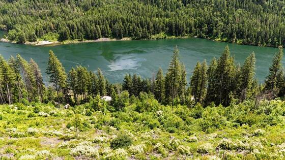
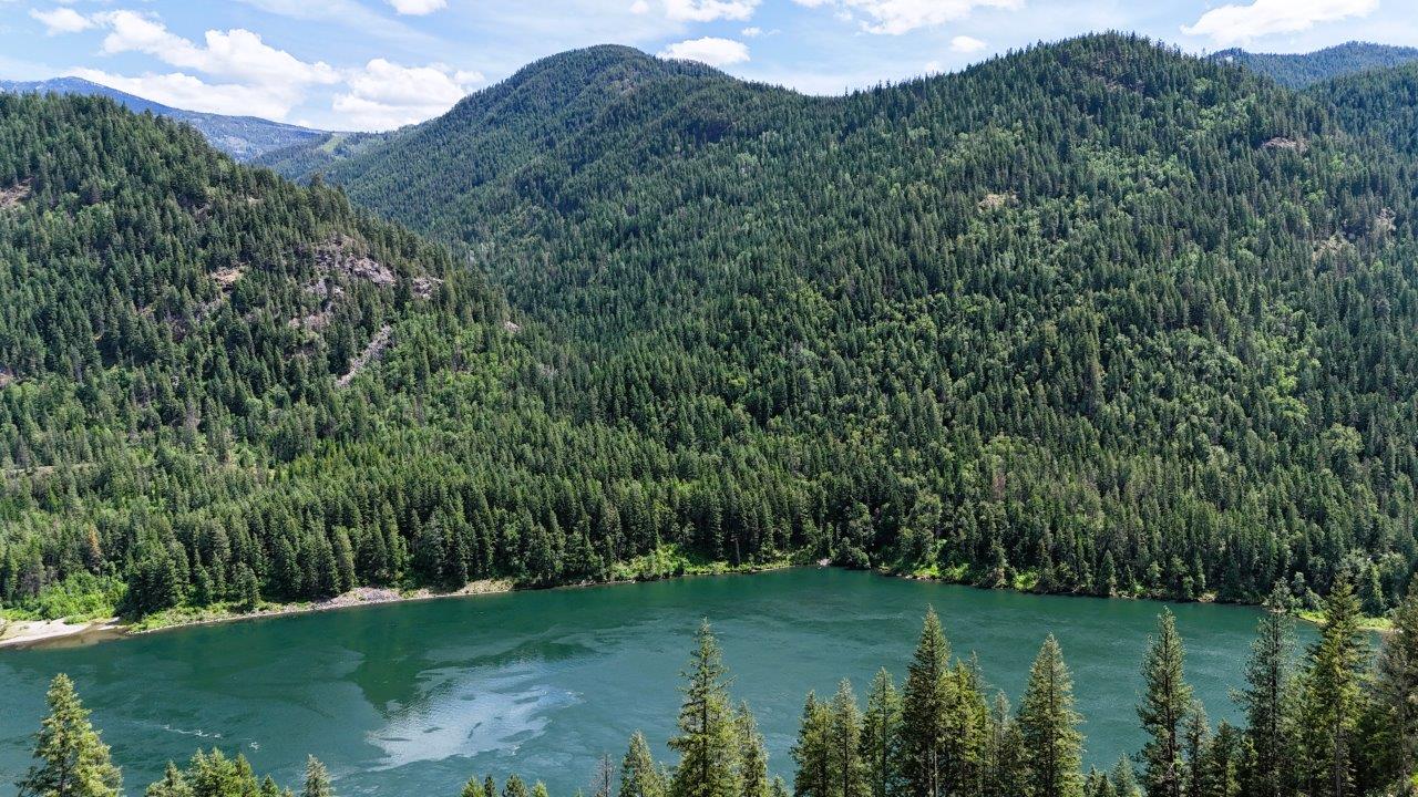
Excellent recreational land 10 minutes to Castlegar/25 minutes to Nelson. Land borders on Crown land and offers amazing views of the Kootenay River and lush mountain side on the other side of the valley. Ideal place for an off-grid cabin. South sloping land/good growing.
Foreign Buyer Ban does not apply to this property


 +8 photos


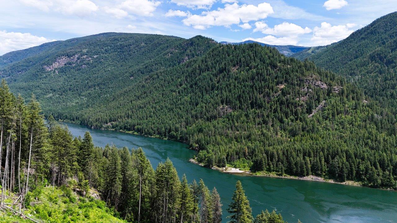
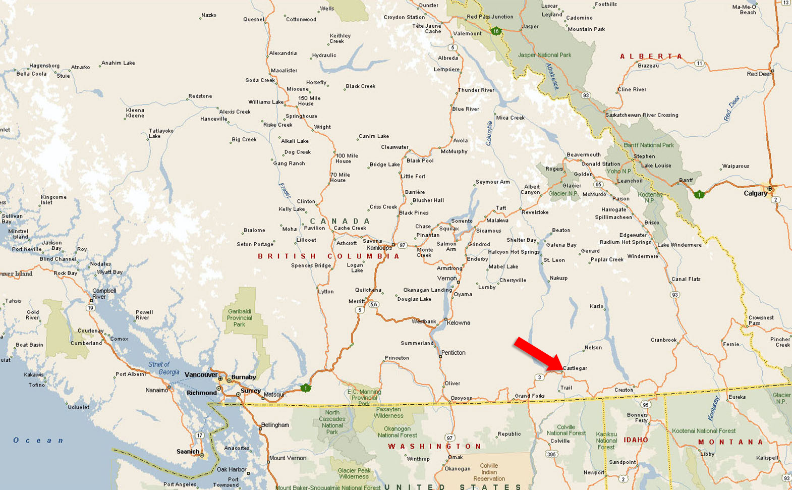
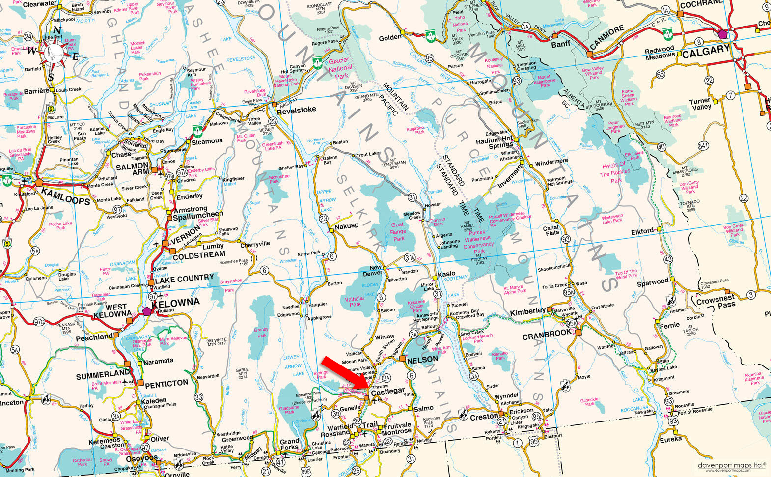
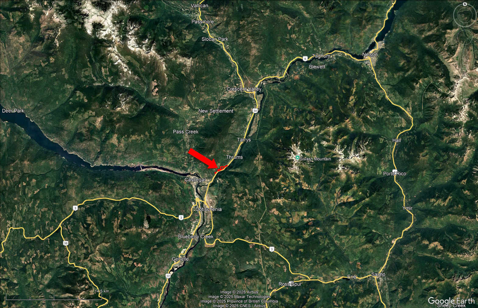
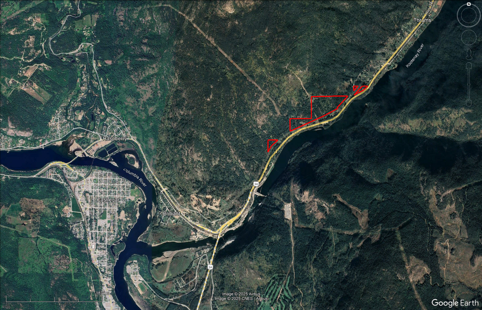
Nearly 60 acres overlooking the Kootenay River, just 10 minutes east of Castlegar in the rural community of Thrums.
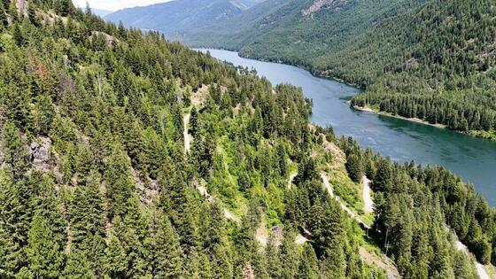
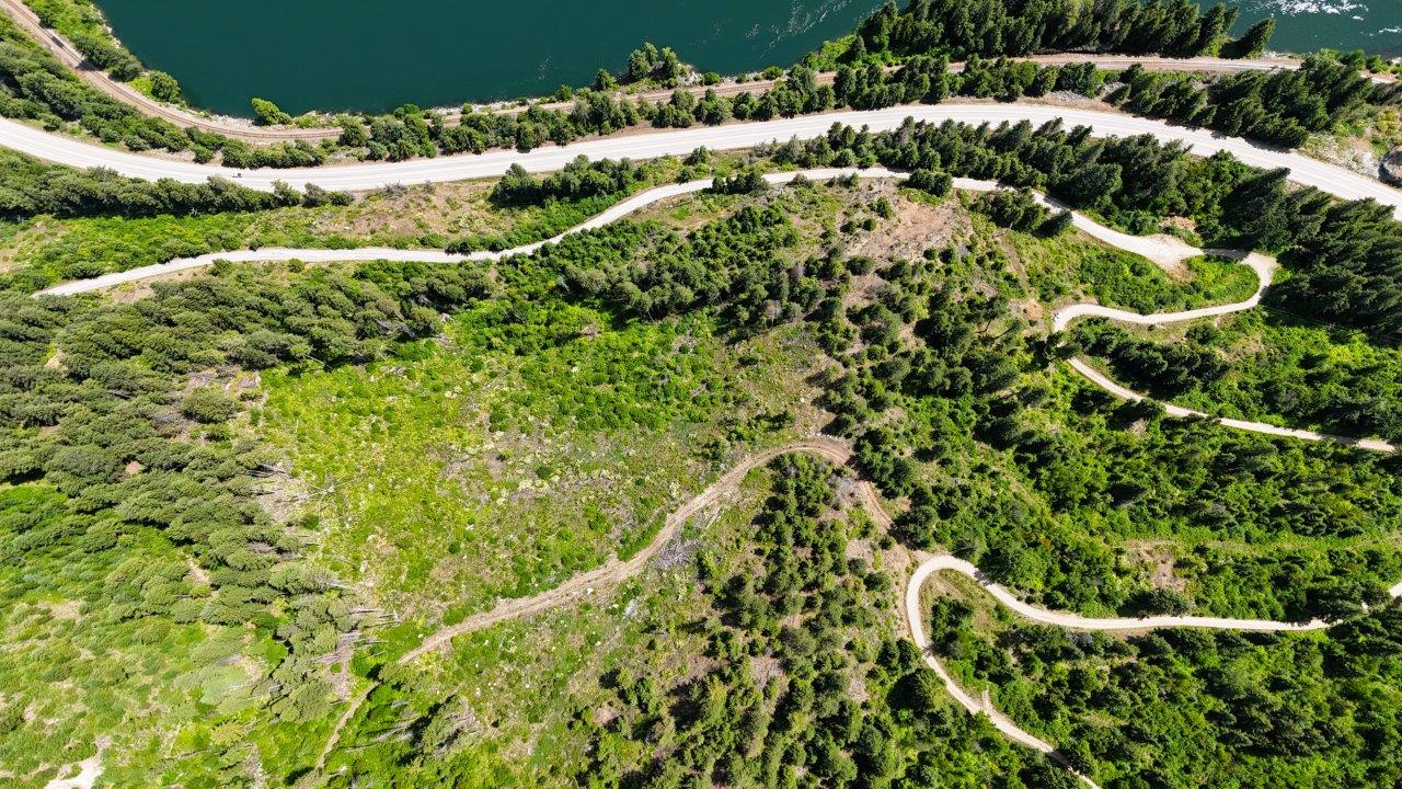
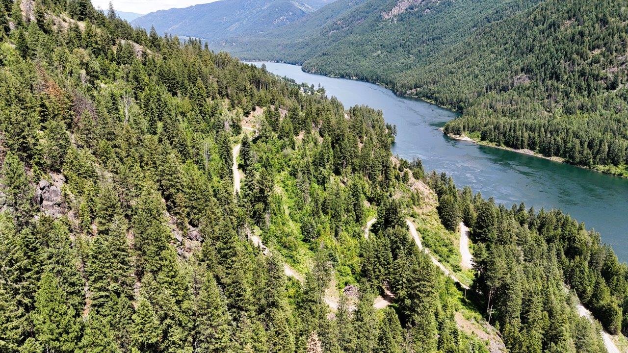
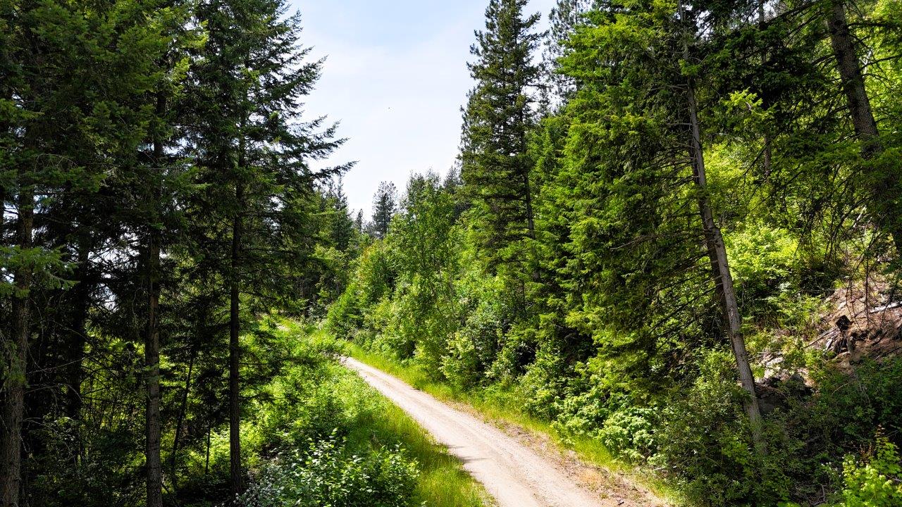
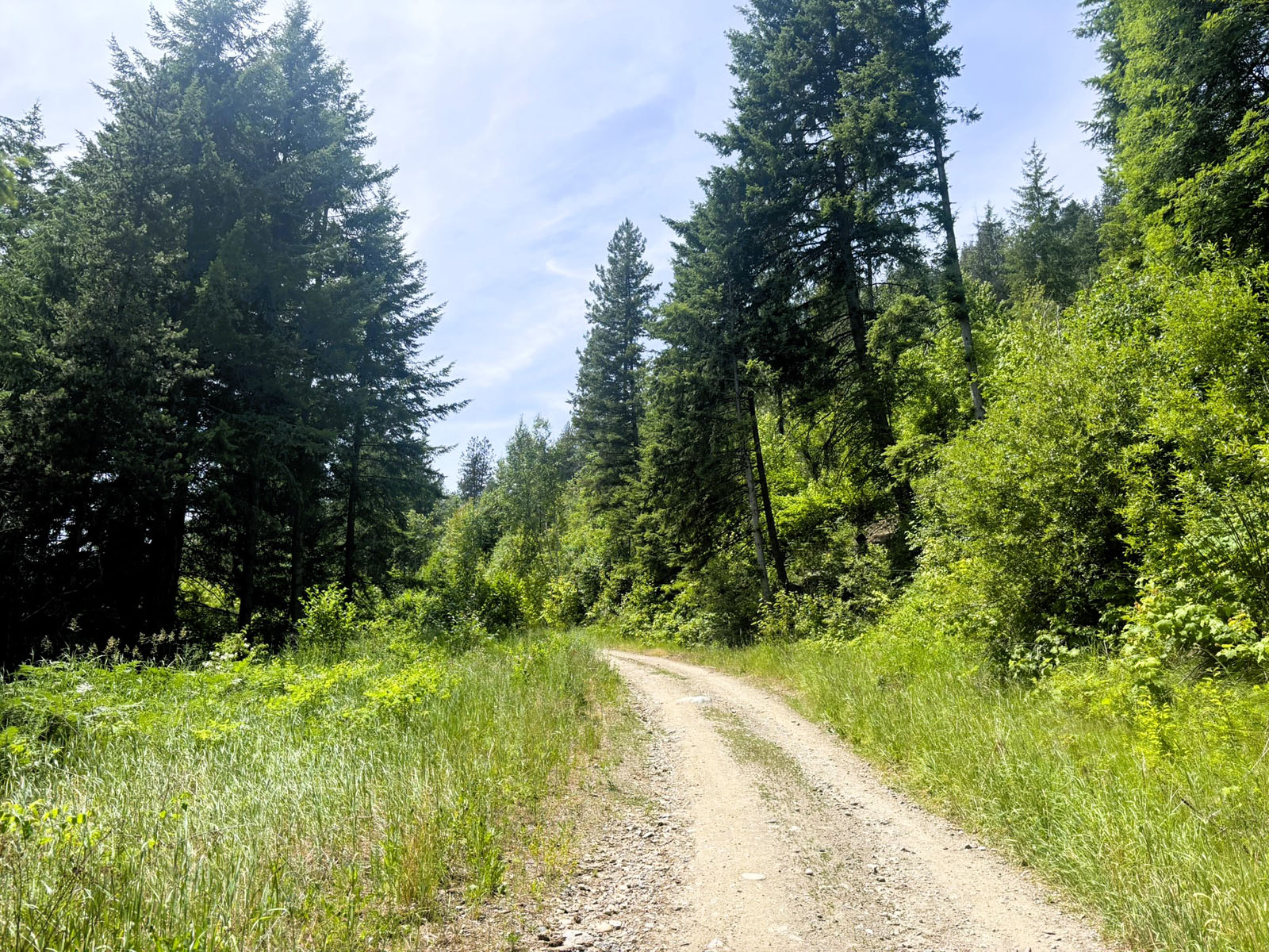
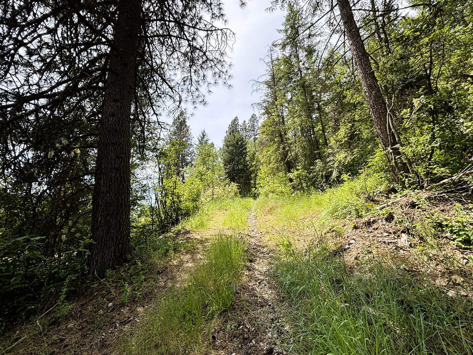
This recreational haven features an excellent internal network of roads and trails, ideal for outdoor enthusiasts. The land borders on Crown land and a network of Forest Service Roads (FSR) for great backcountry access. While a portion of the land touches Lookout Road and on-grid power, the most usable areas are farther from infrastructure, making an off-grid setup more practical.
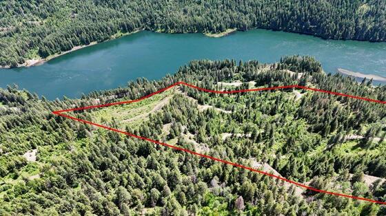
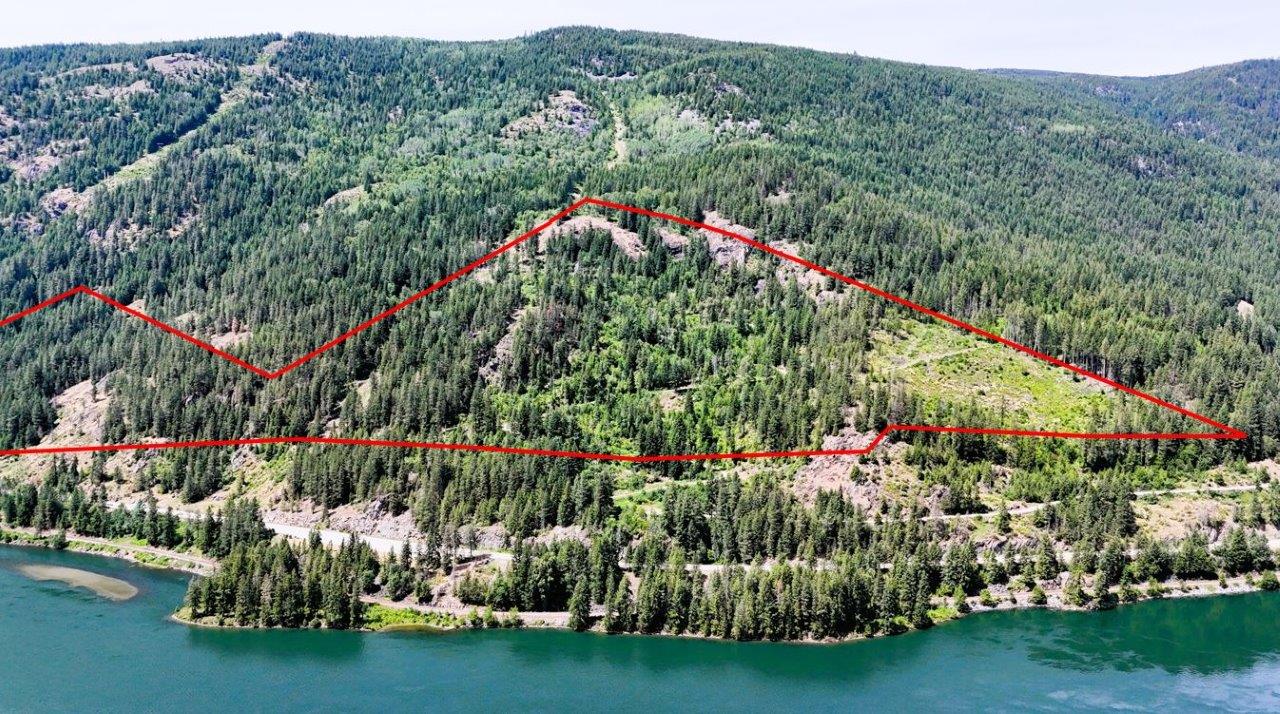
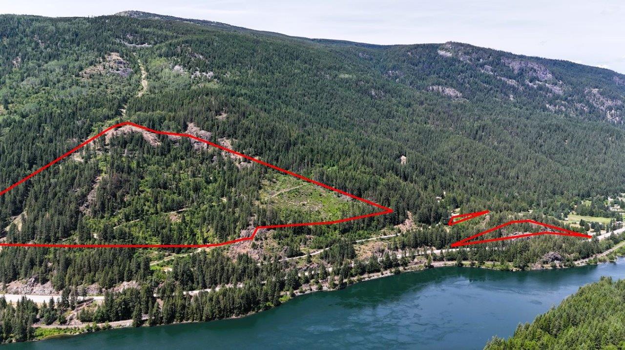
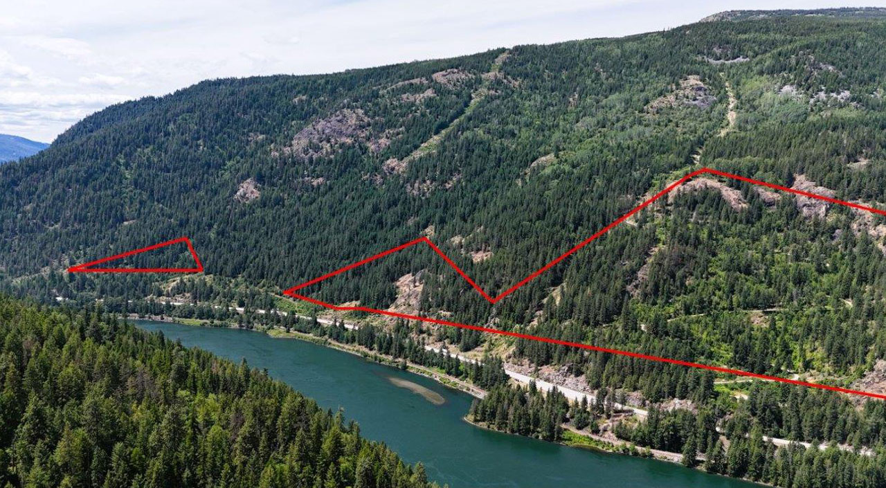
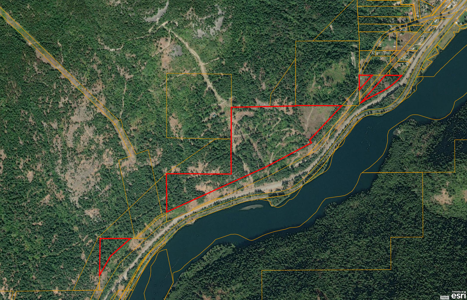
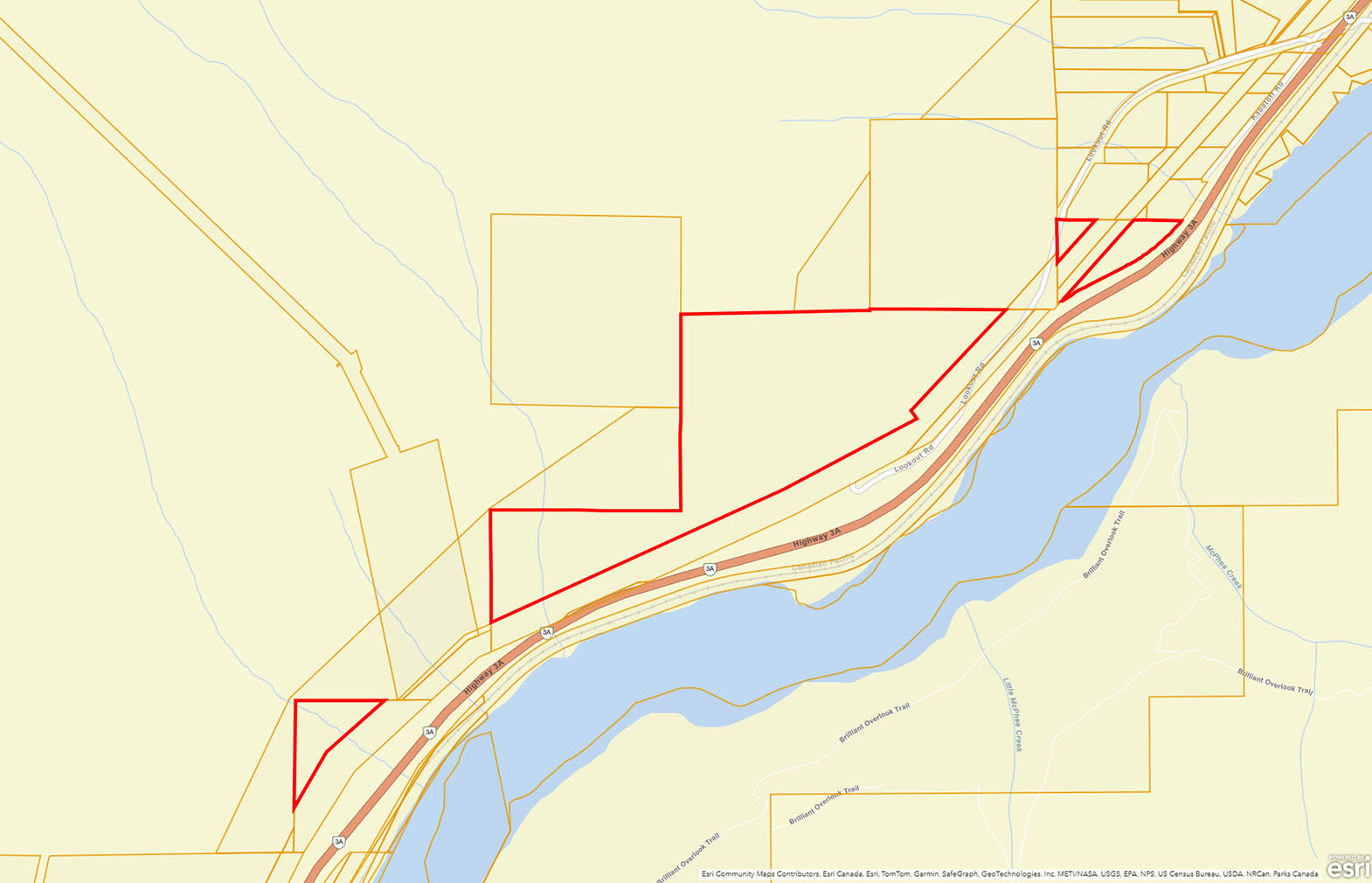
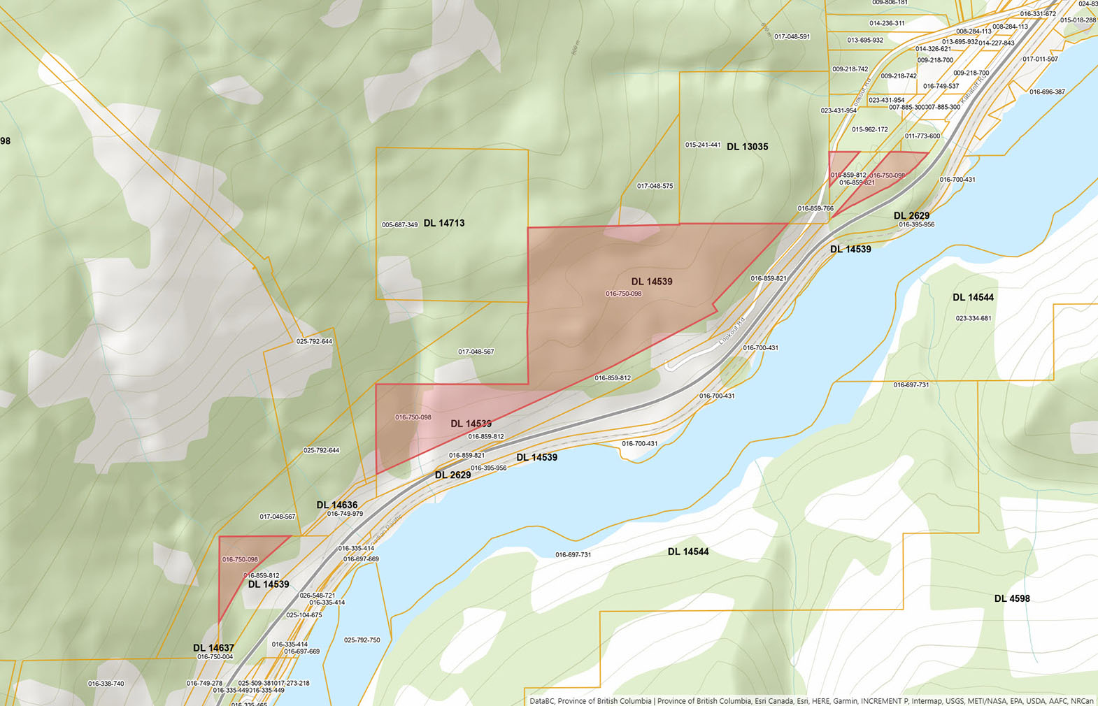
The property comprises one title but is divided into three distinct sections: (1) the central portion—roughly 53 acres—which is the basis for the asking price and description; (2) approximately 4+ acres to the west with access off the highway and up through a power line right-of-way; and (3) about 2+ acres on the east fronting Lookout Road. See aerial images.
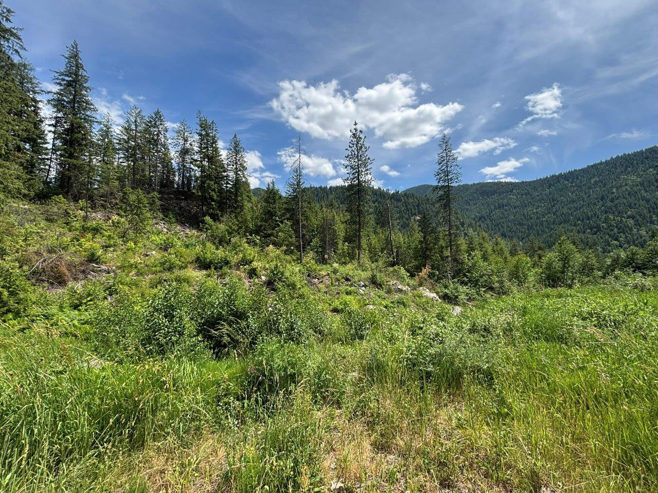
The main/central section slopes to the southeast offering ample of sunlight for solar/growing, the land then crests over a rocky outcrop and there are amazing 180° views of the Kootenay River and lush mountain side across the valley. The property as been partially logged but plenty of forest land remains. Within the central section, there are some nice open clearings and great cabin or home sites.
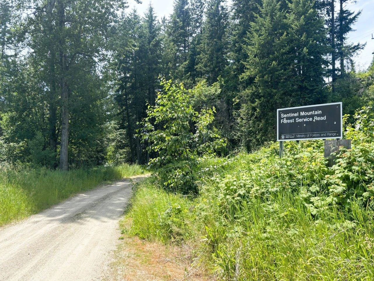
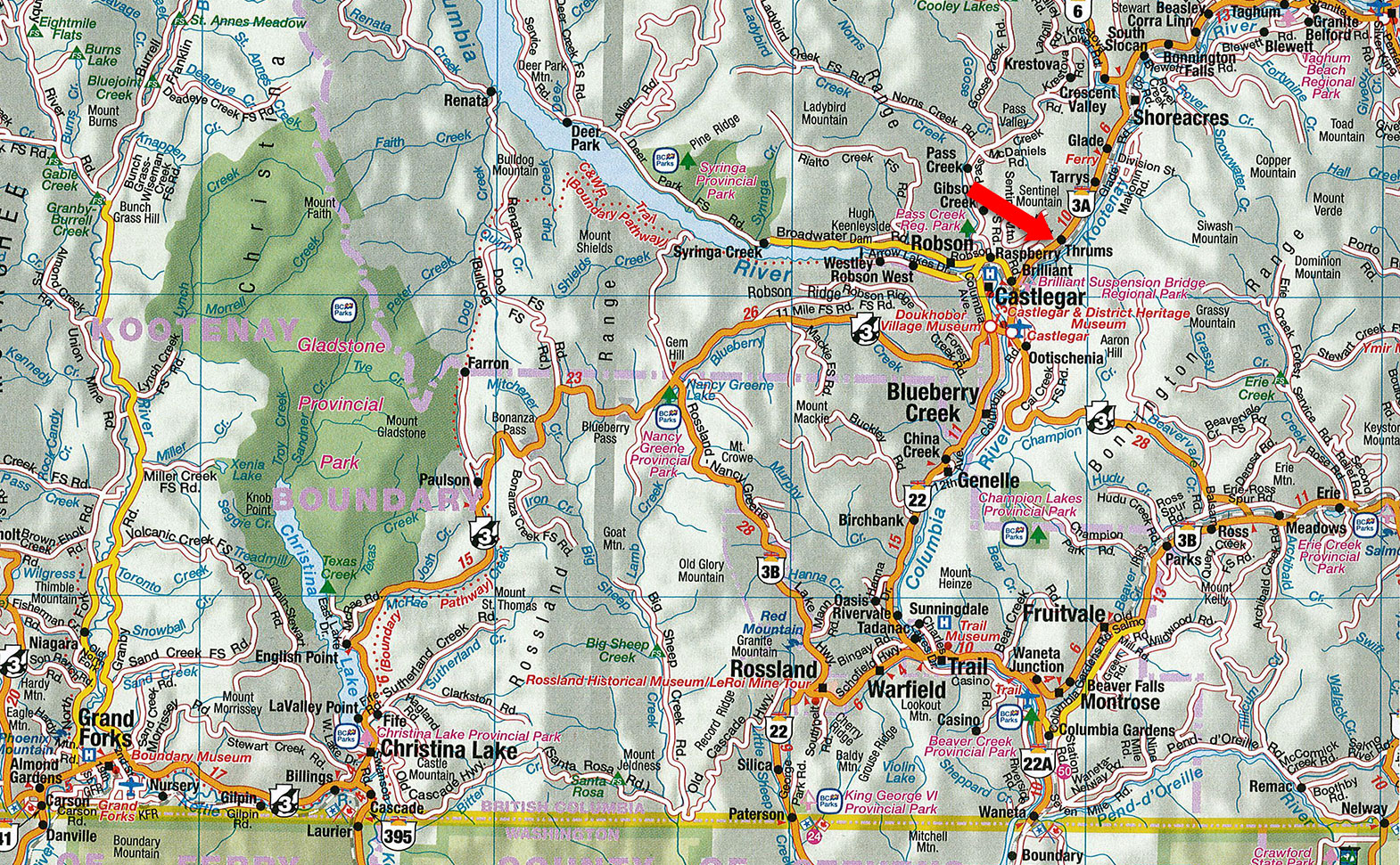
Sentinel Mountain Forest Service Road - Thrums, BC
See aerial images and maps as there are 3 different sections of the land—I can also send a KMZ file that can be opened on your phone and will show the boundaries in relation to your location to help locate the land and boundaries.
Take Lookout Road off Highway 3A and drive to the end of the road. The road then turns into Sentinel Mountain Forest Service Road. The land starts at the second switch back (near where you will see the for sale sign).
There is a driveway/service road that comes off the highway (only accessible is driving towards Castlegar. This service road extends up to the land.
You will drive by this on the way to the main chunk, it has a portion touching Lookout Road.
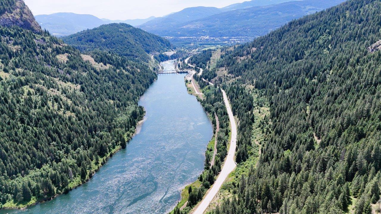
Thrums is an unincorporated community on the northwest shore of the Kootenay River in the West Kootenays. The location, on BC Highway 3A, is by road about 11 kilometres northeast of Castlegar, and 33 kilometres southwest of Nelson. In Thrums there is an excellent bakery/market, and some small home based and industrial business’, the majority of commercial services are a few mins drive into Castlegar.
Castlegar, only a few minutes drive from the property, is a community of over 9,000 people at the confluence of the Kootenay and Columbia Rivers. Outside the city limits are several small surrounding communities of with a further population of about 8,000 people making Castlegar strong commercial hub in the West Kootenays. As a regional trade and transportation centre, with a local economy based on forestry, mining, hydro power, and tourism Castlegar has a wide array of commercial and professional services. Castlegar is home to Selkirk College, a regional airport (serviced by Air Canada). Several sawmills, hospital, excellent recreational facilities, and a nice blend of large-scale retail and unique owner operator businesses.
Please see the mapping section, all boundaries are approximate.
49°20'21.46"N and 117°36'12.56"W
Although a portion of the land touches public road (Lookout Road) the 53 acre more useable section is not connected to public road and or the power grid. The land lends itself more to an off-grid cabin/home.
No well, no septic.
Cell service is available.
Starlink and other Internet options are available.
Bare land.
$757.89 (2025)
RS1
Permitted Uses
Single Family Home, Duplex, Horticulture, Vet Clinic.
Accessory Uses
Accessory Dwelling Unit, Accessory Tourist Accommodation, Cannabis Cultivation and Processions, Cannabis Nursery, Sale of Site Grown Farm Products, Accessory buildings.
Min Lot Size
5 acres.
Contact the RDCK for more details and to confirm your intended use suits.
DISTRICT LOT 14539 KOOTENAY DISTRICT, EXCEPT (1) PART SHOWN COLOURED RED ON PLAN RW 17, (2) PART LYING BETWEEN RW PLAN 638D AND THE KOOTENAY RIVER AND (3) PART INCLUDED IN PLAN RW 37 (4) PLANS NEP69547 AND 6015
PID 016-750-098
 +8 maps
Our property descriptions and geographical information are taken from the BC Assessment Authority, Land Titles Office, government maps and other sources. While LandQuest® does not guarantee the information, we believe it to be accurate, but should not be relied upon without verification. This communication is not intended to cause or induce breach of an existing agency agreement.
Castlegar
 17℃
17℃
 14℃
14℃