


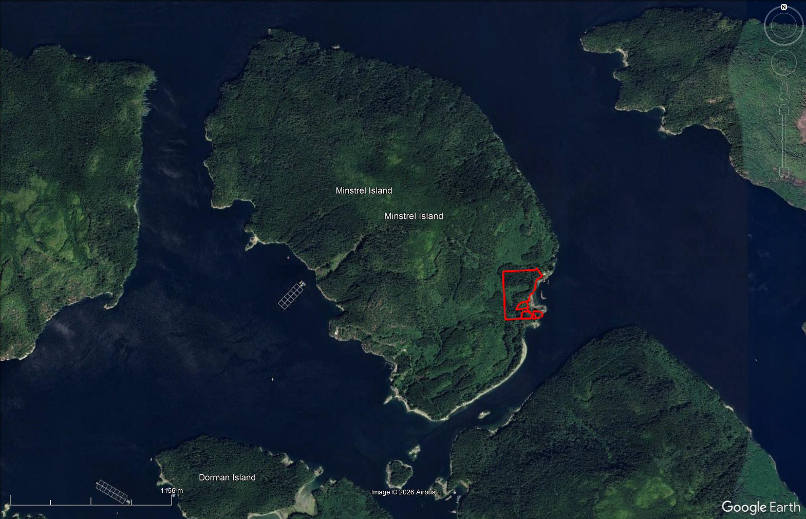
Historical oceanfront property with protected cove set on 18.48 acres & 4 titles. A number of dilapidated buildings & lots of materials amongst them to revive the old home. Settlement here dates to 1907. Excellent fishing, prawning & grizzly bear viewing up the Knight Inlet.


 +16 photos
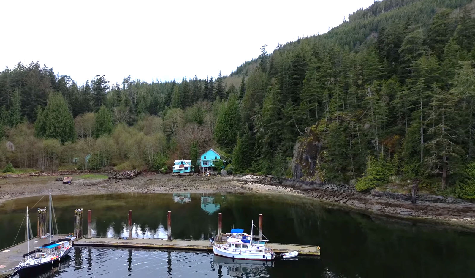

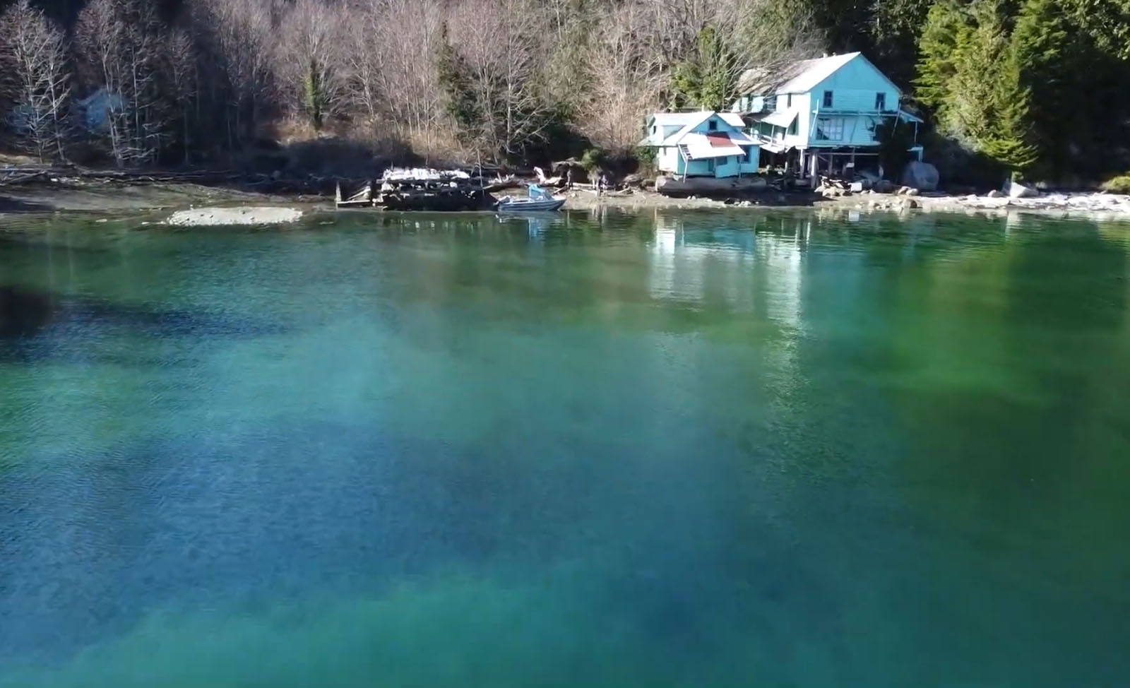


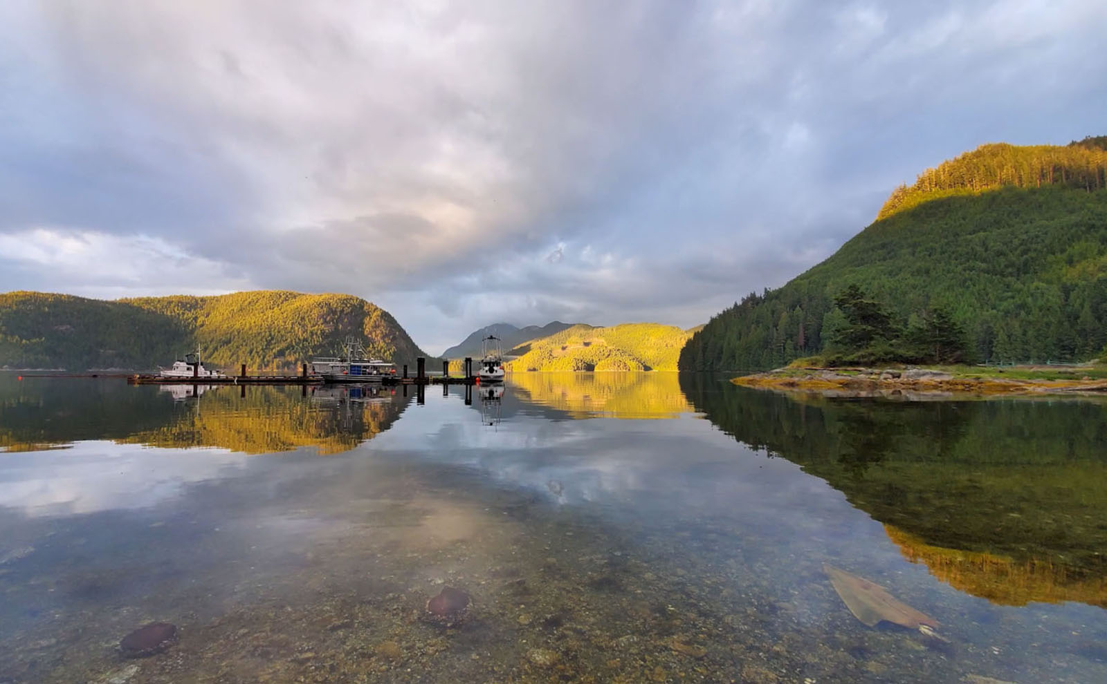
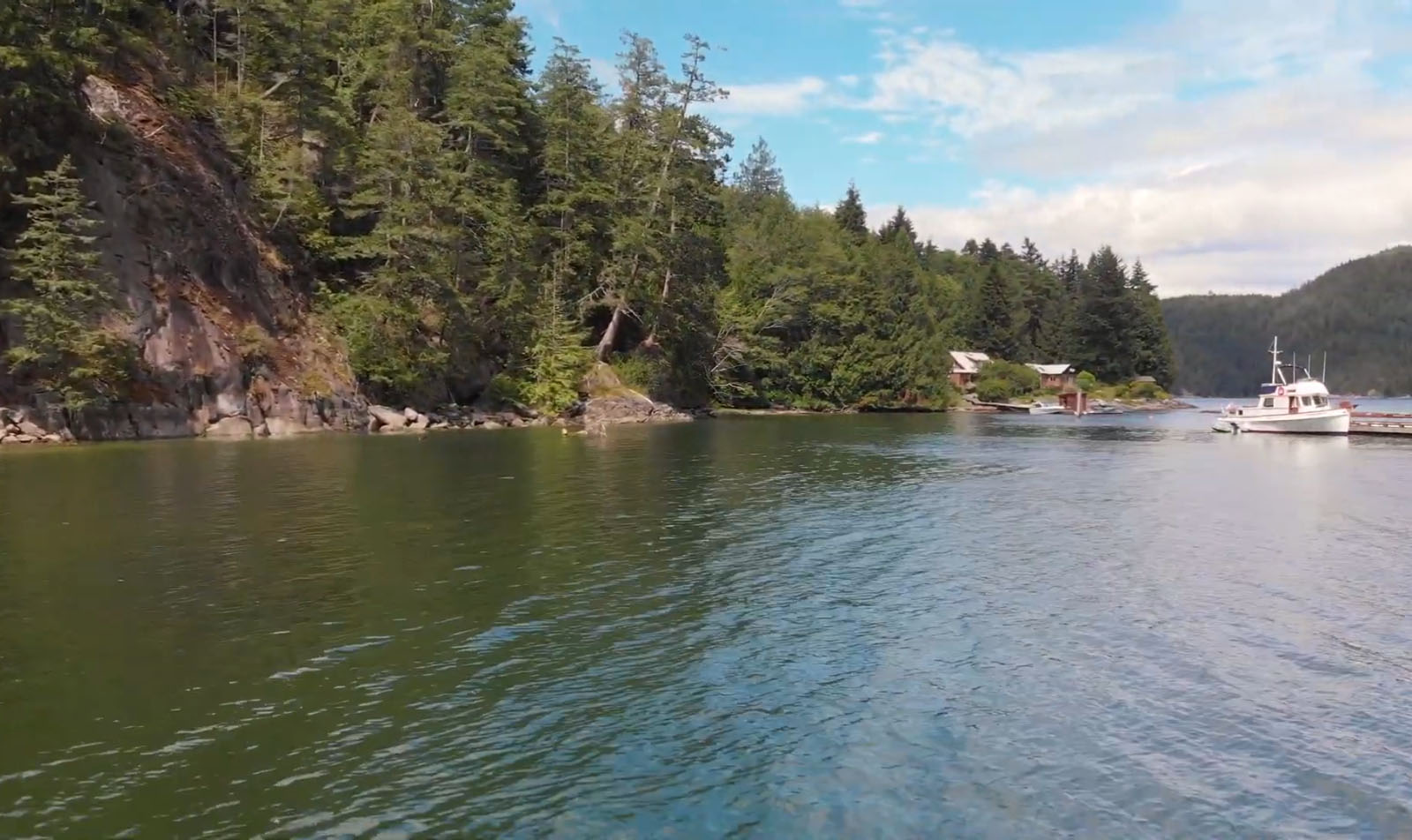
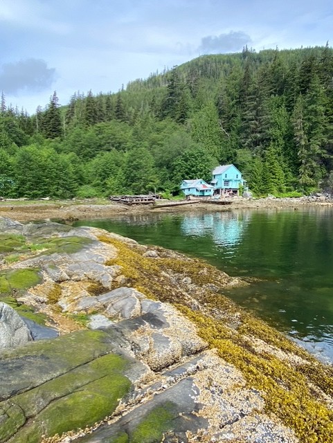
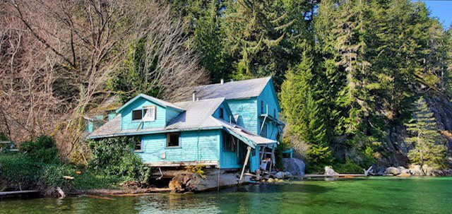
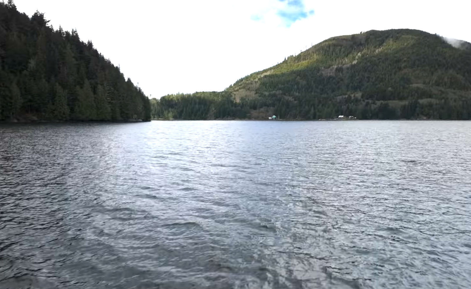
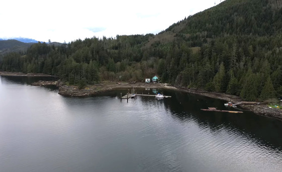
Minstrel Cove, a historical oceanfront gem on Minstrel Island in the Chatham Channel in the lower Knight Inlet Region of the Central Coast.
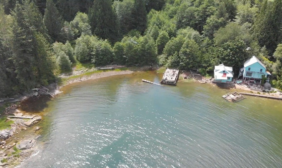
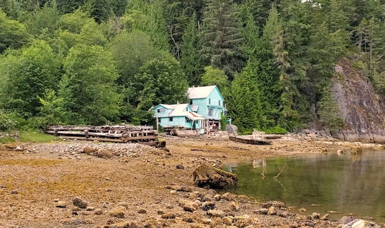
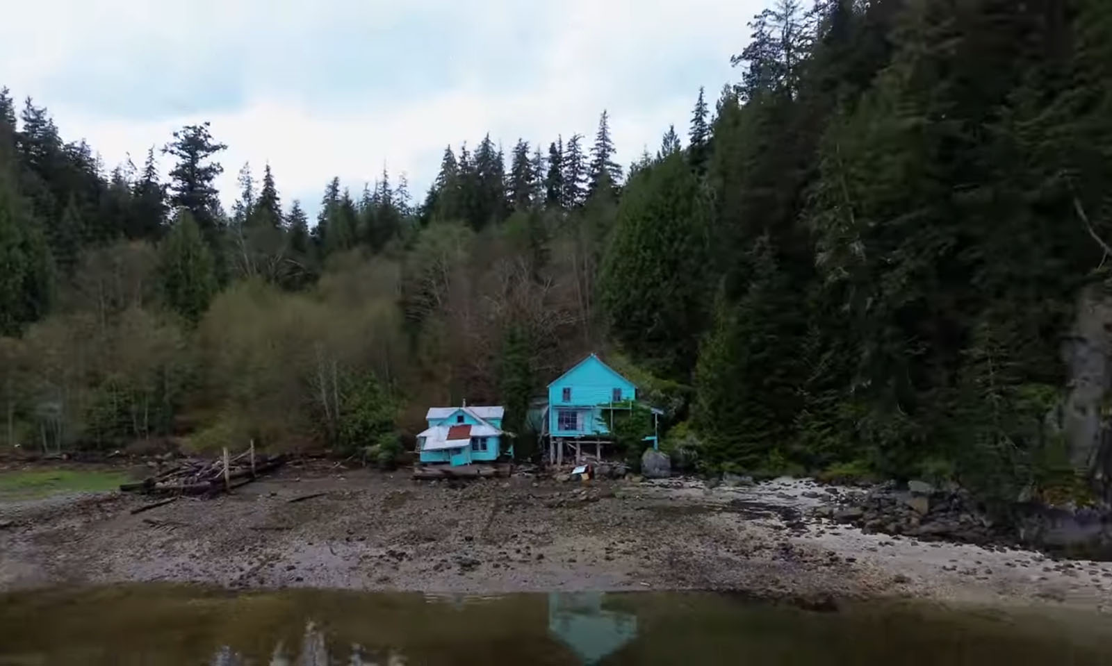
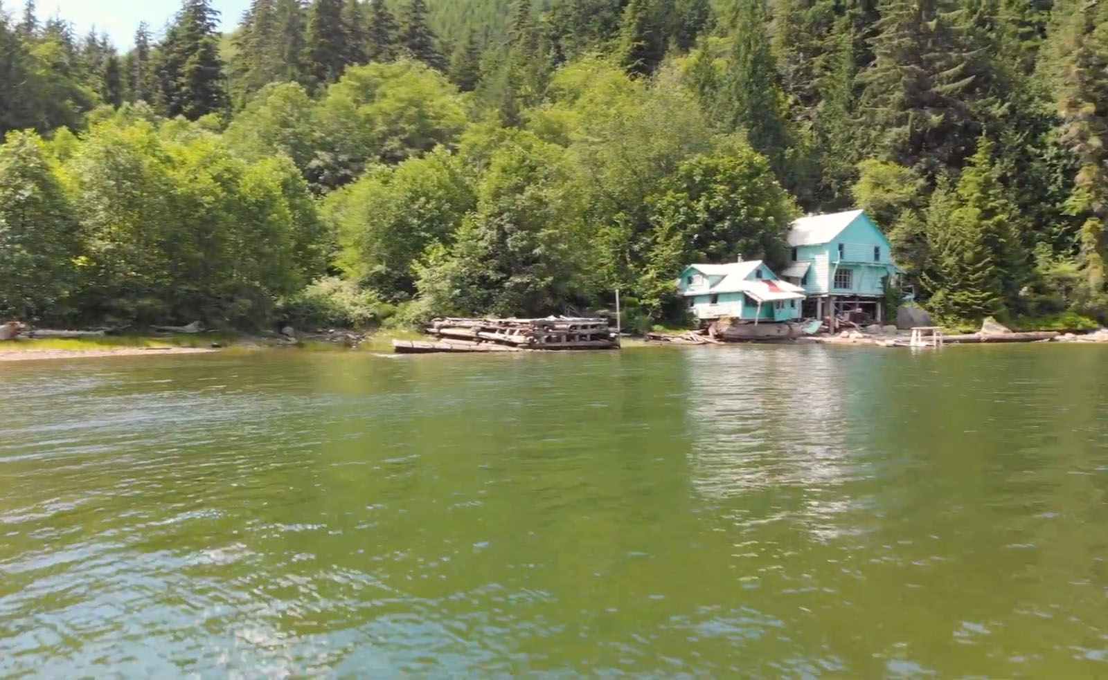
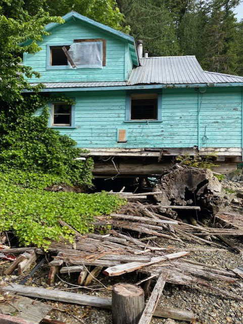
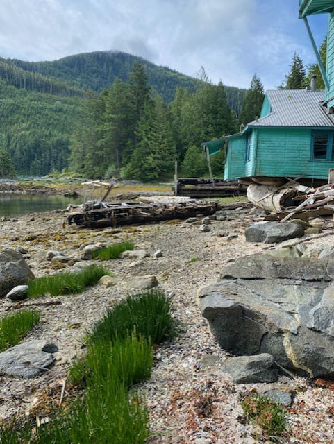
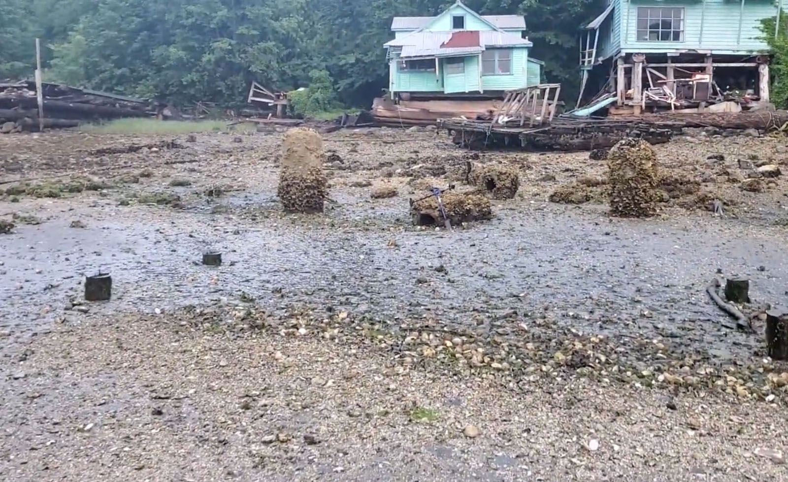
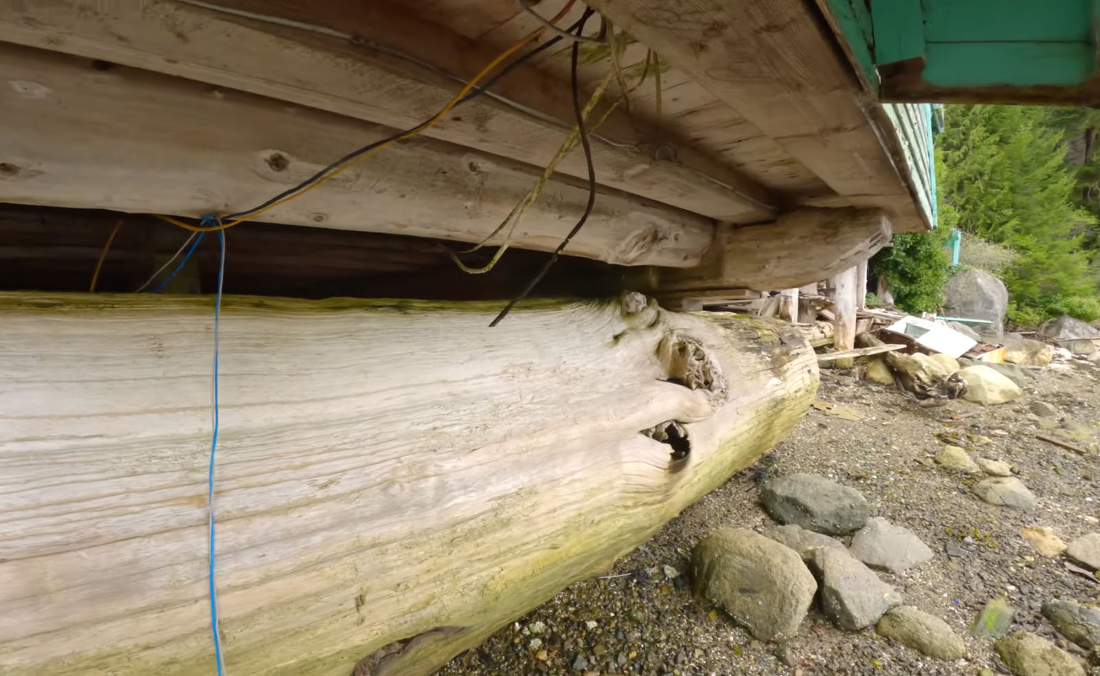
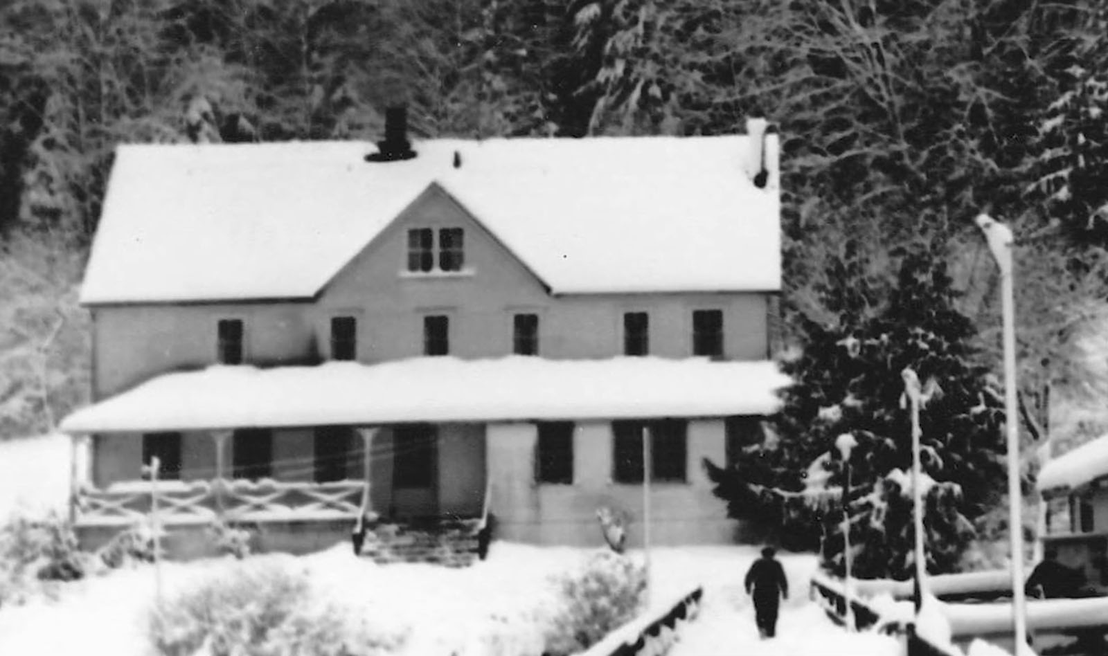
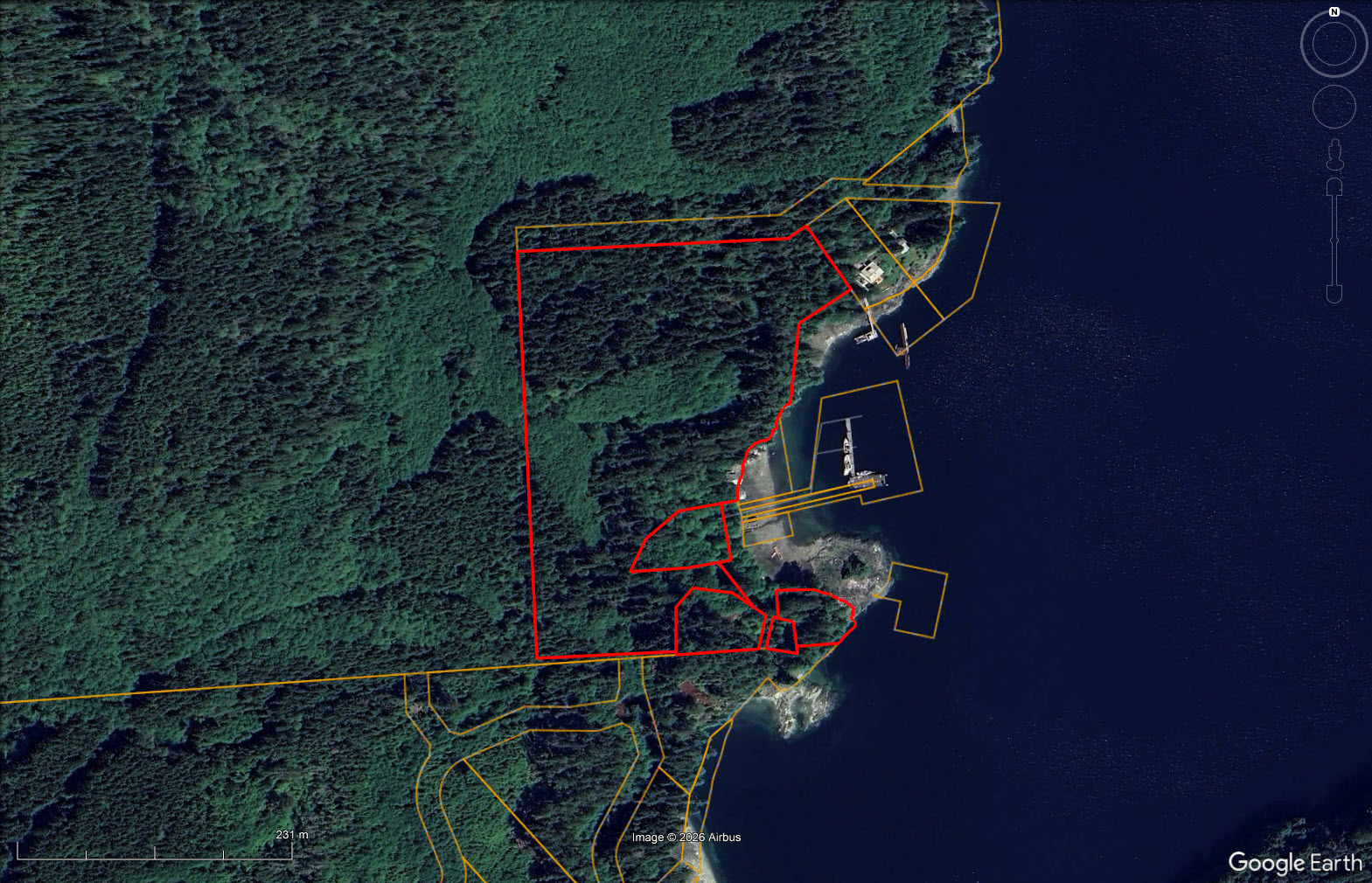
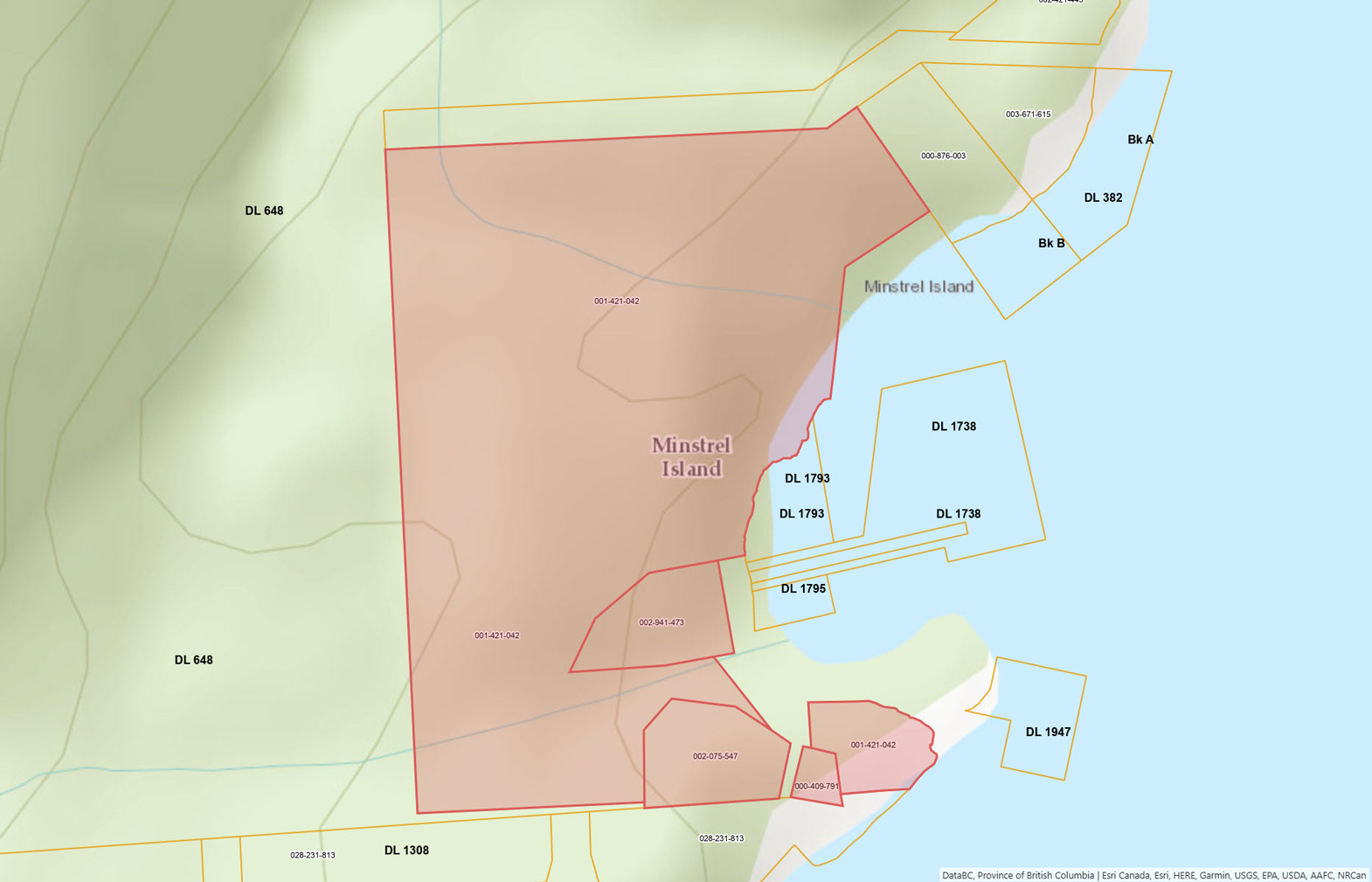
The land is comprised of 18.48 acres of waterfront with 4 separate titles—see maps. There are a few old, dilapidated buildings on the property—a house, restaurant, a couple outbuildings, foundation remnants of an old schoolhouse—and therefore there are lots of materials available with these older structures to set up the home quite nicely. To give you an idea of the history, I have read that the settlement on this land goes back to 1907 where at one time there was a hotel/pub that served more beer than any other in BC!
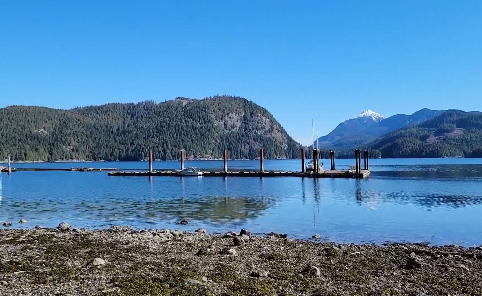
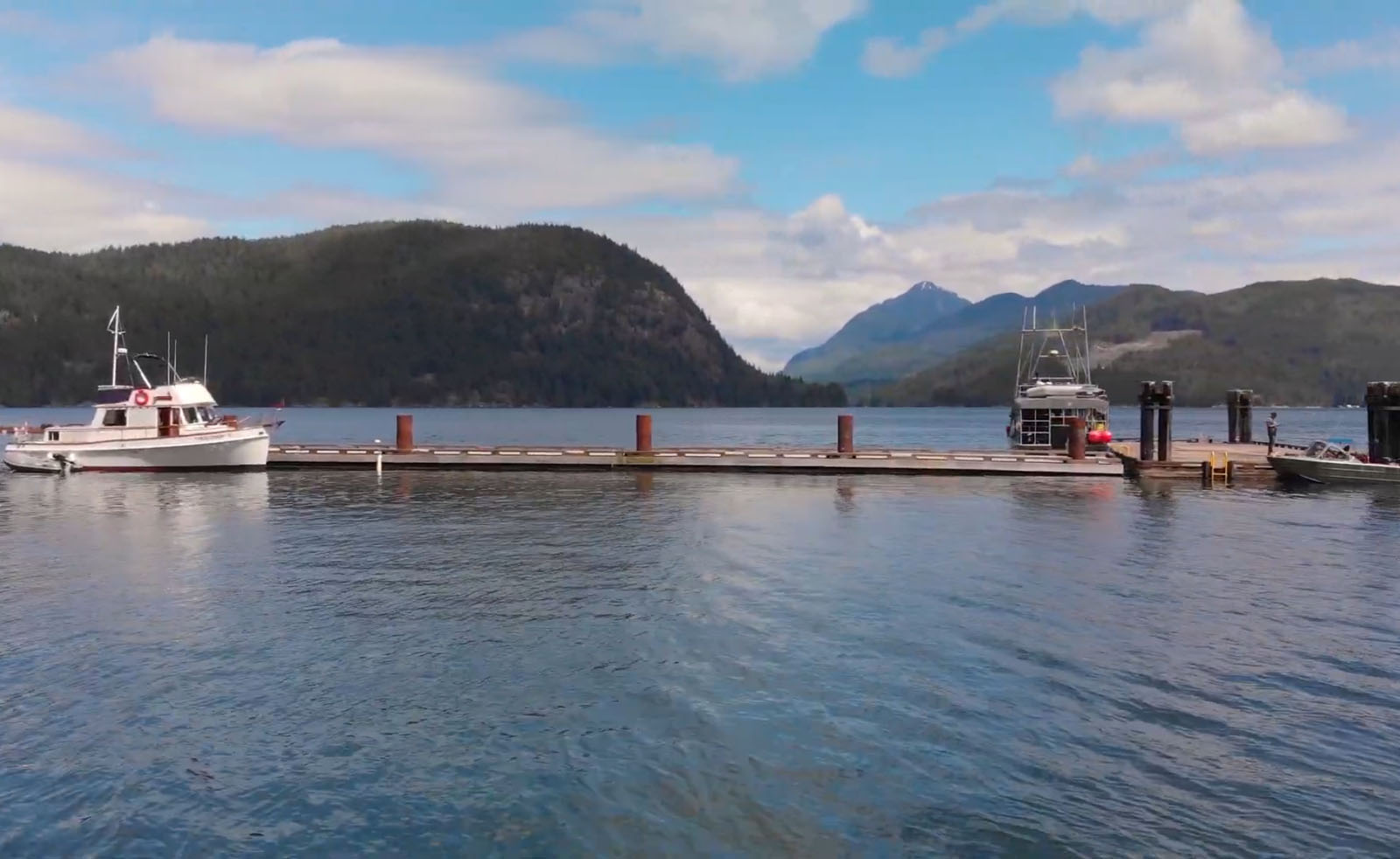
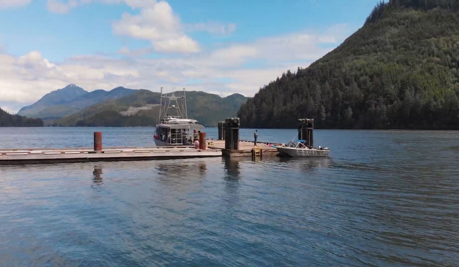
In the past few years Fisheries and Oceans Canada (DFO) has removed the public docks that connected to the shoreline, but the large public float remains in its protected bay—a nice convenience for coming and going. The bay is so protected the old home has sat at high water's edge with little impact for 100+ years.
The property itself is lush and beautiful with loads of potential. There are 2 drilled wells on the land, a sewer outfall system which needs to be repaired but permits remain in place, several fruit trees, and berry bushes.
This could be your dream oceanfront escape with gardens, fishing, crabbing and prawning at your doorstep and world class Grizzly bear viewing up the Knight Inlet.
Property is priced below the current assessment of $373,300.
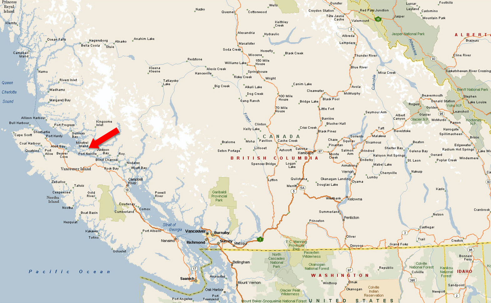
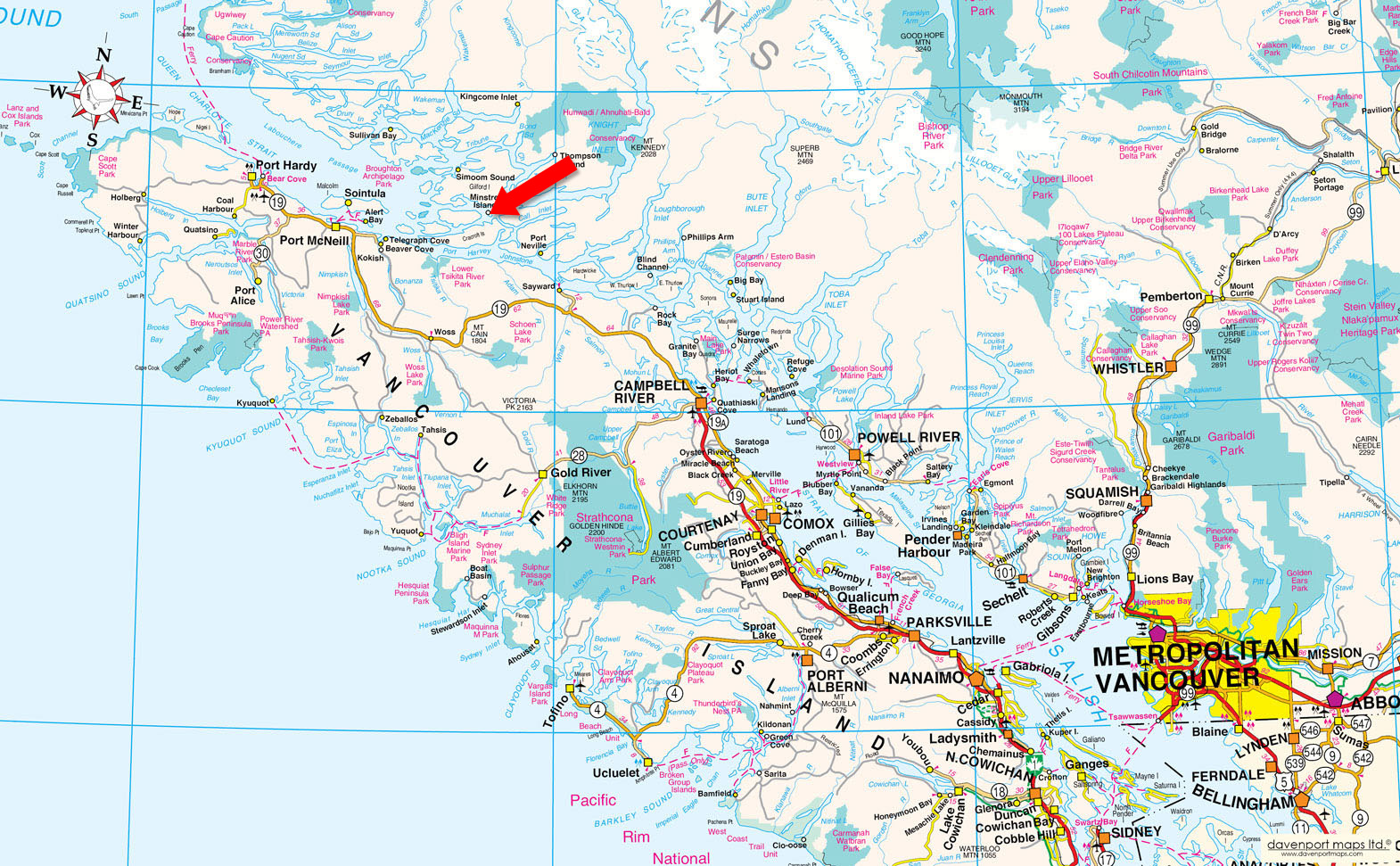
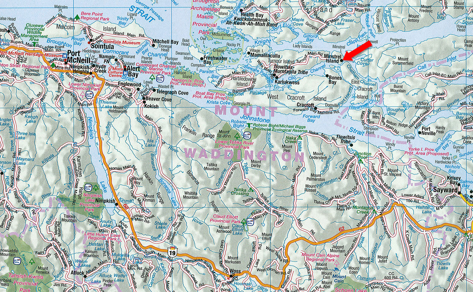
Minstrel Island, BC
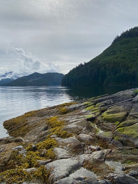
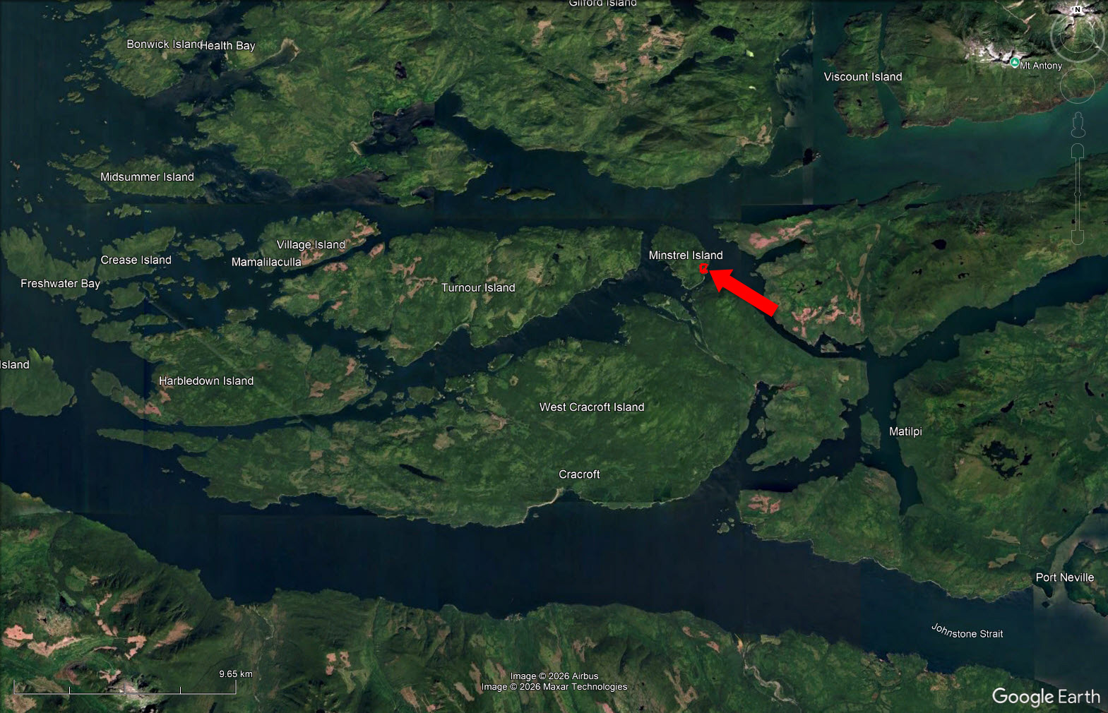
Minstrel Island is a small island in the Central Coast region of British Columbia. It sits near the entrance to Knight Inlet, at the junction of Clio Channel and Chatham Channel, just east of Turnour Island. A narrow waterway called The Blow Hole separates it from East Cracroft Island to the south.
The property is located on 18+ acres in the southeast section of the island—see maps.
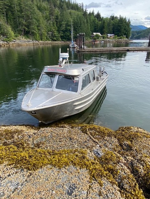
Water or float plane access only.
Float planes available from Campbell River—a scenic 30 minute flight from Campbell River to Minstrel Island. Check out CorilAir in Campbell River.
Minstrel Island is located just south of Knight Inlet at its junction with Chatham Channel. The Blow Hole connects the island to Lagoon Cove where there is a marina with fuel, coffee, snacks etc just a short boat ride away from the property.
Chatham Channel is a strait and marine passageway that leads from the lower reaches of Knight Inlet to the opening of Call Inlet, separating Minstrel and East Cracroft Islands from the mainland to the east.
Knight Inlet is one of the principal inlets of the British Columbia Coast, known for its stunning natural beauty and rich wildlife. It is the largest of the major inlets in the southern part of the Coast, with a length of about 125 km and an average width of 2.5 km. The inlet is fed by the Klinaklini River, which is part of the Great Bear Rainforest, home to a variety of wildlife, including grizzly bears and salmon. Knight Inlet is a popular destination for wildlife viewing, particularly for observing grizzly bears, and offers opportunities for fishing and adventure activities.
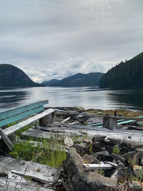
In the early 1900s, Minstrel Island became a busy local hub for logging, fishing, and coastal transport. It was a scheduled stop on steamship routes (e.g., the Union Steamship line), making it a small centre of activity for people traveling the coast or working in regional industries. A hotel, store, saloon, and other services were established as the area grew with hand loggers and boat traffic. The majority of these services and structures including an old school house were on this property which serviced as the main central coast hub.
Interesting fact . . . the old pub on site, at its peak is known to have served more beer than any other establishment in BC.
Stories from its heyday include lively community life—dances, board school, busy hotel bars, and general trade.<
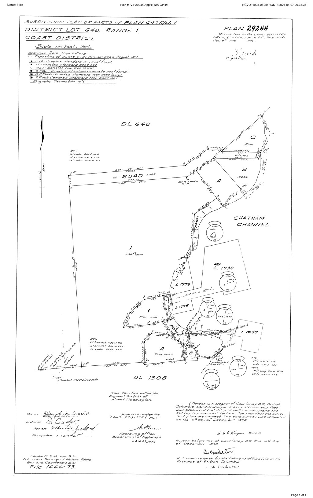
Please see mapping section, all boundaries are approximate.
50°36'49.21"N and 126°18'25.31"W
No power
2 drilled wells
Sewage outflow permit, system needs work but the permit is still active
All structures are in disrepair but some great materials available from these older structures to re purpose and improve/revive the old house, or choose to start from scratch without the need to barge in all the materials.
$1,500
Mount Waddington Regional District
LOT B, DISTRICT LOTS 648 AND 1308, RANGE 1, COAST DISTRICT, PLAN 10039
PID 000-409-791
LOT 1, DISTRICT LOT 648, (MINSTREL ISLAND), RANGE 1, COAST DISTRICT, PLAN 29244
PID 001-421-042
LOT A, DISTRICT LOT 648, RANGE 1, COAST DISTRICT, PLAN 10039
PID 002-075-547
LOT 1, DISTRICT LOT 648, RANGE 1, COAST DISTRICT, PLAN 11791
PID 002-941-473
 +8 maps
Our property descriptions and geographical information are taken from the BC Assessment Authority, Land Titles Office, government maps and other sources. While LandQuest® does not guarantee the information, we believe it to be accurate, but should not be relied upon without verification. This communication is not intended to cause or induce breach of an existing agency agreement.
Port Neville
 7℃
7℃
 5℃
5℃