


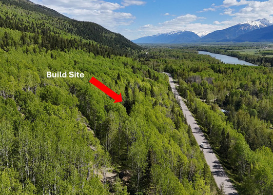
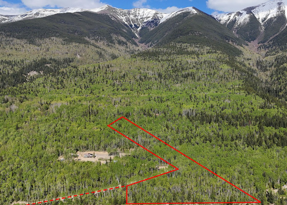
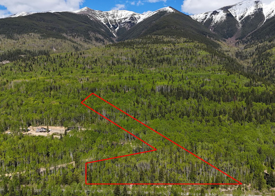
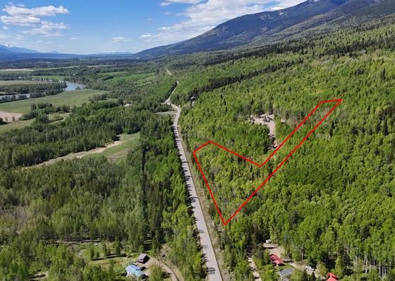
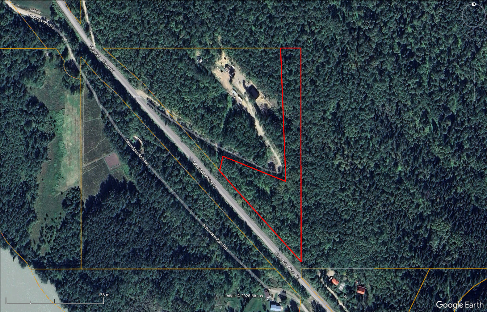
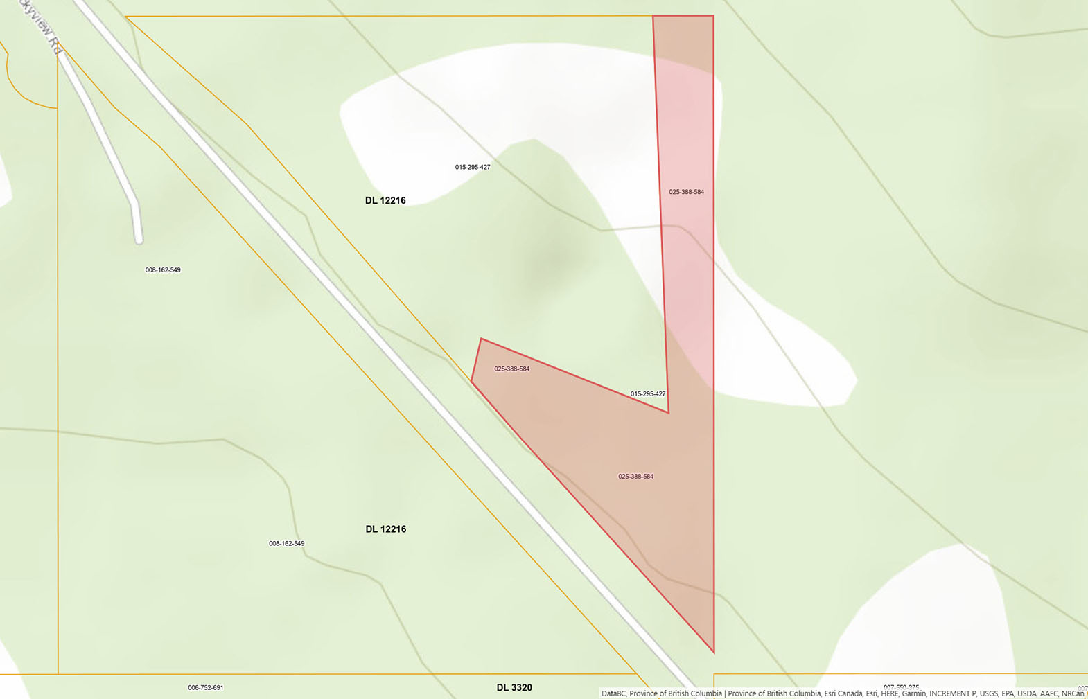
Private 4.99-acre property minutes from McBride. Land has a partially cleared building site, driveway access, and nearby power. Backing onto Crown land and just a few minutes from the town centre and McBride Mountain Trails, it's an excellent opportunity for a home, cabin, or recreational retreat.

 +14 photos
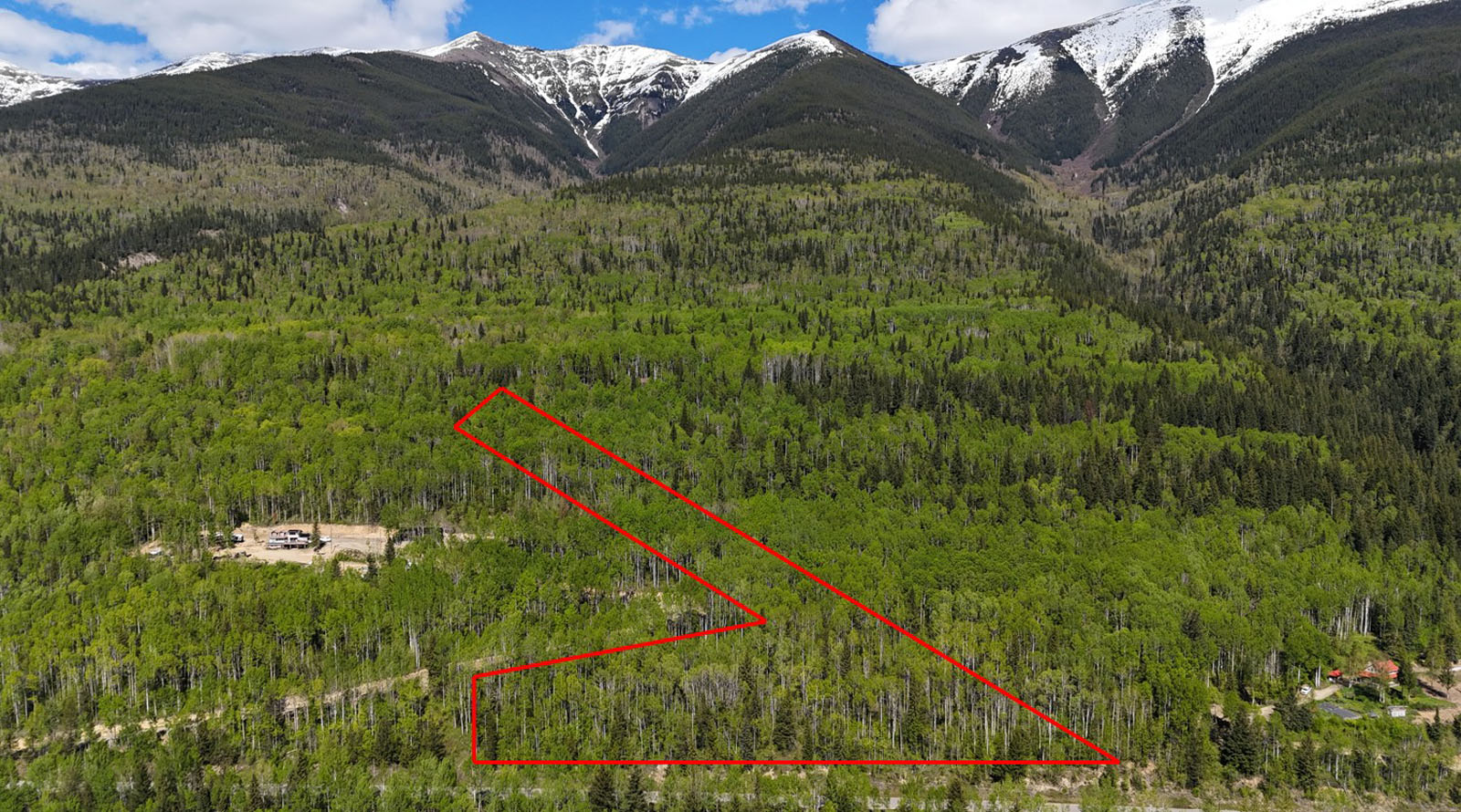
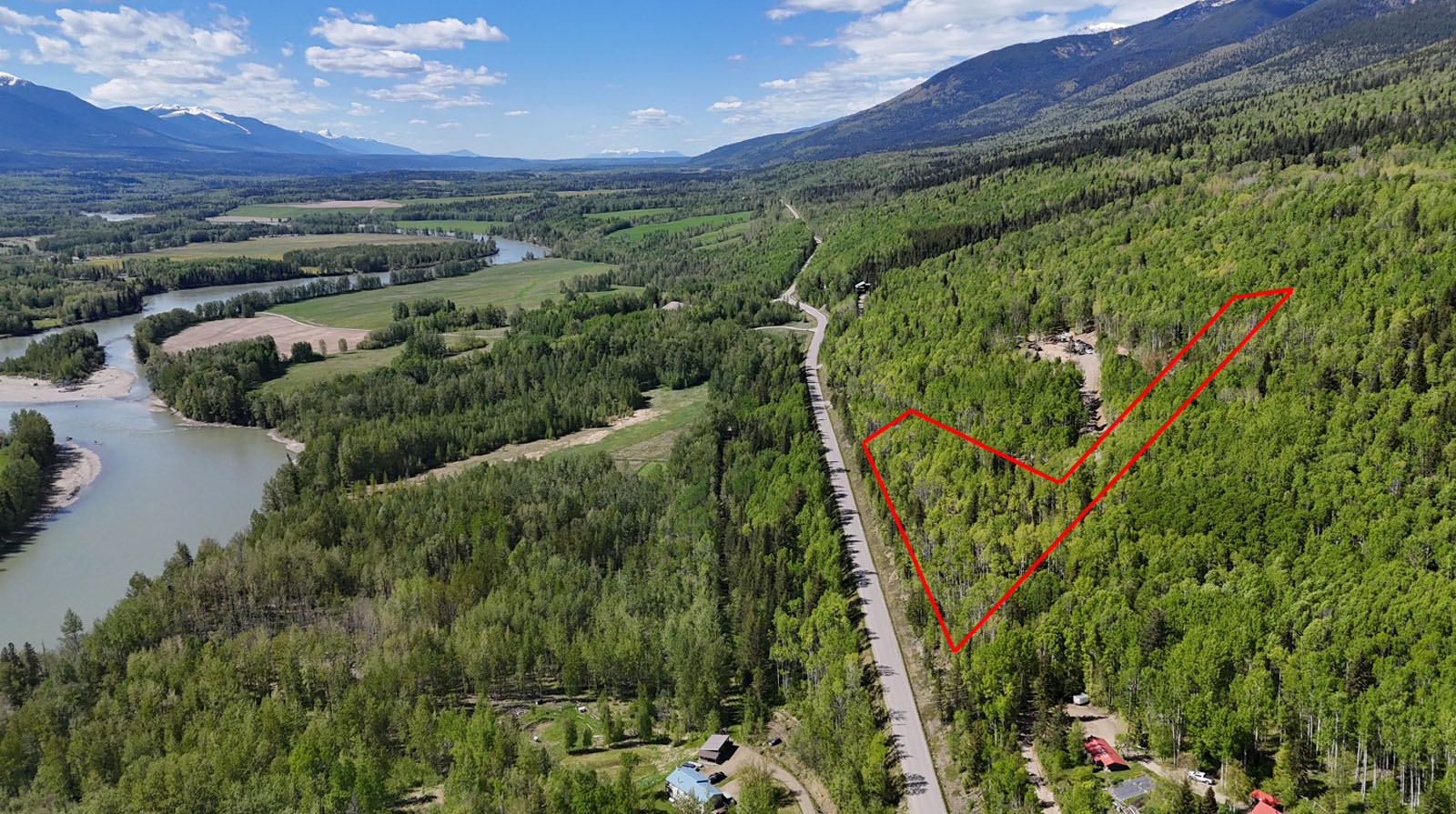
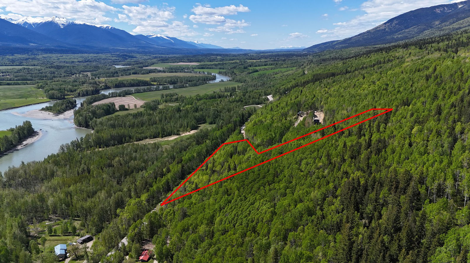
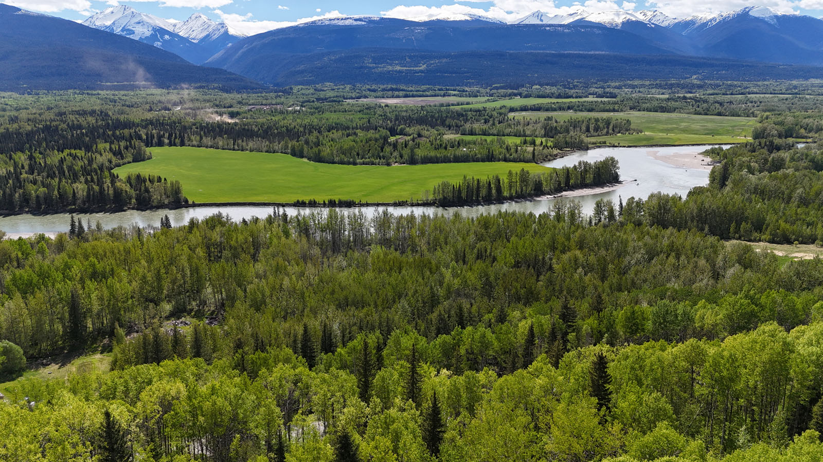
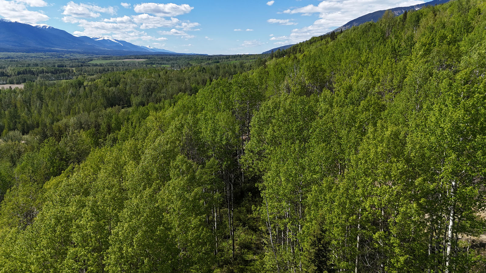
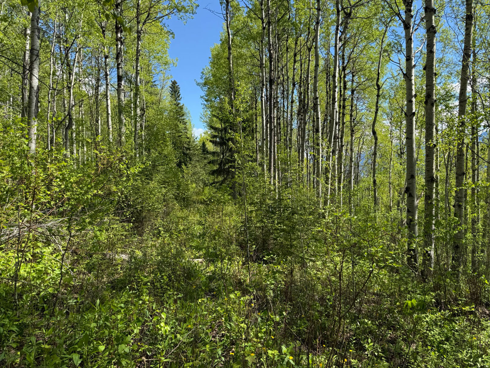
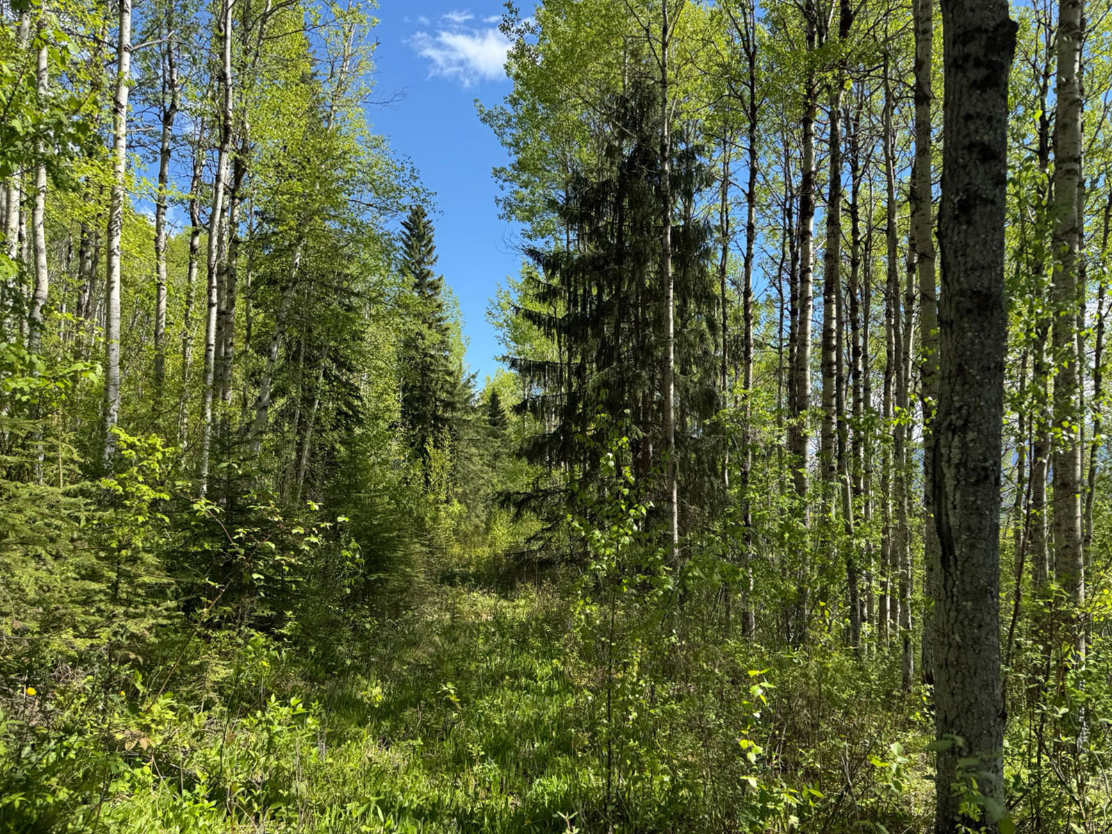
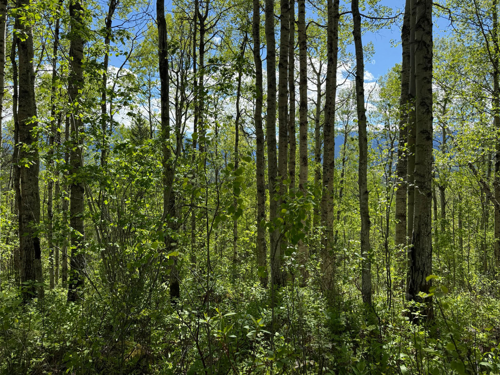
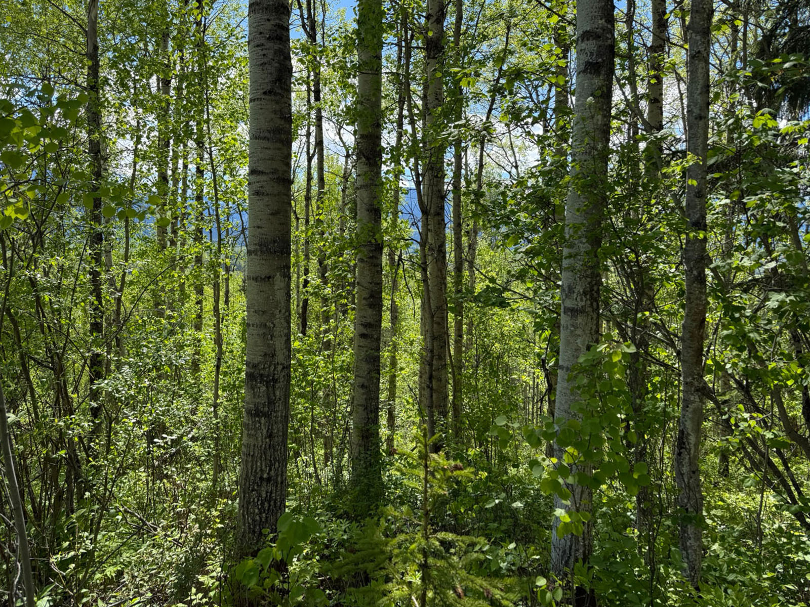
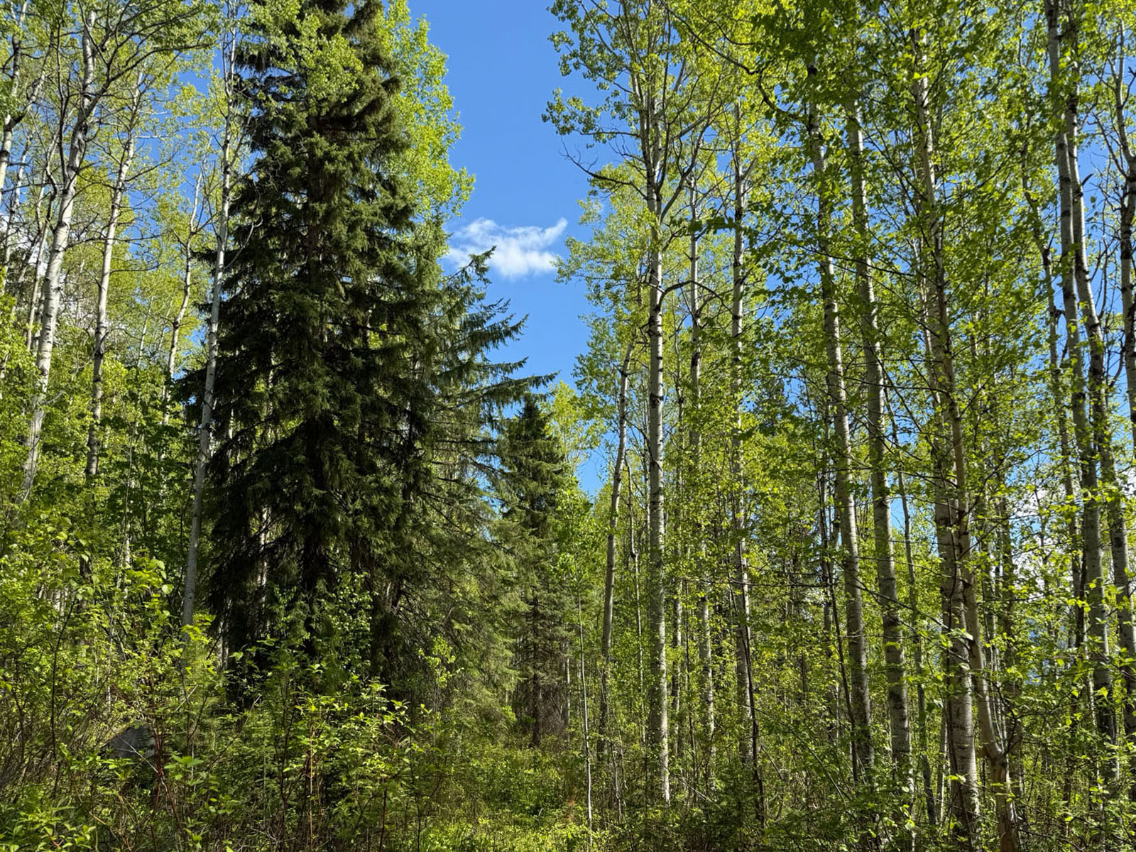
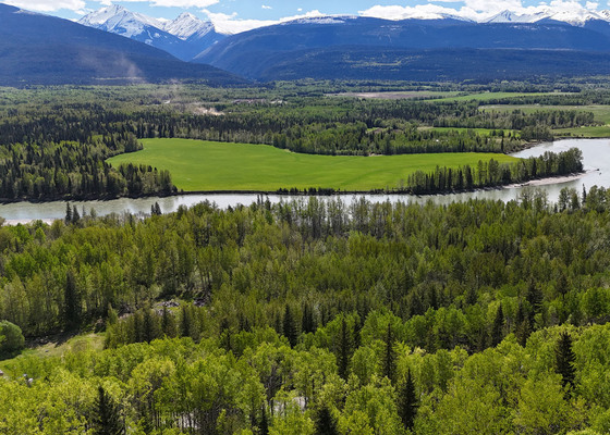
Set on 4.99 acres just minutes from McBride, this inviting rural property offers breathtaking mountain and valley views in a peaceful natural setting. Set at the foot of the Rocky Mountains and looking out to the Cariboo Mountains.
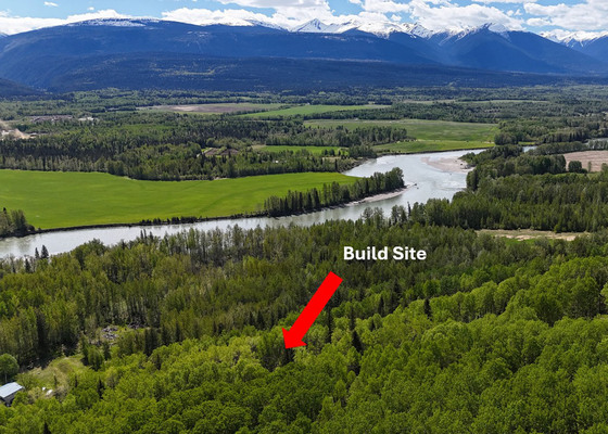
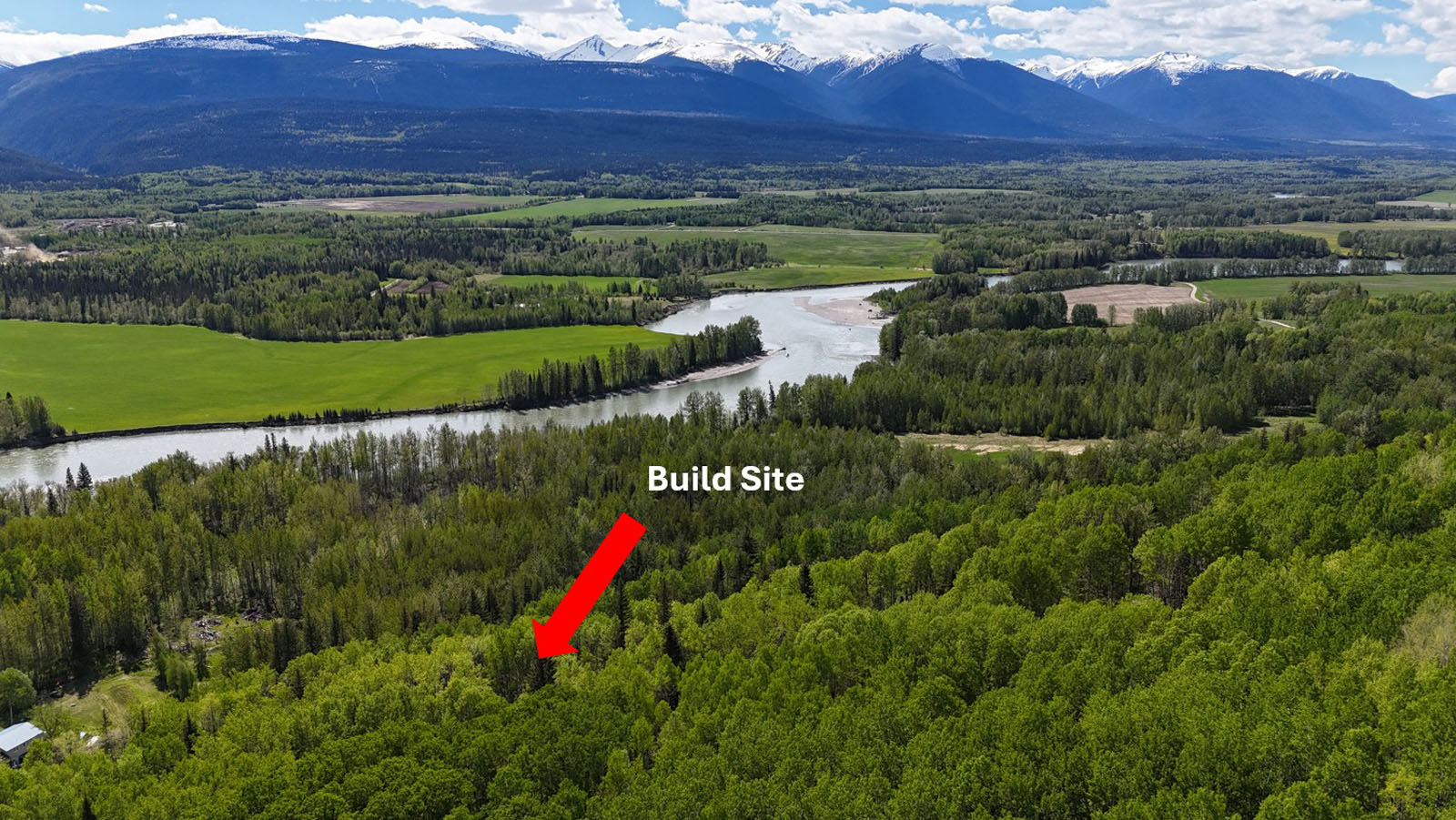
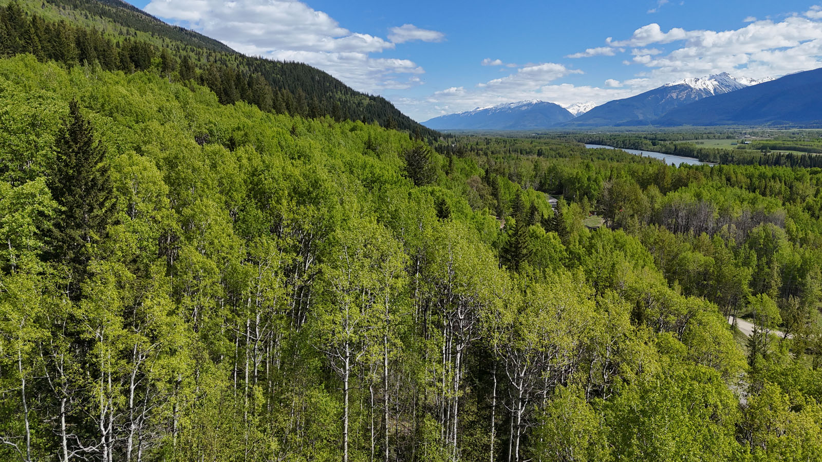
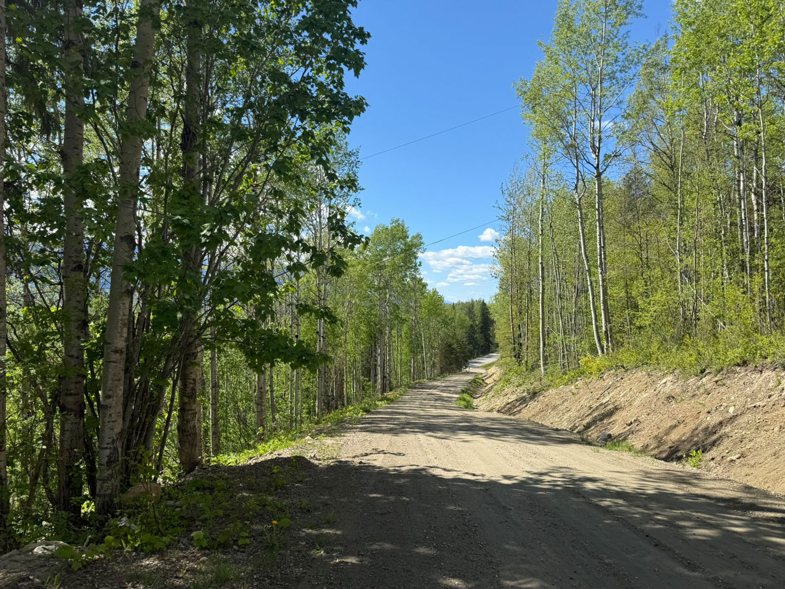
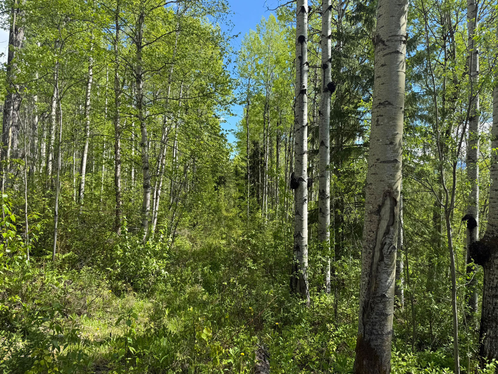
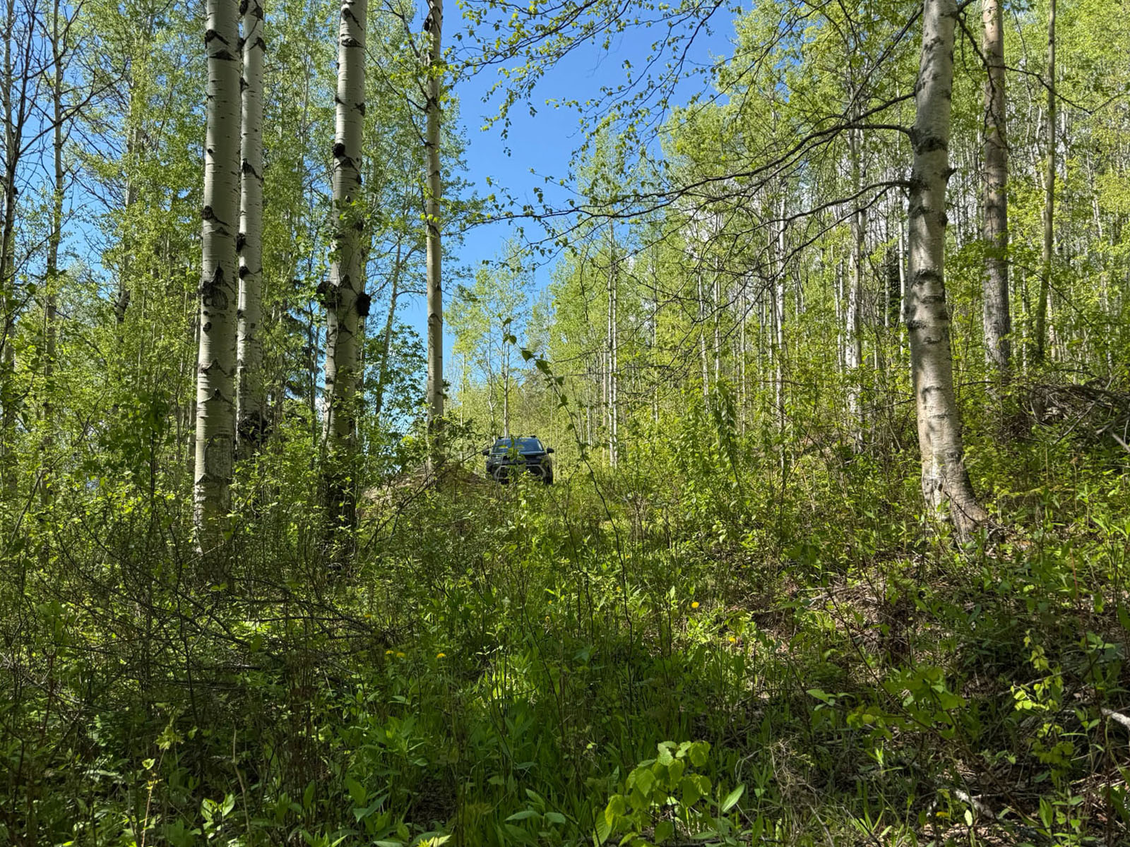
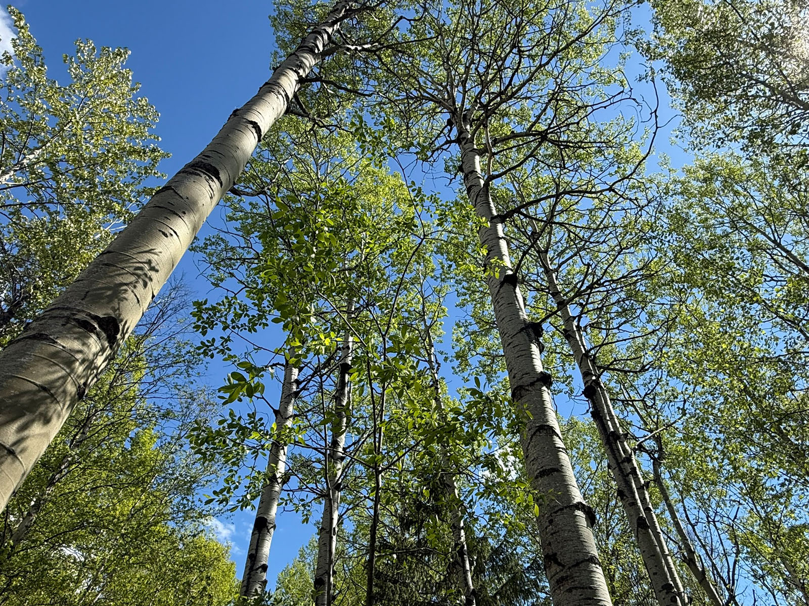
The mostly treed acreage provides exceptional privacy and a true back-to-nature atmosphere, while a partially cleared building site offers an excellent head start for your future home or recreational retreat.
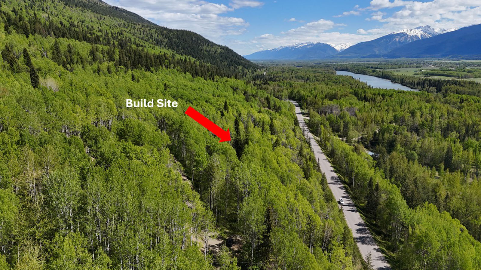
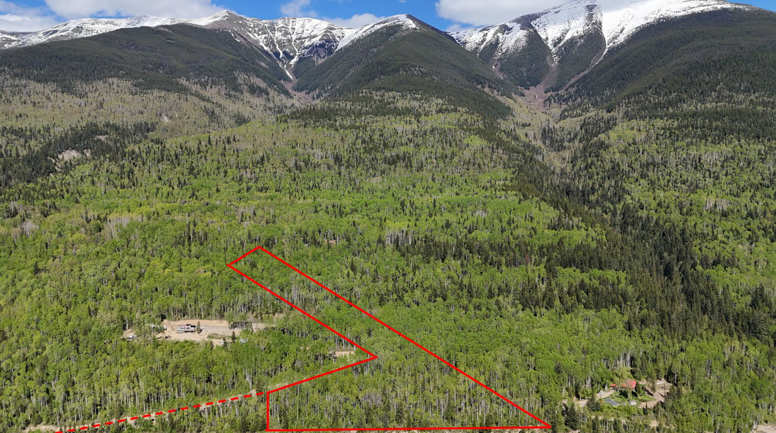
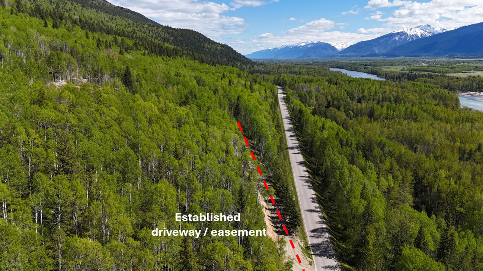
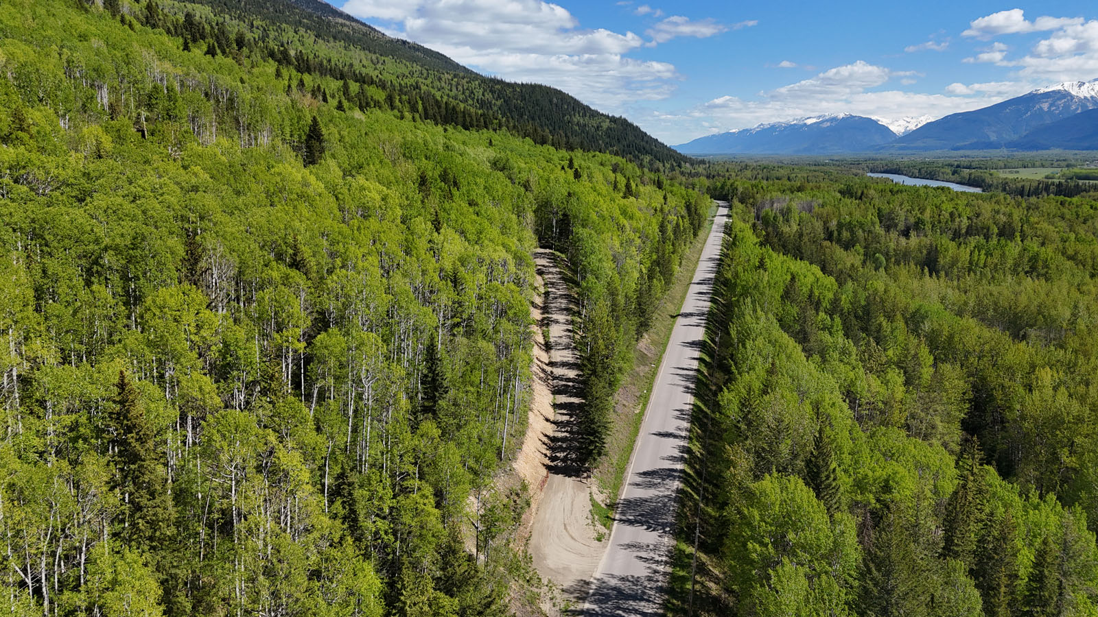
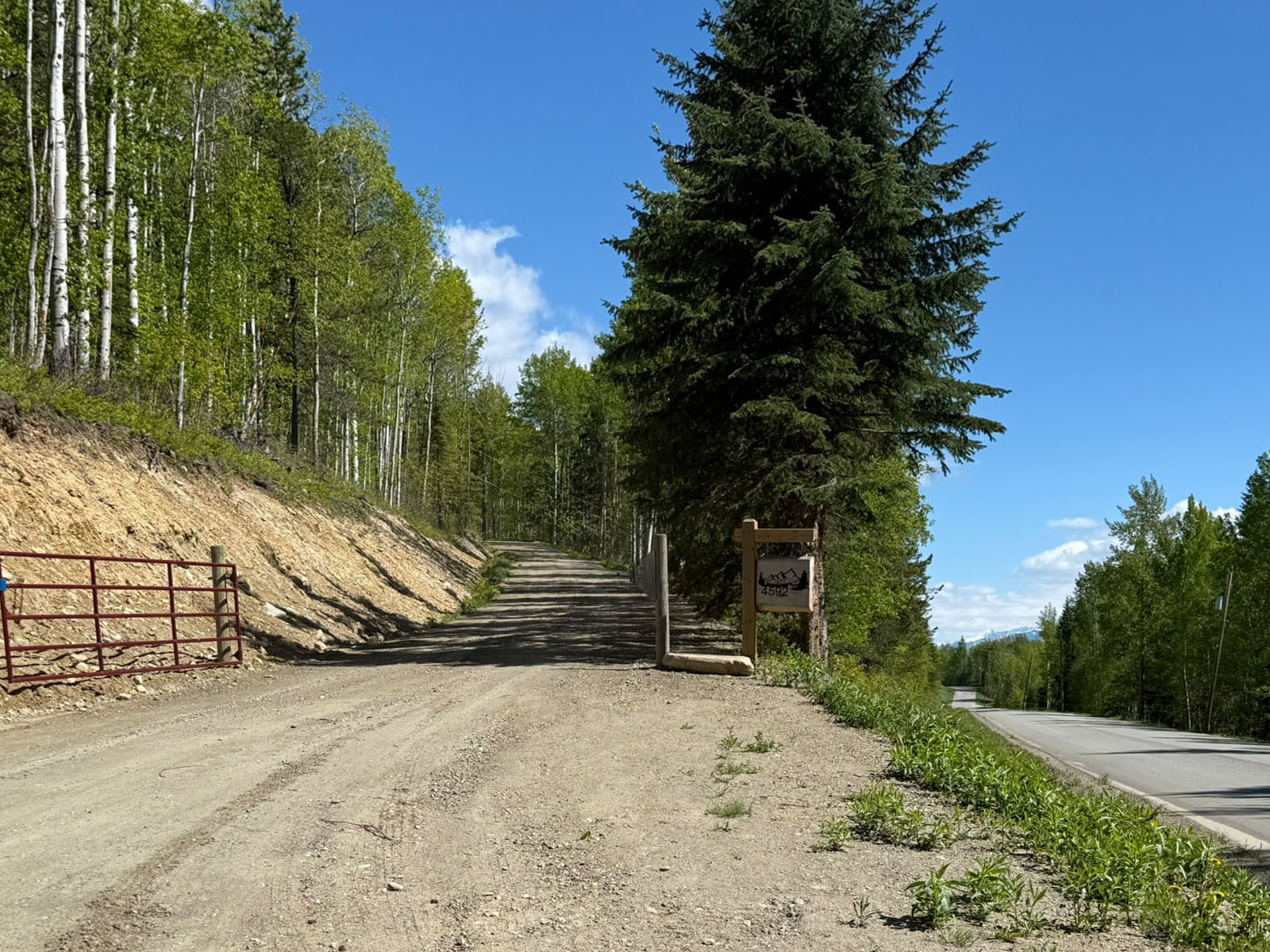
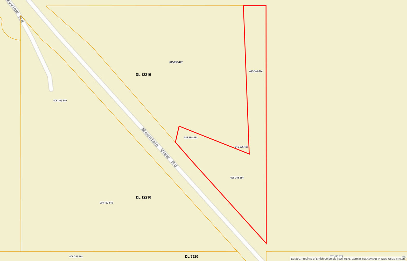
Access is via an established driveway off Mountain View Road, leading to a roughed-in driveway that reaches a prime building location. Power is available nearby making future development even more convenient. T he south-facing, irregularly shaped parcel backs directly onto Crown land, providing immediate access to outdoor recreation and exploration. Just a few mins away are the renowned McBride Mountain Trails offering outstanding mountain biking, hiking, and horseback riding opportunities.
Whether you're looking to build a full-time residence, a weekend getaway, or a recreational cabin, this scenic property offers the perfect combination of privacy, views, and outdoor adventure.
Lot 1 Mountain View Road - McBride, BC
Listing agent can send a KMZ file to download to your phone with mapping of the route to the property with the property lines drawn so you know when you arrive at the land where boundaries are located.
Directions for KMZ file
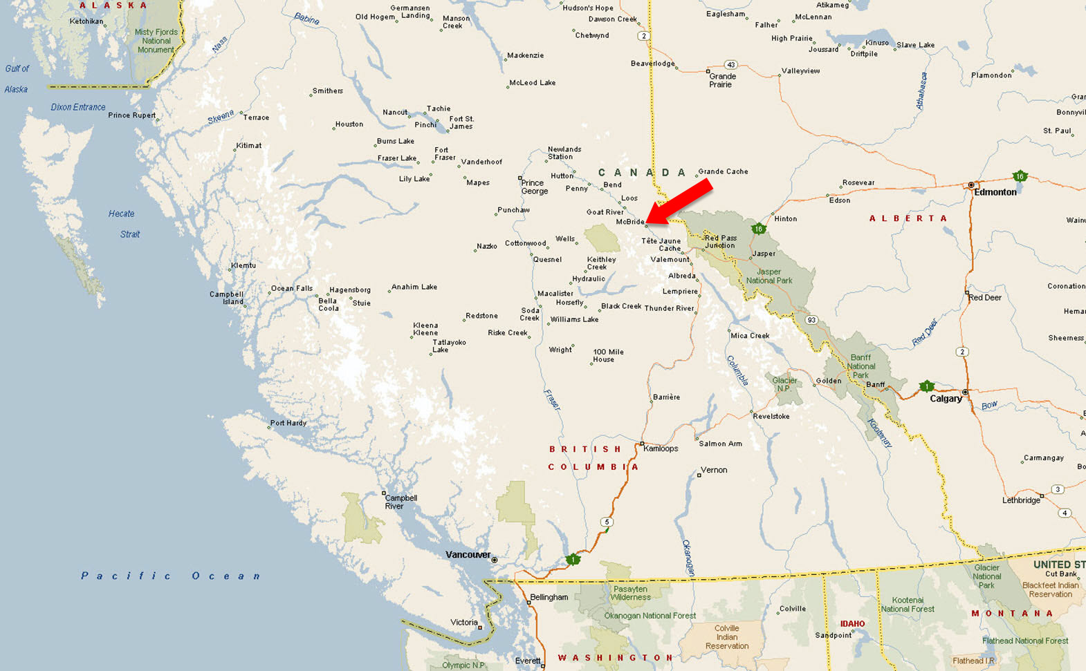
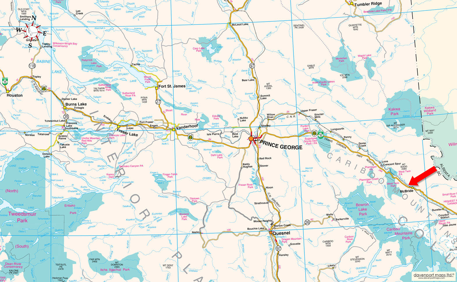
McBride is a welcoming mountain village in the heart of BC’s Robson Valley, set near the headwaters of the Fraser River and surrounded by spectacular natural scenery. The community is flanked by the Rocky Mountains to the east and the Cariboo Mountains to the west, creating a dramatic valley setting with endless opportunities for outdoor recreation.
With a population of approximately 588 residents, McBride serves as a key service hub for the surrounding Robson Valley. The local economy is supported by forestry, agriculture, tourism, rail, trades, and small businesses, with local services including accommodations, restaurants, retail shops, contractors, automotive services, and industrial operators.
McBride combines small-town charm, essential services, and exceptional access to the mountains, making it an appealing place to live, visit, or invest.
Outdoor enthusiasts are drawn to the area for hiking, biking, horseback riding, snowmobiling, fishing, and backcountry exploring. Just outside the village, the McBride Mountain Trails offer a popular multi-use trail network with access to scenic viewpoints, alpine terrain, and year-round adventure.
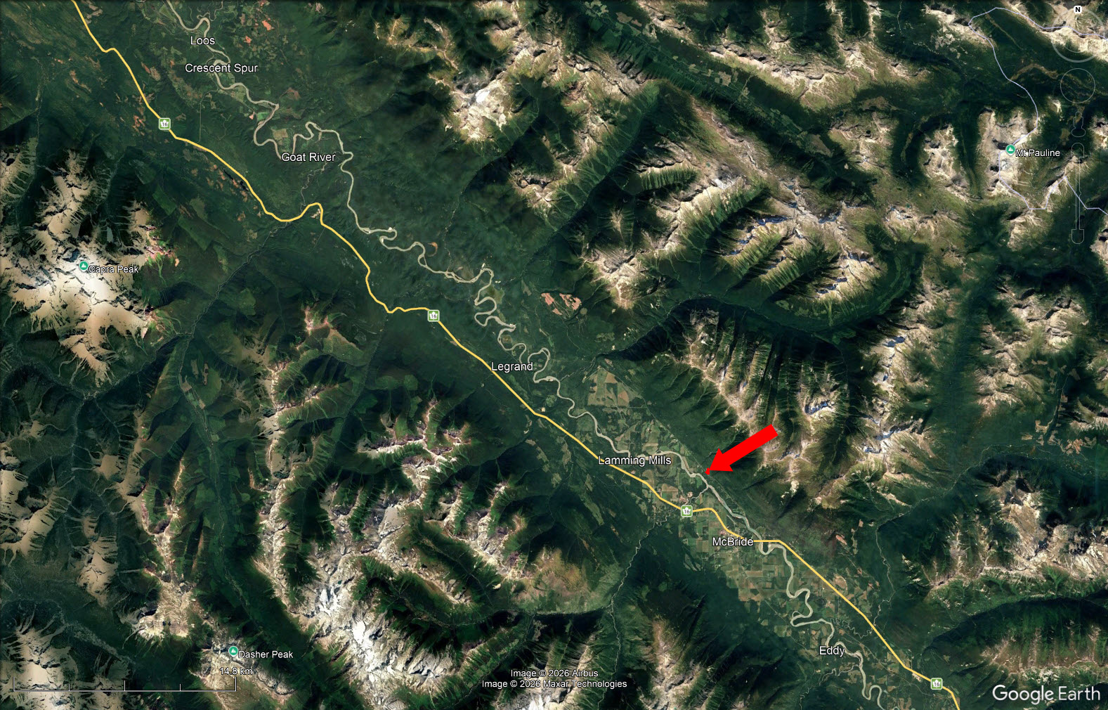
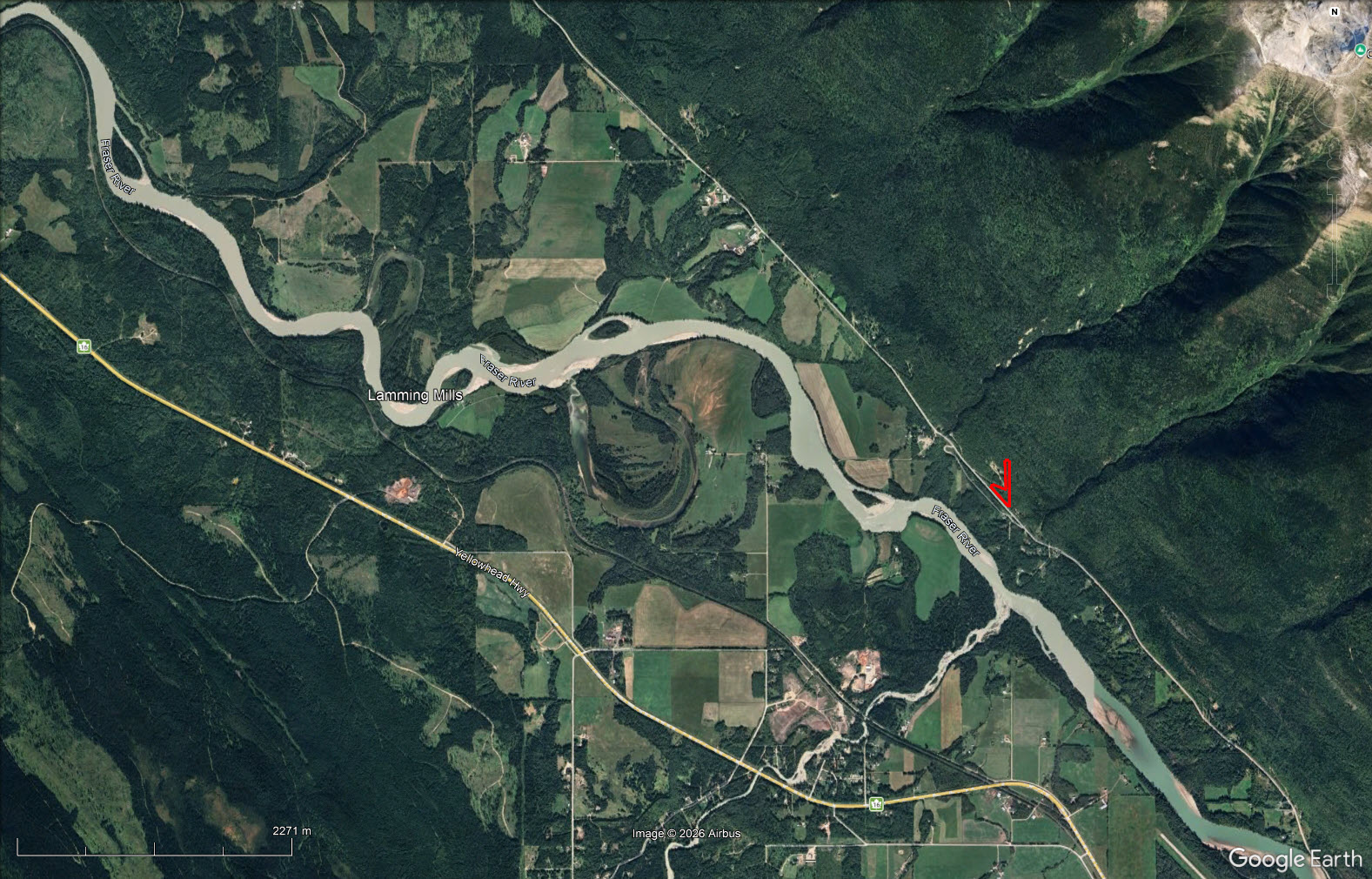
Please see maps and aerial photos—lines sketched in on aerial images are approximations only.
53°20'33.87"N and 120°11'37.46"W
None.
Small Holding (SH)
Permitted Uses
Single Family Dwelling, Forestry, Agricultural, Kennel, Cannabis Production
Accessory Uses
Secondary Suite, Accessory Buildings
Full bylaws can be emailed.
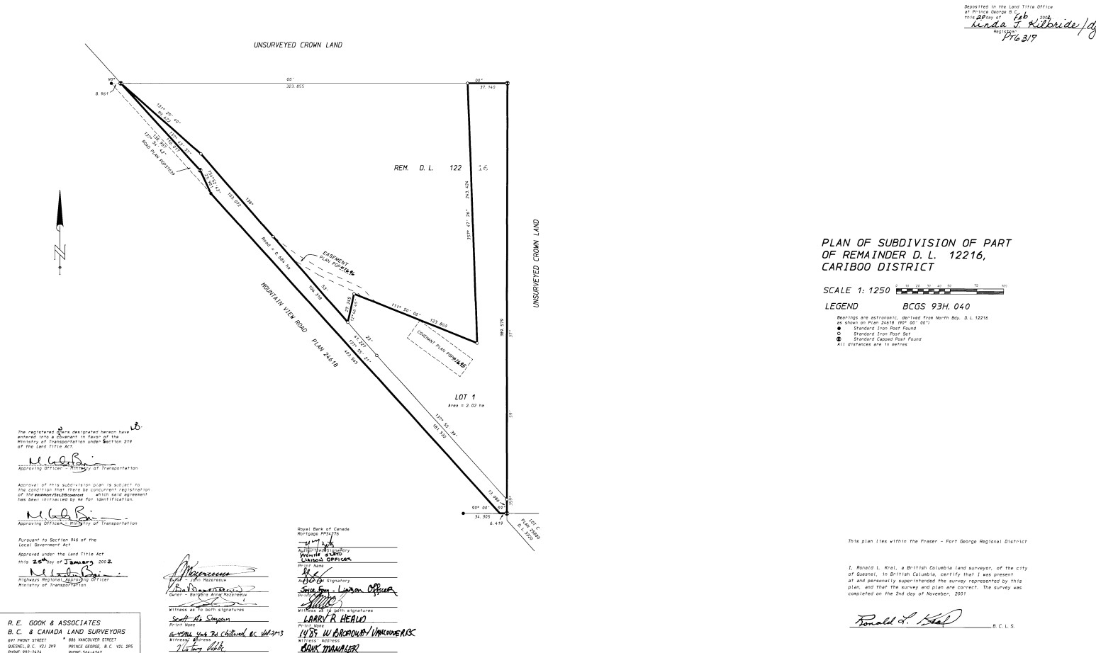
LOT 1 DISTRICT LOT 12216 CARIBOO DISTRICT PLAN PGP47694
PID 025-388-584
Multiple Listing Service®
 +8 maps
Our property descriptions and geographical information are taken from the BC Assessment Authority, Land Titles Office, government maps and other sources. While LandQuest® does not guarantee the information, we believe it to be accurate, but should not be relied upon without verification. This communication is not intended to cause or induce breach of an existing agency agreement.
McBride
 16℃
16℃
 19℃
19℃