


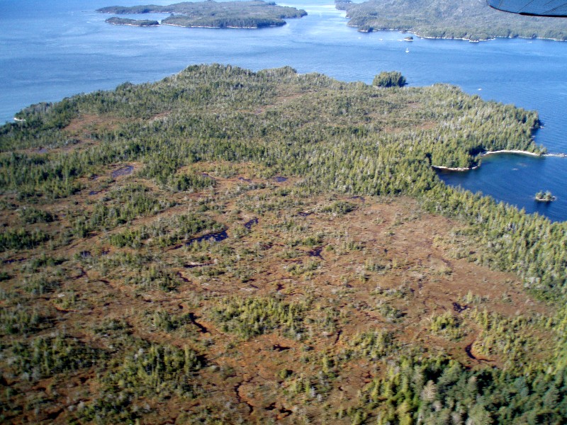
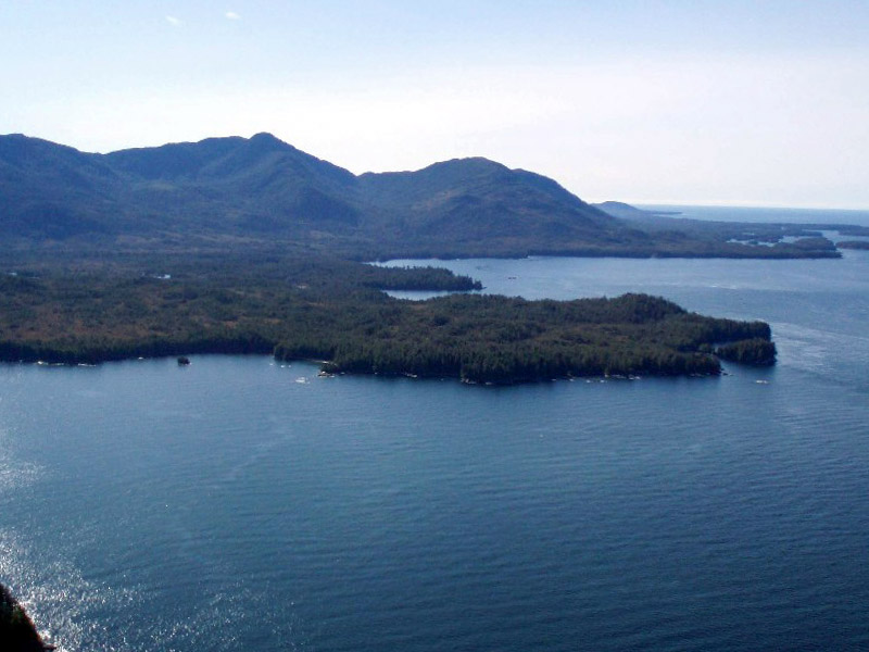
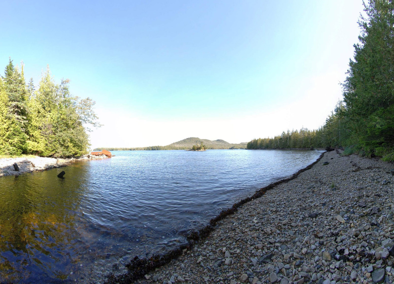
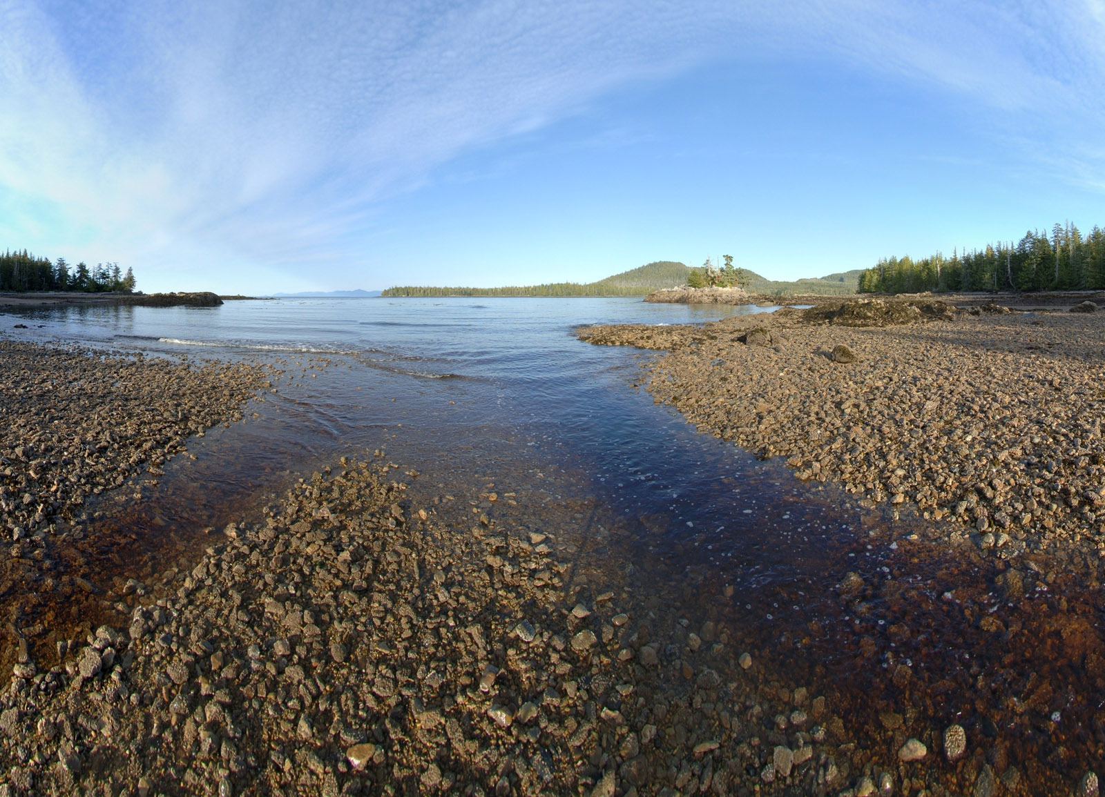
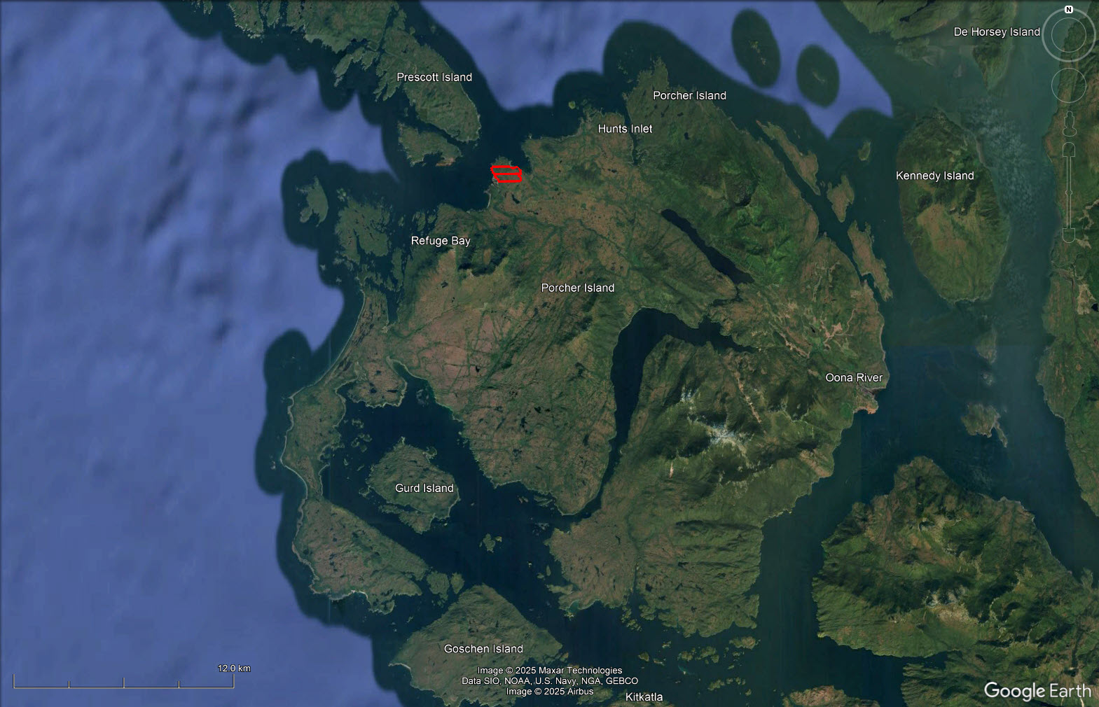
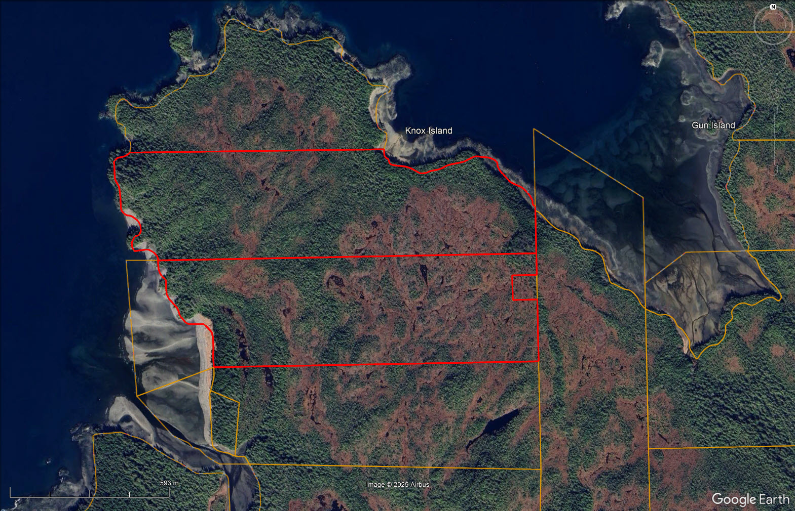
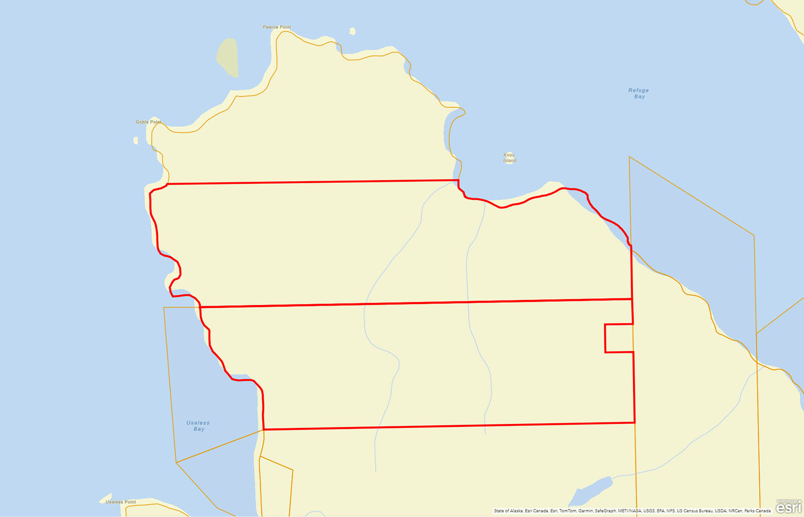
265 acres of oceanfront in 2 separate titles. Sheltered moorage in Refuge Bay on north end of Porcher Island. Very rare property with possible conservancy value. Includes meadows, sandy/gravelly beach and 4,500 feet of ocean frontage. Old cannery site nearby.


 +41 photos
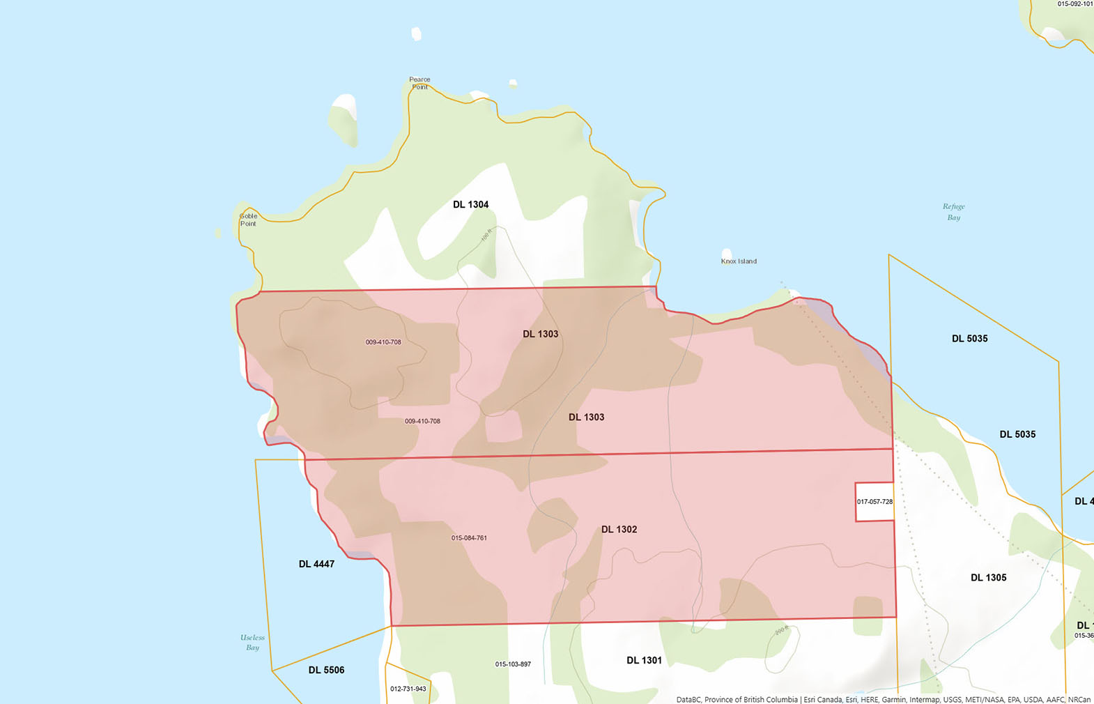
DL 1302: 131 acres
DL 1303: 134 acres
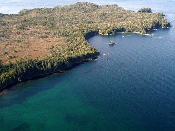
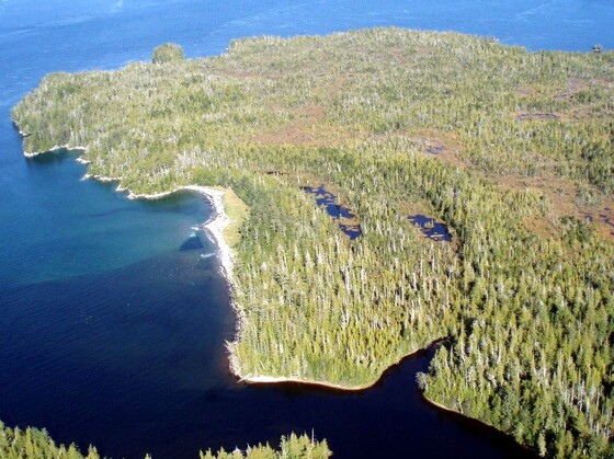
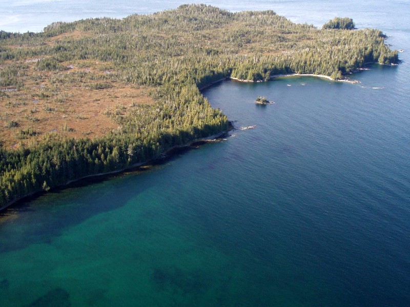
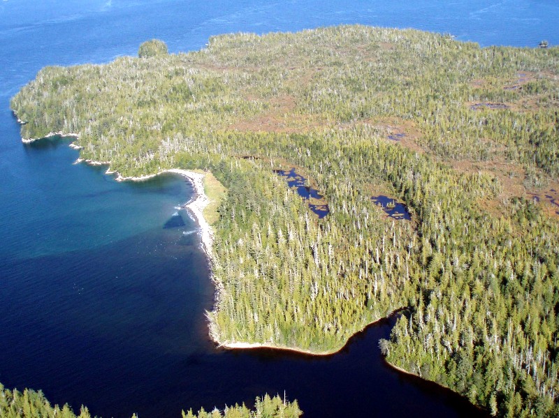
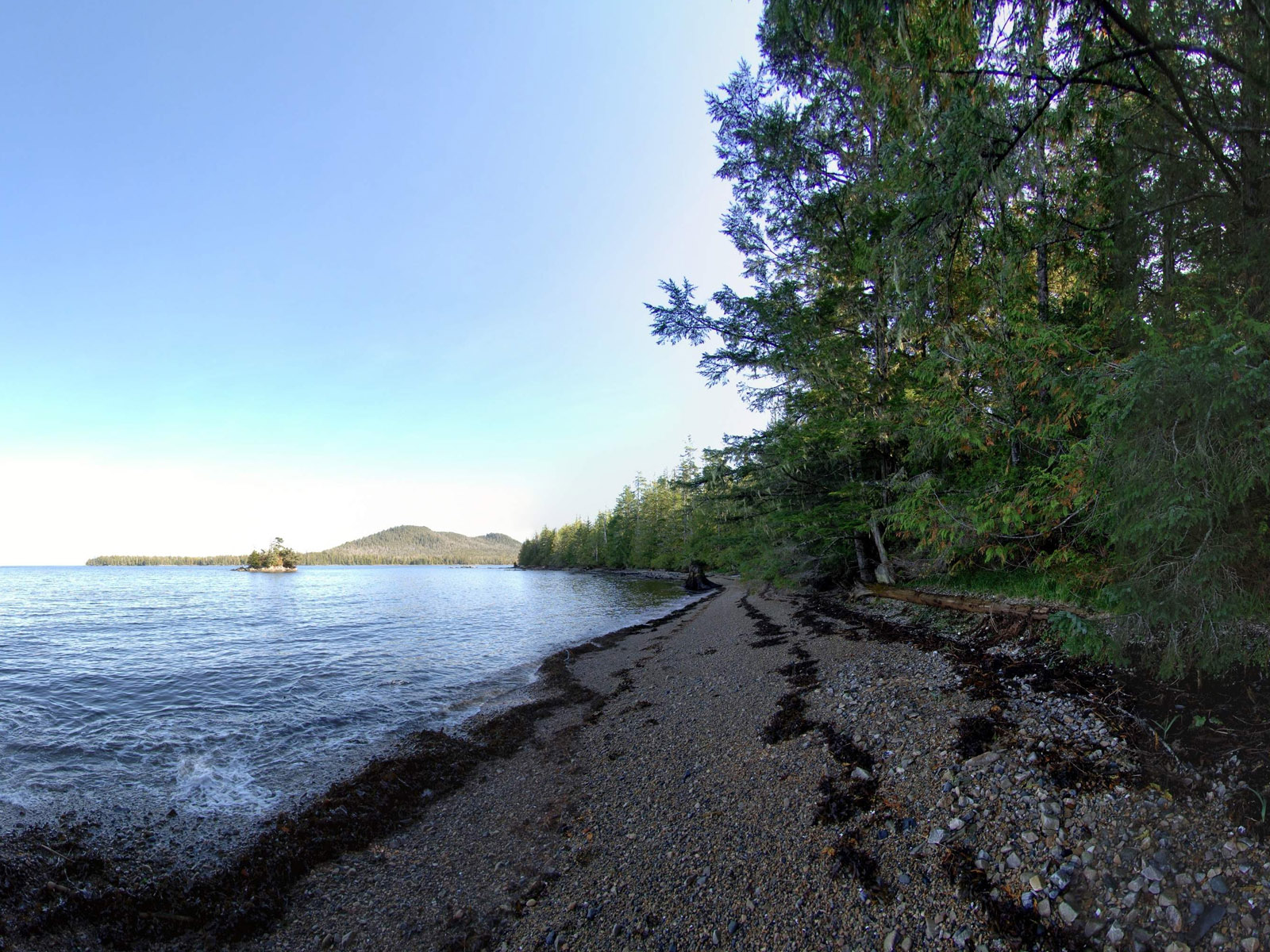
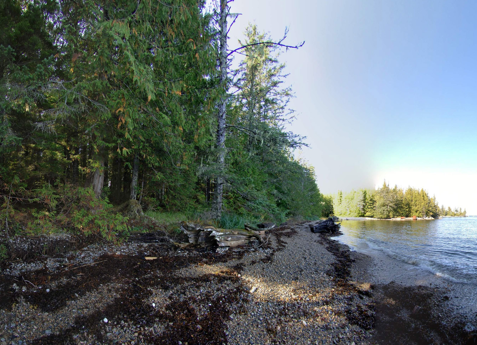
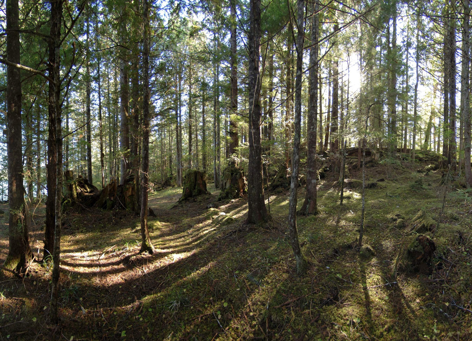
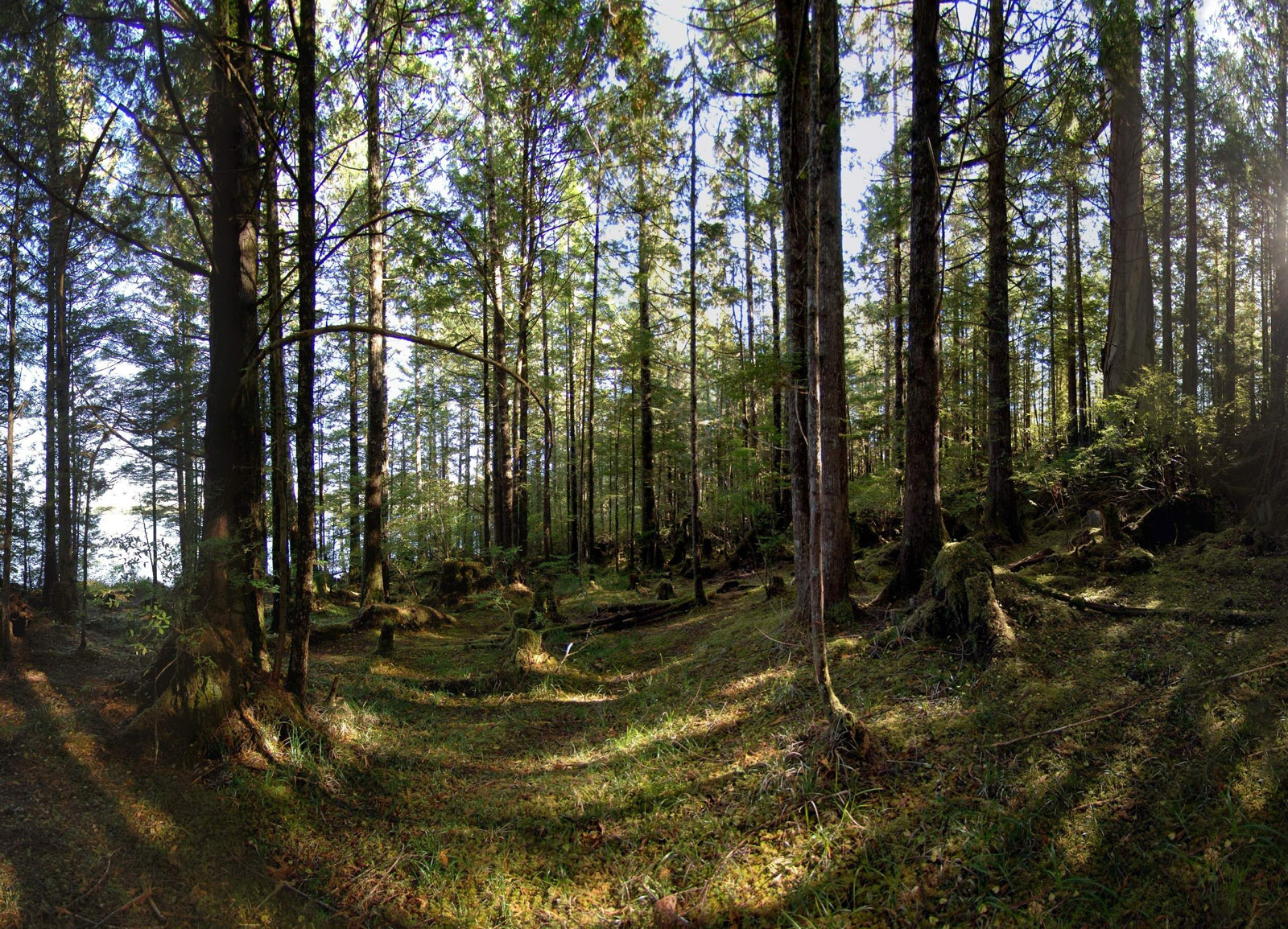
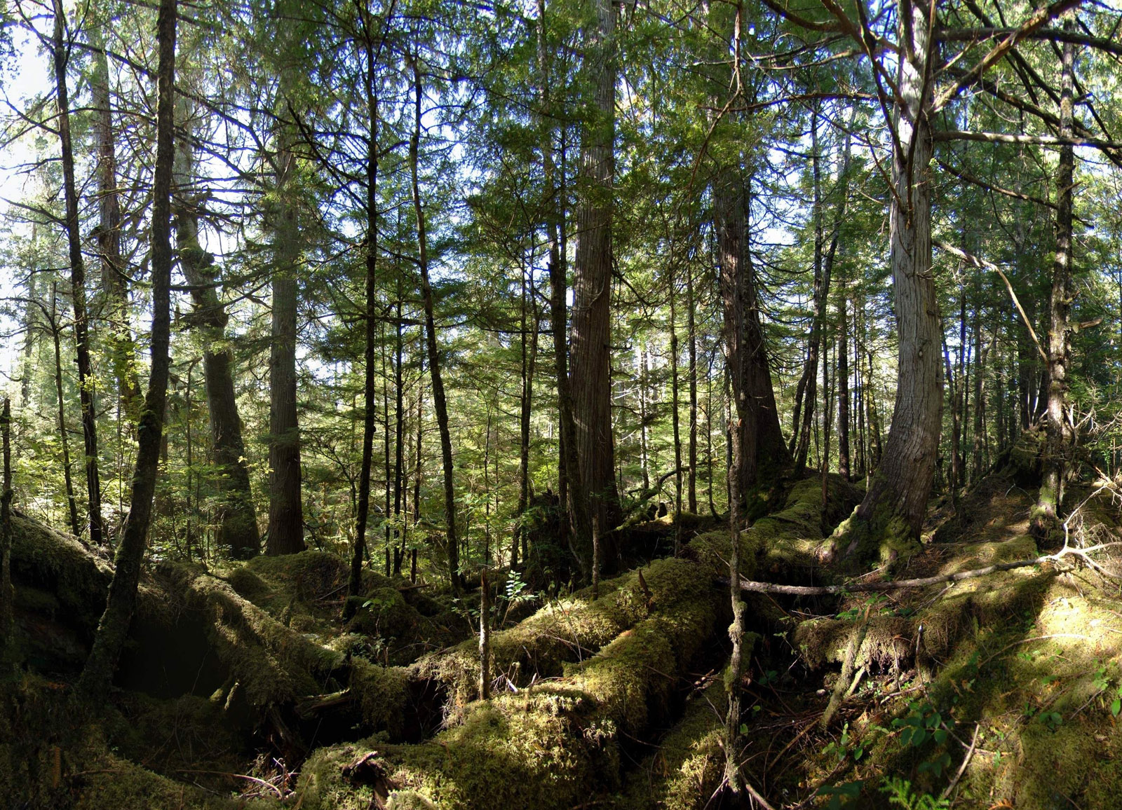
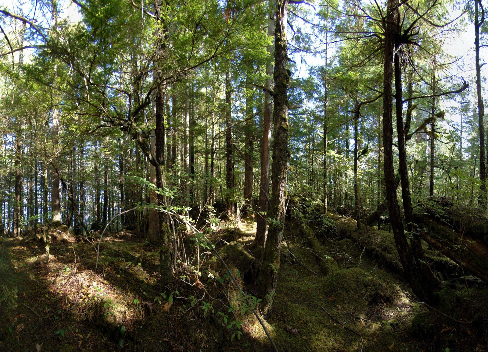
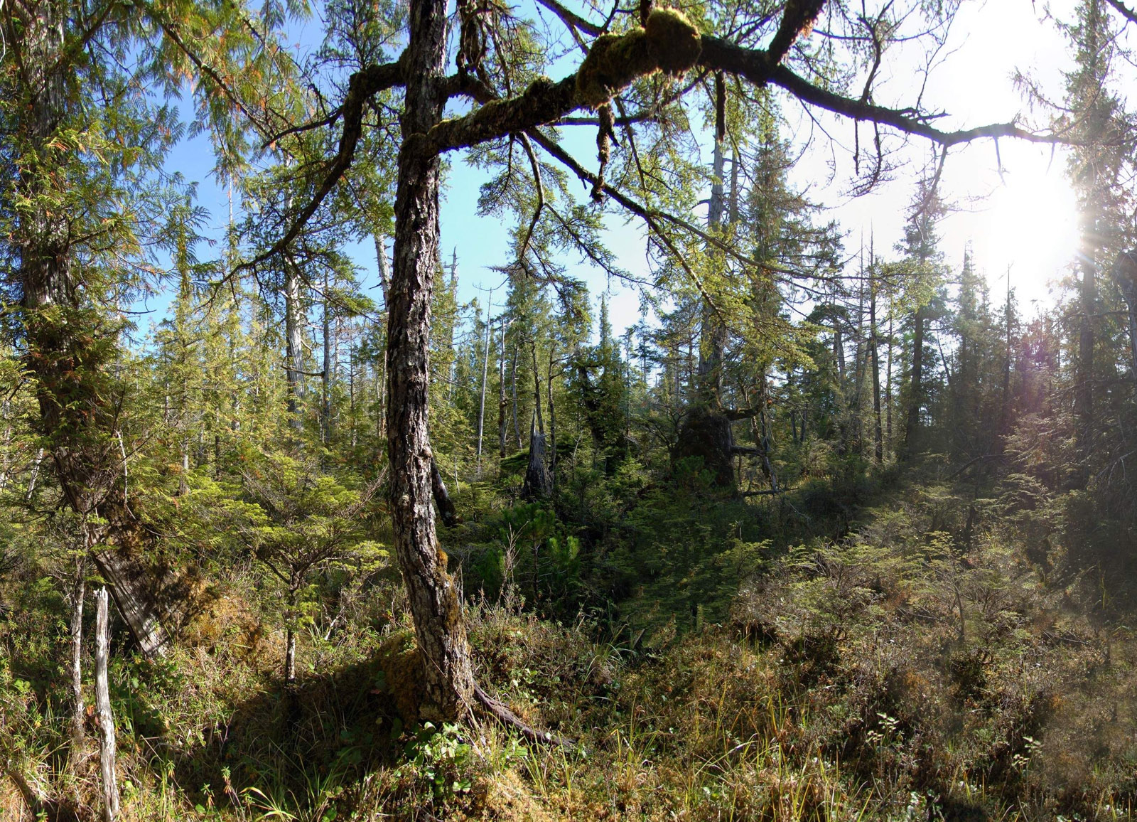
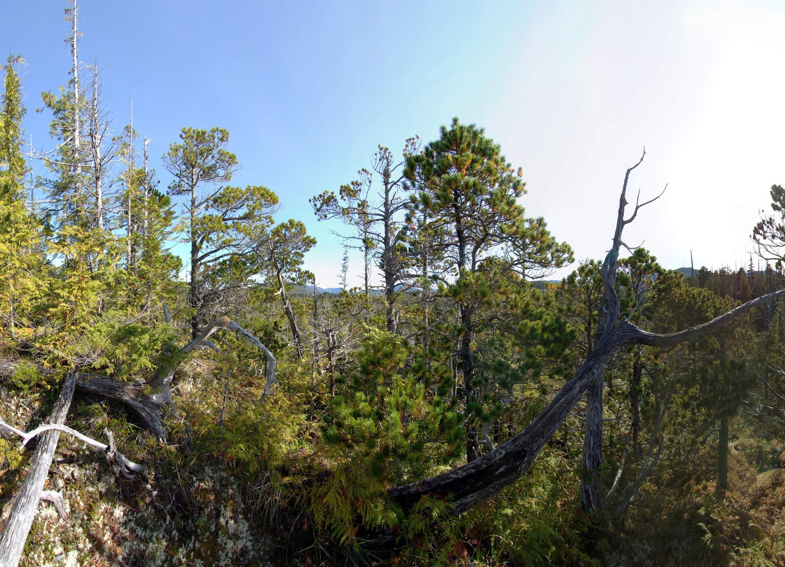
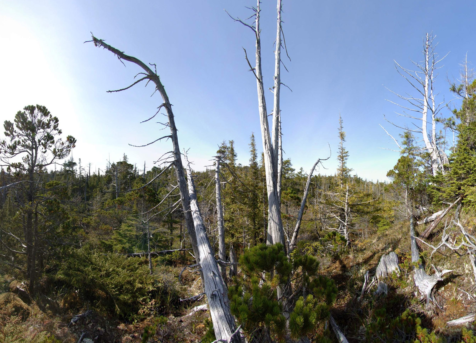
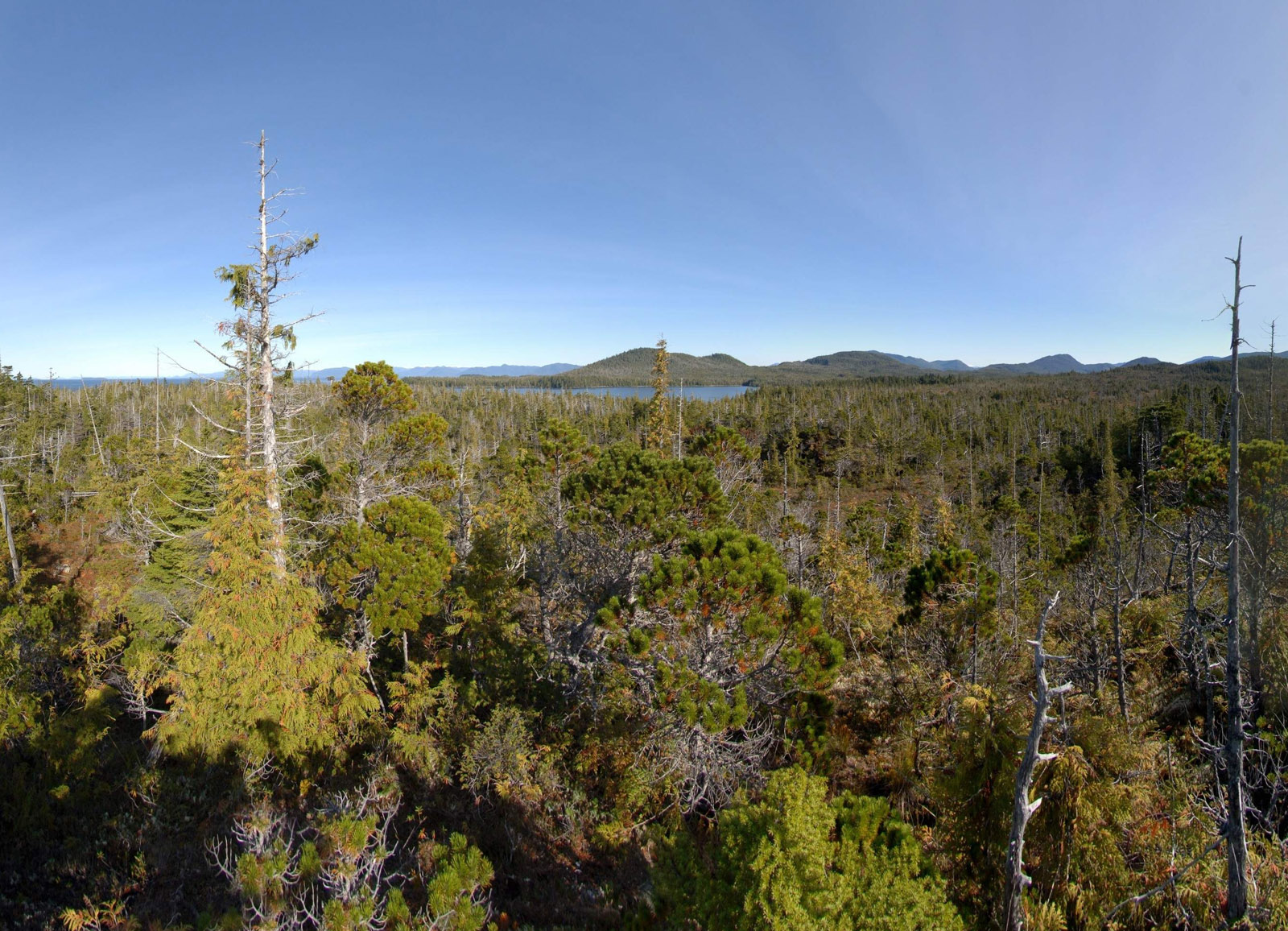
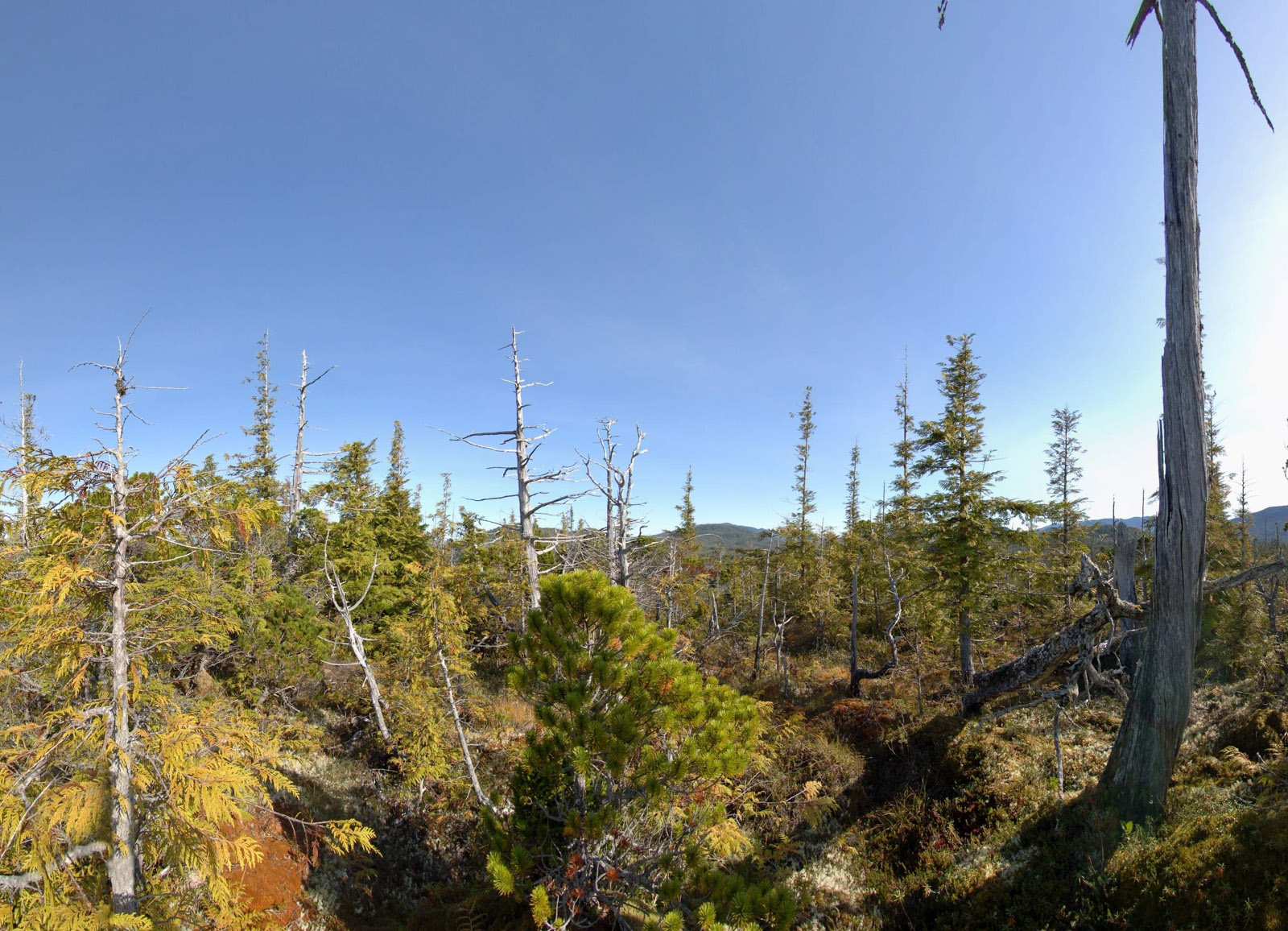
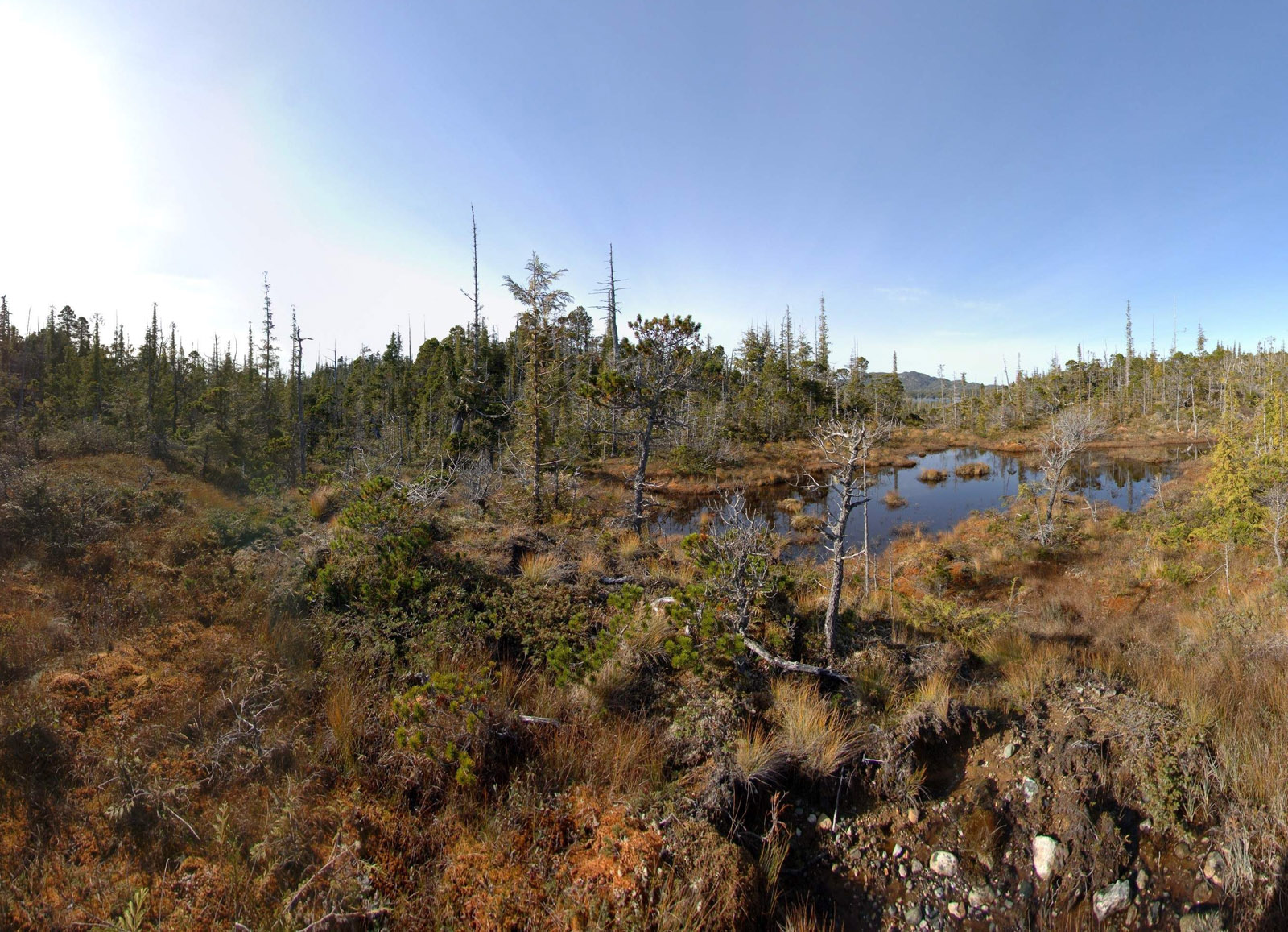
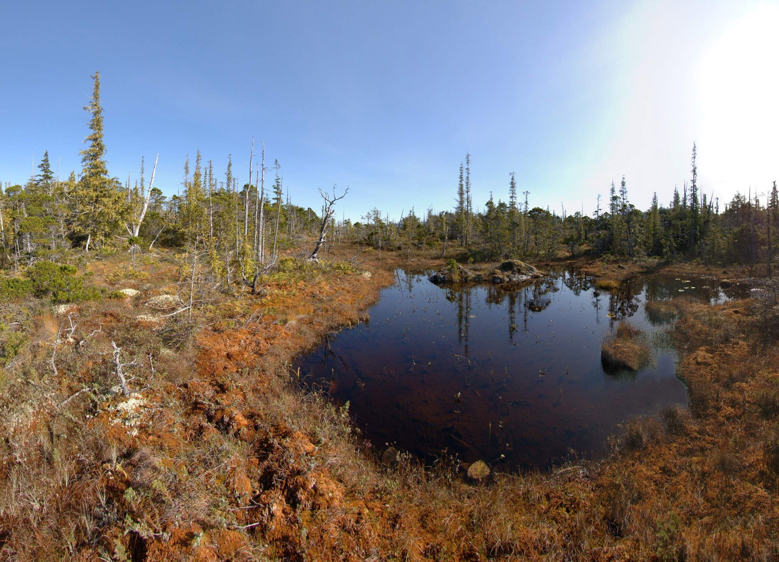
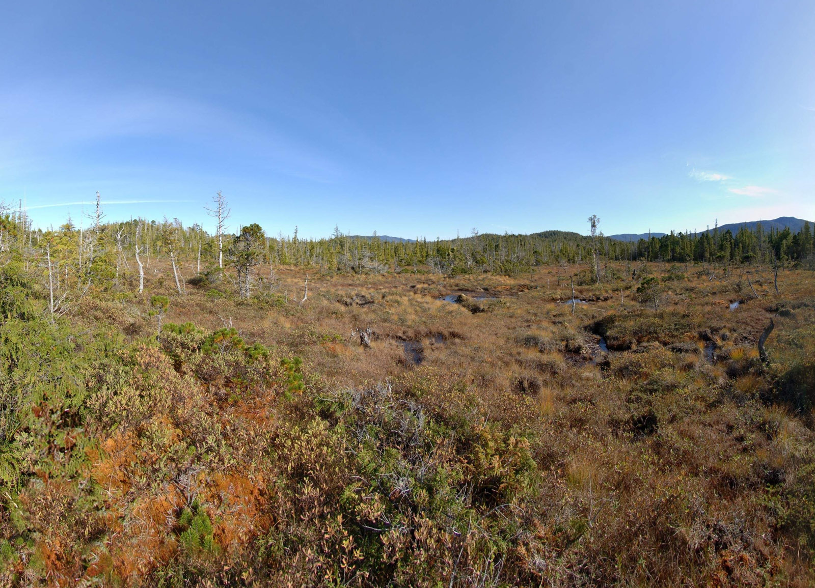
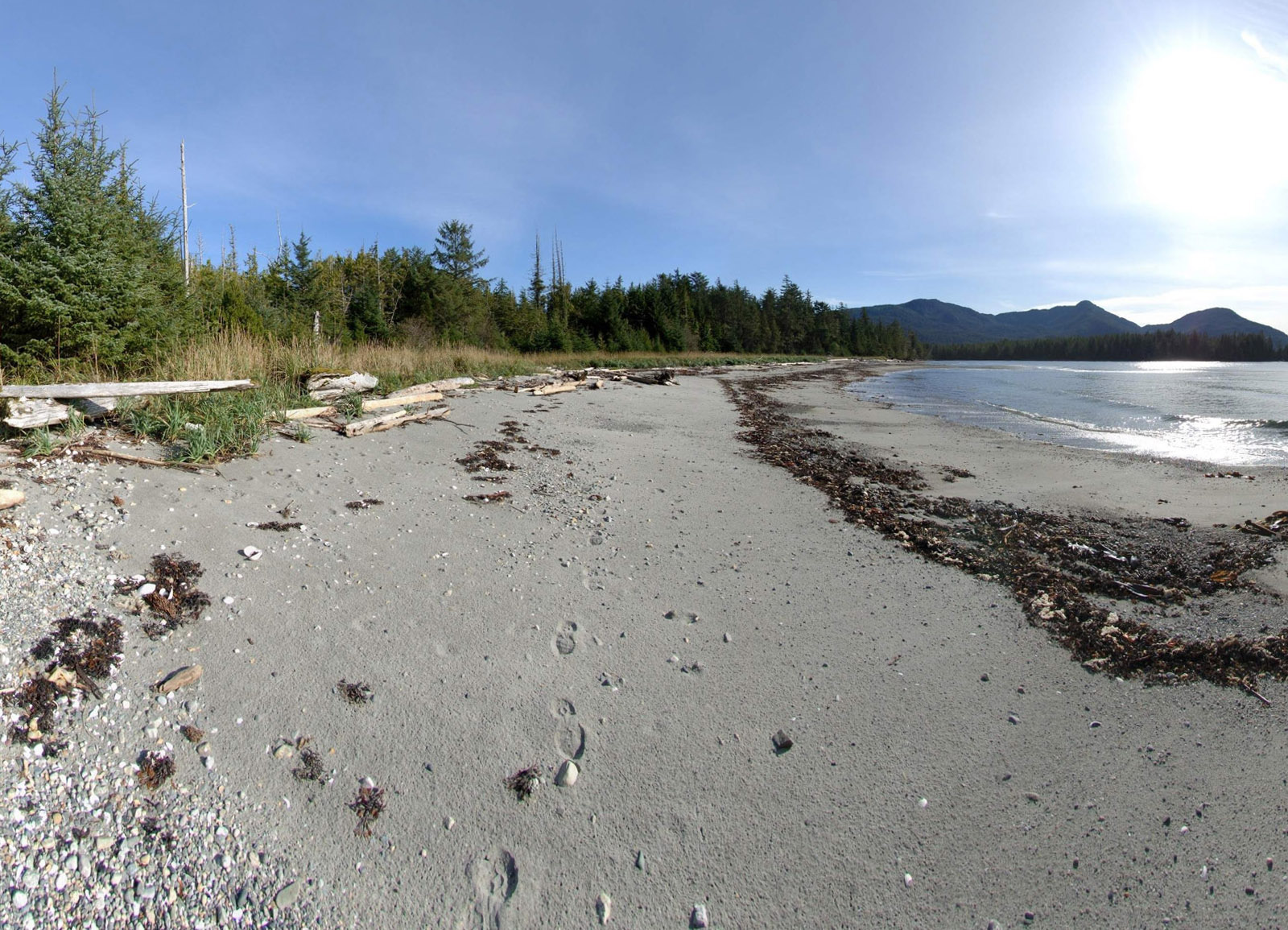
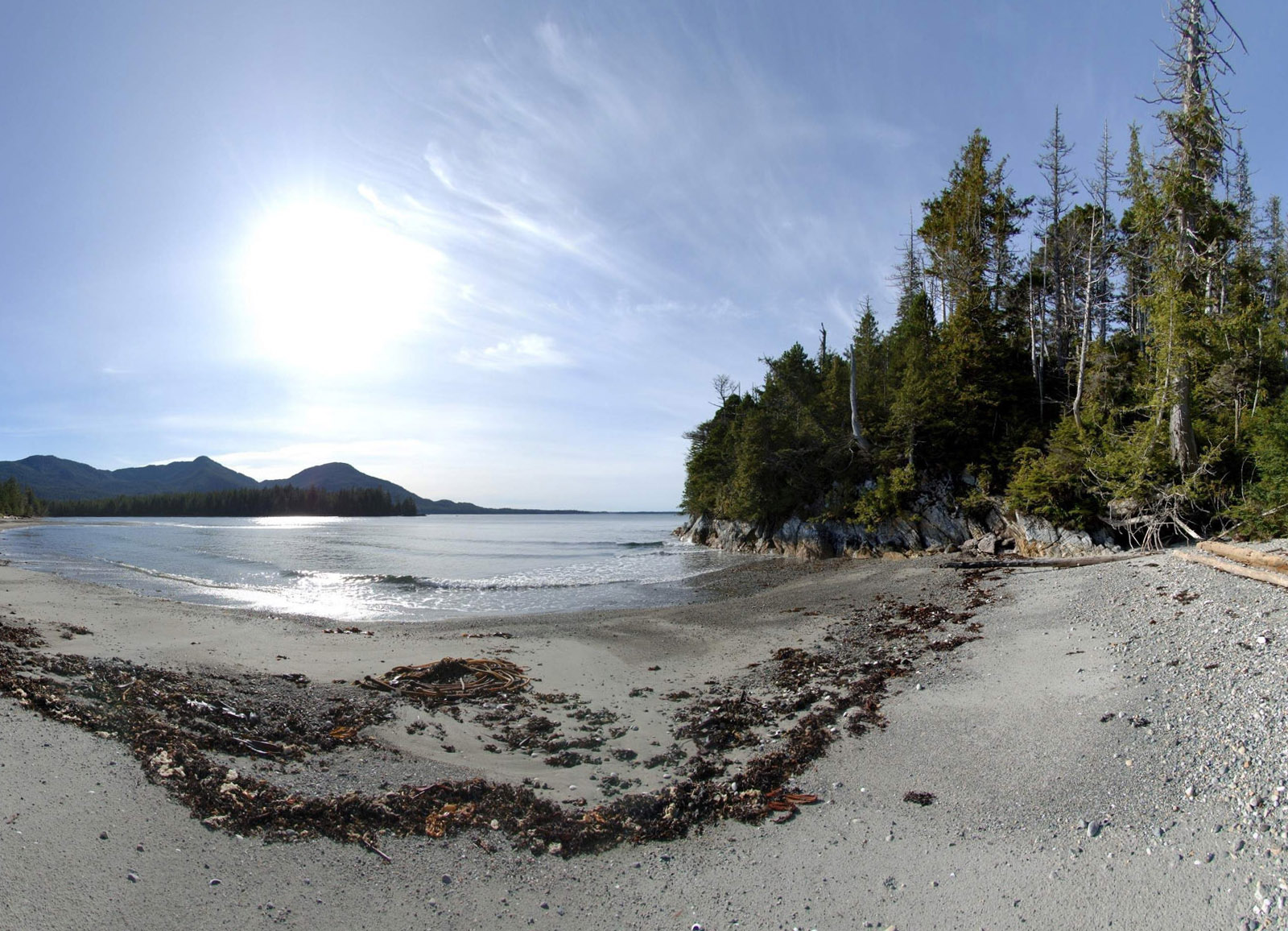
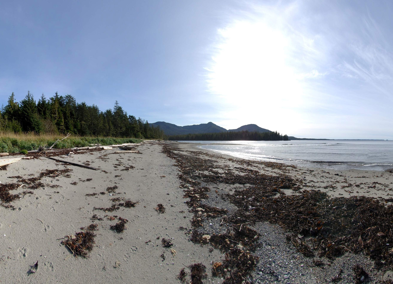
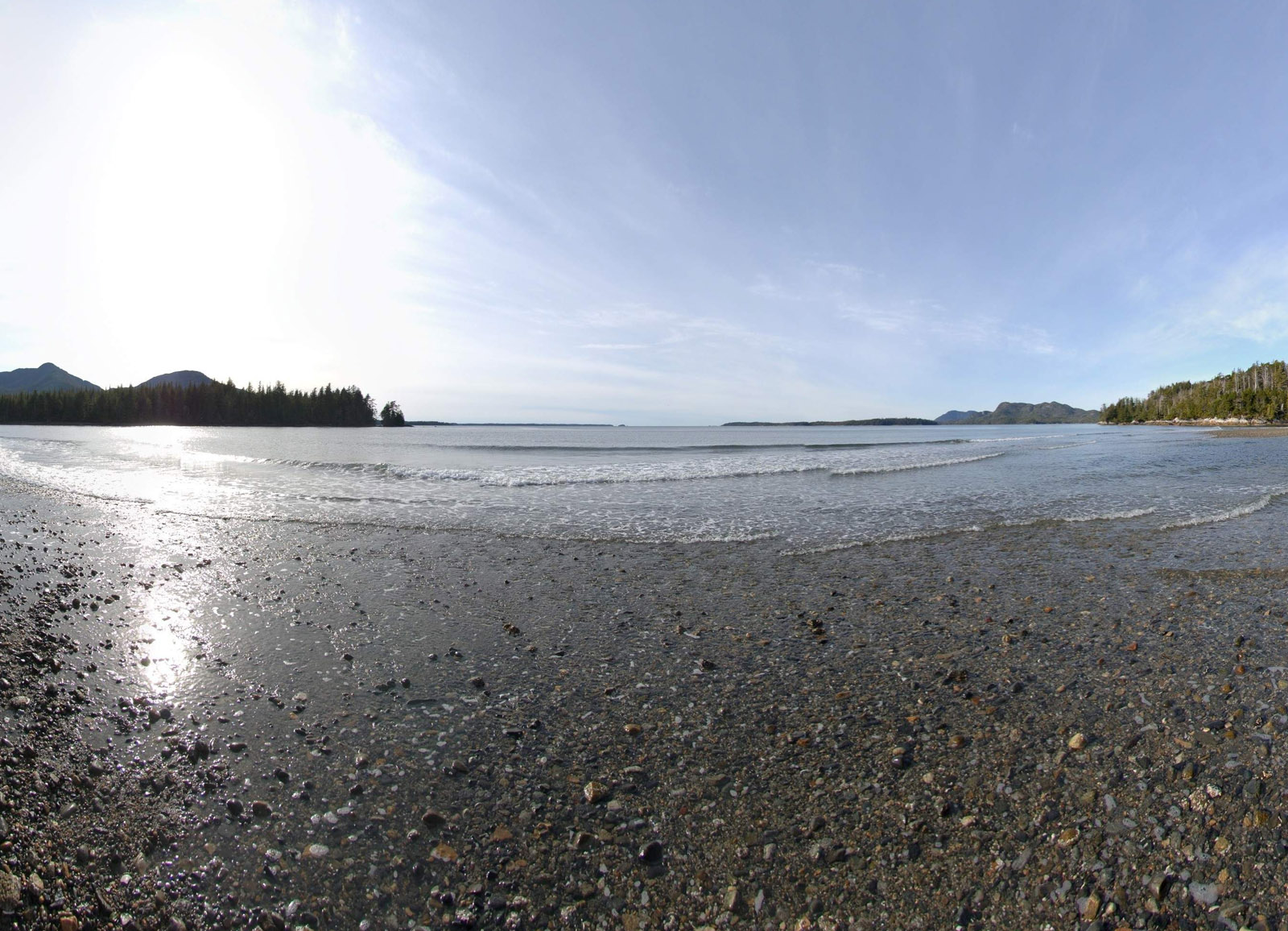
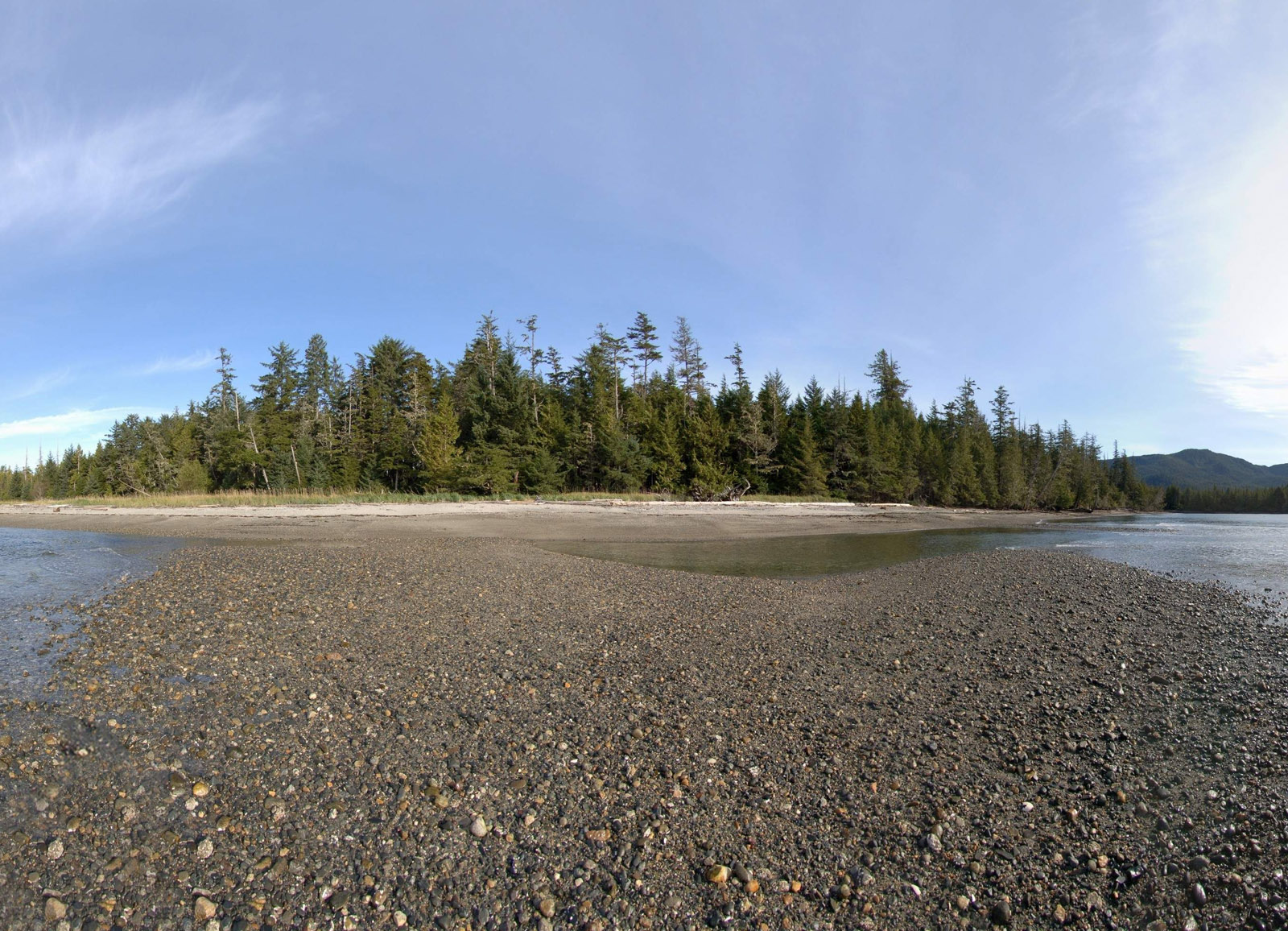
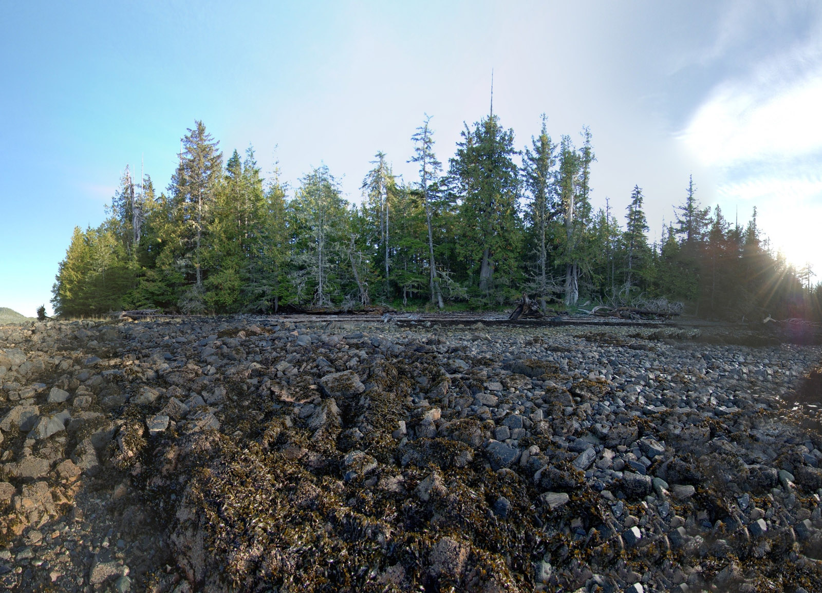
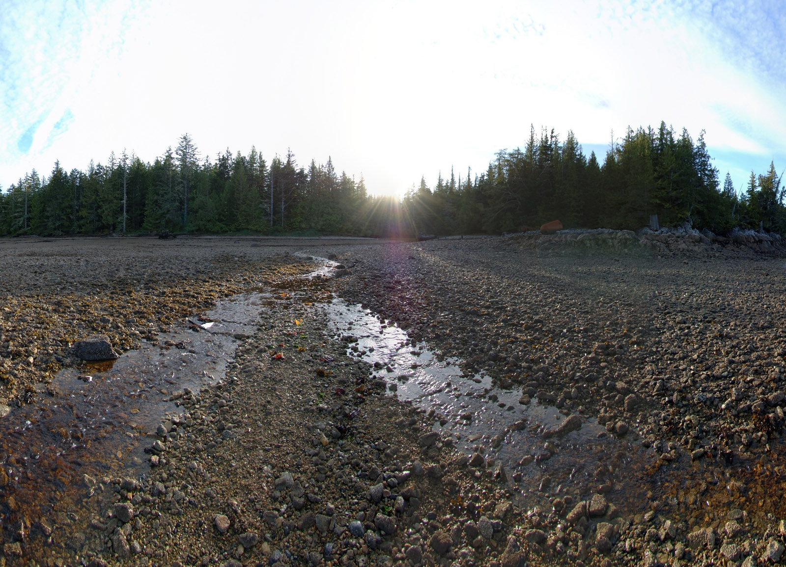
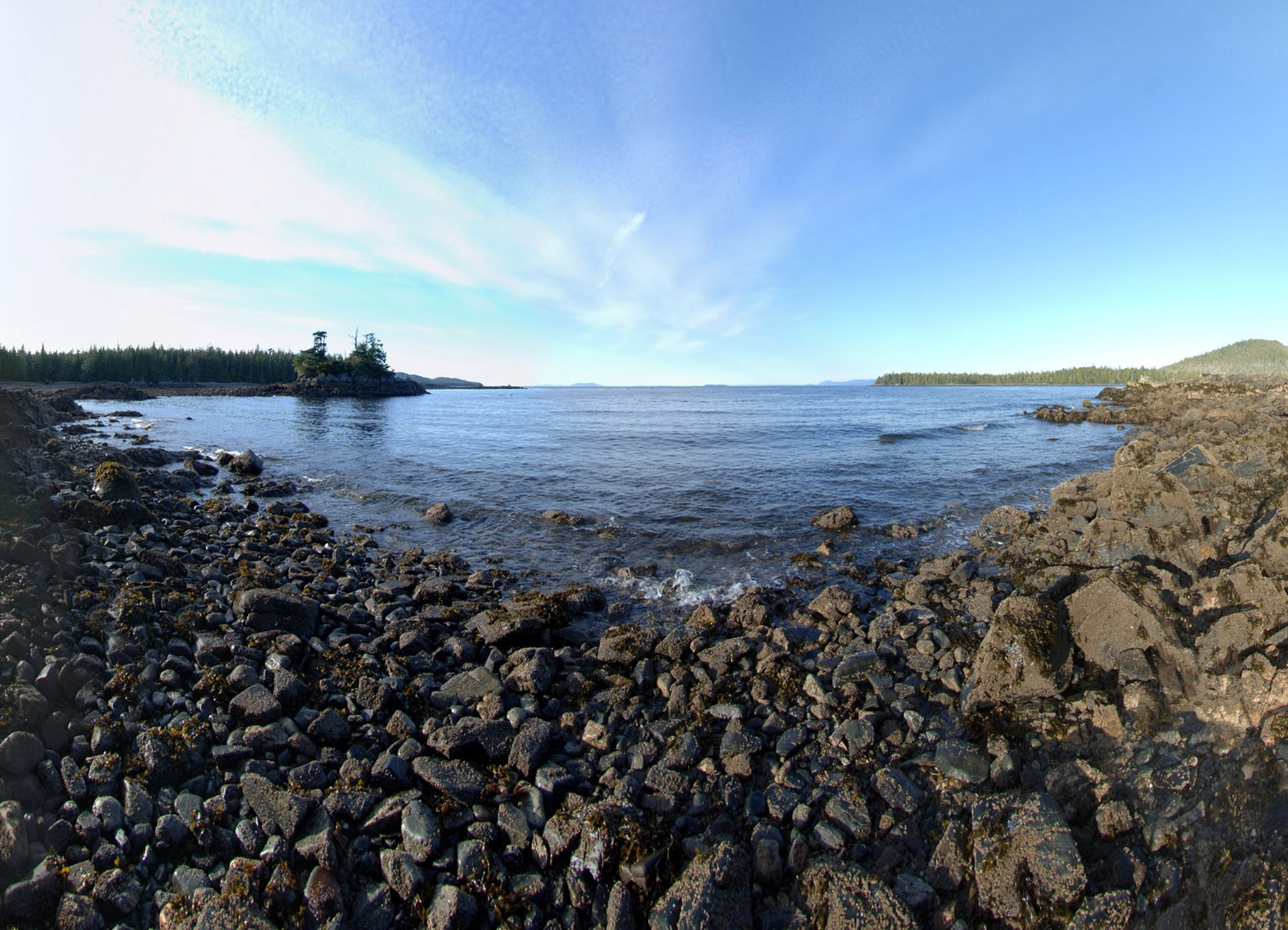
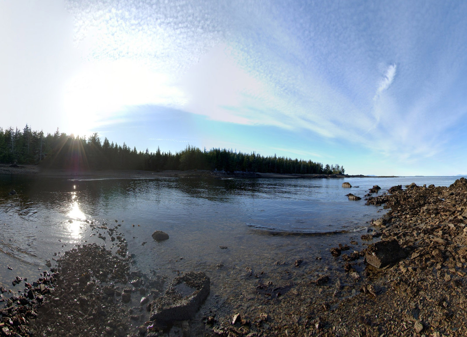
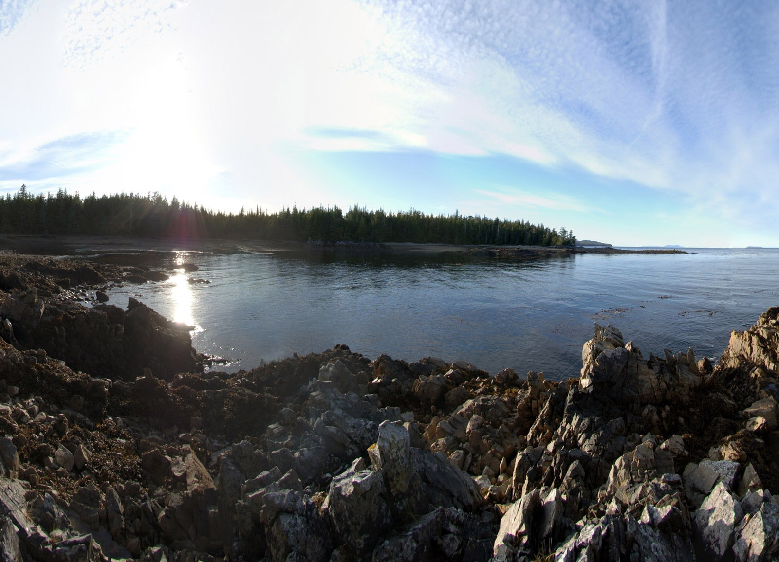
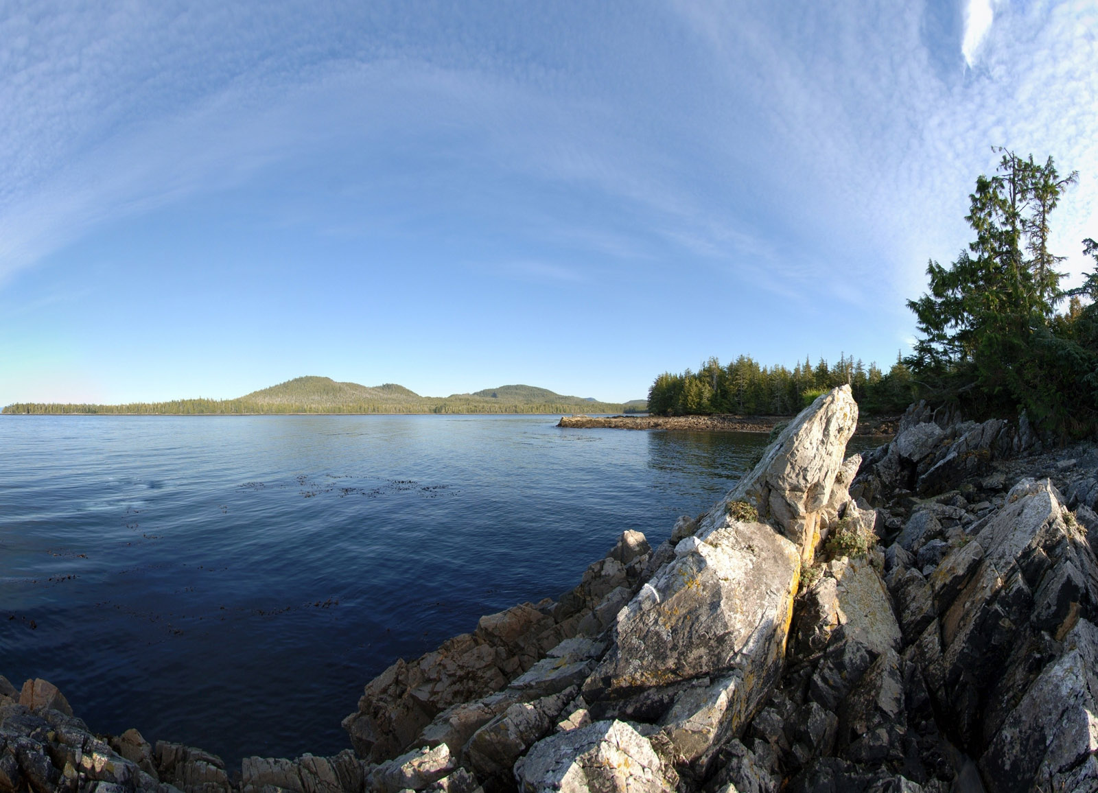
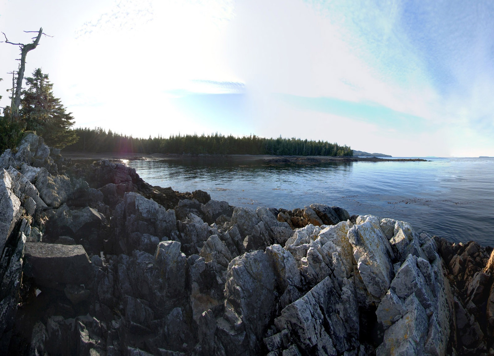
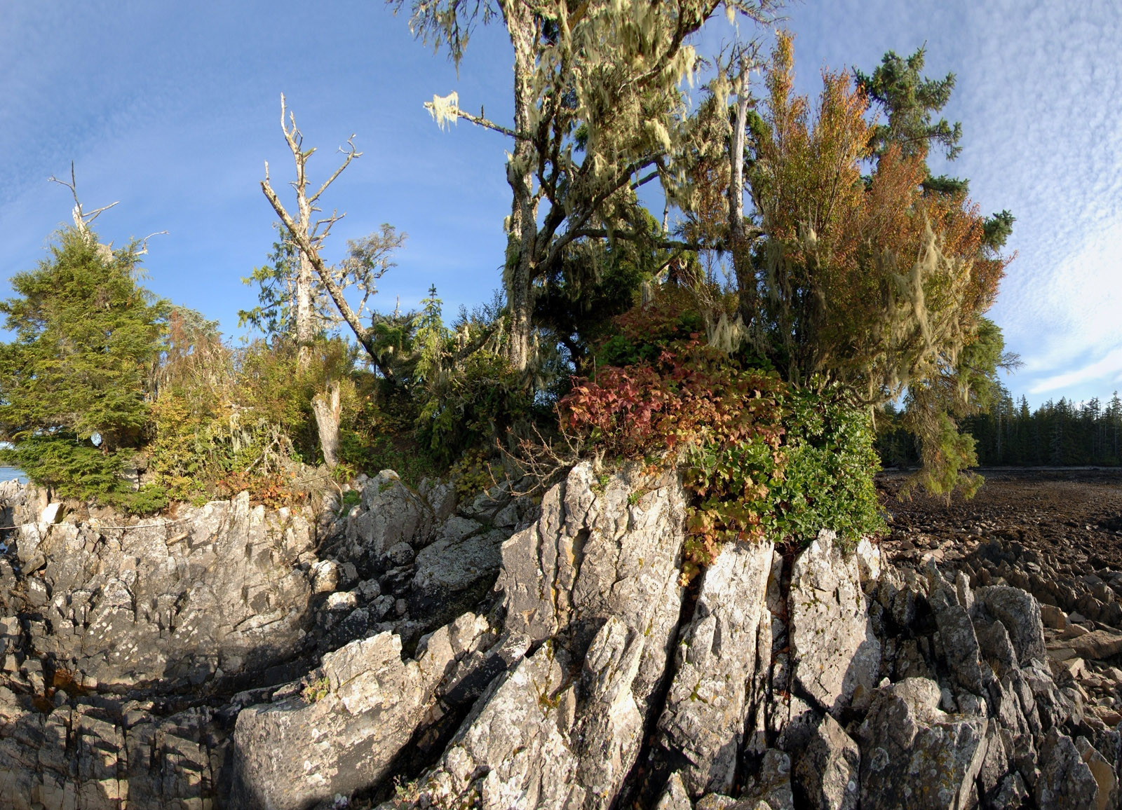
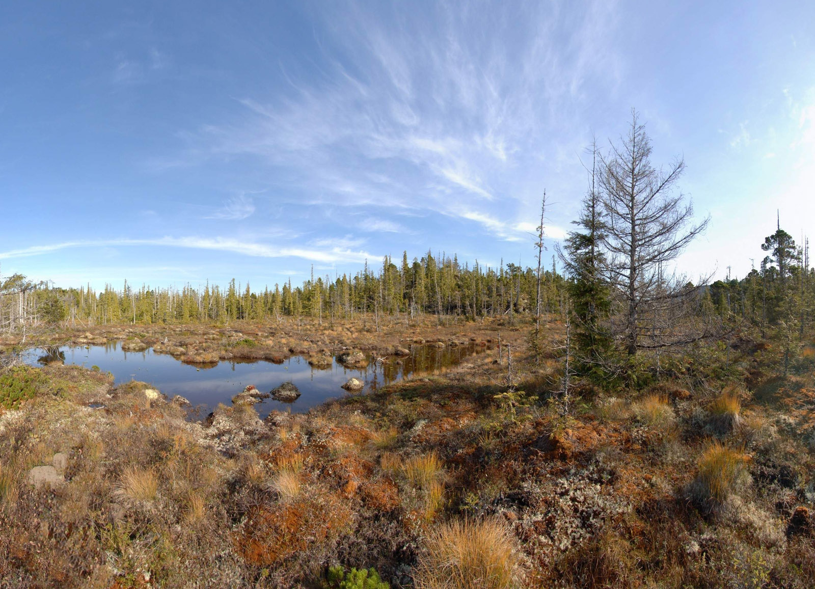
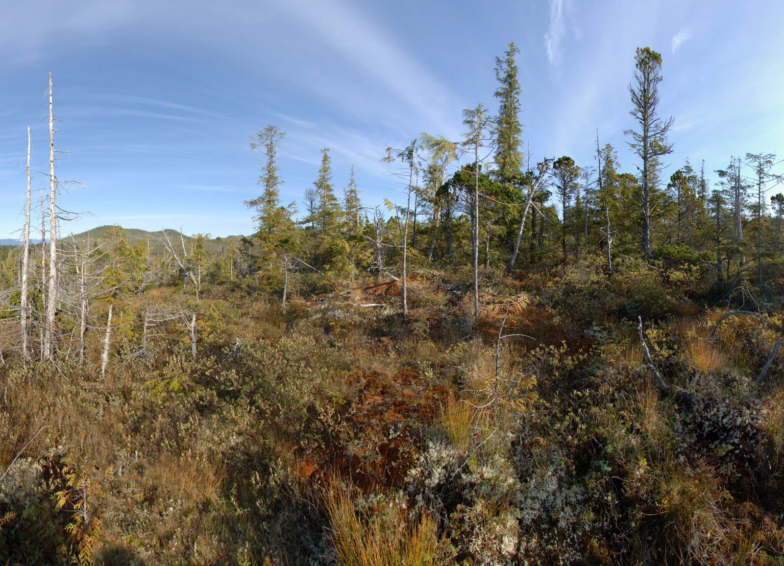
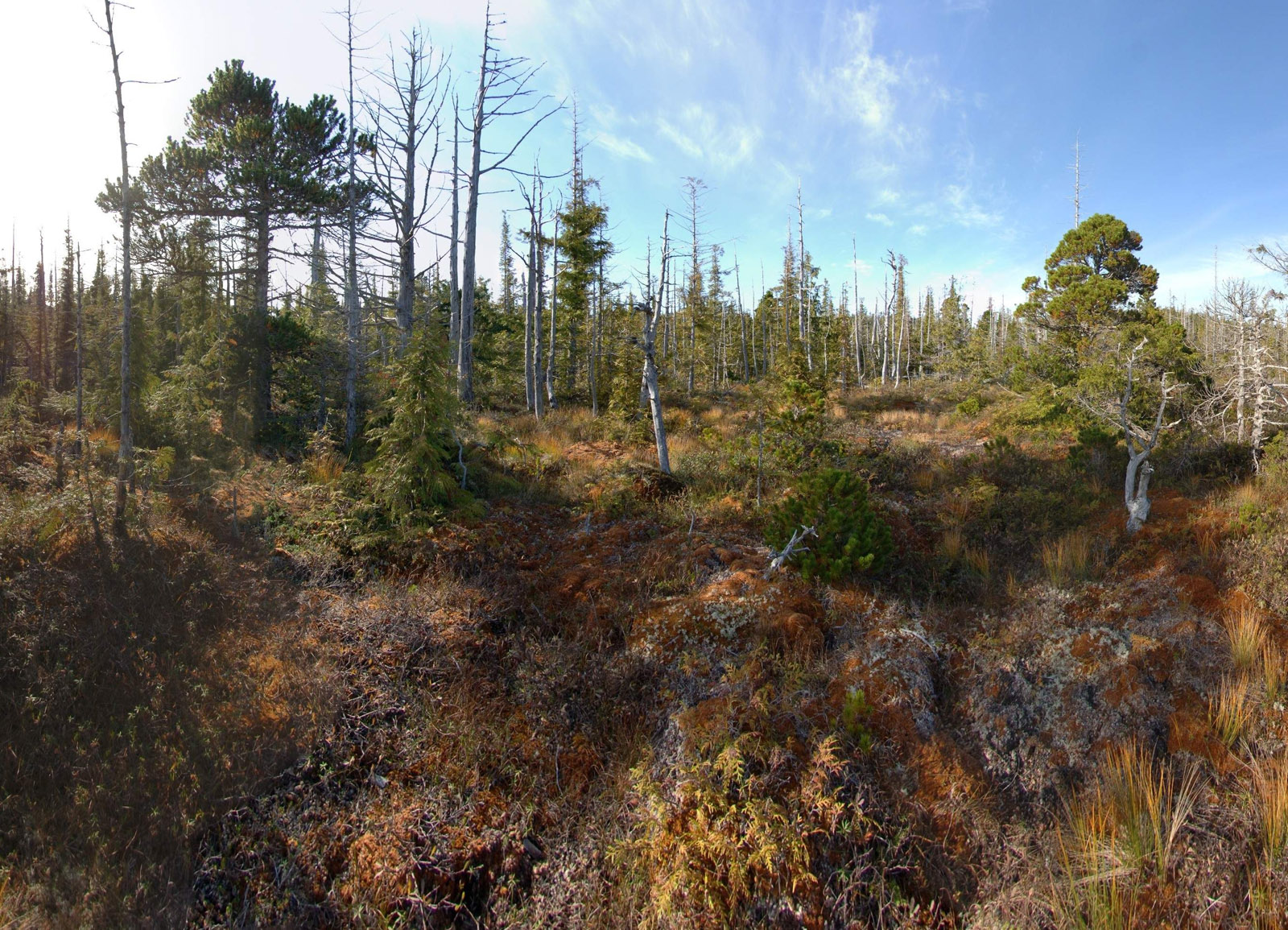
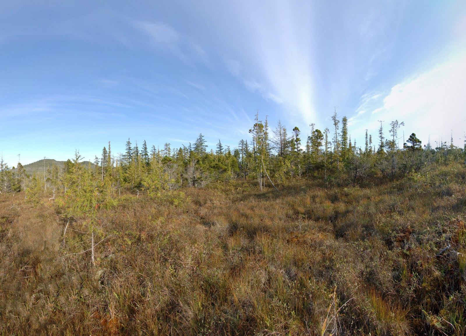
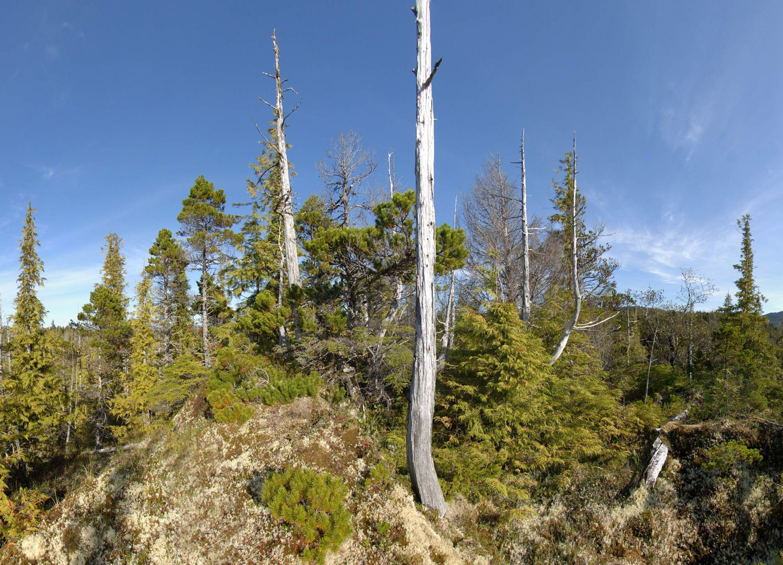
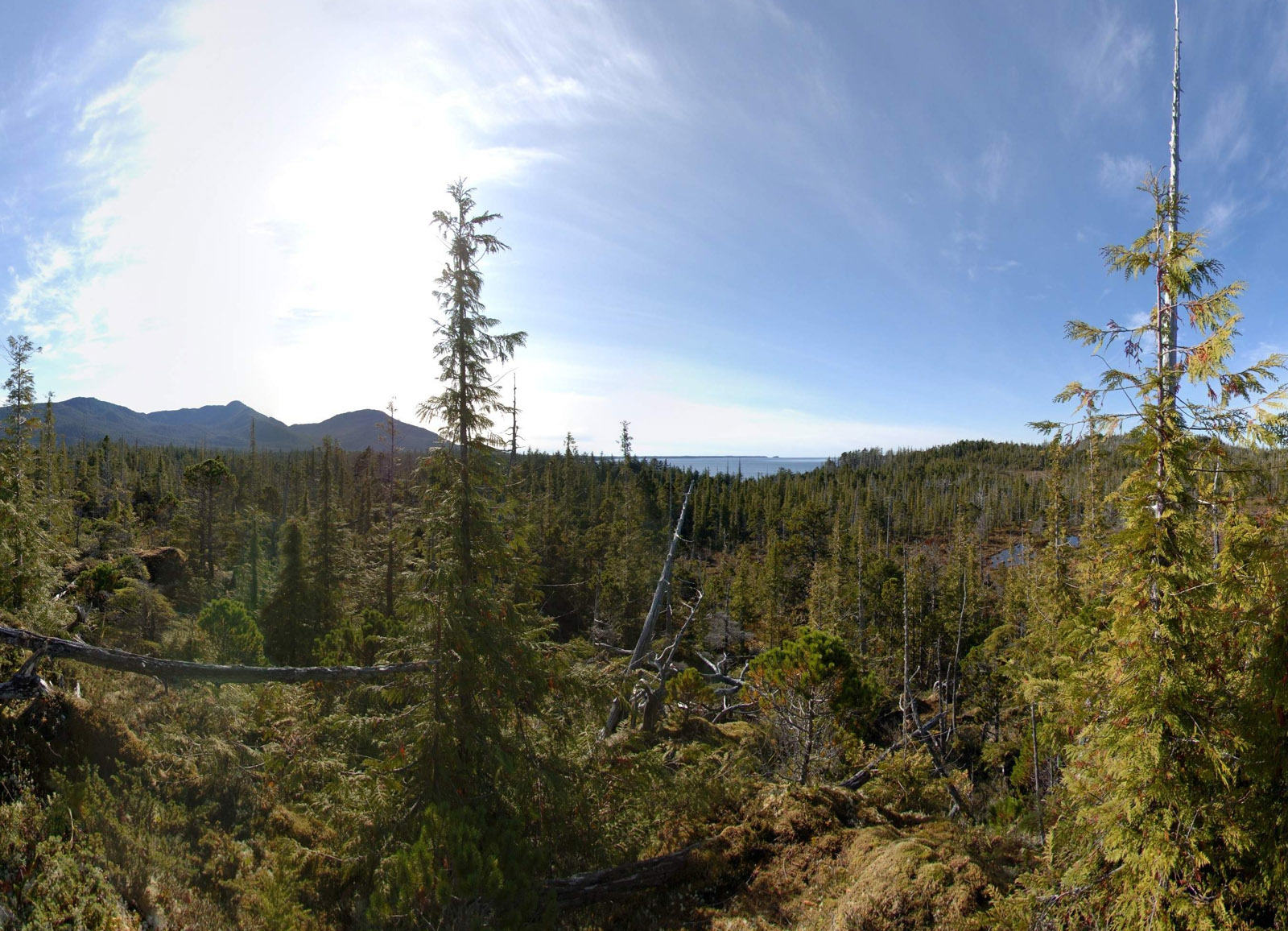
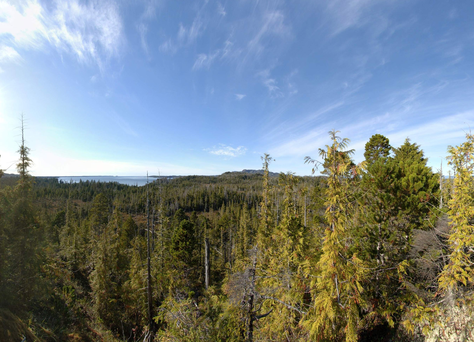
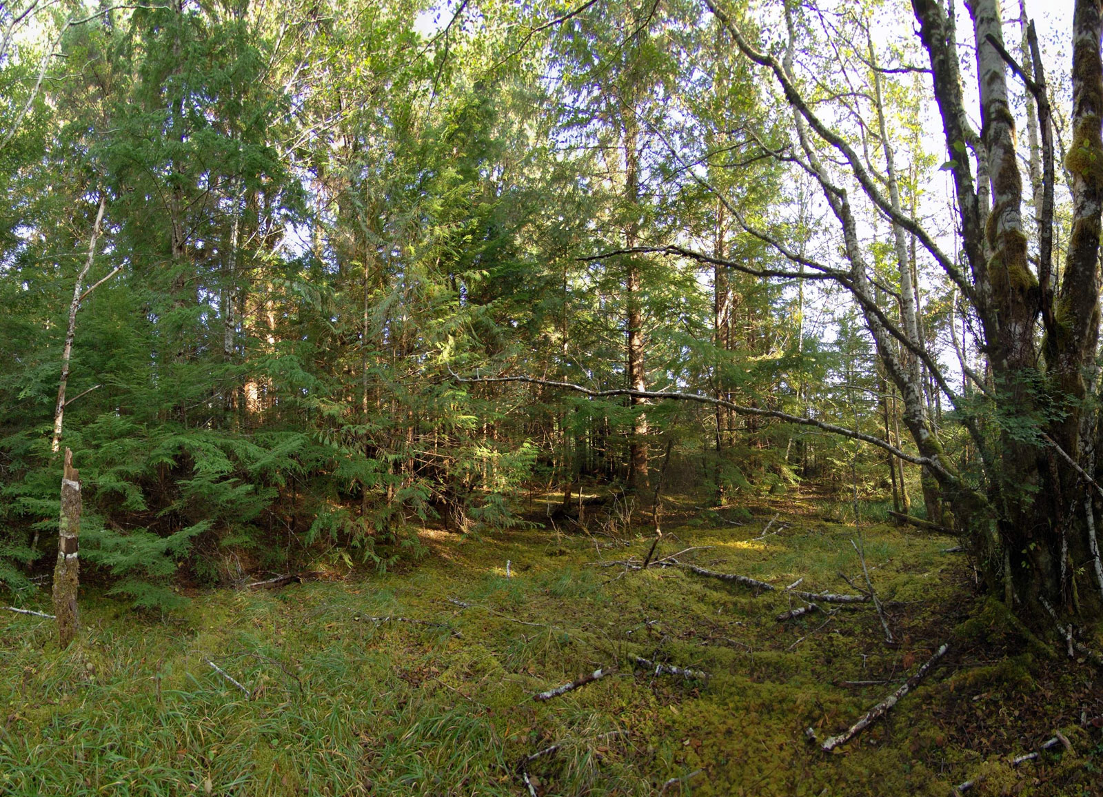
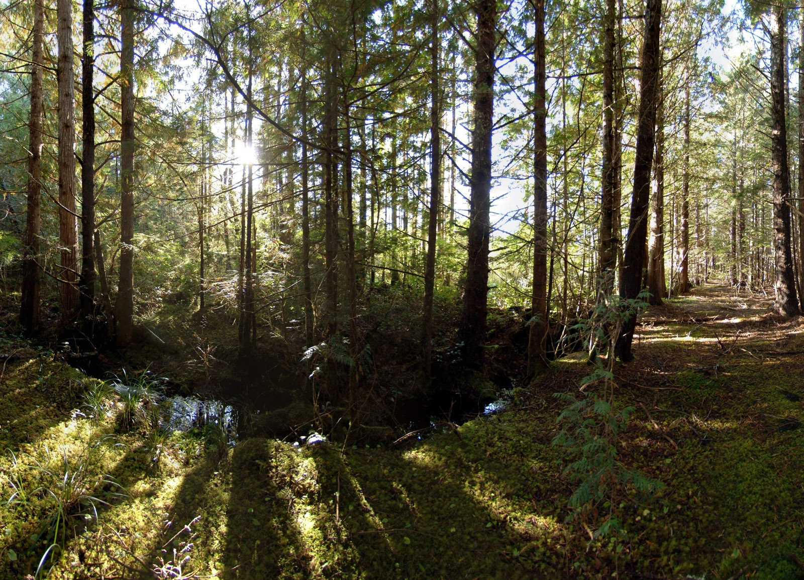
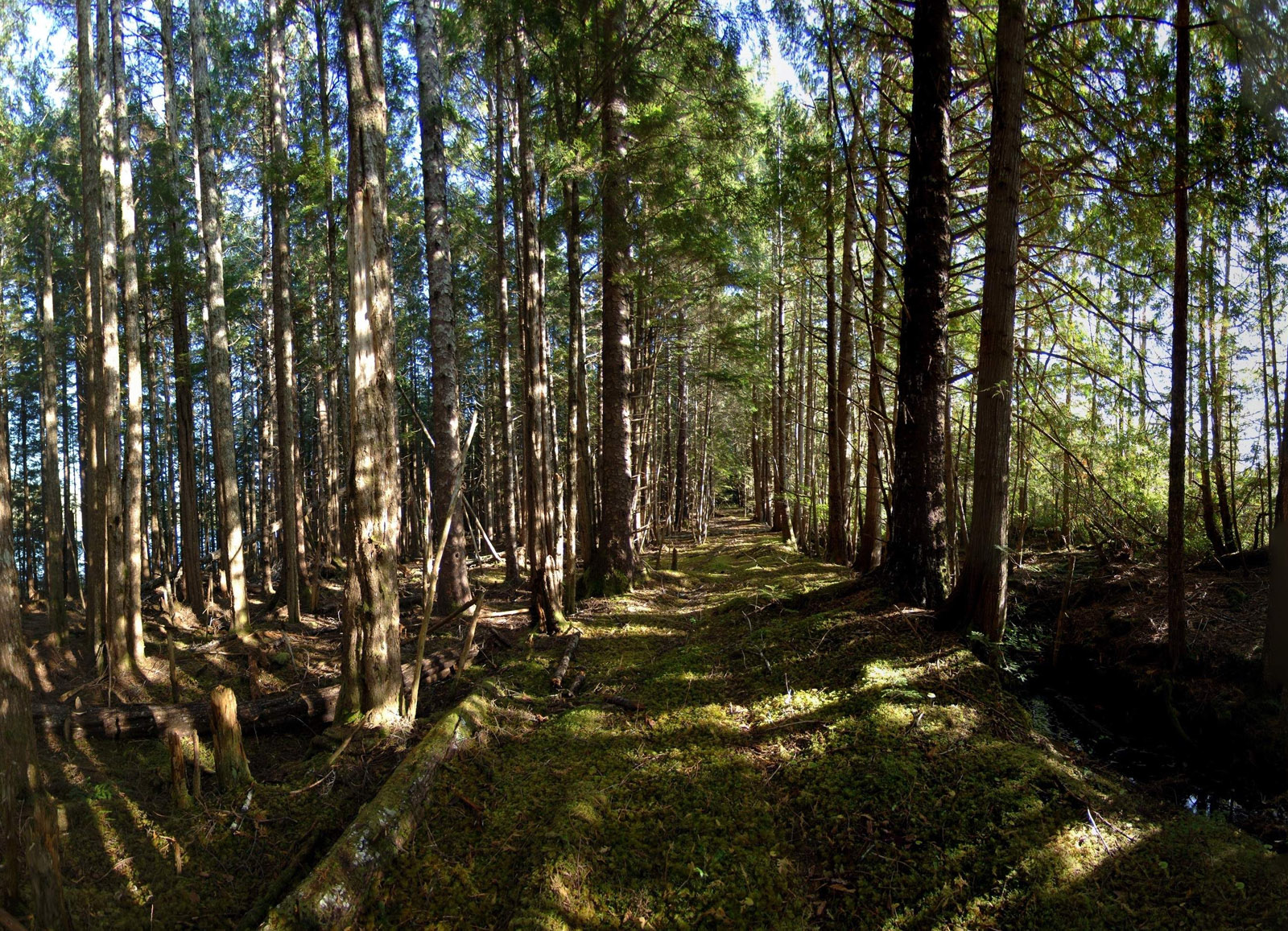
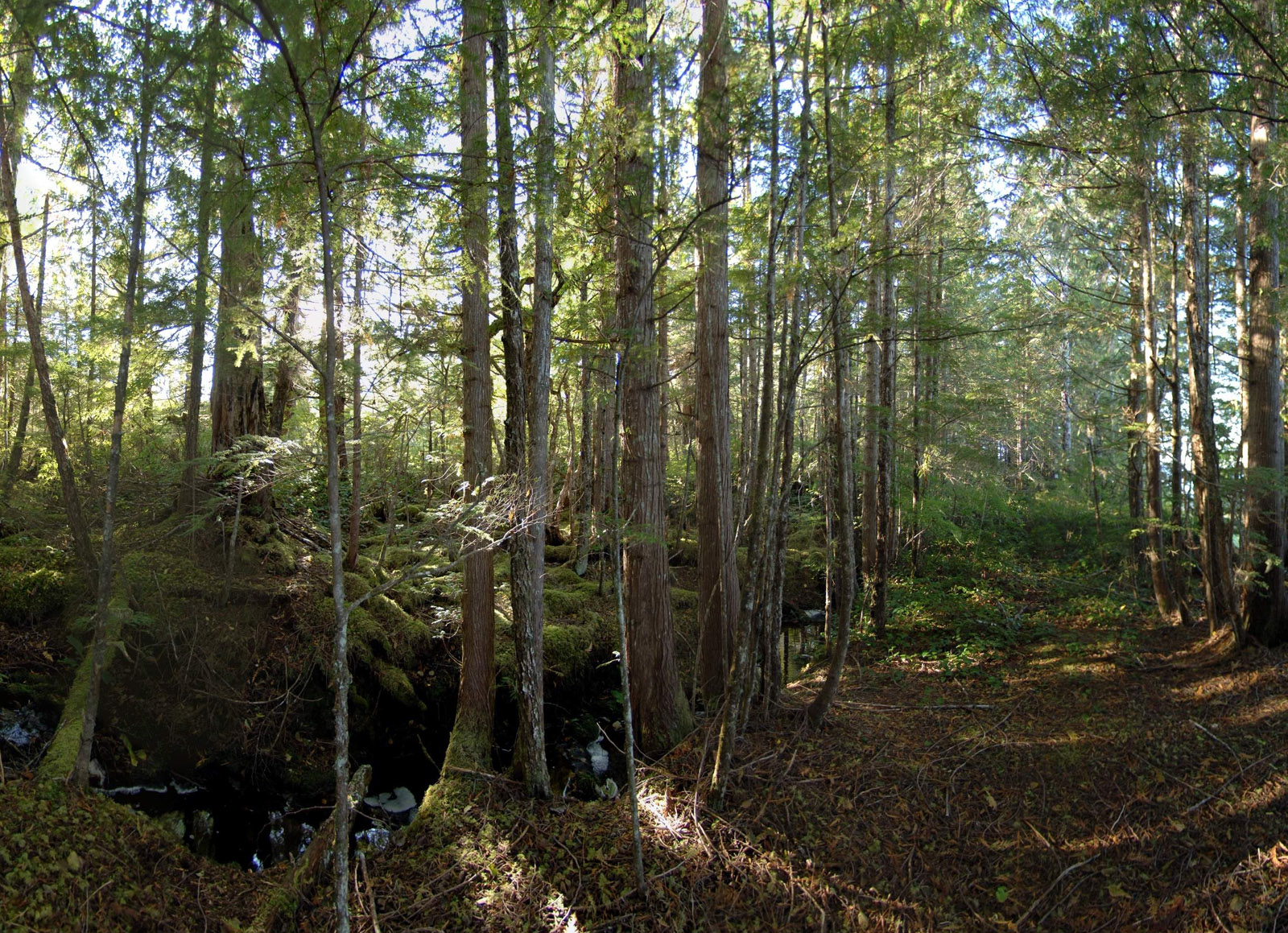
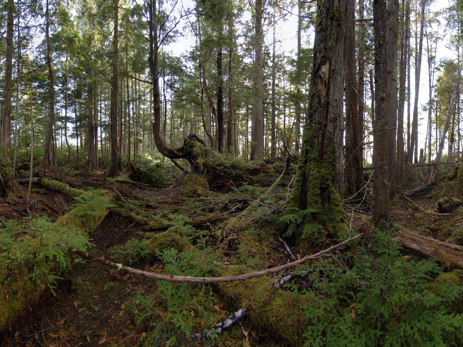
This is one of only a few oceanfront properties on the island and has excellent well-sheltered moorage in Refuge Bay. The east shore of the property is fairly flat. It gently slopes down to the sheltered rock and gravel shoreline, and sandy/gravely beach. A portion of the interior of the property is meadow with some wet areas. There is 4,500 feet of ocean frontage between Useless Bay to the west and Refuge Bay to the east. There is also a fresh water creek that runs through the property, entering the ocean in Refuge Bay on the northeast corner. The land rolls gently over a couple of tree-covered hills to a steeper western shoreline that is also completely treed. The west side is not quite as sheltered, but still very accessible, with some very nice sandy/gravely beaches. There are some remains of an old fishing cannery still visible on the northeast corner by Refuge Bay and there is an old road to the cannery coming in from the southeast. These roads connected the various small communities and homesteads many years ago.
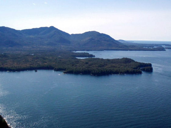
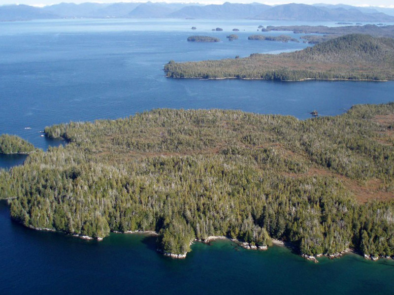
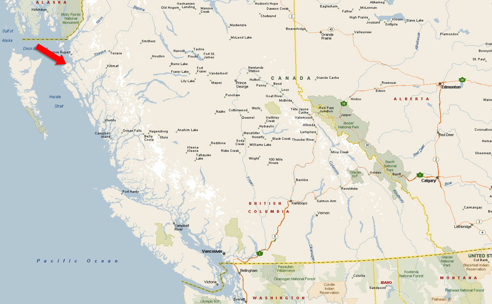
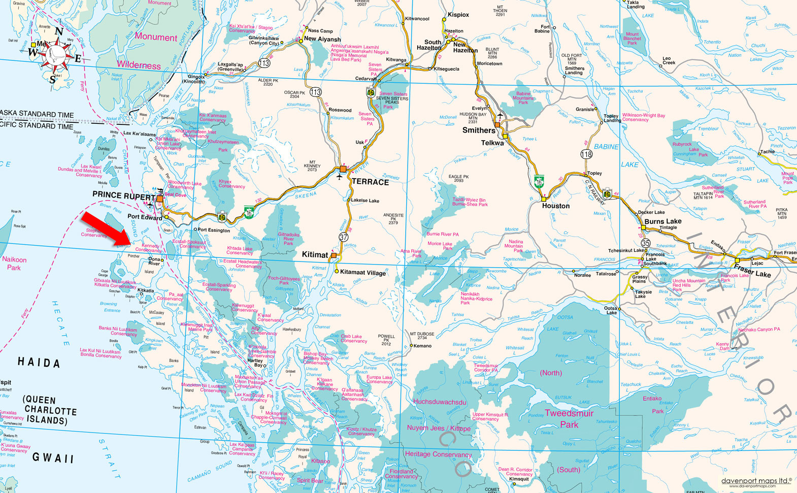
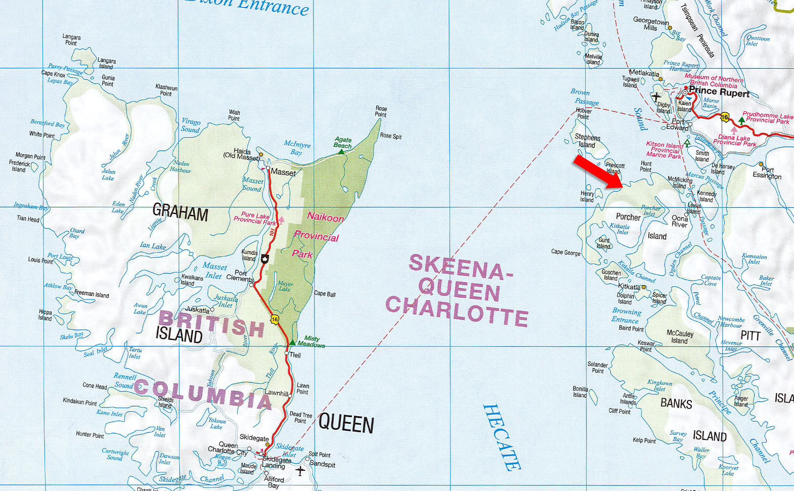
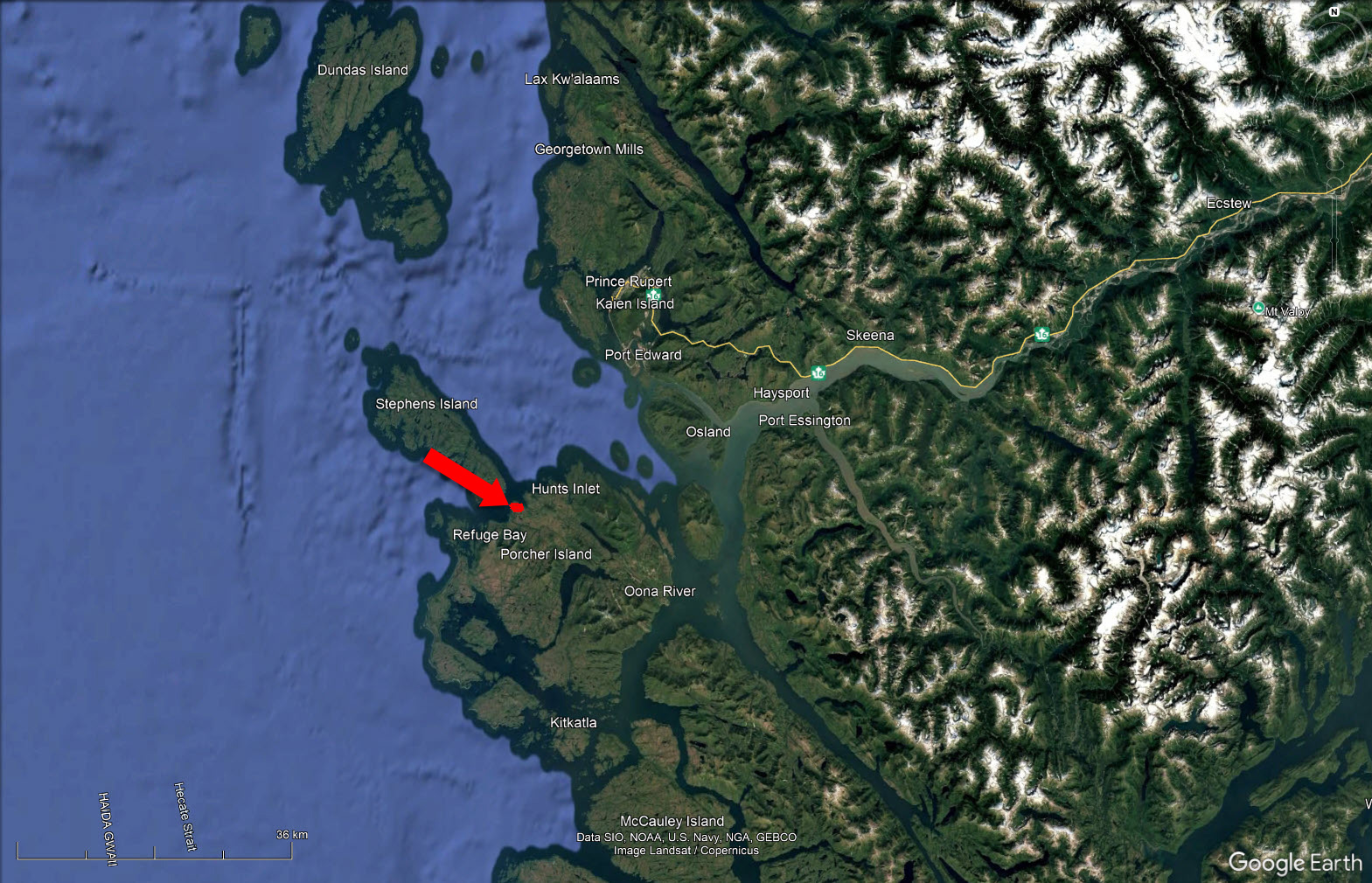
This property is located 24 km (15 miles) south of Prince Rupert on the northern coast of Porcher Island. Porcher Island is a large island just south of Prince Rupert, which is approx. 740 km (460 miles) as the crow flies north of Vancouver.
To reach the property you will require to travel either by boat from Prince Rupert down the telegraph passage and then along the north end of Porcher Island through Malice Passage to Refuge Bay, or by float plane which is a 15-minute trip from Prince Rupert. A person can land by boat or plane on either the east side of the property in Refuge Bay, a very sheltered bay, or on the west side on a good beach and still quite sheltered.
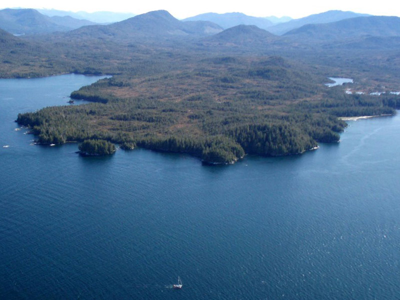
Located approximately 25 kilometres (16 miles) south of Prince Rupert and just 5 kilometres (3 miles) from the British Columbia mainland, Porcher Island is a large coastal island known for its scenic beaches and rugged interior. The shoreline is generally flat and accessible, while the interior features rolling terrain and several hills, with Egeria Mountain rising as the island’s highest point at 2,915 feet. The island is home to three small communities—Hunts Inlet, the village of Porcher Island, and Oona River, the largest and most active. These communities are traditionally rooted in the commercial fishing industry, though some year-round and seasonal residences now contribute to a modest rural lifestyle. The island remains off-grid and accessible only by boat or floatplane, preserving its quiet, remote character.
With a population of approximately 13,000, Prince Rupert is the largest urban centre on British Columbia’s northwest coast and serves as a critical hub for marine transport, tourism, and the seafood industry. The city is home to one of Canada’s deepest ice-free harbours, making it a major gateway for container shipping, log exports, and rail freight via CN Rail. Tourism is a significant part of the economy, with hundreds of thousands of travelers each year arriving by cruise ship, ferry, or road to explore the region’s coastal beauty and wildlife. BC Ferries connects Prince Rupert year-round to Port Hardy via the Inside Passage and to Skidegate on Haida Gwaii. The city also features an airport, rail and bus service, and marine transport facilities, making it an essential link between northern British Columbia and the rest of the province.
Haida Gwaii—formerly known as the Queen Charlotte Islands—is an archipelago located west of Porcher Island, facing Japan across the Pacific Ocean. Often referred to as the “Canadian Galapagos,” the islands are renowned for their rich biodiversity, pristine wilderness, and deep Indigenous heritage. Home to the Haida Nation, the islands feature ancient village sites, monumental totem poles, and an extraordinary cultural legacy preserved in places like the Haida Heritage Centre at Kay Llnagaay in Skidegate. The natural landscape teems with wildlife such as bald eagles, seabirds, Sitka black-tailed deer, and marine mammals, offering unmatched opportunities for eco-tourism, kayaking, fishing, and cultural exploration.
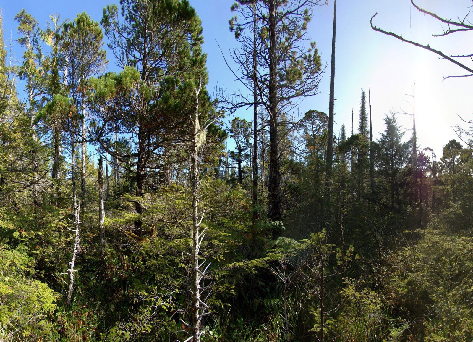
Porcher Island, Prince Rupert, and Haida Gwaii all lie within British Columbia’s coastal temperate rainforest zone, one of the rarest ecosystems on Earth. These regions are dominated by lush old-growth forests of western red cedar, Sitka spruce, and western hemlock, nourished by high annual rainfall and mild coastal temperatures. The vegetation is dense and moss-laden, with thick underbrush of ferns, salal, and berry shrubs. Porcher Island remains largely undeveloped, preserving much of its natural forest cover. Prince Rupert, though urbanized, is surrounded by this same rich forest ecosystem, with nearby areas like Diana Lake Provincial Park offering accessible examples of the region’s biodiversity. Haida Gwaii is especially noted for its unique flora, some of which are endemic to the islands, and includes several protected areas like Gwaii Haanas National Park Reserve, a UNESCO site where ancient rainforests meet rugged coastline.
Fishermen travel from across the globe to experience the exceptional fishing grounds surrounding Porcher Island. Just north of the property lies Goble Point and Edye Pass—nicknamed “Money Point” by local anglers for its legendary productivity. These waters are known for abundant Pacific salmon and giant halibut, with Chinook salmon regularly exceeding 50 lbs. and occasionally reaching up to 80 lbs. Big Useless Creek and Little Useless Creek support seasonal runs of pink, chum, and coho salmon, while Useless Bay features a picturesque white sand cove rich with Dungeness crab, clams, and shellfish. The nearby community of Oona River offers charter boat services for both day and multi-day fishing expeditions. Beyond fishing, the area is popular for kayaking, boating, and wildlife viewing, with miles of remote sandy beaches and calm inlets to explore. Porcher Island is home to Sitka black-tailed deer, small mammals, and an impressive range of birdlife—including bald eagles, which are a common sight soaring above the treetops.
Porcher Island was named after Commander E.A. Porcher, who served on the northwest coast of British Columbia from 1865 to 1868 as the commanding officer of H.M.S. Sparrowhawk. The island’s modern history began to take shape in the early 1900s when the announcement of the port city of Prince Rupert drew settlers from across North America. While many newcomers established themselves in Prince Rupert, a significant number homesteaded on the surrounding islands at the mouth of the Skeena River, including Porcher Island. By 1907, dozens of small farms and communities had emerged on the island, primarily settled by Swedish and Norwegian immigrants. Thanks to Porcher’s mild coastal climate, settlers successfully cultivated fruit and vegetable crops and raised livestock, especially sheep.
Humpback Bay, on the island’s eastern shoreline, is the site of the former Porcher Island Cannery, built in 1929. Opening at the onset of the Great Depression, the cannery struggled early on and was taken over by the Canadian Fishing Company in 1933. It was then repurposed as a fishing station—a local hub where fishermen could refuel, offload catch, purchase supplies, and store nets. Although the cannery eventually ceased operations, some of the original buildings still stand today on privately owned land, offering a quiet testament to the island’s early fishing industry and maritime heritage.
Please see mapping section, all boundaries are approximate.
54° 2'49.55"N and 130°32'43.78"W
$2,433.17 (2025)
There is no zoning on Porcher Island.
District Lot 1302, Land District 14
PID 015-084-761
District Lot 1303, Land District 14
PID 009-410-708
Multiple Listing Service®
 +8 maps
Our property descriptions and geographical information are taken from the BC Assessment Authority, Land Titles Office, government maps and other sources. While LandQuest® does not guarantee the information, we believe it to be accurate, but should not be relied upon without verification. This communication is not intended to cause or induce breach of an existing agency agreement.
Metlakatla
 14℃
12℃
14℃
12℃