


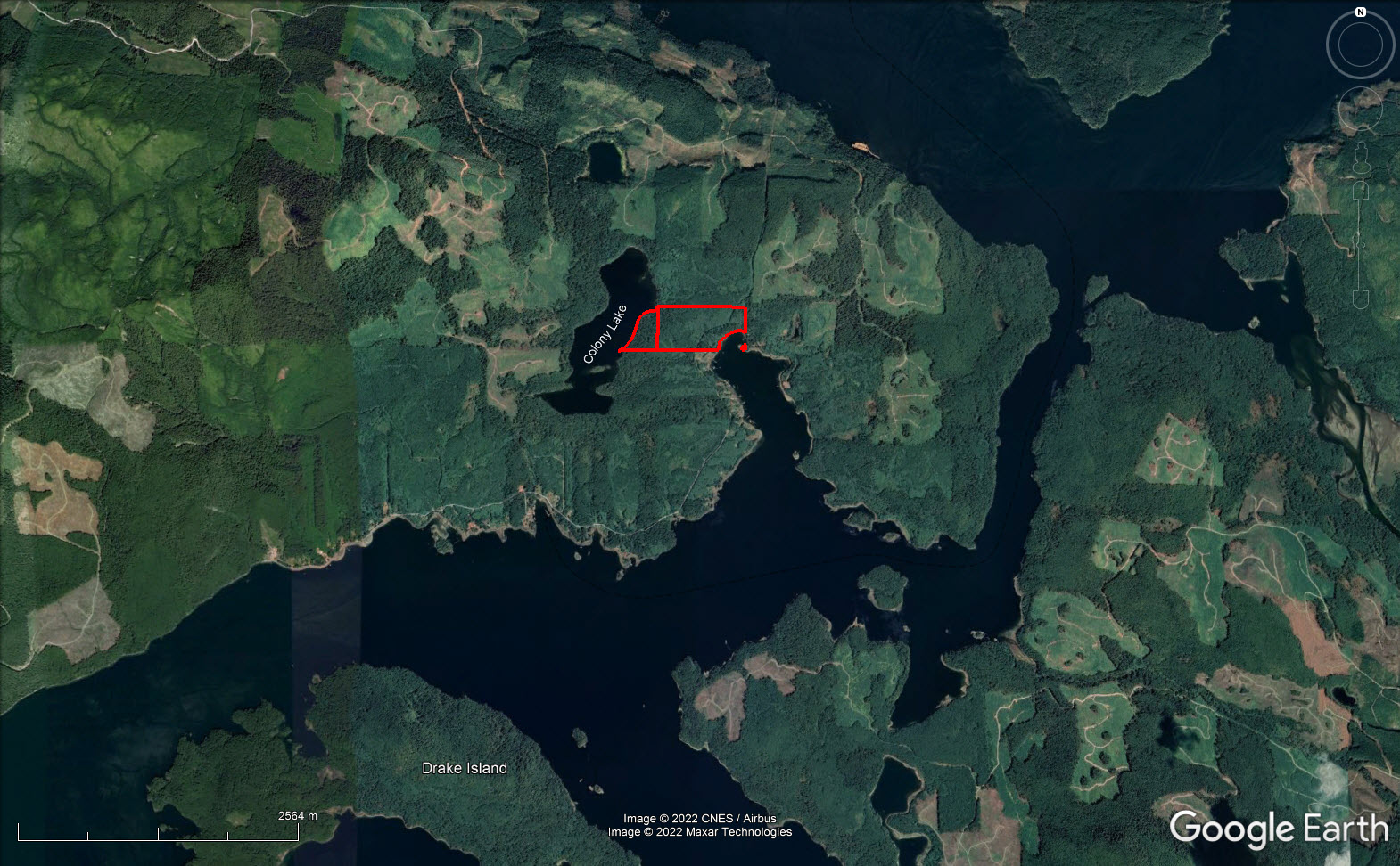
90 acres, 2 titles 1,150 ft oceanfront in Hecate Cove & 1,850 ft lakefront on Colony Lake in Quatsino on the west coast of Vancouver Island. Road goes through property. May be subdivision potential. Substantial mature timber, some cedar, no estimate of volume.
Foreign Buyer Ban does not apply to this property


 +13 photos


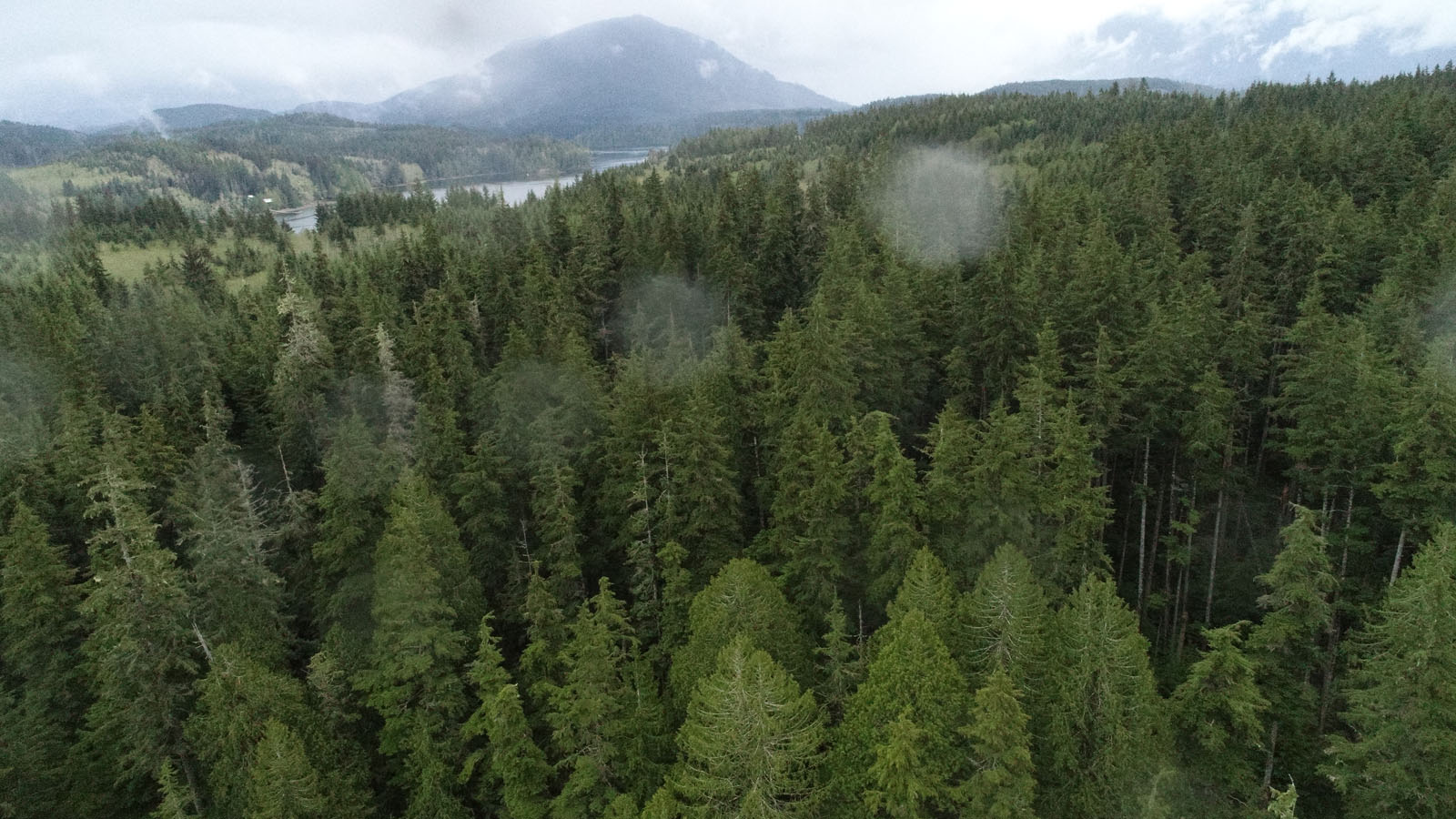


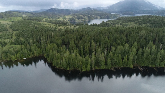
This 90-acre property situated between Hecate Cove and Colony Lake in Quatsino on the west coast of Vancouver Island has many layers of value, including lakefront, oceanfront, possible subdivision potential, timber, and significant conservancy values.
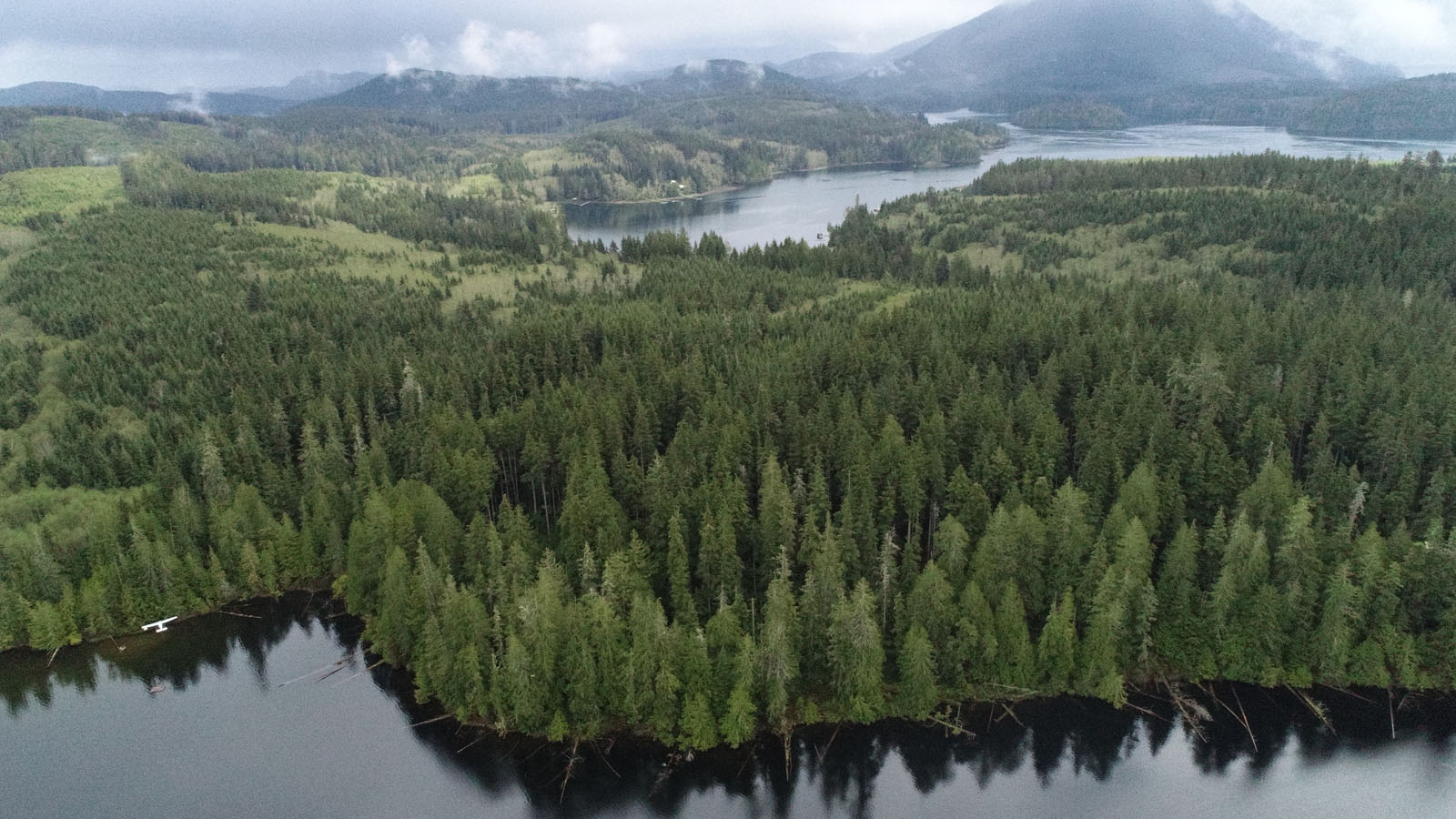
The property has been owned by the same family since the mid-1960s. The interior part of the property was logged in the late 1960s and there is a significant volume of mature and second growth timber, mainly hemlock and cedar. The buyer will be responsible to determine timber quality, volume, and for a logging chance analysis.
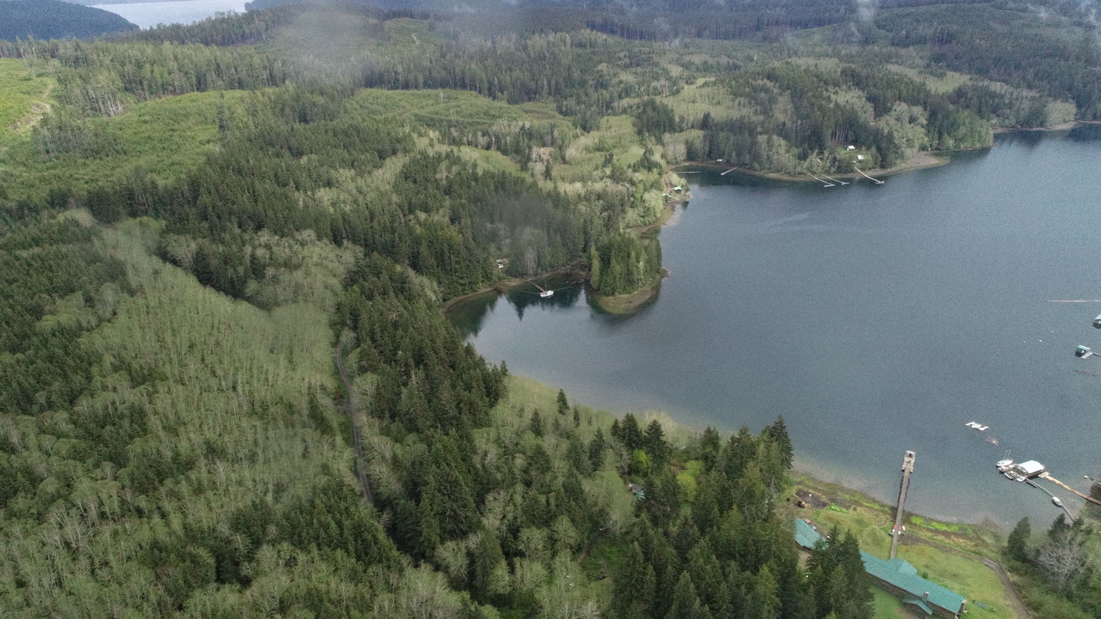
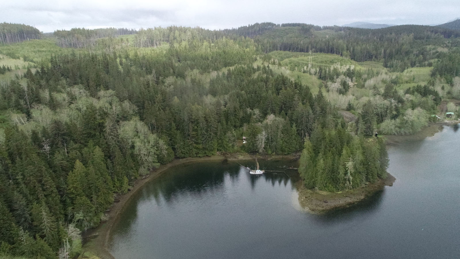
Quatsino Road runs through the oceanfront property fronting on Hecate Cove, which may provide an opportunity to subdivide some oceanfront lots without road construction costs. Hecate Cove is sheltered and suited for deep water moorage with over 1,150 ft of oceanfront. An old home on the property is on a nice building site, but has very little value.
Colony Lake is ideal for access by float plane where you can leave your plane in fresh water without worrying about tides. On our first visit to the property, we flew into the lake, a 5-minute 3.5-mile flight from Coal Harbour, and were easily able to tie the plane at the beach and walk the trail, on an old logging road through the forest, to Quatsino Road. You can see the plane in the drone photos close to the northwest corner of the property.
The lake is a popular swimming hole for Quatsino residents and would be a wonderful place to have a home or cottage. There is only one other property with frontage on the lake, but no homes or buildings. The lakefront title was not logged and a home amid the old mature timber would be awesome.
The property could be a recreational retreat, developed into recreational or single-family lots, fishing lodge, tourism-based business or a combination of the above.
Quatsino Sound is a fishermen and outdoor enthusiast paradise with access to the open ocean of the west coast and some of the best fishing on the BC coast. Numerous lakes and rivers teeming with trout, steelhead and spawning salmon add many layers of recreational value and it is a seafood haven for prawns, crabs, and other delicious fare to be gathered from the ocean. Its 3 fishing lodges are testimony to the exceptional fishing in the area.
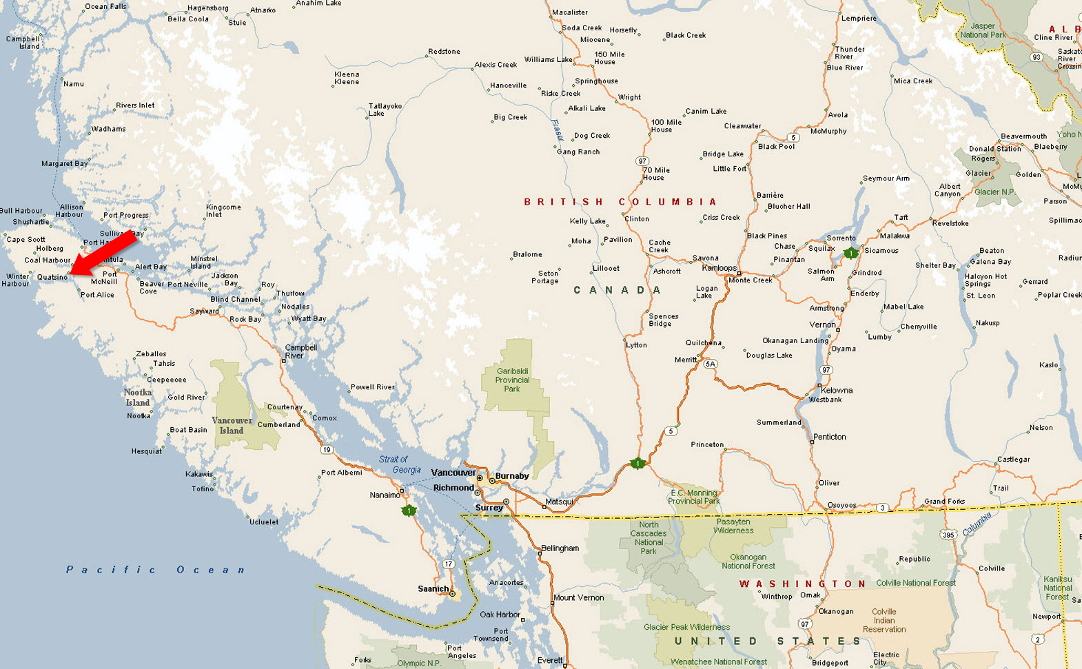
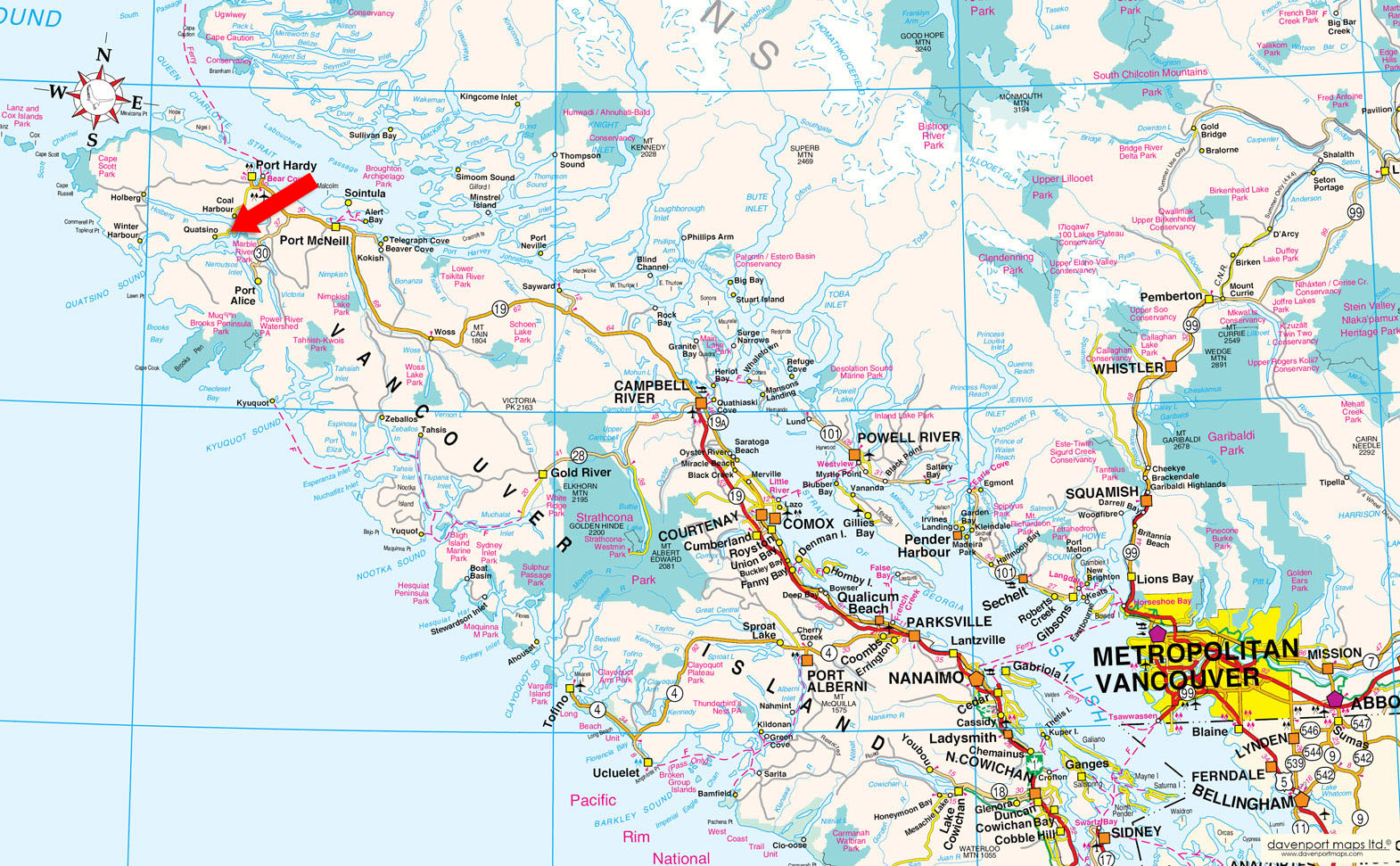
There are no roads to Quatsino and the residents like it that way. It is 15 to 20-minutes by boat from Coal Harbor, which is about a 20-minute drive from Port Hardy, BC on paved road, and there is water taxi and float plane service.
The village of Quatsino is situated at the east end of Quatsino Sound, the northern most inlet on the West Coast of Vancouver Island, and is accessible by boat, float plane or water taxi from Coal Harbour.
Contact Listing Agent.
(Pop. 91)
The hamlet of Quatsino, located in Quatsino Sound in Northwestern Vancouver Island, is accessible by boat or float plane and there is a road through it, but not to it. The nearest neighbours are Coal Harbour to the north, about 20 minutes by boat, and Port Alice to the south, about 35 minutes by boat.
It is one of the great fishing and outdoor recreation locations in British Columbia. From here you can easily access the West Coast, Cape Scott Park and the "glory hole" of the Brooks Peninsula. The area offers a long fishing season with great salmon and halibut fishing. There are more than 50 spawning rivers in the Quatsino area, many with steelhead, spawning salmon, and great trout fishing. It has a government wharf, one room school and post office.
Coal Harbour is 20 minutes west of Port Hardy on a paved road accessed off Highway 19 just south of Port Hardy. There is a government dock and private marina and float plane service and a visit to the museum in the historic hangar by the dock is worth the trip by itself.
Fishing, diving, sea-kayaking, beachcombing, hiking, berry picking, whale, porpoise, sea otter watching, and boating.
Quatsino Sound was surveyed by Captain Richards in H.M. ships Plumper and Hecate, 1860-1862. Quatsino is one of the North Island's earliest settlements. It was first settled in the late 1800s by Norwegian settlers who arrived in Quatsino Sound aboard the Mischief, an old wooden steamship, and chose this sheltered area of outstanding natural beauty to settle.
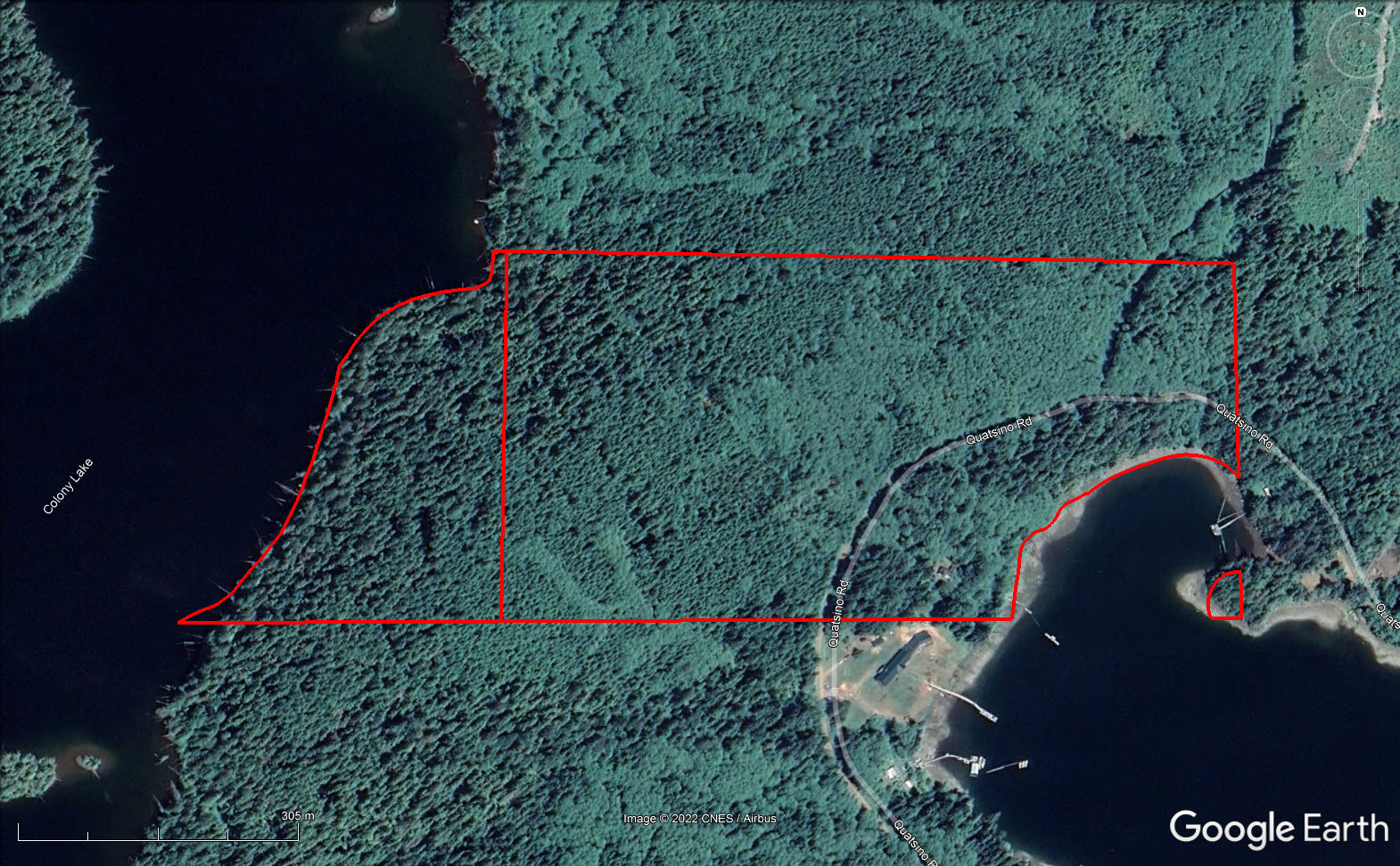
Please see mapping section (all boundaries are approximate).
50°33'8.41"N and 127°36'27.31"W
Subdivision, development potential, timber value.
Hydro, telephone, water taxi
Old house of little value.
$2,385.49 (2021)
Rural Residential (RR-1)
Quatsino Zoning Bylaw No. 670, 2002
Additional zoning information can be found on the Regional District of Mount Waddington website.
The South 1/2 of the Southeast 1/4 of Section 6, Township 10, Rupert District
PID 009-933-107
The Southeast 1/4 of the Southwest 1/4 of Section 6, Township 10, Rupert District
PID 009-933-140
 +8 maps


Our property descriptions and geographical information are taken from the BC Assessment Authority, Land Titles Office, government maps and other sources. While LandQuest® does not guarantee the information, we believe it to be accurate, but should not be relied upon without verification. This communication is not intended to cause or induce breach of an existing agency agreement.
Yreka
 11℃
8℃
11℃
8℃